
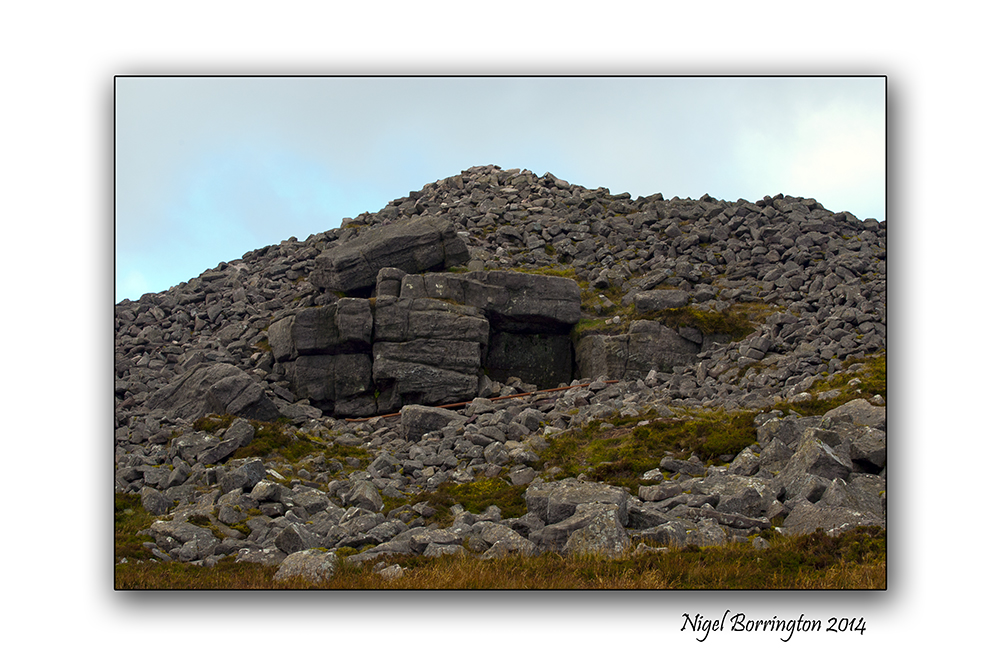
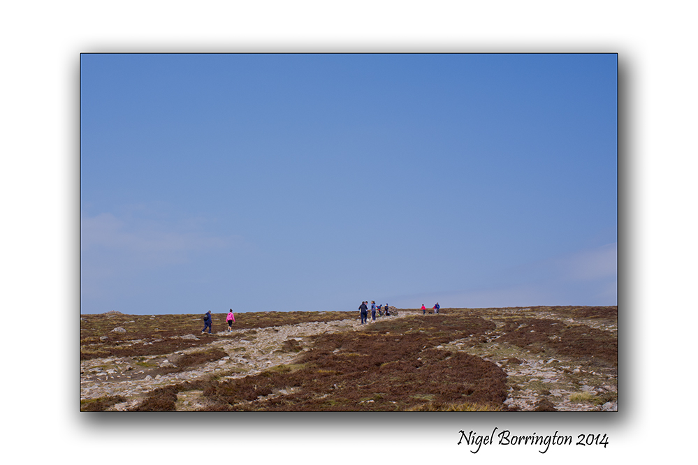
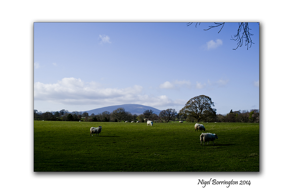
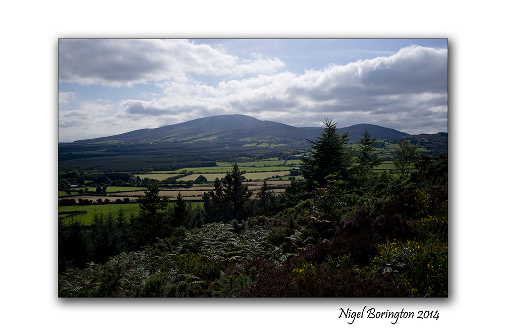
Easter Sunday on the Mountain of Slievenamon

Easter Sunday on Slievenamon, county Tipperary
Landscape Photography : Nigel Borrington
Happy Easter to everyone.
The great Easter holiday weather in our part of Ireland has finally broken with rain this evening for the first time in about two weeks, we had a wonderful morning however as the sky was blue and clear and the sun rise was wonderful.
One thing I love to do on an Easter Sunday is to get outside an experience our local landscape, This morning setting off to walk up Slievenamon our local mountain about 10km from home, many people had the same idea and it was great to meet and say hello to people doing their first big hill walk of the Summer.
The Images below I hope go a little way to sharing the landscape and views from this wonderful mountain, They include some images of the Burial cairn at the very summit of Slievenamon.
Happy Easter !!
Easter Sunday on SLievenamon : Gallery


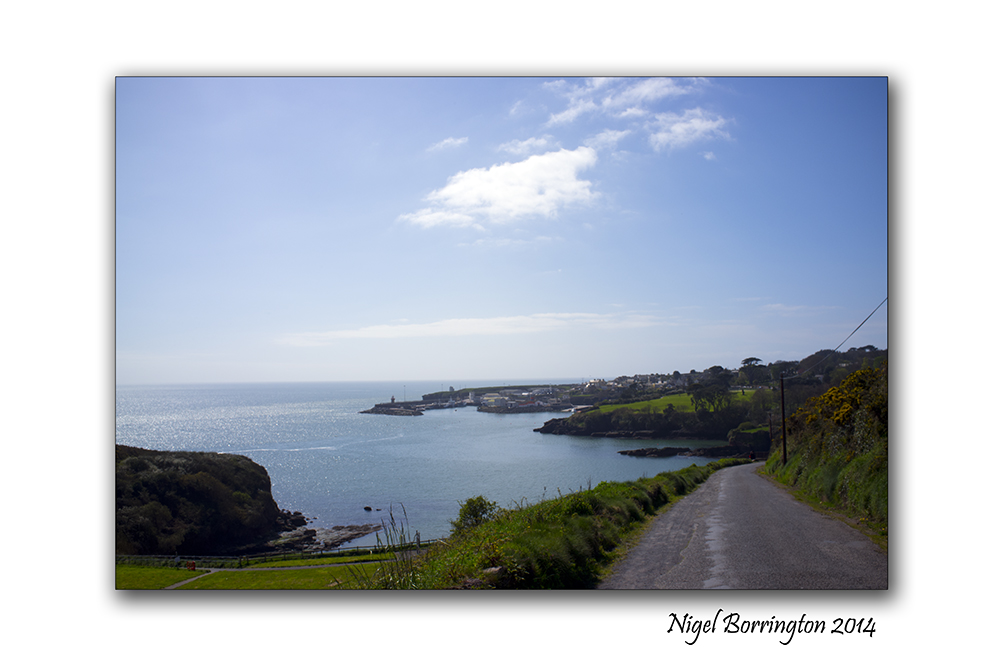
Easter (Ostara) Friday at the beach.
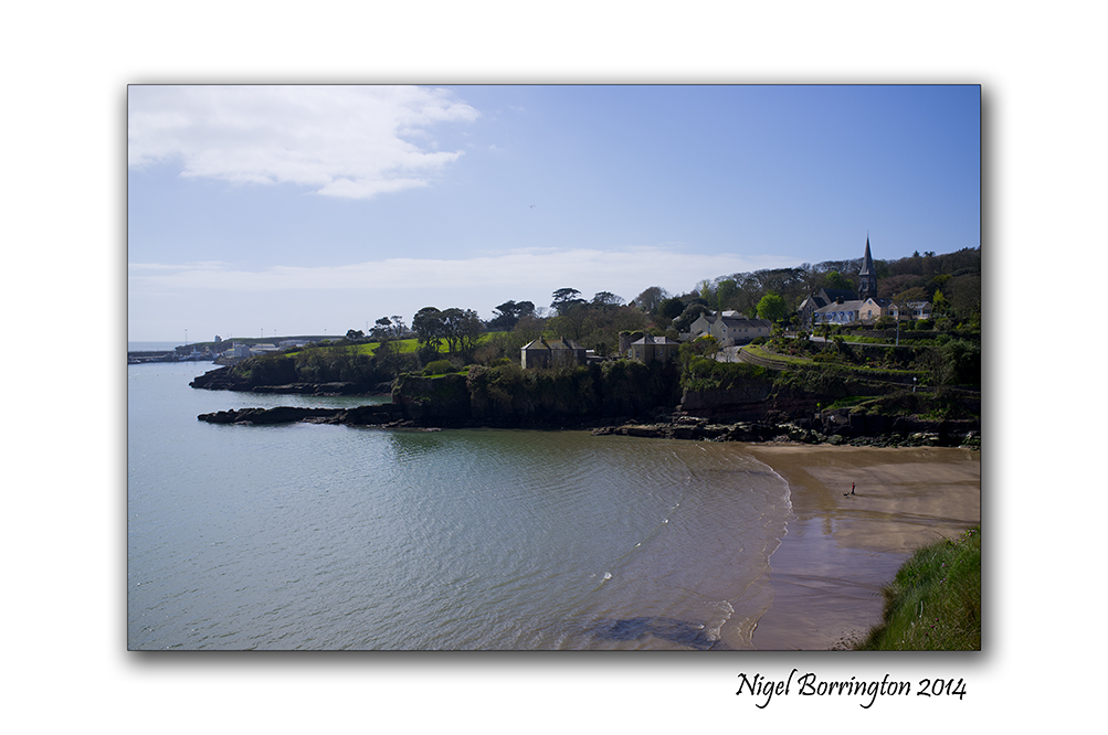
Dunmore east, County Waterford, Ireland
Irish Landscape Photography : Nigel Borrington
The Easter weekend is traditionally to first weekend of warm summer days here in Ireland, its a great time to get out and about and what better place than going down to the beach.
With a population of only 4.3 Million the beaches are never to full at this time of year, yet the weather can be very good. The images in this post were taken this Morning at the small fishing town of Dunmore east and the near by beach of Forenaught, a small and private little place that’s great for a morning swim.
Image Gallery


Easter (Ostara) Holidays in the Landscape.
Easter Holidays in the Irish Landscape
Landscape Photography : Nigel Borrington
Easter (Ostara)
Easter to many Christians marks a religious holiday and the two weeks around Easter weekend is traditionally a Holiday time.
Before the Christian tradition however it was still marked as Ostara by the Pagan world, marking a time of rebirth and new life, Life has returned to the landscape with new growth and natural foods available. Wild life is on the move again starting to make plans for a new breeding season, finding foods themselves and getting to put some much needed body weight back on.
Over the next two weeks I want to get out and capture these changes, as the march towards the summer months feels ever closer and closer.
Image Gallery


Where Go the Boats, A river Poem

Boats on the river Suir, County Tipperary
Landscape Photography : Nigel Borrington
Where Go the Boats?
Dark blue is the river.
Golden is the sand.
It flows along for ever,
With trees on either hand.
Green leaves a-floating,
Castles of the foam,
Boats of mine a-boating—
Where will all come home?
 .
.
On goes the river
And out past the mill,
Away down the valley,
Away down the hill.
Away down the river,
A hundred miles or more,
Other little children
Shall bring my boats ashore
 .
.
Robert Louis, Stevenson
Walking through a field at Coolehill , images with a poem

Coolehill, Windgap, County Kilkenny
Irish Landscape Photography : Nigel Borrington
Walking across a field at Coolehill
Walking across the fields of Coolehill,
Ash, Briar, hawthorn, holly, and hazel
A wall around the field that your in.
 .
.
Above you
is a big blue sky, with its layers of soft clouds,
held up by the rows of oaks.
A sheltered patch of sunshine:
 .
.
I stop
and stand in silence
and close your eyes
and feel the warmth on your face,
whilst a blackbird sings.

inspired by Holbury Lane, Lockerley
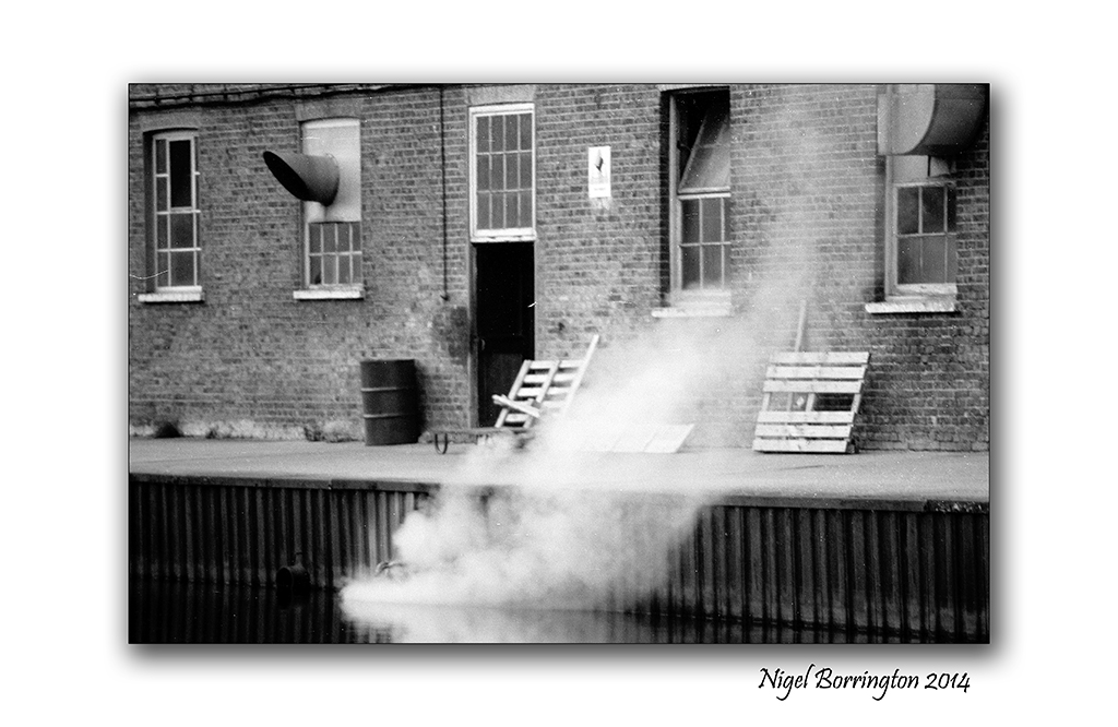
The Grand Union Canal, Walking through time.

Grand Union canal, Harefield, Hillingdon, London, England.
Landscape Photography : Nigel Borrington
Grand Union canal, Harefield (1988 to 2014)
Up until some 18 years ago I lived and worked in Harrow , Middlesex, North London. Working in the IT industry with long hours and shift work included. I really Valued my time off and would spend a lot of my weekends out walking in the country around North London. The Grand Union Canal was one of my most visited locations , it runs from Inner London to Birmingham in the Midlands of the UK.
Recently I took some time off to visit the Canal again after some twenty six years, It was great after all this time to get back and walk some old steps, I had no idea what could have changed. When I got back I remembered that I must have some old images taken during my original walks here.
So when I got back home to Ireland, I found some black and white images of an old canal side factory that marked the start of my walks, the images below show just how little the building has changed. It looks like it is just used for smaller office units these days but apart from this, its still very much looks like the place in my film images.
It was great to walk these old places, I have very good memories of walking and doing my best to relax after a long working week and to get a fresh image of the old canal in my mind was just great.
Film Gallery (1988), using a Nikon FM2 and Ilford XP2 Black and white film


 .
.
Digital Gallery (2014), using a Fujifilm X100.


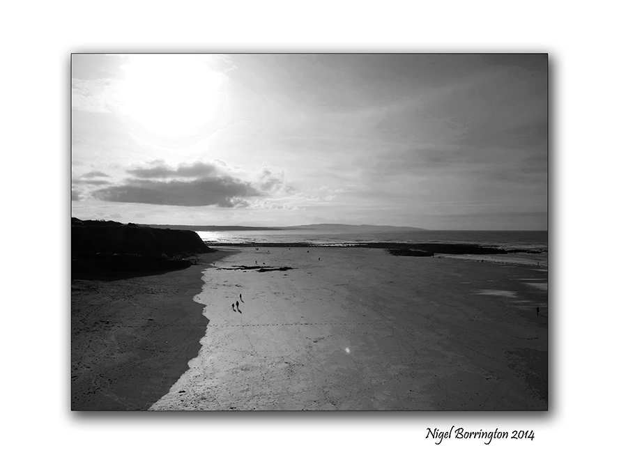
Ballybunion , a view from the cliff

Ballybunion, county Kerry
Irish Landscape Photography : Nigel Borrington
Ballybunion , county Kerry
Ballybunion in county Kerry is one of Ireland’s most visited sea side locations, it a wonderful little town with a long history of holiday makers visiting here.
It has one very interesting feature that relates to its beach’s, there are two commonly used beaches divided by the reamins of an old castle on the cliff. The beach to the left of the castle (if looking toward the sea) is called the “Men’s Beach”, and the one to the right the “Ladies Beach”, given to the fact that men used to bathe on a separate beach from women and children. Although this practice has not been observed for decades, its amazing to think in this day and age how it even worked or became Normal practice.
Family members having to split-up for a swim.
There is a small cafe, hot seaweed baths and ice cream shop on the women’s beach. The large cliffs to the right of the women’s beach have shallow caves.
The sheer cliffs over the beach have a scenic walking path, featuring a blowhole, views of sea stacks and a multitude of wildlife. The path takes about 20 minutes to walk, and goes round to the “Nun’s Beach”, a beautiful beach with no access these days, it is overlooked by an old convent.
You get an overwhelming feeling of history here from times when traditions and culture was very different than the many visitors today experience.
Ballybunion, is still a place well worth a visit !!
Gallery


Skellig Michael, Six hundred steps to heaven
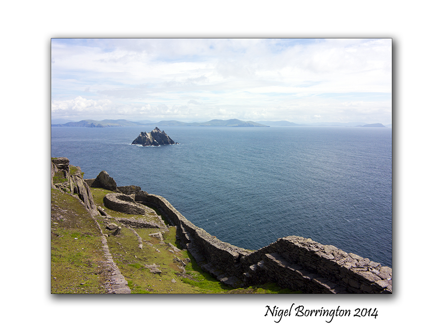
Skellig Michael (unesco heratage site) , country Kerry Ireland
Irish Landscape Photography : Nigel Borrington
Skellig Michael, six hundred steps to heaven
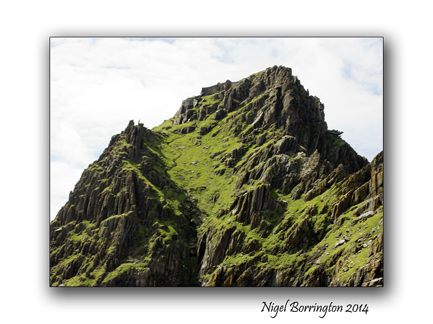
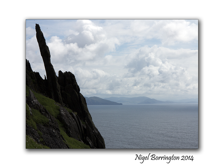
During the summer last year I finally achieved a long ambition, to visit Skellig Michael and the Skellig islands some 16 kilometres off the county Kerry coast line, Ireland.
In yesterday post I shared the boat trip out to the Islands, today I want to share the walk up the six hundred plus stone laid steps to the very top where the world famous monastic outpost is located.
During the boat trip one of our guides pointed out one of three stair cases to the top, if you open up this picture you will see it rising up to the settlement, there are three of these routes up that were hand built with stone cut on the island. The three of them provided landing points during different tides and weather conditions.
Landing on the Island is an experience in its own right as the swell from the sea water makes stepping off the boat great fun. As you set foot on ground again, the first stage of the walk to the top is a well laid foot path taking you to about half way around the island and about one third of the way up the 218 meters you need to climb before reaching the settlement.
As this path ends you are met by a guide, who very firmly insists you all receive a health and safety talk, sadly sometime back a visitor died while walking up the steps, the walk is very steep and if you loose your footing the drop all the way to the sea below is not broken by any obstacles. He advises to take your time, “its not a race to the top and that if you need a rest to take one.”
The walk up is hard but very pleasurable, the views as you go are stunning if a little breath taking due to the hight. One of the warnings however was to keep your eyes on your steps and not to take any images unless you had stopped in a secure location and moved aside for others to pass, even telling the people behind that you intend to stop. as you can see in the images below there are some platforms and viewing points and I did my best to only stop here.
One of the wonderful views on your way up was the hundreds of Puffins nesting here, they were due to leave any-time so its was great to still find so many of them, I got many images of them along the way.
Finally after some forty minutes you reach the last set of steps , turning through some sharp rocks you get the first view of the Settlement. This sight just takes you back, the stone wall that greets you is about four meters high from a terrace that is the only flat area on the entire Island, being used to grows vegetables in its day.
From here the only access to the inner yards and structures is through a small door in the stone wall.

On entering you are met with the sight of the famous beehive cells of which six are still standing. The enclosed area is small and fully protected from the elements by the hight of the sea facing wall. The structure of the cells is very unique and fascinating to see. in the centre of the buildings is a small grassed area that served as a grave yard. I found this fact very interesting as it outlines the fact that the people who lived here spent their entire lives living on this Island from the moment they first arrived.
I want to post one more time on Skellig Michael, showing the full structures , living spaces and detail some of the history of this place. It is truly a fascinating place that holds some mysterys. The biggest one’s to me are : why here ?, why did these people select to live at the top of a rock over ten kilometres from the Kerry coast line, when they could have just lived on the main land?
More in the next post …
Skellig Michael, image Gallery


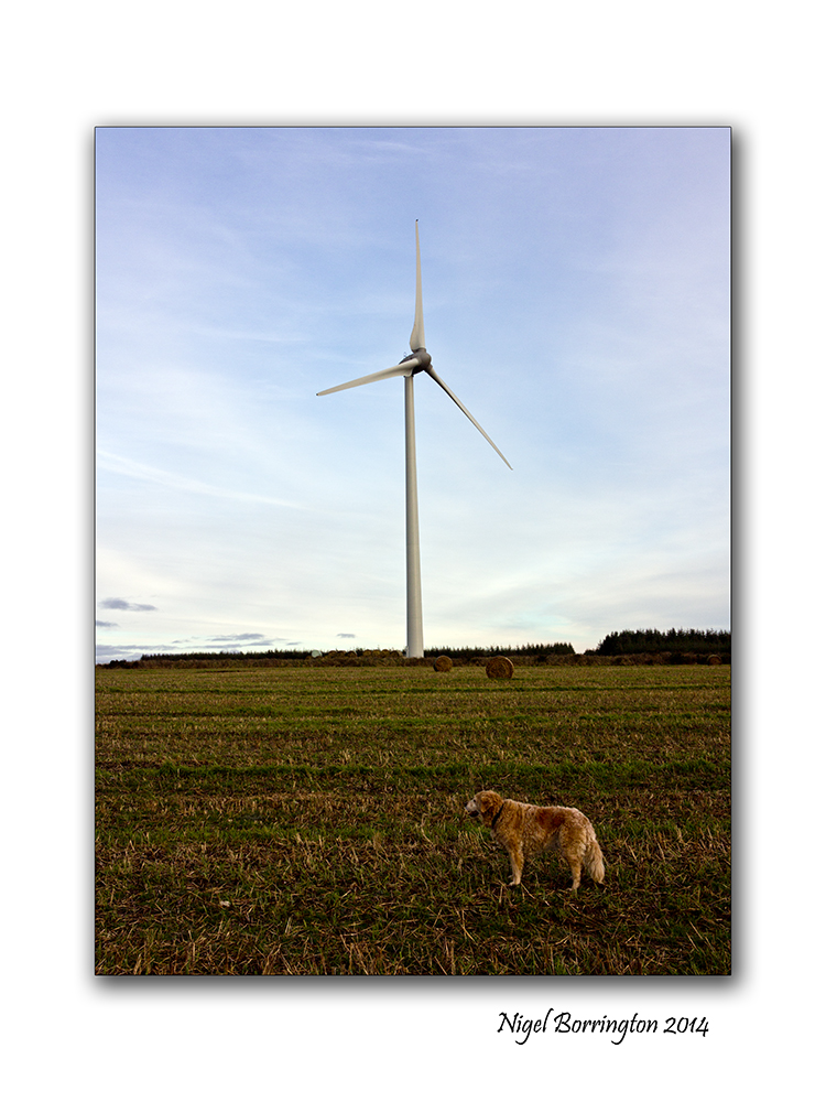
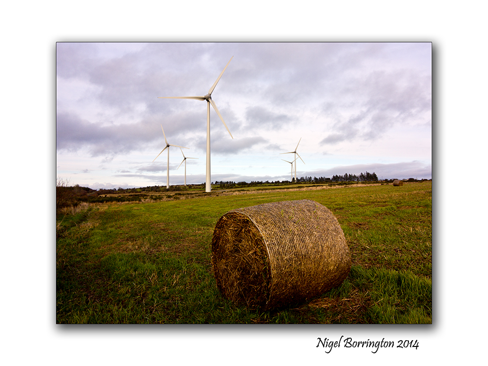
Ballymartin Windfarm , County Kilkenny

Ballymartin Wind farm, County KIlkenny
Irish Landscape Photography : Nigel Borrington
The hills above Mullinavat, County kilkenny offer some wonderful landscape views of south Kilkenny. I love walking around the lanes up here as it is so remote and peaceful.
Over the last 5 years these hills have become a home to a new feature in the landscape, the Ballymartin wind farm, I took these images on an evening walk back in February along with a couple of images of the surrounding landscape.
While I do understand that many people did not want these wind turbines here, I don’t personally have anything against them, they do offer a better solution than a coal powered power plant. I guess it is unlikely that a coal plant would have been built in this location but these turbines maybe stopped one being built in another place.
They are almost graceful as they make use of the wind rushing across the surrounding hills.
Gallery


SMC Takumar 50mm f1.4

SMC Takumar 50mm f1.4
Photography : Nigel Borrington


SMC Takumar 50mm f1.4, classic lens
Over the last couple of months I have posted a little about the quality of older lenses and uploaded some sample images. These post have included a review of the ( 28mm HMC Hoya m42 lens and the Tamron 24mm f2.5 lens).
One other much loved lens I have been lucky to find in great condition is a SMC Takumar 50mm f1.4 M42 Lens. I have owned this lens for a good while and still use it from time to time.
Firstly what is an M42 lens , well this wikipedia article describes these very well, basically they are lenses with a mount to a camera body that was designed to be universal, as to fit any camera designed with an M42 mount.
The stand out feature resulting from this mount is that they use a manual method of control for their aperture blades. Many of these lenses have a switch that can be used to keep the aperture blades wide open when manually focusing the lens then close them down to the required aperture during taking the image, as the view finder maybe to dark to focus otherwise.
I can hear many people asking “Why then would you want to use such a manually controlled lens ?*
Since M42 lenses, lens and Camera manufactures have put much work in-to the development of, firstly Auto Aperture lenses (Apertures controlled by the camera body) then Autofocus lenses with an ability to focus on up-to fifty focus points with an ability to selection from one of them in an image being framed. These developments have opened up a new world to photography, such as sports images that have very quick moving subject in perfect focus.
However there is still a place for old lenses, Landscape or portrait photographs for example do not automatically need auto focus.
Older lenses also offer abilities and features that have been lost in an age of autofocus cameras, abilities such as using hyper focus control for example (Lens Hyper-focus), a method of using lens apertures and focus distance to make sure that a pre-set amount of subjects in your image will automatically be in focus at any given distance range from the lens. In an age of high ISO performance, digital technology, this method is more usable than ever before as you can use Higher ISO settings and ever slower F-stop numbers such as F11 (Thus have a larger depth of subjects in your image in focus) and still achieve fast shutter speeds to capture clean usable images.
As you can see from the images of the Lens above manual focus lenses all contain much needed details such as the aperture being used the focus distance and the depth of field for each aperture.
The two other features that I really like about this Takumar lens are the construction and image quality.
The focus control on the lens is a pleasure to use it is very smooth to turn and wonderful in comparison to even my Pro level Nikon autofocus lenses.
Even though it may appear that this lens has been left behind some as far as new lenses are concerned, the image quality is hard to beat. You can see from the images below that there is no lens flare even when pointed at the sun, the images are sharp from about F2 upwards.
One feature that I feel could be the case is that when these lenses were developed, Black and White film photography was very much still being used as much as colour film was. The coatings on these lenses I feel thus gives a wonderful contrast and deep colour to digital images along with being perfect for great contrast in black and white images.
SMC Takumar 50mm f1.4, Gallery


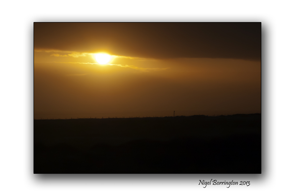
Spring equinox 2014 and Pagan traditions

Spring equinox sun sun 2014
Landscape photography : Nigel Borrington
The Spring equinox 2014
Today marks the arrival of spring, the date of the vernal equinox, or spring equinox as it is known in the northern hemisphere. Spring equinox. During an equinox, the Earth’s North and South poles are not tilted toward or away from the sun. (Ref :Wikipedia)

This means the sun will rise exactly in the east and travel through the sky for 12 hours before setting in the exactly west.An equinox happens twice a year around March 20 and September 22 when the Earth’s equator passes through the centre of the sun.
For those in the southern hemisphere, this time is the autumnal equinox that is taking people into their winter.
In English there is open access to Stonehenge tomorrow. Access will be from 05:45am until 08:30am.
Druids and Pagans like to gather at Stonehenge early in the morning to mark the Spring Equinox, to see the sunrise above the stones.

The Pagans consider this is the time of the ancient Saxon goddess, Eostre, who stands for new beginnings and fertility. This is why she is symbolized by eggs (new life) and rabbits/hares (fertility). Her name is also where we get the female hormone, oestrogen.
From Eostre also come the names “Easter” and “Esther” the Queen of the Jews, heroine of the annual celebration of Purim which was held on March 15. At Easter, Christians rejoice over the resurrection of Jesus after his death, mimicking the rebirth of nature in spring after the long death of winter.
It is also a time to cleanse your immune system with natural remedies. In Wiltshire and other parts of rural Britain it used to be tradition to drink dandelion and burdock cordials as the herbs help to cleanse the blood and are a good tonic for the body after a harsh winter.
The Equinox of the sun : Gallery


Visiting the Saltee Islands spring 2014

Saltees Islands In Spring
Wildlife and Landscape photography : Nigel Borrington
This Spring I am planning another visit to the The Saltees Islands, St. George’s Channel. The Islands consist of the Great and Little Saltee, they are situated approximately 5 kilometers off the coast of Kilmore Quay Co.Wexford.
The larger island Great Saltee is the most famous bird sanctuary in Ireland and is very popular with both day-trippers and birdwatchers alike. These Islands are privately owned and are one of the world’s major bird sanctuaries.
It’s a wonderful visit to make if your into wildlife and Photography or just a wonderful place to spend the day.
The below images were taken last spring.
Saltee Island Gallery


Sunrise from the Mountains, Poem by : Anna Katherine Green

Knockanaffrin,Comeragh Mountains, County Waterford
Landscape Photography : Nigel Borrington
Sunrise from the Mountains
Poem by : Anna Katherine Green
Hung thick with jets of burning gold, the sky
Crowns with its glorious dome the sleeping earth,
Illuminating hill and vale. O’erhead,
The nebulous splendor of the milky way

Stretches afar; while, crowding up the heavens,
The planets worship ‘fore the thrones of God,
Casting their crowns of gold beneath His feet.
It is a scene refulgent! and the very stars
Tremble above, as though the voice divine
Reverberated through the dread expanse.
But soft! a change!
A timid creeping up of gray in east–
A loss of stars on the horizon’s verge–
Gray fades to pearl and spreads up zenithward,
The while a wind runs low from hill to hill,
As if to stir the birds awake, rouse up
The nodding trees, and draw off silence like
A garment from the drowsy earth. The heavens
Are full of points of light that go and come
And go, and leave a tender ashy sky.
The pearl has pushed its way to north and south,
Save where a line spun ‘tween two peaks at east,

Gleams like a cobweb silvered by the sun.
It grows–a gilded cable binding hill
To hill! it widens to a dazzling belt
Half circling earth, then stretches up on high–
A golden cloth laid down ‘fore kingly feet.
Thus spreads the light upon the heavens above,
While earth hails each advancing step, and lifts
Clear into view her rich empurpled hills,
To keep at even beauty with the sky.

The neutral tints are deeply saffroned now;
In streaks, auroral beams of colored light
Shoot up and play about the long straight clouds
And flood the earth in seas of crimson. Ah,
A thrill of light in serpentine, quick waves,
A stooping of the eager clouds, and lo,
Majestic, lordly, blinding bright, the sun
Spans the horizon with its rim of fire!

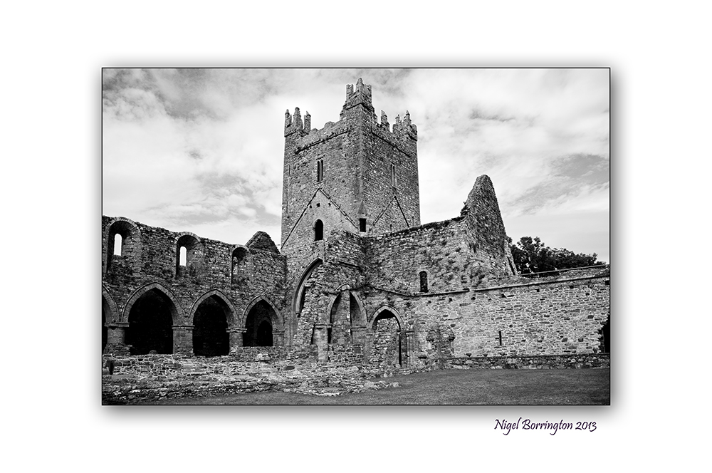
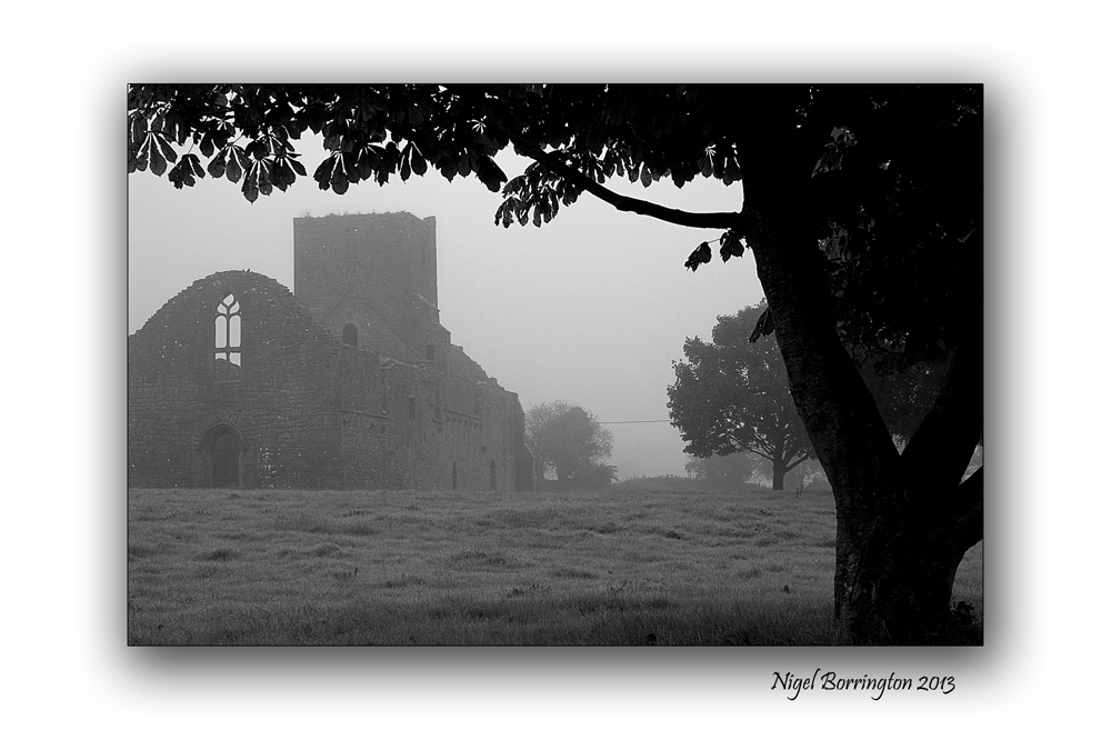
ST Patrick’s day , Irish landscape Gallery.

Coolagh old church , County Kilkenny
Landscape photography : Nigel Borrington
Today is St Patrick’s day here in Ireland and its a public Holiday, For many people religion will play a big part in the day.
Personally I love the outdoors far more and will spend most of the day walking and exploring the local landscape, I find nature and open spaces far more spiritual.
The following gallery of images are just some images taken in and around the wonderful county of Kilkenny.
What ever your doing today enjoy yourself and a happy St Patrick day.
Kilkenny Landscape Gallery


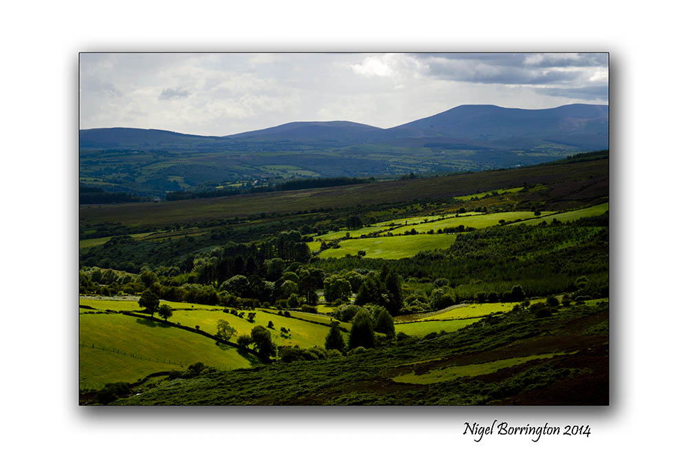
Landscape from the Irish Hills and a Poem By : S. Weir Mitchell
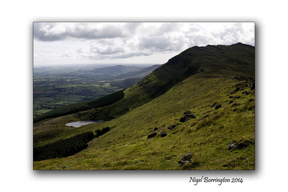
Landscape from the Irish hills
Landscape Photography : Nigel Borrington
The hills of the South east of Ireland are on of my favourite locations to wander and go for long walk, they are not as spectacular as the peaks of the Kerry mountains but there is a stillness here. Space to think and clear your mind and just walk and photograph the landscape.
I will let the words of the below poem say everything else for me, complimenting just how much I like these locations in the soft Irish hills.
S. Weir Mitchell
HERE have I wandered often these many years
Far from the world’s restraint, my heart at ease,
With equal liberty of joy or tears
To welcome Nature’s generosities,
Where these gray summits give the unburdened mind
To clearer thought, in freedom unconfined.
Kind to the dreamer is this solitude.
Fair courtesies of silence wait to know
What hopes are flattering a poet mood,
Stirred by frail ecstasies that come and go,
Like birds that let the quivering leaves prolong
The broken music of their passing song.
Here may we choose what company shall be ours;
Here bend before one fair divinity
To whose dear feet we bring the spirit-flowers,
Fragments of song, stray waifs of poetry,
The orphans of dead dreams, more sweet than aught
Won by decisive days of sober thought.
Landscape of the Irish hills a Gallery


To the River a Poem by : Edgar Allan Poe

Sun set over the river Suir, County Tipperary
Irish Landscape Photography : Nigel Borrington
To the River (1829)
by : Edgar Allan Poe
(1809-1849)
Fair river! in thy bright, clear flow
Of crystal, wandering water,
Thou art an emblem of the glow
Of beauty-the unhidden heart-
The playful maziness of art
In old Alberto’s daughter;
 .
.
But when within thy wave she looks-
Which glistens then, and trembles-
Why, then, the prettiest of brooks
Her worshipper resembles;
For in his heart, as in thy stream,
Her image deeply lies-
His heart which trembles at the beam
Of her soul-searching eyes.
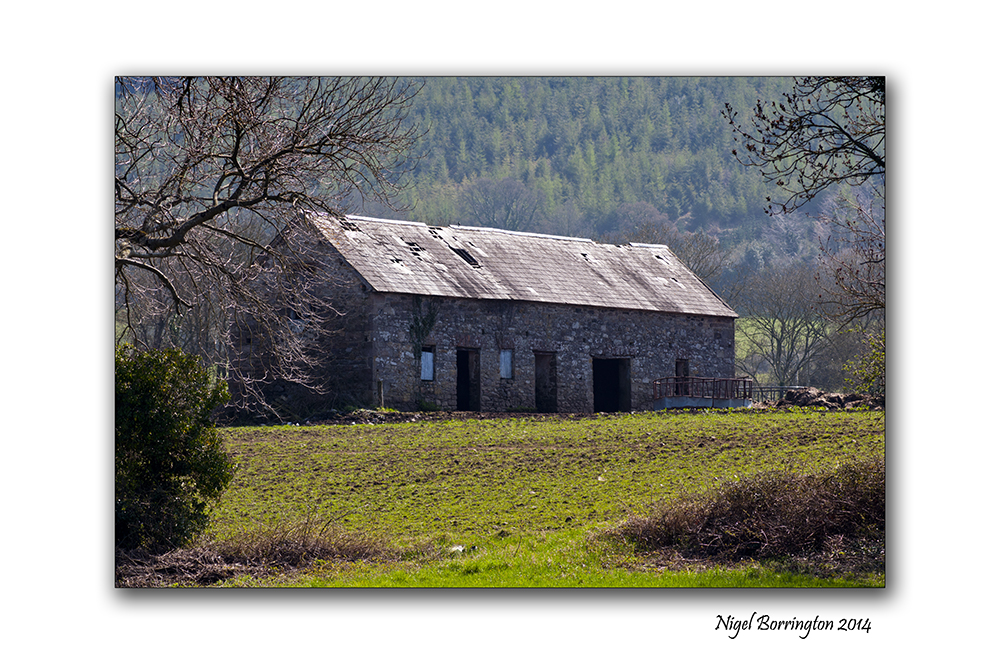
Irish Landscape Photography : The barn by the bank of the river suir.
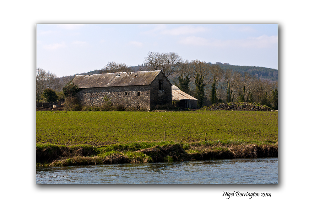
Images from the River Suir, County Tipperary
Landscape photography : Nigel Borrington
A walk along the River Suir as it flows through county Tipperary offers some wonderful views, the old stone barns and farm yards have to be amongst the best of these.
I took the pictures below on a spring walk last year, a warm Sunday afternoon.
The Barn by the river Suir, Gallery


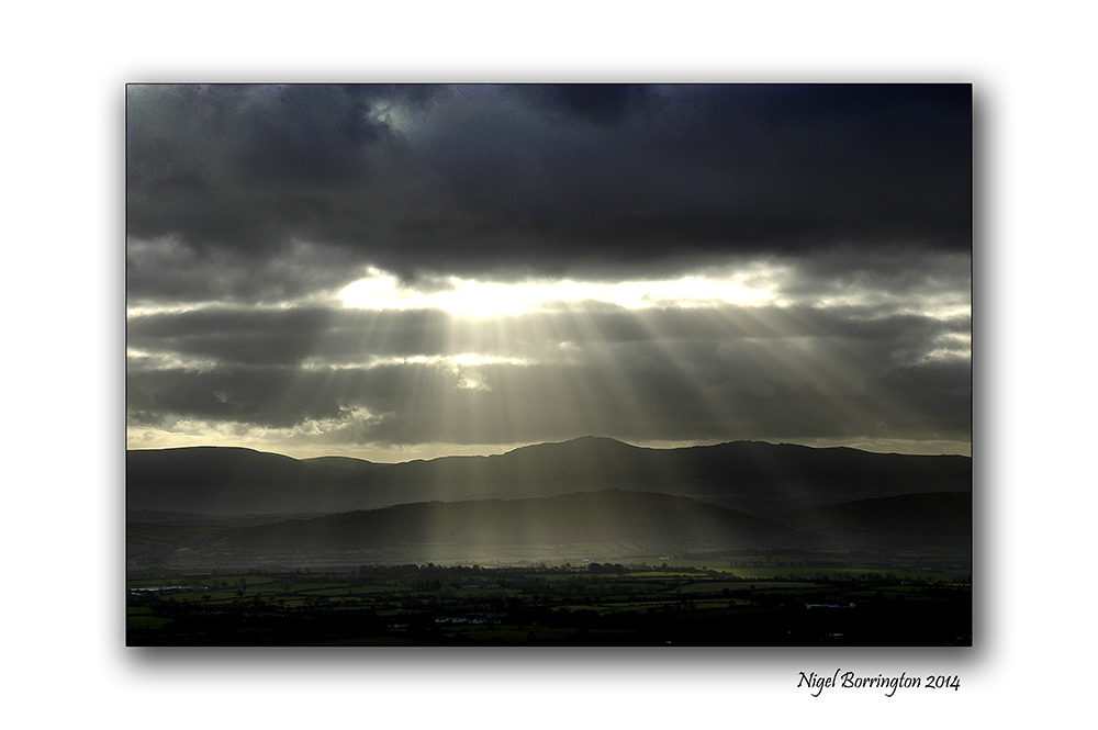
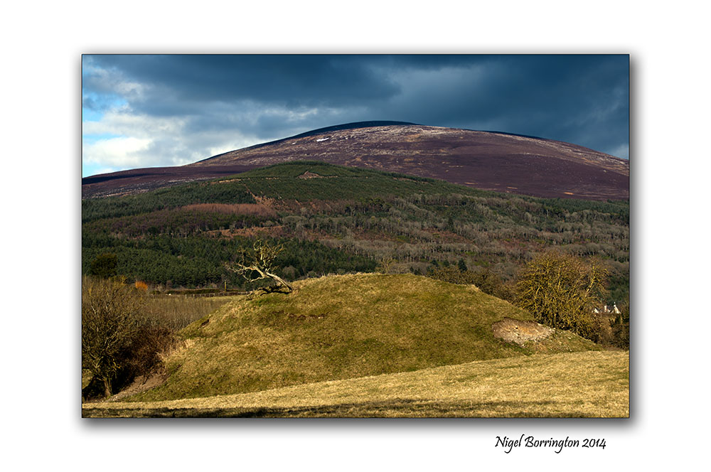
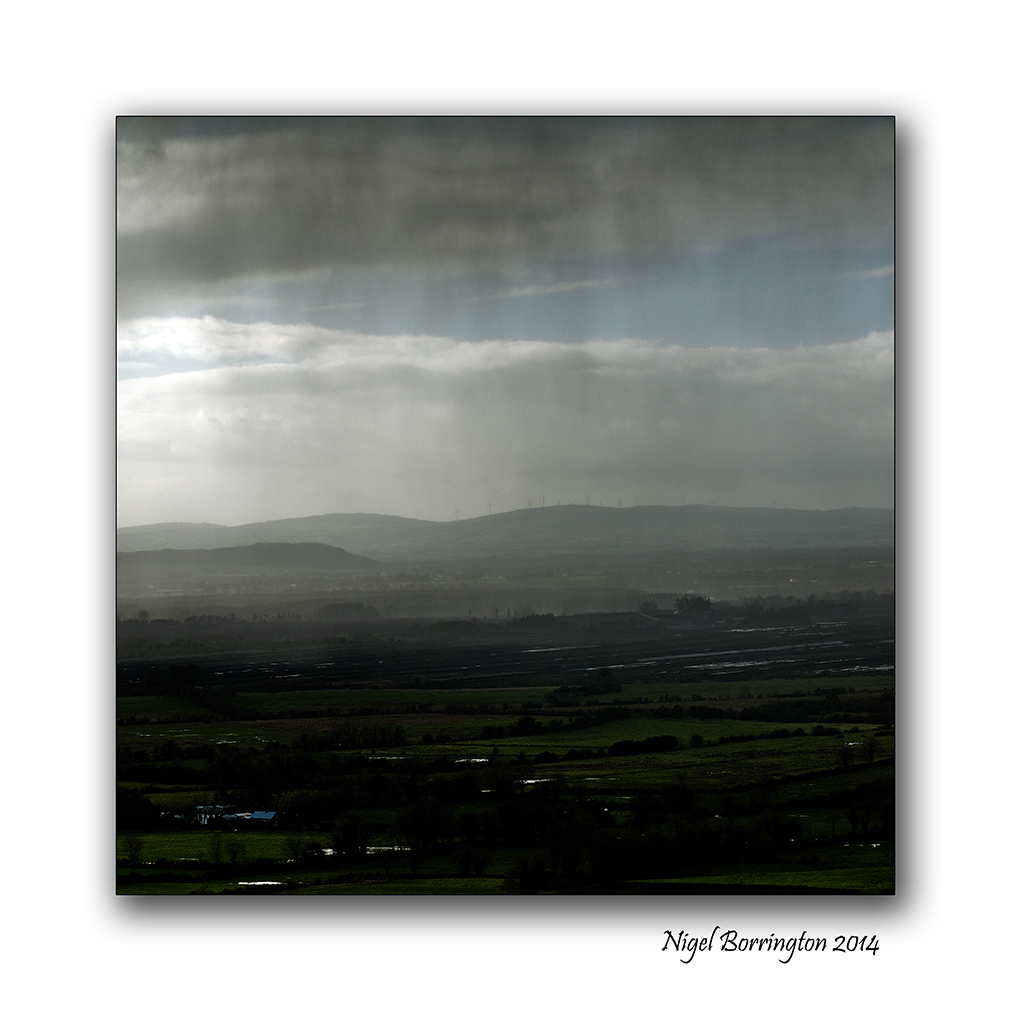
Monday Morning, The Motte at Slievenamon

The Motte at Slievenamon , County Tipperary
Landscape Photography : Nigel Borrington
The Motte
This morning it felt like Spring for the first time here in Ireland, we have a good chance of a period of sunny days for the entire week and it was a wonderful Morning.
I took the chance to visits our nearest Mountain Slievenamon and walk around its lower paths and fields, one of these fields contains the remains of an old Norman Motte. From the top of which you get some wonderful views of the Landscape around this area.
A Motte is the foundations for a motte-and-bailey castle with consisted of a wooden or stone keep situated on a raised earthwork called a motte, accompanied by an enclosed courtyard, or bailey, surrounded by a protective ditch and palisade. These castles were built across northern Europe from the 10th century onwards, spreading from Normandy and Anjou in France, into the Holy Roman Empire in the 11th century. The Normans introduced the design into England and Wales following their invasion in 1066. Motte-and-bailey castles were adopted in Scotland and Ireland.
This is a location I will return to many times this year just to capture how the seasons effect the look of this wonderful setting.
Gallery


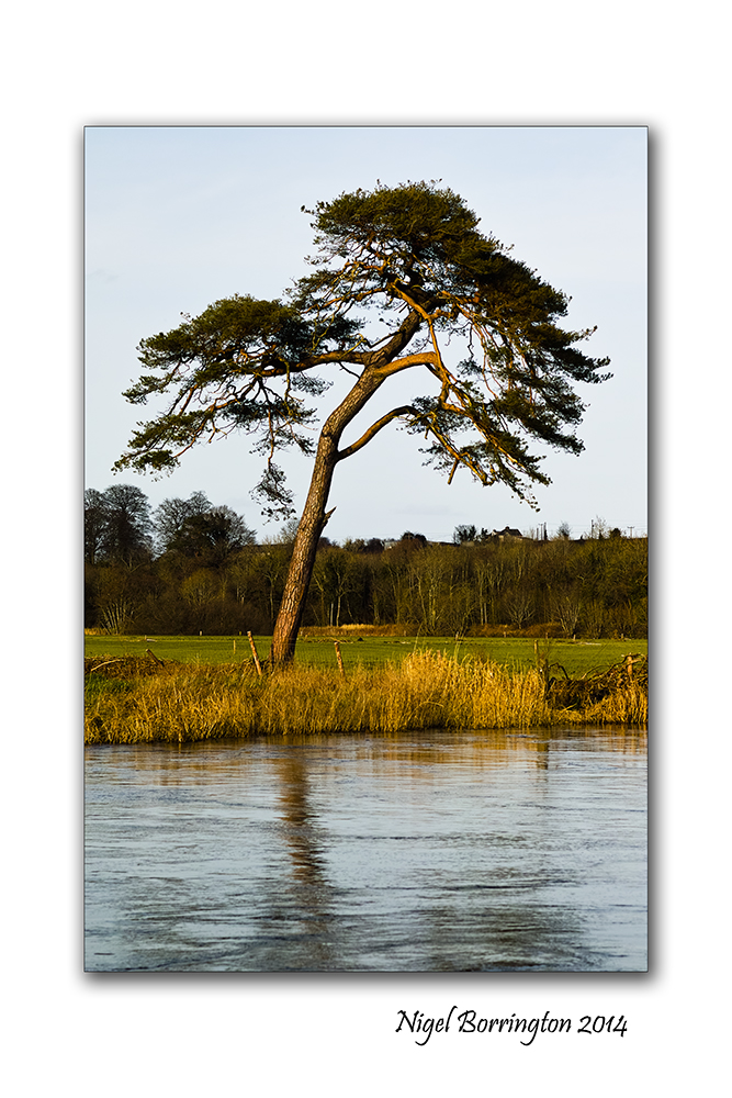
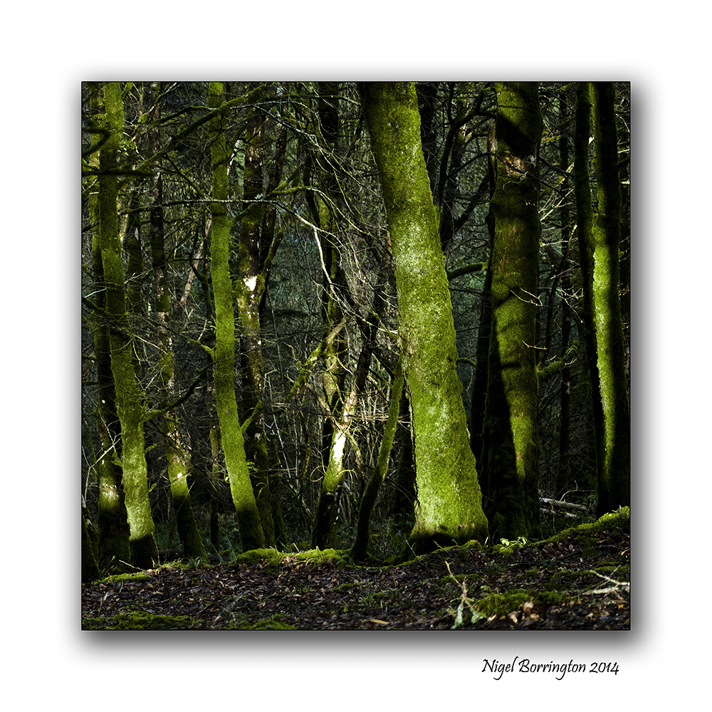
Single tree, By : Daniel Dawes

The Single tree on the river Barrow ,
County Kilkenny,
Landscape Photography : Nigel Borrington
Single tree
By : Daniel Dawes
I watch the light move across the land,
Gliding across the fields with ease,
Shades of green shifting constantly,
Darkness and light working together.
A single tree simply surviving,
Gracefully accepting all seasons,
Its deep roots keeping it grounded,
Its leaves allowing it to sing its song.
I watch its movement in the breeze,
I since its aliveness,
I feel its stillness,
I understand its far more than its label.
The invisible wind changes direction,
The sun falls behind the clouds,
It becomes colder,
The senses pick this up but the stillness remains.
A thought passes through my mind,
A simple question,
I choose to follow it,
It simply sits in my awareness.

What is this stillness?
That does not change with the environment,
That is unaffected by thought,
That senses the sensations.
I look back to the tree,
The awareness looks back at myself,
The mirror begins to reflect the same thing,
I thank the tree for its lesson.
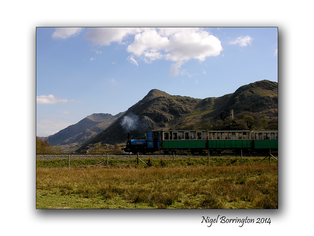
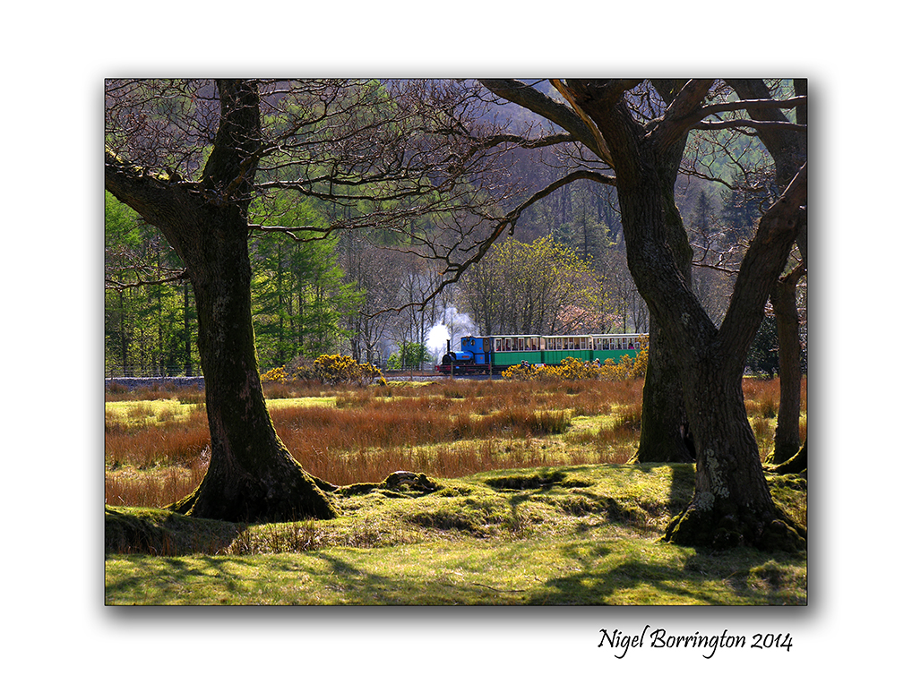
A Walk around Llyn Padaron , Snowdonia National Park.

Llyn Padaron , Snowdonia National Park
Landscape Photography : Nigel Borrington
Llyn Padaron , Snowdonia National Park
The lake of Padaron is located in the Snowdonia National Park, it is one of my favourite walks in north Wales, you can walk all the way around the lake with a full view of Mount Snowdon following you as a wonderful backdrop.
The Images below are just some that I took on a visit during a warm summers day in 2012.
Gallery


It’s the weekend so …….
Ballyvooney Cove, County Waterford
Irish Landscape Photography : Nigel Borrington
Its the Weekend so why not get outside, maybe head down to the coast and go for a beach walk, relax and and watch the waves roll in.
What ever you do, have a great weekend ….


Going Square format

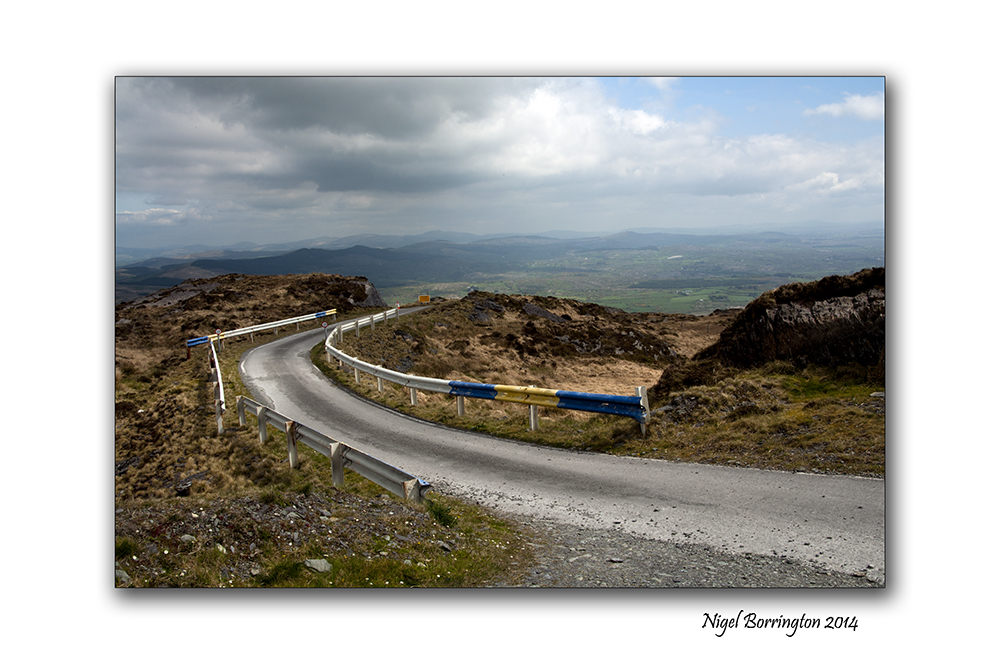
The Grange viewing point , County Tipperary
Landscape Photography : Nigel Borrington
Square format in the landscape

The concept of Square format images in photography dates back to its beginnings.
The idea of using this format makes great sense when you think about it, a lens placed at the front of the camera produces a fully round image so the idea of drawing a square in the centre of this circle and using this square for image produced on an exposed sheet of film would appear to make the best use of the lens for the final image.
In film cameras a camera that produces a square image is usually referred to as a 6×6 or 12×12, these figures referring to the size of the exposed film area. I have used and owned different 6×6 film camera using one during my photography course and for sometime after.
These are the basics of square format film cameras , today most Digital cameras work in a 6×4 image format, meaning that one side of the final image is 1/3 bigger in its dimensions that the other. Some digital cameras however (Such as the Canon G1 x) offer format options, because a sensor unlike film uses pixels to measure its dimensions, square format is now called 1×1.
Working with a digital camera in Square format your most likely going to use the LCD screen on the back of the camera to frame your image, cameras with electronic viewfinders however will show you the same 1×1 view of your subject. A camera with an optical view finder most likely cannot show you the view you need.
If you camera cannot work in anything other that 6×4 format , one trick if you want to produce a square image is to get some scotch tape and use it to square off the live view image that you see on you LCD screen, this will at least let you frame you image for this format.
Square format in the landscape
Ok, so that’s a little bit about the history of this image format and how to produce images using it today, so what about the landscape images produced in Square format.
Yesterday, I took my Canon G1x out on a walk and set it up for a 1×1 image size, Personally I really like using this format.
Many Landscape photographers don’t and I fully understand why, the main reason is that you do not get the same width to your images, this width would appear to be a basic feature of producing a Landscape photo. The idea of removing 1/3 of the image width would appear to be to limiting and it can be, but not always.
Personally I feel the very benefits that come with wide landscape images can also be a problem, some images need to be restrained in their content to reduce distraction, a square format is a great solution.
I feel that with a square image you gain the exact same hight to your image and this lets you include tall features like poles and trees or an old house , yet you can more easily confine your image to just these main subjects.
I have done my best in the images below to try and explore this and show what I feel is the benefits to going square format with your camera.
Square format Gallery


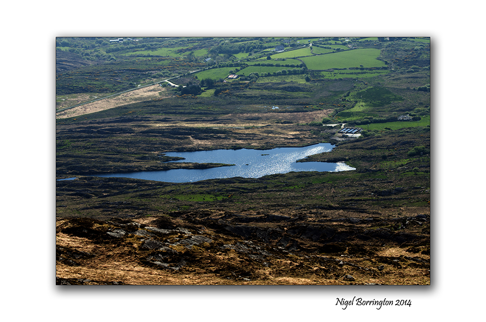
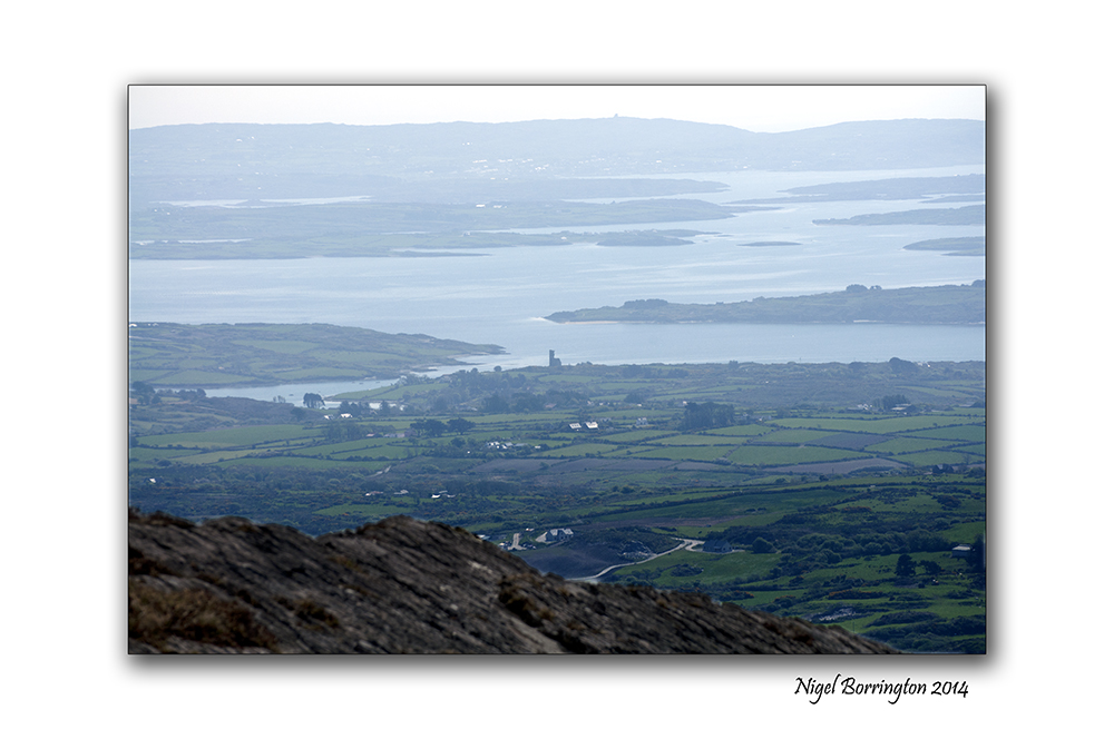
Mount Gabriel, County Cork
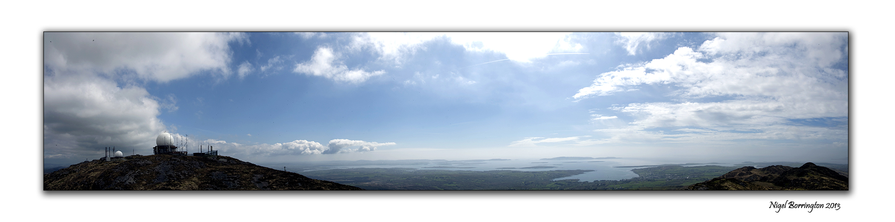
Mount Gabrial, county Cork
Irish Landscape Photography : Nigel Borrington
Mount Gabriel, (Cnoc Osta in Irish) is a mountain on the Mizen Peninsula to the north of the town of Schull, in West Cork, Ireland.
The Mountain is some 407m high and is the highest in the region of west cork, you can use a roadway that services a air traffic control radar to walk or drive to the top.
From the peak of Mt. Gabriel, there are spectacular views South over Schull Harbour and Long Island Bay. To the east and southeast, the views take in Roaring Water Bay and its many islands, popularly known as Carbery’s Hundred Isles. North and West is a panoramic view of the mountains of the Beara Peninsula and South Kerry.
The day we visited it weather was warm and very clear and we got some great views, this is a wonderful walk to do if you are in West cork and one that you will not forget, on a clear day you can see the entire county and all the Peninsulas of west Cork and Kerry to the north.
Mount Gabriel, County Cork, A Gallery


Stradbally cove and caves, County Waterford

Stradbally Cove and caves, County Waterford
Irish Landscape Photography : Nigel Borrington
The cove at Stradbally, County Waterford is on of my favourite places to visit along the coast line of souther Ireland, it a deep cove that contains some wonderful little caves that have a long history, Most likely used for smuggling goods in the past.
These days they more used to take shelter from bad weather or just sit in and enjoy for views of the blue sea here , they are a great feature well worth a visit.
Stradbally Cove and cave: Gallery


You must be logged in to post a comment.