
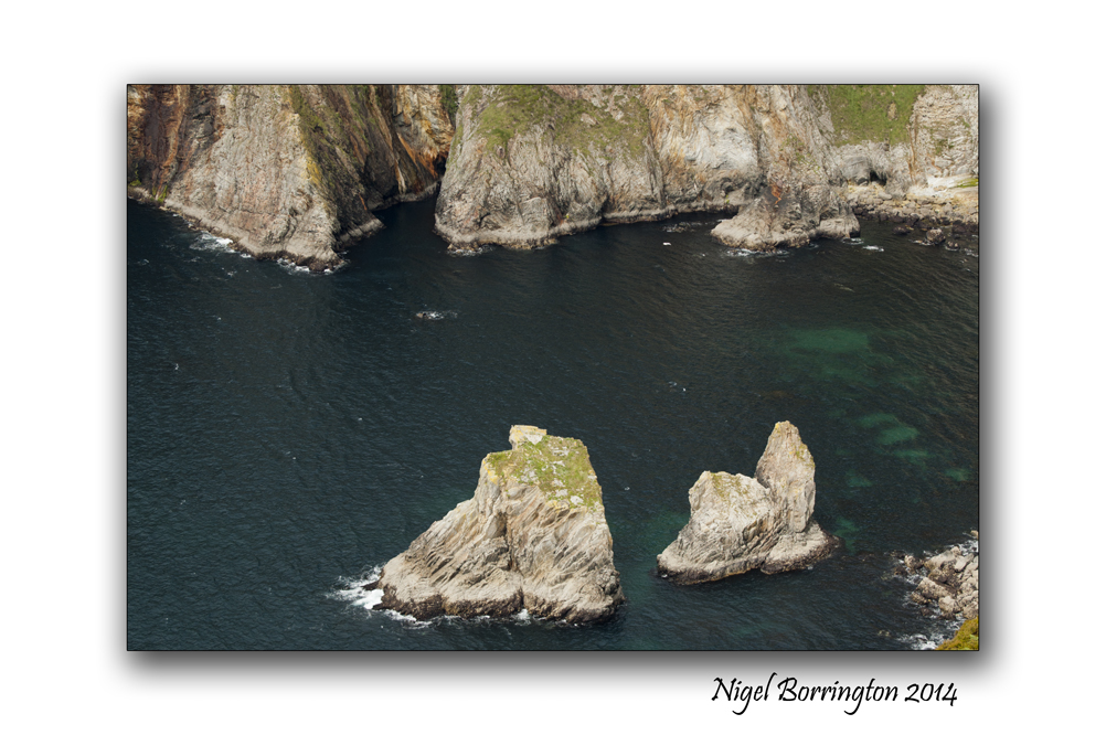
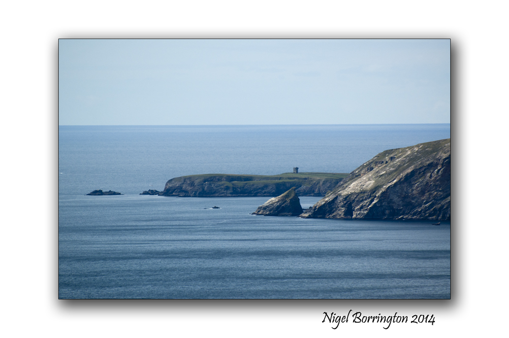
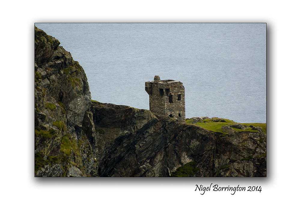
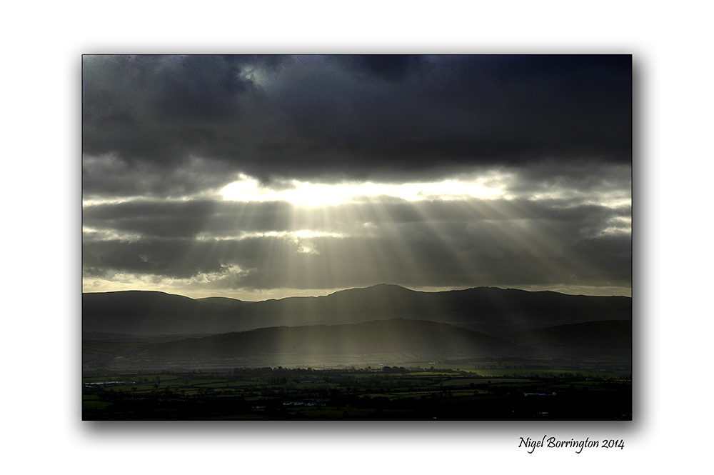
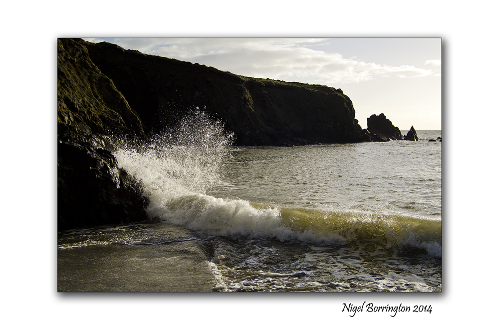
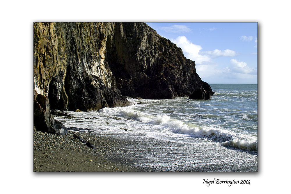
A walk along the Donegal coast line at Slieveleague

Landscape view of the Coast line , Croaghlin , Slieveleague , County
Irish landscape Photography : Nigel Borrington
We all have our favourite walks , places we come back to in our minds and the walk along the coast line of Croaghlin, Slieveleague, county Donegal, for myself personally is one of the best walks in Ireland.
The views south towards the mountain of Benbulben in North County Sligo are just breath taking here. If you are visiting county Donegal and the weather allows, you simply must visit and walk these coastal paths , a car park is very close to the start of the walk and the path surface is excellent.
Gallery


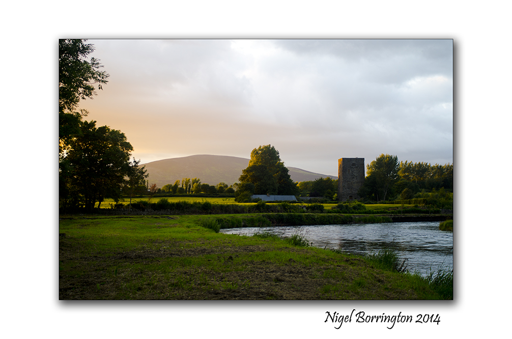
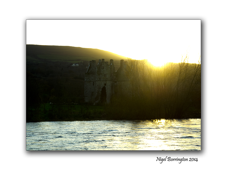
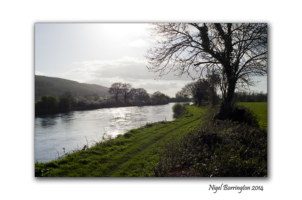
Last night I walked along the river, after the rain – Images and a Poem
Sunset along the river Suir, County Tipperary
Landscape photography : Nigel Borrington
Sometimes when I am out walking and taking pictures, I also use my phone to jot down some words then later use these to write a Poem.
I feel that words and poems – along with images are connected with one another in a big way. I love to share both here on this blog and I often share poems from people who share their work on poetry web sites, matching them to what I feel are related images I have taken.
This time the post is mixing my own Poem and Images from an evening walk along the river Suir, after a rain storm at the start of June.
————————————
Last night I Walked along the river after the rain
Last night in my dreams along the river I walked,
it rained and rained, The floods of June.
There will always be sunshine after the rain
Perhaps I walked , perhaps even ran,
Towards the Setting evening Sun.
 .
.
It lights up the river, I see every rushing and flowing drop,
The warmth from its light can calm every dreaming fear.
After it sets below the trees,
my dreams much deeper,
still linger throughout the night,
But suddenly vanish at dawn’s early light.

Poem and images : Nigel Borrington
A Grain Of Sand, Poem by Robert William Service
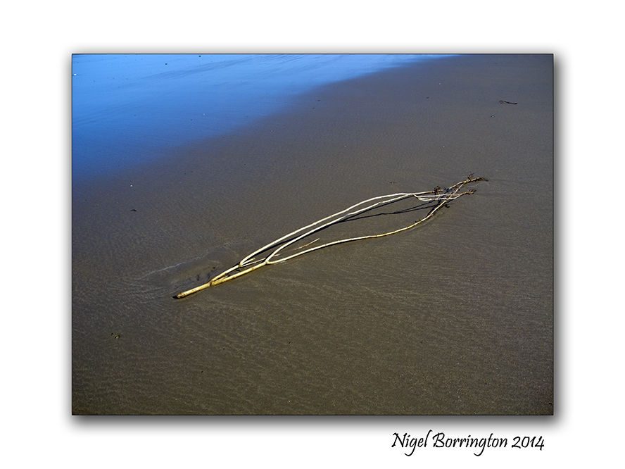
Landscape Photography : Nigel Borrington
A Grain Of Sand
Poem by Robert William Service
If starry space no limit knows
And sun succeeds to sun,
There is no reason to suppose
Our earth the only one.
‘Mid countless constellations cast
A million worlds may be,
With each a God to bless or blast
And steer to destiny.
Just think! A million gods or so
To guide each vital stream,
With over all to boss the show
A Deity supreme.
Such magnitudes oppress my mind;
From cosmic space it swings;
So ultimately glad to find
Relief in little things.
For look! Within my hollow hand,
While round the earth careens,
I hold a single grain of sand
And wonder what it means.
Ah! If I had the eyes to see,
And brain to understand,
I think Life’s mystery might be
Solved in this grain of sand.
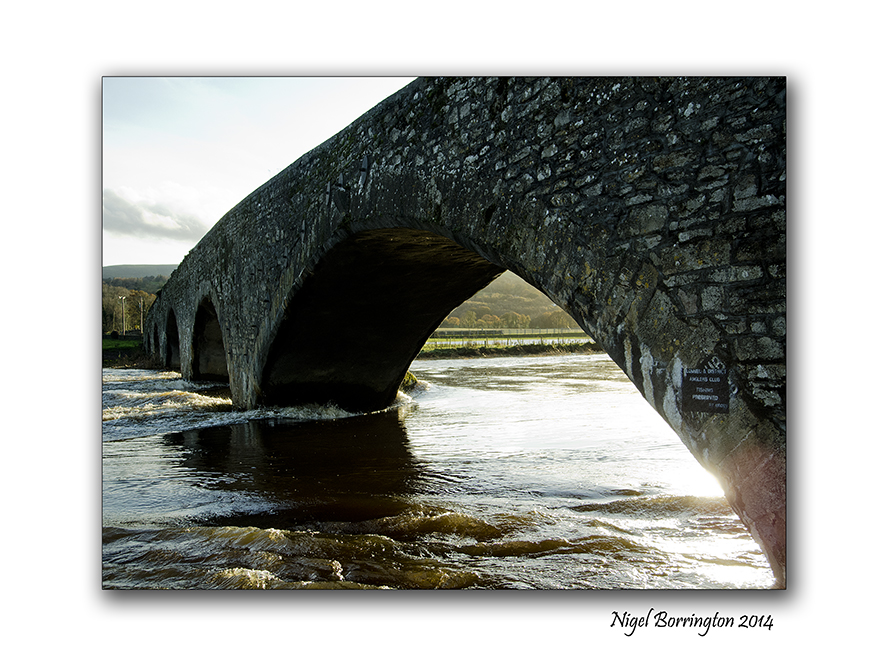
Changing light as the river flows.

Sir Thomas bridge, clonmel, County kilkenny
Landscape photography : Nigel Borrington
The changing light as the river flows
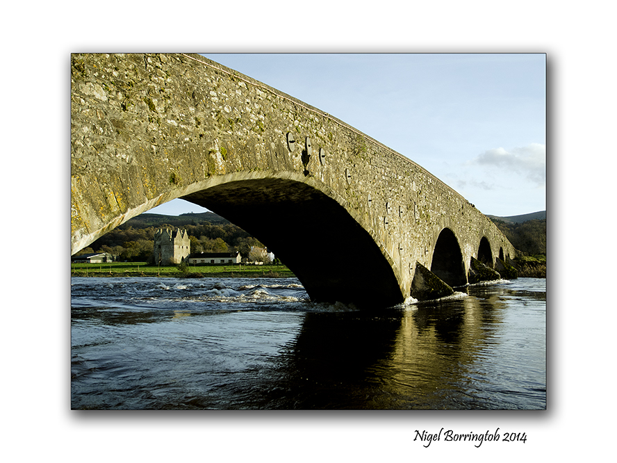
Walking along the river Suir on a springtime evening with the sun about to set, is a wonderful experience by itself but one of the things I love the most is the changing light. The light changes almost moment by moment and the reflections of the sun from the water is just amazing as you walk past some of the many bridges.
One of the best things about photography however is the ability to capture just how much this light does change, I recently put together this small collection of images and I think they show the way the light changes as the sun sets.
The entire landscape changes from yellows and and olive greens to deep blues and blue – greens.
I personally feel that the type of sun light and the different colours it brings is one of the most powerful tools in the art of photography and taking a little time to record your most loved locations at different times of day and weather conditions is a powerful learning tool for getting strong images and for you to have fun with and enjoy yourself.
The changing light as the river flows, Gallery

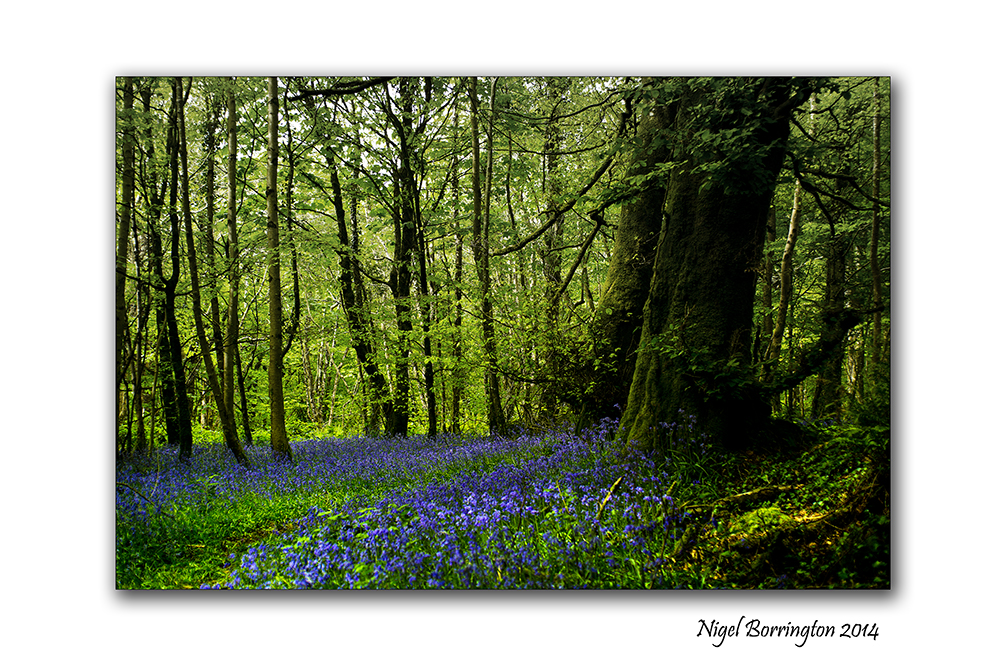
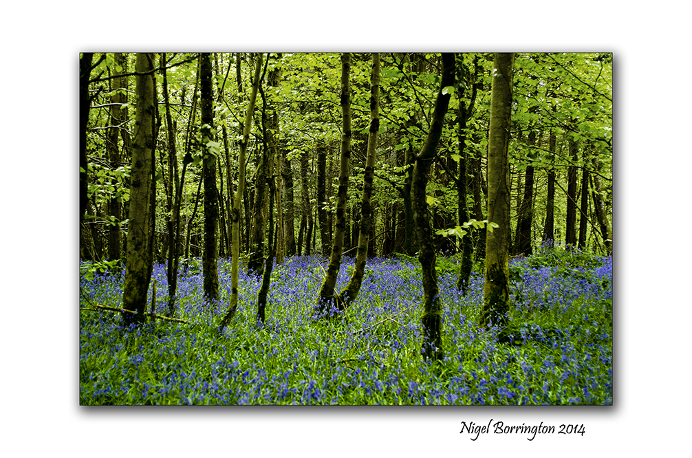
The Blue Monday’s of May – Sitting in the Bluebells
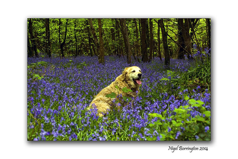
Bluebell Monday in Knockadrina woods, County Kilkenny
Landscape photography : Nigel Borrington
Blue Monday’s of May
Monday again and the month of May is truly in full flight in our local woodlands, In an effort to get my week started I took Molly for a walk in the woods and found the entire woodland floor covered in Blue bells.
Each Springtime these wonderful flower, fill the woods with the colour blue and its just a fantastic moment. It easy to forget just how green the these place are for most of the year. We get the odd purple orchid and yellow of other flowers but only during May do we get the colour blue filling the forest floor in every direction.
The Month of May – a blue month…….


As river flows, Poem by Peter Duggan.

A walk along the river Suir , County Tipperary
Landscape photography : Nigel Borrington
As River flows.
By : Peter Duggan
As river flows so peacefully
I sit here just content to be
As Ravens fly so high above
This morning, it was made for love
It enters deep into my soul
It’s sweetness making me so whole
This softest morning mystery
Oh, how it reaches out to me
The trees, they dance so gracefully
They wave, and flow upon the breeze
Bird song drifts from happy branches
Oh lord, how this my heart enhances
Silence rules above all this
A kind of stillness filled with bliss
Captivates my very core
Oh, I’d not wish for any more.
The river peaceful, calm and still
So wonderful it makes me feel
As it reflects those dancing trees
I watch and let the morning breeze
Caress my skin so tenderly
Then all is gone, there’s only me
The emptiness of all that is
I’m sailing on the waves of bliss.
River Suir Image Gallery


Walking through a field at Coolehill , images with a poem

Coolehill, Windgap, County Kilkenny
Irish Landscape Photography : Nigel Borrington
Walking across a field at Coolehill
Walking across the fields of Coolehill,
Ash, Briar, hawthorn, holly, and hazel
A wall around the field that your in.
 .
.
Above you
is a big blue sky, with its layers of soft clouds,
held up by the rows of oaks.
A sheltered patch of sunshine:
 .
.
I stop
and stand in silence
and close your eyes
and feel the warmth on your face,
whilst a blackbird sings.

inspired by Holbury Lane, Lockerley
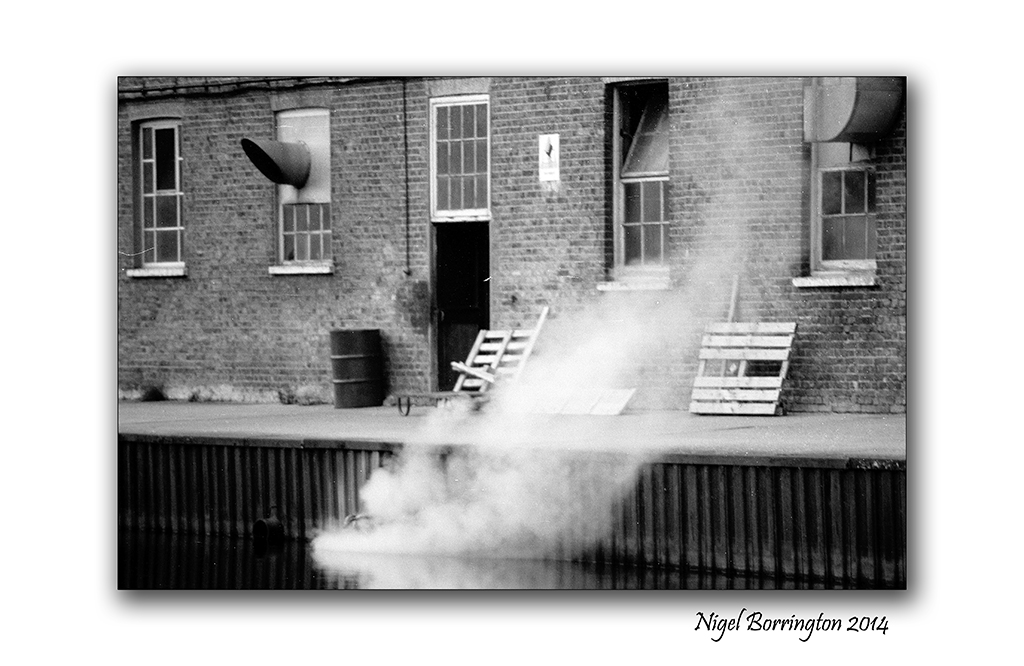
The Grand Union Canal, Walking through time.

Grand Union canal, Harefield, Hillingdon, London, England.
Landscape Photography : Nigel Borrington
Grand Union canal, Harefield (1988 to 2014)
Up until some 18 years ago I lived and worked in Harrow , Middlesex, North London. Working in the IT industry with long hours and shift work included. I really Valued my time off and would spend a lot of my weekends out walking in the country around North London. The Grand Union Canal was one of my most visited locations , it runs from Inner London to Birmingham in the Midlands of the UK.
Recently I took some time off to visit the Canal again after some twenty six years, It was great after all this time to get back and walk some old steps, I had no idea what could have changed. When I got back I remembered that I must have some old images taken during my original walks here.
So when I got back home to Ireland, I found some black and white images of an old canal side factory that marked the start of my walks, the images below show just how little the building has changed. It looks like it is just used for smaller office units these days but apart from this, its still very much looks like the place in my film images.
It was great to walk these old places, I have very good memories of walking and doing my best to relax after a long working week and to get a fresh image of the old canal in my mind was just great.
Film Gallery (1988), using a Nikon FM2 and Ilford XP2 Black and white film


 .
.
Digital Gallery (2014), using a Fujifilm X100.


After the Storm, Poem by : Hilen Letiro

Killamery woodlands after the February storms of 2014
Landscape photography : Nigel Borrington
After the Storm
by Hilen Letiro
The storms may come And limbs may break;
Yet others bend Beneath the weight
Of heavy rain And windy breeze…
A storm can mark The strongest trees.
 .
.
Life sometimes deals With us this way;
In unseen trials We meet each day.
It’s not how much our bodies break
Or how much they may bend;
It’s Our Outlook In Our Own Life
That helps our spirits mend!
Read more at Poem : After the Storm
Skellig Michael : Inside the walls
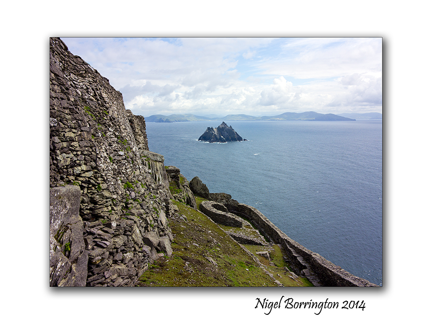
Skellig Michael, county Kerry, Ireland
Landscape Photography : Nigel Borrington
Skellig Michael : Inside the walls
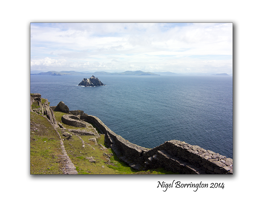
Skellig Michael is an Island some 12 to 16 kilometres by boat from the ring of kerry, county Kerry, Ireland. It is most famous for the fact that during the 6th to the 8th Century’s a religious settlement was established here.
The Island is a world heritage site and falls under the guardianship of UNESCO, you can find the official historic details from the link on the world heritage web page here : Skellig Michael
In my last two posts I shared the boat trip to the Island and then the long but wonderful walk up to the settlement at the very top of the Island some 218 meters from sea level. Today I just want to share images of the inside area , the location that the people who lived here spent their life’s and also the location in which they are buried and there final resting place.
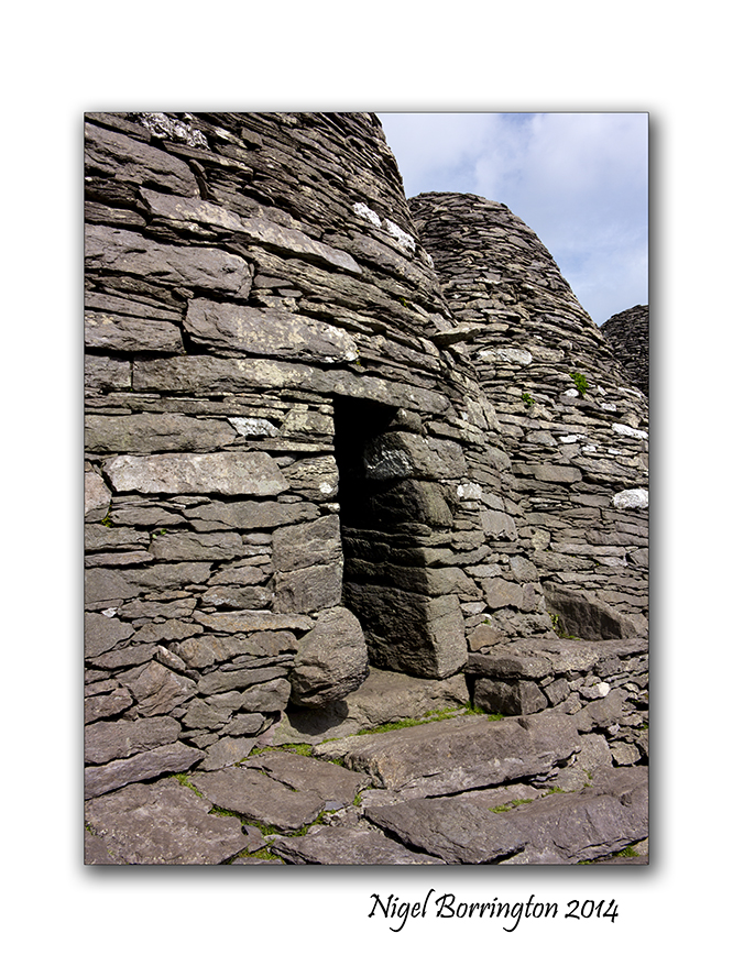
The images in the Gallery below are placed in the order that you view the buildings when you walk through the site, the only access is through a small passage in the outer walls.
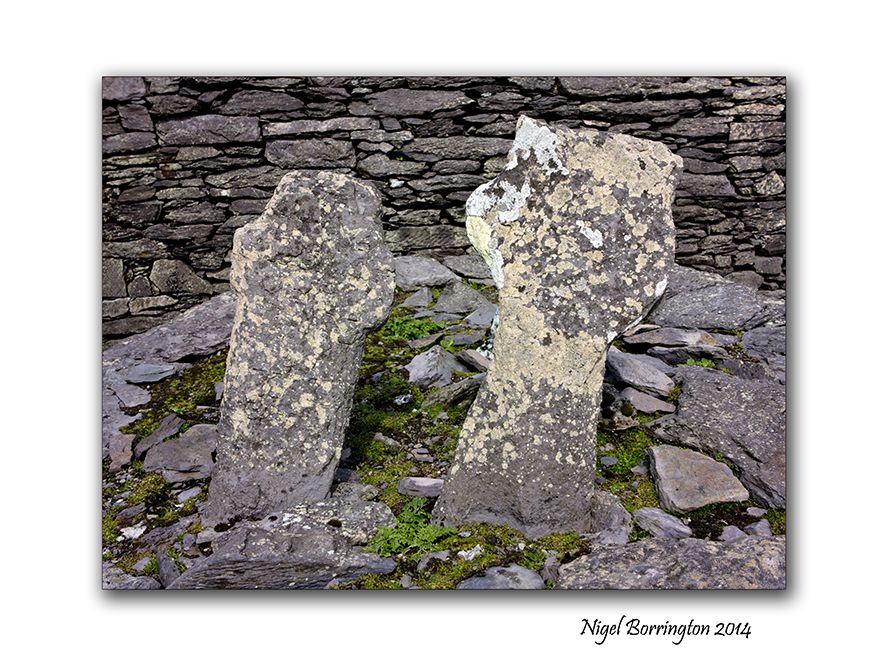
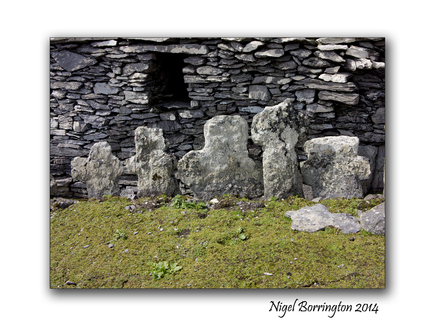
The very first thing that greets you are two small head stones, in a very small patch of grass. These are the graves of two young boys, it was a tradition that monks in this period would take very young boys as members to their orders. These boys where from families on the main land and once they moved here they would most likely never return to see there families. Our guide informed us that it is a possibility that both boys were killed by Viking invaders as when the remains where examined wounds were found that indicate that they were killed by the use of weapons, both boy did not pass the ages of ten or twelve. It is also thought that other graves in the pictures here, in the centre of the living area contain some adult victims of such attacks.
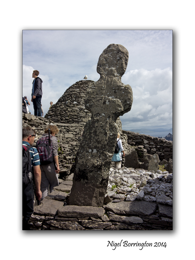
A monastery may have been founded as early as the sixth century, reputedly by Saint Fionán but in 1044 rededicated to Saint Michael, the image here shows a large sculpture that is located towards the middle of the complex. It was described by our guide as being a cross but it could also be very much in the form of a human figure, with the arms to the side and a head looking over the site.
The word Skellig is defined as meaning “splinter of a stone”, and thus this rocky island was dedicated to saint Michael, there are also other Islands around Europe and maybe further away that are dedicated to this saint ( Mont Saint-Michel France, St Michael’s Mount Cornwall)

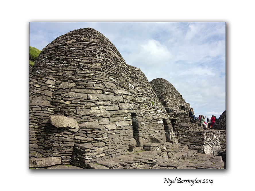
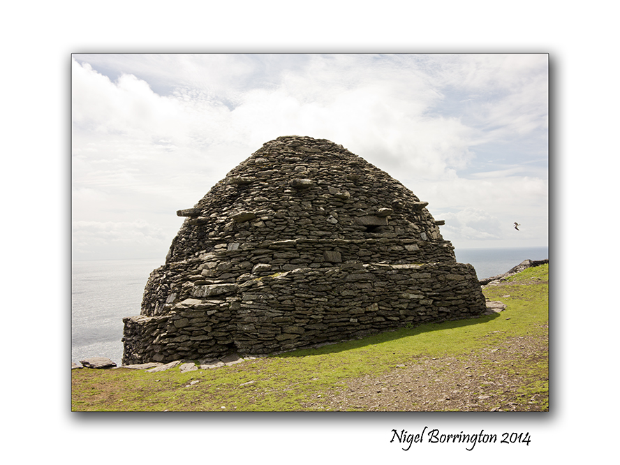
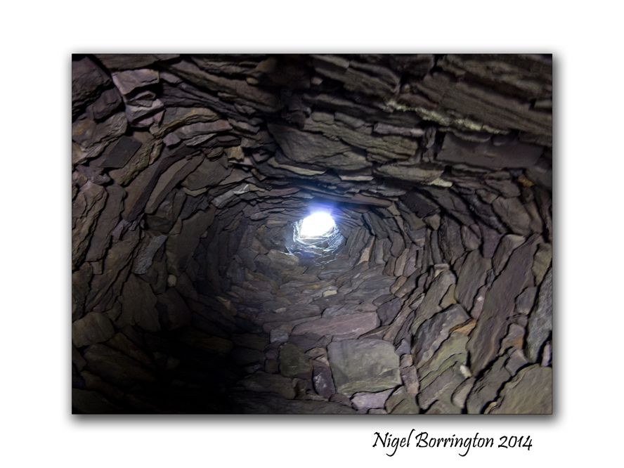
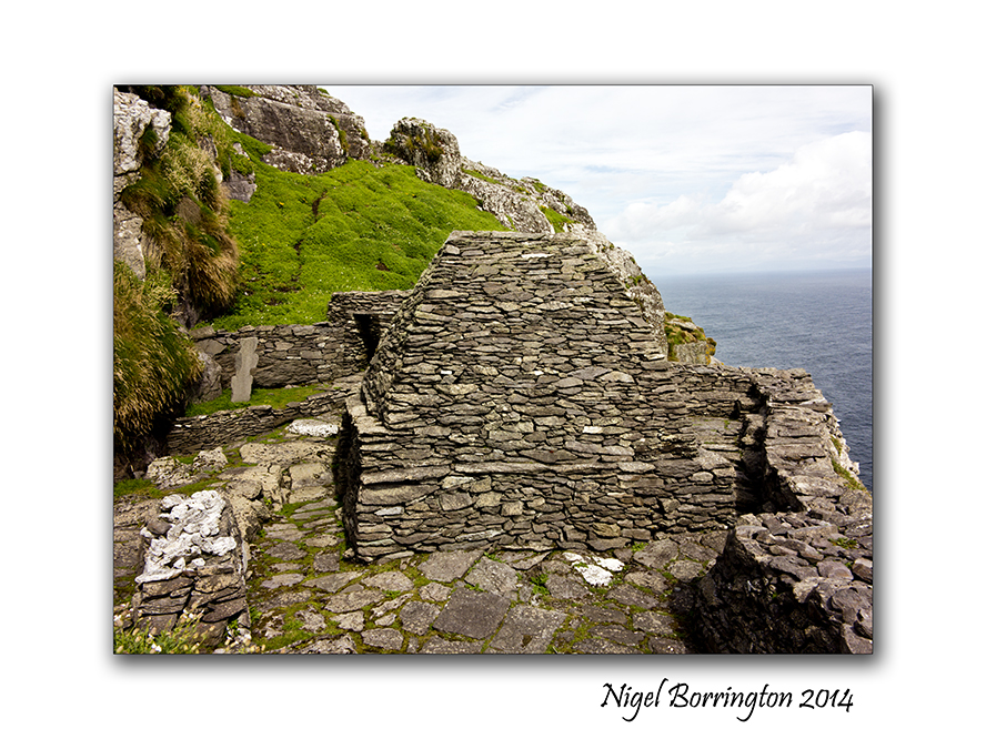
One of the most famous features of Skellig Michael are the so called Beehive structures, there were may be six or seven of these of which six are still standing, they were the living space for each of the monks, this fact would indicate that a maximum of seven people lived here in the beehives at any one time, there is a structure at the very end of the settlement that is constructed completely differently, It is thought that the head of the order would have lived in this building but few fact to prove this exist.
In any case the indications are that eight people lived on Skellig Michael at anyone time during its long history.
Living with in these stone constructions looks very harsh , during the time they were occupied however they would have looked very different, in some of the pictures you can see supporting stones that stick out of the main buildings by some amount, it is thought that these stones supported a covering of thatch consisting of straw and clay, this would have been deep and was used to keep the inner stone structure warn and dry. Not all but some of the Beehives have a hole in the roof that was used to let out smoke from fires inside.
At some point I want to post about the life’s of these people, who they were and why they chose to live here, I need to read a little more however , so for the moment that’s it. Three post over the last three day that I hope share a visit to this wonderful and mystical island. If you get a chance I would really in-courage you to visit. Its an experience of a lifetime and helps to open your mind to European history.
I cannot help however feeling that this place holds something else other than the official history, The question as to why these monks felt the need to occupy Skellig Michael, so far of the Irish coast line, is very big !
This place feels like an escape, a refuge but from what and why ?
With such massive risk’s taken by a small group of people to construct three stone walk-ways to the top of the Island and then build the settlement, the question of why looms very large. These were times that the word of Christianity was first being spread across Ireland so why the need to hide away here ?
I need Much more reading, before I understand these bigger questions 🙂
Gallery


Skellig Michael, Six hundred steps to heaven
Skellig Michael (unesco heratage site) , country Kerry Ireland
Irish Landscape Photography : Nigel Borrington
Skellig Michael, six hundred steps to heaven
During the summer last year I finally achieved a long ambition, to visit Skellig Michael and the Skellig islands some 16 kilometres off the county Kerry coast line, Ireland.
In yesterday post I shared the boat trip out to the Islands, today I want to share the walk up the six hundred plus stone laid steps to the very top where the world famous monastic outpost is located.
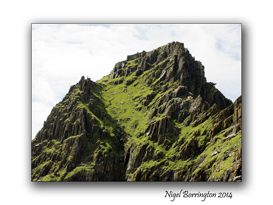
During the boat trip one of our guides pointed out one of three stair cases to the top, if you open up this picture you will see it rising up to the settlement, there are three of these routes up that were hand built with stone cut on the island. The three of them provided landing points during different tides and weather conditions.
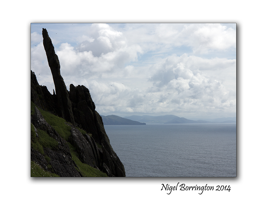
Landing on the Island is an experience in its own right as the swell from the sea water makes stepping off the boat great fun. As you set foot on ground again, the first stage of the walk to the top is a well laid foot path taking you to about half way around the island and about one third of the way up the 218 meters you need to climb before reaching the settlement.
As this path ends you are met by a guide, who very firmly insists you all receive a health and safety talk, sadly sometime back a visitor died while walking up the steps, the walk is very steep and if you loose your footing the drop all the way to the sea below is not broken by any obstacles. He advises to take your time, “its not a race to the top and that if you need a rest to take one.”
The walk up is hard but very pleasurable, the views as you go are stunning if a little breath taking due to the hight. One of the warnings however was to keep your eyes on your steps and not to take any images unless you had stopped in a secure location and moved aside for others to pass, even telling the people behind that you intend to stop. as you can see in the images below there are some platforms and viewing points and I did my best to only stop here.
One of the wonderful views on your way up was the hundreds of Puffins nesting here, they were due to leave any-time so its was great to still find so many of them, I got many images of them along the way.
Finally after some forty minutes you reach the last set of steps , turning through some sharp rocks you get the first view of the Settlement. This sight just takes you back, the stone wall that greets you is about four meters high from a terrace that is the only flat area on the entire Island, being used to grows vegetables in its day.
From here the only access to the inner yards and structures is through a small door in the stone wall.
On entering you are met with the sight of the famous beehive cells of which six are still standing. The enclosed area is small and fully protected from the elements by the hight of the sea facing wall. The structure of the cells is very unique and fascinating to see. in the centre of the buildings is a small grassed area that served as a grave yard. I found this fact very interesting as it outlines the fact that the people who lived here spent their entire lives living on this Island from the moment they first arrived.
I want to post one more time on Skellig Michael, showing the full structures , living spaces and detail some of the history of this place. It is truly a fascinating place that holds some mysterys. The biggest one’s to me are : why here ?, why did these people select to live at the top of a rock over ten kilometres from the Kerry coast line, when they could have just lived on the main land?
More in the next post …
Skellig Michael, image Gallery


Slate Quarries, Ahenny

Ahenny Slate Quarries, County Tipperary
Irish Landscape photography : Nigel borrington
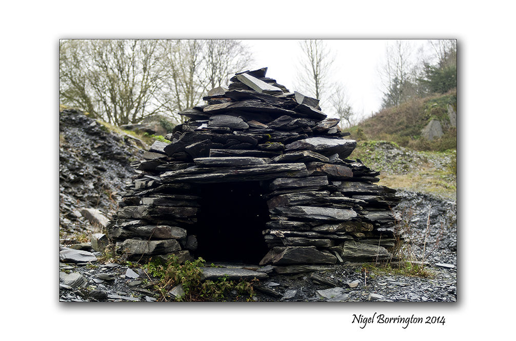
Slate Quarries, Ahenny County Tipperary
The now disused slate quarry at Ahenny County Tipperary was quarried from the 14th Century onwards. Stone from this site was used in the building of Kell Priory in Kells and Ornmonde Castle in Carrick on Suir. The quarry now hosts an outdoor gallery of sculptures.
Located to the south of the village, the Victorian Slate Quarries is an area of both local and international history. Quarrying in the slate quarries of Tullahought were predominant during the reign of Queen Victoria. A large community was built up around the area which covers land in both Kilkenny and Tipperary. Tullahought shares its association with the quarries with the south Tipperary village of Ahenny, which claims the larger of the 3 lakes created by the quarrying of slate in the area.
In the mid 90’s, a yearly festival known as the “Slate Quarries Festival”. The first festival was marked with the creation of stunning works of art which were made entirely out of slate. The art work included the Miners Egg, The Weir, the Dinosaur and most notably, Noah’s arc which sat at the cliff edge over looking the lake.
The most notable building attributed to have the quarries slate is the Palace of Westminster in London (UK House of Parliament).
Gallery


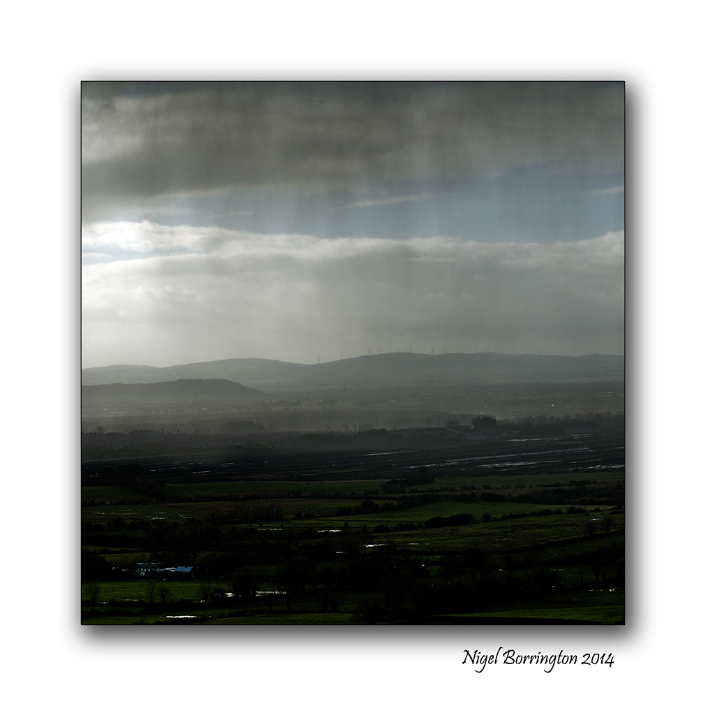
Irish Boglands

Landscape of an Irish peat bog
Landscape Photography : Nigel Borrington
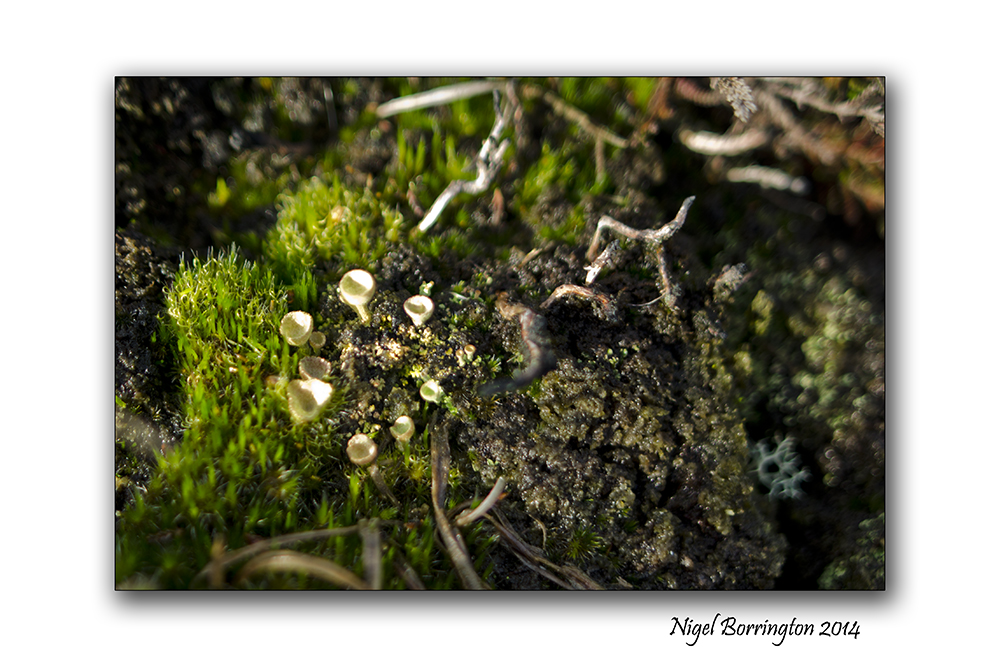
Irish Blanket Bogs
One of Ireland’s most characteristic landscape features is the blanket bog lands. Covering 1,200,000 hectares (1/6th) of the island, Ireland contains more bog, relatively speaking, than any country in Europe except Finland. Across Europe, as well as in Ireland, bogs have been exploited in recent centuries as a source of fuel. With many of the bogs in the rest of Europe already gone, Ireland’s bogs now have an increased importance to the scientific community, as well as the tourist industry.
I took the following images last year on a visit to one of the blanket bogs in the Irish middlands.
Irish blanlet blog-land Gallery


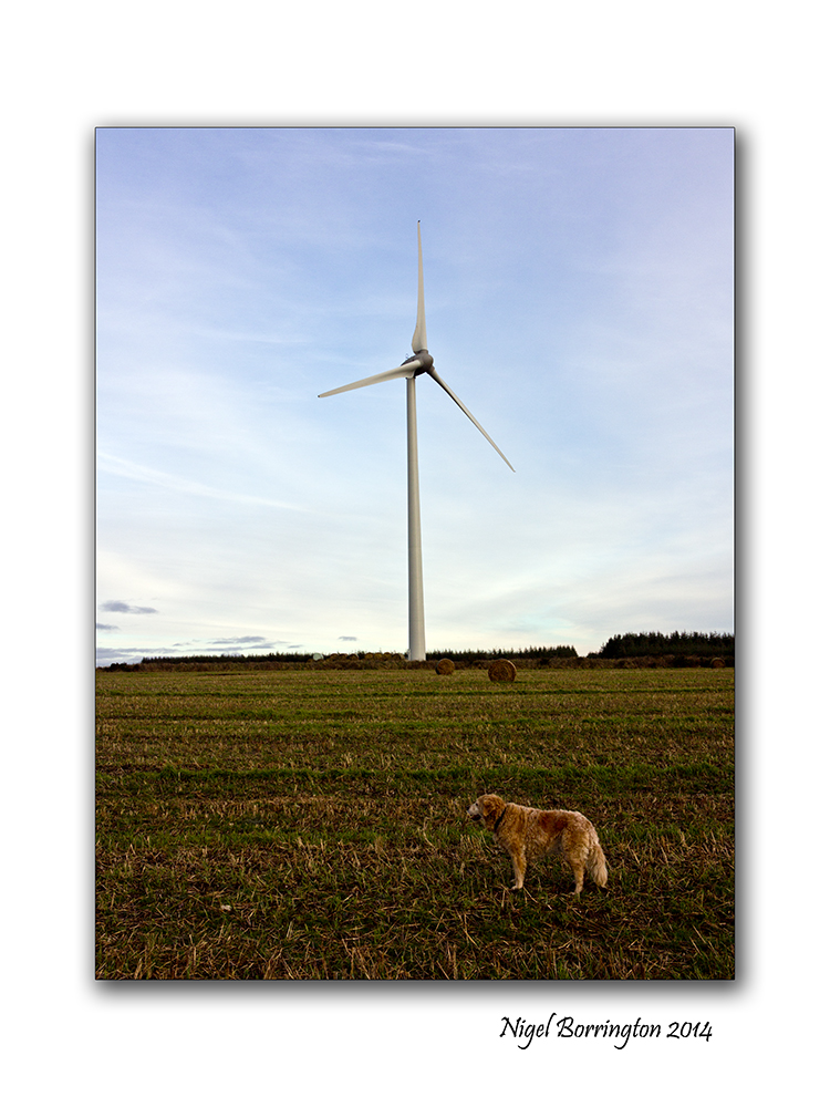
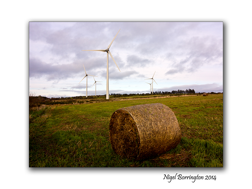
Ballymartin Windfarm , County Kilkenny

Ballymartin Wind farm, County KIlkenny
Irish Landscape Photography : Nigel Borrington
The hills above Mullinavat, County kilkenny offer some wonderful landscape views of south Kilkenny. I love walking around the lanes up here as it is so remote and peaceful.
Over the last 5 years these hills have become a home to a new feature in the landscape, the Ballymartin wind farm, I took these images on an evening walk back in February along with a couple of images of the surrounding landscape.
While I do understand that many people did not want these wind turbines here, I don’t personally have anything against them, they do offer a better solution than a coal powered power plant. I guess it is unlikely that a coal plant would have been built in this location but these turbines maybe stopped one being built in another place.
They are almost graceful as they make use of the wind rushing across the surrounding hills.
Gallery


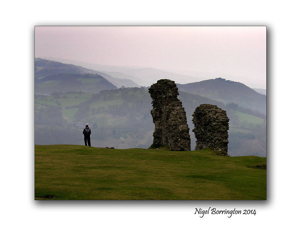
Castell Dinas Bran and the story of Myfanwy.
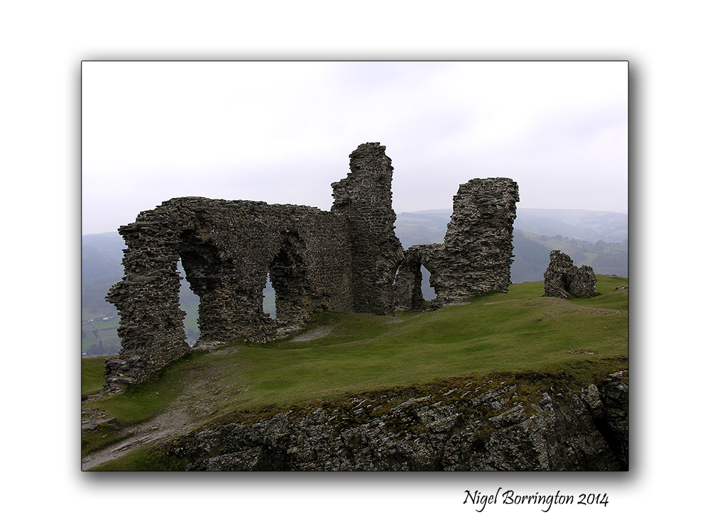
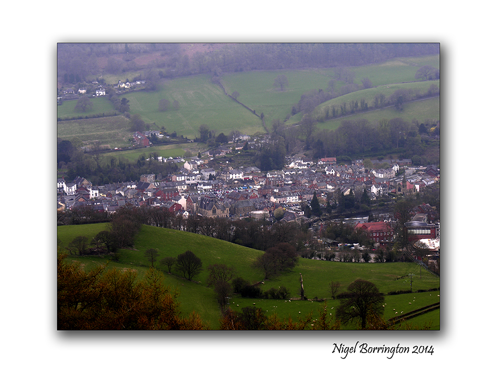
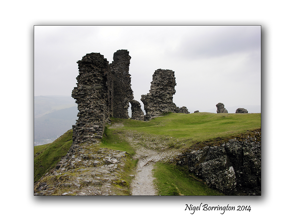
Castell Dinas Bran, Llangollen in Denbighshire, Wales
Landscape Photography : Nigel Borrington
The welsh castle of Dinas Bran is located about the wonderful welsh town of Llangollen in Denbighshire, Wales.
This Castle is a magical place to visit , its the location of a hill fort and remains of a later castle. The walk out of Llangollen to the top of the hill is sort but very steep yet well worth the effort. The views of the horse shoe pass and the surrounding hills is just wonderful.
Whilst the historical record for Dinas Brân is sparse, there are many myths and legends associated with the ancient site.
The popular Welsh song ‘Myfanwy’ was composed by Joseph Parry and first published in 1875. Parry wrote the music to lyrics written by Richard Davies (‘Mynyddog’; 1833–77). The lyrics were probably inspired by the fourteenth-century love-story of Myfanwy Fychan of Castell Dinas Brân, and the poet Hywel ab Einion. That story was also the subject of the popular poem, ‘Myfanwy Fychan’ (1858), by John Ceiriog Hughes (1832–87).
The castle first literary appearance is in a 12th century historical document entitled “Fouke le Fitz Waryn,” or “The Romance of Fulk Fitzwarine.” In this tale the castle, named “Chastiel Bran,” is referred to as a ruin during the early years of the Norman Conquest. The tale continues to tell of an arrogant Norman knight, Payn Peveril, who hears that no one has had courage enough to stay overnight inside the castle ruins, for fear of evil spirits. Payn and 15 ‘knightly followers’ determine to stay the night. A storm blows up and an evil, mace-wielding giant called Gogmagog, appears. Payn defends his men against the attacks of the giant with his shield and cross, then stabs Gogmagog with his sword. As the giant is dying he tells of the earlier bravery of King Bran who had built the castle to try to defeat the giant. Despite King Bran’s attempts against Gogmagog the King had been forced to flee and since then the giant had terrorised all the land around for many years. The giant also tells of a great treasury of idols buried at Dinas Bran which includes swans, peacocks, horses and a huge golden ox but dies without revealing its location.(Oman 1926, 1989)
The Story of Myfanwy
The brooding site is the backdrop for the sad love story of Myfanwy. She is a princess and renowned for her beauty throughout Powys in Wales. Myfanwy is proud of her looks and wants her many suitors to proclaim her beauty in song and verse. Many come to court her but are not able to compose songs that truly reflect her looks. She rejects them all.
However, in the valley beneath the castle lives a poor bard Hywel ap Einion. Taking his courage in his hands the young bard goes to the castle and sings and plays for Myfanwy. Whilst he performs his song to her she is captivated and will look at no other. Hywel ap Einion believes his love for her to be reciprocated because of this.
His hopes and dreams are thwarted when a rich, handsome and more articulate man comes to seek her affection. The dejected Hywel then wanders the forests and lands of Difrdwy and recites this sad poem to his unrequited love:
“Oh fairer thou, and colder too,
Than new fallen snow on Arran’s brow
Oh lovely flower of Trevor race,
Let not a cruel heart disgrace
The beauties of thy heavenly face!
Thou art my daily thought each night
Presents Myfanwy to my sight.”
Image Gallery


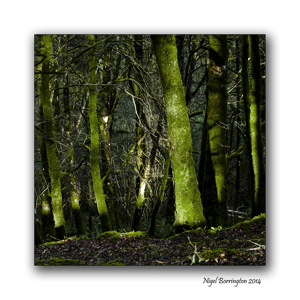
Sunset in the woods , Images and a Poem

killamery Woodlands . County Kilkenny
Landscape Photography : Nigel Borrington
Yesterday evening I went for a evening walk in Killamery, one of our local woodlands, The Sunset was wonderful and the Sky a deep blue, the moment was charged with atmosphere and I just wanted it to last a little longer than I knew it possibly could.
I took these images to capture the moment and later just put down these words.
 .
.
Sunset in the woods
As the sun falls away over the trees
I am cold like the colours in the sky.
Blue and crazy for the woods around me.
 .
.
Beautifully arranged trees and painfully separated.
I follow down this woodland path.
Hoping that the Sun will stay on the Horizon.
Just giving me one more moment to be lost.

The Changing faces of the Kings river , County Kilkenny

The Kings River, Callan , County Kilkenny
Irish Landscape images : Nigel Borrington
The Changing faces of the Kings river
The Kings river has its source in the Slieveardagh Hills in South Tipperary and has many tributaries of its own.
It flows southeast from the hills and crosses into County Kilkenny. It is joined by the Munster River before passing through the town of Callan. It continues eastwards from Callan, past Kells and joins the River Nore west of Thomastown.
Having made a small photographic project of the river, the images below are taken over about a five year period. They are just some of the images I have captured, I feel they show how the passing seasons and the Irish weather effect this little river.
Gallery


Visiting the Saltee Islands spring 2014

Saltees Islands In Spring
Wildlife and Landscape photography : Nigel Borrington
This Spring I am planning another visit to the The Saltees Islands, St. George’s Channel. The Islands consist of the Great and Little Saltee, they are situated approximately 5 kilometers off the coast of Kilmore Quay Co.Wexford.
The larger island Great Saltee is the most famous bird sanctuary in Ireland and is very popular with both day-trippers and birdwatchers alike. These Islands are privately owned and are one of the world’s major bird sanctuaries.
It’s a wonderful visit to make if your into wildlife and Photography or just a wonderful place to spend the day.
The below images were taken last spring.
Saltee Island Gallery


ST Patrick’s day , Irish landscape Gallery.

Coolagh old church , County Kilkenny
Landscape photography : Nigel Borrington
Today is St Patrick’s day here in Ireland and its a public Holiday, For many people religion will play a big part in the day.
Personally I love the outdoors far more and will spend most of the day walking and exploring the local landscape, I find nature and open spaces far more spiritual.
The following gallery of images are just some images taken in and around the wonderful county of Kilkenny.
What ever your doing today enjoy yourself and a happy St Patrick day.
Kilkenny Landscape Gallery


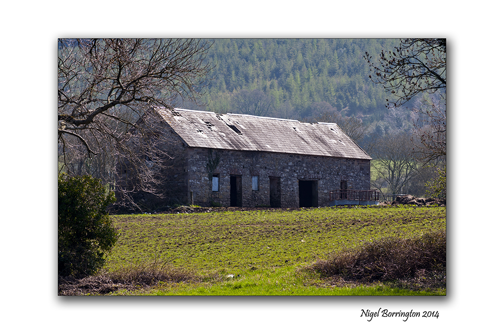
Irish Landscape Photography : The barn by the bank of the river suir.
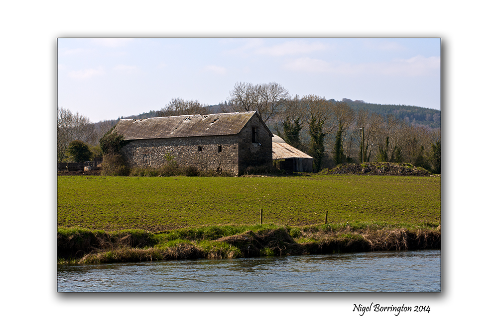
Images from the River Suir, County Tipperary
Landscape photography : Nigel Borrington
A walk along the River Suir as it flows through county Tipperary offers some wonderful views, the old stone barns and farm yards have to be amongst the best of these.
I took the pictures below on a spring walk last year, a warm Sunday afternoon.
The Barn by the river Suir, Gallery


Using old lenses , Hoya M42 28mm f2.8

Hoya M42 , 28mm f2.8 lens
Using Old M42 lenses on a digital SLR

M42 lenses fit to the camera body using an adaptor for the body you own.
Over the years that I have been taking images using SLR cameras both film and now Digital, the items that I have always show the most interest in are the lenses I have Purchased.
These days lenses are usually purchased as a secondary item to the camera body, with all the dazzling features and technology that goes into cameras and marketing them, it is easy to forget just how important an item a lens is.
It is the lens that produces the image, the camera just records this image and if its a great lens then your image stands a good chance of being so too.
Something that becomes very clear to you, the longer your into photography is that for the most part, lens technology the parts of the lens that really create the image, has been very good for a long time. Little development is needed with the type of glass and the coatings that are used on the lenses.
Most of the development today is with adding lens features such as image stabilisation, the process of moving some of the lens elements to allow for any movement in the camera while it is being held in your hands and help produce a stable image.
So just how far back do you have to go to get a good if not great lens ?
Hoya is a lens filter and lens coating company, they have done huge amounts of research and development over an very long period of time. you may know of them mostly through their UV filters that are attached to a lot of peoples lenses.
Back in the 1970’s along with a lens manufacture Tokina they also sold a limited number of great lenses, I am lucky enough to own a Hoya 28mm f2.8 M42 lens in very good condition, it cost £50 in 1975. I have used this lens for many years for Landscape work and have always been very happy with its results.
This is a fully Manual lens , No auto focus, no stabilisation, No auto exposure and just perfect for Landscapes.
I feel that landscape photography should take a little time and the fact that everything is fully manual with this lens, just adds to this experience. You have to think through all the settings and this extends into your thoughts about what your taking images of.
I feel that this Hoya lens is one on the best I have for reproducing great colours, contrast and sharpness.
The Gallery below is just a quick sample of some very recent images taken using this lens.
Hoya M42 28mm, f2.8 lens gallery


Going Square format

The Grange viewing point , County Tipperary
Landscape Photography : Nigel Borrington
Square format in the landscape

The concept of Square format images in photography dates back to its beginnings.
The idea of using this format makes great sense when you think about it, a lens placed at the front of the camera produces a fully round image so the idea of drawing a square in the centre of this circle and using this square for image produced on an exposed sheet of film would appear to make the best use of the lens for the final image.
In film cameras a camera that produces a square image is usually referred to as a 6×6 or 12×12, these figures referring to the size of the exposed film area. I have used and owned different 6×6 film camera using one during my photography course and for sometime after.
These are the basics of square format film cameras , today most Digital cameras work in a 6×4 image format, meaning that one side of the final image is 1/3 bigger in its dimensions that the other. Some digital cameras however (Such as the Canon G1 x) offer format options, because a sensor unlike film uses pixels to measure its dimensions, square format is now called 1×1.
Working with a digital camera in Square format your most likely going to use the LCD screen on the back of the camera to frame your image, cameras with electronic viewfinders however will show you the same 1×1 view of your subject. A camera with an optical view finder most likely cannot show you the view you need.
If you camera cannot work in anything other that 6×4 format , one trick if you want to produce a square image is to get some scotch tape and use it to square off the live view image that you see on you LCD screen, this will at least let you frame you image for this format.
Square format in the landscape
Ok, so that’s a little bit about the history of this image format and how to produce images using it today, so what about the landscape images produced in Square format.
Yesterday, I took my Canon G1x out on a walk and set it up for a 1×1 image size, Personally I really like using this format.
Many Landscape photographers don’t and I fully understand why, the main reason is that you do not get the same width to your images, this width would appear to be a basic feature of producing a Landscape photo. The idea of removing 1/3 of the image width would appear to be to limiting and it can be, but not always.
Personally I feel the very benefits that come with wide landscape images can also be a problem, some images need to be restrained in their content to reduce distraction, a square format is a great solution.
I feel that with a square image you gain the exact same hight to your image and this lets you include tall features like poles and trees or an old house , yet you can more easily confine your image to just these main subjects.
I have done my best in the images below to try and explore this and show what I feel is the benefits to going square format with your camera.
Square format Gallery


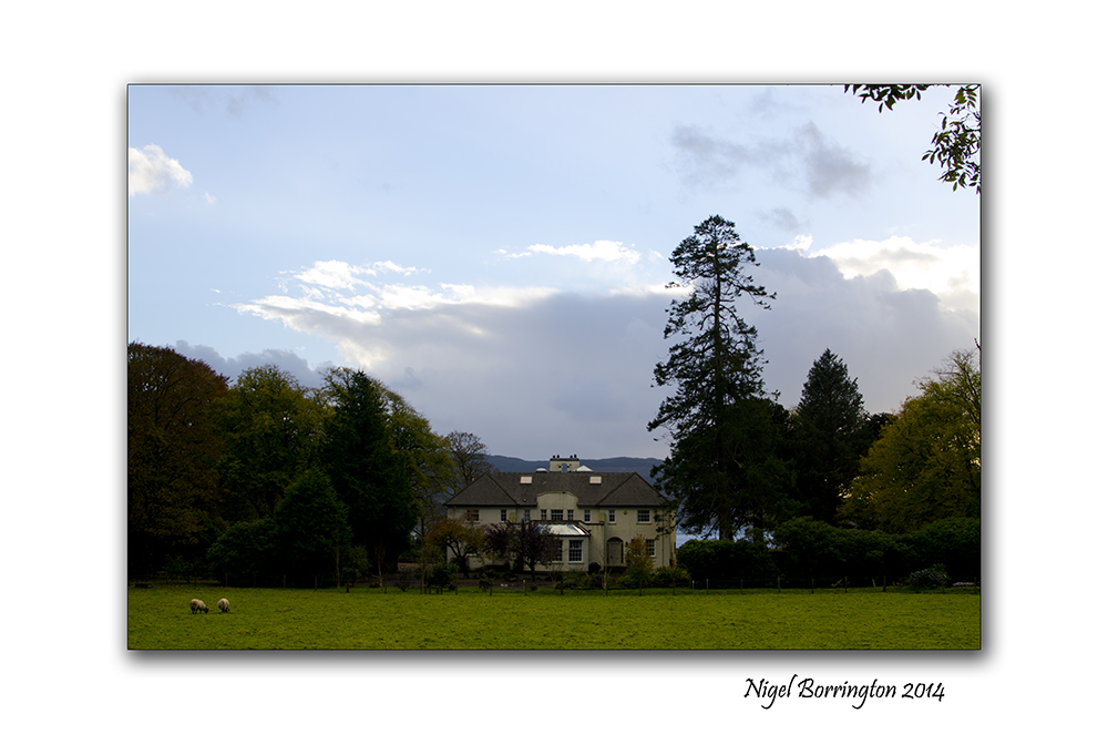
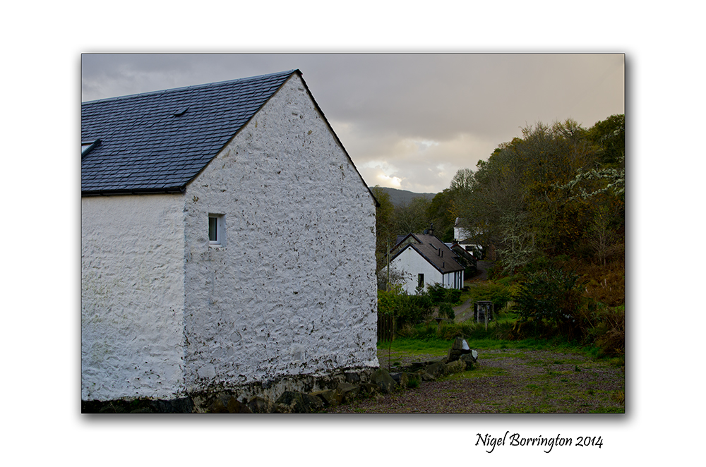
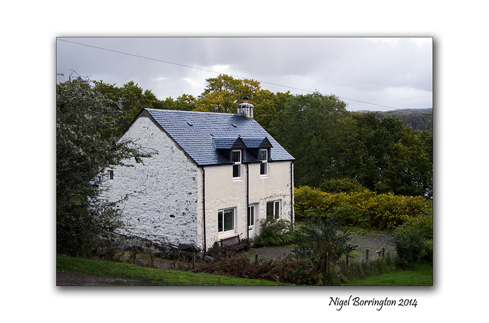
Loch Melfort, Argyll

Loch Melfort, Oban, Argyll
Landscape Photography : Nigel Borrington
Melfort Village, is located about ten miles south of the fishing port of Oban , Argyll , Scotland, It sits on the banks of an open sea Loch that faces the western Islands of ( Luing, Shuna and Scarbe) all home to golden eagles and red dear.
This is a wonderful location for a holiday as the views from the holiday homes are just wonderful and walking along the coast line and loch side lanes here is just as relaxing and inspiring an experience as you can have. Even in the winter a stay is spectacular , sitting by an open fire in the evenings with the wind blowing in the trees and on the open Waters of the Loch is an experience I will never forget.
The Images below were taken last November on a weeks stay here…..
Gallery


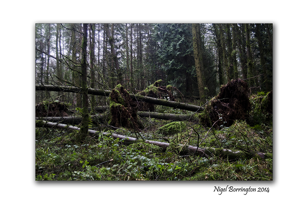
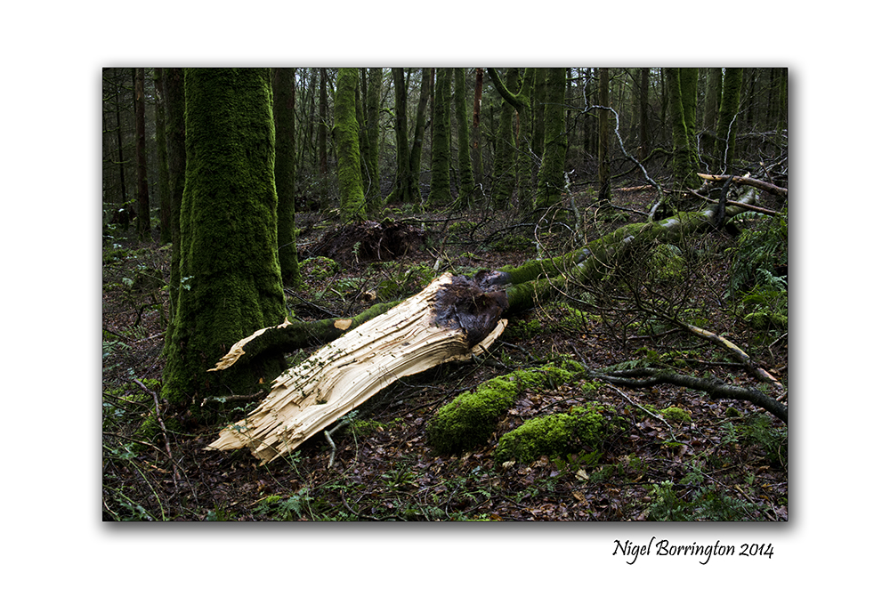
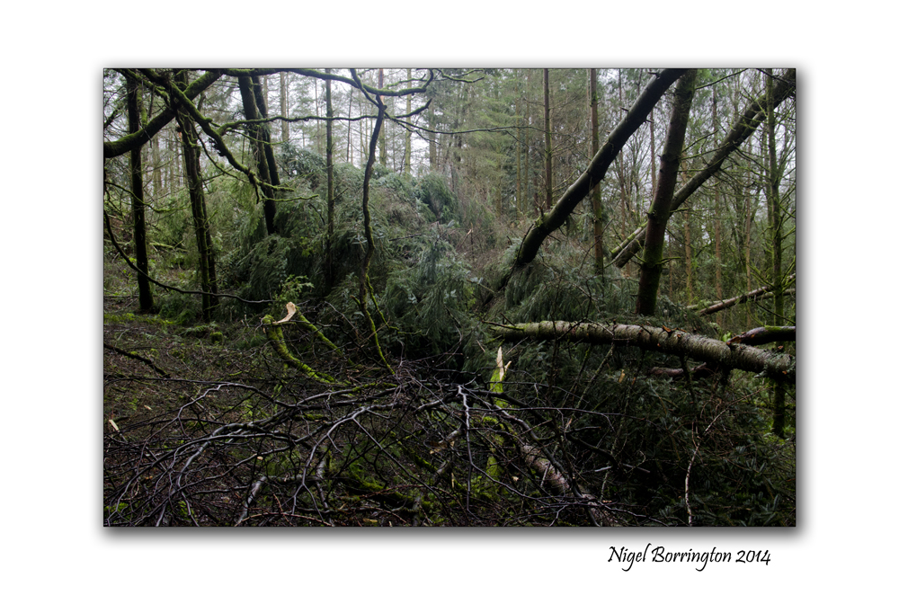
The woodlands of county Kilkenny after the storm
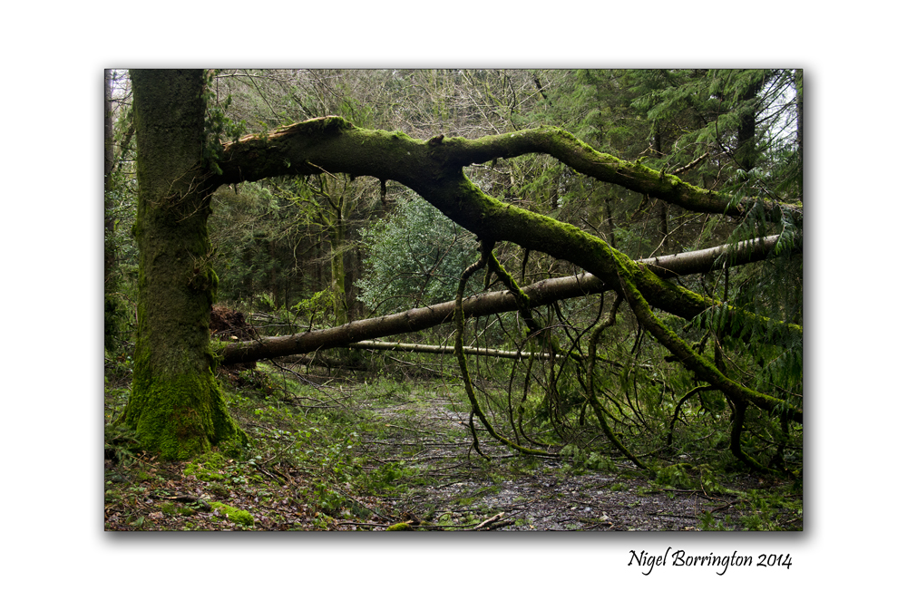
The woodlands of county Kilkenny after storm Darwin, February 2014
Irish Landscape Photography : Nigel Borrington
On Wednesday last week Ireland was hit by one of the biggest Storm’s for many years .
We have had a series of them over this winter and over 262mm of rain this year to date, I have posted over the last week or so about the flooded local rivers which I spend a lot of time walking along and the effects of all this rain is clear to see.
The other locations I do a lot of walking in however is county Kilkenny’s Forests and woodlands, the images below are taken in one of our local forests Castlemorris woodlands.
On this visit however I was in complete Awe of Nature and the power it holds, The forest has lost many of its great trees and I feel that the images can only get some of the sense across of just how bad this last storm was. I can only imagine the noise and the almost complete mayhem that these woods contained during the storm that powered its way through these trees.
Many of the trees have fallen and had their branches ripped from them, the visit was one of the most amazing I think I will ever have, it was silent apart from the sound of trees creaking in the wind , the sound of broken branches resting against other trees, survivors of the days storm. It was an amazing feeling, a real lesson in the power that nature holds.
You can see in the images that the path into the woods is completely blocked with fallen trees and it will take many days to clear these woodlands and return them to normal, many gaps with be visible and many trees missed.
I will let these images tell the rest of the story!!
Gallery


You must be logged in to post a comment.