
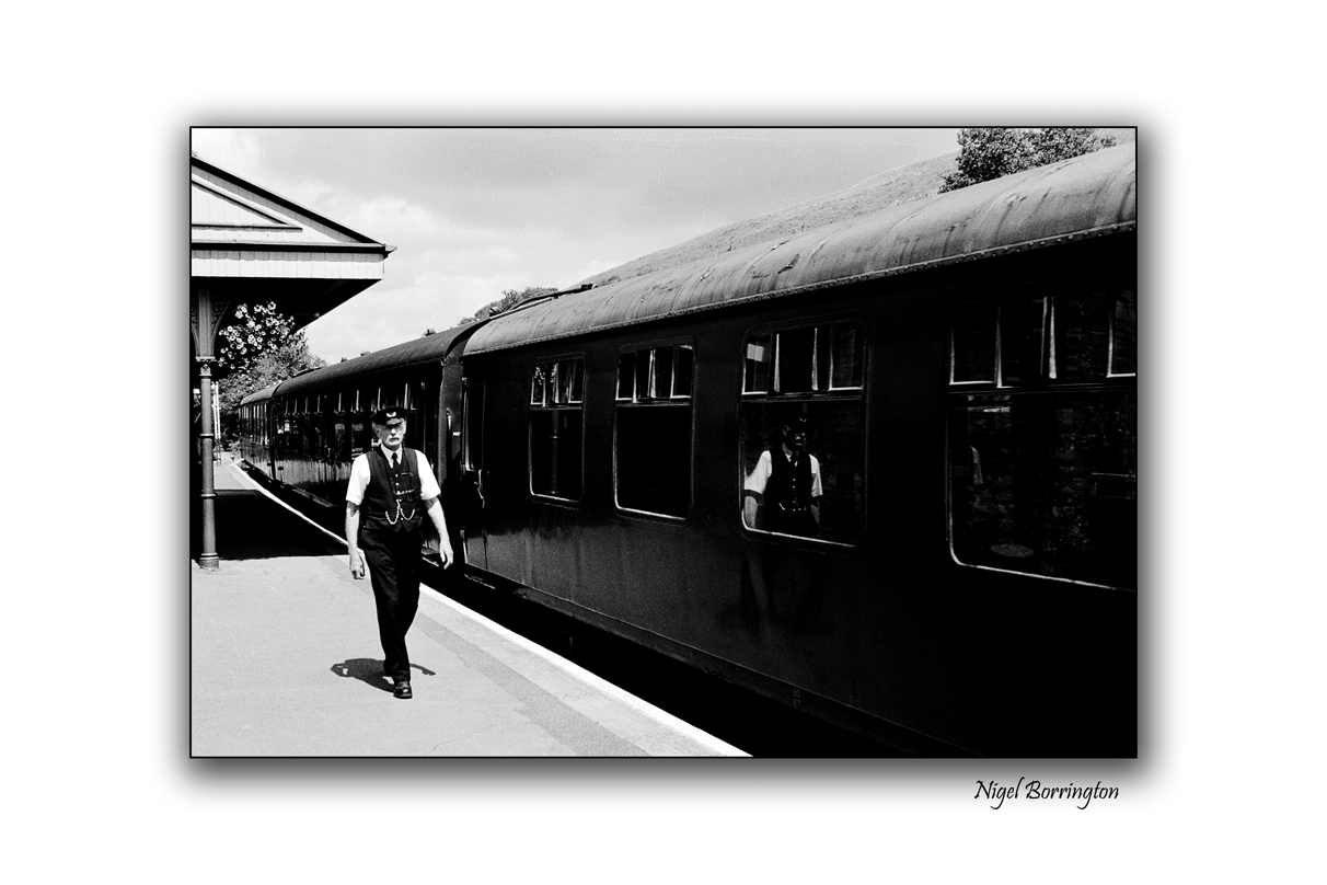
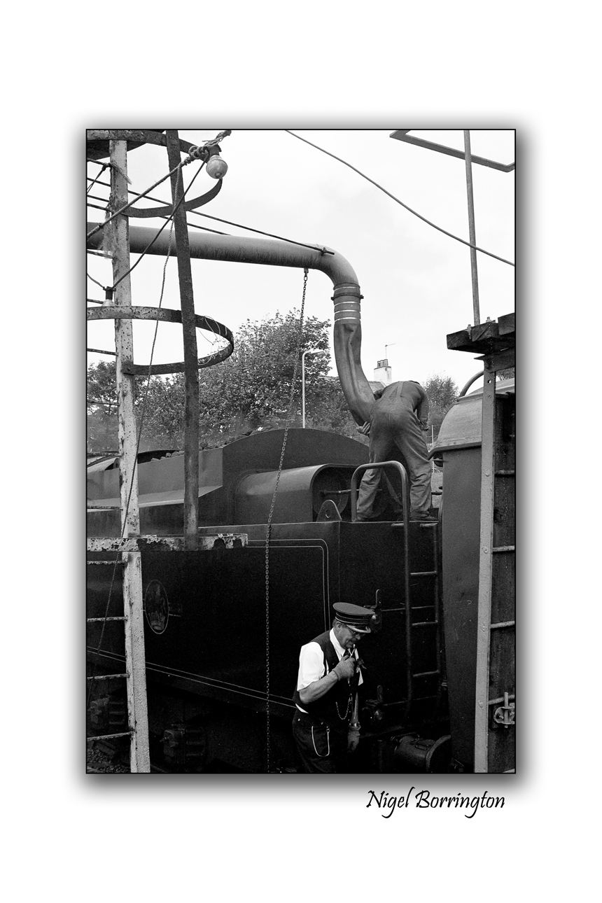
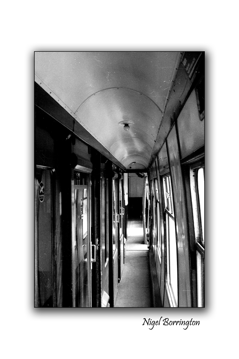
Film Friday, Swanage Steam Railway – Traveling back to the 1940’s

Swanage Steam railway
Nikon FM2n
Nigel Borrington 2018
These images are all taken using a Nikon FM2n, loaded with Ilford XP2 Super black and white film. I used a black and white film on the day I visited the wonderful Swanage steam railway project as I felt it was perfect to capture the atmosphere of a 1940’s experience.
Sometimes when your out for the day with a camera, its the experience of finding subjects that’s the most enjoyable part of the day, on this day however it was the enjoyment of taking a trip into the past and enjoying the feeling that you had slipped back into the countryside of the 1940’s, taking these images was just a process of recording the moments.
Here is a small introduction to this great project.
Welcome to Swanage Railway
The Swanage Railway offers a more intensive heritage steam and diesel timetable train service than virtually any other preserved railway.
Steam and diesel galas, Family events plus regular Evening Dining and Sunday Lunch services complement themed events such as our highly popular Santa Special trains during the run up to Christmas.
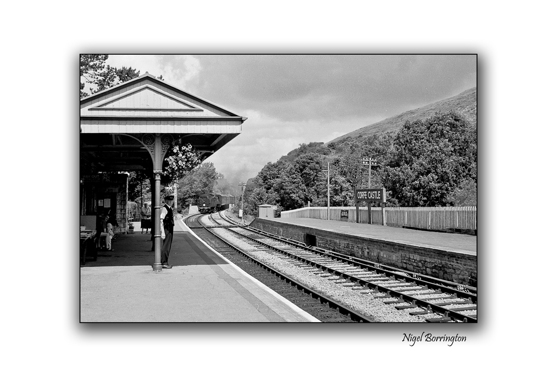
Our award-winning standard gauge preserved steam railway is located in Dorset with easy access from neighbouring Hampshire and the South of England. Visitors can experience a unique journey through six miles of beautiful scenery passing the magnificent ruins of Corfe Castle, travelling down to the blue flag beach at Swanage.
You can even drive and fire your own steam train thanks to our one-hour footplate taster experiences
Swanage Steam railway a Film Gallery


Tuesday Morning on the River, Bagenalstown, River Barrow, county Carlow

Morning on the river
Bagenalstown
county Carlow
Nigel Borrington 2018
Bagenalstown, county Carlow
One of my most loved small towns located along the river Barrow as it flows through county Carlow is Bagenalstown, it is located of the side of the hills that surround the river barrow south of Carlow town. Otherwise known in its Gaelic version as Muine Bheag it is a pleasant stretch of the River Barrow and derives its name from Walter Bagenal, who, in founding the town, had visions of mirroring the city of Versailles, in northern France.
However, his efforts became frustrated due to the re-routing of the coach road away from the town. He left more than enough for visitors to enjoy with handsome stone public buildings including the impressive Courthouse, now a public library in Bagenalstown.

The arrival of the railway in 1846 rejuvenated the town, and its neo-classical railway station is one of the finest in Ireland. Attributed to William Deane Butler it is constructed of limestone and granite and is a seven bay, two-storey building in an Italianate villa style. Today Bagenalstown station still retains its charm in a largely unaltered state. This former mill town made full use of the river Barrow to transport grain, beet, coal, turf and Guinness by barge, evidence of which can be seen in its fine industrial architecture. Near the railway bridge on the R705 Borris road is an example of the Carlow fence which consists of a decorative fence made of granite pieces, laid horizontally over vertical posts and is found nowhere else in the world.
One of the finest views of Bagenalstown may be enjoyed on the approach road from Leighlinbridge and includes the spire of St. Andrew’s Catholic Church and the fine tower of St. Mary’s Church of Ireland Church. St. Andrew’s Catholic Church was built in 1820 on a site provided by the Newton family, successors to the Bagenals. The stained glass behind the altar is worthy of particular attention. Nowadays, riverside walks, picnic tables and a picturesque lock enhance this fine town which has been twinned with the French town of Pont Pean since 1999.

ATTRACTIONS: The ruins of the early 14th century Ballymoon Castle and 13th century Ballyloughan Castle are located near the town. Wells Church, situated closeby, is the preserved ruin of a church dating back to 1262. The church is surrounded by an enclosed and well-maintained graveyard which is still in use today.
ACTIVITIES: Outdoor swimming pool. The McGrath complex offers excellent sporting facilities including cricket, hurling, soccer and Gaelic football fields, tennis court and pitch and putt courses. The River Barrow in this area is renowned for coarse fishing with wheelchair friendly fishing stands located near the swimming pool. The Barrow Way long distance walking route passes through the town.


The Alpine Path, by : L. M. Montgomery

Neuchâtel, Switzerland
Ilford SFX 200
Black and White Negative Film
Then whisper, blossom, in thy sleep
How I may upward climb
The Alpine path, so hard, so steep,
That leads to heights sublime


Irish Landscape Images, Tramore Beach, County Waterford 2018

Irish landscape images Tramore beach
county Waterford Nigel Borrington
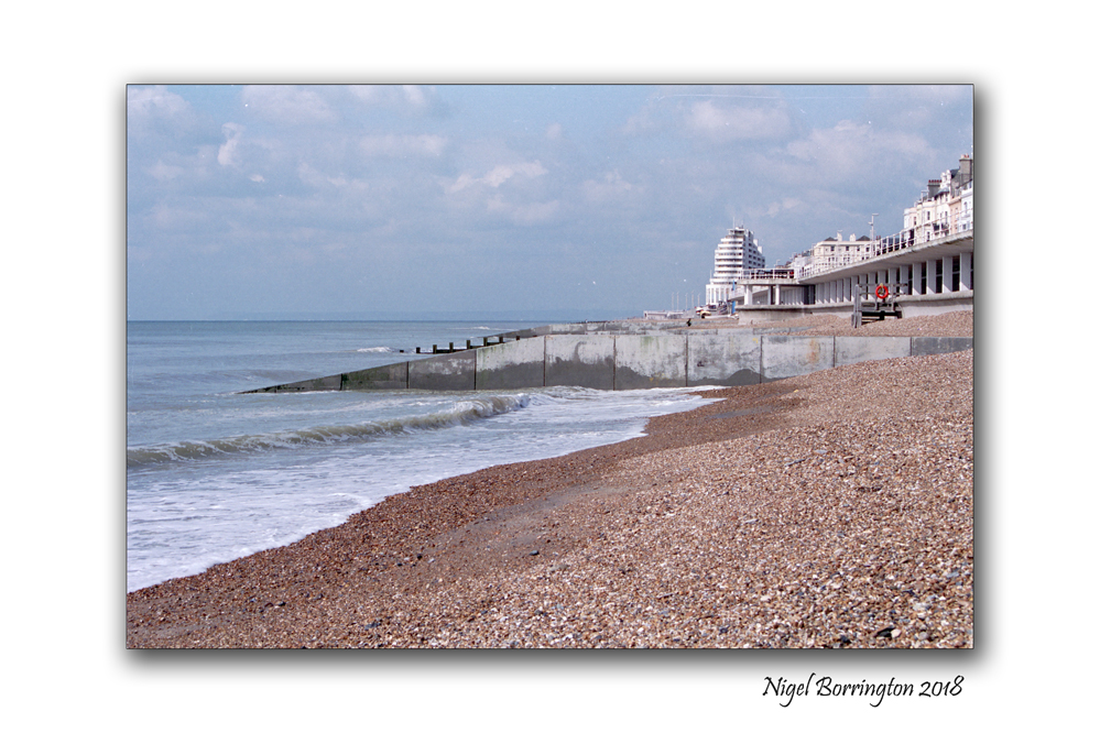
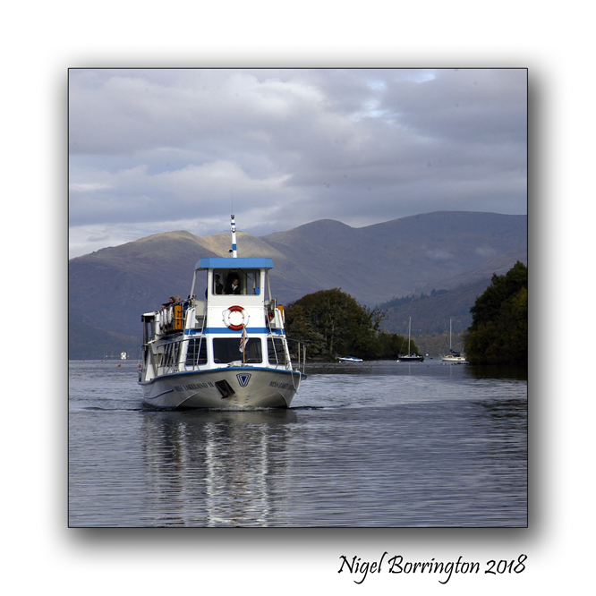
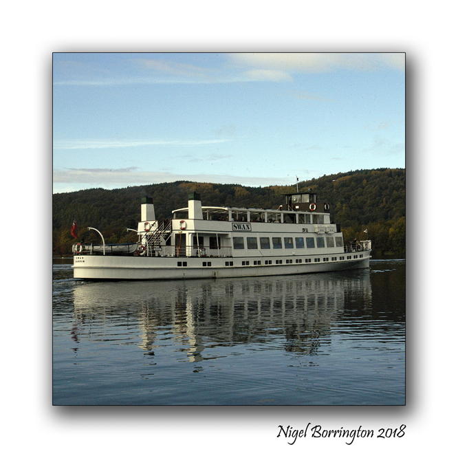
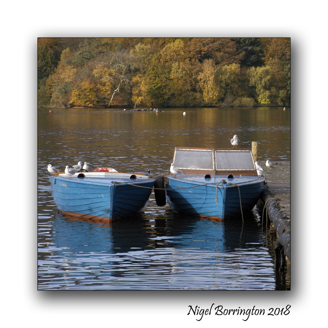
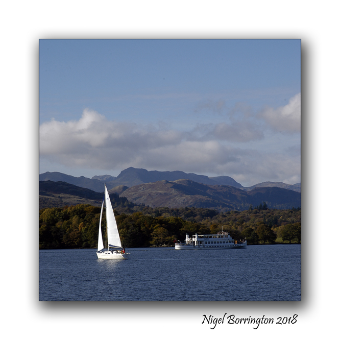
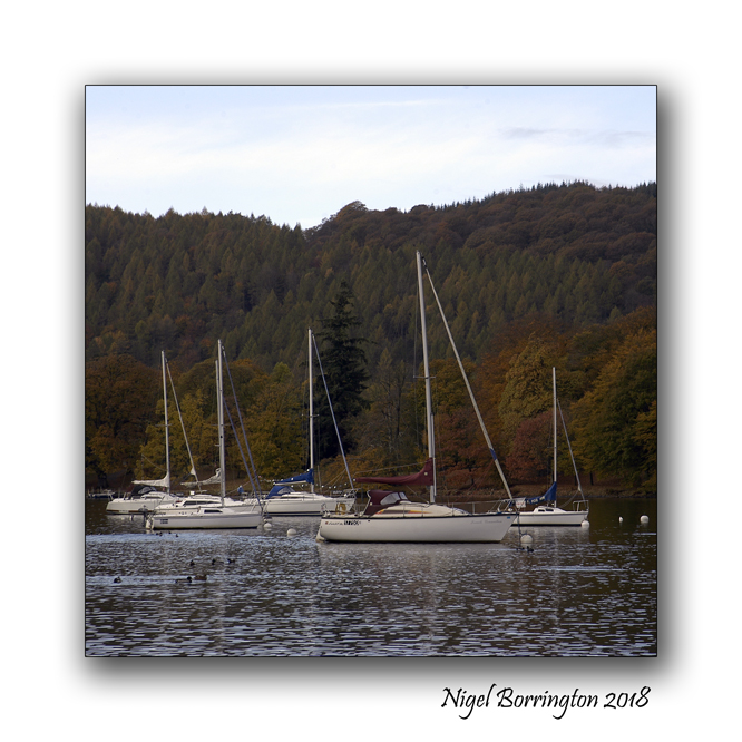
Shooting Square, Lake Windermere, Lake District, UK
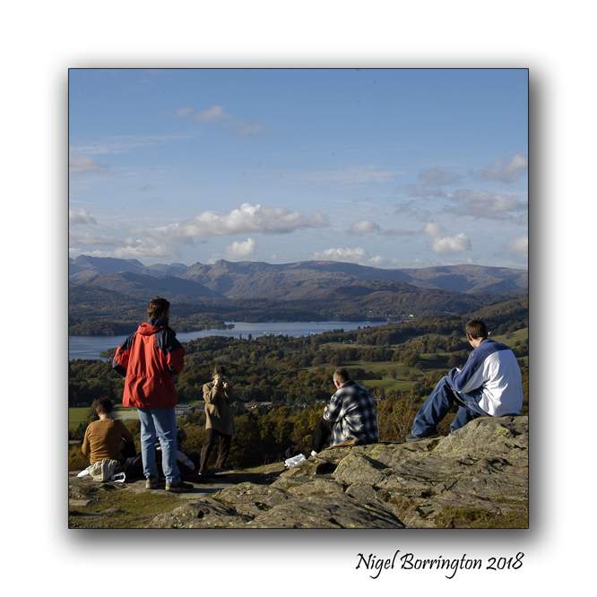
One reason I love shooting Landscape images with square format prints and images in mind for the final results is that your images get closer to your subjects, you loose lots of details in the frame that you mostly do not need.
These images are taken at Lake Windermere in the Lake District and I feel that their square format helps in capturing this great place in a truly focused and closer way.


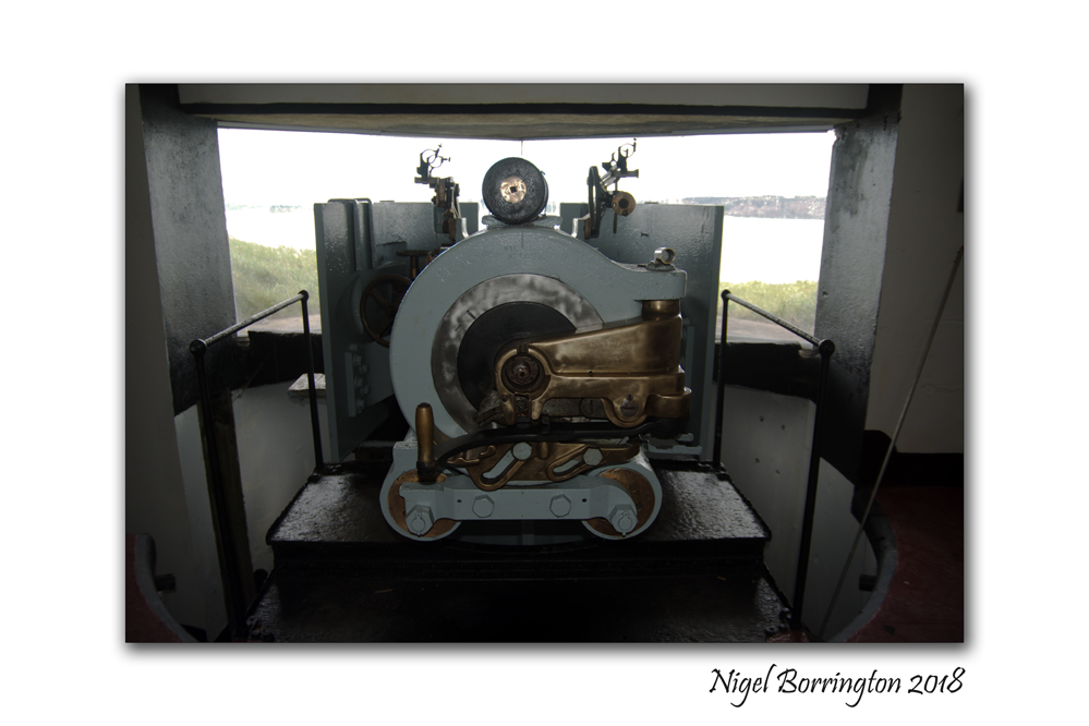
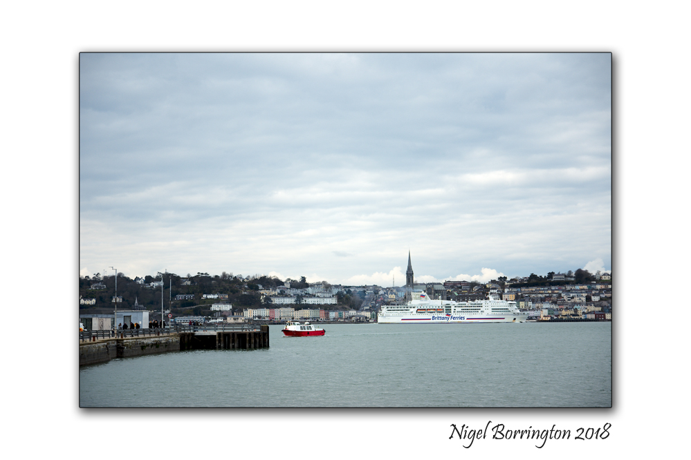
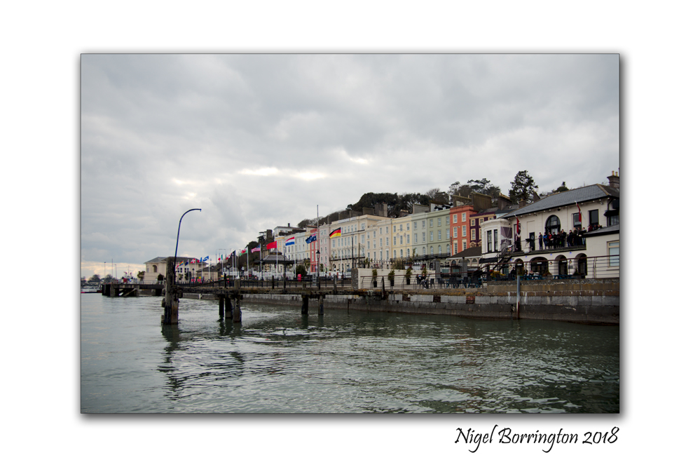
Street views, Cobh, County Cork, Ireland, April 2018
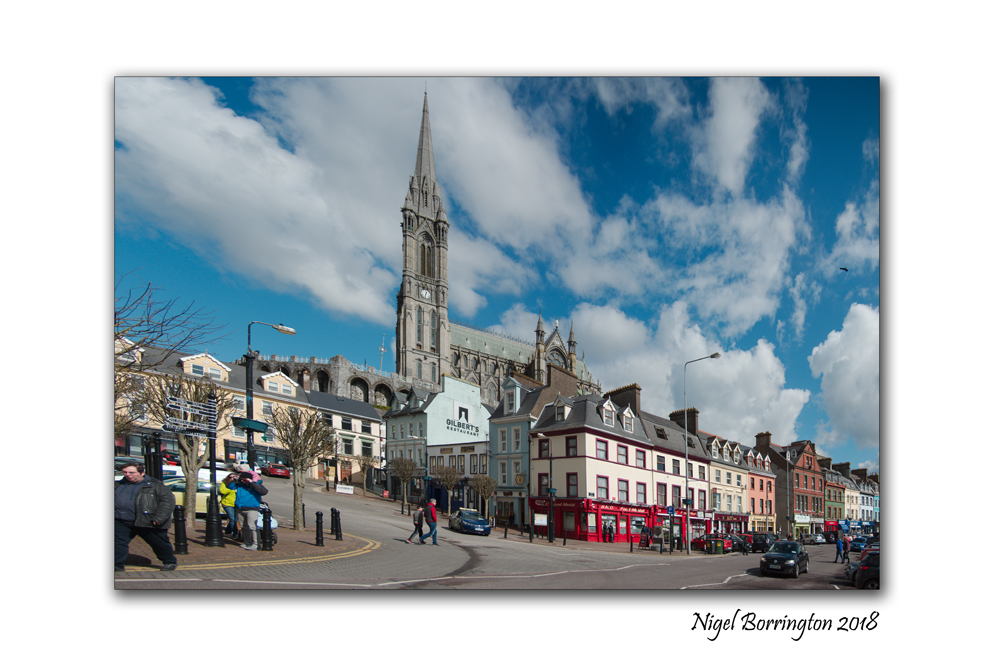
Street Views
Cobh, county Cork
Nigel Borrington
April 2018
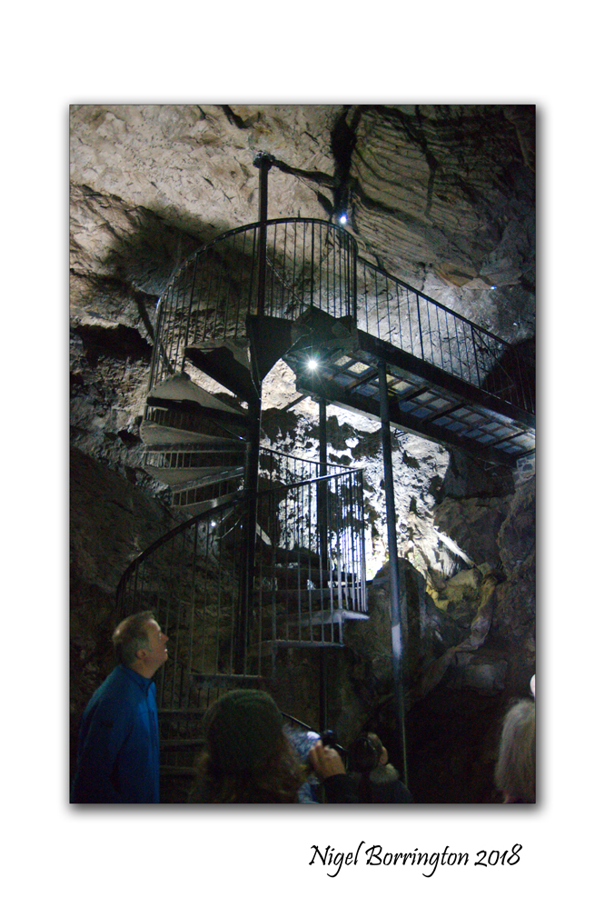
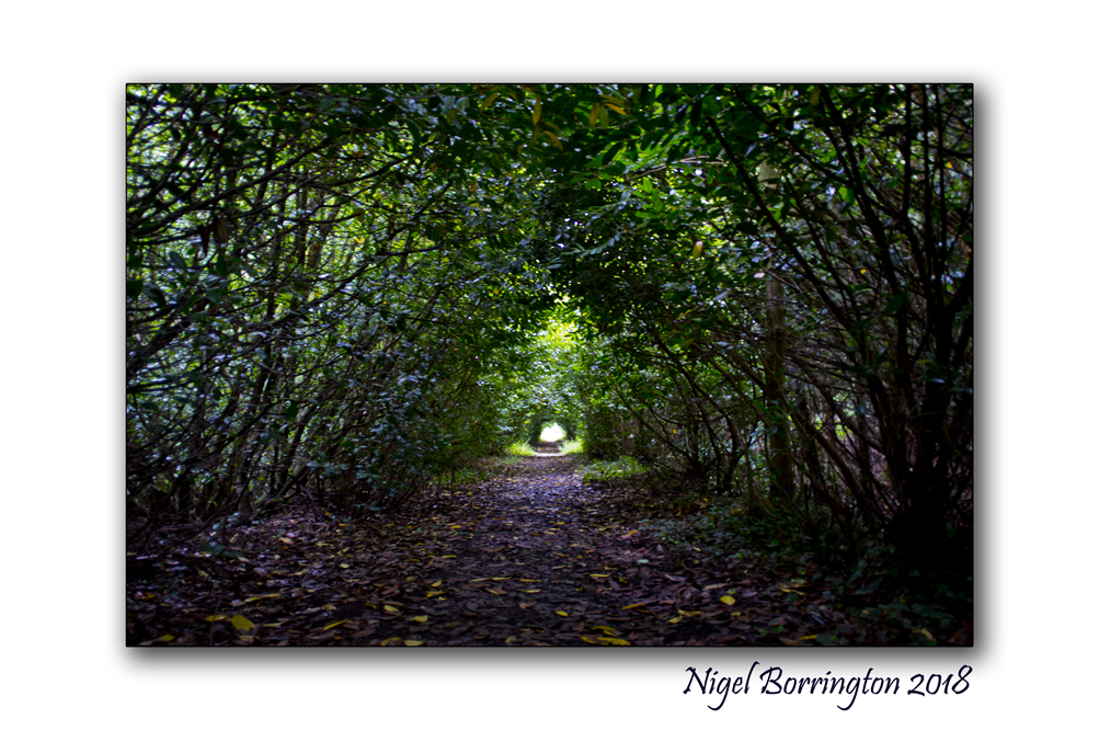
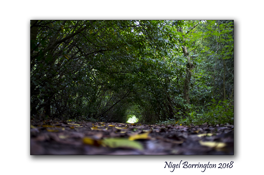
Visiting the Underworld, Dunmore caves, county Kilkenny Ireland
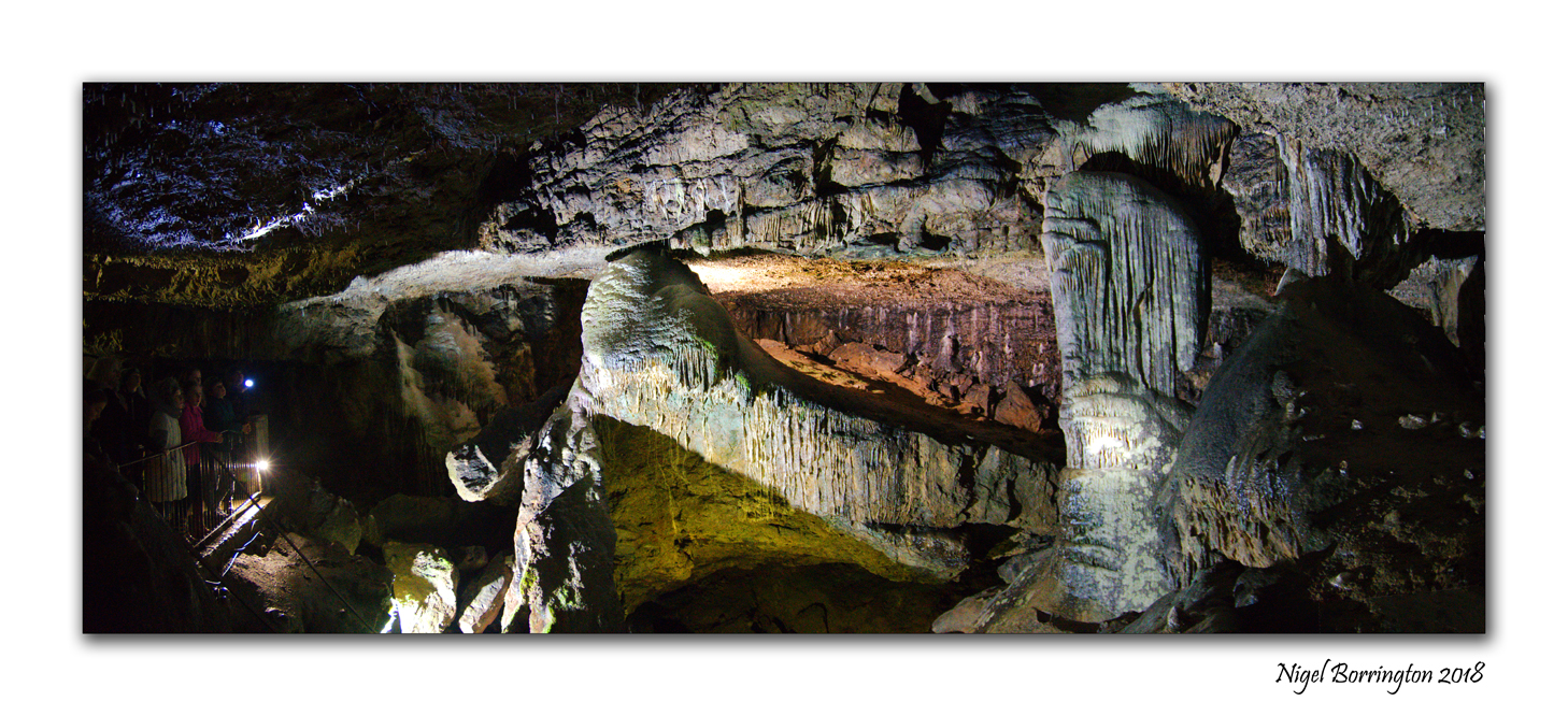
Dunmore caves
County Kilkenny
Nigel Borrington 2018
The Easter holidays are always a great time to do some different activities and visited some locations I had on my list for sometime.
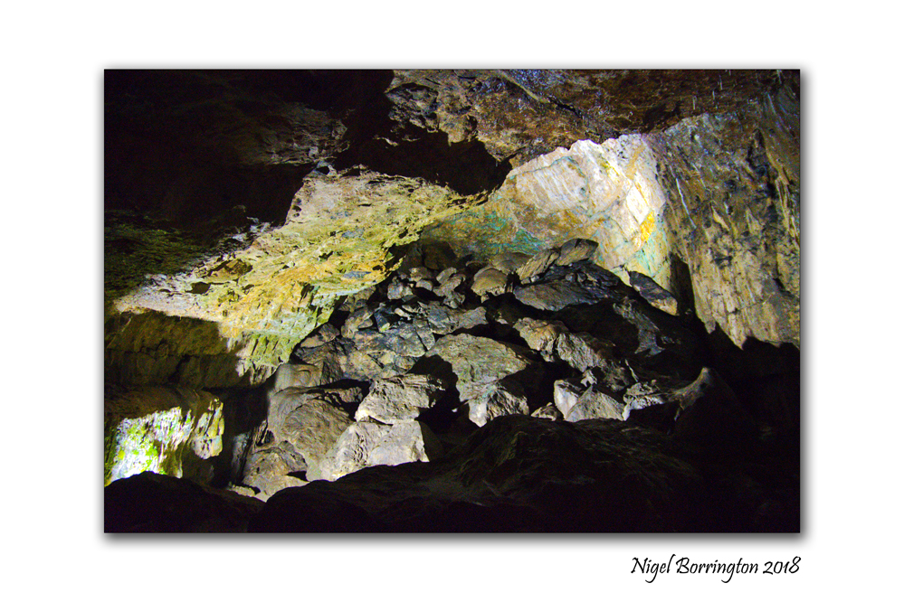
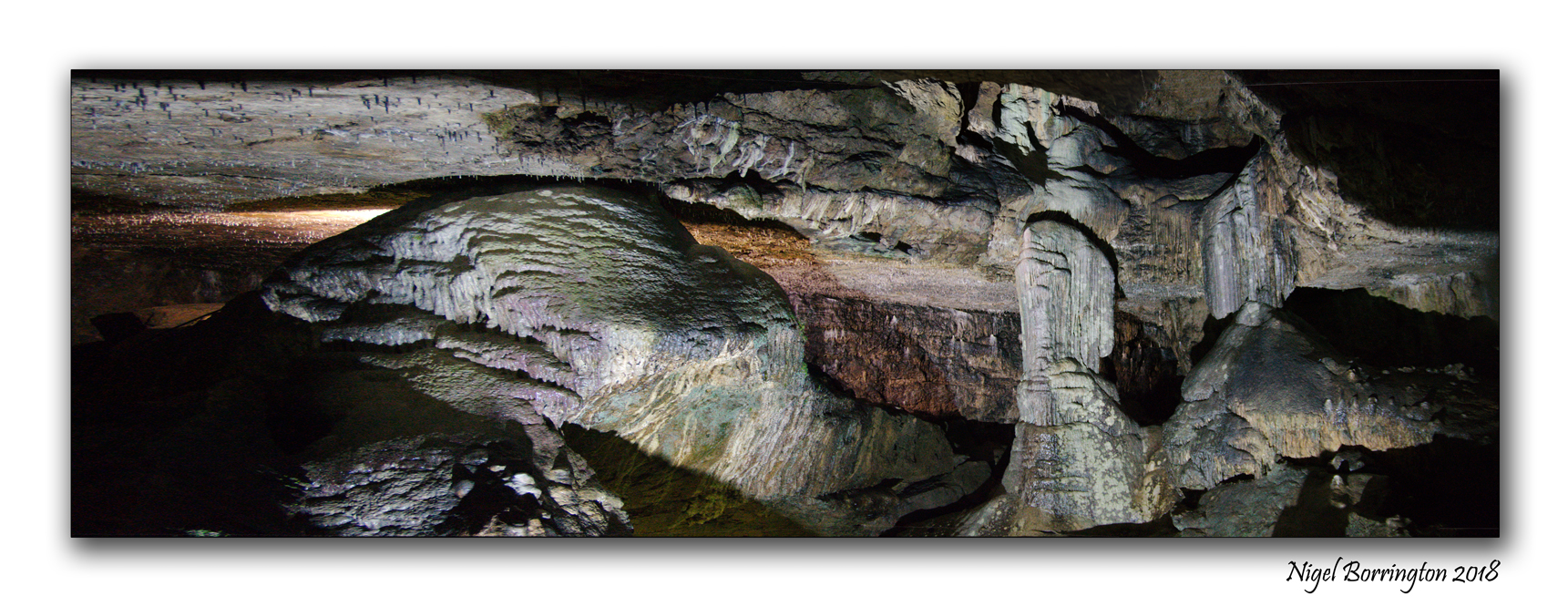
One of these locations was Dunmore caves in the north of county Kilkenny, the caves are some of the most spectacular – located here in Ireland, with a large entrance hall and a great mix of tunnels and caverns. This time was a great visit, there have been some great guides over the years but our female guide over the weekend was clearly into the geology and environment of the area and of the caves themselves along with the Pagan and Viking (history, myths and beliefs) based around the long time use of these caverns.
One local myth in Kilkenny county revolves around the belief that there is a tunnel that goes all the way from the caves into the center of kilkenny city, possibly used for escape in times when the city was under attack. This tunnel has been searched for many times but never found, so maybe it is just a story but the search goes on.
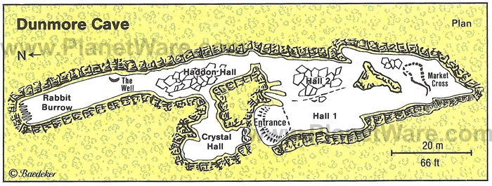
Dunmore caves facts and History
Dunmore Cave (from Irish Dún Mór, meaning ‘great fort’) is a limestone solutional cave in Ballyfoyle, County Kilkenny, Ireland. It is formed in Lower Carboniferous (Viséan) limestone of the Clogrenan Formation. It is a show cave open to the public, particularly well known for its rich archaeological discoveries and for being the site of a Viking massacre in 928.
Development
Dunmore Cave was designated a National Monument by the Commissioners of Public Works in 1944, but development as a show cave with visitor centre and tours didn’t begin until 1967, at the behest of respected archaeologist and spelaeologist J. C. Coleman. The cave was closed in 2000 for archaeological work and redevelopment, and reopened in 2003.
History
The earliest historical reference to the cave is to be found in the Triads of Ireland, dating from the 14th to the 19th century, where “Úam Chnogba, Úam Slángae and Dearc Fearna” are listed under the heading, “the three darkest places in Ireland”.The last, meaning the “Cave of the Alders,” is generally thought to be the present Dunmore Cave, while the first two translate as the caves of Knowth and Slaney. It is not known which exact system of caves/passage tombs near the river Slaney is being referred to, with the most likely, those at Baltinglass. Other sources translate the listed locations as Rath Croghan, the cave or crypt of Slane and the “Cave of the Ferns”.
In the Annals of the Four Masters, dated to the 17th century, Dearc Fearna was recorded as the site of a great Viking massacre in 928 AD:
“Godfrey Uí Ímair, with the foreigners of Ath Cliath, demolished and plundered Dearc Fearna, where one thousand persons were killed in this year as is stated in the quatrain:
Nine hundred years without sorrow, twenty-eight, it has been proved, ‘Since Christ came to our relief, to the plundering of Dearc-Fearna.”
Gofraith, ua h-Iomhair, co n-Gallaibh Atha Cliath, do thoghail & do orgain Derce Fearna,
airm in ro marbhadh míle do dhaoinibh an bhliadhain-si, amhail as-berar isin rann,
Naoi c-céd bliadhain gan doghra,
a h-ocht fichet non-dearbha,
o do-luidh Criost dár c-cobhair
co toghail Derce Ferna.
While the human remains found in the cave are thought to be victims of the Viking massacre, this has not been reliably confirmed. Many of the remains belong to women and children, and it is hypothesised that they are the bodies of people hiding in the cave who were unable to leave when the Vikings tried to smoke them out, dying from asphyxiation.
Archaeological study
The earliest writings on the cave of an archaeological nature came from the bishop George Berkeley, whose report dated 1706 detailed a visit that he made to the cave as a boy. The essay was not published until 1871. In 1869 Arthur Wynne Foot, a physician, made an archaeological visit to the cave with Rev. James Graves and Peter Burtchaell and discovered large quantities of human remains, which they collected. In his reports, Foot meticulously documented his findings, and culled references from the writings of researchers over the preceding 120 years.
In 1999, a hoard of 43 silver and bronze items was discovered in a rocky cleft deep in the cave. Archaeologists dated this hoard, consisting of silver, ingots and conical buttons woven from fine silver, to 970 AD.

Dunmore caves
Visitors center
Count Kilkenny
Ireland
Nigel Borrington 2018


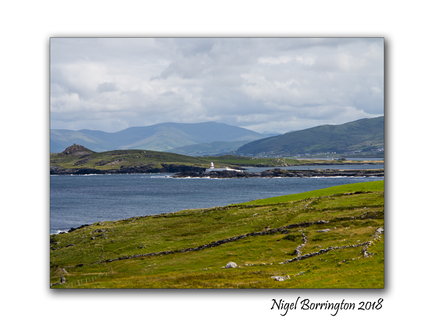
Irish Lighthouses : Valentia Island Lighthouse, in 10 images

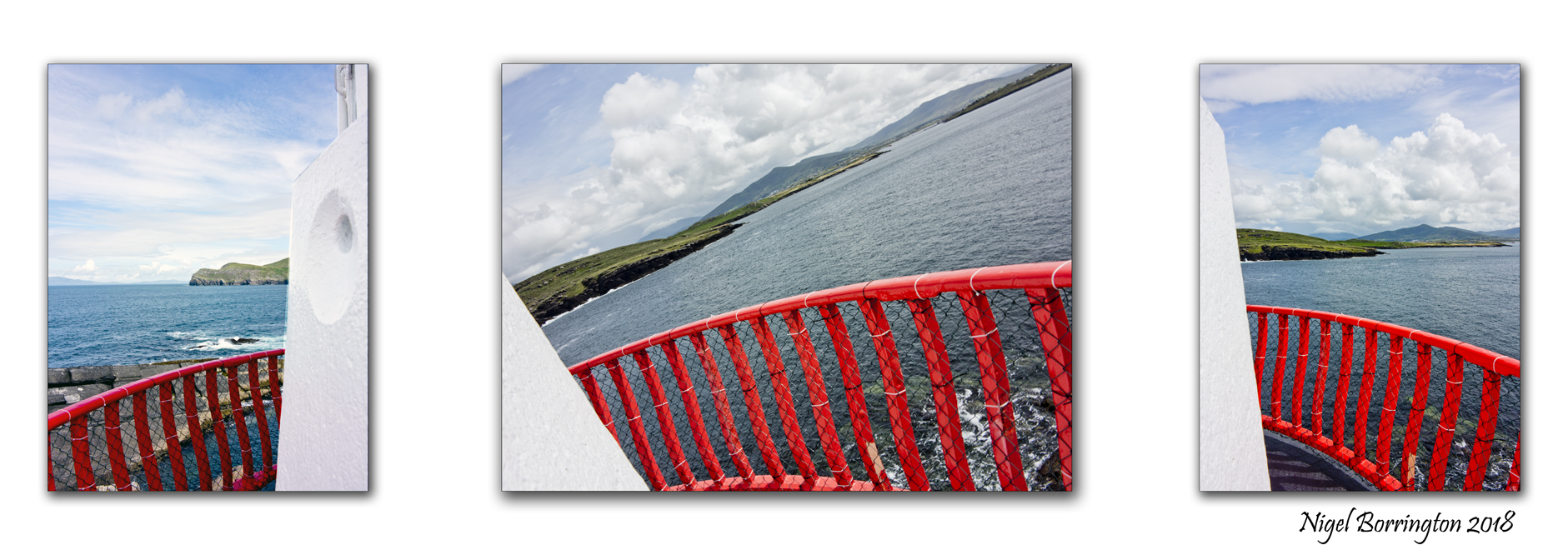
Valentia Island Lighthouse
Built on the site of a 17th century fort, Valentia Island Lighthouse on Cromwell Point has stood against sea and invader for hundreds of years. Now, this gleaming white lighthouse on beautiful Valentia Island looks out across some of the most spectacular sights along the Wild Atlantic Way.
There’s much to enjoy in a visit to this lighthouse. Take a tour of the lighthouse tower and balcony. Be blown away by the dramatic scenery and big weather! Soak up the stories and the science as you learn about the people and technology that have guided ships safely home from sea over the years.
Valentia Island Lighthouse offers a great day out: fascinating history, inspiring views and a unique insight into island life.
A quick history
Valentia Island Lighthouse sits on the site of the 17th century Cromwell Fleetwood Fort, which guarded against the threat of invaders right up to the 19th century. You can still see the cannons overlooking the harbour.
The lighthouse was designed by George Halpin Senior, one of the most famous civil engineers of the time. The light was first exhibited in 1841.
A lighthouse keeper lived with his family on site until 1947, when the lighthouse was automated.


5 Images for the Week , Beautiful Monday, County Kilkenny, Ireland

Beautiful Monday
10th Feb 2018
County Kilkenny
Nigel Borrington
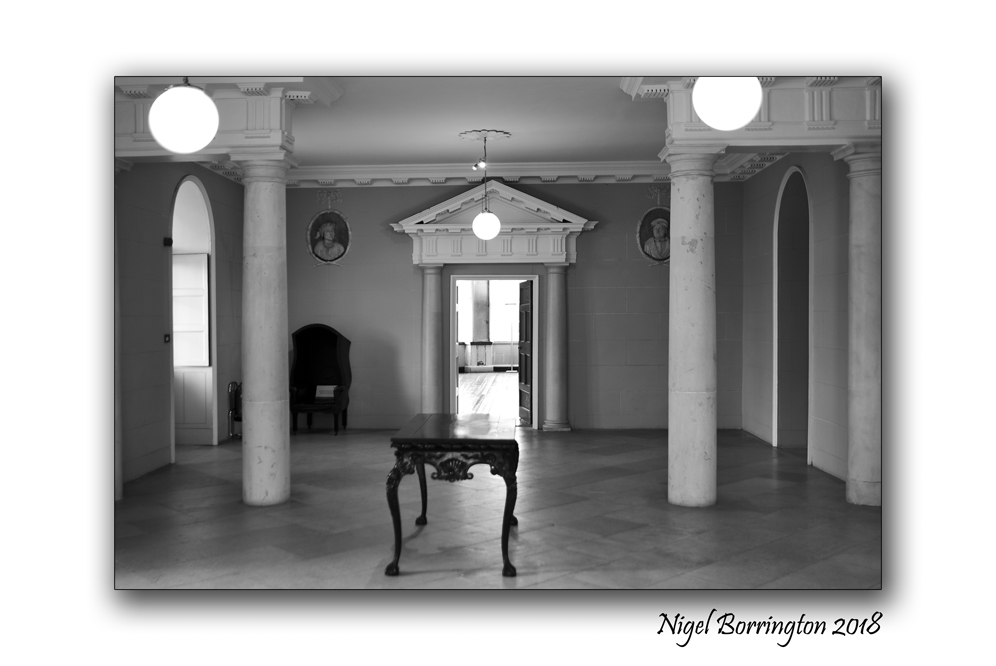
The Castle Inside and out, Rathfarnham Castle – south county Dublin

Rathfarnham Castle
South county Dublin
Ireland
Nigel Borrington 2018
Rathfarnham Castle is located in south county Dublin. It was built in 1585 by Adam Loftus, Archbishop of Armagh. This is one of the finest examples of what is described as a ‘fortified manor house’ in Ireland. It’s 4 flanker towers, instead of being square are angular (angle bastions). This site is steeped in history and had previously been the site of an Iron Age fort.
The interior of the castle was redesigned in the 18th century by two of the greatest architects of the time, William Chambers and James Stewart. Chambers designed Buckingham Palace, Kew Gardens, St James’s Palace, Trinity University, and Casino Marino and James ‘Athenian’ Stuart is best known for his pioneering role in Neoclassicism in the mid 1700’s.
Rathfarnham Castle was for a long time used as a private house and ended up being a Jesuit College before it was taken under the care of the Office of Public Works. It is now open to the public.


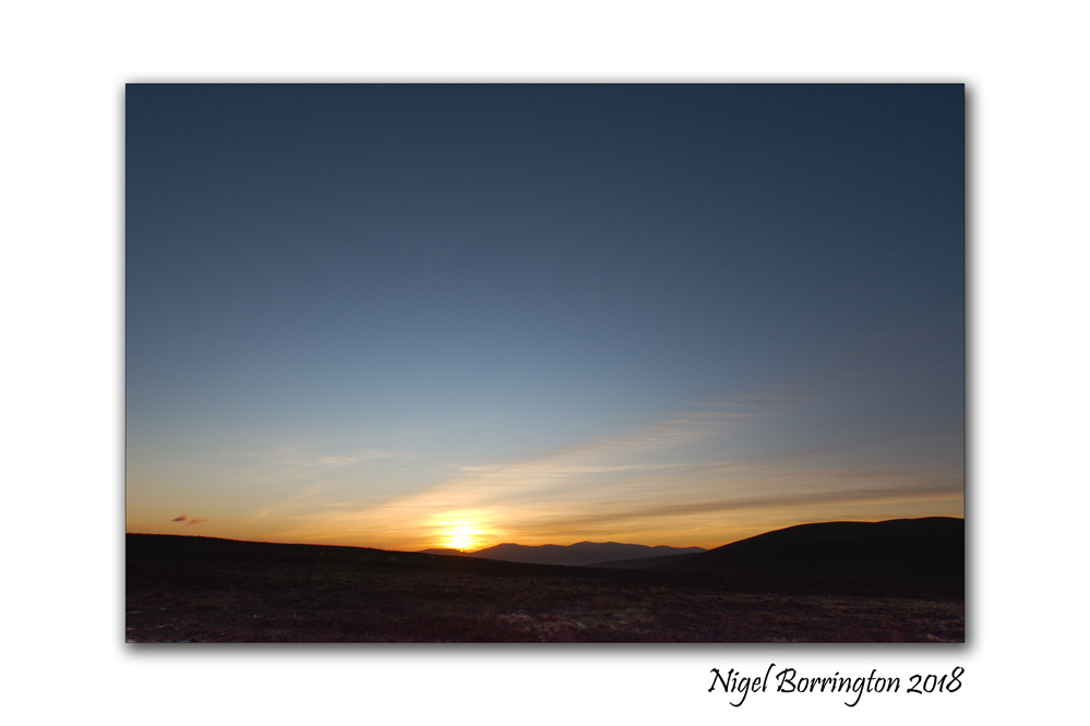
A Dream sunset, Cardigan bay, Wales. A Poem : Ode By Arthur O’Shaughnessy

A Dream sunset Cardigan bay
Wales
August 2017 Nigel Borrington
We are like the Dreamer …….
Ode
By Arthur O’Shaughnessy
We are the music-makers,
And we are the dreamers of dreams,
Wandering by lone sea-breakers
And sitting by desolate streams;
World losers and world forsakers,
On whom the pale moon gleams:
Yet we are the movers and shakers
Of the world for ever, it seems.
With wonderful deathless ditties
We build up the world’s great cities.
And out of a fabulous story
We fashion an empire’s glory:
One man with a dream, at pleasure,
Shall go forth and conquer a crown;
And three with a new song’s measure
Can trample an empire down.
We, in the ages lying
In the buried past of the earth,
Built Nineveh with our sighing,
And Babel itself with our mirth;
And o’erthrew them with prophesying
To the old of the new world’s worth;
For each age is a dream that is dying,
Or one that is coming to birth.
Irish Landscape Images : The Hell Fire Club, Mount Pelier Hill

The Hell Fire Club
Mount Pelier Hill
County Dublin, Ireland
Irish Landscape Images
Nigel Borrington 2018
The Hell Fire Club on Mount Pelier Hill
William Conolly’s Hunting Lodge
The building now known as the Hell Fire Club was built around 1725 as a hunting lodge by William Conolly, the Speaker of the Irish House of Commons. It was named Mount Pelier by Conolly but over the years has also been known as “The Haunted House”, “The Shooting Lodge”, “The Kennel”, and “Conolly’s Folly”. It was one of several exclusive establishments using the name Hellfire Club that existed in Britain and Ireland in the 18th century.
While the building has a rough appearance today, the architecture is of a Palladian design. The upper floor consists of a hall and two reception rooms. On the eastern side, there was a third, timber-floored, level where the sleeping quarters were located. On the ground floor is a kitchen, servants’ quarters and stairs to the upper floors. The entrance, which is on the upper floor, was reached by a long flight of stairs which is now missing. At each side of the building is a room with a lean-to roof which may have been used to stable horses. A stone mounting block to assist people onto their horses can be seen on the eastern side. To the front there was a semi-circular courtyard, enclosed by a low stone wall and entered by a gate.

View of Dublin port
From Mount Pelier Hill
Irish Landscape Images
Nigel Borrington 2018
The house faces to the north, looking over Dublin and the plains of Meath and Kildare, including Conolly’s primary residence at Castletown House in Celbridge. The grounds around the lodge consisted of a 1,000-acre (4.0 km2; 1.6 sq mi) deer park. The identity of the architect is unknown: the author Michael Fewer has suggested it may have been Edward Lovett Pearce (1699–1733) who was employed by Conolly to carry out works at Castletown in 1724.
There was a prehistoric burial site at the summit of Mount Pelier Hill and stones from it were used in the construction of the lodge. A nearby standing stone was also used for the lintel over the fireplace. Shortly after its completion, a great storm blew the original slate roof off. Local superstition held that this was the work of the Devil, an act of revenge for disturbing the ancient cairn. Conolly had the roof replaced with an arched stone roof constructed in a similar fashion to that of a bridge. This roof has remained intact to the present day, even though the building has been abandoned for over two centuries and despite the roof being set alight with tar barrels during the visit of Queen Victoria to Ireland in 1849. There is little evidence that the lodge was put to much use. Conolly himself died in 1729.
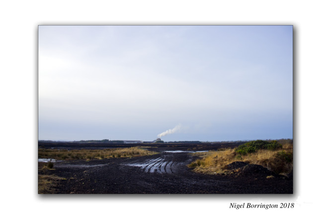
A February Morning at Derryvilla bog, Littleton, County Tipperary – Irish Landscape images.

Derryvilla lake
Littleton bogs
County Tipperary
Irish landscape Photography : Nigel Borrington
One of my favorite places to visit in county Tipperary is Littleton Bogs, near Thurles, the bogs here are harvested for the fuel they provide in the form of Peat. The entire area is effected by this process as you can see in the pictures below. It is however an amazing location to take photographs as even though it has been scared by the peat production, it has a true truly remote/wilderness feeling locations locally, when you walk through this landscape in the early morning the only sounds you can hear are the birds and the breeze in few trees that survive along the foot-paths.
Derryvilla lake is near Littleton (Irish: An Baile Dháith) county Tipperary. The village in County Tipperary is within the townlands of Ballybeg and Ballydavid, about 18 km (11 mi) northeast of Cashel and to the southeast of Thurles.
Gallery of Derryvilla bog and lake, Littleton, County Tipperary


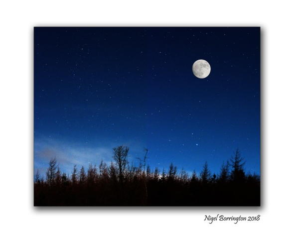
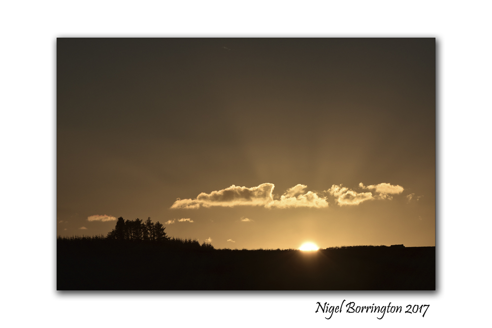
Sunday Evening, Last light and the evening Star, Nier Valley, County Waterford, Ireland

Sunday evening
The Evening Star
Nier Valley
County Waterford
Nigel Borrington
Link : Nier Valley National Parks & Wildlife Service
The Weather today here in Ireland has given us one of the best days for weeks, In the afternoon we did a 10km walk around the Nier Valley in Country Waterford. This walk is high-up in the hills and it was about 4:30pm as we returned to the Car, the Sun was setting and I got these shots of the Last sunlight of this weekend.
What a perfect walk and end to the weekend …..


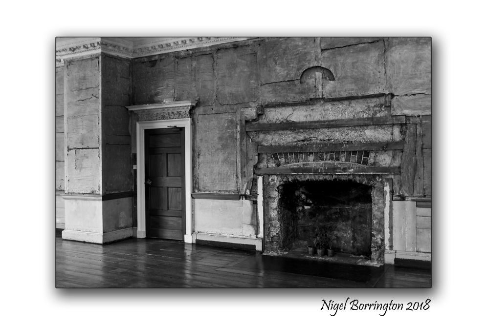
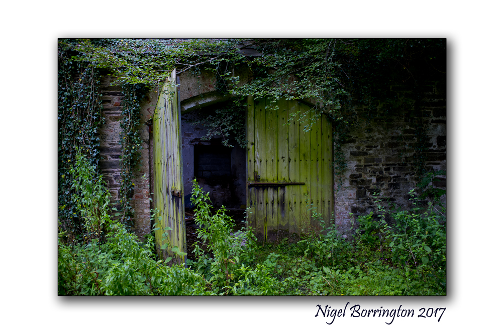
Mystery of a place, all that remains – Castlemorris house and Woodlands, County Kilkenny

All that Remains
Caastlemorris house and Woodlands
County Kilkenny
Ireland
Nigel Borrington

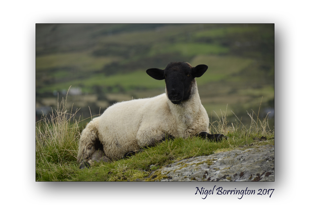
Images without words – The life of the County Cork Sheepdog.

The Sheepdog
County Cork
Ireland
Nigel Borrington


The week of the winter solstice – Newgrange and the Winter Solstice
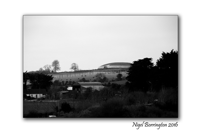
Today marks the Winter Solstice , nowhere here in Ireland will this moment be marks more than at Newgrange the perfect locations to gain a little understanding as to how our European ancestors both recorded and celebrated the movement of the sun and the objects of universe they lived in.
Today is the shortest day of the year, the day when at Newgrange the rising sun can be seen to travel all the way into the passage tomb at the center of the monument.
Newgrange – Winter Solstice
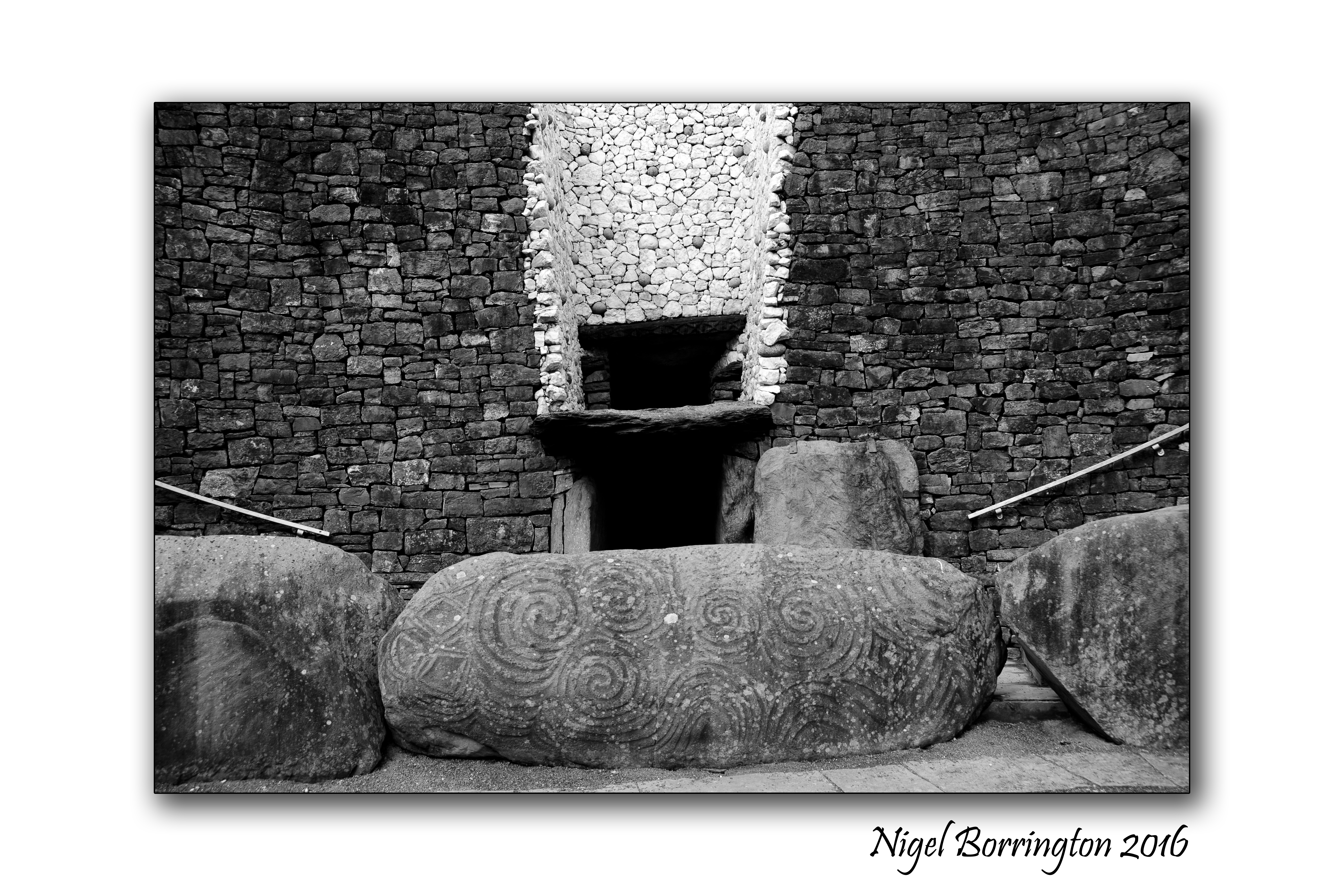
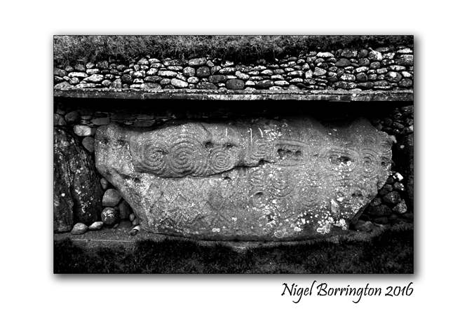
Sunrise at NewgrangeNewgrange is best known for the illumination of its passage and chamber by the Winter Solstice sun. Above the entrance to the passage of the mound there is a opening called a roof-box. On mornings around the winter solstice a beam of light penetrates the roof-box and travels up the 19 metre passage and into the chamber. As the sun rises higher, the beam widens so that the whole chamber is dramatically illuminated.
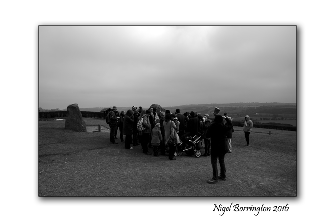
Access to the chamber on the Solstice mornings is decided by a lottery that takes place at the end of September each year. All are welcome to gather outside the entrance to the Newgrange mound on each of the mornings from December 18th to December 23rd inclusive, sunrise is at 8.58am. Access via the Brú na Bóinne Visitor Centre or directly to the actual Newgrange monument.
The images posted here were taken this time last year at New-grange ……
Newgrange a Gallery


The week of the winter solstice – 2017, Castlerigg stone circle, Keswick in Cumbria, UK

Castlerigg stone circle
Keswick in Cumbria, North West England
Nigel Borrington
This week we will all experience the Winter Solstice, the moment that the amount of available Sun light has reached its lowest amount each day. From the 21st of December on the amount of day-light will start to slowly increase again, you could say that this moment marks the tree new year in the solar calendar !
The solstice may have been a special moment of the annual cycle for some cultures even during neolithic times. Astronomical events were often used to guide activities such as the mating of animals, the sowing of crops and the monitoring of winter reserves of food. Many cultural mythologies and traditions are derived from this. This is attested by physical remains in the layouts of late Neolithic and Bronze Age archaeological sites, such as Stonehenge in England and Newgrange in Ireland.
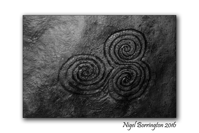
I want to mark this week by sharing some of the great Pagan monuments and sites I have visited both in the UK and here in Ireland, To the Pagan people of the past this week was a very special one, it marked the moment of new birth. It is for moments like these that Pagan people assembled their standing stones and stone circles.
Today I have posted and image of (Castlerigg stone circle,Keswick in Cumbria, North West England), this stone circle is one of the best preserved in Europe and located just north of the lake district, you can seen many of Cumbria’s great mountains in the background.
This stone circle would not only have been used to record the moments of the Winter Solstice but likely all the the events both in the (Sun’s the Moon’s and the stars) calendar of movements.
Here are some great facts about the Castlerigg stone circle :
Description
The stones are of a local metamorphic slate, set in a flattened circle, measuring 32.6 m (107 ft) at its widest and 29.5 m (97 ft) at its narrowest. The heaviest stone has been estimated to weigh around 16 tons and the tallest stone measures approximately 2.3m high. There is a 3.3m wide gap in its northern edge, which may have been an entrance. Within the circle, abutting its eastern quadrant, is a roughly rectangular setting of a further 10 stones. The circle was probably constructed around 3200 BC (Late Neolithic/Early Bronze-Age), making it one of the earliest stone circles in Britain and possibly in Europe. It is important to archaeoastronomers who have noted that the sunrise during the Autumn equinox appears over the top of Threlkeld Knott, a hill 3.5 km to the east. Some stones in the circle have been aligned with the midwinter sunrise and various lunar positions.
There is a tradition that it is impossible to count the number of stones within Castlerigg; every attempt will result in a different answer. This tradition, however, may not be far from the truth. Due to erosion of the soil around the stones, caused by the large number of visitors to the monument, several smaller stones have ‘appeared’ next to some of the larger stones. Because these stones are so small, they are likely to have been packing stones used to support the larger stones when the circle was constructed and would originally have been buried. Differences in opinion as to the exact number of stones within Castlerigg are usually down to whether the observer counts these small packing stones, or not; some count 38 and others, 42. The ‘official’ number of stones, as represented on the National Trust information board at the monument, is 40.
In the early 20th century, a single outlying stone was erected by a farmer approximately 90m to the south west of Castlerigg. This stone has many linear ‘scars’ along its side from being repeatedly struck by a plough, suggesting that it was once buried below the surface and also why the farmer dug it up. It is not possible to say whether this stone was originally part of the circle, or just a naturally deposited boulder.
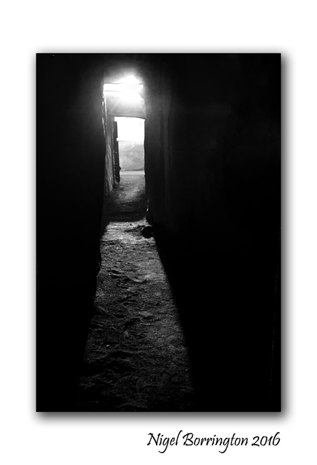
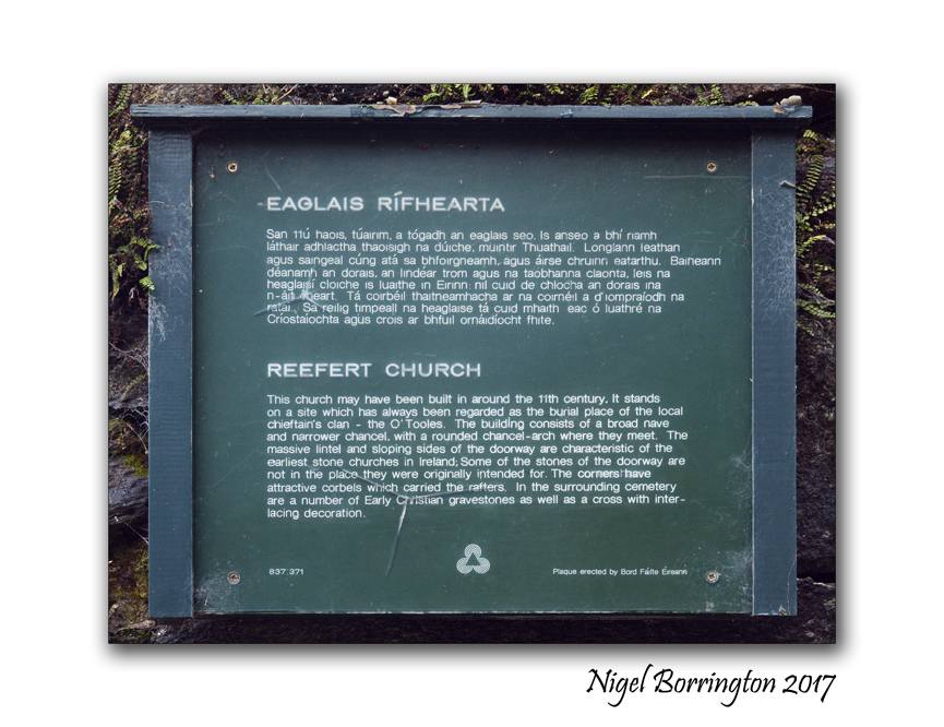
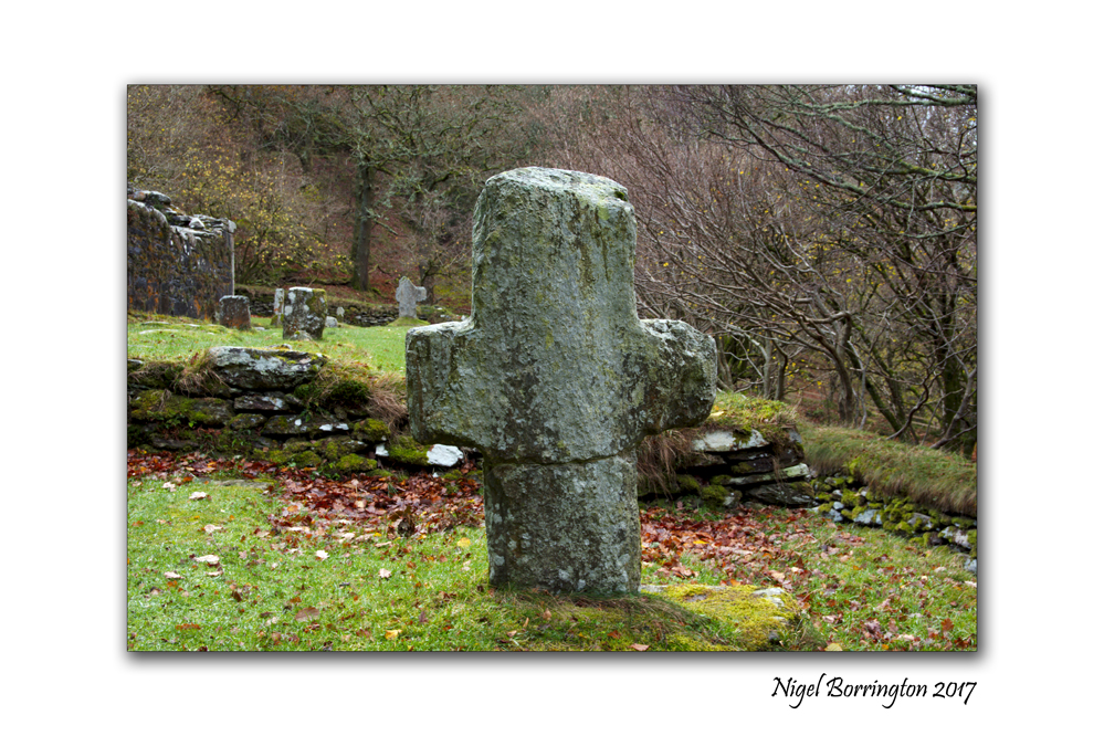
Reefert church, Glendalough, County Wicklow

Reefort, Glendalough Monastic City, Glendalough
Glendalough has one of the biggest collections of Monastic remains in Europe, one of the most beautiful simply has to be Reefort church, located in the ancient woodlands above the lough this little chapel and is small grave yard are such a perfect reminder of an age that has long past us by.
The remains of Reefert Church are situated in a oak woodland setting, on the south-eastern shore of the Upper Lake close to an Information Office. Reefert derives its name from the Irish ‘Righ Fearta’ meaning burial place of the kings (referring to the local rulers – the O’Toole family). It dates from the eleventh century and is likely to have been built on the site of an earlier church. The church and graveyard were originally surrounded by a stone wall enclosure known in Gaelic as a ‘caiseal’. Most of the present surrounding walls however are modern. The upper parts of the church walls were re-built over 100 years ago using the original stones.
Gallery


The view from the Spink, Glendalough, County Wicklow

View from the Spink
glendalough
county Wicklow
ireland
Nigel Borrington
The Spink and the Wicklow Mountains National Park
Back in the 6th century, hermit monk Saint Kevin first sought solace and contemplation in the idyllic surroundings of Glendalough. His followers established a monastery here, which would become one of the most important monastic sites in Europe. The focal point was the 33m high round tower, where the monks could hide away, keen to keep their precious manuscripts from the hands of invading Vikings.
The Glendalough Valley is now part of the Wicklow Mountains National Park. Established in 1991, it now extends to more than 170sq km. Only an hour’s drive from Dublin city, there is a vast array of routes at all levels of difficulty. But Glendalough is best explored on the Spink and Glenealo Valley Route, a high quality loop walk with excellent waymarking and a well-maintained trail.

Back at the Visitor Centre there are refreshments available in the restaurant, or you might want to head for the nearby village of Laragh with its restaurants and pubs. Laragh also makes a great base for further exploration of the surrounding mountains. Experienced walkers might want to climb Lugnaquilla, the highest mountain in Wicklow, while those in pursuit of more leisurely walks can explore historic Glenmalure or the scenic area around Lough Dan.
Slightly further north is the village of Roundwood, with its thriving Sunday market. Further north still the beautiful formal gardens of the Powerscourt Estate lie in the shadow of Sugarloaf Mountain. Don’t miss Powerscourt Waterfall close by, at 130m the highest waterfall in Ireland or Britain. The cascade is impressive at any time of year, but especially dramatic after rain.
Delete
The Spink, Wicklow Mountains National Park, Gallery


Irish Landscape Photography : February’s frost and snow along the river , River Suir , County Tipperary
February 2018
Along the banks of the River Suir,
County Tipperary,
Ireland
Nigel Borrington
As we say Goodbye to February and Hello to the Springtime month of March, we are still in the middle of a very cold week here in the southest of Ireland. This month has been one of the best for mixed weather that I can remember, we started the month wet and windy but then the weather turn much warmer and you could just start to imaging that the spring was on its way 🙂
This week , the final week of the Month has however been the most interesting end to the Month of February for some years, we awoke here in Kilkenny to some snow but only about 1cm, further north in Dublin and the Wicklow mountains they had some 10cm of snow overnight with about 20cm in places by the end of the day light hours today.
The fun however is only about to being, starting from 4pm tomorrow the south of the country is going to be hit by a storm (Emma) heading our way along the French west coast as I post and making land fall in both Ireland and Cornwall in the UK at the same time.
Overnight Thursday into Friday it is predicted that we will receive high winds of around 40 MPH and about 8cm of snow.
The main risk however will be from the high winds as this will of course increase the chance of the snow drifting, its a worry at this time of year as many farmers will have animals outside ready for the spring season. There has however been good notice of whats to come so hopefully there has been time to bring in sheep and livestock.
The only blessing could be that with the Springtime only just around the corner, when it stops snowing the temperatures should recover much more quickly that would be the case in the middle of the winter season.
The last time I experienced such cold winter weather was on a winters visit to the Welsh hills to visit a friend Sandy, here are some of the images from that visit.
While the Snow and Cold can bring hardship at times the landscape views it can bring are wonderful 🙂
Gallery of the Welsh hills in Winter
Share this:
February 28, 2018 | Categories: Comment, Gallery, Images for Christmas, Landscape, Mountains, Nigel Borrington, River Suir, Travel Locations, Winter colour, Winter landscape | Tags: Blizards, February, Kilkenny, Nigel Borrington, river suir, snow, Storem emma, Tipperary, wales, welsh hills, winter, Winter Farm | 3 Comments