
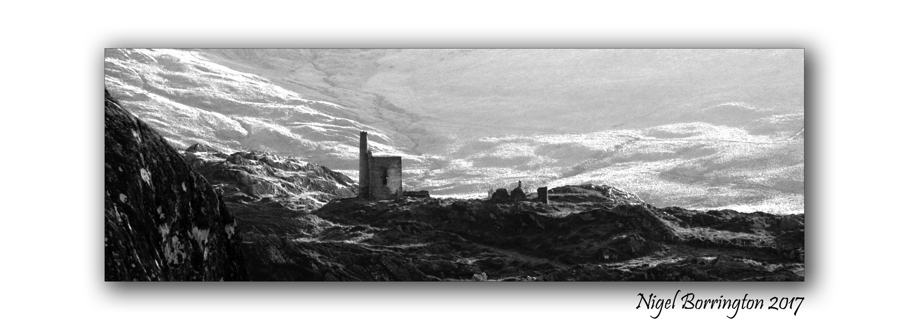
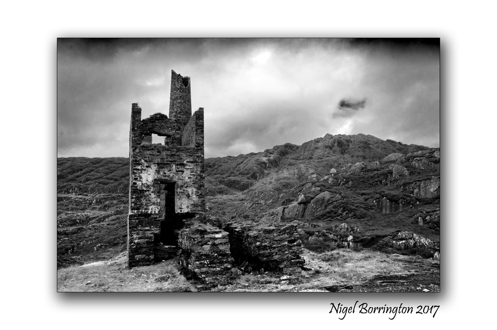
Images from the top of “The Reek” “Croagh Patrick”
Croagh Patrick
The Reek
County Mayo
Nigel Borrington 2018
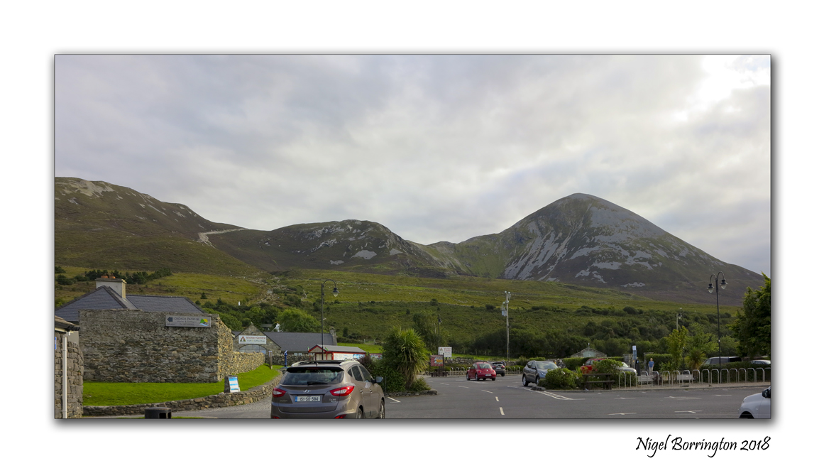
This time last week during a weeks holiday to both counties Sligo and Mayo, in the norths west of Ireland, we hiked up Croagh Patrick or “The reek” as locals know of it. This mountain is one of Irelands Highest peeks and is most famous for being climbed by pilgrims on Reek Sunday every year, which is the last Sunday of each July. On this Sunday, thousands of pilgrims climb Croagh Patrick in honor of Saint Patrick who, according to tradition, fasted and prayed on the summit for forty days in the year 441.
It has been a personal aim to walk the peeks of a list of mountains in Ireland for a couple of years and “The Reek” is just one of these mountains to hike in the next couple of years.
The weather on the day was perfect and we started our walk about Midday having driven some 80km to the main car park used to start the hike. The start of the walk is good, being flat for a while and then only slowly rising in level, so you get a little time to warmup before the main slopes higher up the mountain side. Once you hike the first slopes the path levels off for a while until you come to the bottom of the main peek.
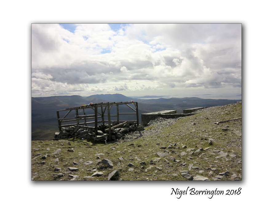
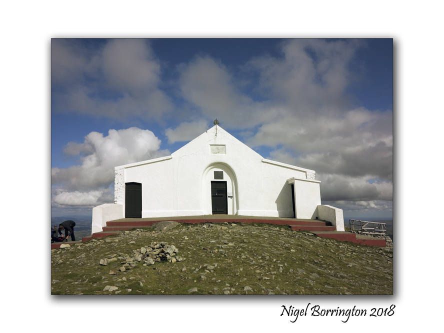
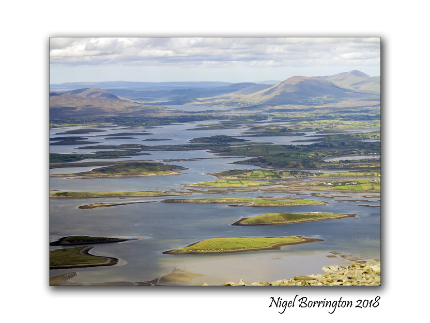
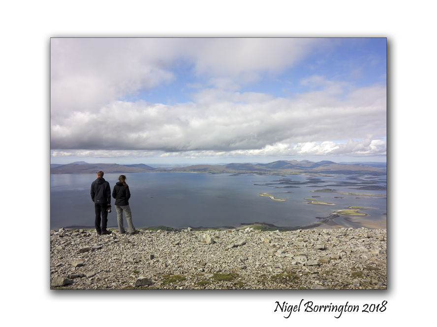
I really enjoyed this hike, its hard – no getting away from that fact but when you do finally get to the top the views are amazing, you can see most of county Mayo and well into county Sligo from here. there is a step that surrounds a small chapel that you can sit on to eat and have something to drink. We rested here for about 10 mins before walking around the top of the peek.
As you can see these images below are mostly taken at the top, when I finally go to open my bag and get my camera out. As I said you truly feel on top of the world here, this point is some 764 metres (2,507 ft) above sea level, not the highest mountain in the country by about 250 meters but here you start your walk at sea level so it could well be the highest distance you have to walk to get to the top…..
I will let these images do the rest of the talking for me other than to say , this is one of the most enjoyable walks of my life and I cannot wait to walk more Irish mountains in the months yo come ..
Croagh Patrick, County Mayo, A gallery


Tuesday Morning on the River, Bagenalstown, River Barrow, county Carlow

Morning on the river
Bagenalstown
county Carlow
Nigel Borrington 2018
Bagenalstown, county Carlow
One of my most loved small towns located along the river Barrow as it flows through county Carlow is Bagenalstown, it is located of the side of the hills that surround the river barrow south of Carlow town. Otherwise known in its Gaelic version as Muine Bheag it is a pleasant stretch of the River Barrow and derives its name from Walter Bagenal, who, in founding the town, had visions of mirroring the city of Versailles, in northern France.
However, his efforts became frustrated due to the re-routing of the coach road away from the town. He left more than enough for visitors to enjoy with handsome stone public buildings including the impressive Courthouse, now a public library in Bagenalstown.

The arrival of the railway in 1846 rejuvenated the town, and its neo-classical railway station is one of the finest in Ireland. Attributed to William Deane Butler it is constructed of limestone and granite and is a seven bay, two-storey building in an Italianate villa style. Today Bagenalstown station still retains its charm in a largely unaltered state. This former mill town made full use of the river Barrow to transport grain, beet, coal, turf and Guinness by barge, evidence of which can be seen in its fine industrial architecture. Near the railway bridge on the R705 Borris road is an example of the Carlow fence which consists of a decorative fence made of granite pieces, laid horizontally over vertical posts and is found nowhere else in the world.
One of the finest views of Bagenalstown may be enjoyed on the approach road from Leighlinbridge and includes the spire of St. Andrew’s Catholic Church and the fine tower of St. Mary’s Church of Ireland Church. St. Andrew’s Catholic Church was built in 1820 on a site provided by the Newton family, successors to the Bagenals. The stained glass behind the altar is worthy of particular attention. Nowadays, riverside walks, picnic tables and a picturesque lock enhance this fine town which has been twinned with the French town of Pont Pean since 1999.

ATTRACTIONS: The ruins of the early 14th century Ballymoon Castle and 13th century Ballyloughan Castle are located near the town. Wells Church, situated closeby, is the preserved ruin of a church dating back to 1262. The church is surrounded by an enclosed and well-maintained graveyard which is still in use today.
ACTIVITIES: Outdoor swimming pool. The McGrath complex offers excellent sporting facilities including cricket, hurling, soccer and Gaelic football fields, tennis court and pitch and putt courses. The River Barrow in this area is renowned for coarse fishing with wheelchair friendly fishing stands located near the swimming pool. The Barrow Way long distance walking route passes through the town.
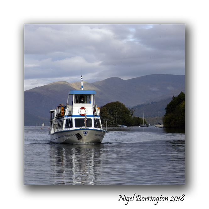
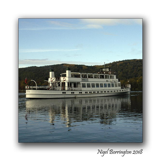
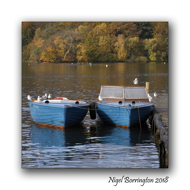
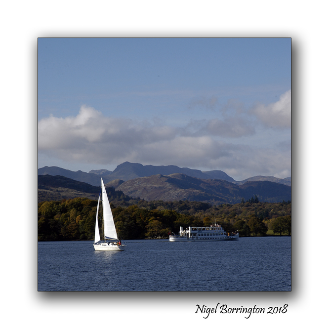
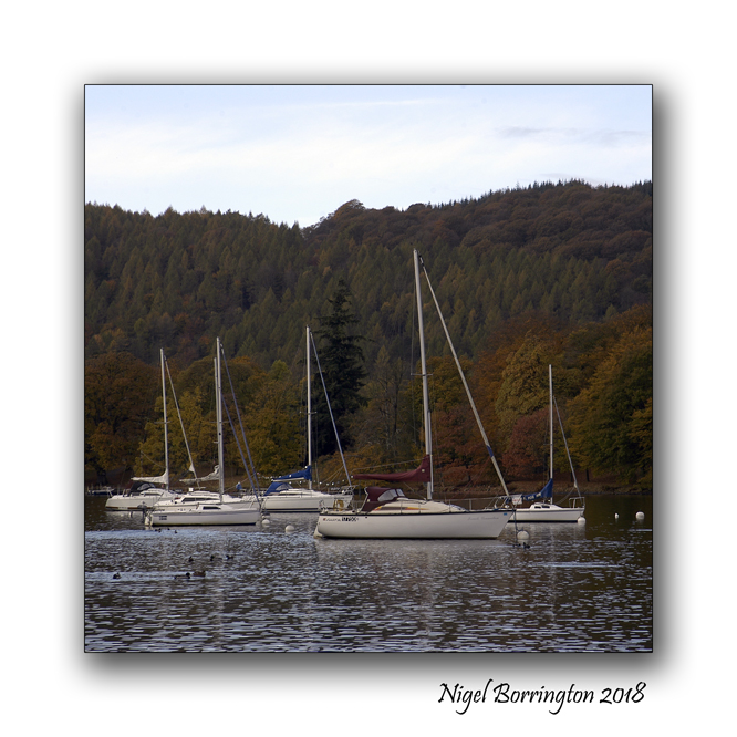
Shooting Square, Lake Windermere, Lake District, UK
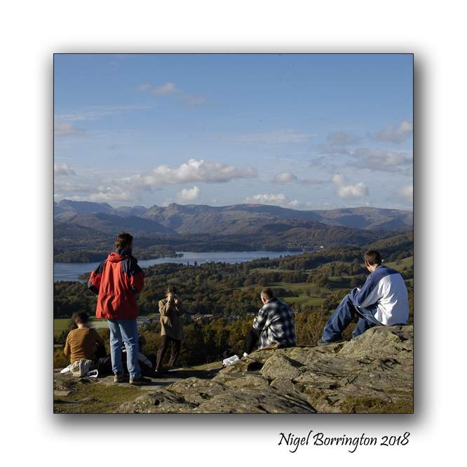
One reason I love shooting Landscape images with square format prints and images in mind for the final results is that your images get closer to your subjects, you loose lots of details in the frame that you mostly do not need.
These images are taken at Lake Windermere in the Lake District and I feel that their square format helps in capturing this great place in a truly focused and closer way.


Street views, Cobh, County Cork, Ireland, April 2018
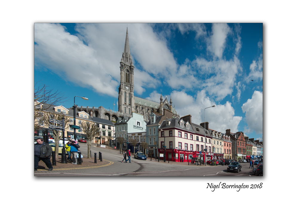
Street Views
Cobh, county Cork
Nigel Borrington
April 2018
Ancient Ireland : Poulnabrone Dolmen and Portal Tomb, Caherconnell, county Clare Ireland
Poulnabrone Portal tomb
County Clare
Ireland
Nigel Borrington
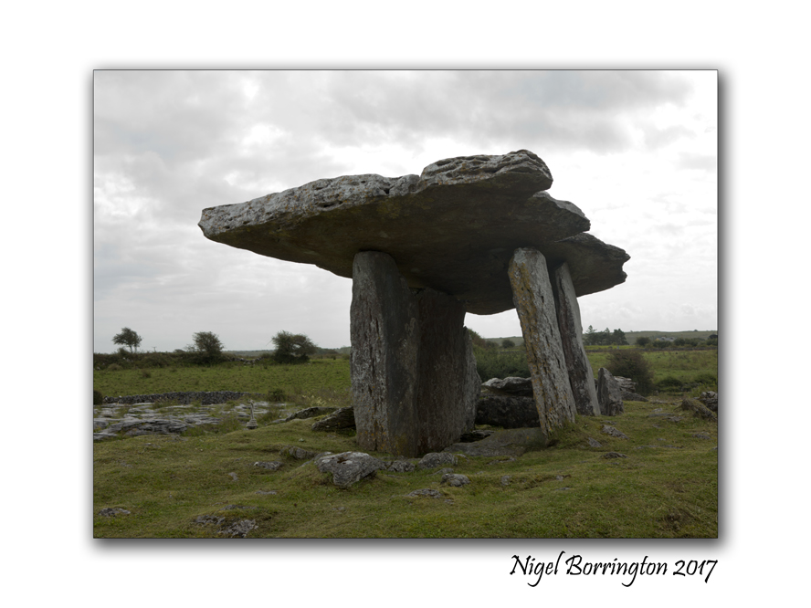
Poulnabrone Dolmen and Portal Tomb is one of the most Dramatic megalithic sites in Ireland, it has superb sculptured form and is easily access from the road.
During the summer months it must be one of the most visited dolmens in the country. The day I visited and took these pictures it was overcast and grey, so there was less visitors than I can imagine at other times. When the site was excavated in 1986 they found some human remains some 16 adults and children plus some of their artifacts, together they dated the tomb to around 3600 B C.
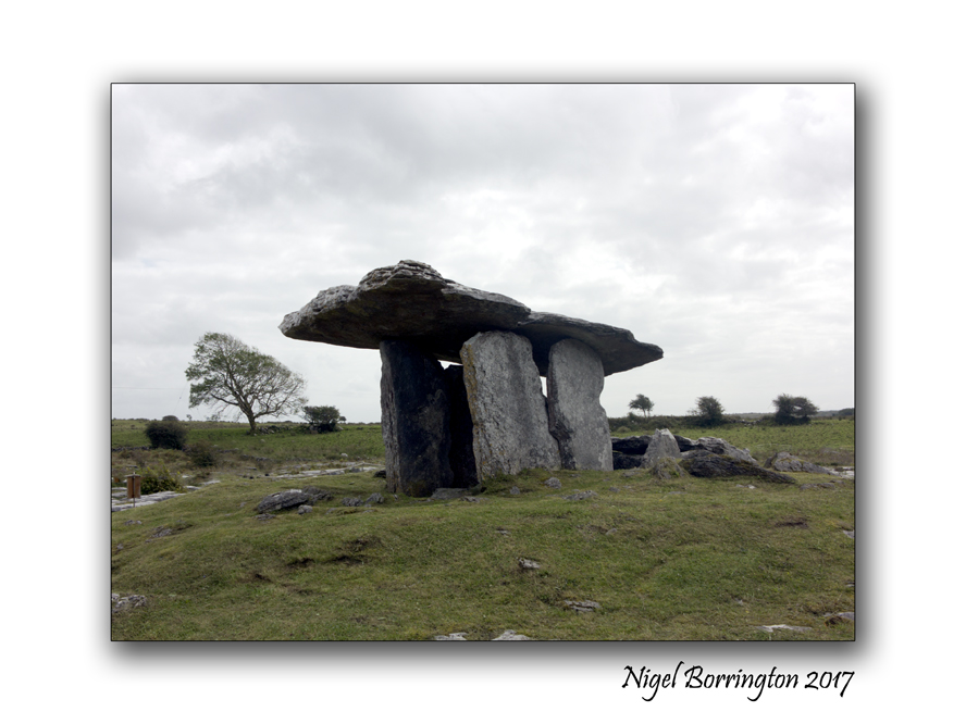
The entrance some 2 meters high faces north, The capstone is tilted at the usual angle for a Doland of this type, it measures about 3 1/2 metres long and some 2 metres wide.
The name Poulnabrone means ‘ the hole of the sorrows’ There are many other interesting sites near poulnabrone including the Wedge tomb at Gleninsheen and Baur South and the Stone Fort at Caherconnell.

Situated on Karst limestone, in a field east of the Ballyvaughan – Corrofin Road the Poulnabrone Dolmen is one of Irelands more accessable megalithic structures.
A sense of place : Allihies and its copper mines
Allihies Copper Mines
Munster
County Cork
Nigel Borrington
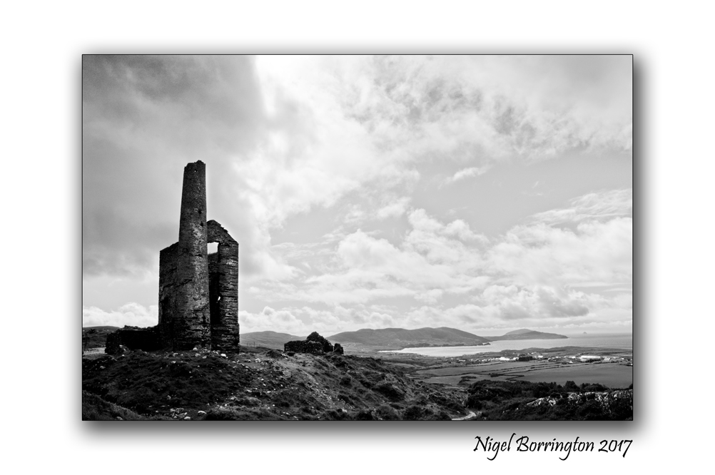
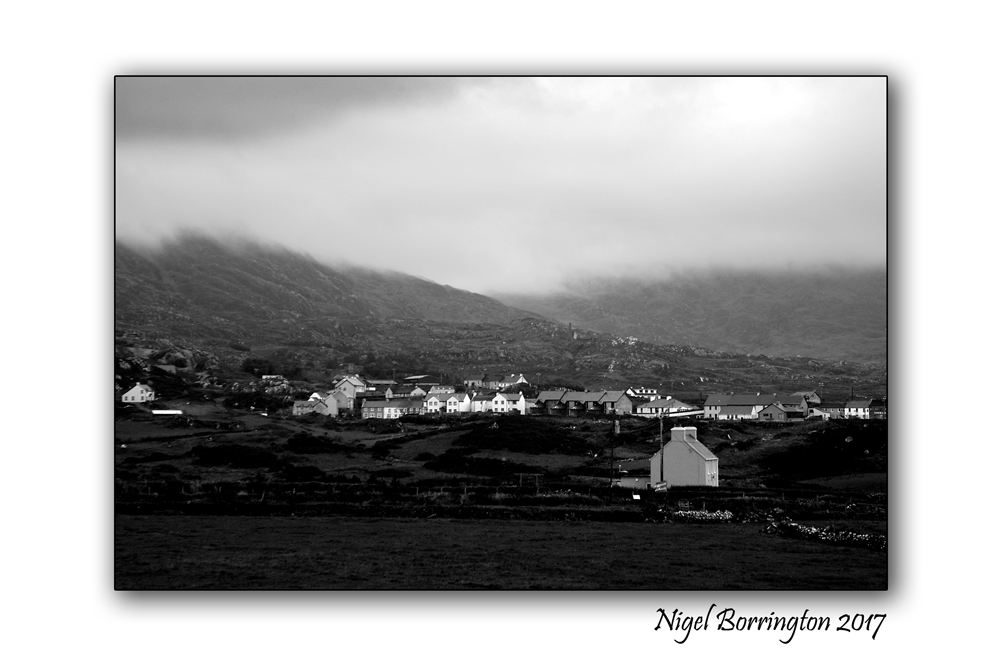
One of my favorite locations to visit in Ireland is Allihies in west cork, The village is located towards the end of the Béara Peninsula. Its a very beautiful places to spend sometime walking and visiting the small coves and beaches.
The Village has a long history with Copper mining, started in Allihies in 1812 when John Puxley, a local landlord, identified the large quartz promontory at Dooneen as copper bearing from its bright Malachite staining.
The Allihies Mines
Initial mining began with a tunnel or adit driven into the quartz lode from the pebble beach below. In 1821 two shafts were sunk . Flooding was a continuous problem and in 1823 the engine house was erected to house a steam engine brought over from Cornwall to pump water from the depths. The remains of this building with the base of the chimney can be seen across the road. There is also evidence of a steam powered stamp engine to the left of the chimney and dressing floors in front of the engine house. The high dam further inland is the remaining evidence of a water reservoir which stored the water that was pumped out from the bottom of the mine. It was used for the steam engines and needed to separate the copper from rock. All the rubble on the cliff at the sea side of the road is the crushed useless quartz rock left over after the copper ore was extracted.
This is one of six productive mines in the Allihies area and its operation continued until 1838 when it closed due to failing ore.
John Puxley died in 1860 and in 1868 his son Henry Puxley sold the mines to the new Berehaven Mining Company who reopened the mine and installed a new 22 inch steam engine in 1872. Little ore was produced though in this period and the mine was finally abandoned in 1878.
Time line of Copper Mining at Allihies
Gallery
The following images are taken during my last visit, I hope to return one day soon to this great little historic Irish town.


St David’s Cathedral, St Davids, Pembrokeshire,Wales : The light from a Golden Dawn

St David’s Cathedral
St Davids, Pembrokeshire
Wales
Nigel Borrington
Images from Outside and Inside of St Davids Cathedral, St Davids, Pembrokeshire, Wales.
The Light from a Golden Dawn ……..


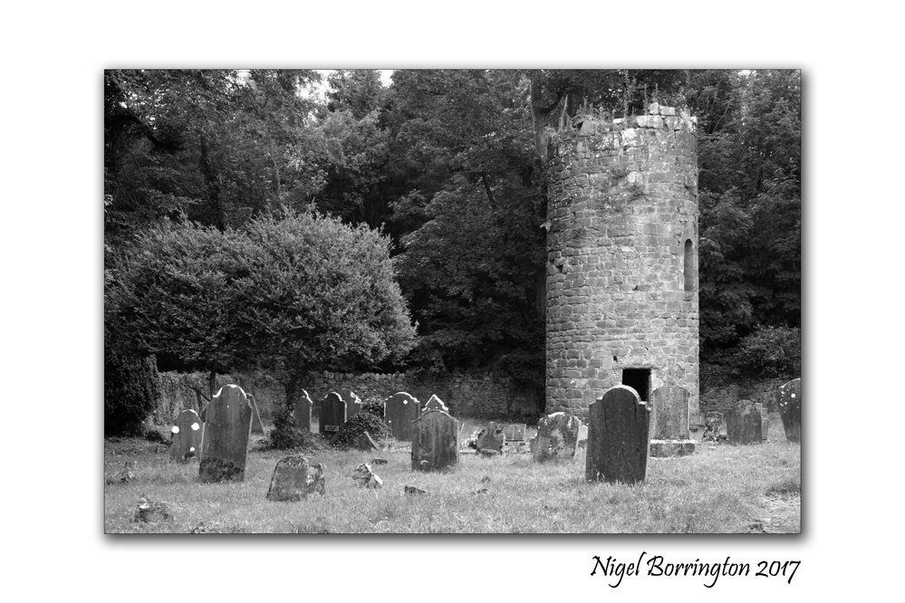
Aghaviller Round Tower and Church

Aghaviller Round Tower and Church
County Kilkenny
Ireland
Nigel Borrington
Aghaviller
Round Tower and Church
Located in county Kilkenny, Aghaviller Round Tower and Church are together one of the most interesting of Irish Historic sites. Based on the presence of the round tower, it is believed that the Agherviller monastic settlement was once a relatively high-status ecclesiastical foundation dating back to Early Christian times. The church and a holy well not far from the site have been dedicated to St Brennain. We don’t know who founded the monastery but it could have been St Brennain. The round tower is built on top of a square stone plinth, an unusual feature which is only found in one other place in Ireland –at nearby Kilree. Sadly, only the lower 9.6 metres of the round tower survived.
The original NE facing round-arched doorway is in its customary location about 4 metres above ground level, although a ground-level lintelled doorway has been added in more recent times. The sandstone tower was unfortunately in deep shade from the nearby dense woods on our late afternoon visit, but it is worth a return trip in morning light to photograph the stonework which is beautifully dressed to the curve inside and out. There is a southwest facing square-headed window at the second storey level.
The church dates to the 12th Century but was significantly modified in the 15th by the addition of a massive tower over the chancel that served as a residence. Only the foundation of the nave remains. An archaeological excavation revealed a gully filled with kiln material and a sizeable ditch/boundary running north–south with stone revetting on its eastern side. This ditch is believed to have surrounded a second or outer enclosure, a common feature of high-status monastic sites.
Gallery


Ancient European beliefs, The powers of the Hand of Glory

The Hand of Glory,
Whitby Museum
Pannet Park, Whitby,
Yorkshire,
England
Today’s post is about as far away from wild Landscapes and attractive views as you could wish for 🙂 , I can fully understand if this post is not for everyone but I hope at least you find it an interesting reflection of social beliefs and traditions from our some what dark European past ….

Abbey Steps
Whitby
Yorkshire
Earlier this month (May 2017) while visiting the great English seaside town of Whitby, with it great Museum, I came across an item that I had never heard of or seen before. Sitting in a glass cabinet in the beliefs and local traditions area was the very old and grey hand, from a long dead man, a man who would have lived locally in the town but at some point in his life come across the misfortune of being found guilty of a crime for which he would have been hanged.
The hand was described as “The hand of Glory” and in the early 19th century it would have been very much a price possession as it was believed that it offered great power, when using it according to old European beliefs along with a candle made of the fat from a malefactor who died on the gallows, lighted, and placed (as if in a candlestick) in the Hand of Glory, which comes from the same man as the fat in the candle, it then would render motionless all persons to whom it was presented.
The second of the Ingoldsby Legends (a collection of myths, legends, ghost stories and poetry written supposedly by Thomas Ingoldsby of Tappington Manor), “The Hand of Glory, or, The Nurse’s Story”, describes the making and use of a Hand of Glory. The first lines are:
Now open, lock!
To the Dead Man’s knock!
Fly, bolt, and bar, and band!
Nor move, nor swerve,
Joint, muscle, or nerve,
At the spell of the Dead Man’s hand!
Sleep, all who sleep! — Wake, all who wake!
But be as the dead for the Dead Man’s sake!

Like many people, I fine absolutely fascinating these old and somewhat dark traditions, here is a full description of this ones history and its reported uses ….
The Hand of Glory – History of the term
Etymologist Walter Skeat reports that, while folklore has long attributed mystical powers to a dead man’s hand, the specific phrase “Hand of Glory” is in fact a folk etymology: it derives from the French main de gloire, a corruption of mandragore, which is to say mandrake.Skeat writes, “The identification of the hand of glory with the mandrake is clinched by the statement in Cockayne’s Leechdoms, i. 245, that the mandrake “shineth by night altogether like a lamp”. Cockayne in turn is quoting Pseudo-Apuleius, in a translation of a Saxon manuscript of his Herbarium.
Powers attributed
According to old European beliefs, a candle made of the fat from a malefactor who died on the gallows, lighted, and placed (as if in a candlestick) in the Hand of Glory, which comes from the same man as the fat in the candle, this would render motionless all persons to whom it was presented. The method for holding the candle is sketched in Petit Albert. The candle could be put out only with milk. In another version, the hair of the dead man is used as a wick, and the candle would give light only to the holder. The Hand of Glory also purportedly had the power to unlock any door it came across. The method of making a Hand of Glory is described in Petit Albert, and in the Compendium Maleficarum.
Process
The 1722 Petit Albert describes in detail how to make a Hand of Glory, as cited from him by Grillot De Givry:
Take the right or left hand of a felon who is hanging from a gibbet beside a highway; wrap it in part of a funeral pall and so wrapped squeeze it well. Then put it into an earthenware vessel with zimat, nitre, salt and long peppers, the whole well powdered. Leave it in this vessel for a fortnight, then take it out and expose it to full sunlight during the dog-days until it becomes quite dry. If the sun is not strong enough put it in an oven with fern and vervain. Next make a kind of candle from the fat of a gibbeted felon, virgin wax, sesame, and ponie, and use the Hand of Glory as a candlestick to hold this candle when lighted, and then those in every place into which you go with this baneful instrument shall remain motionless
De Givry points out the difficulties with the meaning of the words zimat and ponie, saying it is likely “ponie” means horse-dung. De Givry is expressly using the 1722 edition, where the phrase is, according to John Livingston Lowes “du Sisame et de la Ponie” and de Givry notes that the meaning of “ponie” as “horse dung” is entirely unknown “to us”, but that in local Lower Normandy dialect, it has that meaning. His reason for regarding this interpretation as “more than probable” is that horse-dung is “very combustible, when dry”.
In the French 1752 edition (called Nouvelle Édition, corrigée & augmentée., i.e., “New Edition, corrected and augmented”), however, this reads as “..du sisame de Laponie..”, that is, in Francis Grose’s translation from 1787, “sisame of Lapland”, or Lapland sesame. This interpretation can be found many places on the Internet, and even in books published at university presses. Two books, one by Cora Daniels, another by Montague Summers, perpetuate the Lapland sesame myth, while being uncertain whether zimat should mean verdigris or the Arabian sulphate of iron.
The Petit Albert also provides a way to shield a house from the effects of the Hand of Glory:
The Hand of Glory would become ineffective, and thieves would not be able to utilize it, if you were to rub the threshold or other parts of the house by which they may enter with an unguent composed of the gall of a black cat, the fat of a white hen, and the blood of the screech-owl; this substance must be compounded during the dog-days
The hand of glory on display at Whitby Museum
An actual Hand of Glory is kept at the Whitby Museum in North Yorkshire, England, together with a text published in a book from 1823.[14] In this manuscript text, the way to make the Hand of Glory is as follows:
It must be cut from the body of a criminal on the gibbet; pickled in salt, and the urine of man, woman, dog, horse and mare; smoked with herbs and hay for a month; hung on an oak tree for three nights running, then laid at a crossroads, then hung on a church door for one night while the maker keeps watch in the porch-“and if it be that no fear hath driven you forth from the porch…then the hand be true won, and it be yours”
Arley Hall, a country house in the village of Arley, Cheshire, England,
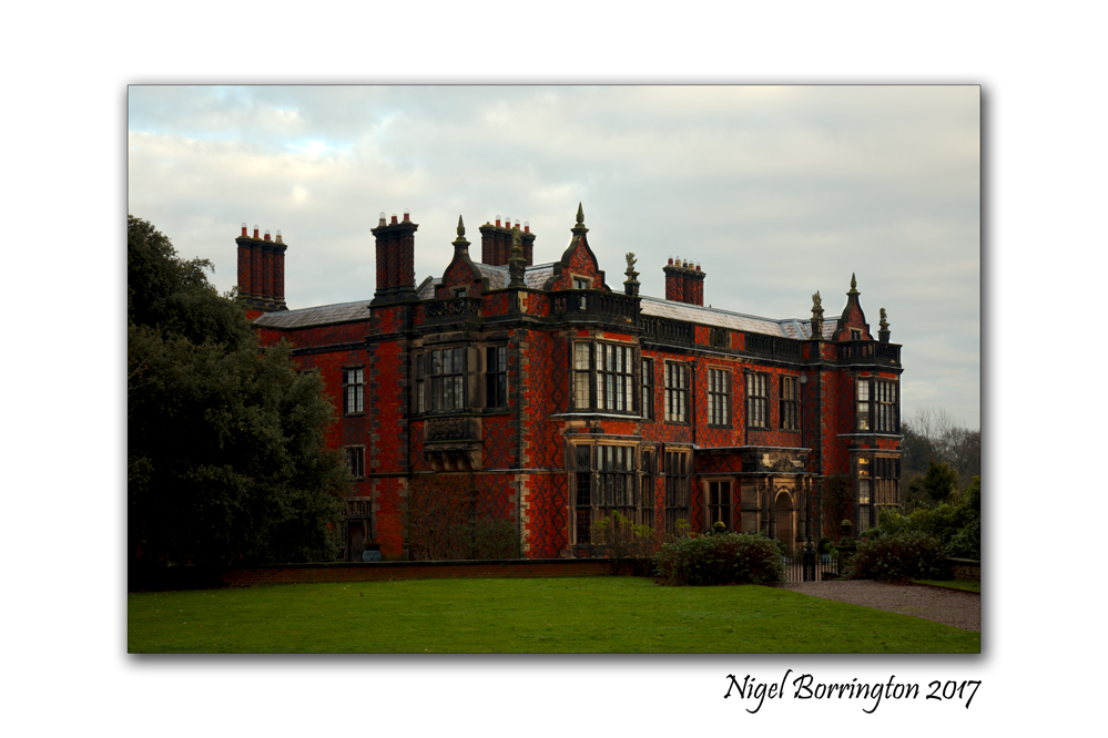
Arley Hall
country house
village of Arley, Cheshire, England,
If you looking for a place to visit in the UK, the county of Chesire has many great country houses and estate lands that you can visit, including Dunham Massey Hall, Tatton Park and Arley Hall.
Over the Christmas and New year period I visited Arley Hall and its great Gardens
Arley Hall is a country house in the village of Arley, Cheshire, England, about 4 miles (6 km) south of Lymm and 5 miles (8 km) north of Northwich. It is home to the owner, Viscount Ashbrook and his family. The house is a Grade II* listed building, as is its adjacent chapel. Formal gardens to the southwest of the hall are also listed at Grade II* on the National Register of Historic Parks and Gardens. In the grounds are more listed buildings, a cruck barn being listed as Grade I, and the other buildings as Grade II.
The hall was built for Rowland Egerton-Warburton between 1832 and 1845, to replace an earlier house on the site. Local architect George Latham designed the house in a style which has become known as Jacobethan, copying elements of Elizabethan architecture. A Gothic Revival chapel designed by Anthony Salvin was subsequently built next to the hall. By the mid-20th century parts of the house were in poor condition and were demolished, to be replaced by five private homes in a matching architectural style.

Arley Hall, Gardens
The present gardens were created in the 1830s, and were developed during the 20th century. The garden’s Herbaceous Border was one of the first of its type in Britain, and remains one of the finest. The house and its gardens have been open to the public since the 1960s, and have also been used as a film location. Stockley Farm, part of the Arley estate, is an additional visitor attraction for children and families.


You must be logged in to post a comment.