


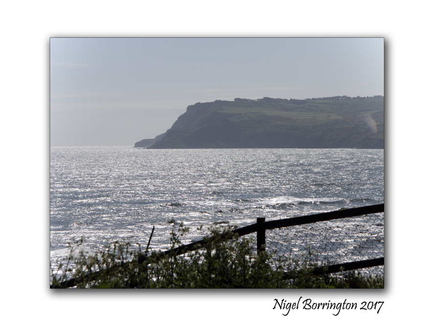
Images without words , A September sunset on the beach ….

St Annes Pier at sunset
September sunset
Nigel Borrington
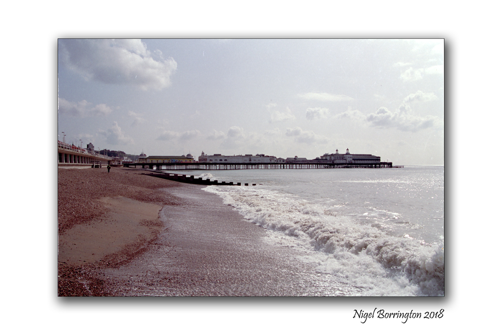
New site header , St Anne’s Pier, Lancashire, UK

St Anne’s-on-the-Sea, Lancashire, UK
Nigel Borrington
St Anne’s Pier is a Victorian era pleasure pier in the English seaside resort of St Anne’s-on-the-Sea, Lancashire. It lies on the estuary of the River Ribble. The pier, designed by A. Dowson, was completed in 1885 and was one of the earliest public buildings in St Anne’s, a 19th-century planned town. The pier was originally intended to be a sedate promenading venue for the resort’s visitors, but attractions were later added. Changes made to the estuary channels to improve access to Preston Dock left the pier on dry land and ended its steamer services to Blackpool and Liverpool.

St Anne’s Pier
St Anne’s-n-the-Sea, Lancashire
Nigel Borrington
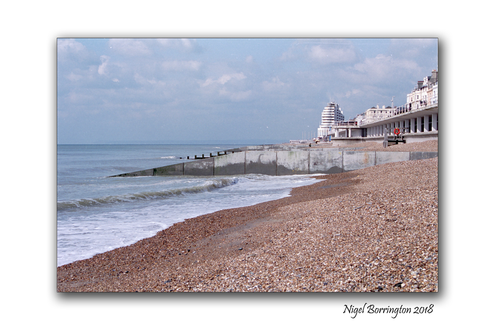
A Tudor-style entrance was built in 1899. Early 20th-century additions included a Moorish-style pavilion in 1904 and the Floral Hall in 1910. The Moorish Pavilion was destroyed by fire in 1974, shortly after the town’s centenary; the Floral Hall burned down in 1982. Originally 914 feet (279 m) long, the pier was reduced to 600 feet (180 m) by the demolition of the seaward end. English Heritage has designated the pier a Grade II listed building.
This is Manchester !!!
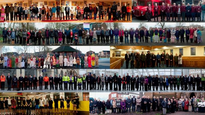
People living and working on one of the most culturally diverse streets in Britain are being celebrated in a new photographic exhibition.
Panoramic snapshots of life in Manchester’s multicultural Cheetham Hill Road
On this blog I do my best to keep away from political events and areas of life that can only affect people in a negative way !!!
However flowing last nights terrorist attack in my home town of Manchester I just wanted to make a quick comment and to share what I feel is such a great city, its people and its very heart !!!
This is Manchester, the Manchester I love and grew-up in !!!!
MULTICULTURAL !!!
LOVING!
CARING!!!
SOFT SHARING PEOPLE!!!
My Heart is Broken!! For the people who have lost loved ones last night and for anyone affected in anyway !!!!
Please go and read this article, it reflects upon the best aspects of life in the city I love the most !!! MANCHESTER , UK …..
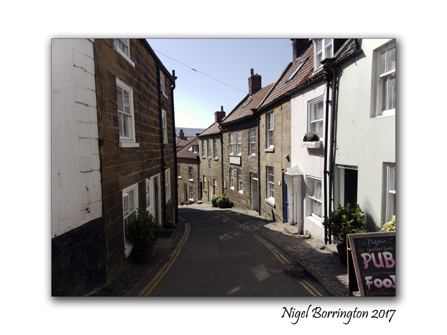
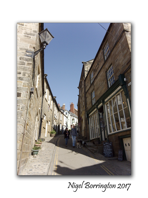
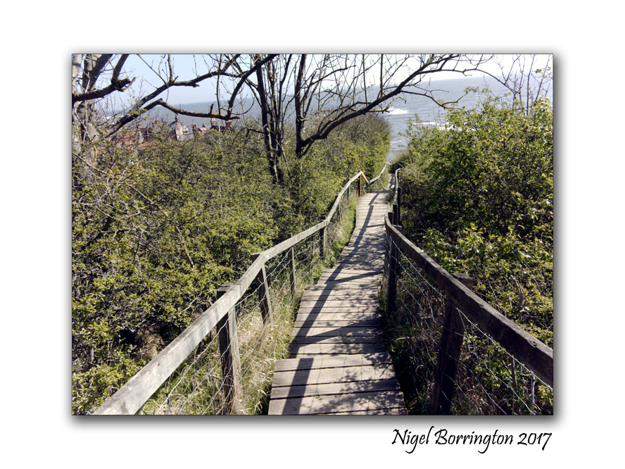
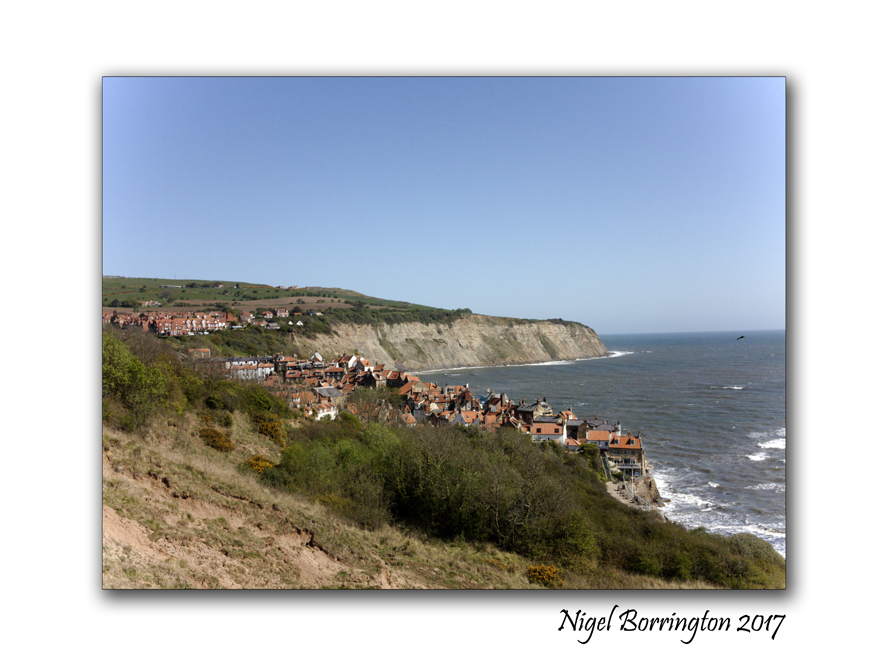
Robin Hood’s Bay, A fishing Village, North York Moors National Park

Robin Hood’s Bay Fishing village North York Moors National Park
Nigel Borrington
Robin Hood’s Bay is a small fishing village and a bay located within the North York Moors National Park, five miles south of Whitby and fifteen miles north of Scarborough on the stunning coast line of North Yorkshire, England.
“Bay Town” is its local name, in the ancient chapelry of Fylingdales in the wapentake of Whitby Strand. The origin of the name is uncertain, and it is doubtful if Robin Hood was ever in the vicinity.
An English ballad and legend tell a story of Robin Hood encountering French pirates who came to pillage the fisherman’s boats and the northeast coast. The pirates surrendered and Robin Hood returned the loot to the poor people in the village that is now called Robin Hood’s Bay
This Village on the Yorkshire Coast is one of the most Beautiful villages in the UK, Here I share a collection of Photographs taken during a visit at the start of May 2017, I hope that I have captured a small sense of this idyllic English sea side village as I enjoyed our time spend here very much and will look back with very fond memories …..
Robin Hood’s Bay, A Sense of place ….


Looking at a Painting : Industrial City by Ls Lowry

Lowry, Laurence Stephen; Industrial City; British Council Collection; http://www.artuk.org/artworks/industrial-city-176858
I have posted a couple of times since the new year, relating to the Manchester Born artists Laurence Stephen Lowry (1887–1976) he was born in Old Trafford, Salford and studied in the evening at Manchester Municipal College of Art. He was a man who rarely left the North West, finding his inspiration in the landscape of North Wales and Lancashire, and in the streets of Manchester and around Salford.
Possible this painting “Industrial City” is one of my favorite cityscapes that Lowry produced, I say possibly because he was prolific in this area of his portfolio and I love so much of his inner city works.
I grow up in Altrincham, a town only a few miles away from city center Manchester and while I missed this core era that Lowry was working in, I have lots of memories of the city looking like it does in these paintings.
During my early years I can remember these streets and factories being slowly torn down and replaced with office blocks along with new more modern houses. Its hard to imagine these days what life was like for a lot of the people captures in Lowry’s drawings and painting, living and working within the same mile, most people hardly traveling very far outside their surroundings.
Industrial City
Lowry restricted his palette to black, vermillion, Prussian blue, yellow ochre and flake white. Whilst there is a naivety in his rendition, he deftly caught the hustle and bustle of men, women and dogs on the move against a background of terraced houses, mills and factories.
The things I love most about this painting , well firstly its angle of view, Lowry paints as if he was standing on top a hill overlooking the homes and industry below. I also like very much the distance in this painting, a distance that few of the people captured in it could experience themselves at street level. To me this distance captures the expanse of the city, each small area making up the whole, yet enclosing people within their own spaces of home and work and life.
City life itself is captured here, every element of the community (Home, work, shops, play, chat, church and industrial dirt – so much of it!).
In the distance through the city smog you can just make out the hills and moors, fresh air and spaces that so clearly is just out of reach.
I feel this painting is LS Lowry at his very best, some artists go in very close with life in order to capture and reflect on it , Lowry pulls back in his view and adds in so many elements that you have to spend time exploring his work, in order for you to see the full message and story he want you to see.
This was life in a Northern English town, lowry painted it and also lived it with the people he captured!!!!
Arley Hall, a country house in the village of Arley, Cheshire, England,
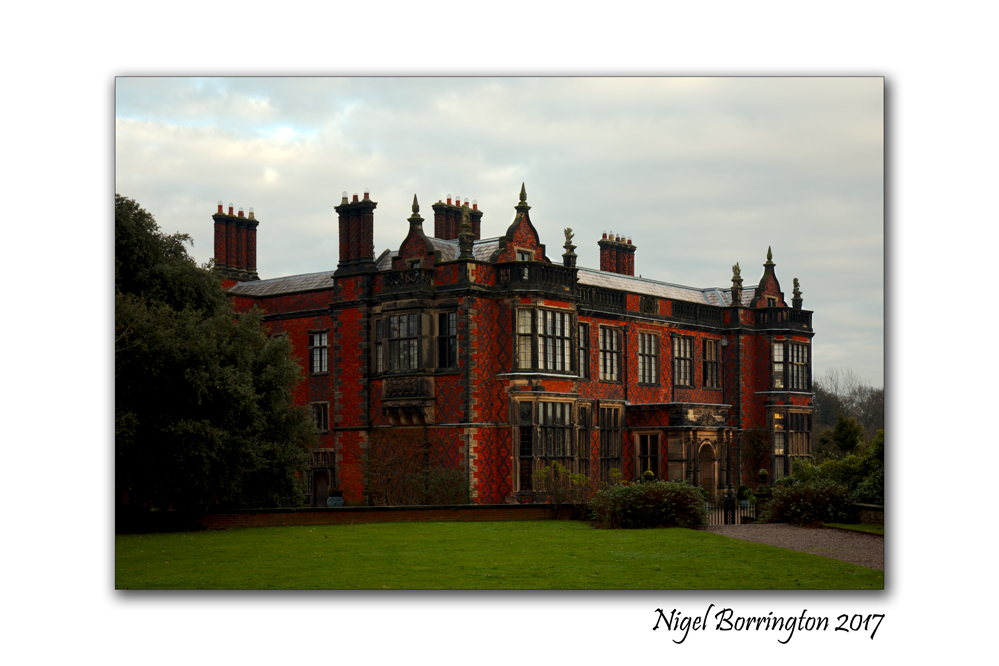
Arley Hall
country house
village of Arley, Cheshire, England,
If you looking for a place to visit in the UK, the county of Chesire has many great country houses and estate lands that you can visit, including Dunham Massey Hall, Tatton Park and Arley Hall.
Over the Christmas and New year period I visited Arley Hall and its great Gardens
Arley Hall is a country house in the village of Arley, Cheshire, England, about 4 miles (6 km) south of Lymm and 5 miles (8 km) north of Northwich. It is home to the owner, Viscount Ashbrook and his family. The house is a Grade II* listed building, as is its adjacent chapel. Formal gardens to the southwest of the hall are also listed at Grade II* on the National Register of Historic Parks and Gardens. In the grounds are more listed buildings, a cruck barn being listed as Grade I, and the other buildings as Grade II.
The hall was built for Rowland Egerton-Warburton between 1832 and 1845, to replace an earlier house on the site. Local architect George Latham designed the house in a style which has become known as Jacobethan, copying elements of Elizabethan architecture. A Gothic Revival chapel designed by Anthony Salvin was subsequently built next to the hall. By the mid-20th century parts of the house were in poor condition and were demolished, to be replaced by five private homes in a matching architectural style.

Arley Hall, Gardens
The present gardens were created in the 1830s, and were developed during the 20th century. The garden’s Herbaceous Border was one of the first of its type in Britain, and remains one of the finest. The house and its gardens have been open to the public since the 1960s, and have also been used as a film location. Stockley Farm, part of the Arley estate, is an additional visitor attraction for children and families.

Wildlife Study, the swans at Langley Park
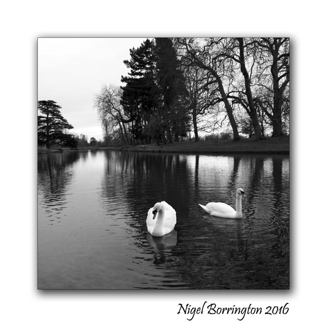
A Study of Wildlife
Swans
Langley Park
Iver Heath
LANGLEY PARK
Langley Park is a beautiful place to ‘escape from it all’ from taking the dog for a walk to go horse riding, cycling or just walking. you can relax with a picnic by the lake or under the beautiful trees and simply watch the world go by. With patience you may even be lucky enough to see some of the wide variety of wildlife in the park such as deer and foxes along with the Swans, and if you listen carefully you can hear the Great Spotted Woodpeckers tat tatting on many of the veteran trees.
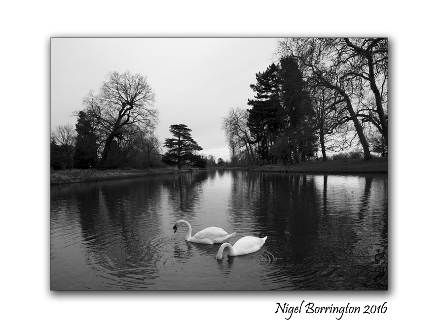
Langley Park is located off the Uxbridge Road (A412), Iver, Bucks, SL0 0LS, and is on the opposite side of the road to Black Park. The car park is in Billet Lane, which is the first turning on the left after the Tesco garage if coming from the Crooked Billet Roundabout.


The week of the winter solstice – 2017, Castlerigg stone circle, Keswick in Cumbria, UK
Castlerigg stone circle
Keswick in Cumbria, North West England
Nigel Borrington
This week we will all experience the Winter Solstice, the moment that the amount of available Sun light has reached its lowest amount each day. From the 21st of December on the amount of day-light will start to slowly increase again, you could say that this moment marks the tree new year in the solar calendar !
The solstice may have been a special moment of the annual cycle for some cultures even during neolithic times. Astronomical events were often used to guide activities such as the mating of animals, the sowing of crops and the monitoring of winter reserves of food. Many cultural mythologies and traditions are derived from this. This is attested by physical remains in the layouts of late Neolithic and Bronze Age archaeological sites, such as Stonehenge in England and Newgrange in Ireland.
I want to mark this week by sharing some of the great Pagan monuments and sites I have visited both in the UK and here in Ireland, To the Pagan people of the past this week was a very special one, it marked the moment of new birth. It is for moments like these that Pagan people assembled their standing stones and stone circles.
Today I have posted and image of (Castlerigg stone circle,Keswick in Cumbria, North West England), this stone circle is one of the best preserved in Europe and located just north of the lake district, you can seen many of Cumbria’s great mountains in the background.
This stone circle would not only have been used to record the moments of the Winter Solstice but likely all the the events both in the (Sun’s the Moon’s and the stars) calendar of movements.
Here are some great facts about the Castlerigg stone circle :
Description
The stones are of a local metamorphic slate, set in a flattened circle, measuring 32.6 m (107 ft) at its widest and 29.5 m (97 ft) at its narrowest. The heaviest stone has been estimated to weigh around 16 tons and the tallest stone measures approximately 2.3m high. There is a 3.3m wide gap in its northern edge, which may have been an entrance. Within the circle, abutting its eastern quadrant, is a roughly rectangular setting of a further 10 stones. The circle was probably constructed around 3200 BC (Late Neolithic/Early Bronze-Age), making it one of the earliest stone circles in Britain and possibly in Europe. It is important to archaeoastronomers who have noted that the sunrise during the Autumn equinox appears over the top of Threlkeld Knott, a hill 3.5 km to the east. Some stones in the circle have been aligned with the midwinter sunrise and various lunar positions.
There is a tradition that it is impossible to count the number of stones within Castlerigg; every attempt will result in a different answer. This tradition, however, may not be far from the truth. Due to erosion of the soil around the stones, caused by the large number of visitors to the monument, several smaller stones have ‘appeared’ next to some of the larger stones. Because these stones are so small, they are likely to have been packing stones used to support the larger stones when the circle was constructed and would originally have been buried. Differences in opinion as to the exact number of stones within Castlerigg are usually down to whether the observer counts these small packing stones, or not; some count 38 and others, 42. The ‘official’ number of stones, as represented on the National Trust information board at the monument, is 40.
In the early 20th century, a single outlying stone was erected by a farmer approximately 90m to the south west of Castlerigg. This stone has many linear ‘scars’ along its side from being repeatedly struck by a plough, suggesting that it was once buried below the surface and also why the farmer dug it up. It is not possible to say whether this stone was originally part of the circle, or just a naturally deposited boulder.
More…
Share this:
December 18, 2017 | Categories: astronomy, Comment, Gallery, Landscape, Pagan, Solo images, The Celtic year, Travel Locations, Winter landscape | Tags: astronomy, Castlerigg stone circle, Keswick in Cumbria, mid winters day, moon, Nigel Borrington, Pagan, Pagan events, Stars, sun, The pagan year, The week of the winter solstice, UK, winter solstice | 2 Comments