
Ancient Ireland : Poulnabrone Dolmen and Portal Tomb, Caherconnell, county Clare Ireland
Poulnabrone Portal tomb
County Clare
Ireland
Nigel Borrington
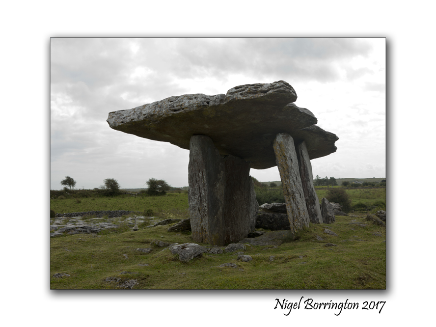
Poulnabrone Dolmen and Portal Tomb is one of the most Dramatic megalithic sites in Ireland, it has superb sculptured form and is easily access from the road.
During the summer months it must be one of the most visited dolmens in the country. The day I visited and took these pictures it was overcast and grey, so there was less visitors than I can imagine at other times. When the site was excavated in 1986 they found some human remains some 16 adults and children plus some of their artifacts, together they dated the tomb to around 3600 B C.
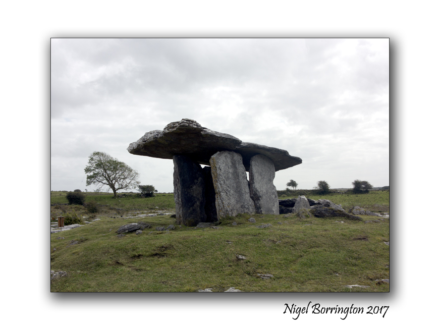
The entrance some 2 meters high faces north, The capstone is tilted at the usual angle for a Doland of this type, it measures about 3 1/2 metres long and some 2 metres wide.
The name Poulnabrone means ‘ the hole of the sorrows’ There are many other interesting sites near poulnabrone including the Wedge tomb at Gleninsheen and Baur South and the Stone Fort at Caherconnell.

Situated on Karst limestone, in a field east of the Ballyvaughan – Corrofin Road the Poulnabrone Dolmen is one of Irelands more accessable megalithic structures.
Sunday with Kilkenny’s ancient stones , Discovering nine megalithic Court Tombs

kilmogue portal Tomb , 6000 years old,
The Standing Stone and Tombs of County Kilkenny,
Landscape Photography : Nigel Borrington
Sunday with Kilkenny’s ancient stones and tombs
Earlier in the year I posted this article about the kilmogue portal Tomb , Located Near Harristown , County Kilkenny.
Sitting at the end of a short path near Harristown, county kilkenny, it is a 6000 year old tomb, know nationally at the Kilmogue Portal Tomb but locally as, “Leac an Scail” – stone of the warrior/hero in English.
This tomb however has become just the first of many ancient remains I feel I have found in this small area of County Kilkenny, since I posted the above post in April (2014).

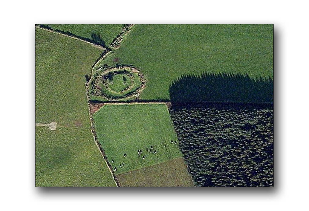
The above is a map of a wooded area located above the Kilmogue Portal Tomb, Harristown, Kilkenny.
When back in April when I re-visited the portal tomb, I took a good look at its surroundings, its a dairy farming area with some very defined field patterns, I had a very strong feeling that this tomb could not be the only local ancient remains, there just had to be more.
It took some weeks of walking the local roads and wood-lands to find what I was looking for and the above map shows clearly the amount of sites I feel I have now found (Ring forts, standing stones and Tombs), while walking through the above woods there are many different type of megalithic remains.
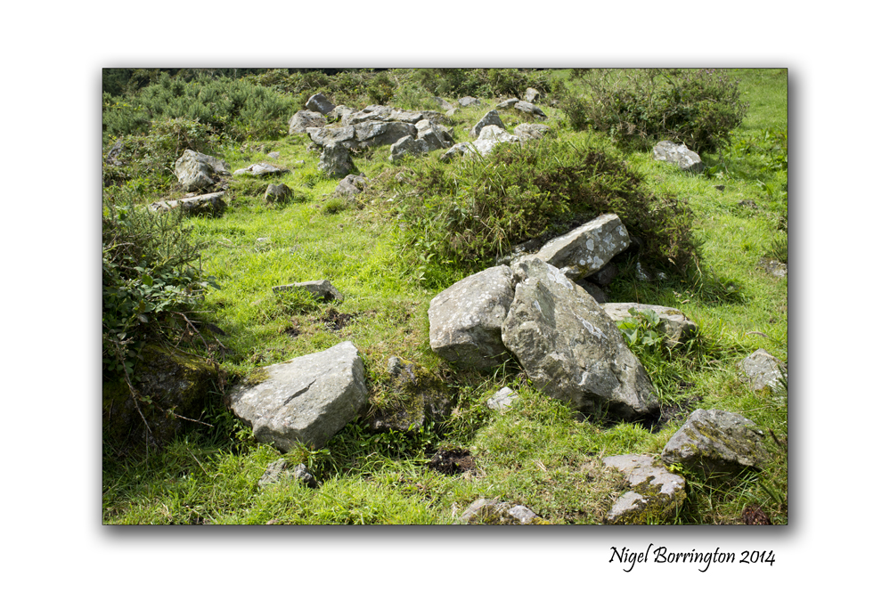
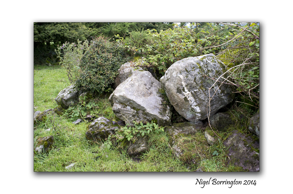
I visited the another of what I felt was a possible megalithic site last Sunday and this Sunday morning, a collection of Multiple tombs and wanted to share some of the pictures and feeling below.
To get to this location I had to navigate through the trees and get over a wall into the field but once in I was amazed at what I found. There are a total of nine tombs that could as important as the Kilmogue Portal Tomb, they are possible megalithic Court tombs or Portal tombs. I feel that to find so many Tombs in one field is very special and reflects on just how important an area this must have been to the people who lived here over a vast period of time.
I need to keep working on this location and study a lot more as to my possible findings but feel its very exciting to find such a large collection of Tombs in one place.
I did at first wonder if these tombs where just collections of rocks that a farmer in the past had cleared from his fields but on getting closer and spending sometime walking around them, as you can see in the pictures these rocks are very large and in the correct formation and organisation to be Tombs.
They have large rocks forming a boarder with a raised area in the centre, they have a single gap forming an entrance and what looks like smaller grave area inside the tombs themselves. These features fully match the definition of what are defined as court tombs.
You are welcome to have a good looks at the pictures below and form you own impression but for the moment I am very pleased to have found such an impressive ancient location.
The Tombs of Harristown, Kilkenny ; Gallery


Local Standing Stones : Gallery

A local walk through History, Megolithic – Ring forts, Tombs and Standing stones.
Ring fort on the Hill, County Kilkenny
Landscape photography : Nigel Borrington
A local walk through History, Megolithic – Ring forts, Tombs and standing stones.
Last Month I posted the following two articles talking about the history of some historic remains and geology around the area where I live, on the County Kilkenny and Tipperary Boarders.
Pagan ring forts and passage tombs , From Kerry to kilkenny
Landscape and Geology around Slievenamon, county Tipperary
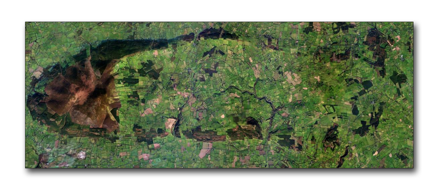
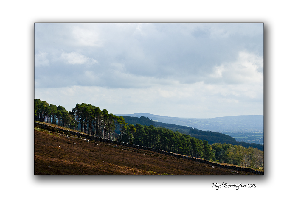
The image below shows the area around the mountain of Slievenamon, County Tipperary ( left ) and the foot hills that flow to the right and form the shape of an oval from the north and south of the mountain.
The Boarder between county kilkenny and Tipperary flows about half way through this image from north to south.
 .
.
Over the last few weeks and during the summer of 2014, I want to study and post about the Stone age – Iron age, pre Christian remains that can be found in almost every one of the woods that can be seen in the above image ( Mainly visible as dark green) along with the remains on the mountain of slievenamon itself.
I have lived here in county Kilkenny for about 11 years , moving from the UK in 2003, from the very first walks I took locally it was clear that this area is full a history in the form of old buildings, farms, churches and grave yards.
The remains that interested me the most have been those of pre-Christian times, Ireland became a Christian country between 300 to 400 Ad. These local pre-Christian remains then date from betweem 300Ad to 6000 or 8000 years ago.
The remains that can be found locally take the form of (Ring forts, Graves and tombs, Standing stones and stone circles) all can be found within the area covered in the pictures above.

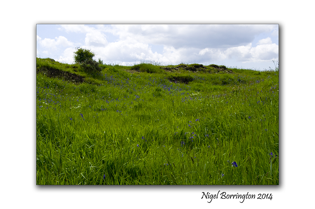
South Kilkenny. Woodlands
During last weekend and this week, I have been visiting the above woodland to the south east of the larger area I am studying and have marked on the image below the types of remains I have found :
The remains that I have walk past on woodland paths and the ones that I have looked for by going deeper into the woods are by themselves amazing but by themselves do not tell you a story of who these people were and how they lived.
Over the next few weeks I want to uses four areas in total including the mountain of Slievenamon, to draw a picture of how I feel the people who built these structures lived.
How they worked this land, how they built their homes and how they buried and remembered their ancestors.
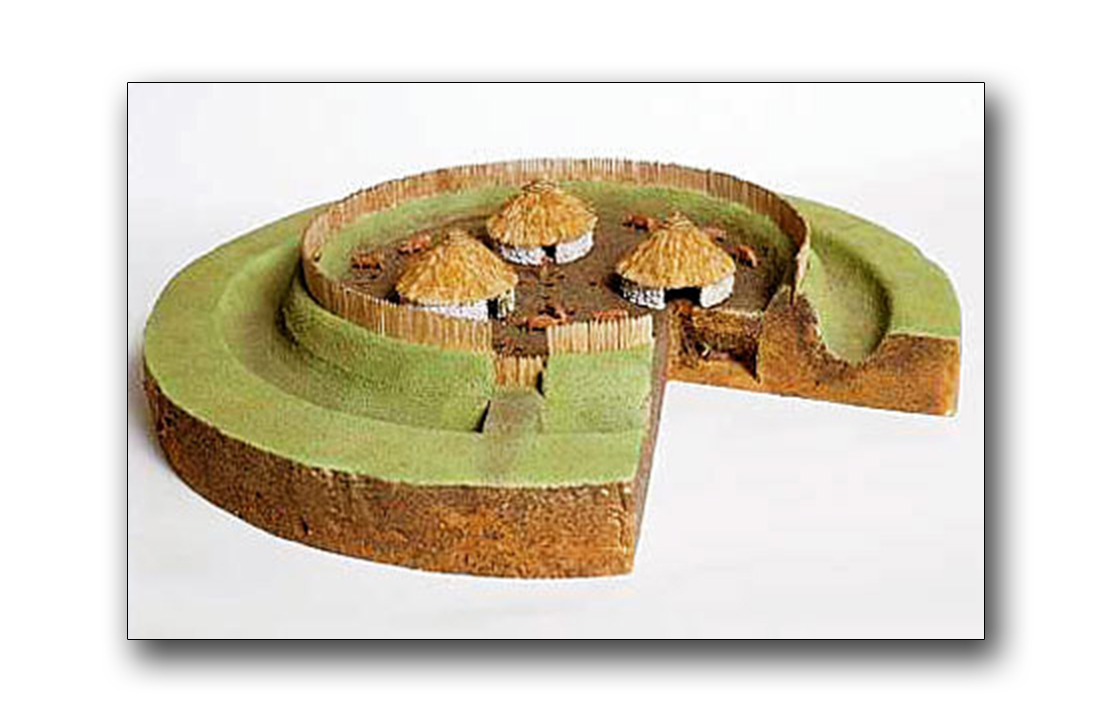
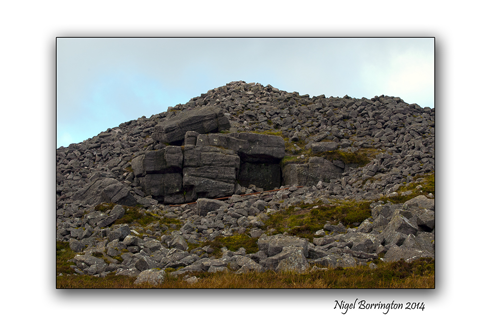
Structure of a ring fort
Image Gallerys
The Images below are all pictures of the structures and remains I have found in the woodland area shown and labelled in the images above, I have split them into groups as follows:
Ring forts, these were used for – homes and cattle pens.
Standing stones, used to record time and mark areas.
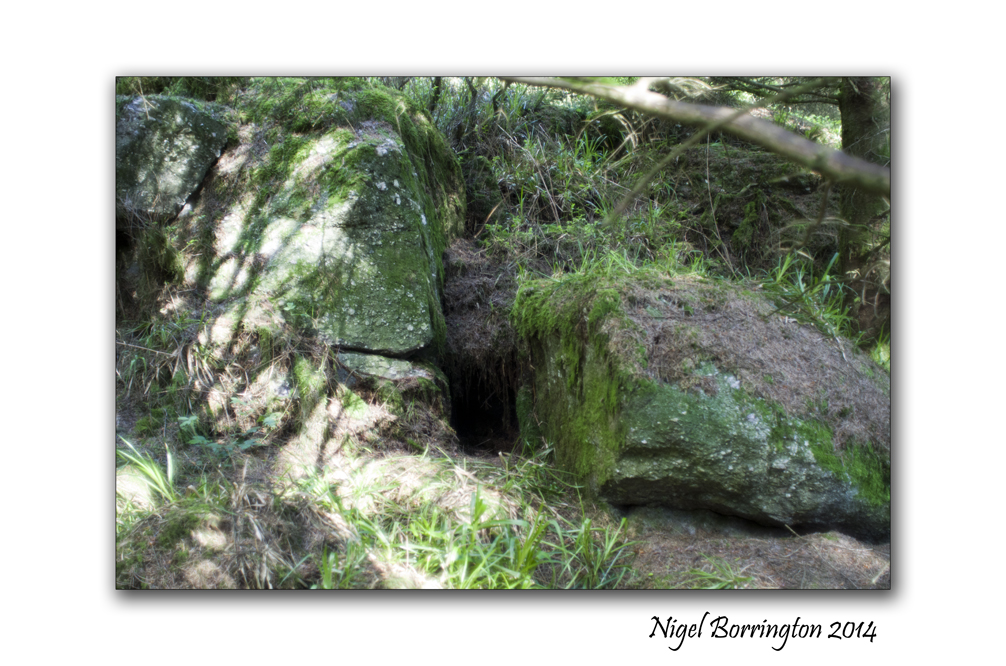
Graves and tombs, Hill top Burial grounds .
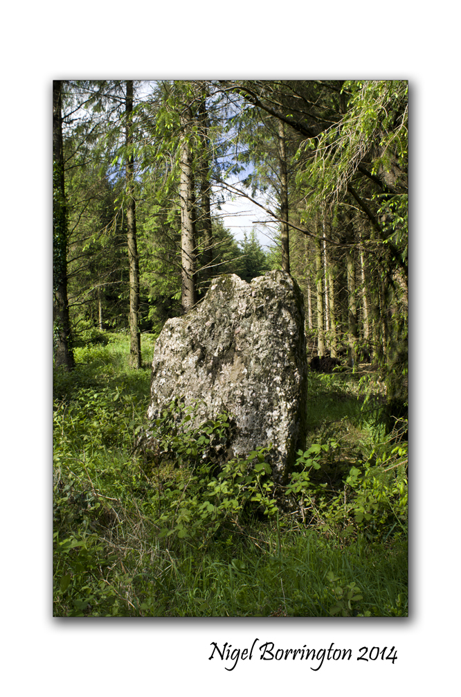
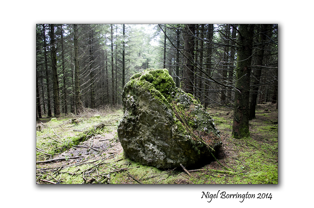
One last thing worth pointing out is that below in the Grave Gallery are two large tomb cap stones, shown in the first two images.
When I first found the stone in the first image, I wondered if it could be anything more than just a large stone left from ice sheets, during the ice age some 10,000 years ago. However I then found the stone in the second image a couple of days later, both these stones are almost the exact same dimensions. It is very unlikely then that these stones can be the result of the ice age and that they are cap stones to large tombs lying underneath.
This web sites show some examples of excavated tombs from this period : Mesolithic tombs
I also have a great example of a tomb like this here : The passage tomb of olioll olum king of munster
Image gallery of the ring fort
Ring fort, marked above the woods


Gallery of Standing stones within the woods


Gallery of Graves and Cap stones within the woods


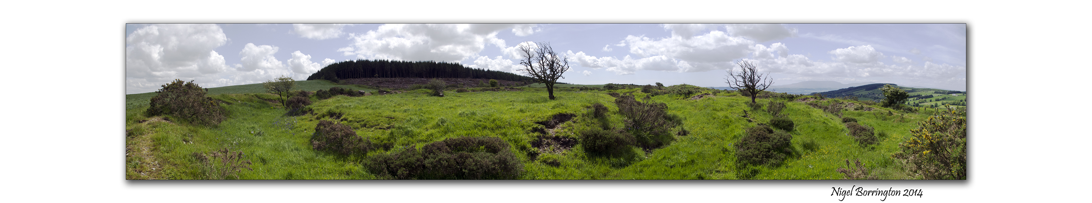
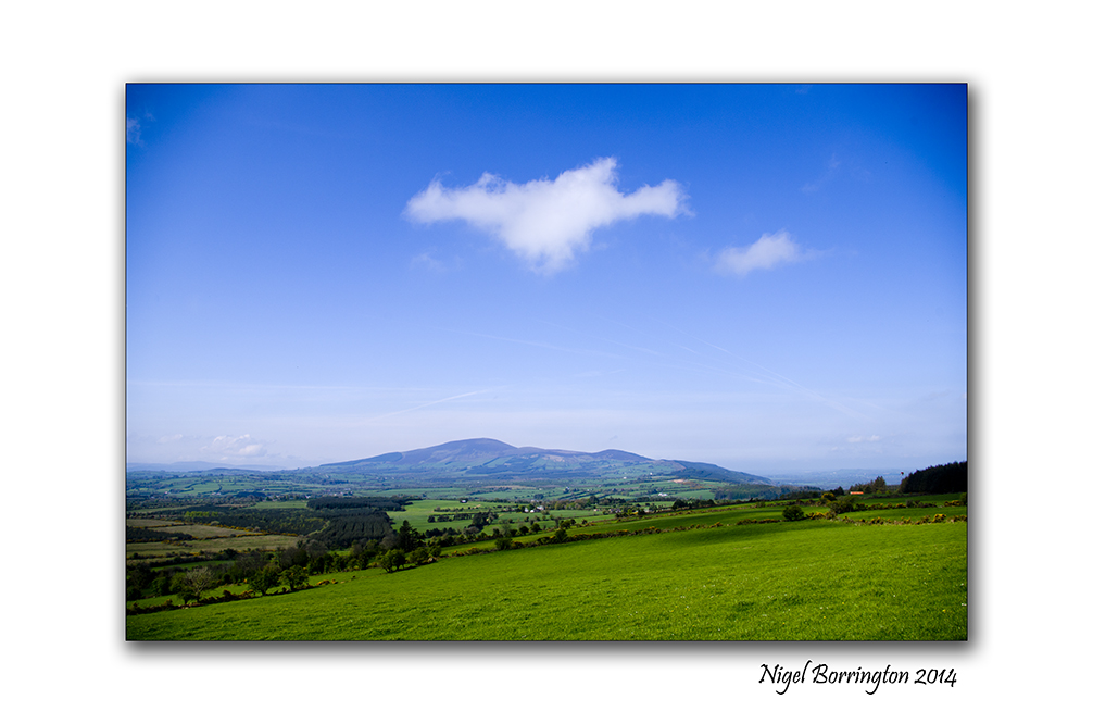
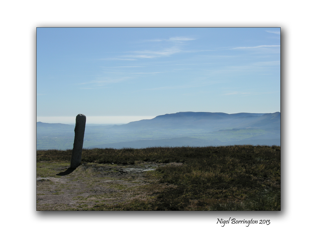
Landscape and Geology around Slievenamon, county Tipperary

Panoramic Landscape of Slievenamon, county Tipperary
Forty square miles around Slievenamon
The Mountain of Slievenamon is located about 10km from our home and over the last few years I have walked up and around the this mountain a lot.
It is an area I am very taken by and love exploring.
For anyone who has visited the mountain and surrounding area, something that you may not have noticed however it the complete scale and geology of the mountain. When you look at the area from a satellite image (Like the one below) the geology of the area becomes a bit clearer.
To the left of the image above is the main mountain peek of Slievenamon, itself Rising up some 721m above the landscape below, however this is not the full extent of the mountain, spreading out towards the east and from the north and south of the mountain run two ridges of hills. These ridges them selves form an oval shape that meets some eight miles away from the mountain top.
Photographic project
Over the summer I want to record this complete area returning to the top of the mountain and then walking and recording as much of the ridge’s as possible.
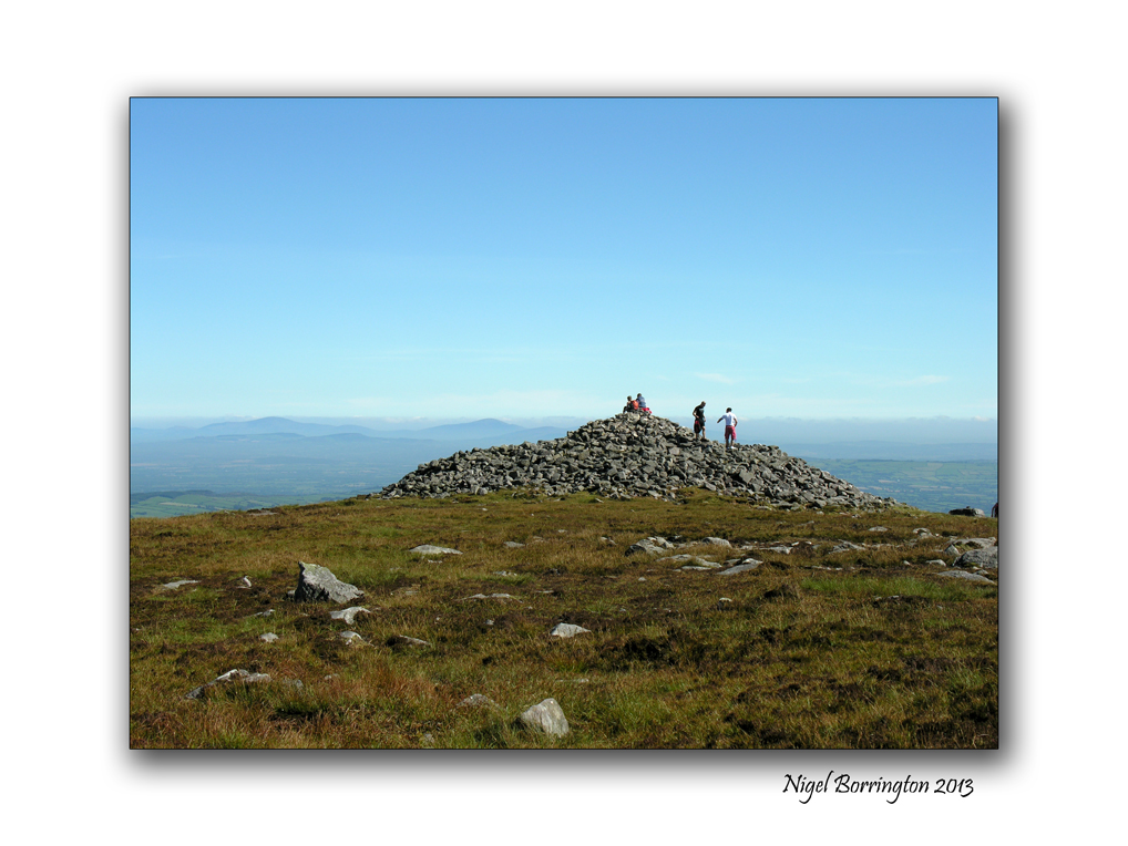
History and Megalithic locations
One of the main reason I have for starting this project on the blog, is that for sometime I have noticed that both at the very top of Sleivenamon and around the oval of the extended foot hills are many Megalithic sites ( Stone circles, Passage tombs, Graves and Standing stones).
I will come back to the satellite image above and mark the location of any landscape images I post.
Above all I just want to share the landscape that I live in and reflect upon some of its history and enjoy myself getting to know it as much as I can.
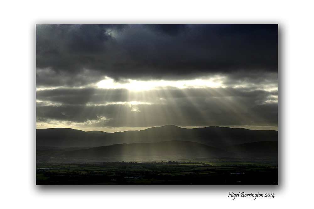
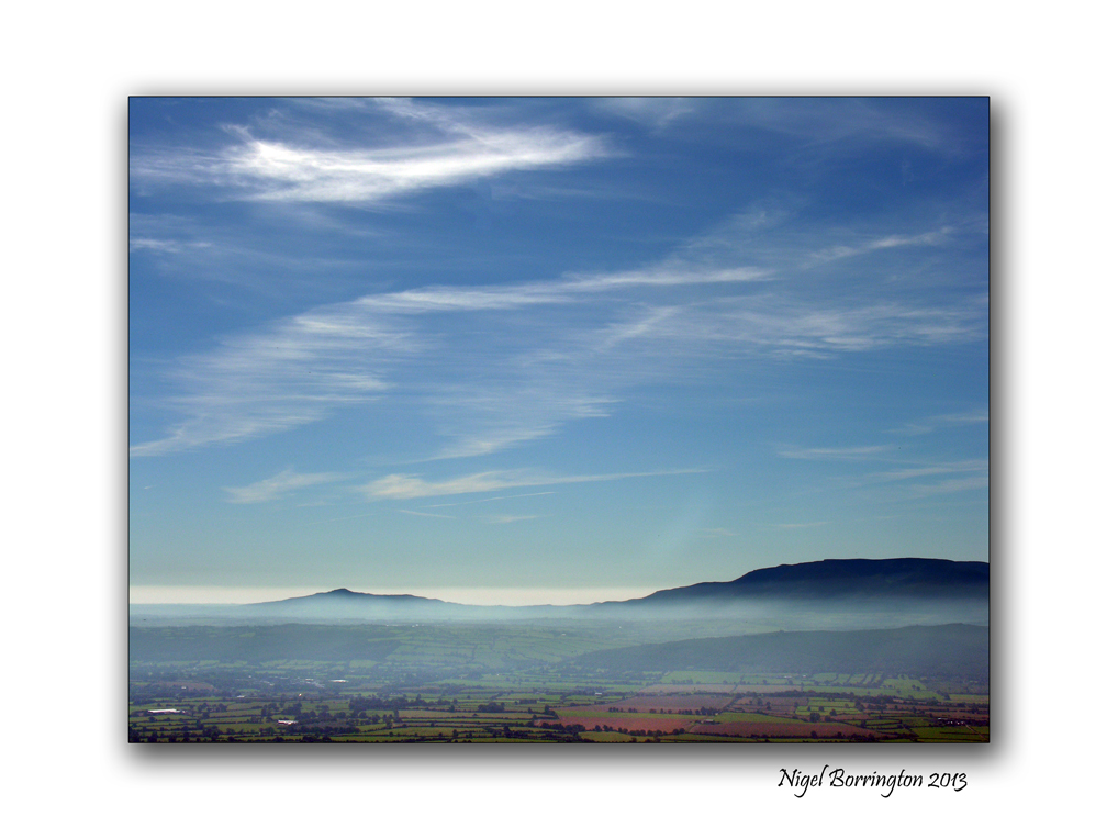
The Landscape of Slievenamon

You must be logged in to post a comment.