
Hairy Wood Ants (Formica lugubris) , Irish woodland wildlife.
Hairy Wood Ants( Formica lugubris)
Wildlife and Nature photography : Nigel Borrington
Hairy Wood Ants (Formica lugubris) photographic project
Recently I been involved working on a project around Ireland to photograph nests of Irish Wood Ants, this has been one of the most interesting photo project I have ever worked on.
These Ants are on the international endangered species list and exist in locations that are kept reasonably private, just to find and get to see these nests themselves is a task and an amazing feeling.
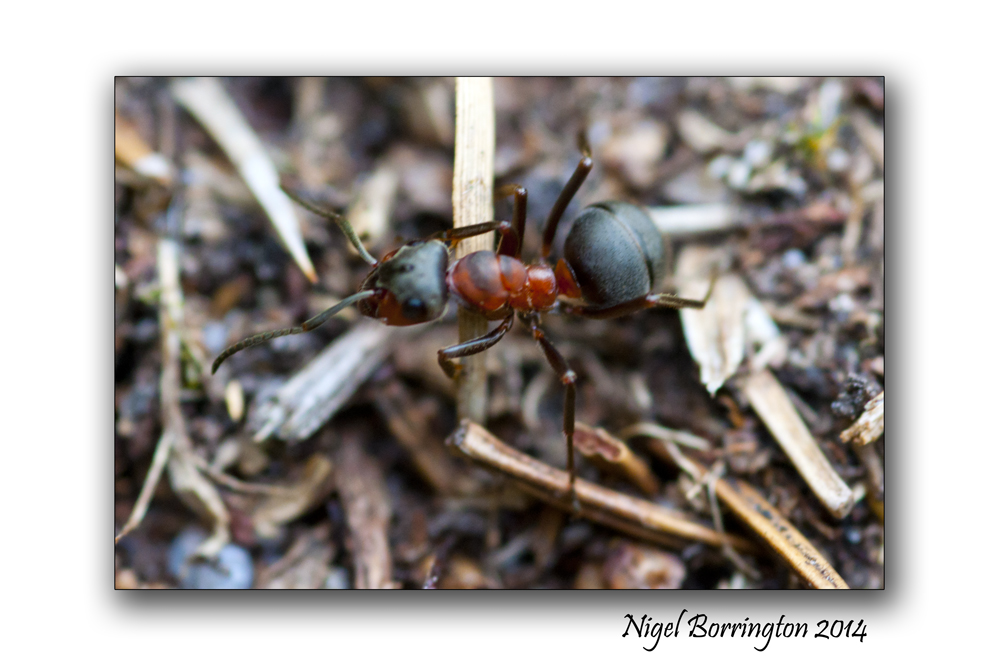
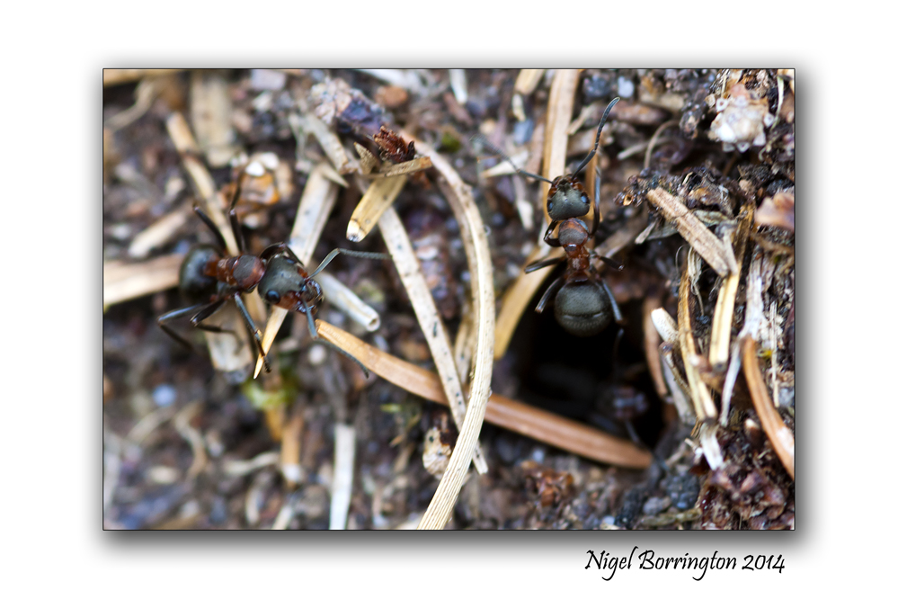
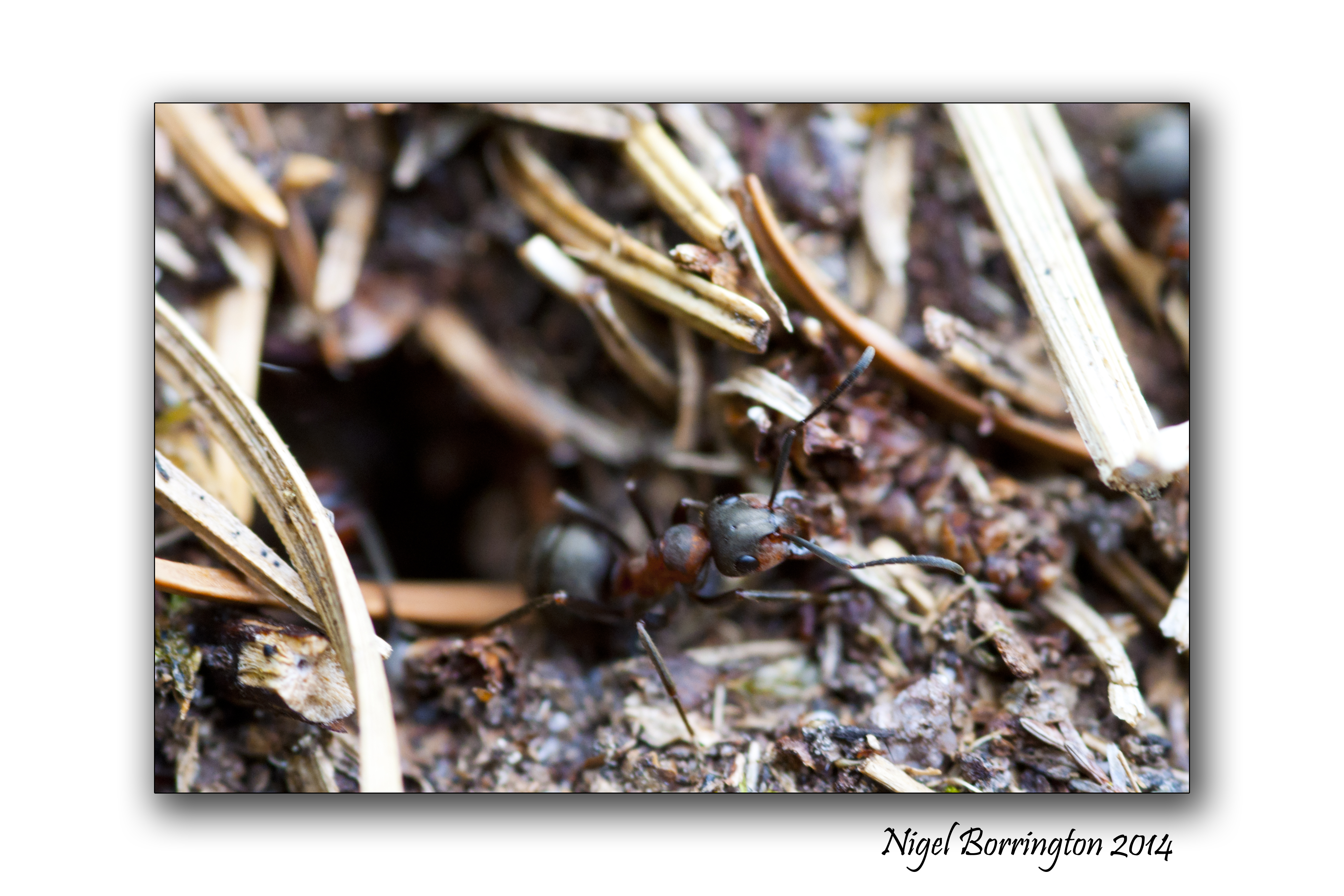
When you get closer to the nests for the first time you will notice just how large they are (3 feet off the ground) and how many Ants that each colony contains, each nest can hold tens of thousands of Ants, the entire surface of the nest is on the move with Ants coming and going from small entrance holes. This flow of movement is 24 hours long during the months that the Ants are active.
They create a clear trail through the woods as they clear a path, travelling both outwards from the nest and returning again with food for the Queen Ant living deep in the ground under the nest itself.
It is thought she lives in a protected area some two meters underground.
In order to protect themselves and nest with its queen, they can shoot out acid some four feet from their bodies.
I will be working on this project most of this summer and look forward to each return, watching these wonderful Wood Ants is an amazing experience and working around them with a camera is great fun.
Gallery


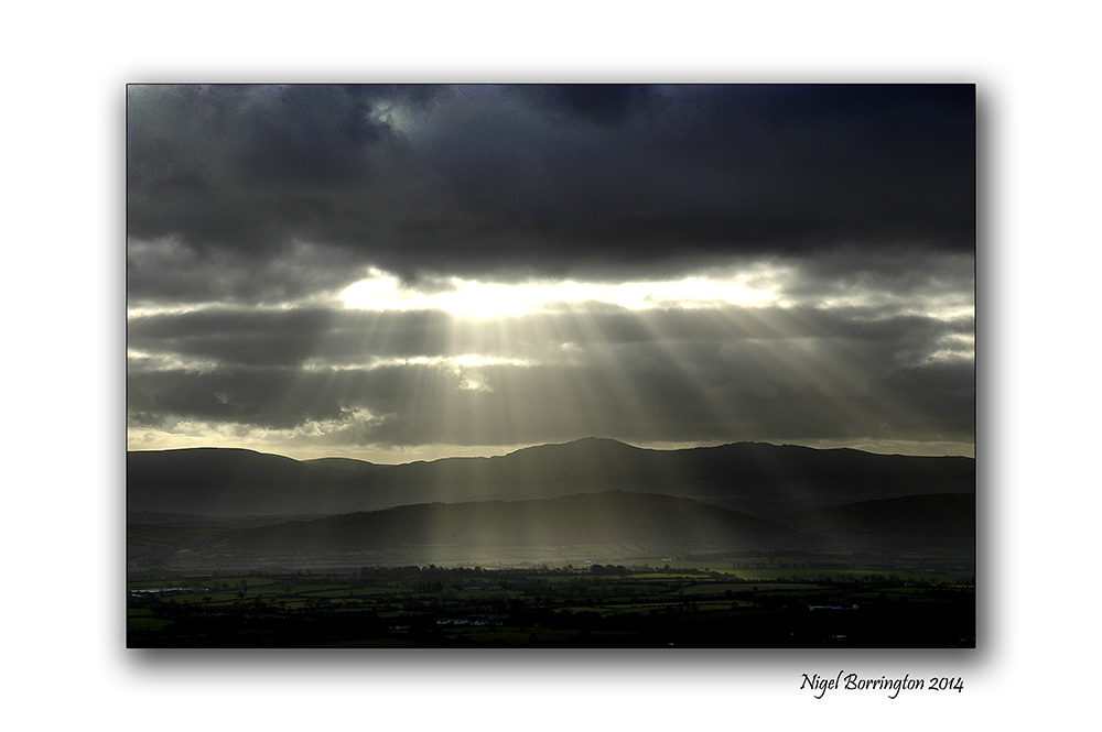
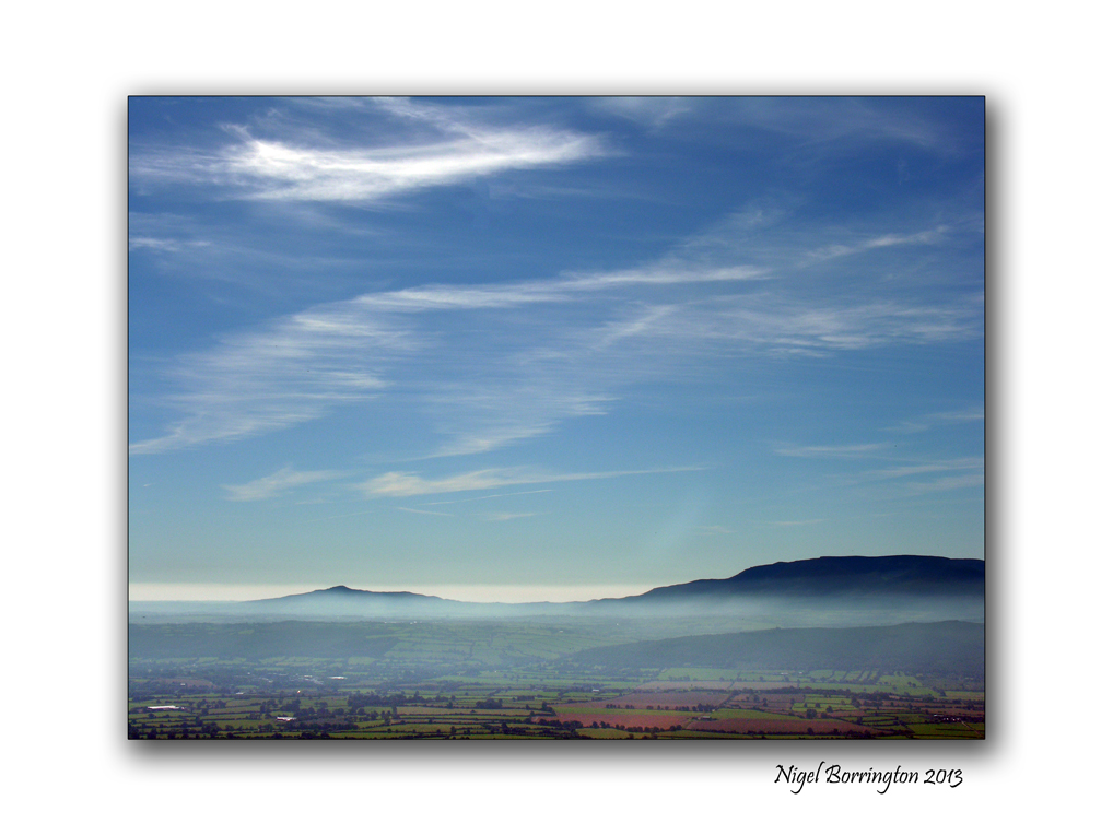
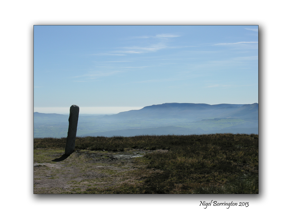
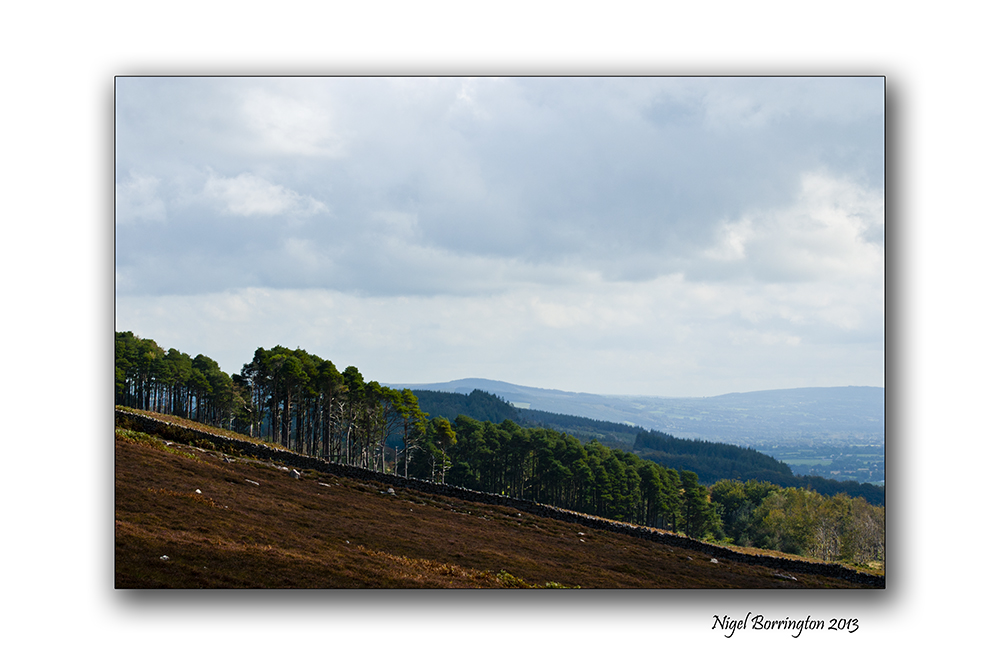
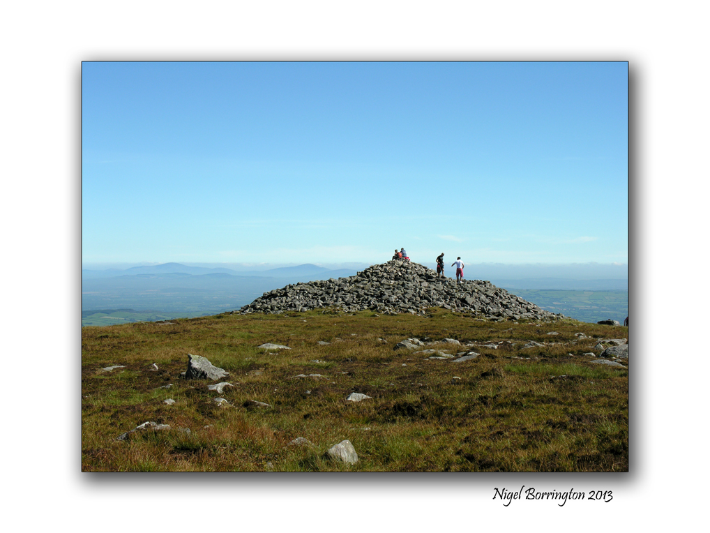
Landscape and Geology around Slievenamon, county Tipperary

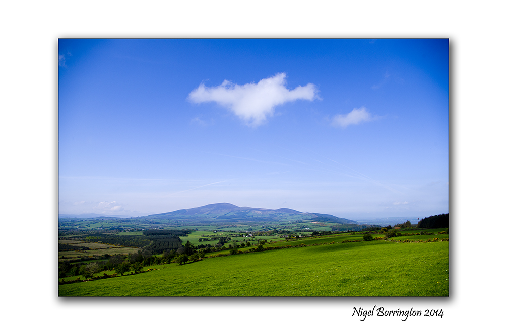
Panoramic Landscape of Slievenamon, county Tipperary
Forty square miles around Slievenamon
The Mountain of Slievenamon is located about 10km from our home and over the last few years I have walked up and around the this mountain a lot.
It is an area I am very taken by and love exploring.
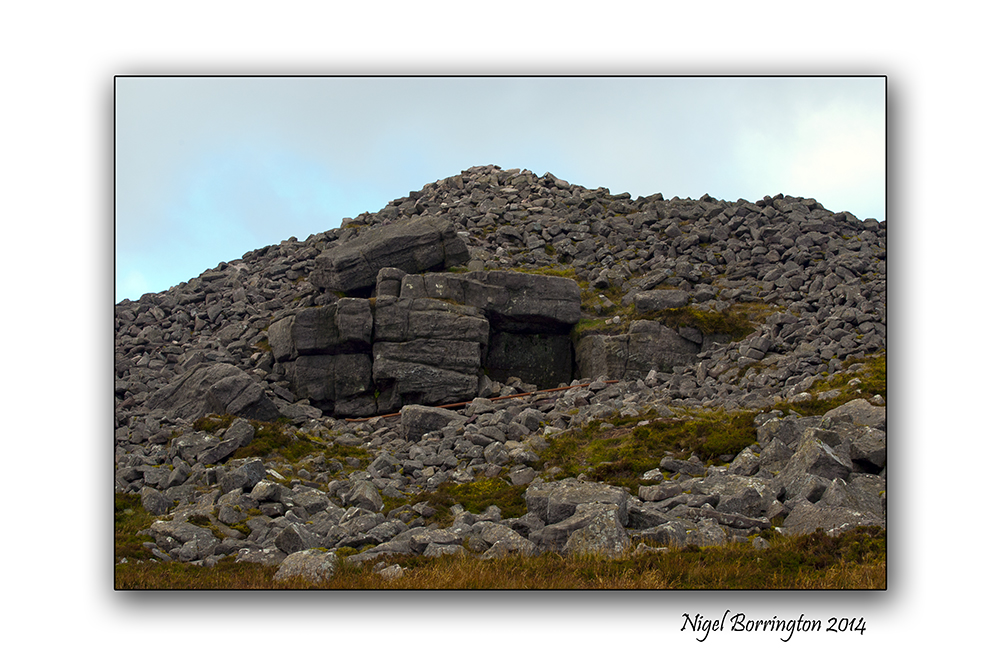
For anyone who has visited the mountain and surrounding area, something that you may not have noticed however it the complete scale and geology of the mountain. When you look at the area from a satellite image (Like the one below) the geology of the area becomes a bit clearer.
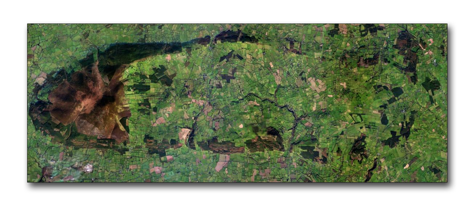
To the left of the image above is the main mountain peek of Slievenamon, itself Rising up some 721m above the landscape below, however this is not the full extent of the mountain, spreading out towards the east and from the north and south of the mountain run two ridges of hills. These ridges them selves form an oval shape that meets some eight miles away from the mountain top.
Photographic project
Over the summer I want to record this complete area returning to the top of the mountain and then walking and recording as much of the ridge’s as possible.
History and Megalithic locations
One of the main reason I have for starting this project on the blog, is that for sometime I have noticed that both at the very top of Sleivenamon and around the oval of the extended foot hills are many Megalithic sites ( Stone circles, Passage tombs, Graves and Standing stones).
I will come back to the satellite image above and mark the location of any landscape images I post.
Above all I just want to share the landscape that I live in and reflect upon some of its history and enjoy myself getting to know it as much as I can.
The Landscape of Slievenamon

You must be logged in to post a comment.