
Drawing from the Irish Bogs …….
Drawing from the Boglands
Digital Drawings
Nigel Borrington 2018
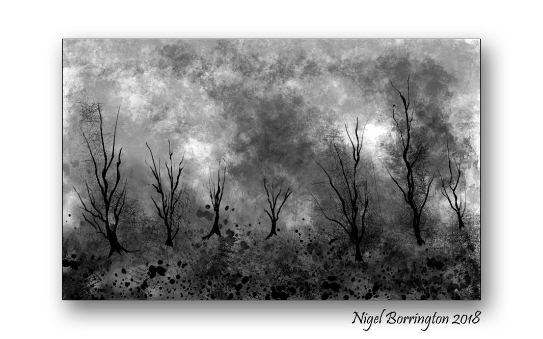
Back in June this year Ireland was in the middle of a 8 weeks drought and even the Boglands had become dry. At one of our nearest Bogs we had a large wild fire which I visited to get the below images. Since then I have been working on some drawings of this event. This is a great subject for ink on paper type drawing.
The above image is just one that I have completed so far …..
Bog fire Gallery


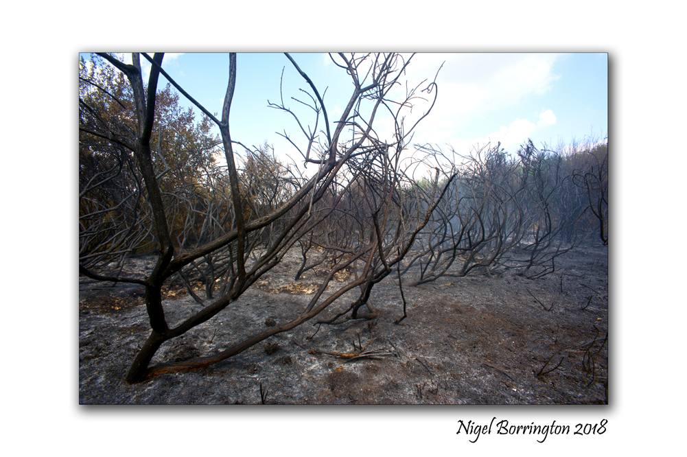
After the Wild fire
littleton bog, tipperary Nigel Borringtpon
Drawings from the Hedgerow …..

Art of the hedgerow
Digital Drawings
Nigel Borrington 2018
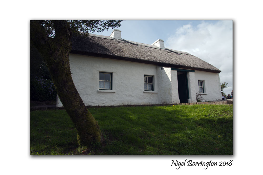
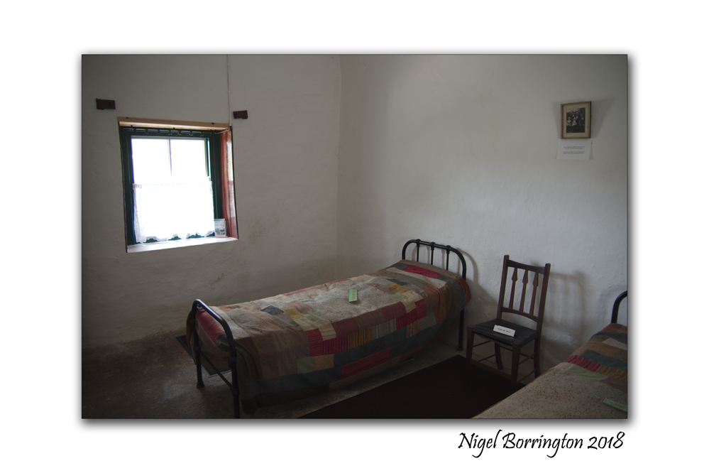
Ireland’s Historic Buildings : Pearse’s Cottage (Teach an Phiarsaigh),Rosmuc, County Galway
Patrick Henry Pearse (also known as Pádraig or Pádraic Pearse; Irish: Pádraig Anraí Mac Piarais; An Piarsach) was born in Dublin on the 10th of November 1879 and he died in Kilmainham Gaol(Jail), county Dublin on the 3rd of May 1916. He was primarily an Irish teacher but was also a great barrister, poet, writer and original Irish nationalist. He was one of the leaders of the Easter Rising in 1916. Following his execution along with fifteen others, Pearse came to be seen by many as the embodiment of the rebellion.
Patrick Pearse’s Cottage at Ros Muc, county Galway in the heart of the Conamara Gaeltacht, ( an Irish speaking and strongly Irish cultural area) was used by Patrick Pearse (1879 – 1916), while he spent time teaching and marking students papers.
The cottage and its interior, although burned during the War of Independence, has been perfectly reconstructed and contains an exhibition and a number of momentous of Pearse’s life.
The cottage was Pearse’s summer residence between 1903 and 1915. It was also as a summer school for his pupils from St Enda’s in Dublin where he worked during the main Academic year.
The historic cottage, has been developed as a national monument and tourist attraction as part of the 1916 centenary commemorations; and is a key ‘discovery point’ on the Wild Atlantic Way route.
I was lucky enough to visit the cottage last week and enjoyed my time here very much, the staff helped greatly when it came to understanding the life of this great Irish man and his time spent here.
If your in county Galway, you just have to call in and spend some valuable time here !
Pearse’s Cottage (Teach an Phiarsaigh), County Galway, Gallery


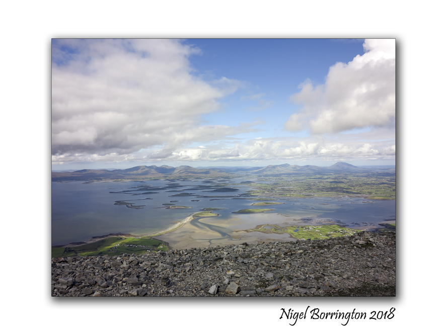
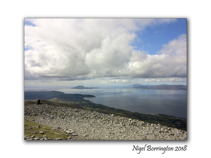
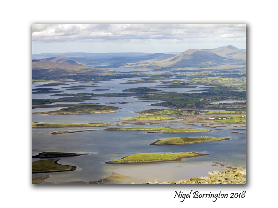
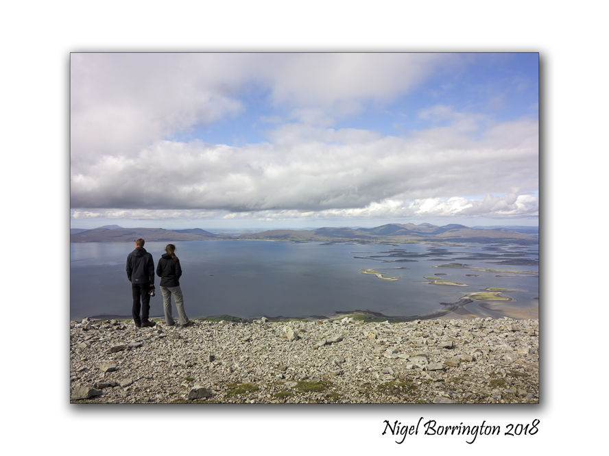
Images from the top of “The Reek” “Croagh Patrick”
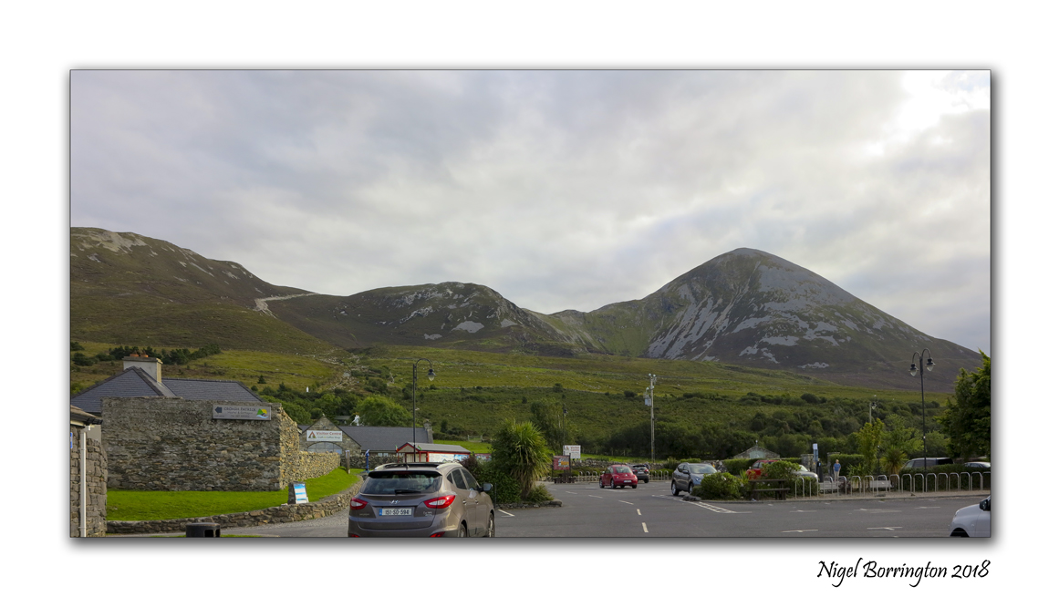
Croagh Patrick
The Reek
County Mayo
Nigel Borrington 2018
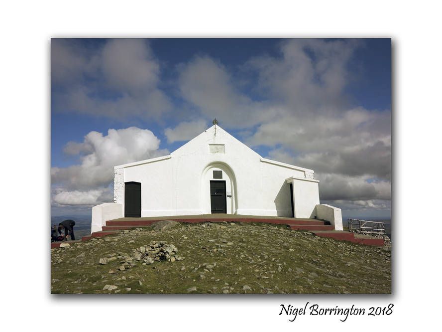
This time last week during a weeks holiday to both counties Sligo and Mayo, in the norths west of Ireland, we hiked up Croagh Patrick or “The reek” as locals know of it. This mountain is one of Irelands Highest peeks and is most famous for being climbed by pilgrims on Reek Sunday every year, which is the last Sunday of each July. On this Sunday, thousands of pilgrims climb Croagh Patrick in honor of Saint Patrick who, according to tradition, fasted and prayed on the summit for forty days in the year 441.
It has been a personal aim to walk the peeks of a list of mountains in Ireland for a couple of years and “The Reek” is just one of these mountains to hike in the next couple of years.
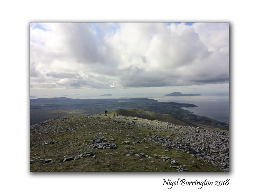
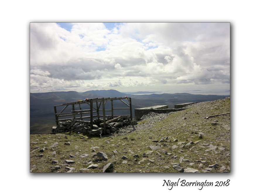
The weather on the day was perfect and we started our walk about Midday having driven some 80km to the main car park used to start the hike. The start of the walk is good, being flat for a while and then only slowly rising in level, so you get a little time to warmup before the main slopes higher up the mountain side. Once you hike the first slopes the path levels off for a while until you come to the bottom of the main peek.
I really enjoyed this hike, its hard – no getting away from that fact but when you do finally get to the top the views are amazing, you can see most of county Mayo and well into county Sligo from here. there is a step that surrounds a small chapel that you can sit on to eat and have something to drink. We rested here for about 10 mins before walking around the top of the peek.
As you can see these images below are mostly taken at the top, when I finally go to open my bag and get my camera out. As I said you truly feel on top of the world here, this point is some 764 metres (2,507 ft) above sea level, not the highest mountain in the country by about 250 meters but here you start your walk at sea level so it could well be the highest distance you have to walk to get to the top…..
I will let these images do the rest of the talking for me other than to say , this is one of the most enjoyable walks of my life and I cannot wait to walk more Irish mountains in the months yo come ..
Croagh Patrick, County Mayo, A gallery


William Butler Yeats country, Those Images A poem

Those Images – Poem by William Butler Yeats
What if I bade you leave
The cavern of the mind?
There’s better exercise
In the sunlight and wind.
I never bade you go
To Moscow or to Rome.
Renounce that drudgery,
Call the Muses home.
Seek those images
That constitute the wild,
The lion and the virgin,
The harlot and the child.
Find in middle air
An eagle on the wing,
Recognise the five
That make the Muses sing.
William Butler Yeats
The Land of Beyond, Robert Service

The Land of Beyond
Robert Service
Have you ever heard of the Land of Beyond,
That dream at the gates of the day?
Alluring it lies at the skirts of the skies,
And ever so far away;
Alluring it calls: O ye yoke of galls,
And ye of the trails overfond,
With saddle and pack, by paddle and track,
Let’s go to the Land of Beyond!

Have ever you stood where the silences brood,
And vast the horizons begin,
At the dawn of the day to behold far away
The goal you would strive for and win?
Yet ah! in the night when you gain to the height,
With the vast pool of heaven star-spawned,
Afar and agleam, like a valley of dream,
Still mocks you the Land of Beyond.

Thank God! there is always the Land of Beyond
For us who are true to the trail;
A vision to seek, a beckoning peak,
A fairness that never will fail;
A proud in our soul that mocks at a goal,
A manhood that irks at a bond,
And try how we will, unattainable still,
Behold it, our Land of Beyond!
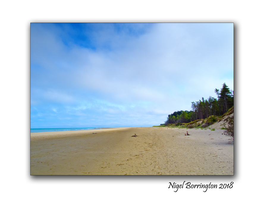
Irish landscapes, Curracloe beach,county wexford

Irish Landscapes
Curracloe Beach
County Wexford
Nigel Borrington
Curracloe Beach in County Wexford is one of the most popular beaches in Ireland. Located 2KM away from Curracloe Village, this soft-sand beach is frequented by sunbathers and nature-lovers alike.
During the summer months, you’ll find that the area is bustling with life, as holidaymakers leave their home counties to take up residence in the holiday homes, campsites, hotels and B&Bs that surround the area. Later on, during the autumn and winter months, Curracloe Beach and its nearby forest become a hot spot for dog-walkers, joggers and anyone else in pursuit of a peaceful stroll.
The area itself is suitable for bathing, as it has a Blue Flag certification. This certification, which is awarded by the Foundation for Environmental Education (FEE), serves as a notice to beach-goers that the area and its surrounding waters have lived up to a number of strict regulatory standards.
Its 7-mile-long beach is famous for its soft and fine sand, which puts it in contrast with many of the stony beaches that you will find around Ireland. The beach is guarded by a number of large and sprawling dunes, all of which are held together and stabilised by a seemingly-endless blanket of green marram grass. During the warmer months, these sand dunes prove to be extremely popular amongst visitors, many of whom will not pass up the opportunity to roll down them.
Curracloe Strand, Ballinesker, was used for the filming of the D-Day sequence in Saving Private Ryan, due to similarity to Omaha Beach in Normandy. Filming began June 27, 1997, and lasted for two months. The village of Curracloe lacked 3-phase electricity but when the film company decided to film there, it was connected.
Curracloe Strand was also used for the Irish beach scene in the movie Brooklyn.


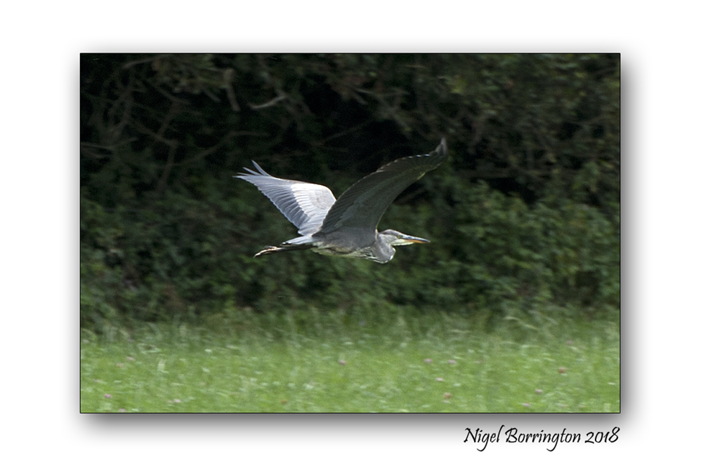
Monday at the River Suir, The Heron ……
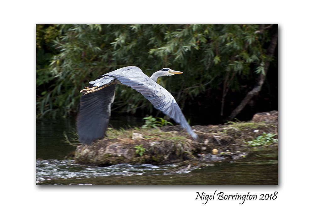
River Birds – Heron
River Suir
Country Tipperary
Nigel Borrington 2018


Irish Landscapes, Baylough (Bay Lough) The Vee,Knockmealdown Mountains, County Waterford, Ireland

Bay Lough is the famous Corrie Lake in the side of Knockaunabulloga, part of the Knockmealdown Mountain range.
Bay Lough and its surrounds is a strong favourite with hill walkers and recreational walkers of all sorts. The walk to the lake from the car park is not too difficult and suitable for family outings. On any fine day you will see hundreds of walkers making the trip to the lake and walking to its furthest point (it is only possible to walk about half way around, the photo to your left is taken at the most distant point to which you can walk).
The name Bay Lough (or Baylough) is only tentatively connected to the lake. It is thought the name derives from an Anglicisation of the Irish word ‘bealach’ (pronounced ‘ba-lock’) which means ‘pass’ or ‘way’. Those mapping the area, who would have been English, no doubt presumed the word ‘bealach’ referred to the lough in the mountain. You’ll find this type of mistaken Anglicisation of place names all around Ireland for the same reason.

Bay Lough is located close to the hightest point of the pass in the Knockmealdown Mountains from Waterford to Tipperary and was along the regular roadway used for this journey. It is thought this path dates back to St. Declan, who travelled from Ardmore to Cashel along the route. You can still walk along St. Declan’s Way also known as Rian Bó Phadraig. It is popular with hikers who want to experience the historical heritage as well as the beauty of the area. The road from the car park to the lake, which can be continued past the lake and on to Mount Anglesby, was in fact the main road from Cappoquin and Lismore to Clogheen before the current road, going by the Vee, was constructed in the early nineteenth century. This old road is known locally as ‘the Soldiers Path’ and is now a forestry path. It is part of a number of spectacular walks around Bay Lough, see the Walks page for more information on these.
This area is a wonderful (and totally free) resource for locals and visitors alike. Should you wish to visit the lake it is most easily accessible from a car park on the Waterford side of the lake – this is the Loc8 Code for the lake –YZS-26-53G – just be aware that you can only drive as far as this Parking Area.
The lake has a strong historical significance both in South Tipperary and West Waterford. In local folklore it is famed as the lake to which Petticoat Loose was banished for all time, ordered to empty it with a thimble.
It is also widely held that the lake is ‘bottomless’ and that it is not possible to swim across it, despite its rather modest proportions.
Irish Landscape Photography : The rain maker

The Rainmaker
Written by
Roger Turner
The weather plots his journey
Town to town in dead of night
Fields dead and on a gurney
He comes in to make it right
A rainmaker, people call him
A psuedo-scammer others say
He sells himself as godlike
He comes quick and does not stay
He tells people what they wish for
He beats the storm in to their town
He seeds their minds with his tall stories
He promises more green than brown
Like an evangelistic angel
He beats the weather to the ground
He’s a salesman like no other
He picks their pockets with no sound

A rainmaker, just a scammer
He works the towns where nothing lives
He is an alchemist non-gratta
He always takes and never gives
He sells snake oil and concoctions
He is a shaman in disguise
He promises rain where none has fallen
There is more moisture in the farmers eyes
He takes credit for a rainfall
He promises gold where once was straw
He’s a rumplestiltskin with their feelings
He sells them only what they wish they saw
He may believe in what he tells them
He always puts his name out on a stake
But, can he truly make the skies open
That is a choice the desperate make
Kilcooley Abbey, County Tipperary. The silence of the Abbey in the field.

Kilcooley abbey is located near the town of Thurles in county Tipperary, it was founded by the Cistercians in 1182AD when the lands were granted to them by Donal Mor O’Brien. It became one of the three great Abbeys in the local area, the other two being Jerpoint and Holy Cross.
It would have been in use at least until the dissolution of Abbeys in the 1500’s and it now sits hidden away on the lands of the Kilcooley estate.
I always love visiting this abbey as its one of the most peaceful of places you could wish of, surrounded by woodlands and farms, very little sound from the modern world penetrates the field its located in. As such you can sense the times when this abbey was first lived in and used on a daily basis as a refuge and place of worship for the Cistercian monks who would have lived here.
If there are such things a Ghosts then how could they not be found still living within and around the grounds of this great Abbey.


Post cards from the edge : Ross castle, Killarney Nation park, county Kerry , Ireland

Ross Castle
Killarney National park county Kerry
Ireland
Nikon D700
Sigma 28mm EX DG f1.8 lens
Nigel Borrington
Images of Summer 2018 : Down in the Barley

Images of Summer Down in the Barley
Nigel Borrington 2018
Cutting Turf , Irish landscape History

Irish Bog lands and Turf cutting
Irish landscapes
Nigel Borrington
On Wednesday I posted some picture showing the results of a Wildfire on the bog lands of Littleton in country Tipperary, having done so I just wanted to share some more images from another Bog land in county Waterford and share some of the history of these amazing places along with some details about the history of turf cutting in Ireland.
The Irish tradition of turf cutting
In the past, Irish people heated their homes and cooked their food using turf taken from from the bog as fuel. Turf was cut from the bog by hand, using a two-sided spade called a sleán. Entire families often helped to save the turf on the bog.
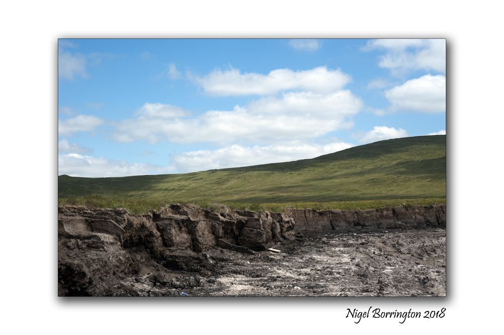
Saving the turf involved turning each sod of turf to ensure the sun and wind could help in the drying process. The turf was then placed upright or ‘footed’ for further drying. Footing the turf was a back-breaking job and involved placing five or six sods of turf upright and leaning against each other. Finally, the turf was brought home and stored in sheds or ricks.

In the midlands and the West of Ireland, the tradition of using turf or peat as fuel has continued in many homes.The turf is mainly cut by machine nowadays, but saving the turf still involves lots of work and requires good weather.


Images without words , Evening stars above the Macgillycuddy’s Reeks, County Kerry
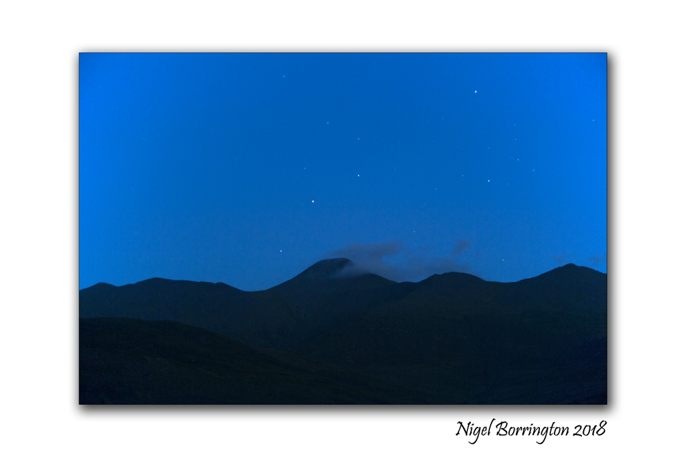
Evening Stars above the Macgillycuddy’s Reeks
County Kerry
Ireland
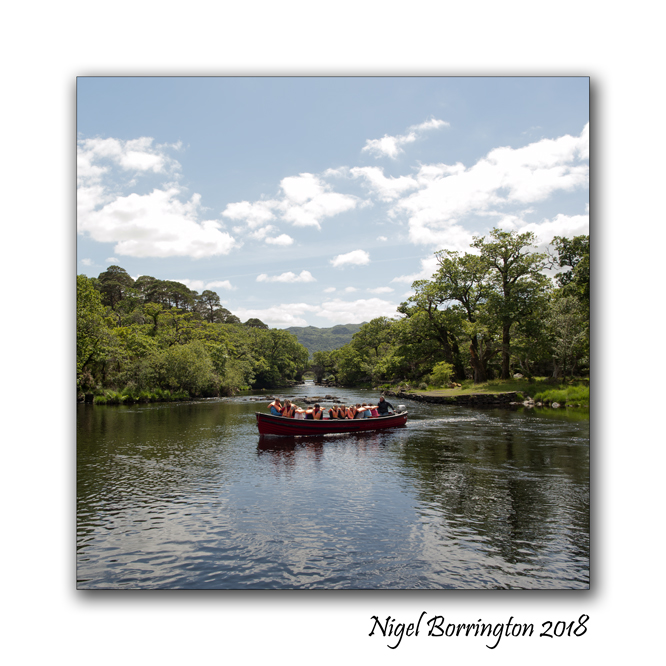
Meeting of the Waters, Killarney National park and lakes , County Kerry, Ireland
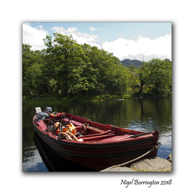
As the name implies the Meeting of the waters is where Killarney’s famous lakes converge. The Upper lake, Middle Lake (also known as Muckross Lake) and Lower Lake (Lough Leane) all come together at this beautiful spot. It is a little haven of tranquility and can only be reached by foot or bicycle. Also found in this area are Dinis cottage and “The Old Weir Bridge”.

The easiest way to reach the spot is by walking along the well signposted path from Muckross House for approximately 5km or if you don’t feel that energetic then approx one mile beyond Torc Waterfall (direction Kenmare) there is a parking spot on the right hand side of the road. Dinis cottage is signposted from here and the cottage and “the meetings of the waters” is a 15 minute walk from here. Its definitely worth the walk on a fine day.
Craftsmen in pictures : Tom Allison – blacksmith
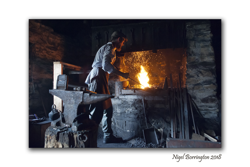
Tom Allison blacksmith blueberry hill farm and muckross farm
county kerry
Nigel Borrington
TOM ALLISON
Last week while visiting Muckross Traditional Farm, I was lucky enough to meet and chat with Tom Allison, he is an experienced professional and you can tell that he has a passion for blacksmithing. With his easy-going way of showing you how he works and creates some amazing items.
Tom studied blacksmithing at Hereford College in 1997 and continued his training with an apprenticeship in Wales for 2 years. Tom moved to Sneem in 2000 to set up his own forge and since then has completed a number of major commissions.
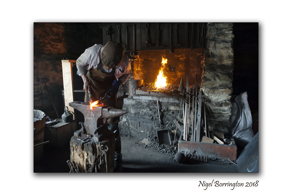
I spend a good amount of time watching Tom work in the old forge at Muckross Traditional Farm while he demonstrated the old skills of blacksmithing. His work ranges from contemporary art and designs to traditional historical reproduction and restoration.

Weekend visits : Emo Court House & Gardens, County Laois, Ireland
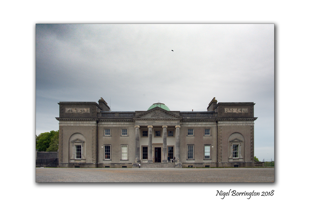
Emo Court House & Gardens
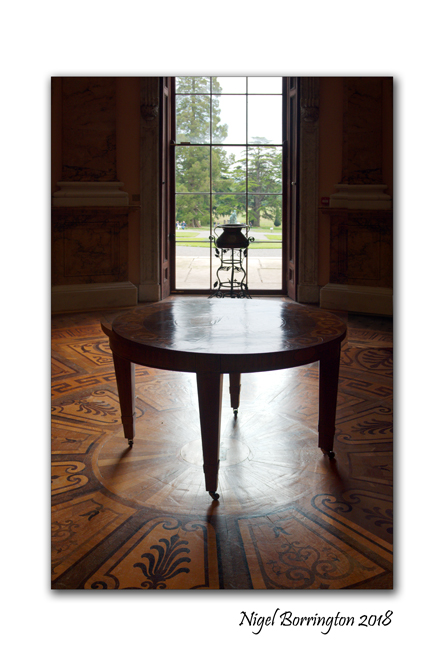
Emo Court is one of Ireland treasures and it is a location I have visited more than once over the years. Its a great place to visit on a weekend with its great walks through the wooded grounds along with a tour into the house and finally a visit to the cafe afterwards for a cake and a cup of tea ….
Emo Court House is a neo-classical mansion in County Laois that attracts visitors from all over the country and beyond. Designed by noted architect James Gandon, it features magnificent gardens and is located just 2.5 km from Emo village and 7 km from Portarlington Railway Station.
Designed in 1790 for the Earls of Portarlington, Emo Court House is a magnificent example of the neo-classical style. After some periods of lying empty, it was acquired by the Jesuits in the middle of the 20th century. Functional renovations were made to the estate before it was sold to Major Cholmeley Harrison, a former London stockbroker, in the 1960s.
Cholmeley Harrison’s vision was to restore Emo Court House to its former glory and today the results of his efforts are obvious. Leading London architect Sir Albert Richardson was commissioned to take on the restoration of the house which remained a private residence, though the public were encouraged to enjoy the gardens for a small entrance fee.
In 1994 Cholmeley Harrison presented Emo Court House to the people of Ireland, continuing to live there in private apartments until his death in 2008. Staff of the Office of Public Works (OPW) now care for the estate and preserve its stately elegance for modern visitors.

Visit Emo Court House to enjoy the beautiful gardens and parklands which were first laid out in the 18th century, containing formal lawns and a lake. Walks through the woodland are a popular way to explore the beautiful grounds.
The Cupcake Café at Emo Court House offers lunch and is open every day from 1 February to 31 October. From 1 November to 31 January it’s open on Saturdays and Sundays. Groups are welcomed at Emo Court House, but booking is required.
Emo Court A Gallery


Tuesday Morning on the River, Bagenalstown, River Barrow, county Carlow

Morning on the river
Bagenalstown
county Carlow
Nigel Borrington 2018
Bagenalstown, county Carlow
One of my most loved small towns located along the river Barrow as it flows through county Carlow is Bagenalstown, it is located of the side of the hills that surround the river barrow south of Carlow town. Otherwise known in its Gaelic version as Muine Bheag it is a pleasant stretch of the River Barrow and derives its name from Walter Bagenal, who, in founding the town, had visions of mirroring the city of Versailles, in northern France.
However, his efforts became frustrated due to the re-routing of the coach road away from the town. He left more than enough for visitors to enjoy with handsome stone public buildings including the impressive Courthouse, now a public library in Bagenalstown.

The arrival of the railway in 1846 rejuvenated the town, and its neo-classical railway station is one of the finest in Ireland. Attributed to William Deane Butler it is constructed of limestone and granite and is a seven bay, two-storey building in an Italianate villa style. Today Bagenalstown station still retains its charm in a largely unaltered state. This former mill town made full use of the river Barrow to transport grain, beet, coal, turf and Guinness by barge, evidence of which can be seen in its fine industrial architecture. Near the railway bridge on the R705 Borris road is an example of the Carlow fence which consists of a decorative fence made of granite pieces, laid horizontally over vertical posts and is found nowhere else in the world.
One of the finest views of Bagenalstown may be enjoyed on the approach road from Leighlinbridge and includes the spire of St. Andrew’s Catholic Church and the fine tower of St. Mary’s Church of Ireland Church. St. Andrew’s Catholic Church was built in 1820 on a site provided by the Newton family, successors to the Bagenals. The stained glass behind the altar is worthy of particular attention. Nowadays, riverside walks, picnic tables and a picturesque lock enhance this fine town which has been twinned with the French town of Pont Pean since 1999.

ATTRACTIONS: The ruins of the early 14th century Ballymoon Castle and 13th century Ballyloughan Castle are located near the town. Wells Church, situated closeby, is the preserved ruin of a church dating back to 1262. The church is surrounded by an enclosed and well-maintained graveyard which is still in use today.
ACTIVITIES: Outdoor swimming pool. The McGrath complex offers excellent sporting facilities including cricket, hurling, soccer and Gaelic football fields, tennis court and pitch and putt courses. The River Barrow in this area is renowned for coarse fishing with wheelchair friendly fishing stands located near the swimming pool. The Barrow Way long distance walking route passes through the town.


Film Friday, Irish landscape photography, Sally Gap, Wicklow Mountains, The drama of 35mm slide film

Irish Landscapes
Sally Gap
Wicklow Mountains
Nikon f90x
Kodak 200iso slide film
Nigel Borrington
From all the possible 35mm films you could use for landscape photography, I feel that slide transparency film offered the most drama and colour depth to each shot you took. Clearly you still needed to me there at the time you found the best lighting and weather conditions but to myself there was no better film available that captured dramatic colours and tones.
This image was taken on a very moody evening, sometime back as I was walking alone the road of the Sally Gap….
Sally Gap, Wicklow Mountains
On the road to Sally Gap, there are spectacular views of the surrounding blanket bog and the Wicklow Mountains. Sally Gap is one of two east-to-west passes across the Wicklow Mountains. Sally Gaps is a cross-road that leads you North to Dublin, West to Blessington, South to Glendalough or East to Roundwood.
the Sally Gap got its road after the Irish rebellion of 1798. It was built by British Army forces looking to flush rebels from the hills, and to this day is known as the Military Road.
Whatever about giving the army a better view of the rebels, the Military Road certainly provides an enviable view of some of Ireland’s most filmed scenery.
Highlights of this winding, twisting feat of engineering include the Glencree valley, the dark waters of Lough Tay, Kippure Mountain and Glenmacnass Waterfall.
Two more unusual stops are Glencree’s Visitor Centre, originally built to house soldiers guarding the pass (and now a centre for Peace and Reconciliation), and the Glencree War Cemetery, a resting place for German soldiers who died in Ireland.

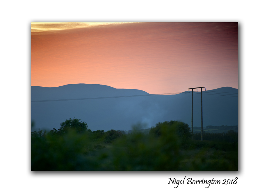
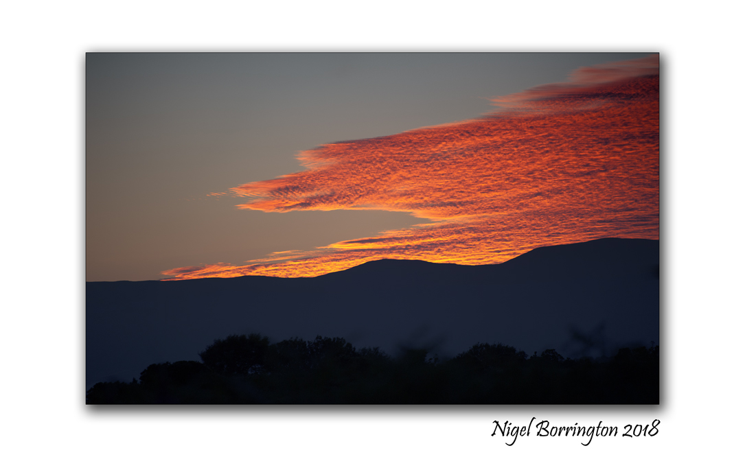
Summer Heat Wave, In pictures ….
Irish landscape photography
County Kilkenny
The heat wave of 2018
Nigel Borrington
Ireland’s is currently in heat wave conditions with no big change on the horizon, so today I headed out for a walk and started to capture our local landscape in these conditions. Here in County Kilkenny we have not been affected quite as badly yet as in county Dublin but as you can see from these images the hedgerows and fields are starting to turn to a light brown and some of the trees are only just hanging on.
Share this:
July 2, 2018 | Categories: Comment, Down on the farm, Gallery, images of ireland, Images of Summer, Irish Landscapes, Nature and Wildlife | Tags: Changes in the landscape, Heat wave, Ireland, Irish landscape photography, Nigel Borrington, summer, summer 2018, The Seasons | 3 Comments