
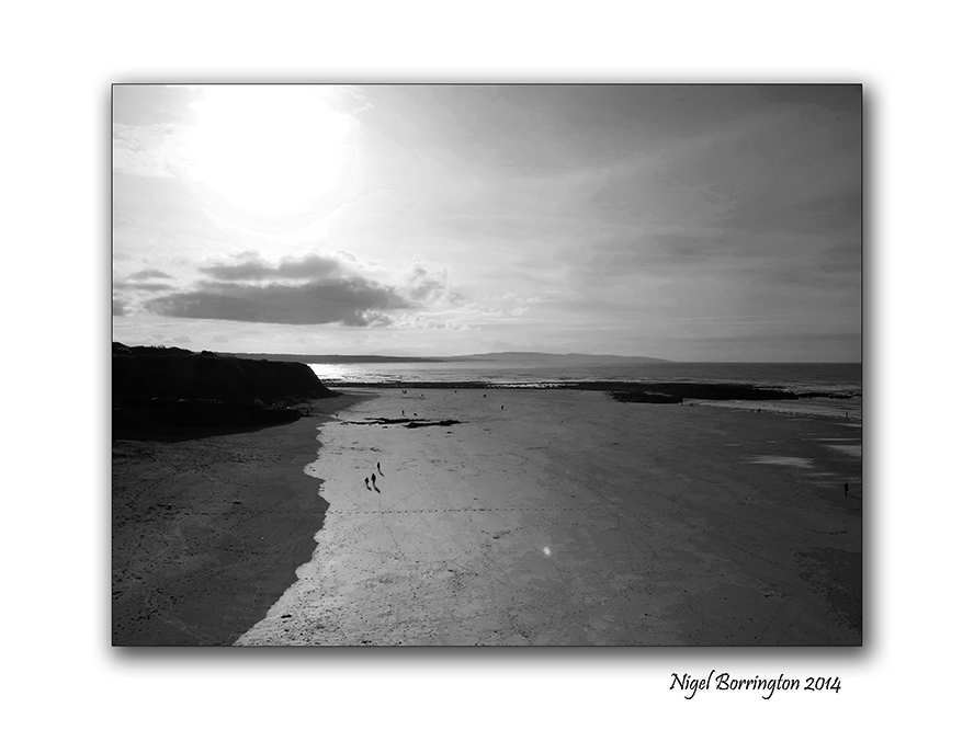
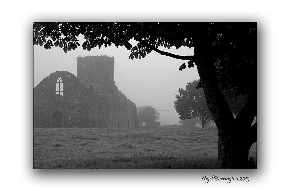
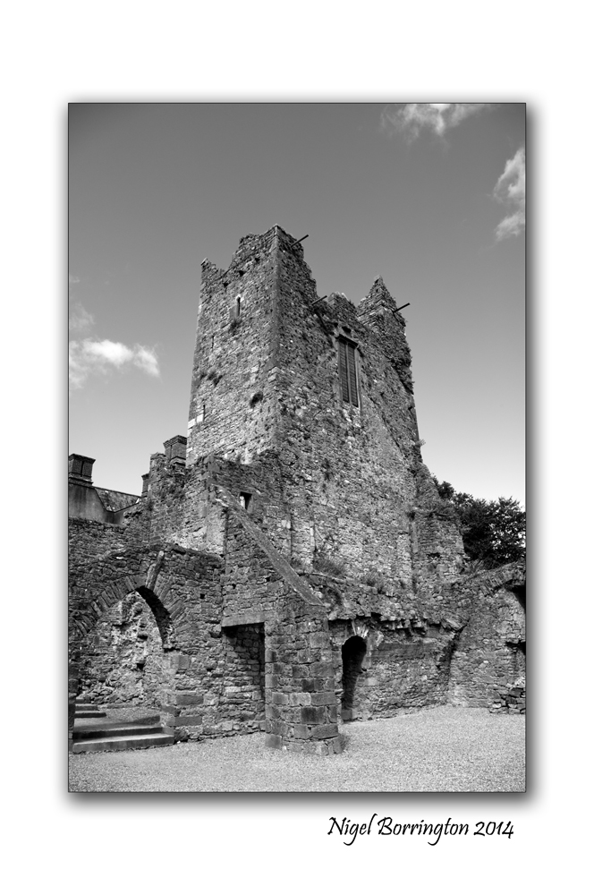
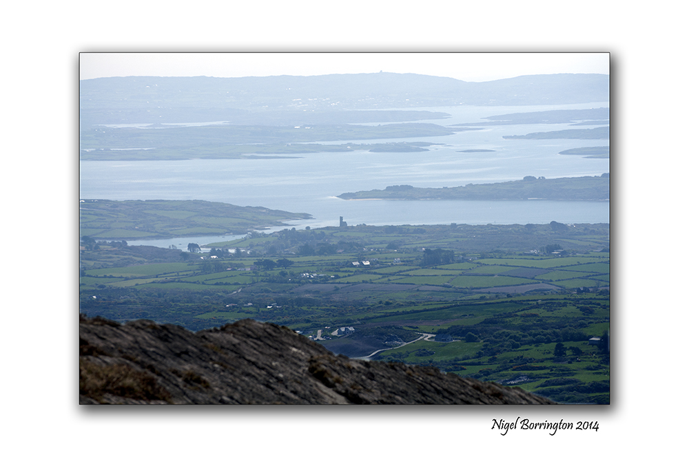
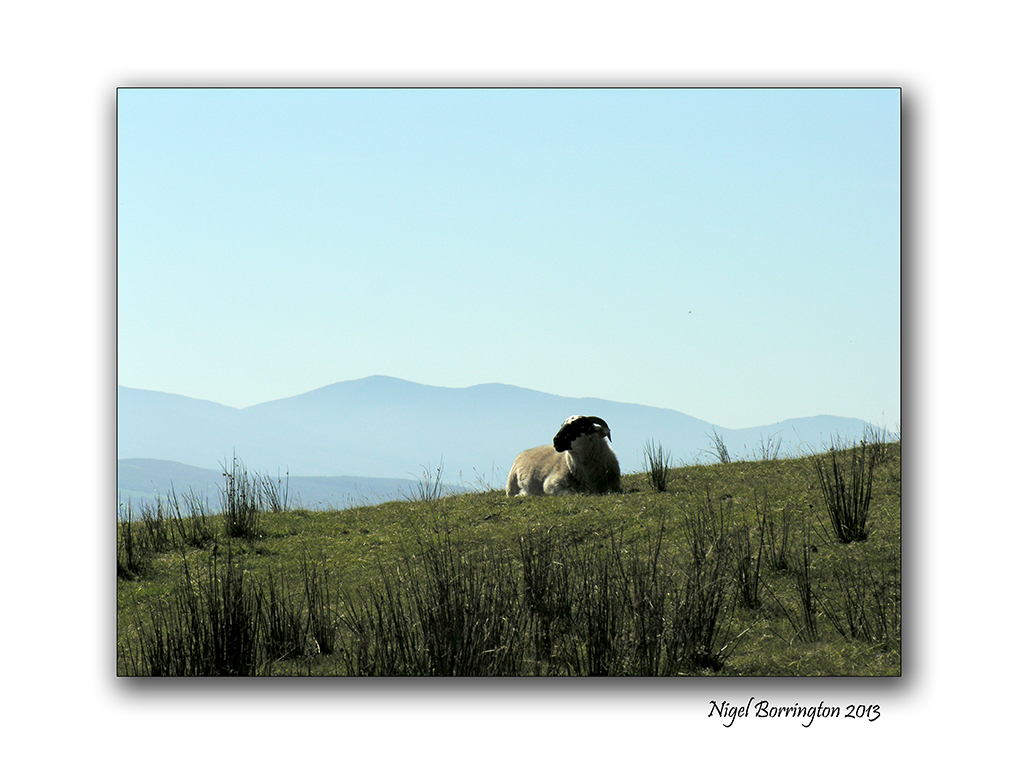
Ballybunion , a view from the cliff

Ballybunion, county Kerry
Irish Landscape Photography : Nigel Borrington
Ballybunion , county Kerry
Ballybunion in county Kerry is one of Ireland’s most visited sea side locations, it a wonderful little town with a long history of holiday makers visiting here.
It has one very interesting feature that relates to its beach’s, there are two commonly used beaches divided by the reamins of an old castle on the cliff. The beach to the left of the castle (if looking toward the sea) is called the “Men’s Beach”, and the one to the right the “Ladies Beach”, given to the fact that men used to bathe on a separate beach from women and children. Although this practice has not been observed for decades, its amazing to think in this day and age how it even worked or became Normal practice.
Family members having to split-up for a swim.
There is a small cafe, hot seaweed baths and ice cream shop on the women’s beach. The large cliffs to the right of the women’s beach have shallow caves.
The sheer cliffs over the beach have a scenic walking path, featuring a blowhole, views of sea stacks and a multitude of wildlife. The path takes about 20 minutes to walk, and goes round to the “Nun’s Beach”, a beautiful beach with no access these days, it is overlooked by an old convent.
You get an overwhelming feeling of history here from times when traditions and culture was very different than the many visitors today experience.
Ballybunion, is still a place well worth a visit !!
Gallery


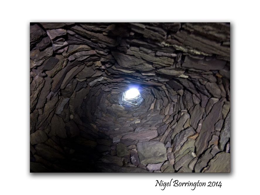
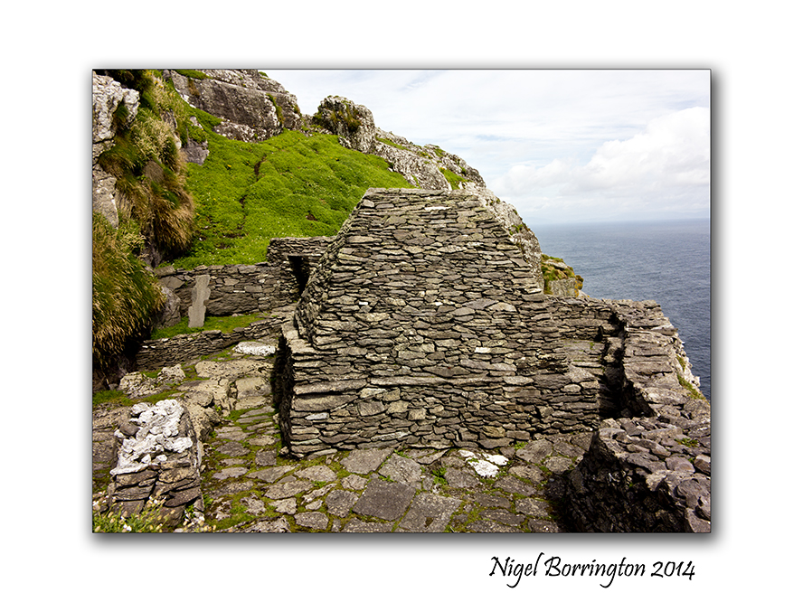
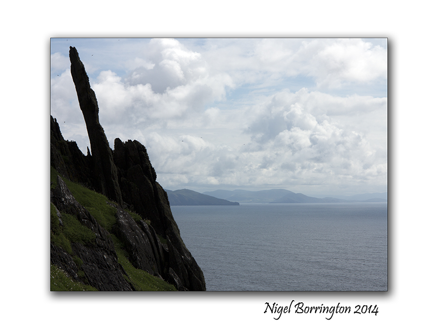
Skellig Michael : Inside the walls
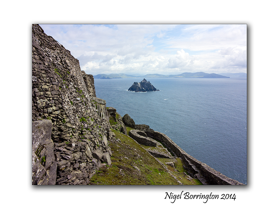
Skellig Michael, county Kerry, Ireland
Landscape Photography : Nigel Borrington
Skellig Michael : Inside the walls
Skellig Michael is an Island some 12 to 16 kilometres by boat from the ring of kerry, county Kerry, Ireland. It is most famous for the fact that during the 6th to the 8th Century’s a religious settlement was established here.
The Island is a world heritage site and falls under the guardianship of UNESCO, you can find the official historic details from the link on the world heritage web page here : Skellig Michael
In my last two posts I shared the boat trip to the Island and then the long but wonderful walk up to the settlement at the very top of the Island some 218 meters from sea level. Today I just want to share images of the inside area , the location that the people who lived here spent their life’s and also the location in which they are buried and there final resting place.
The images in the Gallery below are placed in the order that you view the buildings when you walk through the site, the only access is through a small passage in the outer walls.
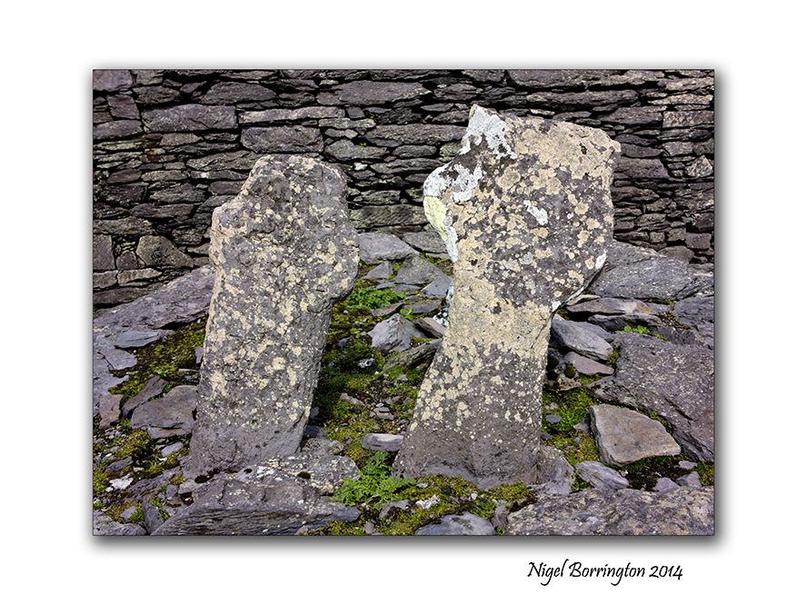
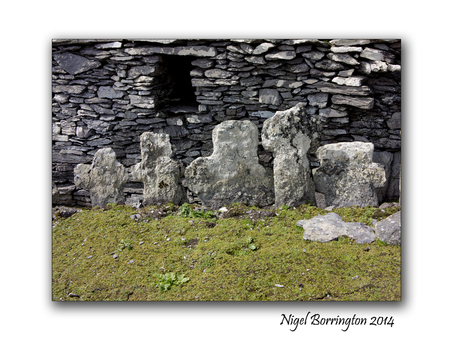
The very first thing that greets you are two small head stones, in a very small patch of grass. These are the graves of two young boys, it was a tradition that monks in this period would take very young boys as members to their orders. These boys where from families on the main land and once they moved here they would most likely never return to see there families. Our guide informed us that it is a possibility that both boys were killed by Viking invaders as when the remains where examined wounds were found that indicate that they were killed by the use of weapons, both boy did not pass the ages of ten or twelve. It is also thought that other graves in the pictures here, in the centre of the living area contain some adult victims of such attacks.
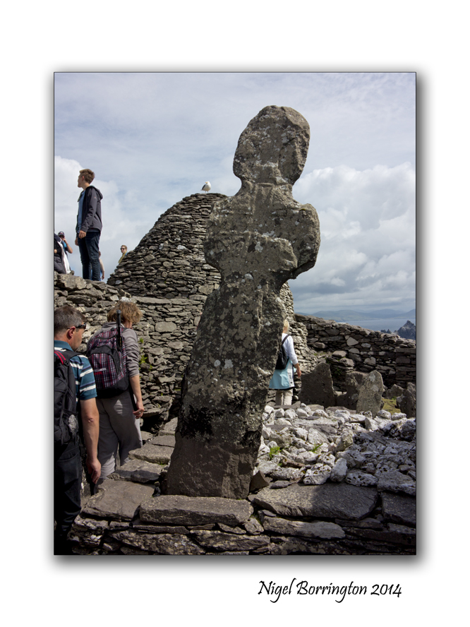
A monastery may have been founded as early as the sixth century, reputedly by Saint Fionán but in 1044 rededicated to Saint Michael, the image here shows a large sculpture that is located towards the middle of the complex. It was described by our guide as being a cross but it could also be very much in the form of a human figure, with the arms to the side and a head looking over the site.
The word Skellig is defined as meaning “splinter of a stone”, and thus this rocky island was dedicated to saint Michael, there are also other Islands around Europe and maybe further away that are dedicated to this saint ( Mont Saint-Michel France, St Michael’s Mount Cornwall)

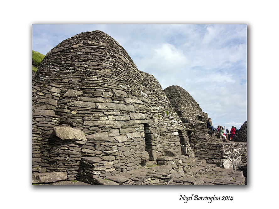
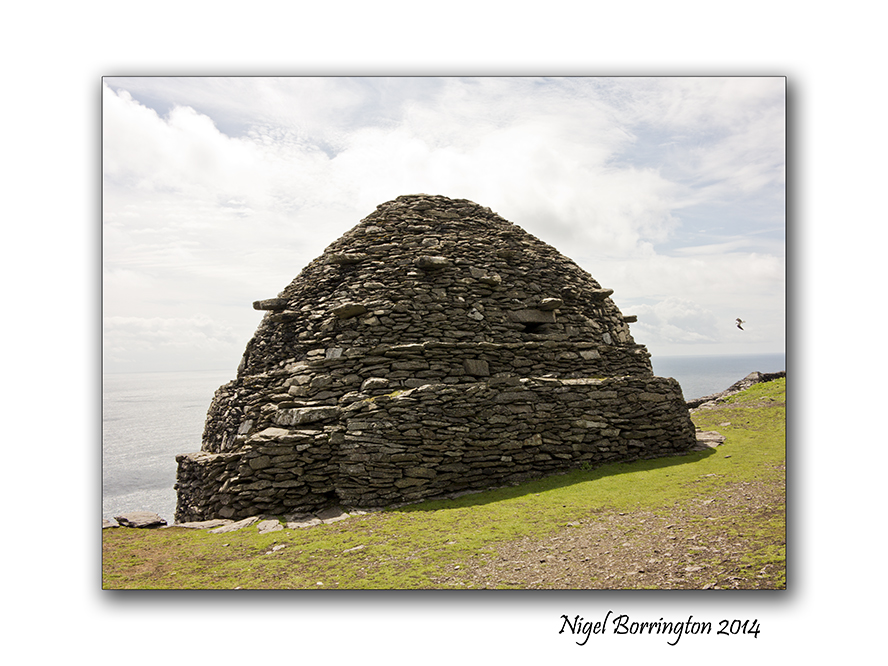
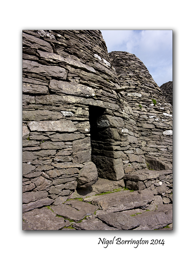
One of the most famous features of Skellig Michael are the so called Beehive structures, there were may be six or seven of these of which six are still standing, they were the living space for each of the monks, this fact would indicate that a maximum of seven people lived here in the beehives at any one time, there is a structure at the very end of the settlement that is constructed completely differently, It is thought that the head of the order would have lived in this building but few fact to prove this exist.
In any case the indications are that eight people lived on Skellig Michael at anyone time during its long history.
Living with in these stone constructions looks very harsh , during the time they were occupied however they would have looked very different, in some of the pictures you can see supporting stones that stick out of the main buildings by some amount, it is thought that these stones supported a covering of thatch consisting of straw and clay, this would have been deep and was used to keep the inner stone structure warn and dry. Not all but some of the Beehives have a hole in the roof that was used to let out smoke from fires inside.
At some point I want to post about the life’s of these people, who they were and why they chose to live here, I need to read a little more however , so for the moment that’s it. Three post over the last three day that I hope share a visit to this wonderful and mystical island. If you get a chance I would really in-courage you to visit. Its an experience of a lifetime and helps to open your mind to European history.
I cannot help however feeling that this place holds something else other than the official history, The question as to why these monks felt the need to occupy Skellig Michael, so far of the Irish coast line, is very big !
This place feels like an escape, a refuge but from what and why ?
With such massive risk’s taken by a small group of people to construct three stone walk-ways to the top of the Island and then build the settlement, the question of why looms very large. These were times that the word of Christianity was first being spread across Ireland so why the need to hide away here ?
I need Much more reading, before I understand these bigger questions 🙂
Gallery


Skellig Michael, Six hundred steps to heaven
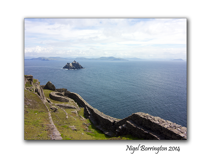
Skellig Michael (unesco heratage site) , country Kerry Ireland
Irish Landscape Photography : Nigel Borrington
Skellig Michael, six hundred steps to heaven
During the summer last year I finally achieved a long ambition, to visit Skellig Michael and the Skellig islands some 16 kilometres off the county Kerry coast line, Ireland.
In yesterday post I shared the boat trip out to the Islands, today I want to share the walk up the six hundred plus stone laid steps to the very top where the world famous monastic outpost is located.
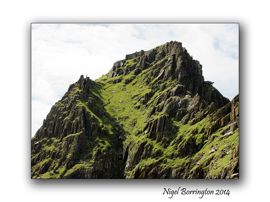
During the boat trip one of our guides pointed out one of three stair cases to the top, if you open up this picture you will see it rising up to the settlement, there are three of these routes up that were hand built with stone cut on the island. The three of them provided landing points during different tides and weather conditions.
Landing on the Island is an experience in its own right as the swell from the sea water makes stepping off the boat great fun. As you set foot on ground again, the first stage of the walk to the top is a well laid foot path taking you to about half way around the island and about one third of the way up the 218 meters you need to climb before reaching the settlement.
As this path ends you are met by a guide, who very firmly insists you all receive a health and safety talk, sadly sometime back a visitor died while walking up the steps, the walk is very steep and if you loose your footing the drop all the way to the sea below is not broken by any obstacles. He advises to take your time, “its not a race to the top and that if you need a rest to take one.”
The walk up is hard but very pleasurable, the views as you go are stunning if a little breath taking due to the hight. One of the warnings however was to keep your eyes on your steps and not to take any images unless you had stopped in a secure location and moved aside for others to pass, even telling the people behind that you intend to stop. as you can see in the images below there are some platforms and viewing points and I did my best to only stop here.
One of the wonderful views on your way up was the hundreds of Puffins nesting here, they were due to leave any-time so its was great to still find so many of them, I got many images of them along the way.
Finally after some forty minutes you reach the last set of steps , turning through some sharp rocks you get the first view of the Settlement. This sight just takes you back, the stone wall that greets you is about four meters high from a terrace that is the only flat area on the entire Island, being used to grows vegetables in its day.
From here the only access to the inner yards and structures is through a small door in the stone wall.
On entering you are met with the sight of the famous beehive cells of which six are still standing. The enclosed area is small and fully protected from the elements by the hight of the sea facing wall. The structure of the cells is very unique and fascinating to see. in the centre of the buildings is a small grassed area that served as a grave yard. I found this fact very interesting as it outlines the fact that the people who lived here spent their entire lives living on this Island from the moment they first arrived.
I want to post one more time on Skellig Michael, showing the full structures , living spaces and detail some of the history of this place. It is truly a fascinating place that holds some mysterys. The biggest one’s to me are : why here ?, why did these people select to live at the top of a rock over ten kilometres from the Kerry coast line, when they could have just lived on the main land?
More in the next post …
Skellig Michael, image Gallery


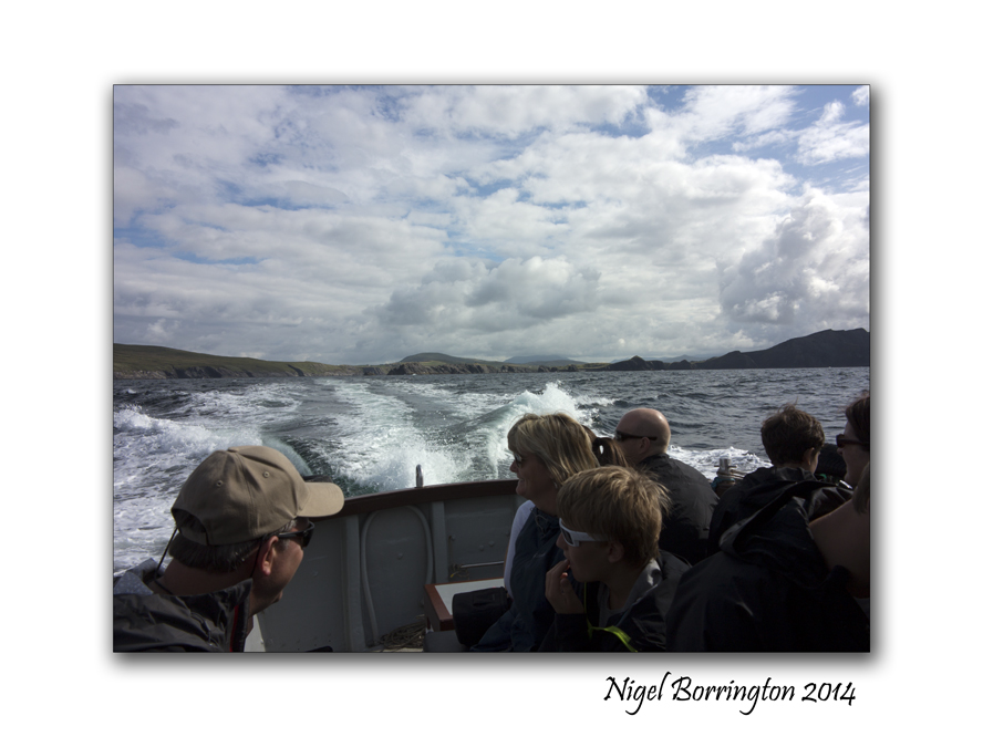
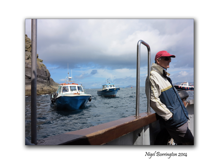
The boat to Skellig Michael

Skellig Michael and the Skellig islands
Irish Landscape photography : Nigel Borrington
The boat to Skellig Michael
During the summer last year I finally achieved a long ambition, to visit Skellig Michael and the Skellig islands some 16 kilometres off the county Kerry coast line, Ireland.
These Islands are full of mystery and mythology from the distant past, a history that goes back to before the 8th and 9th century.
In my next post I will show lots of images taken on the island that show the walk from the landing point to the Pre-Monastic settlement at the very top, but here I just wanted to show the boat trip out to Skellig Michael itself.
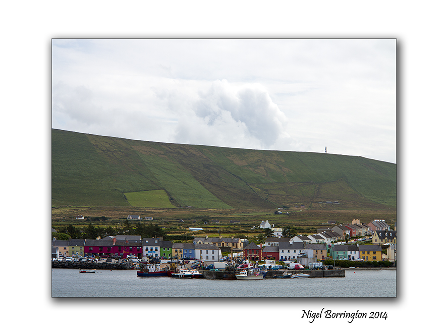
There are many fishing towns around county kerry and west Cork that run boat trips out to the islands and we got our boat from the town of Portmagee on the ring of kerry.
You can see from the images below that there are about eight boats that do the daily trip out from Portmagee. There is only one trip a day, however the trip is very dependant on the weather and sea conditions , if the tide or swell of the water is to high then landing at the small quays on Skellig Michael is not possible, we were lucky on our day that both these needed conditions were perfect.
The trip out takes about an hour and we had some great company with us along the way with people from America and Canada along with us on the boat. This helped past the time very quickly and it was great to meet people who had a common interest in getting out to see the same location.
As you approach the Islands you pass the first of the two Skellig’s an Island that has only even been occupied by sea birds and almost every inch of the rocks here are covered in nesting birds. The sight and sound was just wonderful as we passed. Beyond here you have about another 20 mins before you can land on Skellig Michael itself, waiting your turn along with many other boats to land.
The trip is one of the most memorable boat journeys I have done, the views towards the Islands and back toward the Kerry coast line and the ring of Kerry are spectacular. You can see both these Islands from the coast line yet when you arrive and look back you feel very distant from the coast, the people who lived out here had a very remote existence considering the boats they used had no engines to speed up there journey.
The boat to Skellig Michael Gallery


Irish Boglands

Landscape of an Irish peat bog
Landscape Photography : Nigel Borrington
Irish Blanket Bogs
One of Ireland’s most characteristic landscape features is the blanket bog lands. Covering 1,200,000 hectares (1/6th) of the island, Ireland contains more bog, relatively speaking, than any country in Europe except Finland. Across Europe, as well as in Ireland, bogs have been exploited in recent centuries as a source of fuel. With many of the bogs in the rest of Europe already gone, Ireland’s bogs now have an increased importance to the scientific community, as well as the tourist industry.
I took the following images last year on a visit to one of the blanket bogs in the Irish middlands.
Irish blanlet blog-land Gallery


Sunrise from the Mountains, Poem by : Anna Katherine Green

Knockanaffrin,Comeragh Mountains, County Waterford
Landscape Photography : Nigel Borrington
Sunrise from the Mountains
Poem by : Anna Katherine Green
Hung thick with jets of burning gold, the sky
Crowns with its glorious dome the sleeping earth,
Illuminating hill and vale. O’erhead,
The nebulous splendor of the milky way

Stretches afar; while, crowding up the heavens,
The planets worship ‘fore the thrones of God,
Casting their crowns of gold beneath His feet.
It is a scene refulgent! and the very stars
Tremble above, as though the voice divine
Reverberated through the dread expanse.
But soft! a change!
A timid creeping up of gray in east–
A loss of stars on the horizon’s verge–
Gray fades to pearl and spreads up zenithward,
The while a wind runs low from hill to hill,
As if to stir the birds awake, rouse up
The nodding trees, and draw off silence like
A garment from the drowsy earth. The heavens
Are full of points of light that go and come
And go, and leave a tender ashy sky.
The pearl has pushed its way to north and south,
Save where a line spun ‘tween two peaks at east,

Gleams like a cobweb silvered by the sun.
It grows–a gilded cable binding hill
To hill! it widens to a dazzling belt
Half circling earth, then stretches up on high–
A golden cloth laid down ‘fore kingly feet.
Thus spreads the light upon the heavens above,
While earth hails each advancing step, and lifts
Clear into view her rich empurpled hills,
To keep at even beauty with the sky.

The neutral tints are deeply saffroned now;
In streaks, auroral beams of colored light
Shoot up and play about the long straight clouds
And flood the earth in seas of crimson. Ah,
A thrill of light in serpentine, quick waves,
A stooping of the eager clouds, and lo,
Majestic, lordly, blinding bright, the sun
Spans the horizon with its rim of fire!

ST Patrick’s day , Irish landscape Gallery.

Coolagh old church , County Kilkenny
Landscape photography : Nigel Borrington
Today is St Patrick’s day here in Ireland and its a public Holiday, For many people religion will play a big part in the day.
Personally I love the outdoors far more and will spend most of the day walking and exploring the local landscape, I find nature and open spaces far more spiritual.
The following gallery of images are just some images taken in and around the wonderful county of Kilkenny.
What ever your doing today enjoy yourself and a happy St Patrick day.
Kilkenny Landscape Gallery


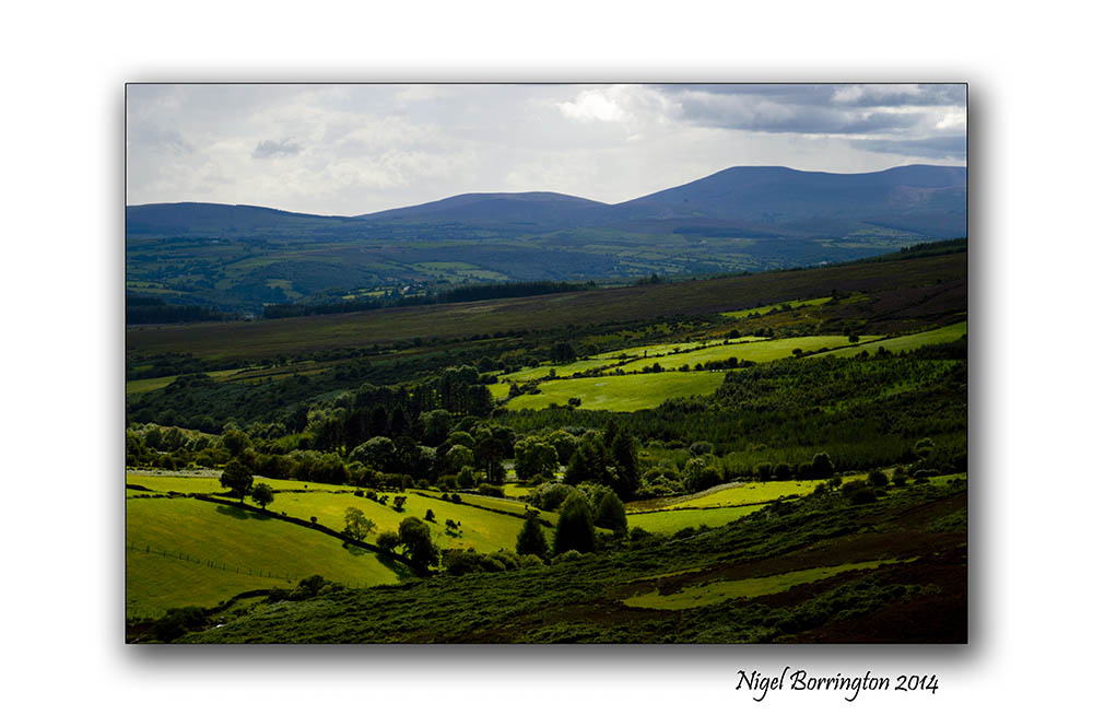
Landscape from the Irish Hills and a Poem By : S. Weir Mitchell
Landscape from the Irish hills
Landscape Photography : Nigel Borrington
The hills of the South east of Ireland are on of my favourite locations to wander and go for long walk, they are not as spectacular as the peaks of the Kerry mountains but there is a stillness here. Space to think and clear your mind and just walk and photograph the landscape.
I will let the words of the below poem say everything else for me, complimenting just how much I like these locations in the soft Irish hills.
S. Weir Mitchell
HERE have I wandered often these many years
Far from the world’s restraint, my heart at ease,
With equal liberty of joy or tears
To welcome Nature’s generosities,
Where these gray summits give the unburdened mind
To clearer thought, in freedom unconfined.
Kind to the dreamer is this solitude.
Fair courtesies of silence wait to know
What hopes are flattering a poet mood,
Stirred by frail ecstasies that come and go,
Like birds that let the quivering leaves prolong
The broken music of their passing song.
Here may we choose what company shall be ours;
Here bend before one fair divinity
To whose dear feet we bring the spirit-flowers,
Fragments of song, stray waifs of poetry,
The orphans of dead dreams, more sweet than aught
Won by decisive days of sober thought.
Landscape of the Irish hills a Gallery


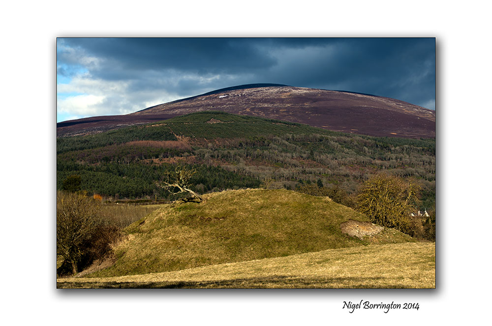
Monday Morning, The Motte at Slievenamon

The Motte at Slievenamon , County Tipperary
Landscape Photography : Nigel Borrington
The Motte
This morning it felt like Spring for the first time here in Ireland, we have a good chance of a period of sunny days for the entire week and it was a wonderful Morning.
I took the chance to visits our nearest Mountain Slievenamon and walk around its lower paths and fields, one of these fields contains the remains of an old Norman Motte. From the top of which you get some wonderful views of the Landscape around this area.
A Motte is the foundations for a motte-and-bailey castle with consisted of a wooden or stone keep situated on a raised earthwork called a motte, accompanied by an enclosed courtyard, or bailey, surrounded by a protective ditch and palisade. These castles were built across northern Europe from the 10th century onwards, spreading from Normandy and Anjou in France, into the Holy Roman Empire in the 11th century. The Normans introduced the design into England and Wales following their invasion in 1066. Motte-and-bailey castles were adopted in Scotland and Ireland.
This is a location I will return to many times this year just to capture how the seasons effect the look of this wonderful setting.
Gallery


Ormonde Castle

Ormonde Castle, County Tipperary
Irish Landscape Photography : Nigel Borrington
One of my favourite historic Location to visit in Ireland is Ormonde Castle in County Tipperary.
Ormonde Castle description on Wikipedia.
The castle is located on the bank of the river Suir, on the edge of the town of Carrick on Suir, when it was first built the castle would have been set in a large private estate with much land surrounding it.
Today its location is in one of the parks that the town contains.
A summers day visit here is perfect as you can visit the Castle them make use of the park if you bring some lunch with you.
Ireland has such great history that is stored in locations like this, historic buildings are a part of Irish history and offer great attractions to visitors here.
If you are visiting then Ormonde Castle is a great location to put on your list.
Ormonde Castle Gallery


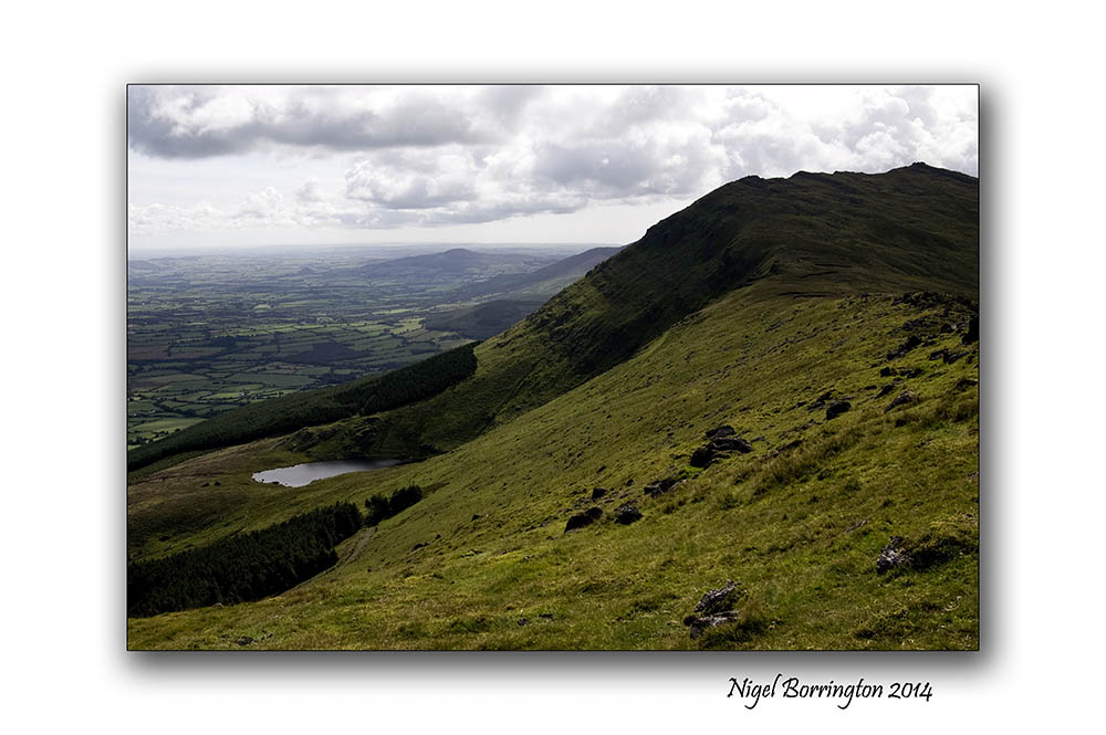
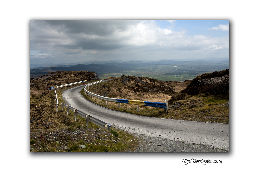
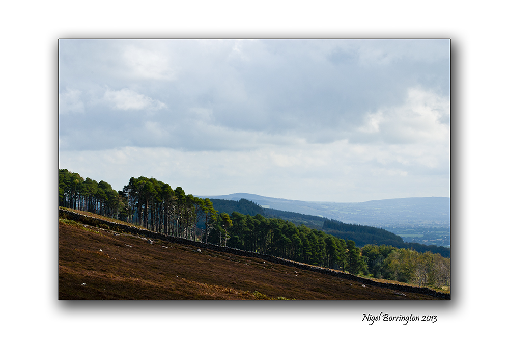
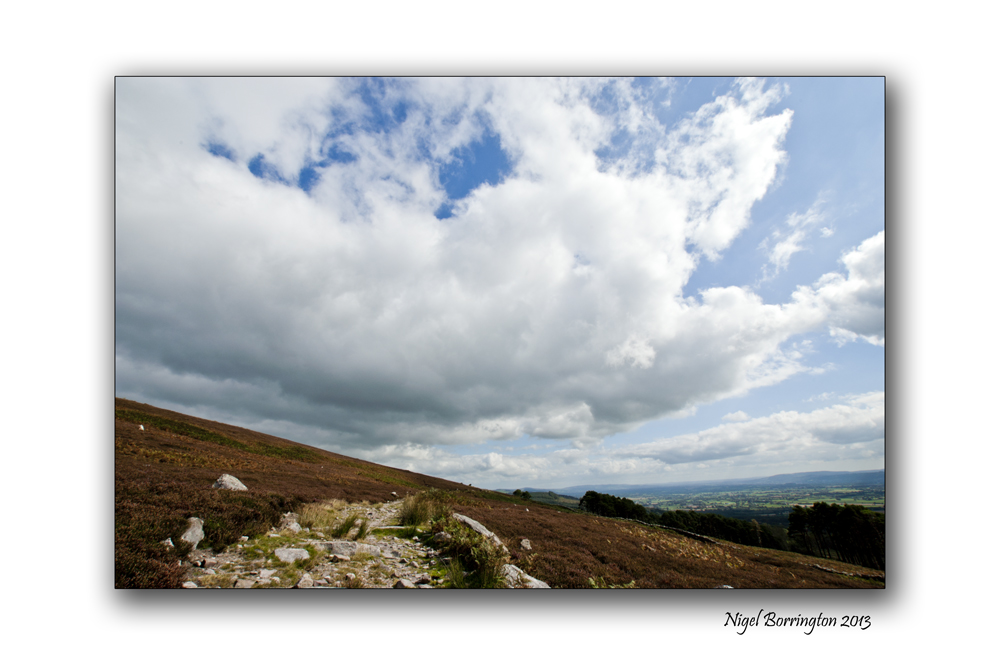
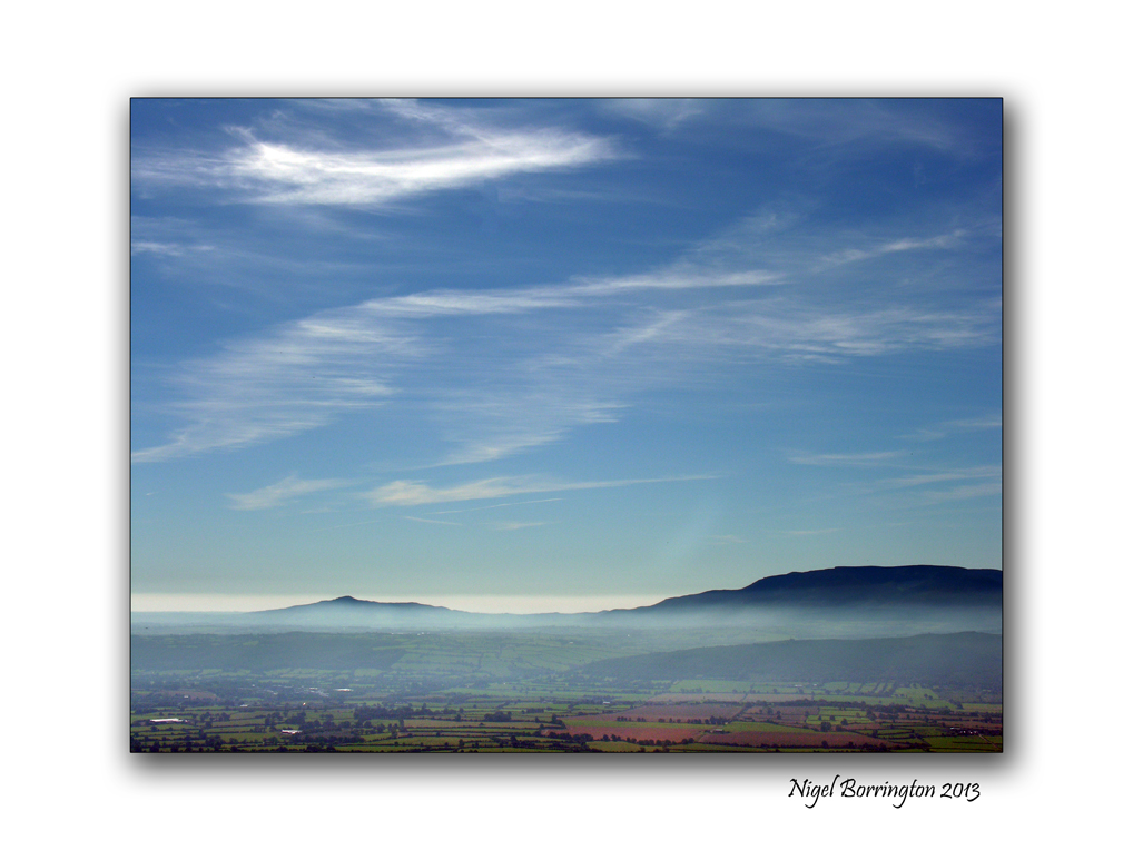
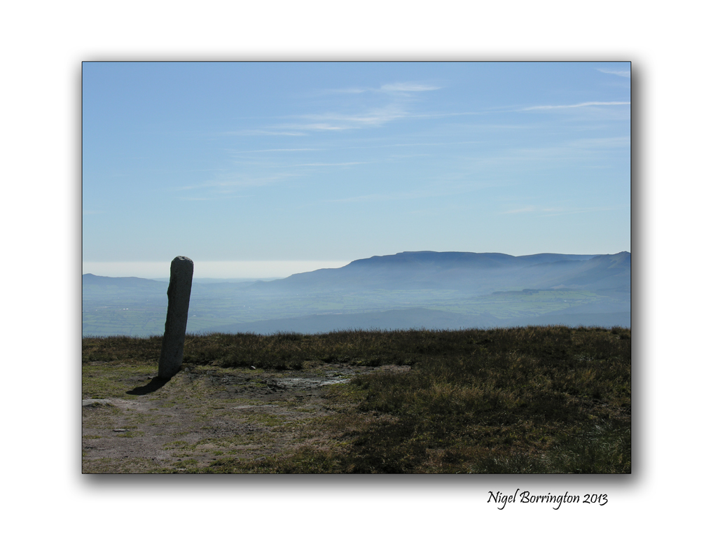
Mount Gabriel, County Cork
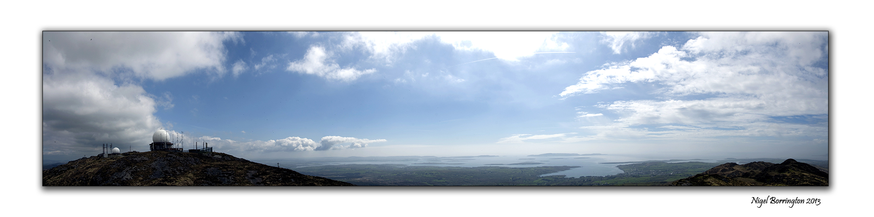
Mount Gabrial, county Cork
Irish Landscape Photography : Nigel Borrington
Mount Gabriel, (Cnoc Osta in Irish) is a mountain on the Mizen Peninsula to the north of the town of Schull, in West Cork, Ireland.
The Mountain is some 407m high and is the highest in the region of west cork, you can use a roadway that services a air traffic control radar to walk or drive to the top.
From the peak of Mt. Gabriel, there are spectacular views South over Schull Harbour and Long Island Bay. To the east and southeast, the views take in Roaring Water Bay and its many islands, popularly known as Carbery’s Hundred Isles. North and West is a panoramic view of the mountains of the Beara Peninsula and South Kerry.
The day we visited it weather was warm and very clear and we got some great views, this is a wonderful walk to do if you are in West cork and one that you will not forget, on a clear day you can see the entire county and all the Peninsulas of west Cork and Kerry to the north.
Mount Gabriel, County Cork, A Gallery


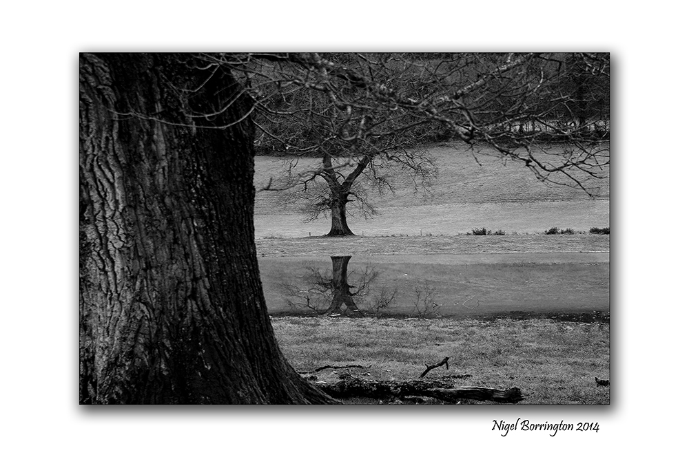
The river is Rising

The River Lingaun, County Kilkenny
Irish Landscape Photography : Nigel Borrington
Yesterday we had the storm of the century here in County KIlkenny, winds over 160kmph and a months rain , We lost power in the house and still have no water supply. We are not alone, there are some 190,000 homes in the country without electric or a clean Water supply.
The county has suffered much damage to peoples Houses and land and the rivers are on the rise again.
It was the eighth Storm this winter and in as many weeks, The First I can remember to receive a name ( Storm Darwin ), he or she will be remembered for many years to come.
The rising river Lingaun : Gallery


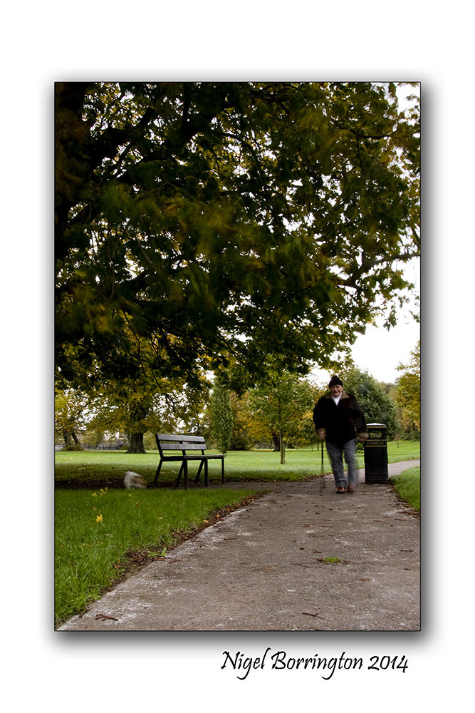
Life between the Storms .
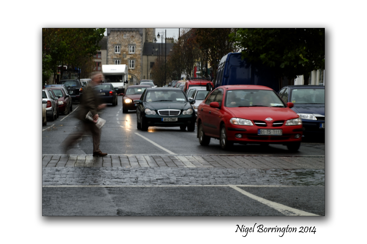
Life between the Storms
Today here in Ireland we are experiencing our eighth storm in eight weeks, with winds up to 160 kmph, the rivers are still flooded and we are are due two more storms before the weekend.
Yet life goes on, I took these two images of people going about their lives one getting his new paper and the other walking his dog.
As always life goes on but when its raining and the weather is very bad the doors get shut the fire is set, the newspaper is read and the dog is in his basket….
After the storms , Poem By : Boris Pasternak

Storm clouds over County Kilkenny
Landscape Photography : Nigel Borrington
After The Storm
By : Boris Pasternak
The air is full of after-thunder freshness,
And everything rejoices and revives.
With the whole outburst of its purple clusters
The lilac drinks the air of paradise.
The gutters overflow; the change of weather
Makes all you see appear alive and new.
Meanwhile the shades of sky are growing lighter,
Beyond the blackest cloud the height is blue.
An artist’s hand, with mastery still greater
Wipes dirt and dust off objects in his path.
Reality and life, the past and present,
Emerge transformed out of his colour-bath.
 .
.
The memory of over half a lifetime
Like swiftly passing thunder dies away.
The century is no more under wardship:
High time to let the future have its say.
It is not revolutions and upheavals
That clear the road to new and better days,
But revelations, lavishness and torments
Of someone’s soul, inspired and ablaze.
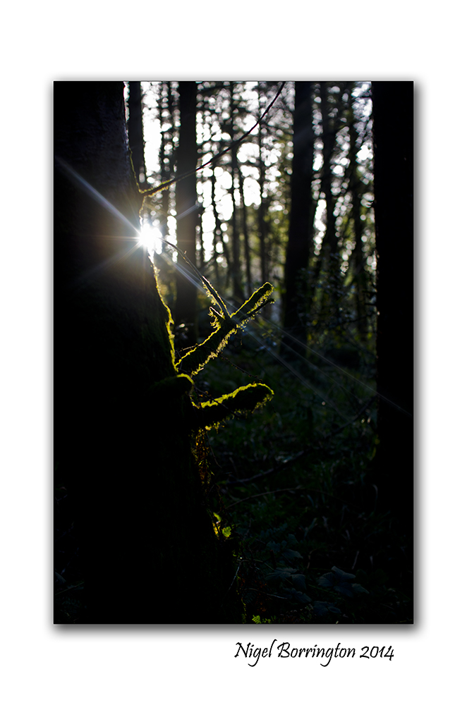
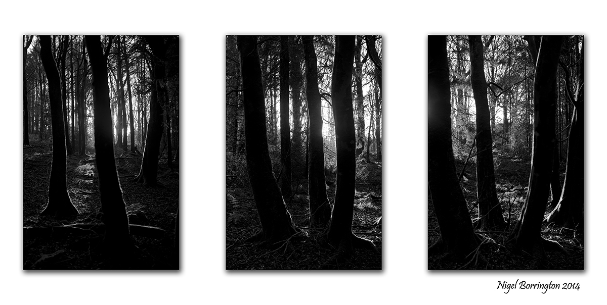
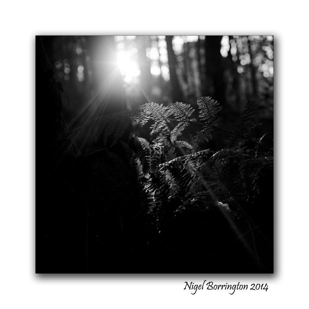
Following the light .

Following the suns light through the trees
Castlemorris Woodlands , County KIlkenny
Irish Landscape Photography : Nigel Borrington
During the Winter months the Suns is sitting low in the sky for most of the day, this is a feature that I personally like a lot when taking images. Long shadows form on the landscape from woodlands and trees , hedge rows form deep and dark areas in your images during the morning and long into the afternoon.
What about the Sun in the deepness of the forests, its light finds it hard to penetrate far into the woodlands and onto forest floors.
If you get as deep into the woods as you can and find an thinned area of old tall trees however the light that does get through can be used to wonderful effect, in the images below I did my best to capture the light that was getting through, making use of some moss covered rocked and the trunks of the trees themselves.
One thing I noticed was that if you position the sun right behind a tree , the light wraps its way around both sides of the trees in front of you, forming an outline of sun light.
I also very much like placing the sun on the very edge of the image or just outside it and using lens flare to bring a beam of light on to some of the rocks and plants.
Following the suns light through the trees: Gallery


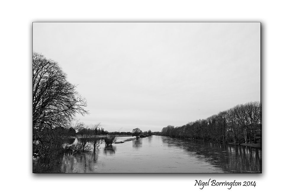
When the river floods

The River Suir, Kilsheelan, County Tipperary
Irish Landscape photography : Nigel Borrington
The power and energy of a flowing river has to be one of the wonders of nature, if you live anywhere near a river you will know very well the seasonal effects that wet and dry weather can bring to the environment of the river banks.
We have had about two months of very wet weather here In Ireland and it has created some of the worst floods for over a hundred years, in many towns along Ireland’s river banks.
These images, I feel show the effects and power of the flooding river Suir, County Tipperary. The river level here is about eight foot higher than its normal level and none of the river banks can be walked along. Two the pictures show the posts of some steps that you walk through to get to the banks of the river, they are fully submerged under about 4 feet of water.
I took these images on Monday of this week, since then the water level is even higher.
The river Suir in flood : Gallery


When I Am Among the Trees, Poem by : Mary Oliver
Castlemorris Woodlands , County KIlkenny
Irish Landscape Photography : Nigel Borrington
When I Am Among the Trees
by Mary Oliver
When I am among the trees,
especially the willows and the honey locust,
equally the beech, the oaks and the pines,
they give off such hints of gladness.
I would almost say that they save me, and daily.
I am so distant from the hope of myself,
in which I have goodness, and discernment,
and never hurry through the world
but walk slowly, and bow often.
 .
.
Around me the trees stir in their leaves
and call out, “Stay awhile.”
The light flows from their branches.
And they call again, “It’s simple,” they say,
“and you too have come
into the world to do this, to go easy, to be filled
with light, and to shine.”
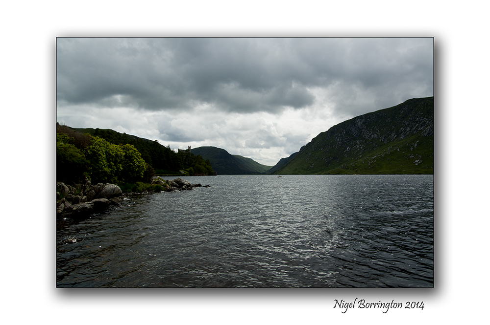
A swim at Glenveagh national park.
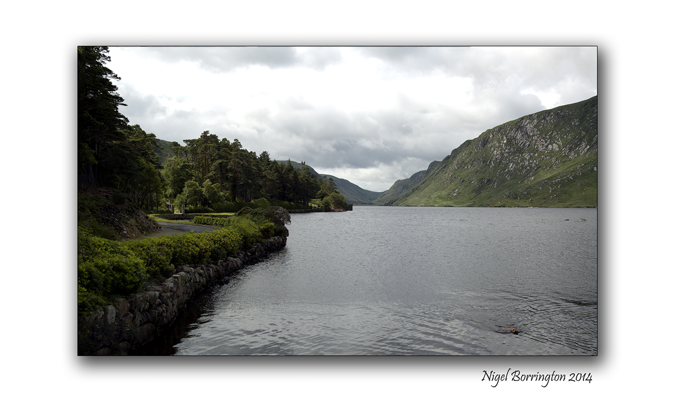
A swim at Glenveagh National Park
Irish landscape Photography : Nigel Borrington
Molly is our ten year old Golden Retriever and she just loves the water, here are some images of her as she was taking a swim the the lake at the Glenveagh National Park, Co. Donegal.
Glenveagh National Park
Glenveagh National Park is one of six national parks in Ireland. Situated in the Northwest of Co. Donegal, Glenveagh encompasses some 16,000 hectares in the heart of the Derryveagh Mountains. Such a great wilderness is the haunt of many interesting plants and animals. These lands were managed as a private deer forest before becoming a national park in 1975. With the completion of public facilities Glenveagh National Park was officially opened to the public in 1986.
Gallery


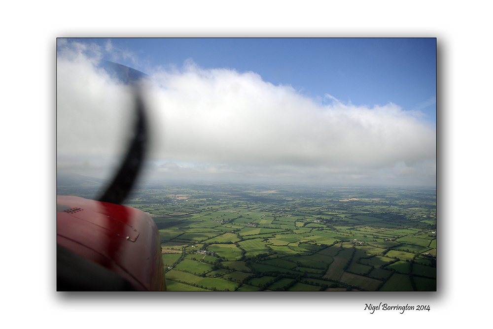
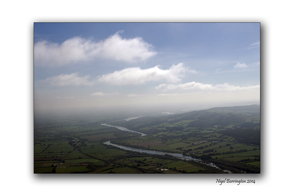
Images of Ireland from the Air.

Images of the south east of Ireland from the air.
Irish Landscape photography : Nigel Borrington
One of the most exciting ways you can see County Kilkenny and its surrounding counties is from the air, the images posted here are taken during a flight in a light aircraft.
You can fly from Kilkenny air field on a sight seeing visit to any location you would like, on this trip we travelled south of Kilkenny and followed the river Suir towards Waterford city, returning to the airfield about 2 hours later.
Its a great way to see Ireland and wonderful on a sunny clear day.
Gallery of the flight


Irish Landscape Photography

A sunset over the lower lakes of Killarney national park.
Irish Landscape photography : Nigel Borrington
One evening on a visit to Killarney, National park, I was just returning from a long walk after watching the Stag’s in the mountains above the lakes and getting some photographs. I then noticed that the Sun-set was just wonderful over the far hills in the west.
I had about 20 shots left on the card I had, so captured a few images from the grounds of the Hotel.
I have shared some of them before but still enjoy looking at them and remembering this wonderful moment, so here is another one that I wanted to share and post.
2013, a year on the Mountain .
Images of slievenamon 2013
Irish Landscape Photography : Nigel Borrington
During 2013 my post have covered many different locations and landscapes around Ireland and Europe, yet selecting the location for one of my final post of the year was very simple for me.
The landscape around the mountain of Slievenamon, County Tipperary is one of the most scenic in the south east of Ireland, it is very local to myself and I have taken many images during 2013 here.
So for my final Gallery I want to share some images of this wonderful location and I look forward to sharing much more in 2014.
Happy new year to everyone !!!
Slievenamon 2013 – Gallery

The Sea Of Time, Poem by Robert Crawford
Images of the Waterford coast.
Infra-red photography
Irish landscape photography : Nigel Borrington
The Sea Of Time.
by Robert Crawford
On that strange sea
Where Man’s bark moves as toward eternity,
What sails put forth that are not seen again!
So joyous it may be, or in pain,
The mariner doth drive still on and on
Beneath no mortal star,
And to no mortal port — as one
Who may but anchor somewhere so afar,
 .
.
Not himself wrecks if he shall reach no more
In that tremendous sea another shore:
He is so like a wave himself at last,
He would toss through the future as the past —
But tethered as a whale is to a wave,
So he might still the one life have
Through all the changes that may be
On that tremendous sea!
Jerpoint Park

Jerpoint Park, County Kilkenny
Irish Landscape Photography : Nigel Borrington
Newtown Jerpoint the Lost Town
Jerpoint Park in County Kilkenny hosts a Monument of notable importance: The Lost Town of Newtown Jerpoint.

Map of the village
It was founded by either Earl Marshall or Griffin Fitzwilliam in 12th century, just west of the Cistercian Abbey, where the main crossing of the River Nore was formed by a tole paying bridge.
It was a vibrant town, with approx 27 dwelling houses, a court house, woollen mill, a tannery, a brewery and reputed to have had 14 taverns. It was powered by two water wheels working on the little Arrigle River and a tower house stood near the market place, where a wealthy merchant would have lived.

Traveling further up East-West Street, St. Nicholas’s Church and graveyard are situated over looking the town, where the earthly remains of St. Nicholas ( Bishop of Myra) lay a unique feature of this church is the rood-screen which dates from the 15th century; this is the gallery-like construction running across the church between the nave and the chancel. It was used to support a missive reconstruction of the crucifixion, while the floored area above could also have been used for religious plays and choirs. The final phase was the construction of a small tower over the rood-screen itself, which served as the priest’s residence.
The Heritage Council of Ireland has published a Heritage Conservation Plan about Newtown Jerpoint that you can download.
Saint Nicholas Bishop of Myra

Saint Nicholas was born in 260ad in Patara, a coastal town in what is now Turkey. The poor knew him throughout the land for his generosity, his love for children and being associated with ships, the sea and sailors. He was eventually consecrated Bishop of Myra, just miles from his hometown. The beloved Bishop died in 343ad.
Many Christian churches and many countries observe December 6th his feast day with great celebrations, processions, services and gift giving.
Images of St. Nicholas in paintings, icons, statues, collectibles, and stained glass often show him alongside three young men in a barrel that he brought back to life after an innkeeper murdered them. He is almost always seen with three bags or balls as well, symbolising the three bags of gold he tossed through the chimney of the home of a poor man in his village for the daughters dowry, so they would not be sold as slaves. Thus he is also seen as the “gift giver”. A ship and the sea are also common symbols of the saint. Western and Eastern depictions of blessed Nicholas differ in style and costume.

Saint Nicholas is a patron of many places and people. He is closely associated with Russia, Greece, Holland, Austria, Belgium, Aberdeen and New York. Pawnbrokers, travellers, unwed persons, children, sailors and many others claim a special relationship to the saintly figure. Many churches are dedicated to him as well. Saint Nicholas is third most popular subject of icons in the church, with only Jesus Christ and the blessed Virgin Mary having more representations.
Tradition in these parts tell that the earthly remains of St. Nicholas were secretly removed from Bari by returning crusader knights, who brought them back to Newtown Jerpoint for safe keeping. They buried those remains with all due reverence in the church that to this day bears the Saint’s name. The grave of St. Nicholas is marked by beautifully carved grave slab just outside the church, the tall figure of the Saint dominates the carving, and flanking him on both sides are the heads of the two crusader knights who brought his remains here.
Jerpoint Park, Black and white Gallery


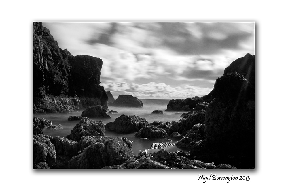
A day at Ballybunion beach, a Poem
Ballybunion beach, county Kerry, Ireland
Landscape photography : Nigel Borrington
One day last summer while I was walking along the beach at Ballybunion,county Kerry, I was trying to think of words that gave a sense of this place , so I jotted down the following word list for a poem, but I feel its a poem as it is.
Ballybunion beach
cool air, sound of sea birds, fresh breeze,
people walking, dogs running, cold swimmers, children shouting,
Waves rolling, people eating, chatting, talking, cliffs casting shadows,
Old castle walls dominating, caves temping you to explore,
Posters offering family photographs, lunch time meals and places to shop,
Restful moments , capturing views,
Old people pottering, memories of traditions past,
Time dragging to a stop, mind slowing,
Families gathering, men managing, car doors shutting, keys locking, after parking,
deep breaths taken, locations chosen, bags unpacked,
People now sitting, grannies talking, best instructions, suggestions given,
Steps taken, shoes in hand,
Temperature falling, evening calling, holiday homes inviting,
Beach clearing, winds rising, cold setting in,
Sea birds return, dogs last walk of the day
Night fisher man setting lines, day over
Peace and nature returning, tide rising,
On Ballybunion beach.
Share this:
April 7, 2014 | Categories: Comment, Gallery, Landscape, Poetry Gallery, Travel Locations | Tags: a sense of place, Ballybunion, Ballybunion beach, county kerry, Ireland, Irish photography, Nigel Borrington, poem, poetry, word list | 21 Comments