
2 hour painting, The town of Allihies west cork, Ireland

Allihies copper Mines and town
Irish landscape painting
Nigel Borrington
Allihies in west county cork is one of my favorite locations to visit in Ireland.
The town is located at the far end of the Béara Peninsula, west cork, the landscape scenery here is just stunning. The town itself is about as remote as it gets in this part of the world. There are many coastal walks along with paths that wind through the hills. The town is also well known for its copper mining history with many of the old mines still standing in the hills acting as a backdrop for the town.
There is a museum that you can visit details here : Allihies copper mine visitors center
My painting / sketch here was painted digitally using a combination of PC applications and taken from some sketches and photos I came home with on the return from my last visit.
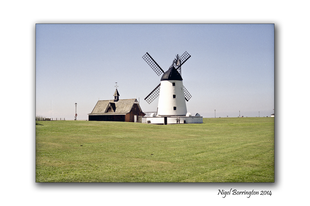
Arley Hall, a country house in the village of Arley, Cheshire, England,
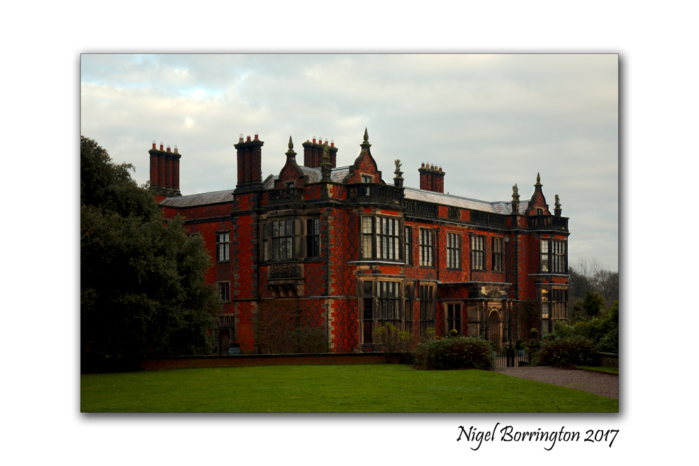
Arley Hall
country house
village of Arley, Cheshire, England,
If you looking for a place to visit in the UK, the county of Chesire has many great country houses and estate lands that you can visit, including Dunham Massey Hall, Tatton Park and Arley Hall.
Over the Christmas and New year period I visited Arley Hall and its great Gardens
Arley Hall is a country house in the village of Arley, Cheshire, England, about 4 miles (6 km) south of Lymm and 5 miles (8 km) north of Northwich. It is home to the owner, Viscount Ashbrook and his family. The house is a Grade II* listed building, as is its adjacent chapel. Formal gardens to the southwest of the hall are also listed at Grade II* on the National Register of Historic Parks and Gardens. In the grounds are more listed buildings, a cruck barn being listed as Grade I, and the other buildings as Grade II.
The hall was built for Rowland Egerton-Warburton between 1832 and 1845, to replace an earlier house on the site. Local architect George Latham designed the house in a style which has become known as Jacobethan, copying elements of Elizabethan architecture. A Gothic Revival chapel designed by Anthony Salvin was subsequently built next to the hall. By the mid-20th century parts of the house were in poor condition and were demolished, to be replaced by five private homes in a matching architectural style.

Arley Hall, Gardens
The present gardens were created in the 1830s, and were developed during the 20th century. The garden’s Herbaceous Border was one of the first of its type in Britain, and remains one of the finest. The house and its gardens have been open to the public since the 1960s, and have also been used as a film location. Stockley Farm, part of the Arley estate, is an additional visitor attraction for children and families.

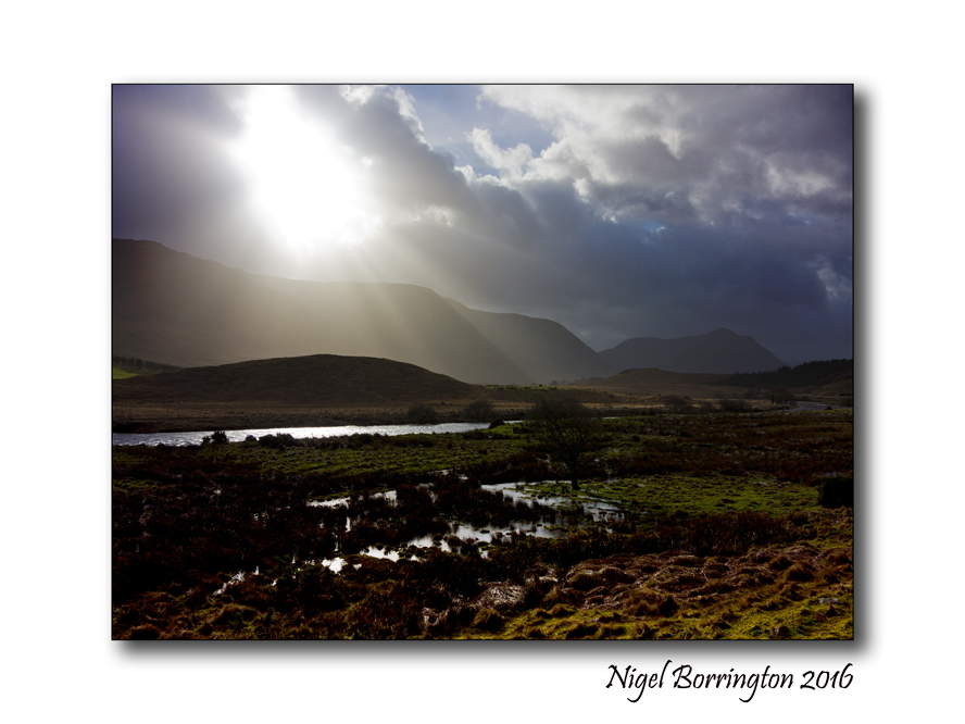
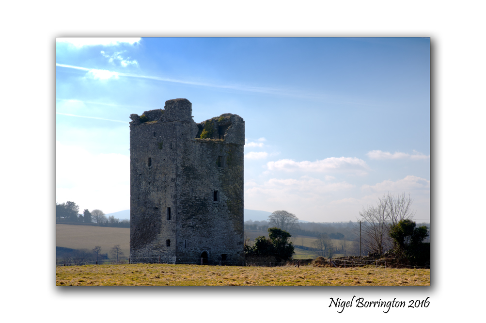
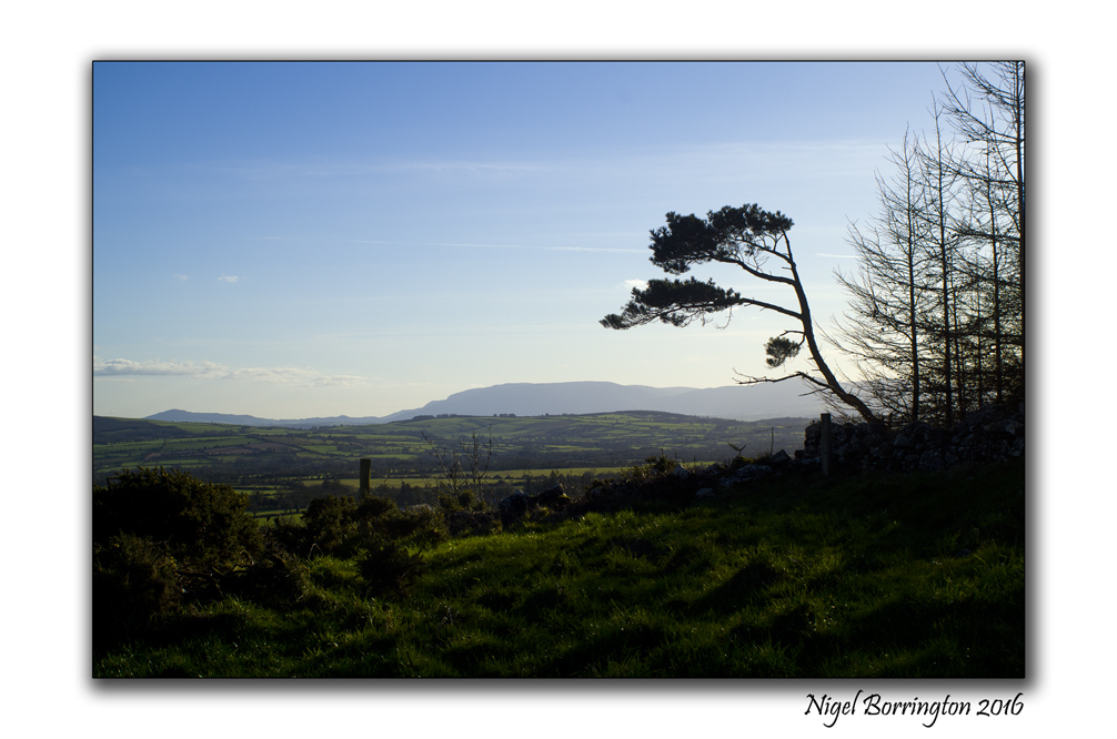
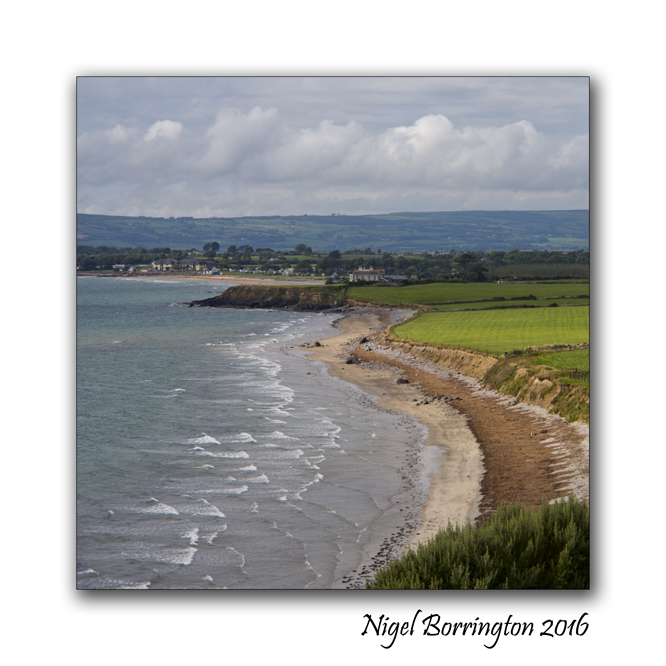
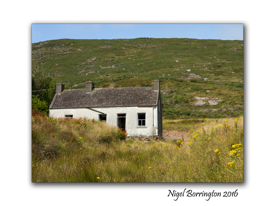
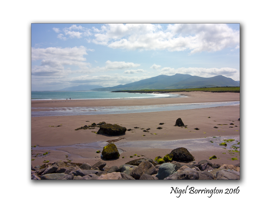
Happy Christmas and New year to everyone ! .. A 2016 Gallery
January 2016
Happy Christmas and a happy new year for 2017 to everyone 🙂
Todays post is my last for the year, I want to spend sometime off line with my family for the holidays.
I also want to say a very big thank you for such a great 2016 to everyone here in the word-press community, it has been great fun sharing posts with you all and reading your own posts!!!, its a great thrill to know so many great people and blogger’s here !!
Have a great Christmas time and a wonderful new year period, I look forward to sharing some on-line time with you all again in January 2017 – 🙂 🙂 🙂
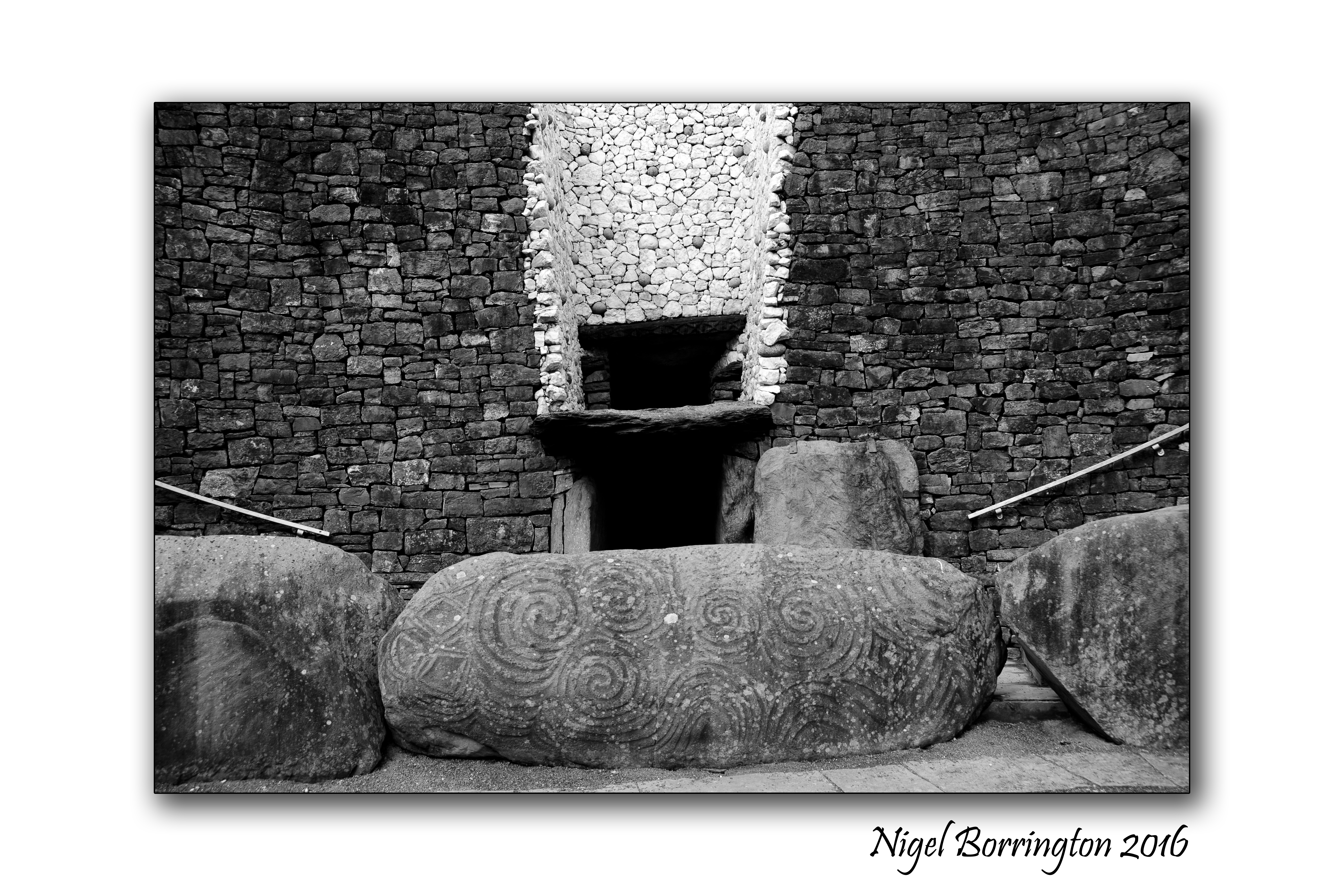
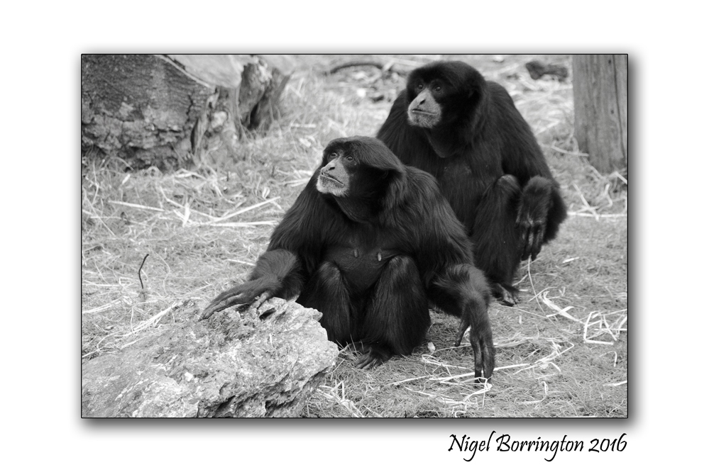
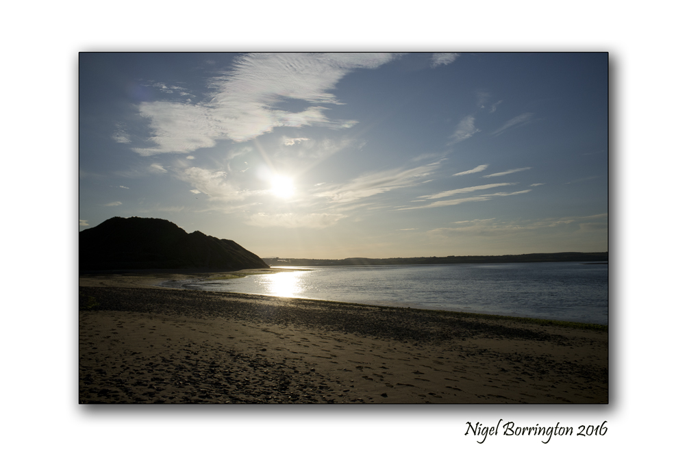
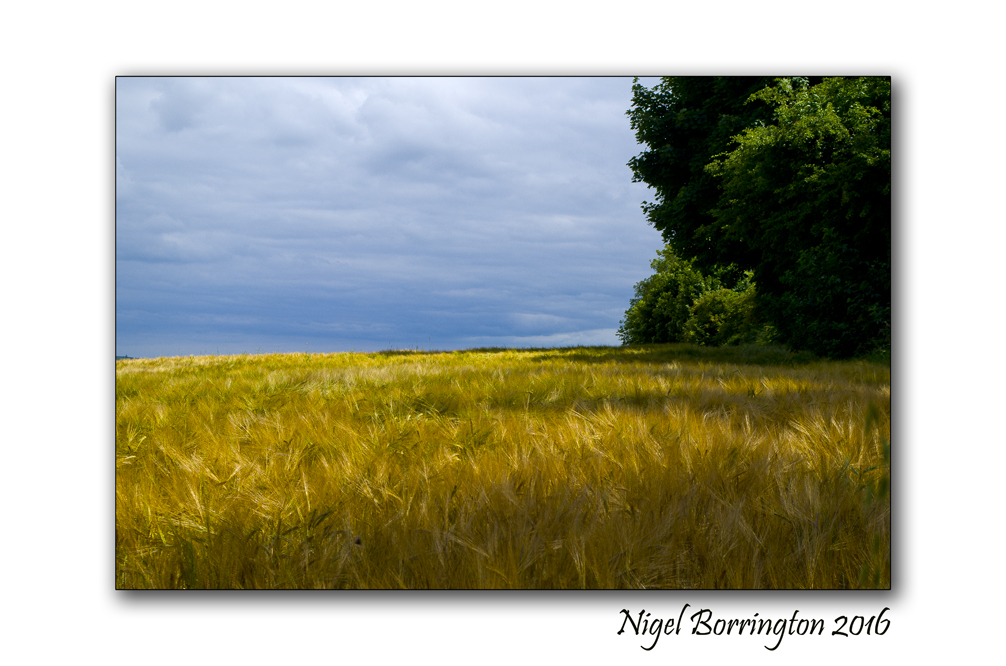
A gallery of images from 2016
January 2016
February 2016
March 2016
April 2016
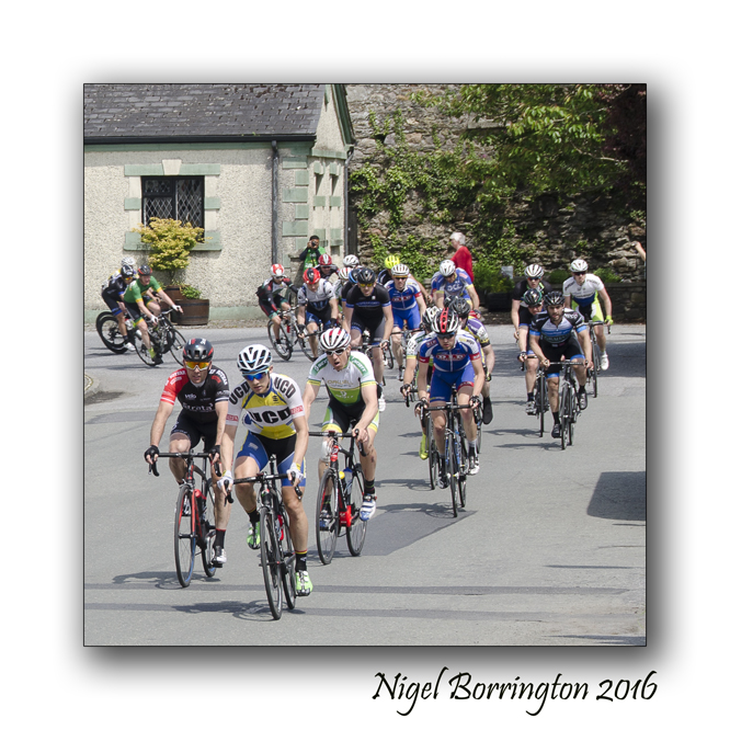
May 2016
June 2016

July 2016
August 2016

September 2016
October 2016
November 2016

December 2016
Otters of the River Suir , County Tipperary

Otters of the River Suir
County Tipperary
Nigel Borrington
Last weekend while on walk between Clonmel and Carrick-on-suir, both in county Tipperary, We came across a family of Otters, they had made one of the rivers contributor’s their home ( A Holt or Couch in otter terms ). We spent about an hour with them watching as two adults and four pups hunted and play in the waters. One of the Pups managed to catch a fish and then share this food with the other three pups on the river bank.
For a long time I have hopped to have an encounter with these otters, I knew they were around this location but had never been in luck when it came to seeing them, so this hour was a truly special time and one I will not forget 🙂 , it changes the way you feel about a river when you have the chance to view its wild life for such a long period of time.
Here are some basic facts about the otter in Ireland …..
Written by Dr Mathieu Lundy
The otter (Lutra lutra) is regarded as one of Ireland’s most charismatic native mammal species.
The otter is highly secretive and although widespread people tend to only get rare glimpses of the species in the wild. Otter populations declined throughout Europe after the 1960s and the species is now very rare or absent from many parts of its former range. The Irish otter population appears to have remained largely stable and is regarded as a European stronghold. In Ireland otters are found in a diverse array of aquatic habitats, from small streams to major rivers, upland lakes to coastal lagoons and sandy beaches. However, otters that live at the coast do need access to some freshwater habitat to bathe. Within these habitats otters feed on a range of both aquatic and terrestrial prey. Much of the information regarding distribution, habitat use and diet comes from spotting otter tracks and signs. Individual otters are highly territorial, using droppings called spraints to mark their home ranges. Favoured locations for leaving spraints are in-stream boulders, bridge footings and grass tussocks, these are called seats. These territorial signs are an ideal way to tell if otters are using an area. Within its territory an otter may have a number of resting sites, called couches and underground denning sites called holts, which can be a considerable distance (up to 1km) from a river, lake or the seashore.

Distribution
The species of otter that occurs in Ireland is called the Eurasian otter and is found in Europe and across Asia to China and Japan. In other regions the otter shares aquatic habitats with species specialised to different habitats such as sea otters, but in Ireland the otters that live at the coast and those that occupy our rivers are the same species.
In Ireland the otter population is geographically widely spread. In local areas its presence will depend on the provision of suitable aquatic habitats, sufficient food and cover for resting and breeding. During different seasons male otters and juvenile otters will disperse and otter signs may be observed in areas where they have not been present hitherto.
Home ranging behaviour
The territories of otters can stretch for several kilometres; the total length of the home range depends on the availability of food. The smallest territories are thought to occur at coastal sites, where territories may be as small as 2km. The longest territories occur in upland streams where an individual may have to range more than 20km to find sufficient food. The territories of males tend to be larger than females and indeed may overlap with a number of female otters. The availability of suitable territories along the coast and inland at lakes and rivers is thought to maintain the otter population of Ireland. The entire population is estimated to be in the region of 10,000 adults.
Within their territories an individual otter may utilise a number of holts. These tend to be natural crevices, associated with the roots of trees growing along river and lake banks. These natural recesses provide the otter with a holt that has multiple entrances from which the otter can escape if disturbed. Whilst individual otters rarely dig their own holts they will use burrows made by other animals such as rabbits and foxes. It is possible to build artificial holts to attract otters to use certain areas. Artificial holts are built to resemble natural holts, with a resting compartment and multiple entrances, these are particularly important where the natural bank side vegetation has been removed.
Other resting sites are also used, frequently in dense vegetation and may be associated with frequently used runs and slides into the water.

Reproduction
Although otters can breed at any time of year most seem do so in spring or early summer. Scent markings by the females signal to male otters that the females are ready to mate. The pregnancy lasts for around two months after which a litter of cubs is born, usually two or three, but as many as five have been seen. The cubs remain in the natal holt for up to two months before venturing out on their own, although the mother may move the cubs between holts within her territory periodically. Unlike other resting sites the natal holts do not tend to be marked with spraints. The juvenile otters remain as a family group for around six months or longer before the young otters disperse to establish their own territories.
Foraging
Otters that live in rivers and lakes tend to be completely nocturnal, described as being crepuscular – activity peaks at dusk and dawn. Foraging at night or in ‘muddy’ water is aided by their highly sensitive whiskers, which detect their prey items. Otters are principally piscivorous, relying predominantly on salmonids (salmon and trout), but also eel and small fish species such as stickleback. However, otters are not limited to fish and feed opportunistically on a range of prey when available: frogs are frequently eaten by otters, and the remains of invertebrates (crayfish), birds and small mammals have also been found in spraints. Otters that forage at the coast may have flexible foraging times linked to the tides. At low tide otters hunt in the exposed rock pools and seaweed covered rocks for fish and invertebrate prey.

Conservation Status
The Irish otter population remains one of the most stable in Europe. There is some evidence to suggest that since initial national surveys in the early 1980s there have been declines in the prevalence of the species. It is hoped that the reasons for these declines will be addressed by the designation of Special Areas of Conservation (SACs), ongoing national assessments and by targeted intensive surveys. The risks to the current otter population are the availability of sufficient food within their habitats and provision of resting and denning sites. This species is protected under the Wildlife Act (1976) and Wildlife (Amendment) Act 2000.
Otters have been found dead in illegal snares, which may not be intended for otters, but which still pose a threat to individual animals. A significant number of otters are also killed on our roads. There is some evidence that the incidence of these accidents increases during periods of flooding when fast flowing rivers at bridge crossing become impassable and otters must venture onto roads to find alternative routes. The occurrence of otters at any site relies on a complex interaction of the characteristics of the wider landscape and local site specific habitat factors. Broad-scale intensive agriculture and urbanisation of catchments reduces the likelihood that otters will occur, along with reduced diversity of river banks and lake shores. Maintaining prey populations and preserving the natural features of rivers, lakes and coasts will benefit the Irish otter population and ensure that the Irish population remains a European stronghold.
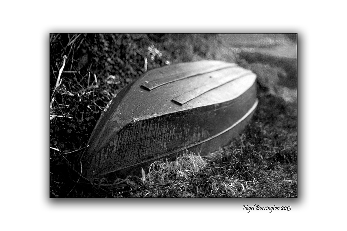
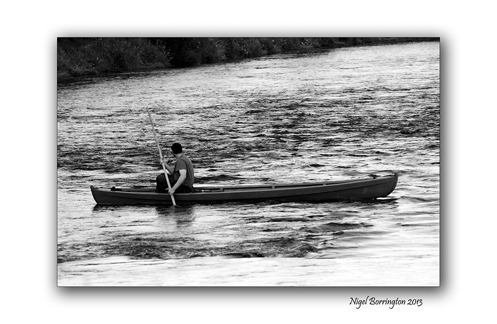
The Boat men of the river Suir

Fishing boat
river Suir
County Tipperary
Fishing on the River suir
The walk along the river Suir, County Tipperary is one of the best river walks in the south east of Ireland. It is currently undergoing an upgrade to a hard surface that will for the first time allow for both walkers and cyclists.
The river is used by many local people during the year but the fisher man are most probably it’s most common visitors, the River is renowned for its game angling, holding both salmon (Salmo salar) and brown trout (Salmo trutta).
I have taken many photographs of the fishermen here over the years alone with the boats they use for their fishing, these boats ( all made locally ) are used more like punts as the have a completely flat bottom and are moved along the river with a pole.
Fishing in Ireland : CLOCULLY TO CARRICK-ON-SUIR
The River Suir from Clocully to Carrick-on-Suir is a combination of deep pools, fast glides and varying widths and depths.
From Clocully to Ballydonagh, a consortium of private landowners control the angling, these are all private fisheries. This stretch also includes parts of the River Tar and River Nire, which contain good stocks of trout of up to 30 cm.
Fishing on the river Suir : Gallery


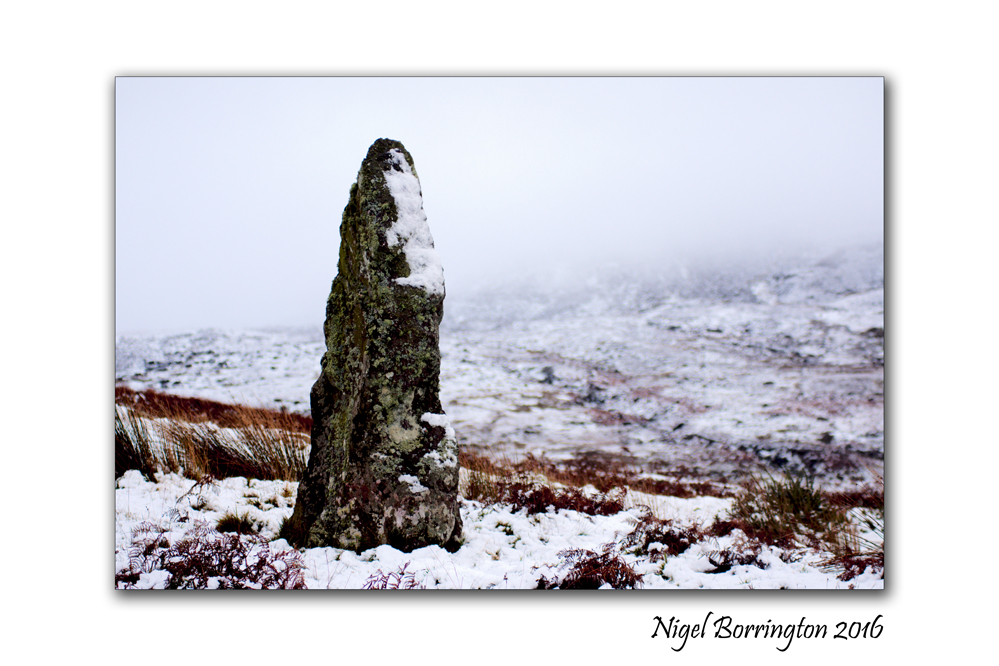
Irish standing stones : Carrigeen, Nire Valley, County Waterford
Irish standing stones
Carrigeen
Nire Valley
County Waterford
Irish Standing stones : Carrigeen,
Carrigeen standing stone is among the best located stones in Ireland. It stands in a superb location at the top of the picturesque Nire valley from where there is magnificent panoramic views of the surrounding mountainous region. On the day this image was taken it was -2 degrees and the mountains had a thick covering of mist.
The stone stands some height, an impressive 2.5 meters and tapering to a sharp point. It stands solidly upright and is oriented in a WNW-ESE direction.
An interesting observation here, was when looking westwards, that the jagged crest of the stone seemed to align somewhat with the distant profile of the mountain ridge to the west. (see photo below). This may be just coincidental or was it of significance and could this jagged profile of the stone have survived through thousands of years?
Apart from this speculation, Carrigeen standing stone and its surroundings is a ‘must see’.
The first Snow of the Winter , Gallery

Irish Landscapes
Nire Valley
County Waterford
Nigel Borrington
This Morning many parts of Ireland awoke to the first Snows of the Winter, Snow in November while not unusual is early for Ireland. Maybe its a sign of the winter weather that’s ahead of us, in any-case I just had to get out this morning and capture as many images as I could 🙂
Here are just a few from an early morning walk through the Nire Valley , county Waterford …….
Nire Valley , County Waterford – the first Snows of Winter


A sketch of the old farm house, Keem Strand, Achill island, County Mayo
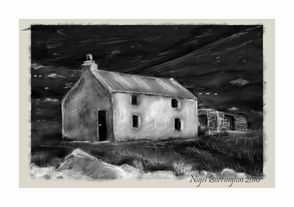
Old Farm house
Keem Strand
Achill Island
county Mayo
Nigel Borrington
Created using a Wacom Mobile Studio table …..
Irish Castles : A Lament for Kilcash – Monday Poetry

Irish Castles
Kilcash castle
Nigel Borrington
A Lament for Kilcash
Now what will we do for timber,
with the last of the woods laid low?
There’s no talk of Cill Chais or its household
and its bell will be struck no more.
That dwelling where lived the good lady
most honoured and joyous of women
– earls made their way over wave there
and the sweet Mass once was said.
Ducks’ voices nor geese do I hear there,
nor the eagle’s cry over the bay,
nor even the bees at their labour
bringing honey and wax to us all.
No birdsong there, sweet and delightful,
as we watch the sun go down,
nor cuckoo on top of the branches
settling the world to rest.
A mist on the boughs is descending
neither daylight nor sun can clear.
A stain from the sky is descending
and the waters receding away.
No hazel nor holly nor berry
but boulders and bare stone heaps,
not a branch in our neighbourly haggard,
and the game all scattered and gone.
Then a climax to all of our misery:
the prince of the Gael is abroad
oversea with that maiden of mildness
who found honour in France and Spain.
Her company now must lament her,
who would give yellow money and white
– she who’d never take land from the people
but was friend to the truly poor.
I call upon Mary and Jesus
to send her safe home again:
dances we’ll have in long circles
and bone-fires and violin music;
that Cill Chais, the townland of our fathers,
will rise handsome on high once more
and till doom – or the Deluge returns –
we’ll see it no more laid low.

Kilcash Castle located on the county Kilkenny / Tipperary boarders but firmly in county Tipperary is one of the most haunting places to be found locally. It has a long history that started with its construction in the sixteenth century by the wall family who latter passed it on to the Butlers of Ormond who much latter sold it to the Irish State in 1997 for £500
Brief History of Kilkash castle and the Poem
By the late 20th century Kilcash Castle was in a dangerous state of repair, and it was sold to the State by the trustees of the Ormond estate for £500 in 1997. It is undergoing extensive structural repairs to save it from collapsing. But this means it is covered in scaffolding and the site is closed off to visitors.
The author of the popular Irish poem and song Cill Chaise (Kilcash) casts himself back in time to mourn the death of Margaret Butler, the former Lady Iveagh, in 1744. Her death moves the writer to lament her tolerance and to compare the cutting down of the woods of Kilcash with the destruction of the Gaelic way of life.
But the woods were not destroyed by the English, but through their sale by the Butler family, who needed the income to supplement their new lifestyle in Kilkenny Castle.
Traditionally, the poem has been attributed to Father John Lane, Parish Priest of nearby Carrick-on-Suir, who was educated for the priesthood at the expense of the former Lady Iveagh, the deagh-bhean or good lady in the song. However, the dating is misplaced, for Father Lane died in 1776 and the sale of the timber at Kilcash was not advertised in local newspapers until 1797.
Although the timber was sold off between 1797 and 1801, the earliest manuscripts of the text do not appear for another 40 years, which means Cill Chaise was written no earlier than the early 1800s, but perhaps much later. The air seems to be Bliadhin ’sa taca so phós mé (This time twelve months I married), which was collected by George Petrie in Clare and published in 1855.

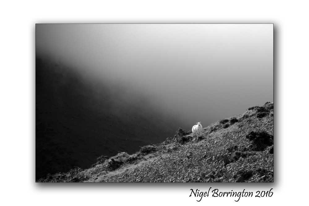
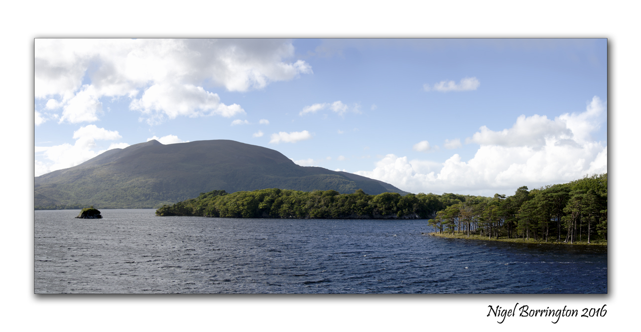
Irish Landscapes , Mountain sheep, carrauntoohil, Macgillycuddy’s Reeks, county kerry
Irish Landscapes
carrauntoohil Mountain
Macgillycuddy’s Reeks range
county kerry
Nigel Borrington
“Sailing to Byzantium” a poem by William Butler Yeats

Muckross lake
lakes of Killarney
Irish landscape Photography
Nigel Borrington
Sailing to Byzantium
by William Butler Yeats
That is no country for old men. The young
In one another’s arms, birds in the trees
– Those dying generations – at their song,
The salmon‐falls, the mackerel‐crowded seas,
Fish, flesh, or fowl, commend all summer long
Whatever is begotten, born, and dies.
Caught in that sensual music all neglect
Monuments of unageing intellect.
An aged man is but a paltry thing,
A tattered coat upon a stick, unless
Soul clap its hands and sing, and louder sing
For every tatter in its mortal dress,
Nor is there singing school but studying
Monuments of its own magnificence;
And therefore I have sailed the seas and come
To the holy city of Byzantium.
O sages standing in God’s holy fire
As in the gold mosaic of a wall,
Come from the holy fire, perne in a gyre,
And be the singing‐masters of my soul.
Consume my heart away; sick with desire
And fastened to a dying animal
It knows not what it is; and gather me
Into the artifice of eternity.
Once out of nature I shall never take
My bodily form from any natural thing,
But such a form as Grecian goldsmiths make
Of hammered gold and gold enamelling
To keep a drowsy Emperor awake;
Or set upon a golden bough to sing
To lords and ladies of Byzantium
Of what is past, or passing, or to come.
Irish Landscape Images : lough callee, Carrauntoohil, Macgillycuddy’s Reeks, County Kerry
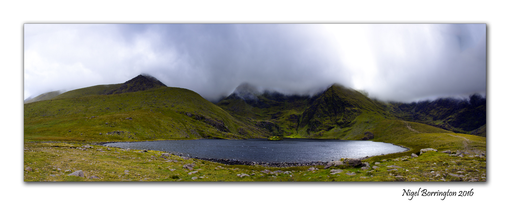
lough callee
carrauntoohil Mountain
Macgillycuddy’s Reeks range
county kerry
panorama By Nigel Borrington
Carrauntoohil (/ˌkærənˈtuːl/, Irish: Corrán Tuathail)
The highest peak on the island of Ireland. Located in County Kerry, Ireland it is 1,038 metres (3,406 ft) high and is the central peak of the Macgillycuddy’s Reeks range. The ridge northward leads to Ireland’s second-highest peak, Beenkeragh (1,010 m), while the ridge westward leads to the third-highest peak, Caher (1,001 m). Carrauntoohil overlooks three bowl-shaped valleys, each with its own lakes. To the east is Hag’s Glen or Coomcallee (Com Caillí, “hollow of the Cailleach”), to the west is Coomloughra (Com Luachra, “hollow of the rushes”) and to the south is Curragh More (Currach Mór, “great marsh”).
The summit of Carrauntoohil
Carrauntoohil is classed as a Furth by the Scottish Mountaineering Club, i.e. a mountain greater than three thousand feet high that is outside (or furth of) Scotland, which is why it is sometimes referred to as one of the Irish Munros.
The Macgillycuddy’s Reeks also contains many loughs of which lough callee is just one, the image above was taken last week while approaching the devils ladder route up to carrauntoohil Mountain peek. The morning was misty yet lots of wonderful light was finding its way on the the green slopes and the deep water of the lough, the mountain top is some distance above this level and hidden in the mist ……
Irish Landscape photography , 7 days in county Kerry

Carrauntoohil
County Kerry
Irish Landscape Photography
Nigel Borrington
Just returned from a seven day family Holiday in County Kerry, what a wonderful part of the world county Kerry is 🙂
I will share lots more images but here are just a few ……


Landscape Art works : Ancient Rome, engraved by A. Willmore published 1859–61

Artwork details
Artist : After Joseph Mallord William Turner 1775–1851
Title : Ancient Rome, engraved by A. Willmore
Date : Published 1859–61
Medium : Engraving on paper
Collection : Tate
Acquisition: Transferred from the British Museum 1988
Its a good while since I posted here about some of my most loved artists and art work, I want to start again to share some of my most liked works of art over the next weeks.
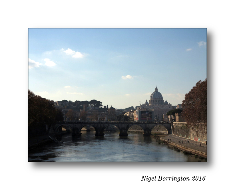
River Tiber
Rome
Nigel Borrington
I last visited Rome in December 2015 and took a few landscape images along the banks of the river Tiber, this river is a great location for photographers and artists alike.
Some years back while I was studying art history, I took a close look at the art work created by many artist who lived in Rome or who had visited this great city and done their best to capture its atmosphere.
Art work such as this great engraving by A. Willmore in the style of J._M._W._Turner, this is a fantastic etching as it captures the river and it location perfectly, live along the river banks.
it is not to hard to imaging this work as a great black and white print in modern terms.
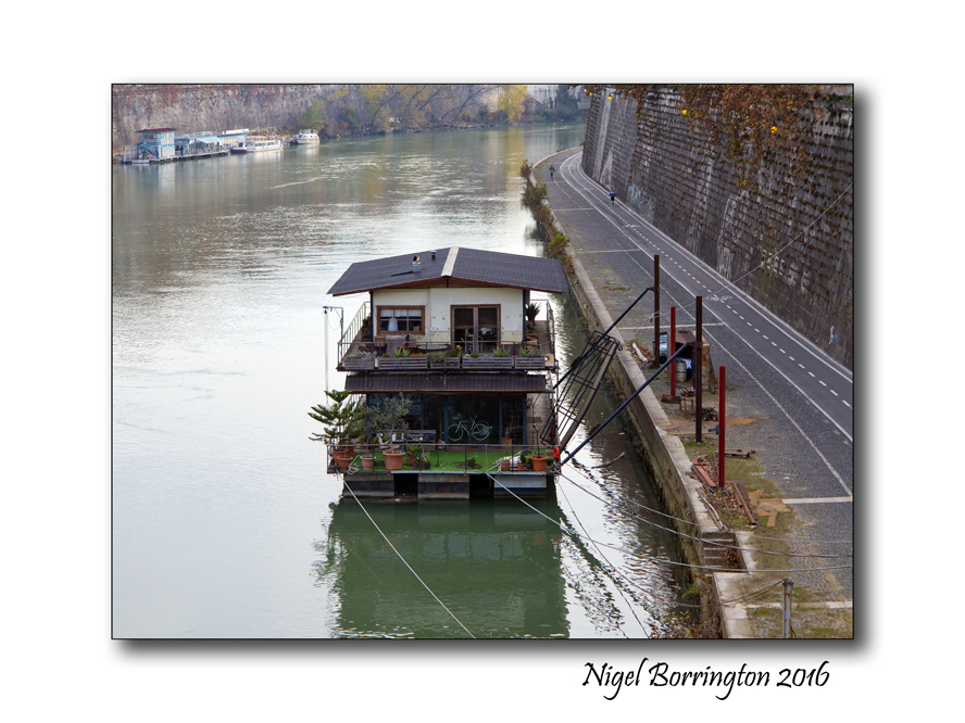
Life along the river bank
River Tiber
Rome
Nigel Borrington
Today the river Tiber is still used in many of the same ways as you can see in this drawing, it is now even the home to many people who live in house boats. the banks are today acting as walking routes and cycle paths.
Irish Landscape Photography – Ireland in September
Irish Landscape Photography
This Gallery of Landscape Images is a collection of some of my favourite places to take Landscape photographs, they are images taken in the months of September over the last three years …..
Ireland in September


Friday Poetry : in the Valley Of Slievenamon , Charles Joseph Kickham

The Valley Of Slievenamon
Irish Landscape Images
Nigel Borrington
Alone, all alone, by the wave-washed strand
All alone in the crowded hall
The hall it is gay, and the waves they are grand
But my heart is not here at all.
It flies far away, by night and by day
To the times and the joys that are gone.
But I never will forget the sweet maiden I met
In the valley of Slievenamon.
It was not the grace of her queenly air
Nor her cheek of the rose’s glow
Nor her soft black eyes, not her flowing hair
Nor was it her lily-white brow,
‘Twas the soul of truth, and of melting ruth
And the smile like a summer dawn
That sold my heart away on a soft summer day
In the valley of Slievenamon.
In the festival hall, by the star-washed shore,
Ever my restless spirit cries.
‘My love, oh, my love, shall I ne’er see you more.
And my land, will you never uprise?’
By night and by day, I ever, ever pray
While lonely my life flows on
To see our flag unfurled and my true love to enfold
In the valley of Slievenamon.
Charles Joseph Kickham
Poems by Charles Joseph Kickham
Wildlife Study, the swans at Langley Park
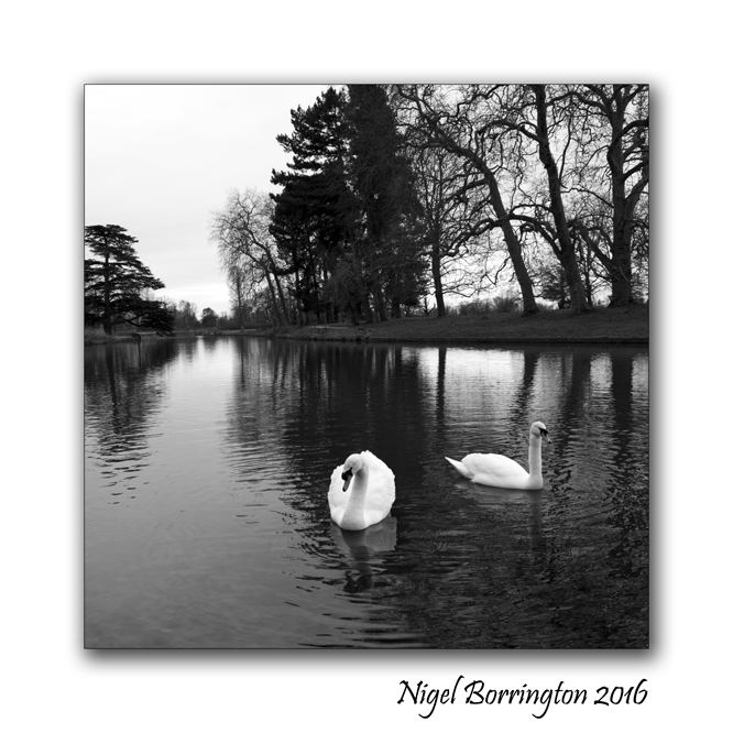
A Study of Wildlife
Swans
Langley Park
Iver Heath
LANGLEY PARK
Langley Park is a beautiful place to ‘escape from it all’ from taking the dog for a walk to go horse riding, cycling or just walking. you can relax with a picnic by the lake or under the beautiful trees and simply watch the world go by. With patience you may even be lucky enough to see some of the wide variety of wildlife in the park such as deer and foxes along with the Swans, and if you listen carefully you can hear the Great Spotted Woodpeckers tat tatting on many of the veteran trees.
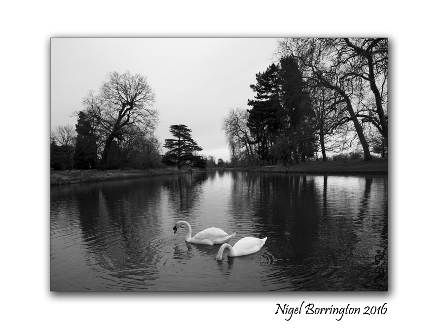
Langley Park is located off the Uxbridge Road (A412), Iver, Bucks, SL0 0LS, and is on the opposite side of the road to Black Park. The car park is in Billet Lane, which is the first turning on the left after the Tesco garage if coming from the Crooked Billet Roundabout.


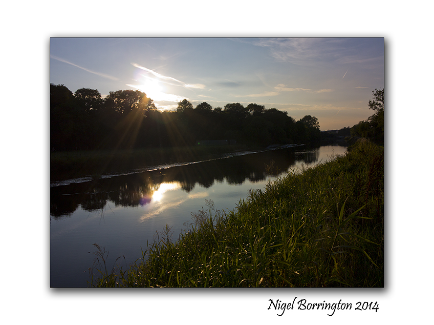
Irish Landscape Photography, River Dawn, County Waterford

Irish Landscape Photography
River Dawn
County Waterford
Nigel Borrington
Irish Landscapes

The Landscape of Ireland is some of the most idyllic on the European continent, counties Kerry and Mayo have some of the most stunning mountains and the west coast along with west cork have some of the most beautiful beaches and coast line. The North is wild in the winter months and county Wexford warm and sunny in the summer. While this is all very true and these places are great to visit, very few People live in these remote locations.
For most of us who live here it is landscapes like the one above (The River Dawn) that we get to see and visit most often, the local countryside with its low lying farm-land and rivers that flow slowly through it. Rivers like the River Dawn in the picture above that flows through county Waterford before joining the River Suir close to waterford city.
Even though I love to visit the most iconic places here, it is the everyday landscapes I love to photograph the most …..

river Dawn Joins the river Suir
county Waterford
Nigel Borrington
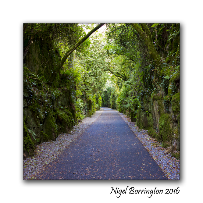
Welcome to the Deise Greenway, County Waterford

The Deise Greenway
County Waterford
Ireland
Irish Landscape Photography : Nigel Borrington
The Waterford / Deise Greenway
The Amazing new Deise Greenway is almost completed and for anyone who has not heard about this new public cycle and walking path in county Waterford Ireland, here is some basic information !
The History of the Greenway – A Railway history
Waterford to Dungarvan
The Railway Line from Dungarvan to Waterford was constructed during the 1870’s and was officially opened on the 12th August 1878 with the first train departing Waterford at 10.10 and arriving at Durrow just over an hour later.

The building of the Railway was a remarkable project in that it had to be contructed over very harsh terrain. From the Dungarvan side, two causeways had to be contructed, one over the Colligan estuary and one through the sea at Barnawee, a very impressive viaduct has to be built at Ballyvoile and an even more impressive tunnel, 480 yards long, fully lined was constructed just a little further down the line. Another viaduct at Kilminnion and an almost 100 feet high curved viaduct at Kilmacthomas to name just a few. It headed down towards the lovely station at Kilmeaden and then on the riverbank of the River Suir below Mount Congreve into Waterford City.

The Railway line was not just of national importance, it was also our line with the UK with many Irish people emigrating there but many used it to come over and back. In March 1967, the last passenger train left Dungarvan station for Rosslare. But it reopened again with the opening of the Magnesite ore processing plant at Ballinacourty but this plant closed in 1982. Engineers ran occasional locomotives on the line up until 1990.

CIE own the line but Waterford County Council acquired a license from them at the start of this century to make it into a pedestrian walkway/cycle path for tourism and leisure.
It has impressive history, a history we can not neglect by not taking an interest in the line, we need to preserve it for the people as an amenity for the people.
Rebirth of the rail line – The Deise Greenway
The Deise Greenway is almost complete so last weekend we took a walk along the section from Ballyvoyle brick-lined tunnel down to Dungarvan Bay. This section of the route is just fantastic to walk as it induces the Ballyvoyal tunnel and viaduct and then the wonderful views of the waterford coastline above the town of Dungarvan.
Below are some of the pictures I took on Sunday ……
Gallery


Irish Landscape photography , The path to the beach – County Kerry

Irish Landscape Photography
Brandon Point
County Kerry
Nigel Borrington
The Path down to the Beach at BallyQuin, Brandon, County Kerry Ireland


Solo images : Jameson Irish Whiskey , County Cork – The Mash
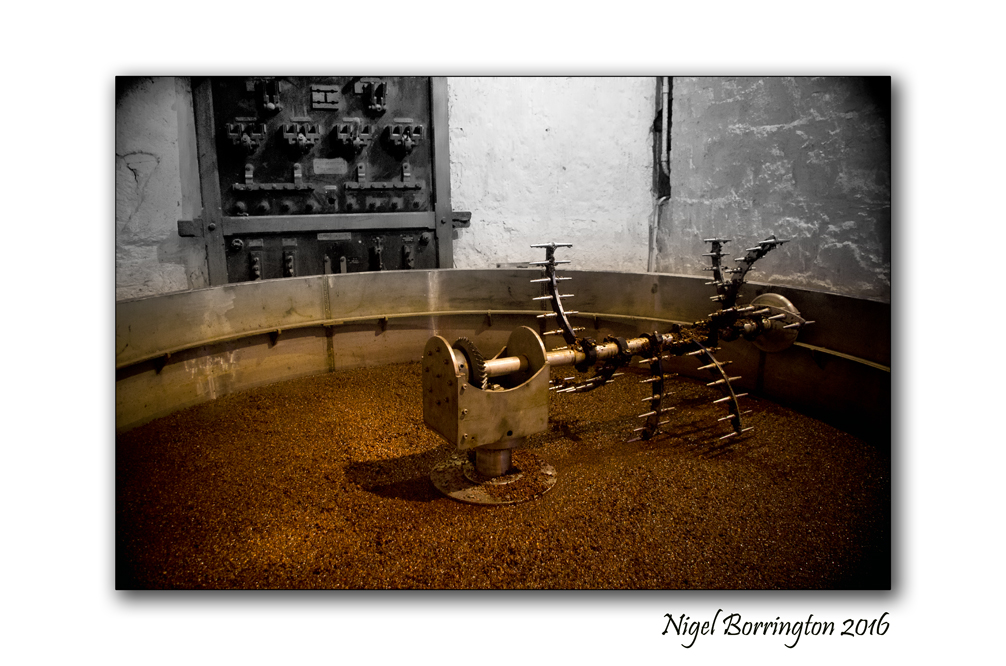
Jameson Irish Whiskey
The Mash
Nigel Borrington
The Whiskey mash
A mechanical metal stirring unit with a central bevel gear, installed to make stirring easier. That way the sugar could not only be extracted faster but also more efficiently. Less sugar was left in the husks of the grain, and the whisky became more affordable.
The mash has to be stirred for some time to extract the malt sugar from the grist. In earlier times, a lot of water used to evaporate during this process, and with the water steam the temperature fell constantly, which further impaired the extraction process. Only in the last century, when energy costs rose, nearly all mash tuns were equipped with a lid made of sheet metal (e.g. copper) in order to limit the loss of energy.
Irish landscape photography : A weekend in the Landscape.

Its the weekend so why not get outside and see the places you always wanted to !
Have a great weekend whatever your doing 🙂


Tramore Beach in Time and the “Princess Of The Sea”, Anne-Lise Andresen and Liam Mc Daid
Tramore Beach
Far away in time
Irish Landscape
Nigel Borrington
– The Princess Of The Sea –
A Collaborated Poem
Anne-Lise Andresen and Liam Mc Daid
On the beach I found a seashell
luster of colors mixed with gold illuminate
Washed by the sea millions of times
tides turn as gentle footprints remain
I sit and ponder, how could it happen
salt breeze within an ocean’s breath inhales
A journey of unimaginable time
drifting murmurs echo against waves crashing
In the sunlight it shone with many shades
satin pearl treasure heart between two shells
Carefully I opened and found its soul
it was then as one on whitewashed wings we flew free

I found a beautiful princess of the sea
Upon a sigh or dream revealed its inner secret
A Collaborated Poem
Anne-Lise Andresen and Liam Mc Daid

A week in Seville , Spain
Seville
Spain
Nigel Borrington
Just returned from a great weeks Holiday in Seville , Spain.
What a wonderful and historic city it is with its great cycle friendly streets, churches, royal palaces and rivers. I will post more on individual places but for now here are just some on the many places I visited and images I took.
Share this:
February 7, 2017 | Categories: Cityscape, Comment, Seville, Travel Locations | Tags: city visits, holidays, Nigel Borrington, Seville, spain | 3 Comments