
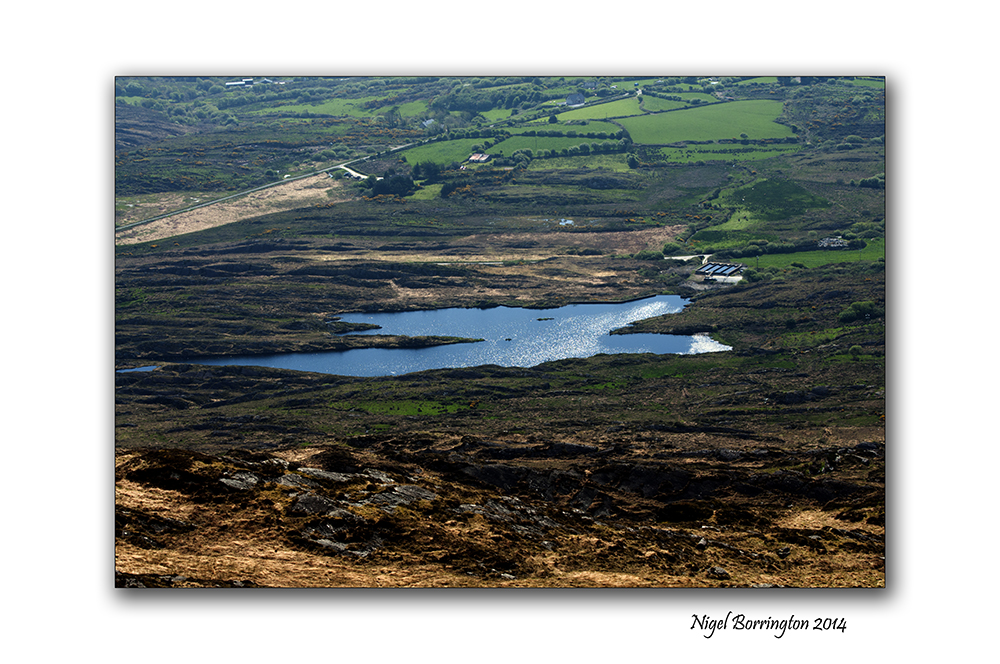
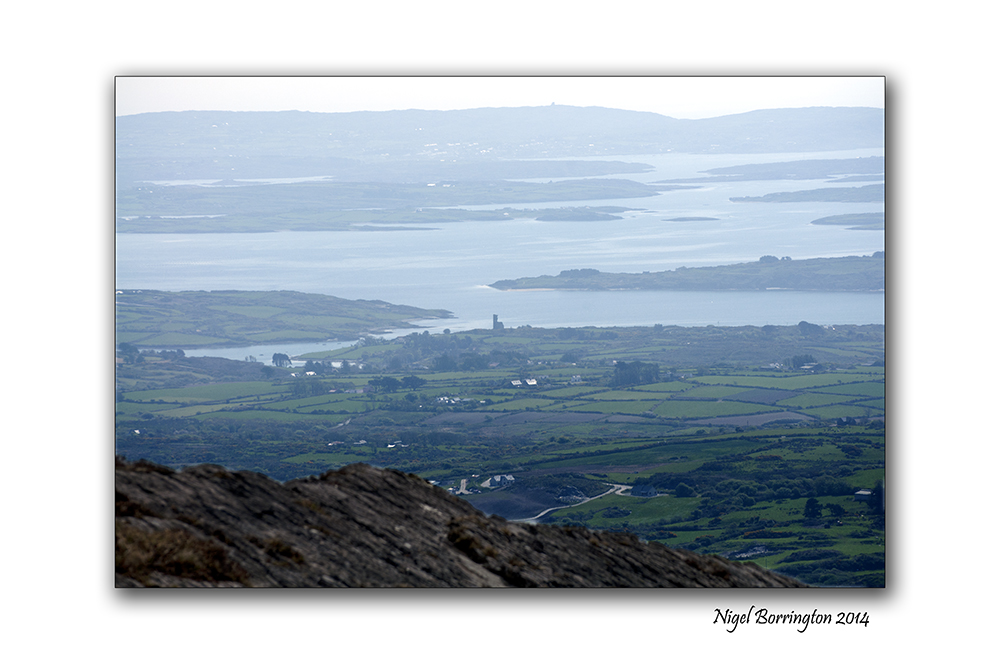
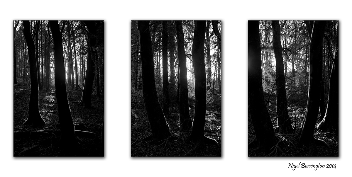
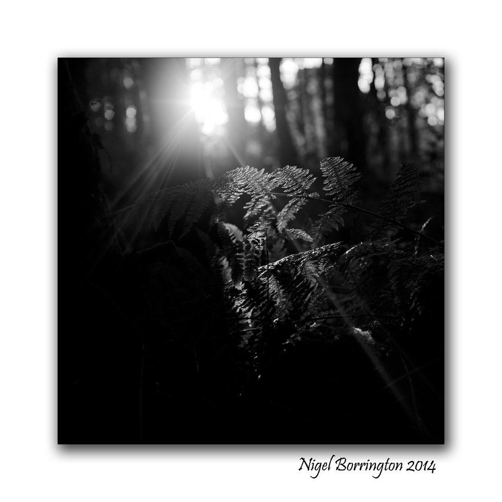
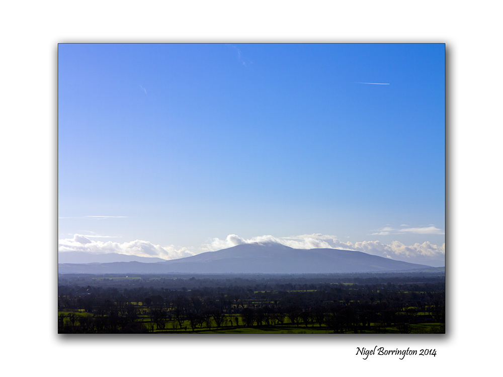
Going Square format

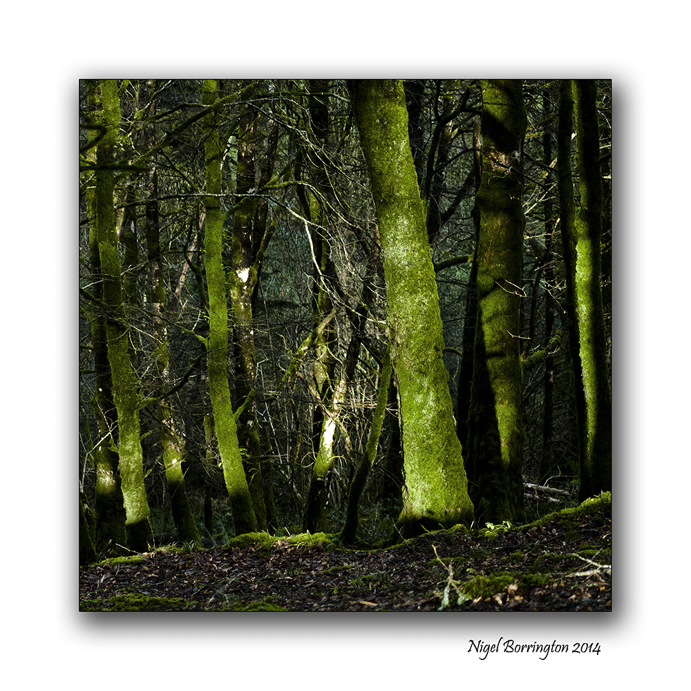
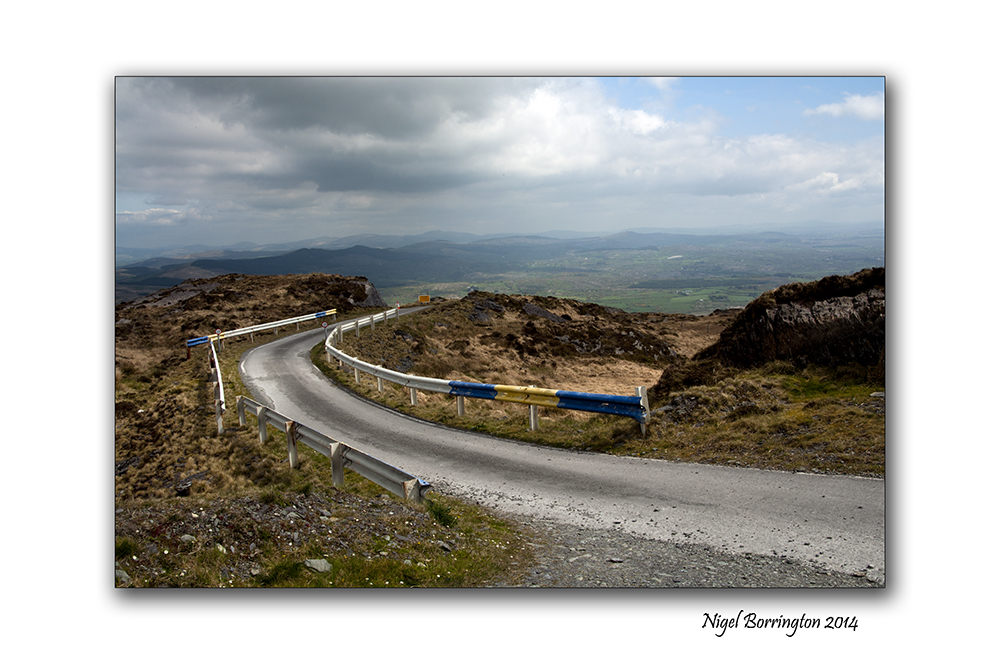
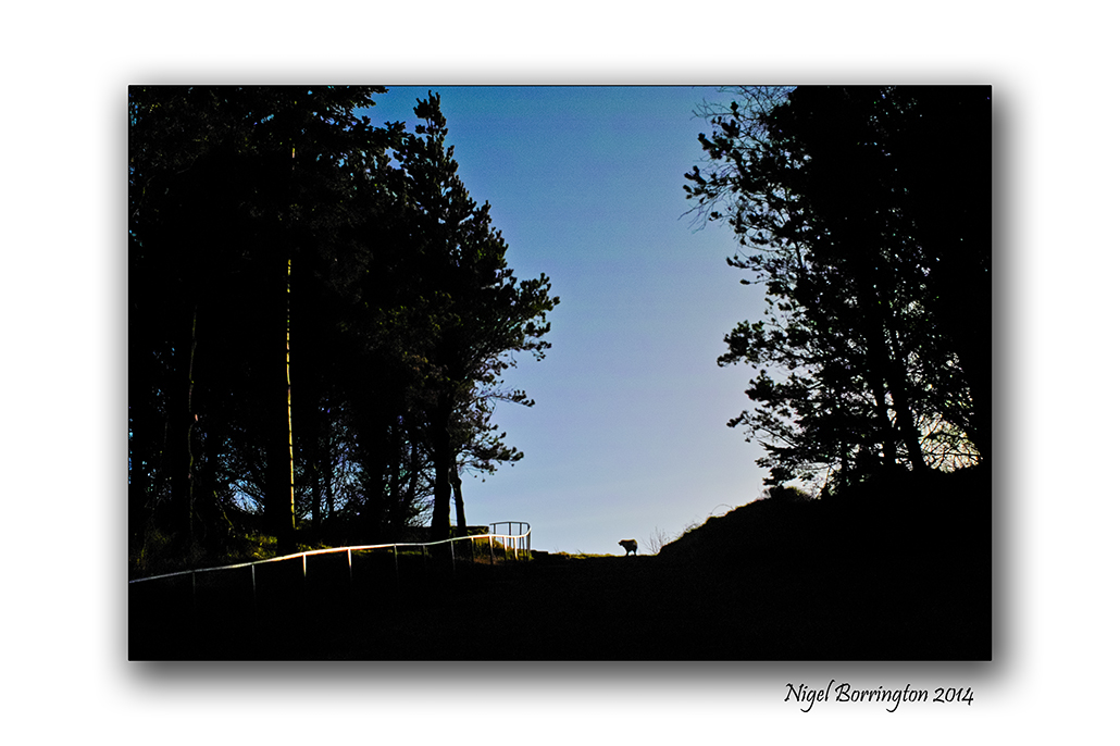
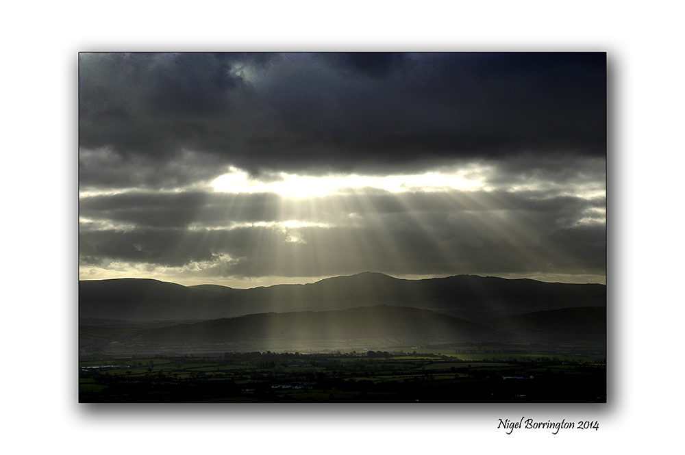
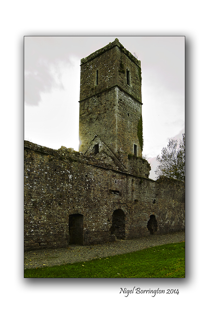
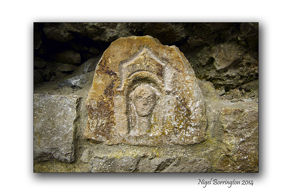
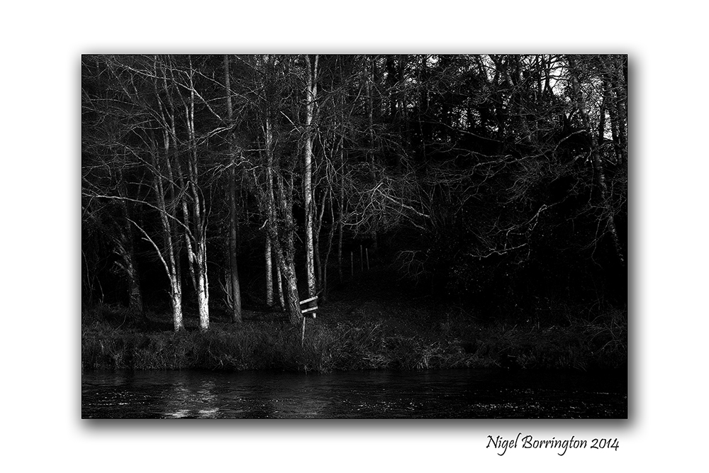
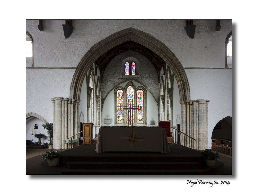
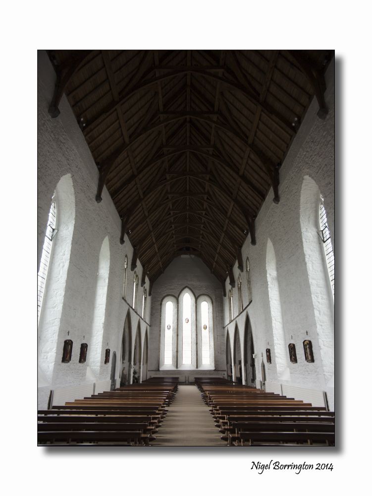
The Grange viewing point , County Tipperary
Landscape Photography : Nigel Borrington
Square format in the landscape

The concept of Square format images in photography dates back to its beginnings.
The idea of using this format makes great sense when you think about it, a lens placed at the front of the camera produces a fully round image so the idea of drawing a square in the centre of this circle and using this square for image produced on an exposed sheet of film would appear to make the best use of the lens for the final image.
In film cameras a camera that produces a square image is usually referred to as a 6×6 or 12×12, these figures referring to the size of the exposed film area. I have used and owned different 6×6 film camera using one during my photography course and for sometime after.
These are the basics of square format film cameras , today most Digital cameras work in a 6×4 image format, meaning that one side of the final image is 1/3 bigger in its dimensions that the other. Some digital cameras however (Such as the Canon G1 x) offer format options, because a sensor unlike film uses pixels to measure its dimensions, square format is now called 1×1.
Working with a digital camera in Square format your most likely going to use the LCD screen on the back of the camera to frame your image, cameras with electronic viewfinders however will show you the same 1×1 view of your subject. A camera with an optical view finder most likely cannot show you the view you need.
If you camera cannot work in anything other that 6×4 format , one trick if you want to produce a square image is to get some scotch tape and use it to square off the live view image that you see on you LCD screen, this will at least let you frame you image for this format.
Square format in the landscape
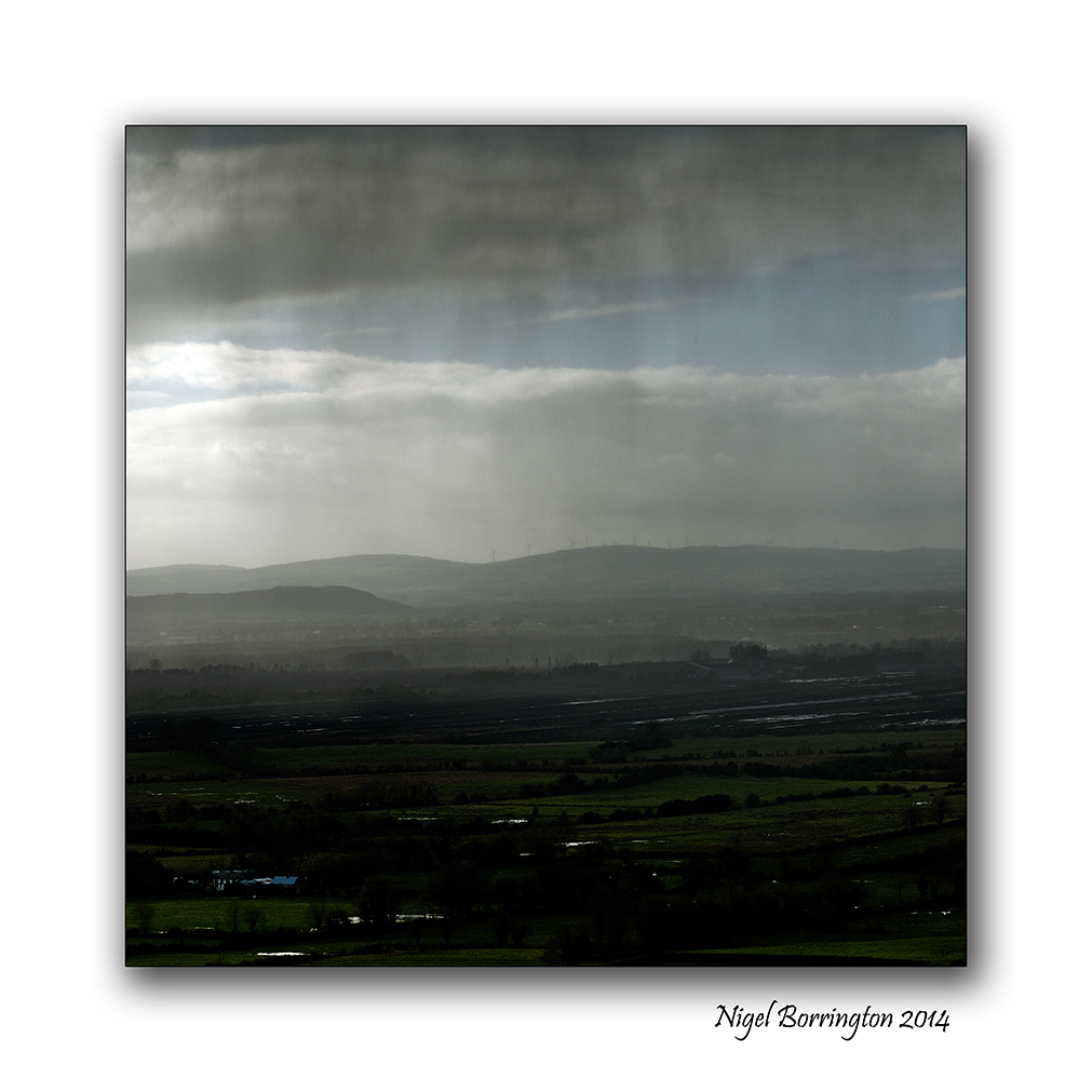
Ok, so that’s a little bit about the history of this image format and how to produce images using it today, so what about the landscape images produced in Square format.
Yesterday, I took my Canon G1x out on a walk and set it up for a 1×1 image size, Personally I really like using this format.
Many Landscape photographers don’t and I fully understand why, the main reason is that you do not get the same width to your images, this width would appear to be a basic feature of producing a Landscape photo. The idea of removing 1/3 of the image width would appear to be to limiting and it can be, but not always.
Personally I feel the very benefits that come with wide landscape images can also be a problem, some images need to be restrained in their content to reduce distraction, a square format is a great solution.
I feel that with a square image you gain the exact same hight to your image and this lets you include tall features like poles and trees or an old house , yet you can more easily confine your image to just these main subjects.
I have done my best in the images below to try and explore this and show what I feel is the benefits to going square format with your camera.
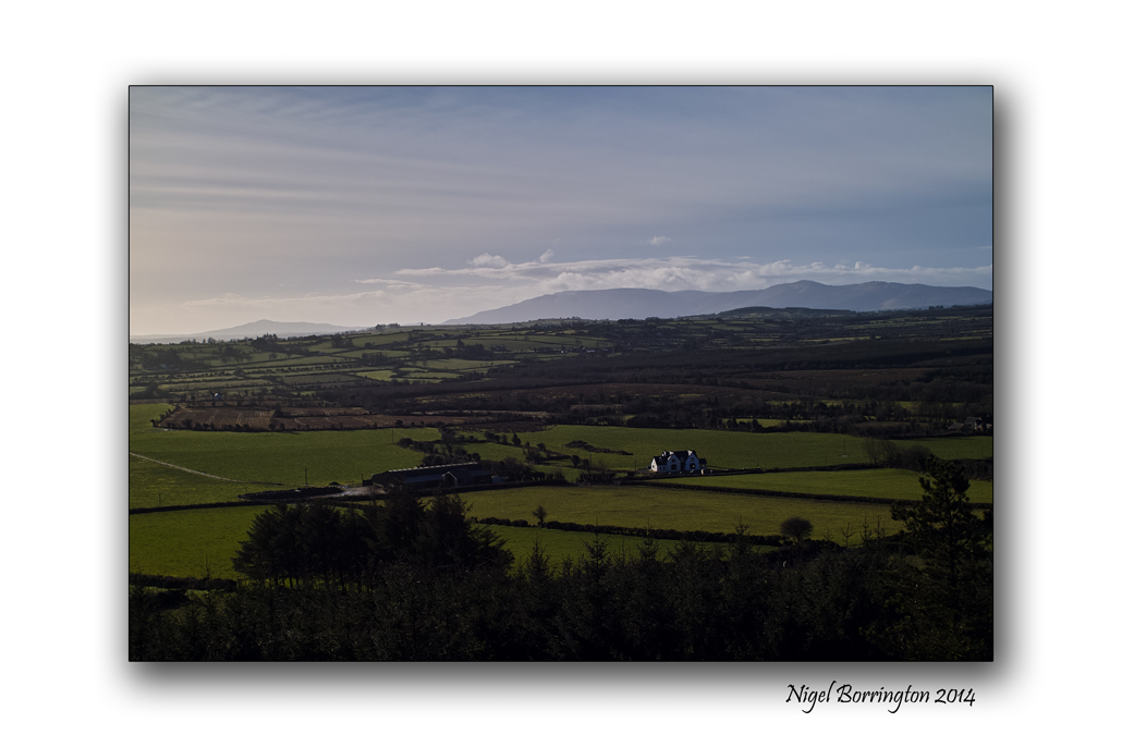
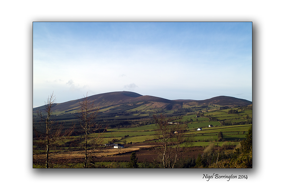
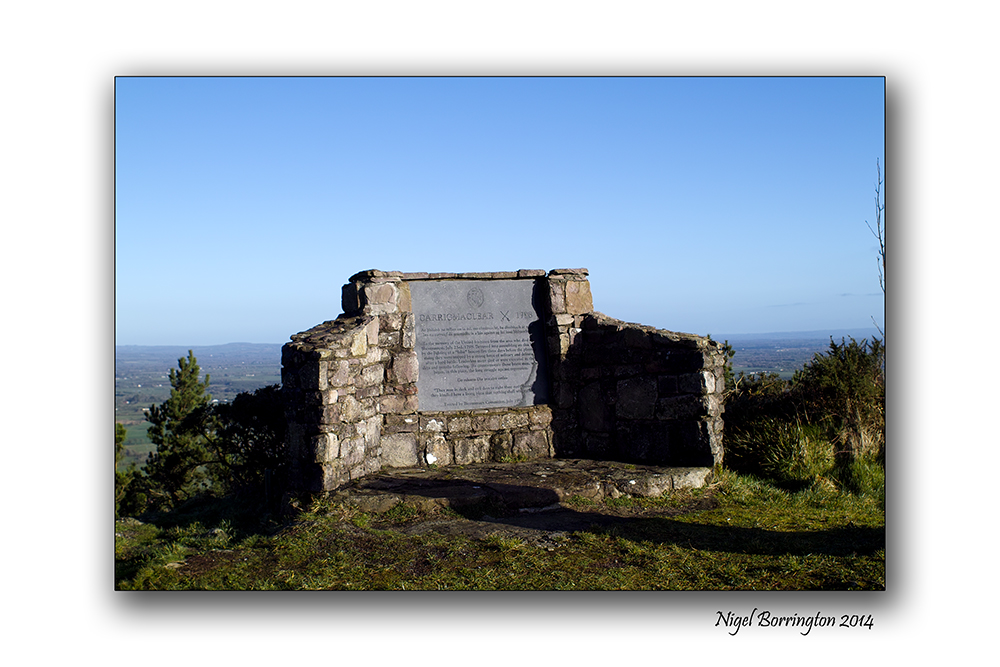
Square format Gallery


Mount Gabriel, County Cork
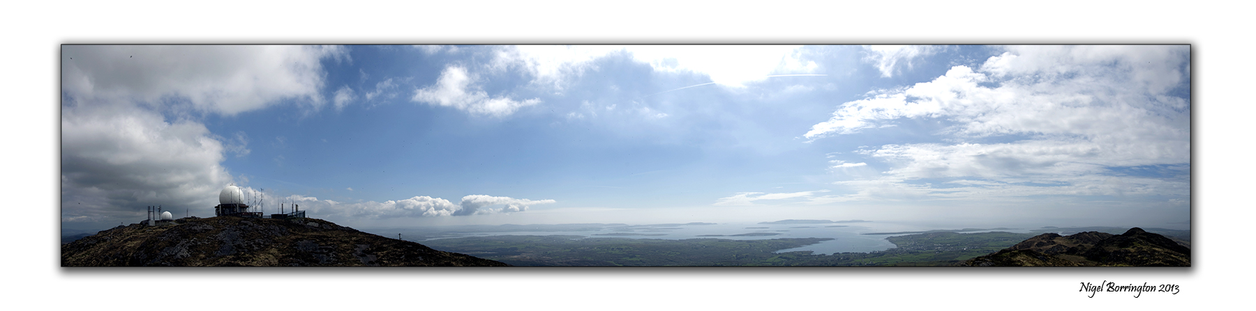
Mount Gabrial, county Cork
Irish Landscape Photography : Nigel Borrington
Mount Gabriel, (Cnoc Osta in Irish) is a mountain on the Mizen Peninsula to the north of the town of Schull, in West Cork, Ireland.
The Mountain is some 407m high and is the highest in the region of west cork, you can use a roadway that services a air traffic control radar to walk or drive to the top.
From the peak of Mt. Gabriel, there are spectacular views South over Schull Harbour and Long Island Bay. To the east and southeast, the views take in Roaring Water Bay and its many islands, popularly known as Carbery’s Hundred Isles. North and West is a panoramic view of the mountains of the Beara Peninsula and South Kerry.
The day we visited it weather was warm and very clear and we got some great views, this is a wonderful walk to do if you are in West cork and one that you will not forget, on a clear day you can see the entire county and all the Peninsulas of west Cork and Kerry to the north.
Mount Gabriel, County Cork, A Gallery


Stradbally cove and caves, County Waterford

Stradbally Cove and caves, County Waterford
Irish Landscape Photography : Nigel Borrington
The cove at Stradbally, County Waterford is on of my favourite places to visit along the coast line of souther Ireland, it a deep cove that contains some wonderful little caves that have a long history, Most likely used for smuggling goods in the past.
These days they more used to take shelter from bad weather or just sit in and enjoy for views of the blue sea here , they are a great feature well worth a visit.
Stradbally Cove and cave: Gallery


Warmer days, down by the river.

The River Suir, May 2013
Irish Landscape Photography : Nigel Borrington
Today could the the first day for weeks that we get no rain, the forecast is for a completely dry day, so in a effort to get my mind away from the bad weather I want to post some images from one of my best loved walks in the south east of Ireland.
These images are from May 2013 and show the River Suir in county Tipperary as she winds her way slowly towards the coast at Waterford Harbour, Myself and our Dog Molly do this walk many times but May just has to be one of the best Months. Life has returned to the river Banks with many birds and flowers returning. Molly just loves this walk as it offers her the chance to swim and walk along the river path for some miles.
These images show the views that will soon exist here and the recent floods will be a long forgotten part of this rivers annual cycle.
May on the River Suir, Gallery :


Two canal locks and one old Tamron 24mm lens.

Tamron Adaptall 24mm f2.5 lens
Two Locks one lens many years of enjoyment
For some 40 years I have been taking Landscape photographs in both the UK and Ireland, one of the very first lenses I purchased when I first got a Nikon 35mm film SLR, was this 24mm F2.5 Tamron, wide angle Lens, purchased in 1987.
The images below are from a visit I made to Top side lock, near Berkhamsted, Hertfordshire in the south of England a wonderful old lock with a lock keepers house. The second image is from Ballyellin lower lock on the river Barrow, County Carlow , Ireland, taken in January this year.
Sometime keeping a hold onto equipment that you like using and that work very well, is far more important that searching for the new. Endlessly upgrading equipment has become the norm, we live in an age of none stop upgrades yet now and again it is still possible to keep a hold of the old and trusted things.
This lens works very well and in many cases even better now that its used with a digital camera body.
It is a manual focus lens yet because it contains all the focus and aperture details on the lens barrel it is very easy to use, you can set it up for what is known as Hyper-focus and shoot all day like this.
I just love using this lens and get a real kick from the fact it still works so well.
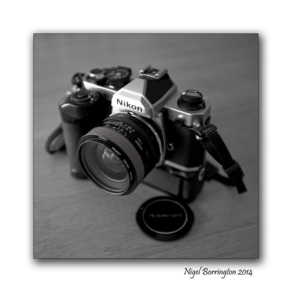
Tarmon 24mm f2.5, Nikon Manual exposure SLR film camera
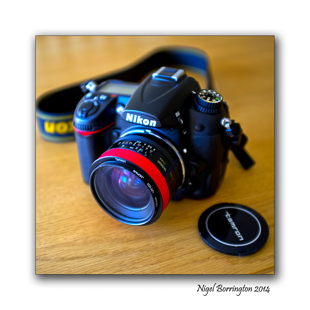
Tarmon 24mm f2.5, Nikon Digital SLR camera
Top side lock , Grand union Canal, Hertfordshire, United Kingdom


 .
.
Ballyellin Lower lock, County Carlow, Ireland


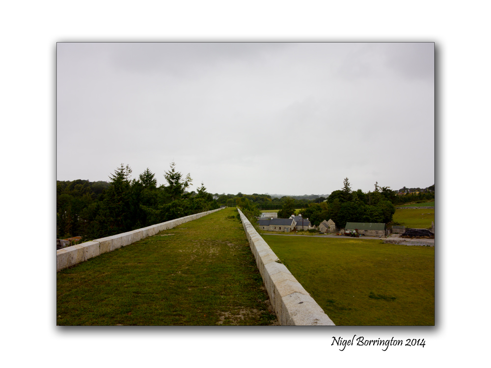
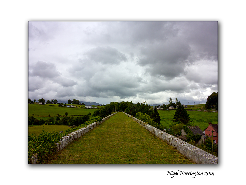
Borris Viaduct, County Carlow

Borris Viaduct, Co Carlow, Ireland
Irish Landscape Photography : Nigel Borrington
In January I visited the Viaduct in Borris, County Carlow.
The Viaduct is Located just north of the town and was an amazing construction for its day, back in the 1800’s this construction help link north county Carlow to county Wexford for both passenger transport and goods – daily , until 1947.
History

On the 1st January 1855 the first ground was cut near Borris, County Carlow, for what was to be the Bagenalstown County Carlow to Wexford, Railway.
However with expensive construction costs and difficult terrain the company only ever made it half way to Ballywilliam in county Wexford, shortly after going bankrupt with debts of £100,000.
After a period of failed ownerships the railway was sold for £24,000 by the board of works to GS&WR in 1876. Passenger services ceased on the 2nd Febuary 1931, a goods service remaining until 27th January 1947, CIE finally closed the line on the 1st January 1963, 108 years to the day after the first ground was cut near Borris.
Visiting the Location
The day I visited here it was very damp and cold as you can see in the images.
The Viaduct is located on a farm and is used as a public foot-path, access is through the grounds of a local school. The path up to the level that the rail line would have been on is steep but easy to walk up.
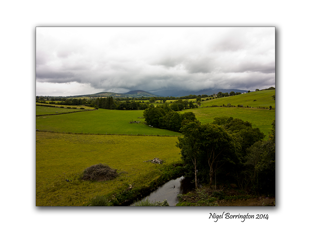
The first thing you notice is that the walls each side of the Viaduct and the path are very low and are not fenced, so you feel that you want to walk down the centre of the path. It is a good few hundred meters to the end of the Viaduct itself but the walk is well worth it as the views of County Carlow from here are spectacular !!
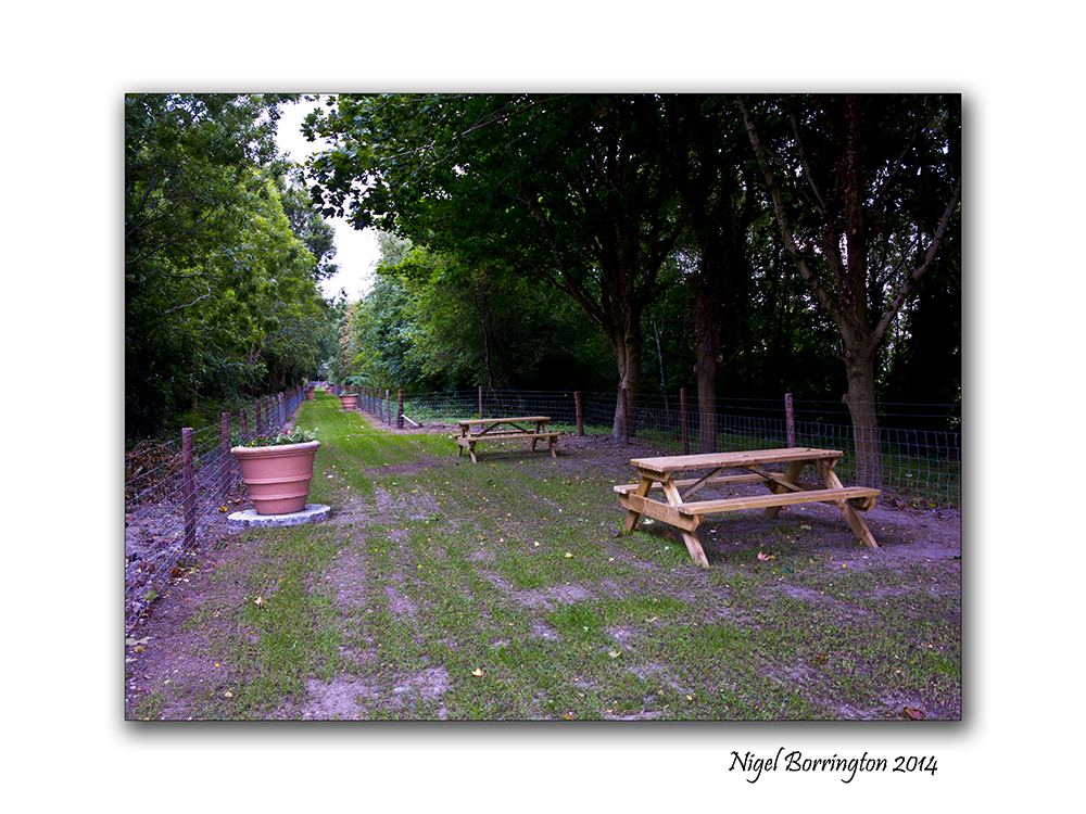
Once you reach the end of the path the old rail line cuts through some trees, there are picnic areas offering some great views of the county, at the end of this wooded part of the walk is a small bridge with a well kept garden and another picnic area.
You get the feeling that this is a much love and well kept area for the town and a pleasure to visit.
If you are in county Carlow you simply have to pay it a visit.
Location Gallery


A morning walk on the hill

Carrigmaclear hill, County Tipperary
Irish Landscape Photography : Nigel Borrington
This Morning the weather here was a welcome break from the days of rain we have been having since Christmas. Parts of the south of Ireland has been getting the
worst floods for over a hundred years.
This Morning however we had clear blue sky’s and a frost, I just had to get out early and take a walk. Carrigmaclear is a local hill near the mountain of SLievenamon , County Tipperary, the following images are taken on this mornings walk in the first light of the day.
Gallery

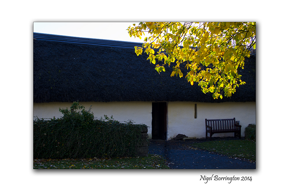
When I Am Among the Trees, Poem by : Mary Oliver
Castlemorris Woodlands , County KIlkenny
Irish Landscape Photography : Nigel Borrington
When I Am Among the Trees
by Mary Oliver
When I am among the trees,
especially the willows and the honey locust,
equally the beech, the oaks and the pines,
they give off such hints of gladness.
I would almost say that they save me, and daily.
I am so distant from the hope of myself,
in which I have goodness, and discernment,
and never hurry through the world
but walk slowly, and bow often.
 .
.
Around me the trees stir in their leaves
and call out, “Stay awhile.”
The light flows from their branches.
And they call again, “It’s simple,” they say,
“and you too have come
into the world to do this, to go easy, to be filled
with light, and to shine.”
Seeing into the light , By : Diana van den Berg
The Light through the clouds, Suir river valley , Tipperary
Irish landscape Photography : Nigel Borrington
Seeing the Morning light
By : Diana van den Berg
Dreaming into the light
swimming
flying
embracing
touching
the spreading awareness
warm light
light
losing self in the light
light
finding the harmony of balance
in namaste and ubuntu
and the messages of the clouds
in the light
light
spreading
amongst tall sunpainted autumn grasses
inhaling the unconscious grace
of a giraffe melting into
the late afternoon gold
of light caressing the shadows
and drawing them
into the light
light light…
Hookhead lighthouse , From day into night : Image Gallery

Hookhead lighthouse, county wexford
Irish landscape photography : Nigel Borrington
One evening a little time back , while staying in country Wexford, I visited the lighthouse at Hookhead.
I always wanted to visit this great lighthouse, just before dusk and at the point that the lights are turned on for the night. It was a great feeling to stand below the tower and experience the darkness arriving over the coastline of Wexford.
The following images show this transition from evening light to darkness over the open Celtic sea.
Gallery


Moor Abbey , County Tipperary

Moor Abbey, Co. Tipperary
Irish Landscape Photography : Nigel Borrington
Located in the beautiful Glen of Aherlow, looking out to the stunning Galtee Mountains are the ruins of Moor Abbey.
This Franciscan friary was founded in the 13th century by Donnchad Móir Ó Briain, King of Thomond (1210-1242). Historical evidence suggests that in 1471 a new church was constructed at the site, but that the following year it was destroyed by fire. The buildings that survive today date from this period.
The church consists of a nave and chancel, separated by a tall bell-tower. In the chancel is a double piscina for washing liturgical vessels. Beside the doorway in the north wall of the chancel is a stoup which contained holy water that would have served the friars entering the church from the sacristy which formerly stood to the north.
In 1541 the friary was dissolved and later became the property of John Fitzgerald, brother of the Earl of Desmond. In 1569, during a rebellion led by the Earl of Desmond, the abbey was burned by government soldiers led by Sir Humphrey Gilbert, originally from Devon and a half-brother of Sir Walter Raleigh. The following year Fr. Dermot O’Mulrooney and two other friars returned to the friary, but were murdered by government forces.
The south east of Ireland has many Abbey’s such as this one, Moor Abbey however is top of my personal list. I love a visit here , the Abbey is well kept and the location is just wonderful to spend some time in.
Moor Abbey a Gallery


Youghal lighthouse, county Cork

The Lighthouse at Youghal, county Cork
Irish Landscape Photography : Nigel Borrington
The lighthouse at Youghal’s, County Cork, is situated on the cliffs at the entrance to Youghal Bay.
The Geraldine owners of the town first built a tower on the site in 1202 and funded the nuns of the Chapel of St. Anne under the condition that they maintain the light in the tower.
his tower was demolished in 1848 to allow for the construction of the present lighthouse due to the large number of vessels using Youghal Bay – over 500 circa 1850.
The current lighthouse was built of granite and began working on 1st February 1852. It has since been automated with a light flashing every 2.5 seconds reaching a distance of 17 nautical miles miles from shore.
There are diving rocks below the lighthouse for those wishing to take a refreshing dip!
Gallery


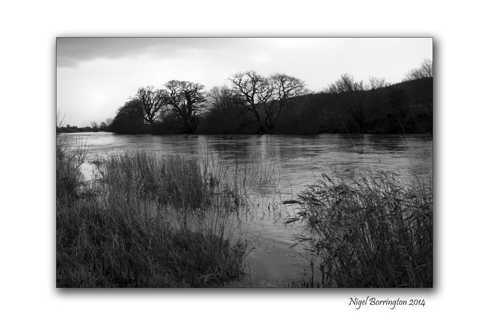
When the river is high , A black and white image Gallery

When the River is high, the river Suir, County Tipperary
Irish Landscape Photography : Nigel Borrington
The river Suir in county Tipperary is one place I just love to spend sometime, in the winter it floods and bursts its bands many times. During these times it wonderful to get very close to the river , to walk along its banks and see the fields along side flooded with river water.
These Images are from a walk taken yesterday afternoon, the weather this week is predicted to give even more rain, I may get time to return and see the effect that this will have on the river bank.
When The river is high, Black and white Gallery


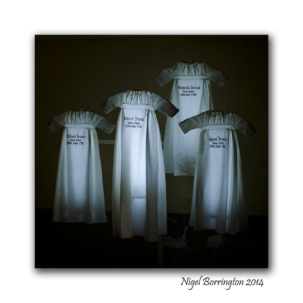
Happy Burns Night ! , Robert Burns Cottage and home place.

Robert Burns Birthplace Museum
Photography : Nigel Borrington
Happy Burns night to everyone who would like the celibate the life and works of this great Scottish poet and Artists.
The following images are from a visit I made last year to his birthplace Museum located in the town of Ayr, Alloway, Scotland
Once again Happy Burns night !!!
Birthplace Museum
Robert Burns Birthplace Museum offers a truly unique encounter with Scotland’s favourite son.
The museum comprises the famous Burns Cottage where the poet was born, the historic landmarks where he set his greatest work, the elegant monument and gardens created in his honour and a modern museum housing the world’s most important collection of his life and works.
The images below I feel show the life that this young poet lived and include the small rooms that he grew up in with his brother and sisters ( Analella, Gilbert and Agnes Burn), the display of the bed they shared and their bed clothes, I felt was just brilliant.


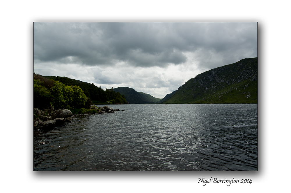
A swim at Glenveagh national park.
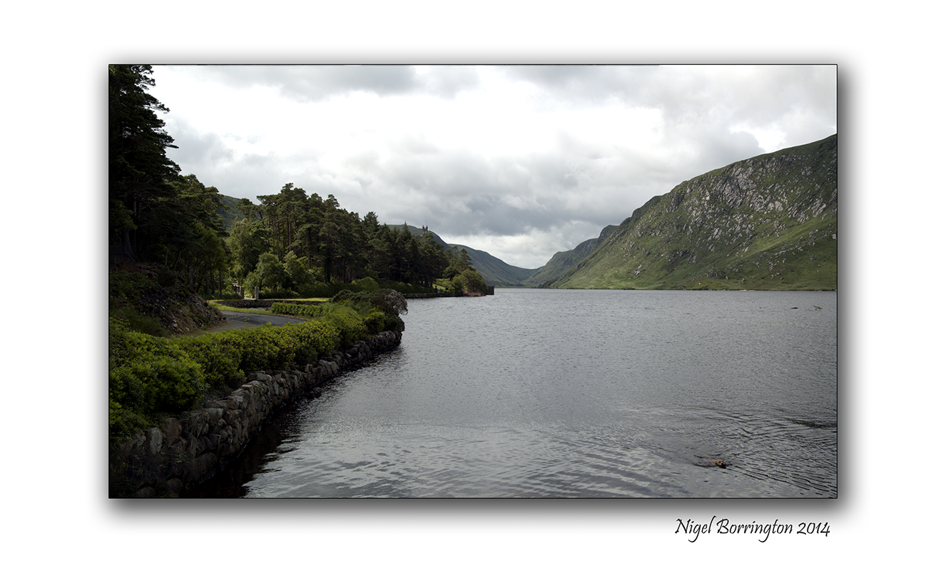
A swim at Glenveagh National Park
Irish landscape Photography : Nigel Borrington
Molly is our ten year old Golden Retriever and she just loves the water, here are some images of her as she was taking a swim the the lake at the Glenveagh National Park, Co. Donegal.
Glenveagh National Park
Glenveagh National Park is one of six national parks in Ireland. Situated in the Northwest of Co. Donegal, Glenveagh encompasses some 16,000 hectares in the heart of the Derryveagh Mountains. Such a great wilderness is the haunt of many interesting plants and animals. These lands were managed as a private deer forest before becoming a national park in 1975. With the completion of public facilities Glenveagh National Park was officially opened to the public in 1986.
Gallery


Winter trees by the river bank
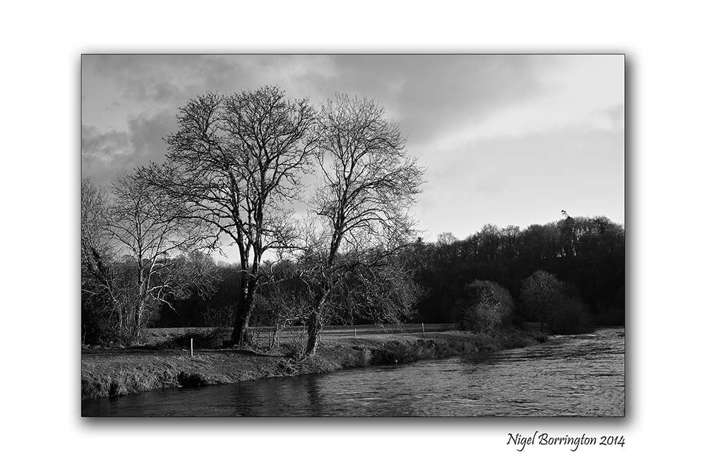
Winter trees along the river Nore, county KIlkenny
Irish Landscape Photography : Nigel Borrington
A river walk in January along side the river Nore, county kilkenny, offers some great views.
Amongst the best of these views are the great leafless trees, their hight and their shapes casting long shadows, their reflections in the water.
Gallery


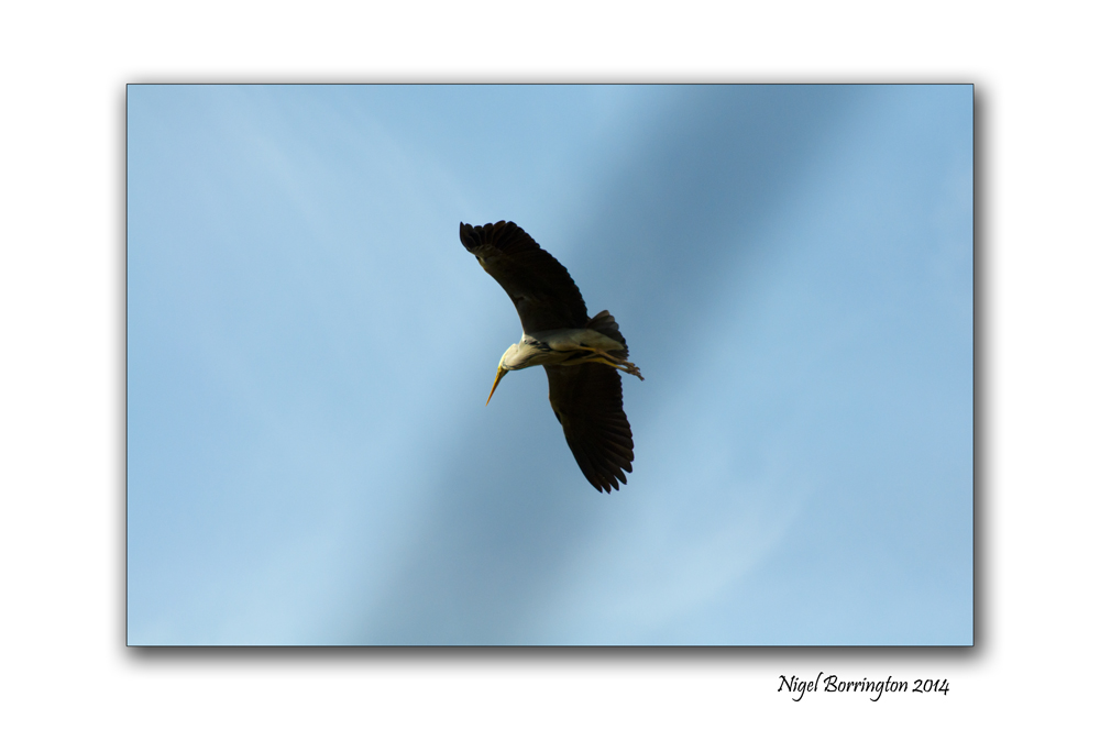
The Herons flight , Galway Bay.

Herons flying above Galway bay
Nature Photography Nigel Borrington
On a very enjoyable visit, I managed to Capture these Herons during a spring time visit to Galway Bay. At this time of year the Local Herons are hunting along the coast line for fish and getting ready to nest build in the spring.
To get these images I stood under some trees along side a beach and captured them as they flew above me.
The Herons flight : Gallery


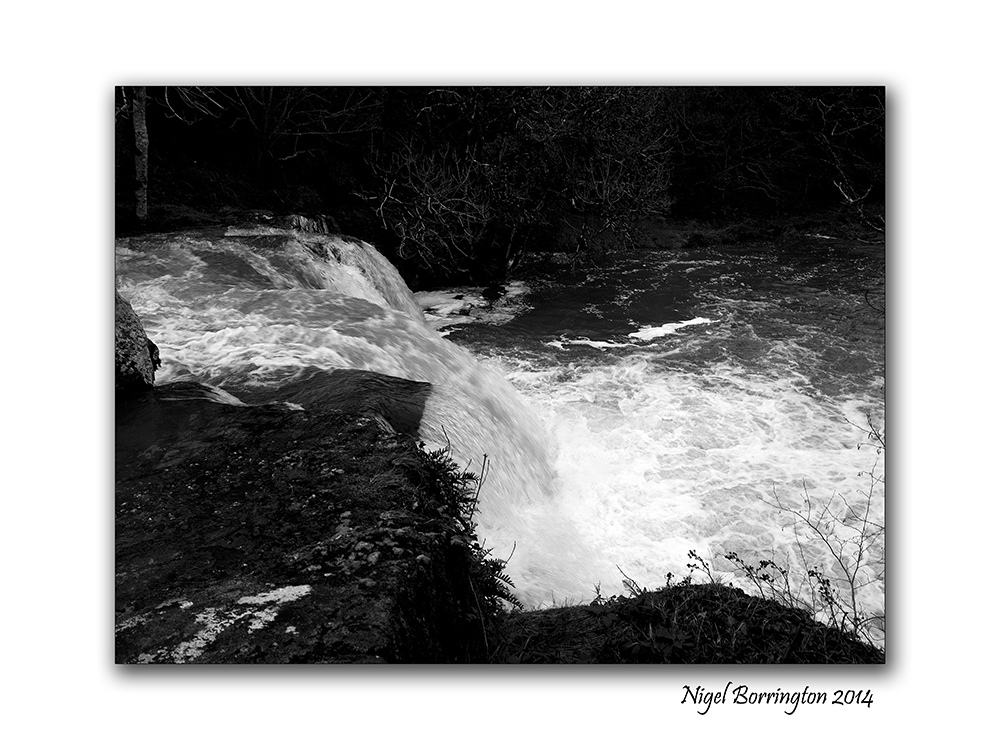
Following the river over the waterfall

River Pollanassa, Waterfall, Mullinavat, County Kilkenny
Irish landscape photography : Nigel Borrington
County Kilkenny has many rivers both small and large, flowing through its lands. The River Pollanassa, however would not be the best known or the most spectacular of them but for the waterfall it has created as the river flows towards the town of Mullinavat.
The following images show the river as it flows towards, over and past the Waterfall.
The Waterfall at Mullinavat


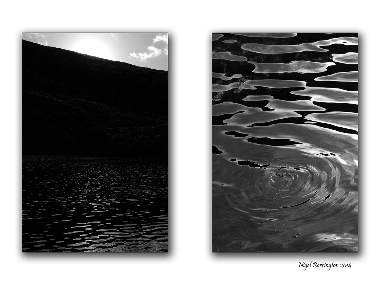
The Unnamed Lake, Poem by : Frederick George Scott (1861-1944)

The Unnamed Lake,Comeragh Mountains,Co.Waterford
Irish Landscape Photography
The Unnamed Lake
By : Frederick George Scott (1861-1944)
IT sleeps among the thousand hills
Where no man ever trod,
And only nature’s music fills
The silences of God.
Great mountains tower above its shore,
Green rushes fringe its brim,
And o’er its breast for evermore
The wanton breezes skim.
Dark clouds that intercept the sun
Go there in Spring to weep,
And there, when Autumn days are done,
White mists lie down to sleep.
Sunrise and sunset crown with gold
The peaks of ageless stone,
Where winds have thundered from of old
And storms have set their throne.
 .
.
No echoes of the world afar
Disturb it night or day,
The sun and shadow, moon and star
Pass and repass for aye.
‘Twas in the grey of early dawn,
When first the lake we spied,
And fragments of a cloud were drawn
Half down the mountain side.
Along the shore a heron flew,
And from a speck on high,
That hovered in the deepening blue,
We heard the fish-hawk’s cry.
Among the cloud-capt solitudes,
No sound the silence broke,
Save when, in whispers down the woods,
The guardian mountains spoke.
 .
.
Through tangled brush and dewy brake,
Returning whence we came,
We passed in silence, and the lake
We left without a name.
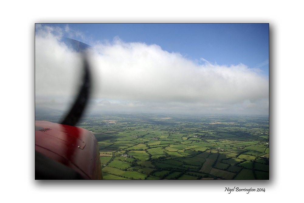
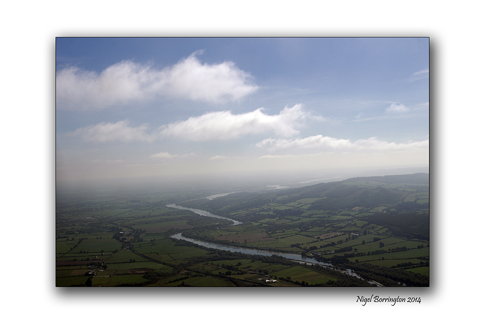
Images of Ireland from the Air.

Images of the south east of Ireland from the air.
Irish Landscape photography : Nigel Borrington
One of the most exciting ways you can see County Kilkenny and its surrounding counties is from the air, the images posted here are taken during a flight in a light aircraft.
You can fly from Kilkenny air field on a sight seeing visit to any location you would like, on this trip we travelled south of Kilkenny and followed the river Suir towards Waterford city, returning to the airfield about 2 hours later.
Its a great way to see Ireland and wonderful on a sunny clear day.
Gallery of the flight


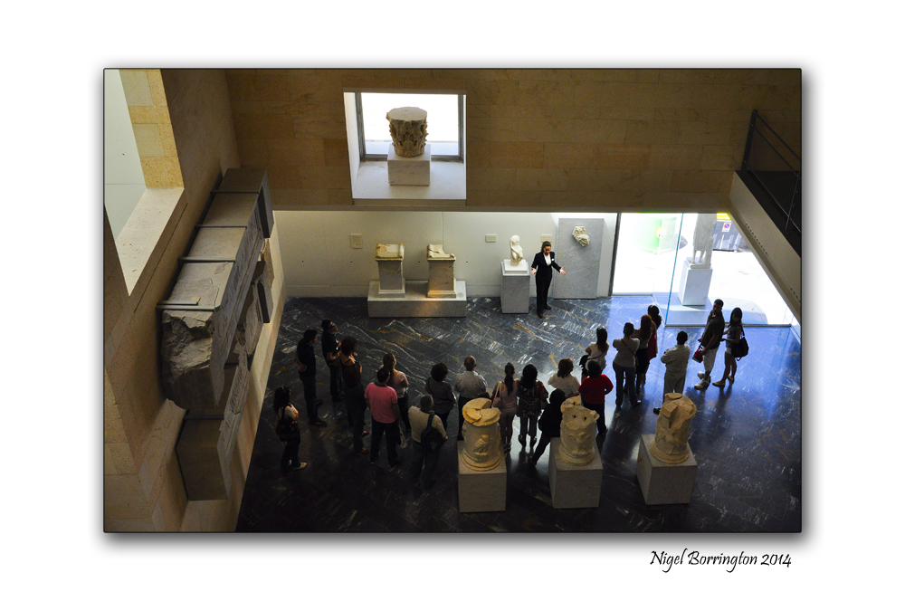
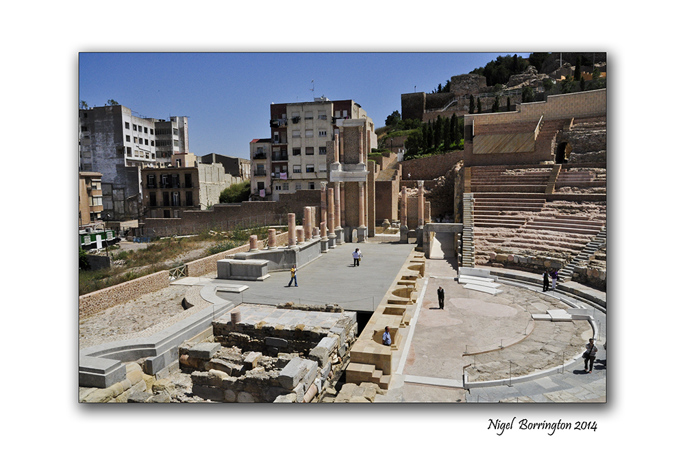
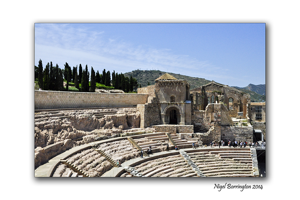
An early spring visit to Cartagena, South east Spain.
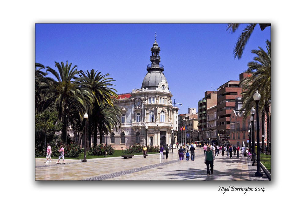
Cartagena, south east Spain
Street and cityscape Photography : Nigel Borrington
The Spring and late Winter is one of the best time of year to visit Spain, the following images are taken in a the small coastal town of Cartagena , a very friendly and lively little town that has a colourful history including having been of the the key ports for the Roman empire.
“Much of the historical weight of Cartagena in the past goes to its coveted defensive port, one of the most important in the western Mediterranean. Cartagena has been the capital of the Spanish Navy’s Maritime Department of the Mediterranean since the arrival of the Spanish Bourbons in the 18th century. As far back as the 16th century it was one of the most important naval ports in Spain, together with Ferrol in the North. It is still an important naval seaport, the main military haven of Spain, and is home to a large naval shipyard.
The confluence of civilizations as well as its strategic harbour, together the rise of the local mining industry is manifested by a unique artistic heritage, with a number of landmarks such as the Roman Theatre, the second largest of the Iberian Peninsula after the one in Mérida, an abundance of Phoenician, Roman, Byzantine and Moorish remains, and a plethora of Art Nouveau buildings, a result of the bourgeoisie from the early 20th century. Cartagena is now established as a major cruiser destination in the Mediterranean and an emerging cultural focus.”
Cartagena : Street Photography Gallery


Irish Landscape Photography

A sunset over the lower lakes of Killarney national park.
Irish Landscape photography : Nigel Borrington
One evening on a visit to Killarney, National park, I was just returning from a long walk after watching the Stag’s in the mountains above the lakes and getting some photographs. I then noticed that the Sun-set was just wonderful over the far hills in the west.
I had about 20 shots left on the card I had, so captured a few images from the grounds of the Hotel.
I have shared some of them before but still enjoy looking at them and remembering this wonderful moment, so here is another one that I wanted to share and post.
Yesterday’s Sun and wind, a poem for the January sun.

A view of Slievemamon, county Tipperary
Irish Landscape photography : Nigel Borrington
Yesterday’s Sun and wind
By : Ann Copland
She is the wind swift and pure
so rare to find her like this, still innocent
above a sunny afternoon far into tomorrow.
 .
.
The wind begins three Counties away
to cool the day, relieve us from the warming sun
Were you not sure she is real?
One day, you may see her, if you look
very close, spheres carry new molecules
Her breath is ice, you’ll feel it early maybe
just a brief gust before the temperatures drop
 .
.
Welcome on a January afternoon
by the time we see a branch sway
or a hat tumble, the freezing breath
has warmed to a gentle winter breeze
So much effort, the team who make nature
I’ll let the wind breathe

Duiske Abbey

Duiske Abbey, County Kilkenny
Irish Photography : Nigel Borrington
Duiske Abbey, County Kilkenny, is one of the best maintained Cistercian Abbey’s in Ireland also known as Graiguenamanagh Abbey, it is a 13th-century Cistercian monastery situated in Graiguenamanagh, County Kilkenny in Ireland.
Duiske Abbey was founded by William Marshall in 1204 and is one of the first, largest and perhaps the finest of the thirty-four medieval Cistercian monasteries in Ireland. The Abbey is the parish church of Graiguenamanagh town and beautifully dominates the town centre.
The Abbey is located in the valley of the river Barrow, on a site between the main river and the Duiske tributary. The abbey derives its name from the Douskey River Irish: An Dubhuisce, meaning “Black Water”.
Both the Abbey and the town of Graiguenamanagh are wonderful locations to visit with a camera, Park in the town and visit the Abbey first , then you can walk along the river Barrow, north towards kilkenny or south towards Waterford.
Gallery


You must be logged in to post a comment.