
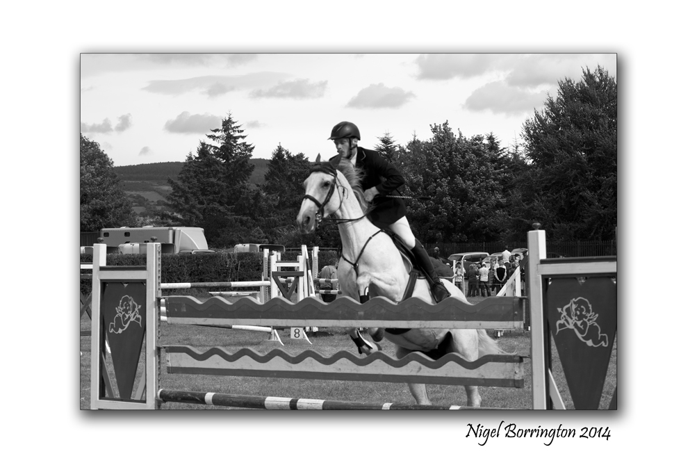
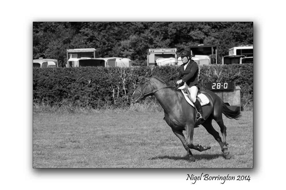
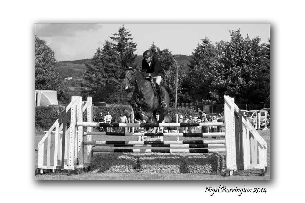
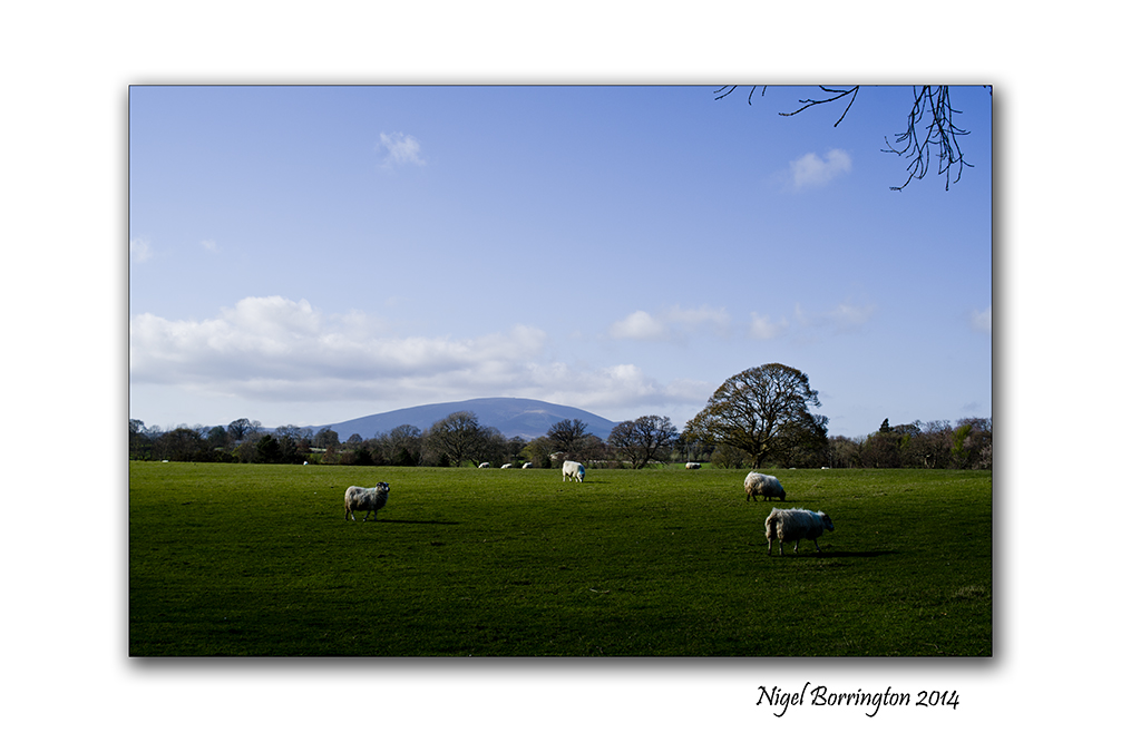
Over the Jump, Iverk show , County Kilkenny
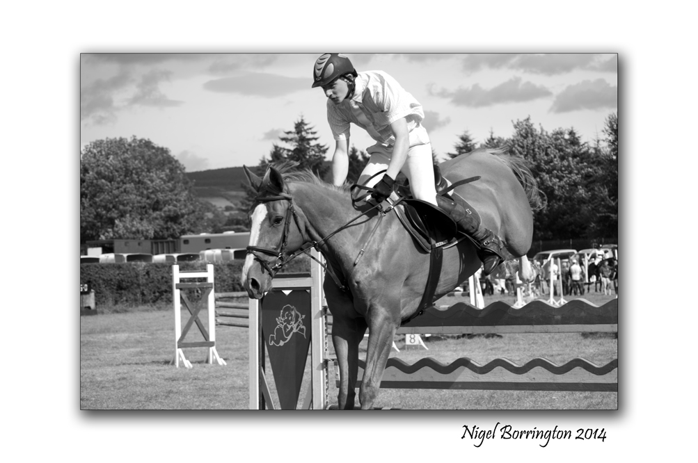
Over the Jump, Iverk Show, county KIlkenny
Phorography : Nigel Borrington
Iverk show , County Kilkenny
The Iverk Show is held each year at Piltown, county Kilkenny.
It is one of Ireland’s biggest country shows with many product displays and farming competitions including Horses, dogs and livestock.
The Images below were taken during the show jumping, it was great fun to watch and get some action pictures as the weather was just perfect being warm and sunny.
Gallery

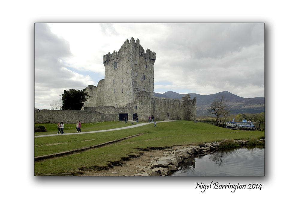
Ross Castle, Killarney National Park, Co. Kerry, Ireland

Ross Castle, Killarney National Park, Co. Kerry, Ireland
Landscape Photography : Nigel Borrington
Ross Castle sits on the edge of Killarney’s lower lake and was built by O’Donoghue Mór in the 15th century.
This is one of Ireland treasures and a wonderful place to visit, the views of lower lake are just wonderful from the walls here.
History and Myths
Ross Castle (Irish: Caisleán an Rois) is a 15th century tower house and keep on the edge of Lough Leane, in Killarney National Park, County Kerry. It is the ancestral home of the O’Donoghue clan, though it is better known for its association with the Brownes of Killarney who owned the castle until more recently.
The castle is operated by the Irish OPW – Office of Public Works, and is open to the public seasonally with guided tours.
The Castle came into the hands of the Brownes who became the Earls of Kenmare and owned an extensive portion of the lands that are now part of Killarney National Park . Legend has it that members of the O’Donoghue clan still exists in a deep slumber under the waters of Lough Leane.
On the first morning of May every seven years he rises from the lake on his magnificent white horse and circles the lake. Anyone catching a glimpse of him is said to be assured of good fortune for the rest of their lives. The large rock at the entrance to the bay is known as O’Donoghue’s prison. Ross Castle was the last stronghold in Munster to hold out against Cromwell. It was eventually taken by General Ludlow in 1652.
Ross Castle is open to the public. Details from Ross Castle, Killarney, Co. Kerry
Ross Castle Image Gallery


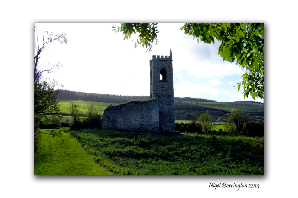
Saturday Morning walk on coolagh hill, county Kilkenny : Gallery

Coolagh old church on the hill, County Kilkenny
Landscape Photography : Nigel Borrington
It’s the weekend so why not get out and about and do some walking in your local area.
Often when you walk you will find places and views that you never knew existed just driving past in a car.
What ever you do I hope you have a great last weekend of June 2014.
Coolagh Kilkenny a Gallery


Celebrating Mid summers day 2014

Mid summers sunset over Slievenamon, county tipperary,
Landscape photography : Nigel Borrington
Mid summers day 2014
Happy Mid summers day !!!
This mornings sunrise over slievenamon county Tipperary was at 04:57am and by the time it sets again on the other side to the west the time will be 21:57 , thats seventeen hours of sun light and the most anyone can witness during the suns movement across the sky during any one year.
Today is also called the Summer Solstice
Solstice, or Litha means a stopping or standing still of the sun. It is the longest day of the year and the time when the sun is at its maximum elevation.
Wiccan blessing for Summer
As the sun spirals its longest dance,
Cleanse us
As nature shows bounty and fertility
Bless us
Let all things live with loving intent
And to fulfill their truest destiny
This date has had spiritual significance for thousands of years as humans have been amazed by the great power of the sun. The Celts celebrated with bonfires that would add to the sun’s energy, Christians placed the feast of St John the Baptist towards the end of June and it is also the festival of Li, the Chinese Goddess of light.
Pagans are in awe of the incredible strength of the sun and the divine powers that create life. For Pagans this spoke in the Wheel of the Year is a significant point. The Goddess took over the earth from the horned God at the beginning of spring and she is now at the height of her power and fertility. For some Pagans the Summer Solstice marks the marriage of the God and Goddess and see their union as the force that creates the harvest’s fruits.
This is a time to celebrate growth and life but for Pagans, who see balance in the world and are deeply aware of the ongoing shifting of the seasons it is also time to acknowledge that the sun will now begin to decline once more towards winter.
Lugh (Celtic) god of the summer soltice
Similar to the Roman god Mercury, Lugh was known as a god of both skill and the distribution of talent. He is associated with midsummer because of his role as a harvest god, and during the summer solstice the crops are flourishing, waiting to be plucked from the ground at Lughnasadh.
The Harbour, Poem By : Winifred Mary Letts
The Harbour, Poem
By : Winifred Mary Letts
I think if I lay dying in some land
Where Ireland is no more than just a name,
My soul would travel back to find that strand
From whence it came.
I’d see the harbour in the evening light,
The old men staring at some distant ship,
The fishing boats they fasten left and right
Beside the slip.

The fishing boat rests along the shore,
The grey thorn bushes growing in the sand,
Our Wexford coast from Arklow to Cahore –
My native land.

The little houses climbing up the hill
Sea daises growing in the sandy grass,
The tethered goats that wait large -eyed and still
To watch you pass.
The women at the well with dripping pails,
Their men colloguing by the harbour wall,
The coils of rope, the nets, the old brown sails,
I’d know them all.
And then the sun- I’d surely see
The disk against a golden sky.
Would let me be at my rest.

The Foxglove bells, a poem By : Mary Webb

The Foxglove bells
By : Mary Webb
The foxglove bells, with lolling tongue,
Will not reveal what peals were rung
In Faery, in Faery,
A thousand ages gone.
All the golden clappers hang
As if but now the changes rang;
Only from the mottled throat
Never any echoes float.
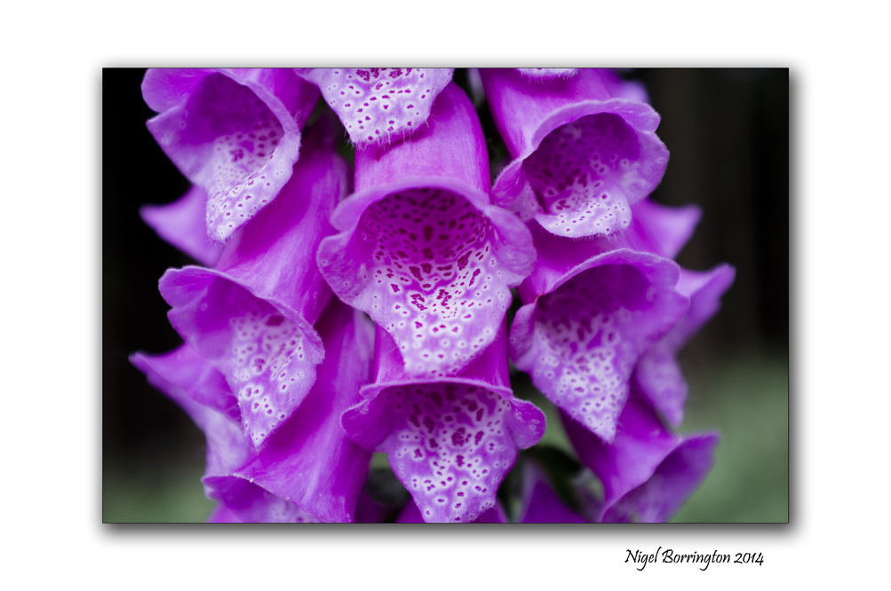
Quite forgotten, in the wood,
Pale, crowded steeples rise;
All the time that they have stood
None has heard their melodies.
Deep, deep in wizardry
All the foxglove belfries stand.
Should they startle over the land,
None would know what bells they be.
Never any wind can ring them,
Nor the great black bees that swing them–
Every crimson bell, down-slanted,
Is so utterly enchanted.

Its the weekend so why not ……
Ballyquin, County Waterford
Landscape Photography : Nigel Borrington
Its the weekend so why not….
Head to the beach and look a the views …..

Sit down on the sand and watch the waves roll in !!

Take the Dog for a Walk ……
Callan, Kilkenny. Remembering the Workhouse and Cherryfields Grave yard.

Cherryfields, Grave yard for the poor of the Callan workhouse.
Photography : Nigel Borrington
Remembering the Workhouse and its uncounted and unnamed dead.
During the years between 1841 and 1922 the Callan workhouse operated as a place to house and offer support to may of the poor and fallen people who lived in the surrounding areas.
I want to share here some images and facts about both the workhouse and the associated grave yard that is located just one kilometre south of the town of Callan.
Both these site still exist today and a visit to them is both very moving and haunting.
The Workhouse now operates as a home for people with special needs and many feel that this is a great outcome considering its original use and its history.
A visit to Cherryfields Grave yard is very moving, I have included some written details below with some recent images, the thing that personally hits me the most about this place is that no one knows how many people lay at rest here as there is not one single name to be found anywhere.
My final Gallery at the bottom of the post reflects on the contrast between cherryfields and other local grave yards, where all the graves are marks with stones, the only technical difference being the level of finance you or your family possessed.
The Callan Work house

The Callan Union of workhouses was situated partly in Co Kilkenny and partly in Co Tipperary. It comprised an area of 106,633 statute acres with a population of 42,707.
The Callan workhouse was contracted for on May 29, 1840 and was completed in 1841.
The management of the workhouse was as follows: Master, matron, clerk chaplain, schoolmaster, porter.
It cost £5,500 to build and $1,140 to fit out. The entire complex, situated at the south end of the town, covered an area of six and a quarter acres. It was built to accommodate 600 people and its first admission took place on March 25, 1842.
Thirty-three Poor Law Guardians, elected from various areas in the Union, had overall responsibility for the workhouse.
In its first years of operation, the Callan Workhouse functioned very well, but the catastrophe of the Great Famine (1845-48) totally overwhelmed it, reducing its functions to utter chaos.
Built, as mentioned to accommodate 600 people, it had at the height of the Famine thousands of unfortunates clamouring for admittance. Even by 1851 it was still crammed to over capacity. The census for that year lists 2,102 people as residing in it.
The statistics for the Famine in the Callan area are grim and mind-boggling. Between 1841 and 1851 a total of 1,411 people, 688 males and 723 females, died in Callan Workhouse, and 2,104, 1,050 males and 1,054 females died in the temporary fever sheds, a grand total of 3,515 people. These virtually all died during the years of 1846 to 1850.

After the famine years, the workhouse settled back into a more normal level of operation and continued to function right up until the 1920s. In 1922 it was garrisoned by Free State troops during the Civil War.
It was later sold to private individuals and public bodies.
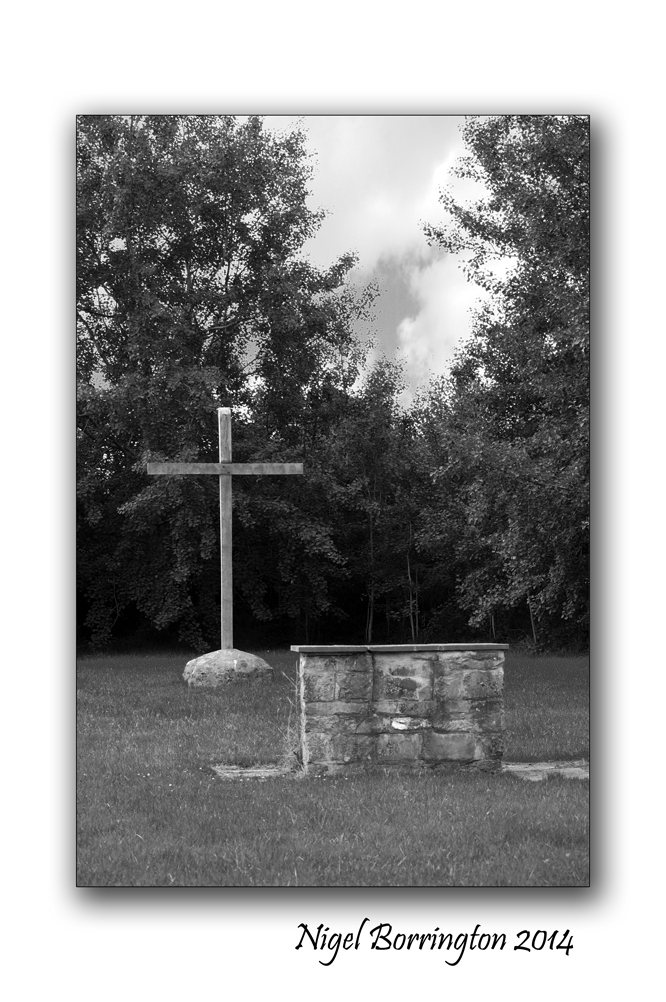
CherryFields Grave Yard
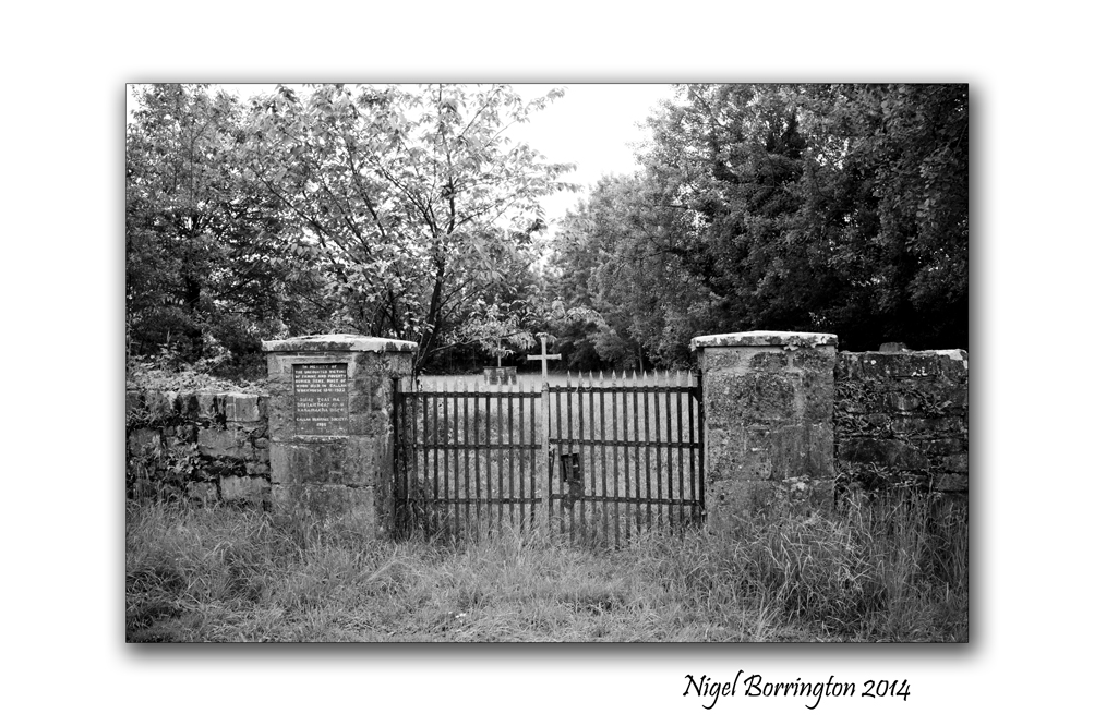
on approaching Cherryfields – Callan, A plaque on a pillar at the graveyard reads: In memory of the uncounted victims of famine and poverty buried here, most of whom died in Callan Workhouse 1841-1922. The Plaque was erected in 1986 by Callan Heritage Society.
The now disused burial ground is the resting place of those who died in Callan Workhouse and who had no family or friends to claim them.
It is located in a remote one and a quarter acre site about one and a half miles south-east of the town off the Clonmel Road in the townland of Baunta Commons.

Because cherries grew three in times gone by it is still popularly known as Cherryfield.
Most of those buried in Cherryfield were victims of the Great Hunger which devastated Ireland during the 1840s. The Callan area of Co Kilkenny was severely affected by this catastrophe.
Tales have been passed down about the endless procession of funerals from the Workhouse. It is said that often up to six bodies at a time were carted out for burial, and that it was not uncommon for corpses to fall off the ‘funeral cart’ because the boreen into Cherryfield was so rough and muddy.
Originally it was intended to have a ‘pauper’s graveyard’, as the terminology of the time called it, located in less remote place as Lord Clifden proposed, but because Baunta Commons consisted of large areas of poor agricultural common land there was little problem in acquiring a cheap site.
The graveyard was crudely fenced off for many years but was fully enclosed by a wall in the 1860s. A substantial gate and entry piers were also erected at that time.
Gallery


Contrast of Cherryfields to other local Grave yards
The surrounding areas of south Kilkenny, contain many old grave yards all of which are wonderful to visit, they hold great records of the people who lived locally and now rest in these places.


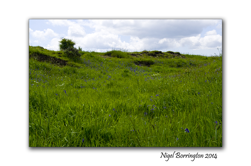
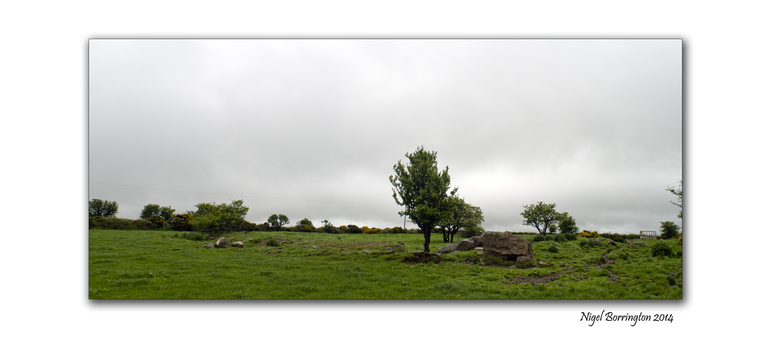
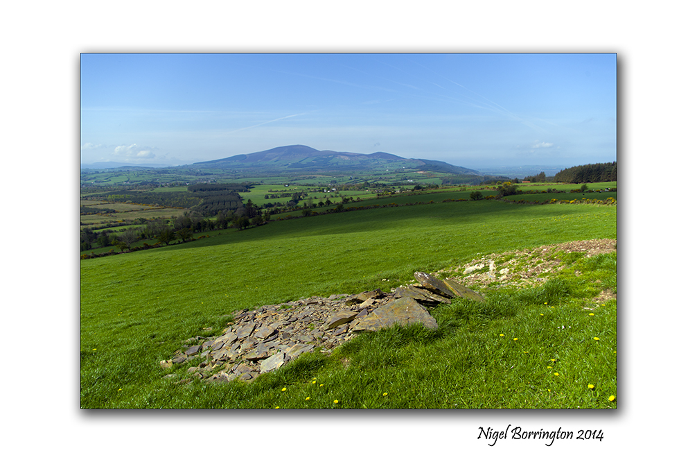
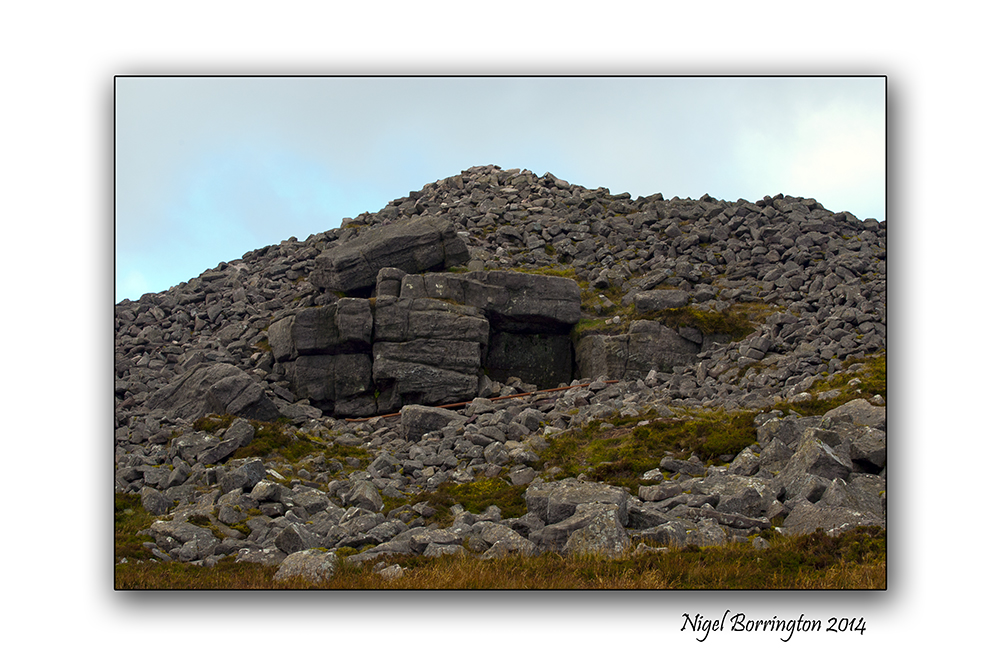
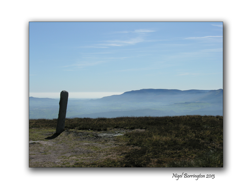
A local walk through History, Megolithic – Ring forts, Tombs and Standing stones.
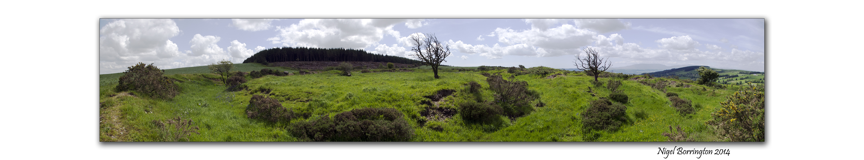
Ring fort on the Hill, County Kilkenny
Landscape photography : Nigel Borrington
A local walk through History, Megolithic – Ring forts, Tombs and standing stones.
Last Month I posted the following two articles talking about the history of some historic remains and geology around the area where I live, on the County Kilkenny and Tipperary Boarders.
Pagan ring forts and passage tombs , From Kerry to kilkenny
Landscape and Geology around Slievenamon, county Tipperary
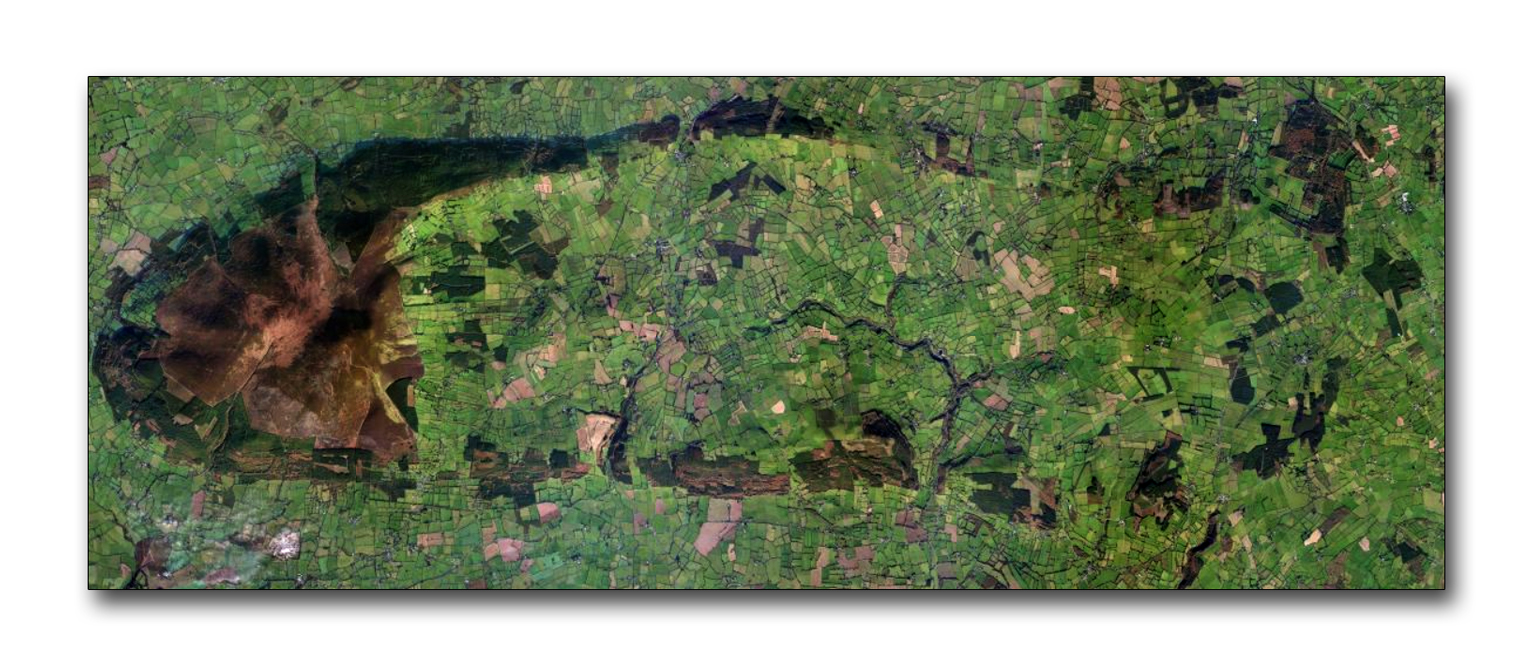
The image below shows the area around the mountain of Slievenamon, County Tipperary ( left ) and the foot hills that flow to the right and form the shape of an oval from the north and south of the mountain.
The Boarder between county kilkenny and Tipperary flows about half way through this image from north to south.
 .
.
Over the last few weeks and during the summer of 2014, I want to study and post about the Stone age – Iron age, pre Christian remains that can be found in almost every one of the woods that can be seen in the above image ( Mainly visible as dark green) along with the remains on the mountain of slievenamon itself.
I have lived here in county Kilkenny for about 11 years , moving from the UK in 2003, from the very first walks I took locally it was clear that this area is full a history in the form of old buildings, farms, churches and grave yards.
The remains that interested me the most have been those of pre-Christian times, Ireland became a Christian country between 300 to 400 Ad. These local pre-Christian remains then date from betweem 300Ad to 6000 or 8000 years ago.
The remains that can be found locally take the form of (Ring forts, Graves and tombs, Standing stones and stone circles) all can be found within the area covered in the pictures above.

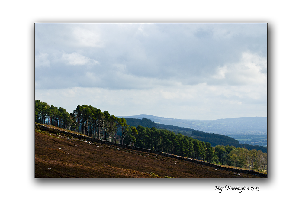
South Kilkenny. Woodlands
During last weekend and this week, I have been visiting the above woodland to the south east of the larger area I am studying and have marked on the image below the types of remains I have found :

The remains that I have walk past on woodland paths and the ones that I have looked for by going deeper into the woods are by themselves amazing but by themselves do not tell you a story of who these people were and how they lived.
Over the next few weeks I want to uses four areas in total including the mountain of Slievenamon, to draw a picture of how I feel the people who built these structures lived.
How they worked this land, how they built their homes and how they buried and remembered their ancestors.
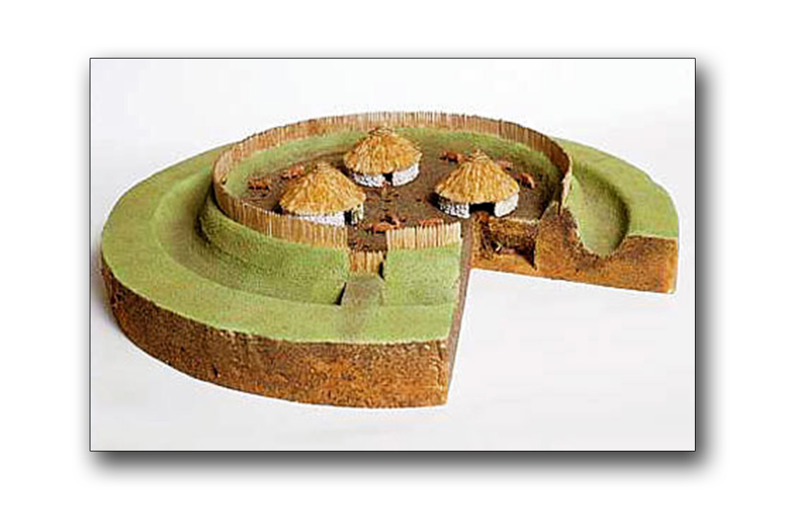
Structure of a ring fort
Image Gallerys
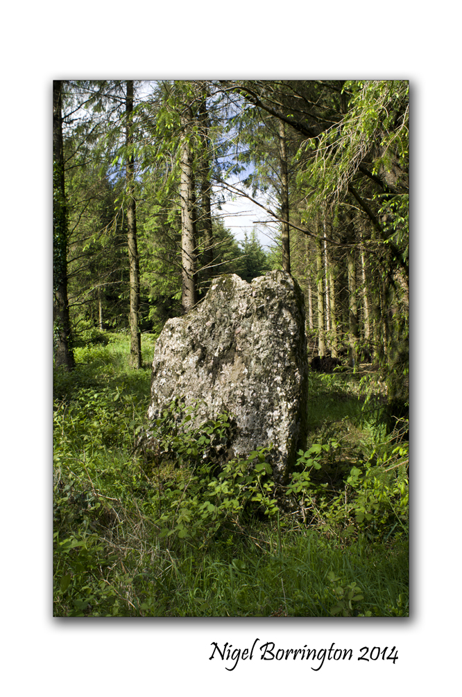
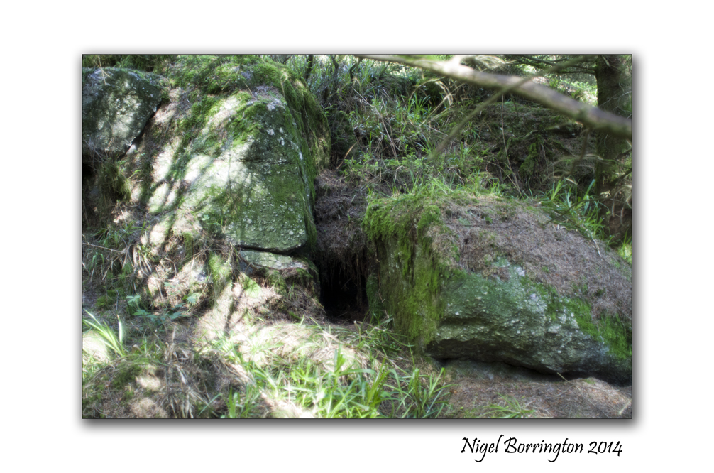
The Images below are all pictures of the structures and remains I have found in the woodland area shown and labelled in the images above, I have split them into groups as follows:
Ring forts, these were used for – homes and cattle pens.
Standing stones, used to record time and mark areas.
Graves and tombs, Hill top Burial grounds .
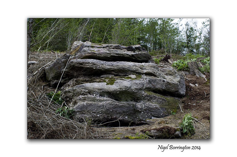
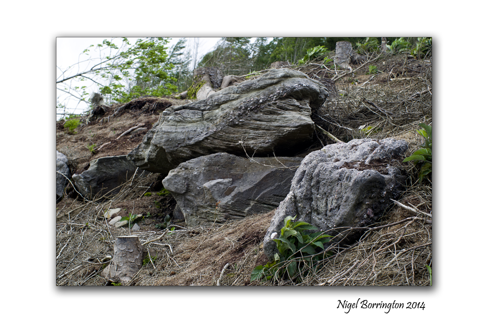
One last thing worth pointing out is that below in the Grave Gallery are two large tomb cap stones, shown in the first two images.
When I first found the stone in the first image, I wondered if it could be anything more than just a large stone left from ice sheets, during the ice age some 10,000 years ago. However I then found the stone in the second image a couple of days later, both these stones are almost the exact same dimensions. It is very unlikely then that these stones can be the result of the ice age and that they are cap stones to large tombs lying underneath.
This web sites show some examples of excavated tombs from this period : Mesolithic tombs
I also have a great example of a tomb like this here : The passage tomb of olioll olum king of munster
Image gallery of the ring fort
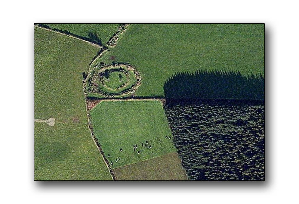
Ring fort, marked above the woods


Gallery of Standing stones within the woods

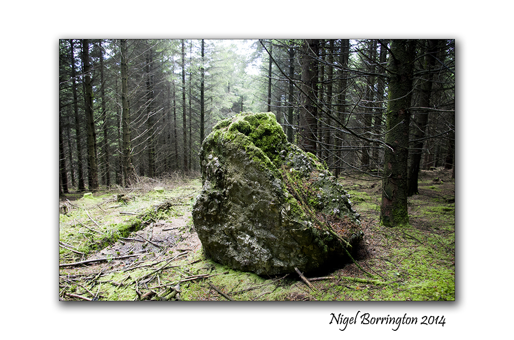

Gallery of Graves and Cap stones within the woods


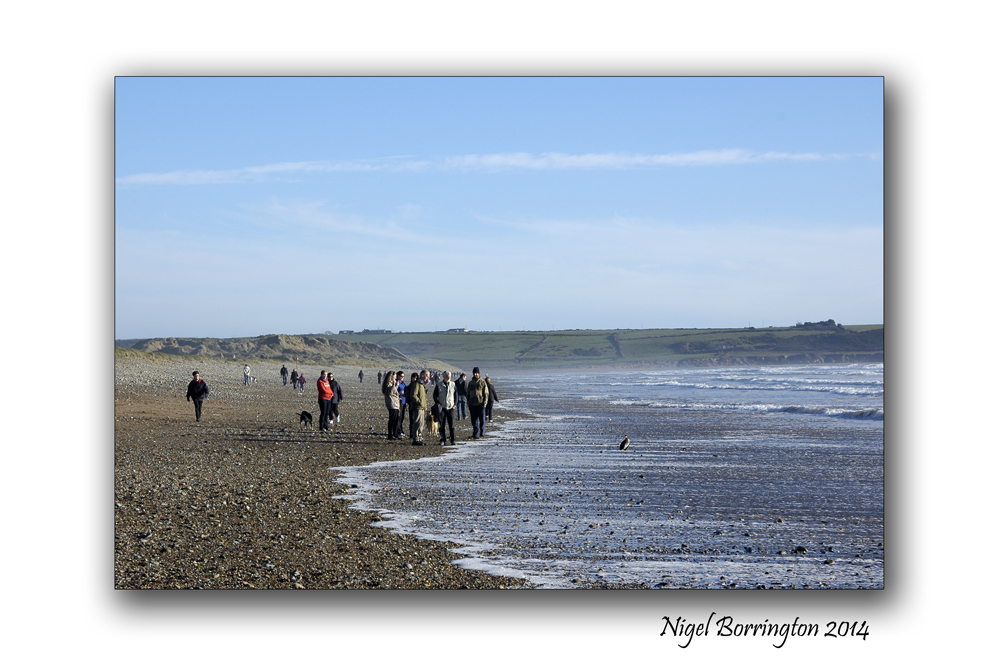
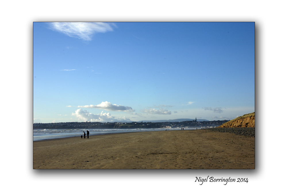
A walk along the beach , Images and a Poem

A walk along the beach at Tramore, County Waterford
Landscape photography : Nigel Borrington
A walk along the beach at Tramore
The sight of sunlight shining on the water just dazzling,
The sound of waves breaking delicately on the sand,
The feeling of the suns warming my skin,
The cool wetness of the sand between my toes.
Fellow dog walkers passing by,
Saying hello and talking for a while,
Their dogs swim and bring back sticks,
The marks they level in the sand,
Smoothed again by the waves.
 .
.
The fresh breeze moving through me,
Slipping across the water a sea bird gliding silently,
The salty sea air carrying her to deeper waters.
Above me seagulls friends swirl singing their daily song,
Before diving down into the sea to snatch a fish.
The breeze and warming sun feeding my soul,
The enchanting pleasures of sight and sounds,
I breathe in the wonderful scent of salt water that fills the air,
The intoxicating aroma of wildflowers thick along the dunes,
A feeling of contentment fills every corner of my being,
As I walk along the beach I realise… Life has true beauty…
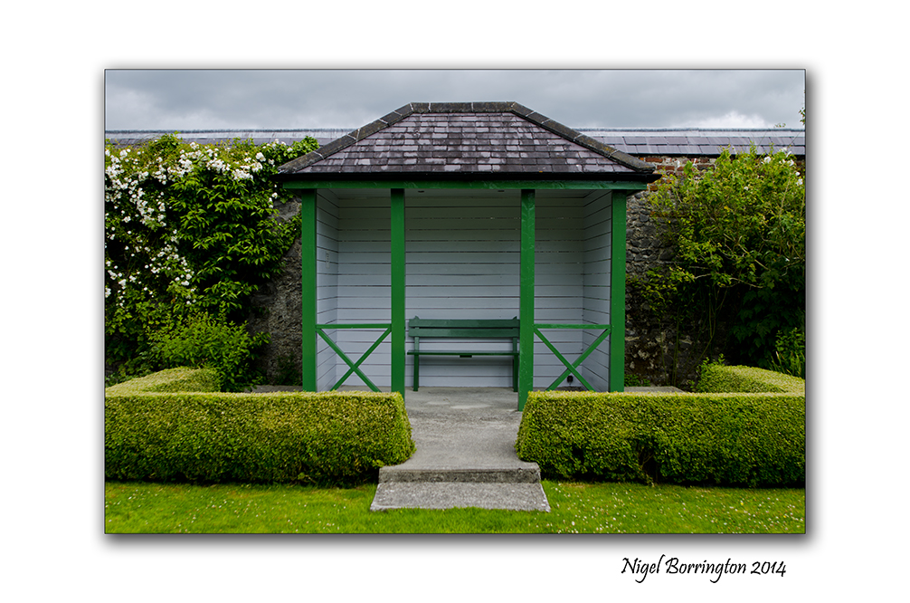
Butler House, Kilkenny

Butler House , County Kilkenny
Irish landscape Photography : Nigel Borrington
There can be few better places to visit on an early June weekend than the gardens at the Butler House in the Centre of KIlkenny city, the Roses are in Bloom and the pond in the middle of the garden offers a cool and relaxing place to visit.
I just love taking in a book or just walking around and taking time to view all the flowers and hidden wooded areas.
The history of Butler house is described below and flowed by some of the many images I have taken here.
The History of Butler House
Butler House is the Dower House of Kilkenny Castle and has always been associated with the Butler Family, Dukes & Earls of Ormonde who resided at Kilkenny Castle for 500 years.
18th Century
The house was home to Lady Eleanor Butler who lived here after the death of her husband Walter in 1783. Lady Eleanor Butler was the mother of John, the 17th Earl of Ormonde and her daughter, also Eleanor, was one of the famous “ladies of Langollen”.
19th Century
James, Earl of Ormonde resided in the house while the Castle was under reconstruction in 1831.
A soup kitchen was run from here during the cholera epidemic of 1832.
The Royal historical and Archaeological Association of Ireland held their meetings in Butler House in 1870.
20th Century
Kilkenny Design, the state design agency, restored Butler House in 1972.
The decor and furnishings reflect a certain 1970s Art Deco style, which because of the muted colours and natural fabrics used, proved sympathetic to the original features of the house. In 1989, the Kilkenny Civic Trust acquired both Butler House and the Castle Stables. The house was then opened to the public as a guesthouse and conference centre.
In 2000, The Kilkenny Civic Trust had the gardens at Butler House landscaped, in order to return them to their original splendour. The gardens have since become an attraction for the many visitors to Kilkenny.
Butler house Gallery


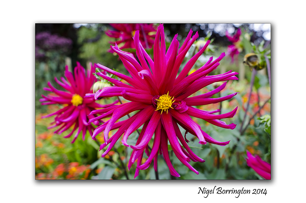
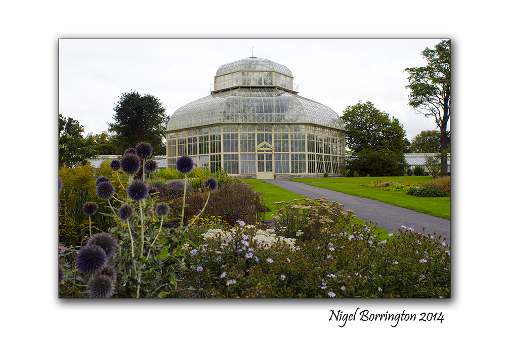
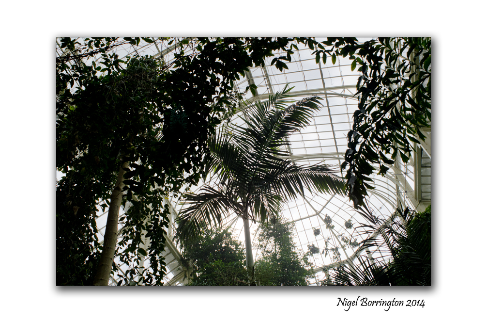
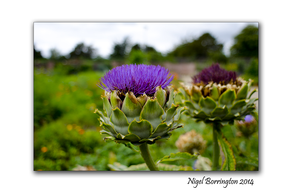
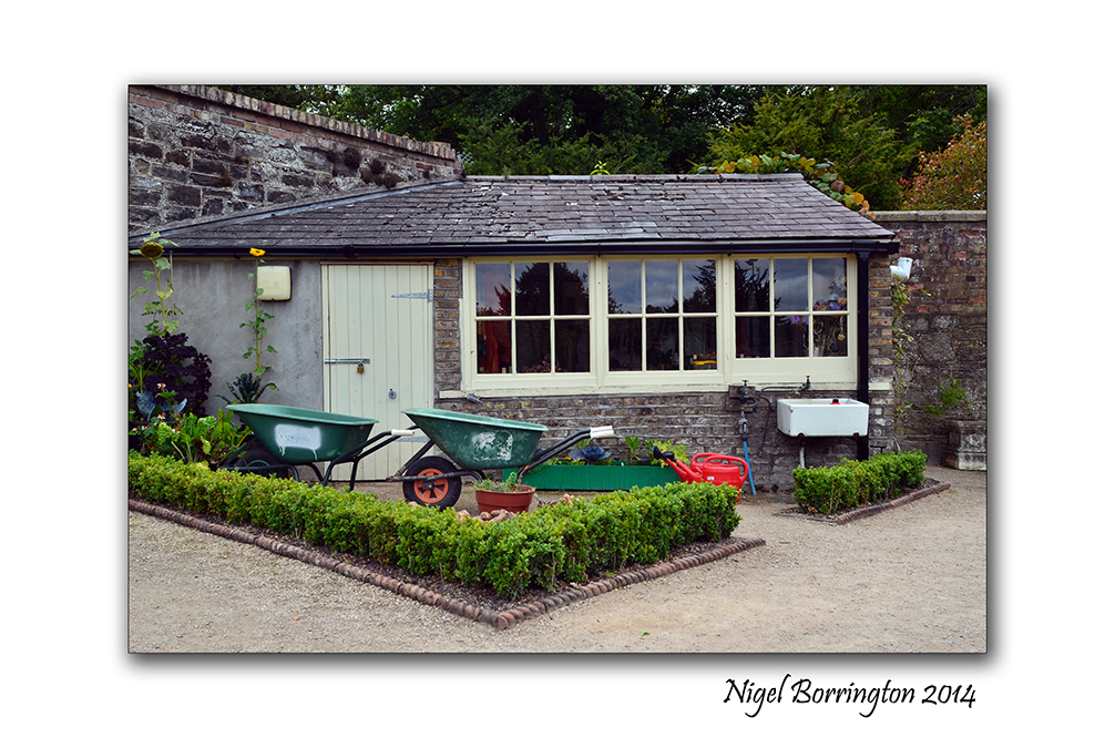
National Botanic Gardens – Dublin

National Botanic Gardens – Dublin
Photography : Nigel Borrington
National Botanic Gardens – Dublin
The images here were taken during a visit to the Botanic Gardens Dublin.
These Gardens are one of the best in the country and a wonderful location for flower and nature photography during the summer months.
The following web page is the official site and is a great source for all activities and descriptions of the history and purpose of these internationally respected gardens.
National Botanic Gardens – Dublin
The images I posted here are from a days visit , late summer 2013. There are many great things to see and places to eat here so you can spend a full day just browsing and learning.
Gallery


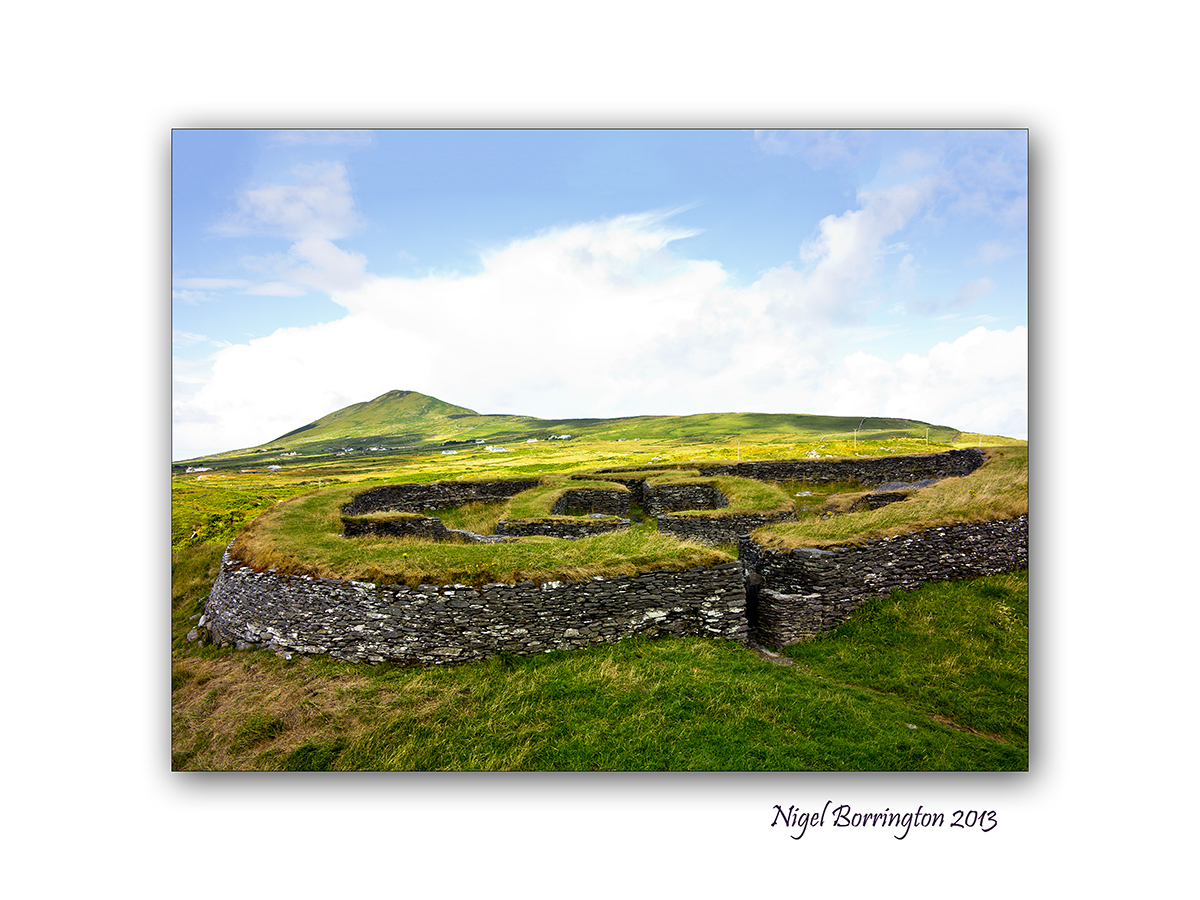
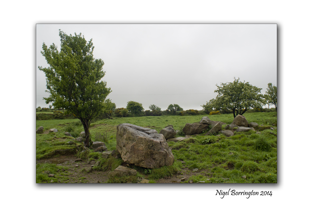
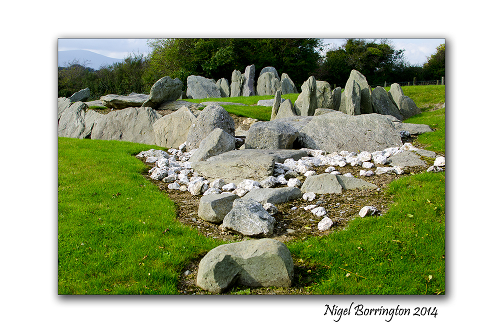
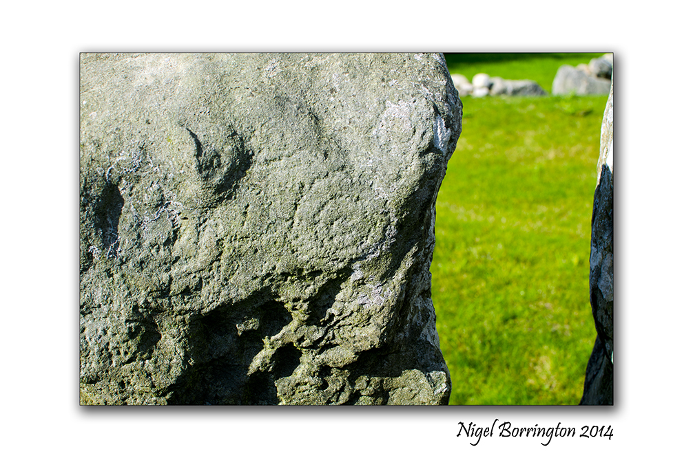
Pagan ring forts and passage tombs , From Kerry to kilkenny
 Knockroe passage tomb, county Kilkenny
Irish landscape Photography : Nigel Borrington
Pagan ring forts and passage tombs , From Kerry to kilkenny
During July last year 2013, I visited two ring forts near Cahersiveen, County Kerry and posted on them as below :
 .
.
Cahergall ring fort is a massive stone construction, built between 400BC and 500AD, It can be found close to Cahersiveen, County Kerry. Leacanabuaile feels very much more like a dwelling place for people to both live and keep themselves safe from the surrounding Environment. This included raiders and wild animals stealing cattle.
Leacanabuaile, stone ring Fort
Sitting on a hill side near Cahersiveen in County Kerry is Leacanabuaile Stone Fort, it is considered one of the best examples of an Irish ring fort.
The name translates to ‘Hillside of the Summer Pasturage’.
Returning home
The visit to both these locations was one of the most interesting history trips I have ever done and left me with a great sense of the History of Europe and of the people who lived here before Christian times.
On returning to county Kilkenny I fell like I was living in a place with a much more limited sense of history, Tipperary and Kilkenny feel much less remote than the coast line and mountains of county Kerry and their history seems to be much more modern.
Well it has taken me almost a year since the visit to Cahergall and Leacanabuaile to realise that this impression of my local area is far from true. Apart from the location of Knockroe (Post here), I have started to visit and find more and more local remains of Ireland’s past and it clearly goes way beyond the days of St Patrick and the early church.
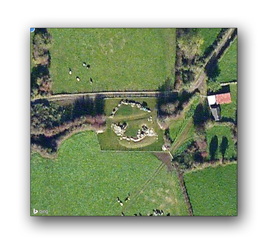
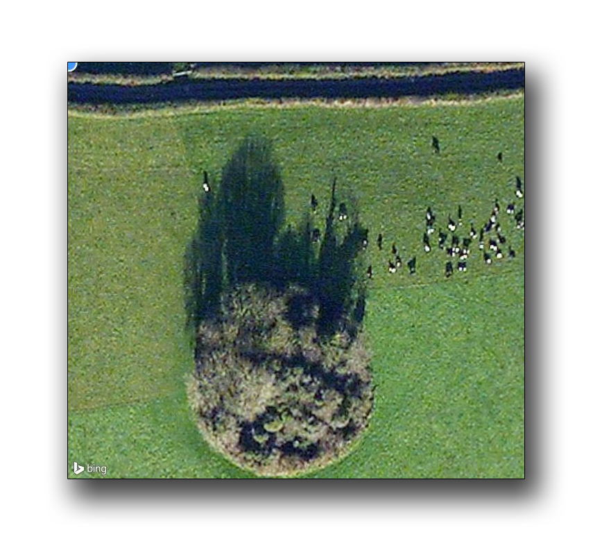
The images below are satellite images of many passage tombs and ring forts, within 10km of our home :


 .
.
Finding these locations was a real eye opener and showed to me that these forts and passage tombs must have been located through out the country.
The forts in Kerry have been restored over the last 5 years and may well have been in the same poor condition as the local ones here.
It is more than likely that the stone from these locations has been used in more modern times to build local Churches, Farms and stone walls on farm land, Yesterday I posted on the high cross at Kilkamerry and talked about this re-use of Pagan sites to build Christian locations.
It is very likely then that current church yards and grave yards have also been constructed on more of these sites, many more circular features exist on the local landscape and are possibly also ring forts but for these ones time has made things a little less clear.
What does becomes clear from looking deeper is that the pagan history of Ireland was extensive and that the pre-Christian population of this Island was as big as any other location on the European continent.
The images here are of the tomb or ring fort on Ballinlinagh hill, county Kilkenny and of the passage tomb of Knockroe :
Gallery

 —————–

Killamery High Cross

Killamery High Cross, County Kilkenny, Ireland
Landscape Photography, Nigel Borrington
Killamery High Cross
Located in an old grave yard very near the county Kilkenny and Tipperary border, is one of the most impressive of the Irish High crosses. There was a unique early Medieval tradition in Ireland and Britain of raising large sculpted stone crosses, usually outdoors.
These probably developed from earlier traditions using wood, perhaps with metalwork attachments, and earlier pagan Celtic memorial stones; the Pictish stones of Scotland may also have influenced the form.
The earliest surviving examples seem to come from the territory of the Anglo-Saxon kingdom of Northumbria, which had been converted to Christianity by Irish missionaries; it remains unclear whether the form first developed in Ireland or Britain.
The Killamery High Cross, is one of the western Ossory group of crosses. The cross stands at 3.65 metres high and the west face of the cross bears most of the figure sculpture. The east face pictured right, is decorated with three marigolds on the shaft and has a boss in the centre of the head surrounded by intertwining serpents with an open mouthed dragon above the boss.
The cross is known as the Snake-Dragon cross and has a gabled cap-stone and the narrow sides have double mouldings. At the end of the southern arm of the cross there is a panel depicting Noah in the Ark and the end of the northern arm features four scenes centered around John the Baptist. There is also a worn inscription on the base of the western side of the cross which is said to read as ‘OR DO MAELSECHNAILL’ a prayer for Maelsechnaill. Maelsechnaill was the High King of Ireland from 846 to 862.
The western face has a Sun Swastika at the centre and has figure sculpture around the whorl, to the left is a hunting scene and to the right a chariot scene above the whorl is scene showing a figure holding a Baby with another figure to the right of them, below the sun disc is a crucifixion scene. The shaft of this face bears two ornate panels. The top one is a fret pattern and the lower panel is a key pattern.
County kilkenny has five such high crosses, most a likely still in their original setting but being over a thousand years old must of their location will have changed.
Some people have a theory that these high crosses were originally larger standing stones used in pagan stones circles or passage tombs, the form of the cross being sculpted into them during the times of the pagan’s conversion to Christianity. In Ireland this would have been during the time of Saint Patrick.
It was felt much more effective when converting people to Christianity to convert original locations for the use of the early church, including fresh water springs.

Fallen standing stone marking a well/spring
In Ireland most springs would have been the location of worship to river or fresh water gods or goddess, in post pagan times many of these locations became holy wells dedicated to a Christian saint. Most even the forgotten spring above still have the original pagan standing stone in place , used to help find and mark the location of the spring and to leave offerings to the gods and goddesses ( Well dressing ).
Gallery


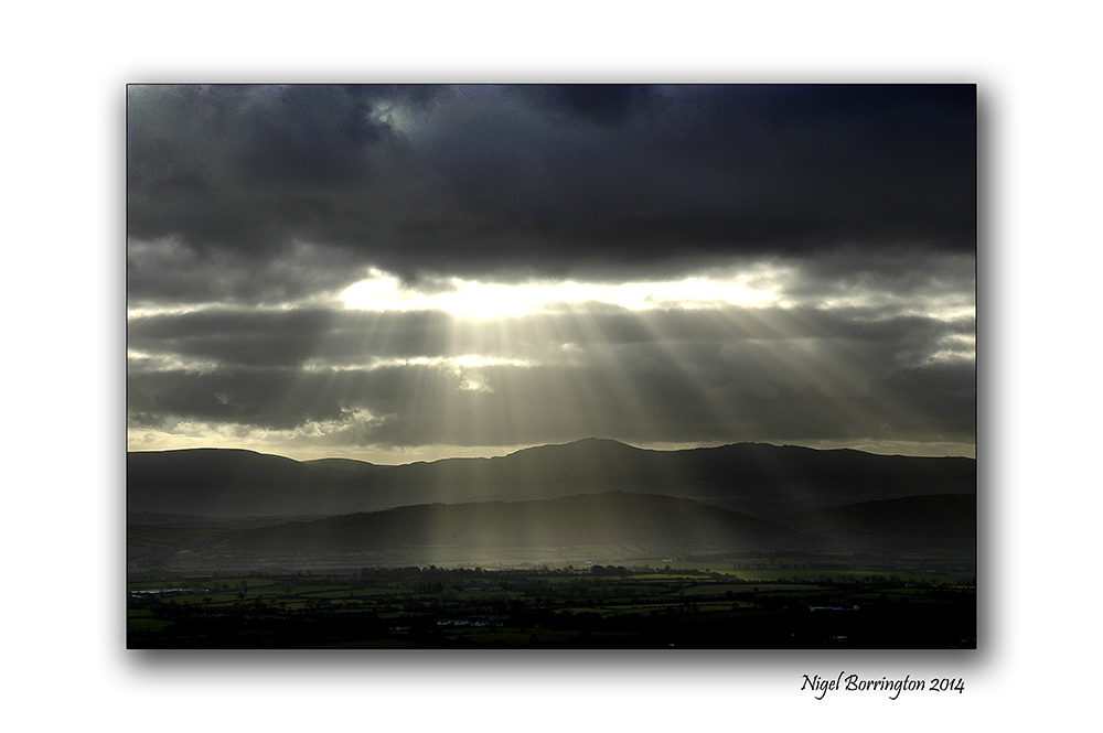
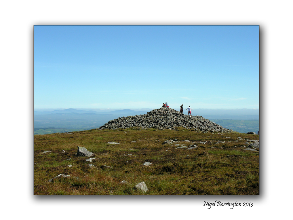
Sunset over the mountain of Slievenamon , Star break and Poem.

Sunset over slievenamon, County Tipperary
Landscape Photography : Nigel Borrington
Evening walks near the mountain of Slievenamon, county Tipperary can bring some great evening views, the sun sets right over the top on the mountain where there is a cairn, a burial place of a king dating back over six thousand year.
On one of these walks I was lucky enough to get these sunset images and I put some words to them in this poem:
Star break, a Poem
Behind the High cloud the sun is coiling and uncoiling
a dragon wrapped around itself spitting fire behind the mountain top
For a moment as I think of older days it is eclipsed entirely
aith a hidden God in the ground where six thousand years ago
A star fell from nowhere and lit up this very mountain’s top
turning westward by day, into oblivion leaving its mark.
 .
.
A king wise in these things called this a “star break”
and of no danger to the integrity of his vision
Star, soon the mountain will shrug you off you will drop below
the ragged edge line into tomorrow while I take the only path.
I came to find what I left, now ahead of me and waiting behind
a light of dawn, time of ages drifting through the night.
Me…..
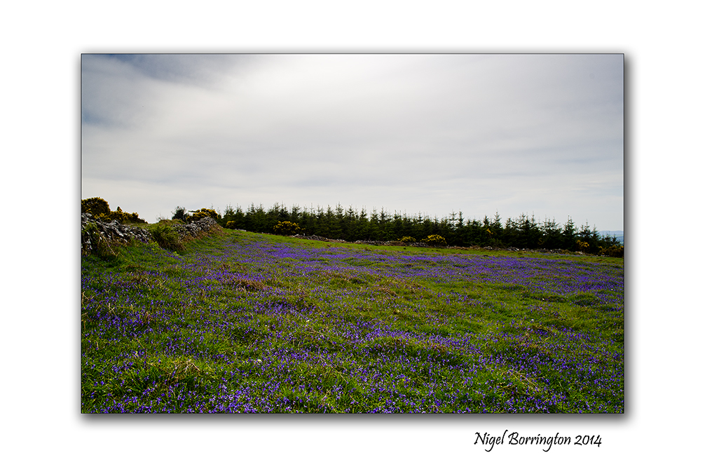
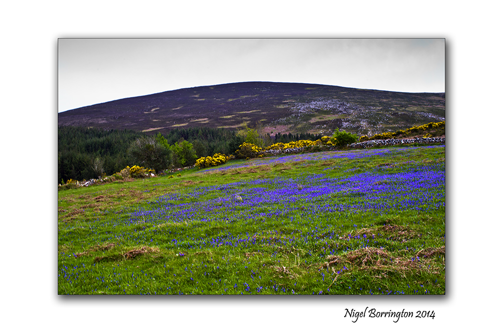
Images from a field of blue bells – Poem : ‘The Bright Field’ by R. S. Thomas

Our dog Molly, In the Blue bells field, Slievenamon, County Tipperary
Landscape Photography : Nigel Borrington
Located on the west slopes of Slievenamon , County Tipperary, is a small yet wonderful little field .
To reach it you have to walk some thirty minutes through wood-lands and up a mountain track, finally reaching a gate. The site that welcomes you in May is that of a field full of blue bells and an old derelict farm cottage. This cottage would be able to tell some amazing stories and if it only could!
Above the field are the mountain slopes that I am much more use to seeing, with mountain heather and scrub lands, streams and baths.
I have visited this field many times, its a great location during the summer and a wonderful escape and resting place after a walk to the top of the mountain.
I just wanted to share one of my most loved local locations here and also one of my most loved Poems by R. S. Thomas, which I feel is perfect for this post ….
The Bright Field
by R. S. Thomas
I have seen the sun break through
to illuminate a small field
for a while, and gone my way
and forgotten it. But that was the
pearl of great price, the one field that had
treasure in it. I realise now
that I must give all that I have
to possess it. Life is not hurrying
on to a receding future, nor hankering after
an imagined past. It is the turning
aside like Moses to the miracle
of the lit bush, to a brightness
that seemed as transitory as your youth
once, but is the eternity that awaits you.
The field a Gallery


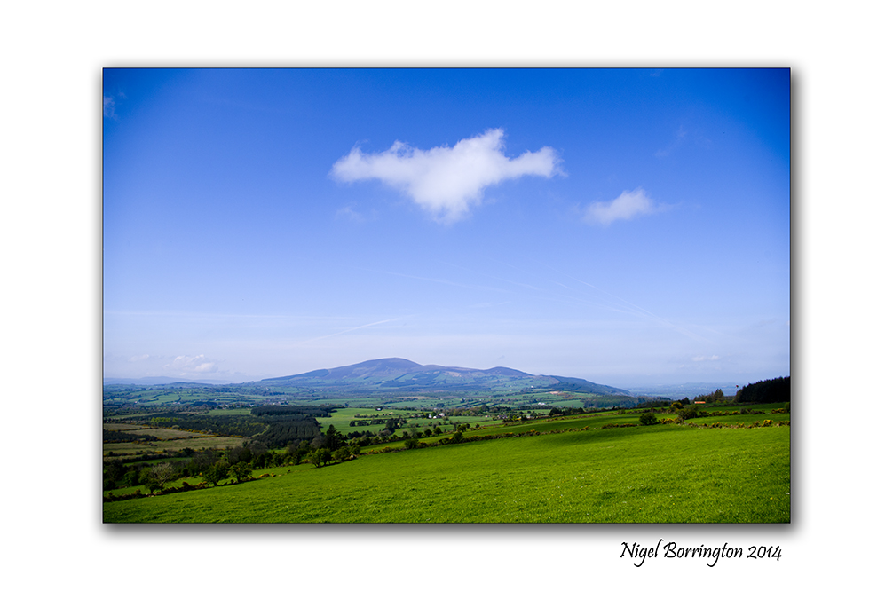
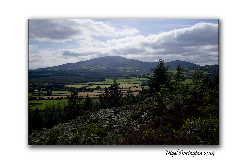
Kilkenny, Ireland , 500 million years ago
Landscape view of the kilkenny/Tipperary boarders
Irish Landscape photography : Nigel Borrington
Kilkenny, Ireland 500 Million years ago
During the week I posted an article about the area around the mountain of Slievenamon, County Kilkenny.
I hope over the summer to post many times about this area and show many of the foot hills along with the main mountain itself. A fellow blogger margaret, suggested that the formation of the mountain and the oval shape of the extending foot hills could be volcanic in their origins, I do think at some point in the long distant past this could be true.
I found the following summary of the geological history of county Kilkenny so I am going to share it here as I found it fascinating to think of some 500 million years of history of Ireland and its Geology.
Also a Gallery of images that show some of the amazing ice age rocks and landscape formations that can be found through out this great little part of the world.
Geologic History of Kilkenny
500 Million years ago – Sedimentary rock formed under parts of eastern Kilkenny, which was
under the sea.
400 Million years ago – the two parts of Ireland, the island, were fused together under the ocean.
400 Million years ago – the mountains at Brandon and the uplands at Tullogher were formed, again
under the sea.
350 Million years ago – Kilkenny was at a dry land stage with plant life that fossilized into the
yellow sandstones of Kiltorcan.
345 Million years ago – Kilkenny was submerged for about 20 Million years under a tropical shallow
ocean. Lime deposits from this era eventually became the limestone found commonly in
Kilkenny and Ireland. The polished limestone provides the famous Kilkenny marble.
320 million years ago – Kilkenny covered by a muddy delta and swamps, with deposits eventually
forming todays sandstones and coal.
250 Million years ago – a mountain building era resulting in the east-west mountains of Munster,
and the Walsh Mountain area between Millinavat and Slievenamon.
2 Million years ago – Ice age glacial periods intermixed with cold and warm periods begin.
500,000 years ago – A warm period known as the Gortian. Kilkenny is covered by forest of birch,
oak, pine, leder, fir, holly, yew, heather and grass.
200,000 years ago – A cold period lasting 70,000 years called the Munsterian. All of Kilkenny (and
Ireland) is covered by a sea of ice. Movement of Glaciers helped form the soil of today.
130,000 years ago – A warm period known as the Glenavian lasting about 60,000 years with climate
much like today.
70,000 years ago – A cold phase lasting about 60,000 years known as the Midlandian stage. Ice
sheets covered the northern half of Kilkenny, from Callan to Goresbridge. The southern have
would have included tundra grasslands and some woodland. Animal life is noted during this
time, including wooly mammoths, wolf, arctic fox, brown bear, the giant Irish Elk, reindeer
and lemmings.
10,000 years ago – The ice begins to melt, sea levels begin to rise and plants begin to reappear
in all of Kilkenny.
9,000 years ago – A birch dominated forest covers much of Kilkenny.
8,000 years ago – Hazel and pine become part of the forest population.
Landscape and Geological Gallery


Landscape and Geology around Slievenamon, county Tipperary

Panoramic Landscape of Slievenamon, county Tipperary
Forty square miles around Slievenamon
The Mountain of Slievenamon is located about 10km from our home and over the last few years I have walked up and around the this mountain a lot.
It is an area I am very taken by and love exploring.
For anyone who has visited the mountain and surrounding area, something that you may not have noticed however it the complete scale and geology of the mountain. When you look at the area from a satellite image (Like the one below) the geology of the area becomes a bit clearer.
To the left of the image above is the main mountain peek of Slievenamon, itself Rising up some 721m above the landscape below, however this is not the full extent of the mountain, spreading out towards the east and from the north and south of the mountain run two ridges of hills. These ridges them selves form an oval shape that meets some eight miles away from the mountain top.
Photographic project
Over the summer I want to record this complete area returning to the top of the mountain and then walking and recording as much of the ridge’s as possible.
History and Megalithic locations
One of the main reason I have for starting this project on the blog, is that for sometime I have noticed that both at the very top of Sleivenamon and around the oval of the extended foot hills are many Megalithic sites ( Stone circles, Passage tombs, Graves and Standing stones).
I will come back to the satellite image above and mark the location of any landscape images I post.
Above all I just want to share the landscape that I live in and reflect upon some of its history and enjoy myself getting to know it as much as I can.
The Landscape of Slievenamon
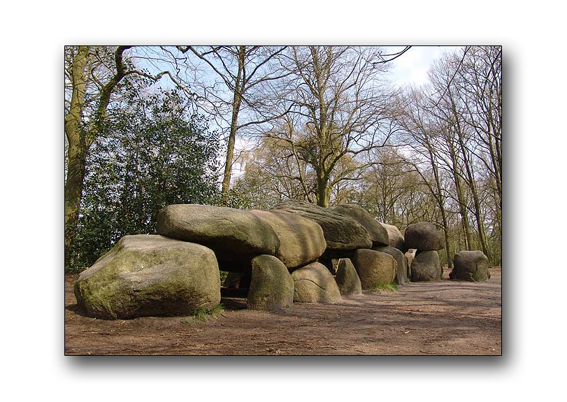
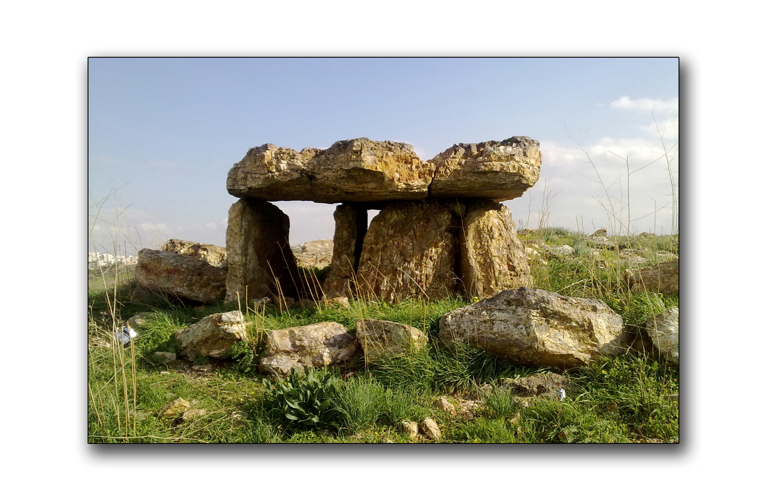
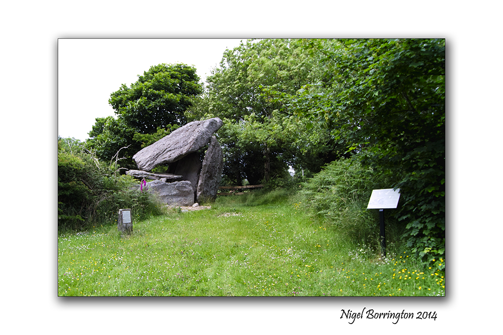
World wide megalithic Portal tomb’s a connection to county Kilkenny .

portal tomb at NewMarket, county Kilkenny
Landscape Photography : Nigel Borrington
Portal tombs, Dolmen’s, portal graves or quoit are a type of single-chamber megalithic tomb, usually consisting of two or more upright stones supporting a large flat horizontal capstone (table), although there are also more complex variants. Most date from the early Neolithic period (4000 to 3000 BC). Dolmens were typically covered with earth or smaller stones to form a barrow. In many instances, that covering has weathered away, leaving only the stone “skeleton” of the burial mound intact.
It remains unclear when, why, and by whom the earliest tomb’s were made. The oldest known tomb’s are in Western Europe, where they were set in place around 7000 years ago.
County Kilkenny has two such Tombs , the Newmarket tomb and the Kilmogue Portal Tomb at Harristown, both are dated to some 6000 years of age.
I did a little more reading on these tombs and it is very clear that they are very widely spread through out the world as the link below details :
http://en.wikipedia.org/wiki/Dolmen
The link shows their world wide locations as :
3.1 Asia
3.1.1 Korea
3.1.2 India
3.1.3 Eurasia (North Western Caucasus) Circassia
3.1.4 Middle East
3.2 Africa
3.2.1 Horn of Africa
3.2.2 North Africa
3.3 Europe
T-shaped Hunebed D27 in Borger-Odoorn, Netherlands.
Flint Dolmen in Johfiyeh, Jordan
You can see the full details by the link above!
I have been visiting these sites in Ireland for sometime as in Ireland we have many passage tombs through out the country.
Understanding however just how international these locations are is very fascinating.
It needs to be remembered that some 6000 years ago very few of the nations we know, if any existed and people travelled without boarders.
The first time anyone gave Ireland a name as such, it was called “Hibernia”.
Hibernia is the Classical Latin name for the island of Ireland. The name Hibernia was taken from Greek geographical accounts. During exploration of northwest Europe (c. 320 BC), Pytheas of Massilia called the island Iérnē (written Ἰέρνη). In his book Geographia (c. 150 AD), Claudius Ptolemaeus (“Ptolemy”) called the island Iouerníā (written Ἰουερνία, where “ου”-ou stands for w). The Roman historian Tacitus, in his book Agricola (c. 98 AD), uses the name Hibernia. The Romans also sometimes used Scotia, “land of the Scoti”, as a geographical term for Ireland in general, as well as just the part inhabited by those people.
Something that becomes very clear is that the peoples who lived in many different world wide locations often shared the same culture, they lived very closely to and with their environment, they were clearly pagan in their beliefs and as such very close to their surroundings.
Life would have been completely different from the life we know, they lived and moved to the cycles of the seasons, they eat and lived of the wildlife and nature that surrounded them, in some season they would have little food if any.
They clearly had Gods and figure heads, yet we have a tendency to place our own modern religious understanding on-to what this meant to them directly.
It is likely that their Gods were Mythical in nature and derived from memories of real people who they connected with different elements and forces of life that affected the way they lived and survived.
This wikipedia page lists some of the celtic Gods and Goddesses and shows the forces of life and nature that they were related to.
Kilkenny Portal tomb Gallery
NewMarket Portal Tomb
 .
.
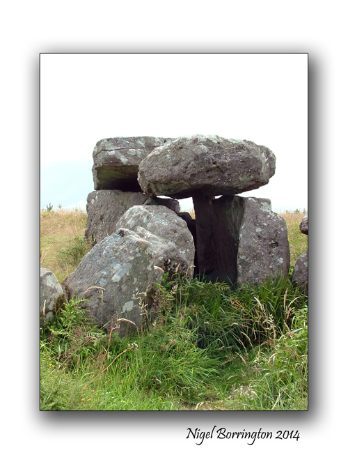
Kilmogue Portal Tomb


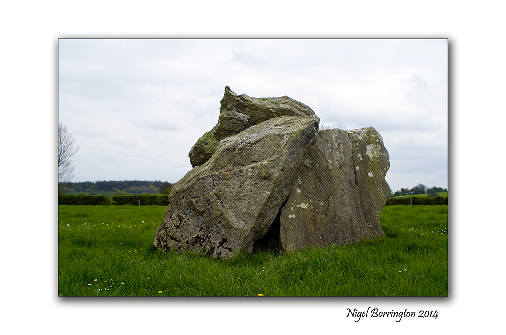
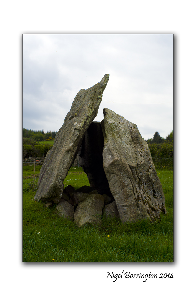
Kilmogue Portal Tomb, six thousand year of age.
Kilmogue Portal Tomb, county KIlkenny
Irish Landscape photography : Nigel Borrington
Kilmogue Portal Tomb
Sitting at the end of a short path near Harristown, county kilkenny, is a six thousand year old tomb, know nationally at the Kilmogue Portal Tomb but locally as, “Leac an Scail” – stone of the warrior/hero in English.
I have visited the site many times and I still find it an amazing location, the site has a sign placed near it that you can see below. It clearly states that the site has never been officially excavated, as is the case for many of these locations in Ireland. From evidence of Tombs constructed in exactly the same way around the European continent it is thought to be some six thousand years old. To put this in context , the great pyramids in Egypt were constructed around 2560 BC, so this tomb is some 1500 years older.
The tomb is constructed with a very large cap stone and side walls and it is hard to imagine just how the cap stone was lifted into place. The stones that can still be witnessed here would however have been surround by a mount of earth that has been long removed or washed away by six thousand years of rain. This earth mount would have been large maybe some 20 meters in diameter. It was likely then that the walls of the tomb were put in place first and supported with wood, then the earth mound constructed and finally the large cap stone rolled up the sides into its place and covered with more earth on top.
It is not known who’s tomb this was but the person buried here must have been considered very important in this Neolithic community, and the tomb would have acted as a place of memory for them and as was the tradition at the time the community would have held ceremonies here.
Each time I have visited I wonder just what these people where like, they were clearly pagan in their beliefs and very close to their surroundings and its nature. Life would have been completely different from the life we know, they lived and moved to the cycles of the seasons, they eat and lived from the wildlife and nature that surrounded them, in some season they would have little food. They most likely had Gods and figure heads yet we have a tendency to place our own modern religious understanding on-to what this meant to them.
It is likely that their Gods were Mythical in nature and derived from memories of real people who Mythically they created with different elements and forces of life and nature that affected the lives they lived.
List wikipedia page lists some of these Gods and Goddesses and shows the forces in life and nature that they related to.
I hope that the images below relate the Tomb and its location, the surrounding Landscape is very rural and one of county Kilkennys biggest dairy farming areas.
Leac an Scail, Image Gallery


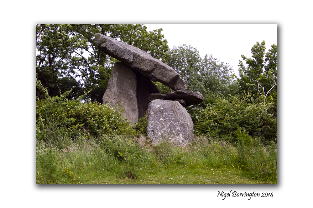
The Passage tomb of (Olioll Olum), King of Munster

The Passage Tomb of , Olioll Olum ( Died 234), Galbally Limerick
Irish Landscape Photography : Nigel Borrington
Irish Passage Tombs
Located on the side of Duntryleague Hill, County Limerick and the westerly extension of Slievenamuc hill is a passage tomb. The Tomb was constructed for Olioll Olum, one of the early Kings of Munster.
The name Duntryleague is derived from Dún-Trí-Liag, meaning the fort of three pillar stones. Diarmuid and Gráinne are also said to have rested here in their flight from the angry Fionn Mac CumhaillWell.
The route through the forest leading to the burial ground is accessible and leads to this amazing rock structure of the tomb. There is one enormous rock slab resting steadily across a number of famous cairns which measures approximately 25m north -south and 22m east-west. Continuing on from the cairn you come across many natural viewing points which extend over the terrain of west Limerick.
Olioll Olum, was a King of Munster, who died in 234, he is said to have been progenitor of most of the great families of the south of Ireland. He married Sabia, daughter of Con of the Hundred Battles, ruler of the north of Ireland.
He willed that after his death the sovereignty of Munster should vest alternately in the descendants of his son Eoghan Mor (the Eugenians, or Eoganachts, occupying the southern part of Munster), and those of his son Cormac Cas (the Dalcassians, occupying the northern part of the same province).
The images below include some landscapes of the surrounding mountains, this is not a bad place to be laid to rest.
Gallery of a Passage Tomb


Easter (Ostara) Friday at the beach.
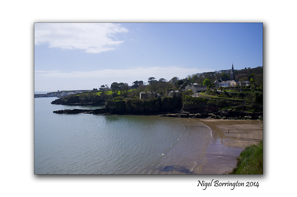
Dunmore east, County Waterford, Ireland
Irish Landscape Photography : Nigel Borrington
The Easter weekend is traditionally to first weekend of warm summer days here in Ireland, its a great time to get out and about and what better place than going down to the beach.
With a population of only 4.3 Million the beaches are never to full at this time of year, yet the weather can be very good. The images in this post were taken this Morning at the small fishing town of Dunmore east and the near by beach of Forenaught, a small and private little place that’s great for a morning swim.
Image Gallery


Easter (Ostara) Holidays in the Landscape.
Easter Holidays in the Irish Landscape
Landscape Photography : Nigel Borrington
Easter (Ostara)
Easter to many Christians marks a religious holiday and the two weeks around Easter weekend is traditionally a Holiday time.
Before the Christian tradition however it was still marked as Ostara by the Pagan world, marking a time of rebirth and new life, Life has returned to the landscape with new growth and natural foods available. Wild life is on the move again starting to make plans for a new breeding season, finding foods themselves and getting to put some much needed body weight back on.
Over the next two weeks I want to get out and capture these changes, as the march towards the summer months feels ever closer and closer.
Image Gallery


Where Go the Boats, A river Poem

Boats on the river Suir, County Tipperary
Landscape Photography : Nigel Borrington
Where Go the Boats?
Dark blue is the river.
Golden is the sand.
It flows along for ever,
With trees on either hand.
Green leaves a-floating,
Castles of the foam,
Boats of mine a-boating—
Where will all come home?
 .
.
On goes the river
And out past the mill,
Away down the valley,
Away down the hill.
Away down the river,
A hundred miles or more,
Other little children
Shall bring my boats ashore
 .
.
Robert Louis, Stevenson

You must be logged in to post a comment.