
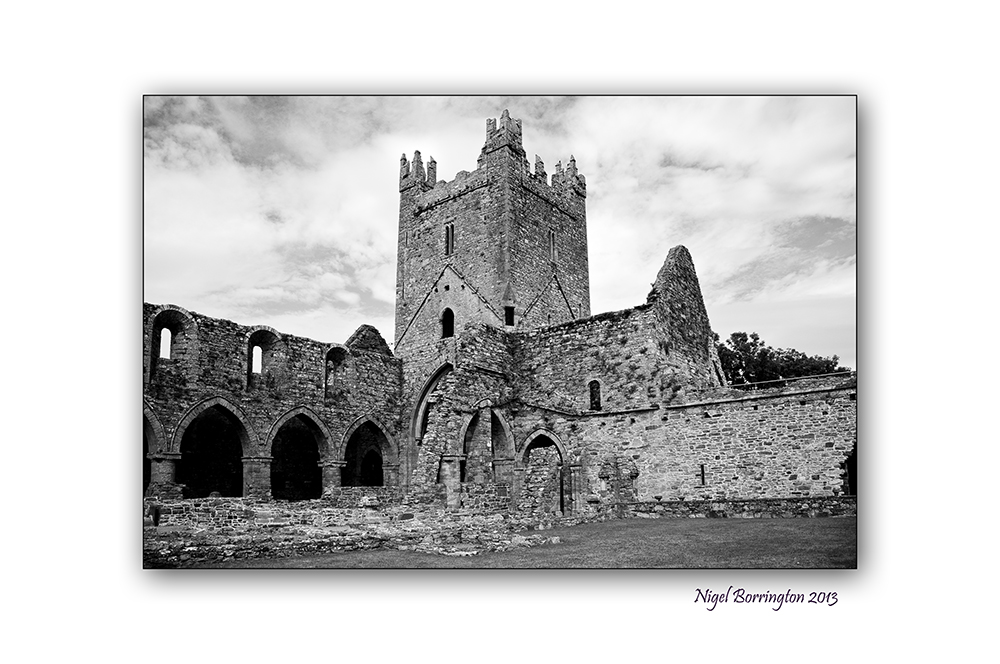
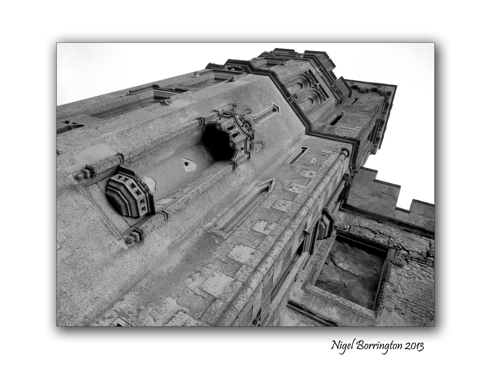
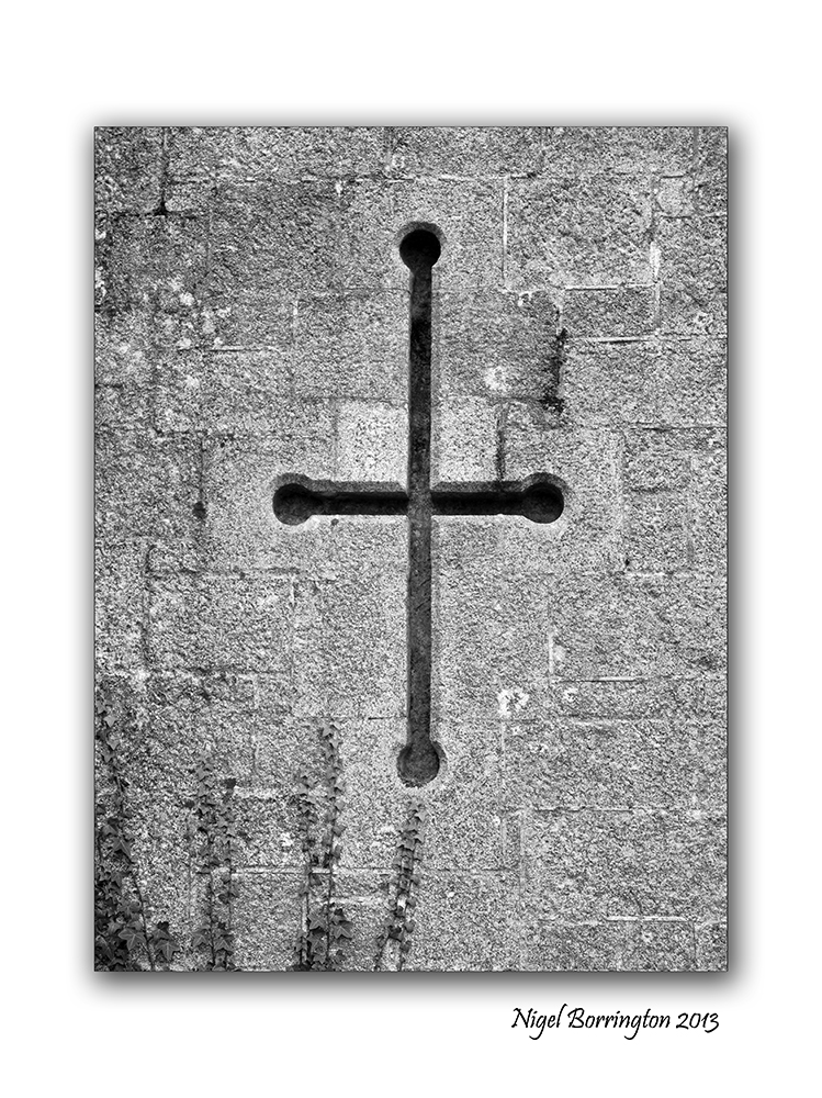
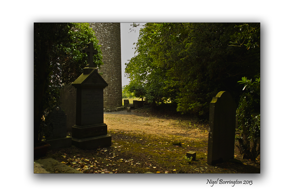
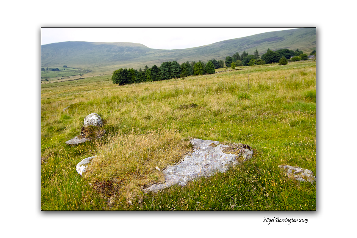
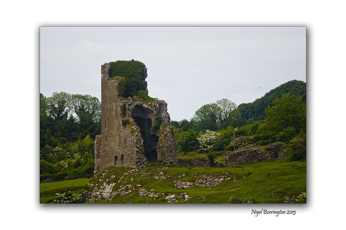
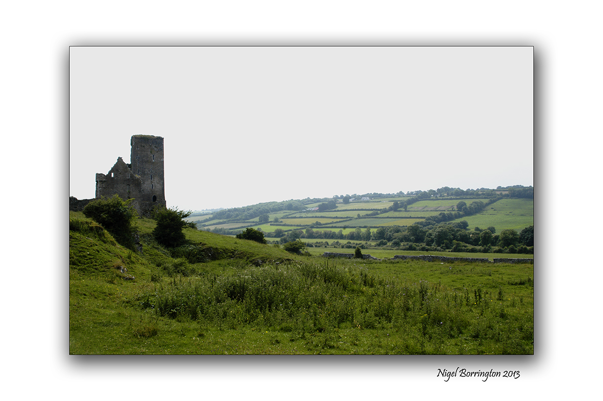
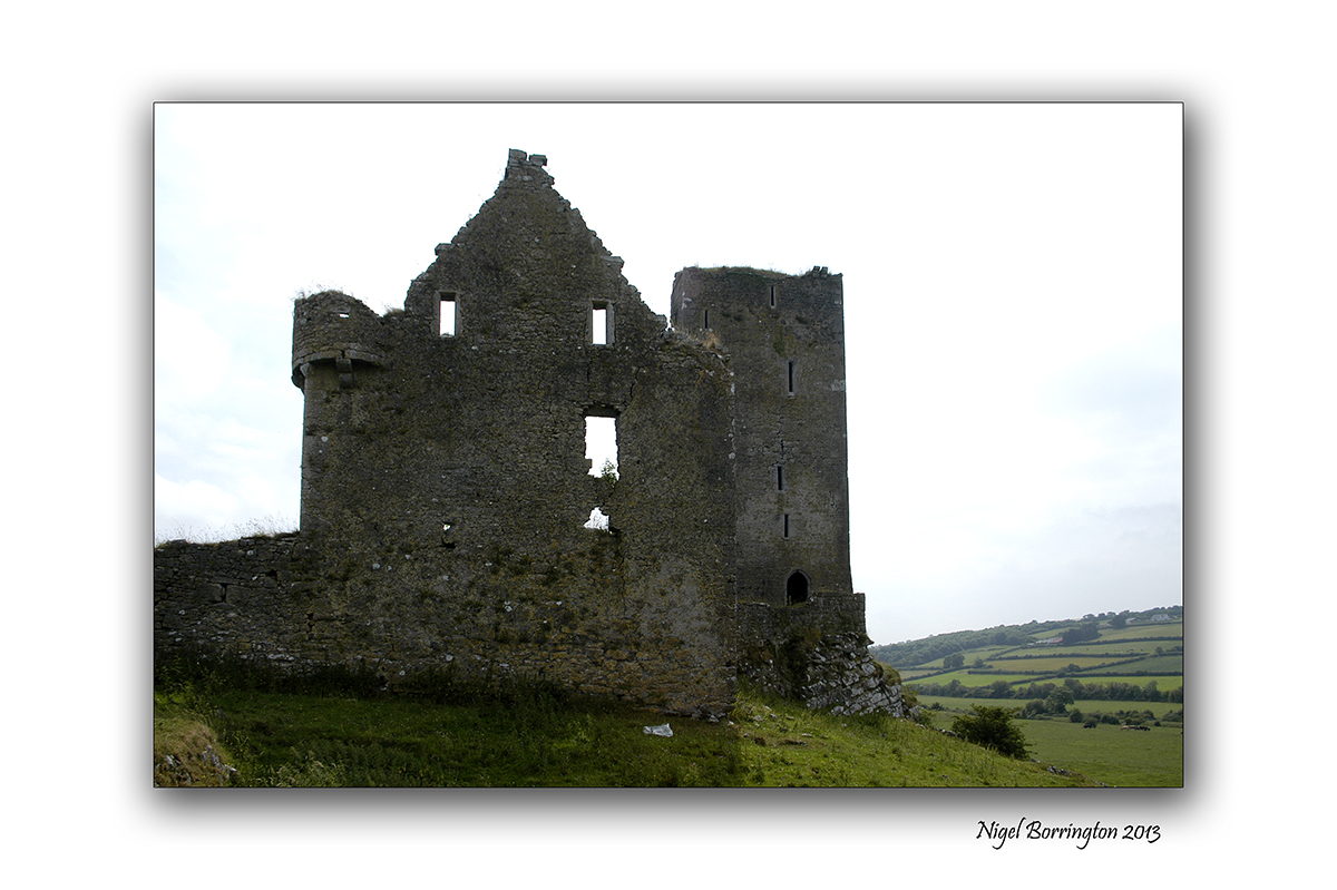
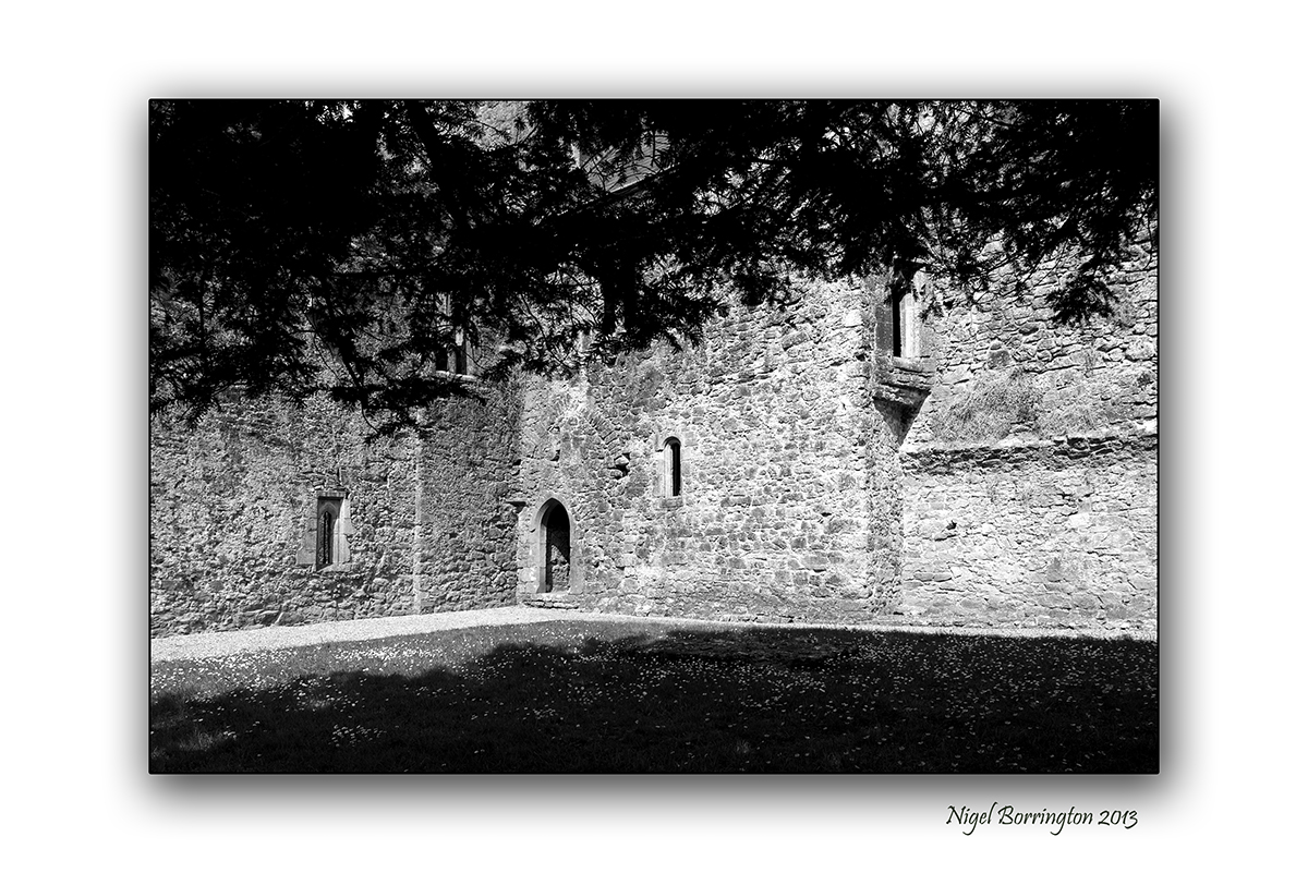
Jerpoint abbey, county Kilkenny

A sense of place,Jerpoint Abbey, County Kilkenny
Irish Landscape Photography : Nigel Borrington
A Sense of Place, Jerpoint Abbey
I intend to post a more detailed article about Jerpoint abbey soon, however here I just want to post some Images that I hope give you a feeling for this wonderful Cistercian abbey founded in the second half of the 12th century. The abbey is located near Thomastown, county Kilkenny.
For the moment if you would like more details on the abbey please following the link above.
Jerpoint Abbey, a black and white Gallery


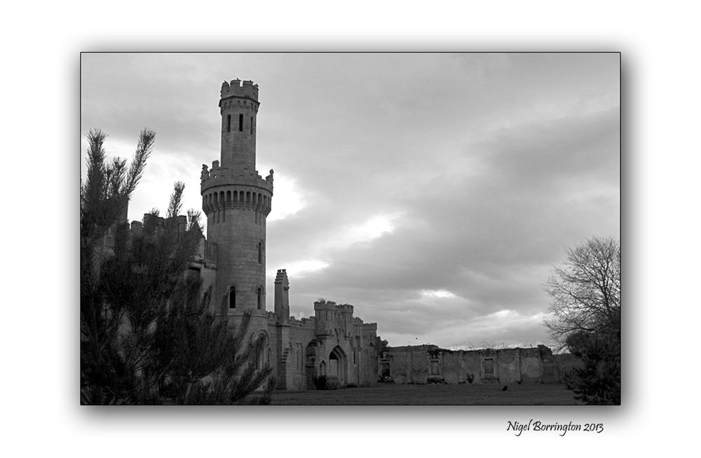
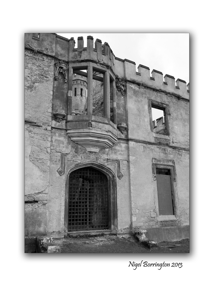
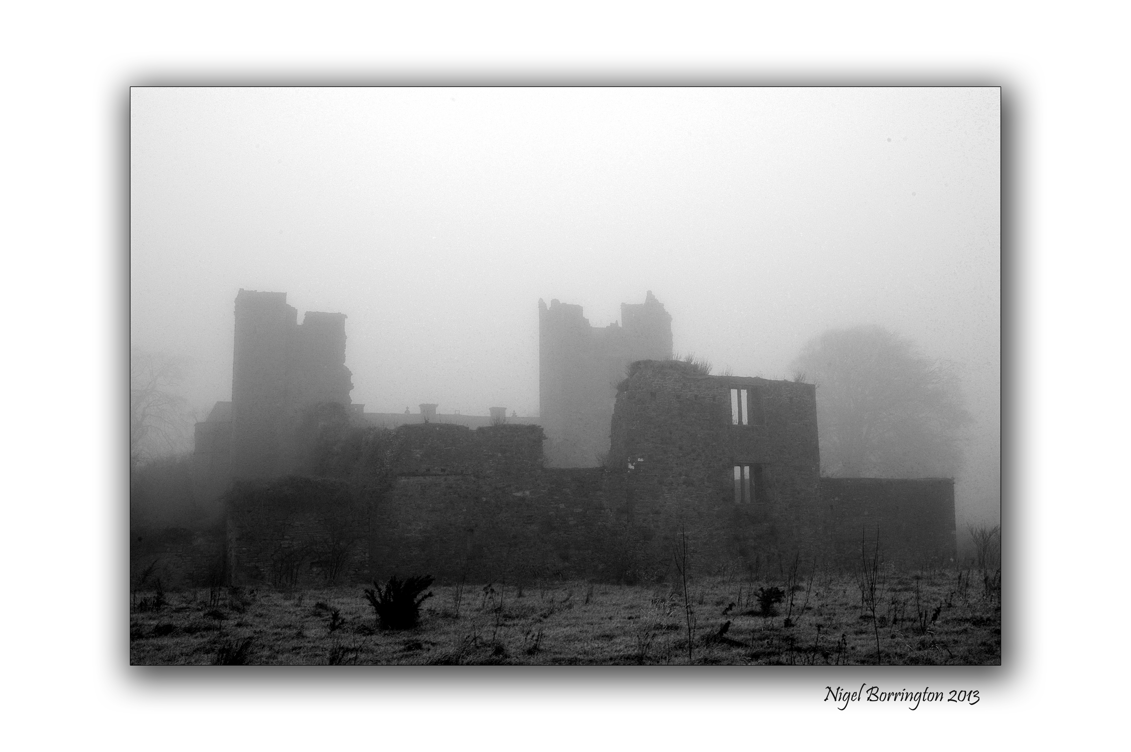
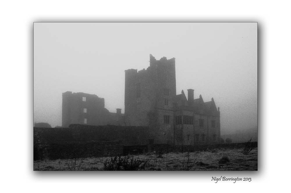
Ducketts grove, county Carlow

Images of Duckett’s Grove, County Carlow
Irish landscape photography By,
Kilkenny photographer : Nigel Borrington
A sense of place Ducketts grove, county Carlow
Ducketts grove is described in full on this link.
Here in this post however I just wanted to show a visual sense of this old Castle sitting in the middle of county Carlow, the photographs were taken during the winter of 2010. Its a wonderful place to visit on a late winters afternoon when the tree’s are all stripped of leafs and the ground is hard and cold.
The cold and snow of a winters day, seems to match so well this wonderful abandoned place.
Ducketts grove in twelve images : a Gallery


Kilree Round Tower, County KIlkenny

All image using a sigma SD15. 15-30mm lens
The Secret of Kells, Kilree Round Tower, County KIlkenny
Landscape Photography : Nigel Borrington
The secrets of the Kells is at Kilree
Kells, county kilkenny is full of heritage from past and while most people are drawn immediately to Kells Priory, one of the largest and best preserved walled monastic sites in Europe, there is another just as important with a history stretching back longer than the Cistercian brotherhood of the priory.
At Kilree, there is a trio of treasures – A round tower, an ancient church and a high cross where a king may or may not be buried. And adding to the mystique is a fourth, natural phenomenon, a Ballaun stone going back to pre-historic times that was used by the first inhabitants of this island. to drink from an for pagan idolatry.
Historians and archaeologists may have got it wrong about Kilree on a number of levels. When you first view if coming from Kells village it reminds you of Freestone Hill – An ancient place used before Christianity. It has commanding views of the surrounding countryside and seems to be the highest spot in the area and therefore a natural stronghold. Looking from it, you take in Knockdrinnagh Wood, Ballygowan, Hugginstown and the high lands beyond it and around to the Slieveardagh Hills. It also boasts commanding views of Sliabh an mBan and the Comeraghs in the distance.

So it begs the question was the round tower of Kilree used as a look out with its bells when danger was imminent. Was it used by the monks who were for all intents and purposes living in a hollow by the King’s River and therefore had no idea of who or what was approaching them. It’s probably too simplistic a view but we are sure of one thing – the tower was built around the 11th century and would have been used as a defence against the maurauding Vikings who had a stronghold in Waterford.
It is said but not proven that the bones of a great king are buried under the high Cross at Kilree, just 40 yards from the round tower and the church of St Brigid that lies in ruins yet still has a strong association with the people of the area in both Kells and Stoneyford. Although it stands 90 feet high, Kilree Round tower is not easy to see because it is set amid a grove of trees. A fine slim building with a diameter inside of just 9 feet it must have been tight in there. With six different levels and a battlement area at the top as well as a belfry, it is little wonder that rope ladders were used here.
Like the other round towers in the county, its entrance faces the church and there is a long association between the two.
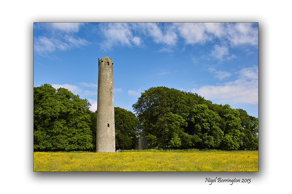
The round tower and church are enclosed in a grove of beautiful trees which seem to detract slightly from the height of the tower but once you enter this wonderful place you can feel the past coming at you. It’s sad that a sign in bold yellow at the entrance tells you to beware of the bull. What a lovely first impression for visitors. The land is extremely fertile and there is a rich covering of spring grass on the field and you can appreciate why a farmer would be so anxious to keep it so but the sign should be taken down when the bull is not there.
It is important to appreciate the work done by researchers over the years on Kilree and the rest of the county none more so that Canon Carrigan in his History of the Diocese of Ossory; the wonderful parish history of Dunnamaggin by Richard Lahart which provides us with so much detail but it is the findings of Ireland’s great antiquarian scholar from Slieverue in South Kilkenny, that is most revealing. The research by John O’Donovan on place names and on sites like Kilree for the Ordance Survey is invaluable in deepening our knowledge of our past.
Up to the middle of the 19th century it was claimed that King Niall Caille was buried here in 844AD and that his bones lay under the high Cross which is uninscribed. It seems now that the high cross was erected significantly before this date and we learn from different researchers that these kind of crosses were commemorative and not built to cover the dead. He upset a lot of people when he said the real ancient Irish name for the site was not actually Kilree which up to them was meant to be the church of the king but Cill Freach after a female saint, Freach. Canon Corrigan also studied this and felt that Kilree was a corruption of the name Cill Ruiddchi, the church of St Ruiddchi. While it is hard to go past the original name of Cill Bride as the name for the church, named after St Brigid, we do know from local people and from Richard Lahart that the well at Kilree was also named in honour of St Brigid and that goes back over 1,000 years. It is hard to see past Cill An Ri and of course it is still known locally by people as The Steeple, a reference to the bell tower on top of the round tower.
Inside the church,tombs of local people remain. The poorer people would have bee buried furthest away from the church. From Norman times the Howlings, Holdens or Howels are associated with the site and for some reason these are the same people as the Walsh’s of the Mountain (I don’t understand that). From medieval times, the Comerfords were closely associated with Kilree along with the Izod family, Flemings, Ryans, St Legers and of course in recent times, the Goreys.
Again the lack of signposts for such an amazing place is sad. The only sign coming from Kilkenny city is at Kells Priory and those in charge of the site, have done a good job in keeping it quiet.
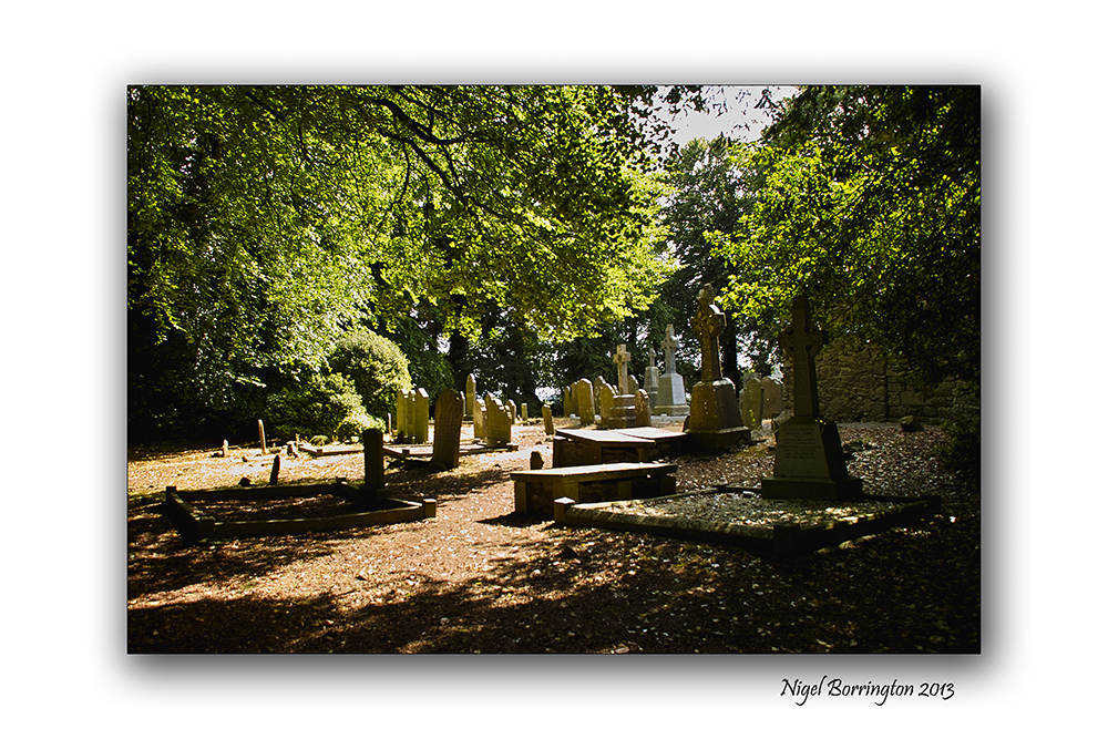
But what stands out most about Kilree is that it is still used as a graveyard and the ancient burial ground is well looked after by the people iving in the area..
Kilree is also home to a Ballaun Stone located 250 yards north of the round tower in the corner of a field of heavily weathered limestone and is marked on the Ordance survey map for the area. A bullaun is the term used for the depression in a stone which is often water filled.
Local folklore often attaches religious or magical significance to bullaun stones, such as the belief that the rainwater collecting in a stone’s hollow has healing properties. Ritual use of some bullaun stones continued well into the Christian period and many are found in association with early churches like Kilree or should that be St Brigids or St Freach’s or St Ruiddchi’s/ take your pick.
Published in the kilkenny people. 2012
Image Gallery

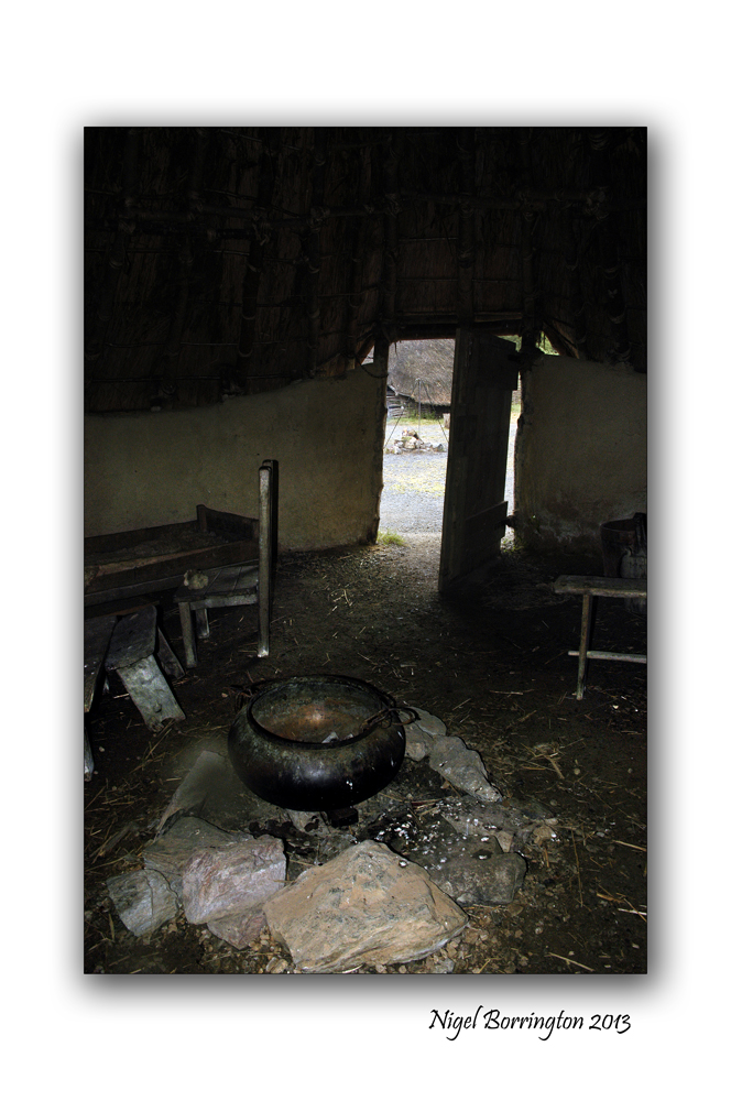
Irish National Heritage park
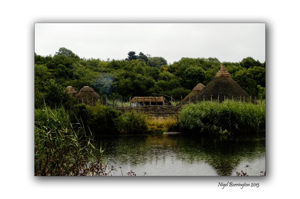
All images using a Nikon D700
Irish National Heritage park – A Crannog
Landscape photography : Nigel borrington
One place in Ireland you have to visit, in order to get a good sense of the nations history is the National heritage park.
Location
The Irish National Heritage Park Ferrycarrig, is Located in the South East of Ireland, approximately 3 miles from Wexford Town off the Dublin (N11) Rosslare Road (N25). Eleven miles from Rosslare Europort.
Sat Nav: N: 52.348 W: -6.51673
This park is Unique in Europe, occuping 35 acres and has 16 archaeological and historical reconstructions all located in their natural settings. The Heritage Park outlines the history of Irish life as the story of 10000 years unfolds before you. It is history presented in a unique way in magical and varied settings.
A Crannog
The images in this post are from the reconstructed Crannog, Wiki-pedia defines a Crannog as follows
“Crannogs were used as dwellings over five millennia from the European Neolithic Period, to as late as the 17th/early 18th century although in Scotland, convincing evidence for Early and Middle Bronze Age or Norse Period use is not currently present in the archaeological record. The earliest radiocarbon determinations obtained from key sites such as Oakbank in Loch Tay or Redcastle, Beauly Firth approach the Late Bronze Age – Early Iron Age transition at their widest interpretation at 2 sigma or 95.4% probability, falling after c.800BC and therefore could only be considered Late Bronze Age by the narrowest of margins. Crannogs have been variously interpreted as free-standing wooden structures, as at Loch Tay, although more commonly they exist as brush, stone or timber mounds which can be revetted with timber piles. However, in areas such as the Western Isles of Scotland, timber was unavailable from the Neolithic onwards. As a result, completely stone crannogs supporting drystone architecture are common here.
Today, crannogs typically appear as small, circular islets, often 10 to 30 metres (30 to 100 ft) in diameter, covered in dense vegetation due to their inaccessibility to grazing livestock.”
http://en.wikipedia.org/wiki/Crannog
Crannog images


Ormonde Castle
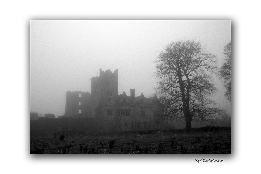
All images using a Nikon D7000
Ormonde Castle, County Tipperary
Irish Landscape photography: Nigel Borrington
Sitting on the bank of the river Suir ( Carrick-on-suir, county Tipperary ), Ormonde Castle calls out of Irish history and it’s fifteen hundreds.
From the misty past this castle still stands on the edge of a town whose history is completely dependant on this castle and the Ormonde family who built it. I will post with more details on the town and castle but for the moment I just wanted to give you a sense of this place.
These pictures where taken last December, about four day before Christmas and on a very foggy morning, the Castle stands on the banks of the river Suir and is often covered in mist during the winter months.
Ormonde castle a gallery


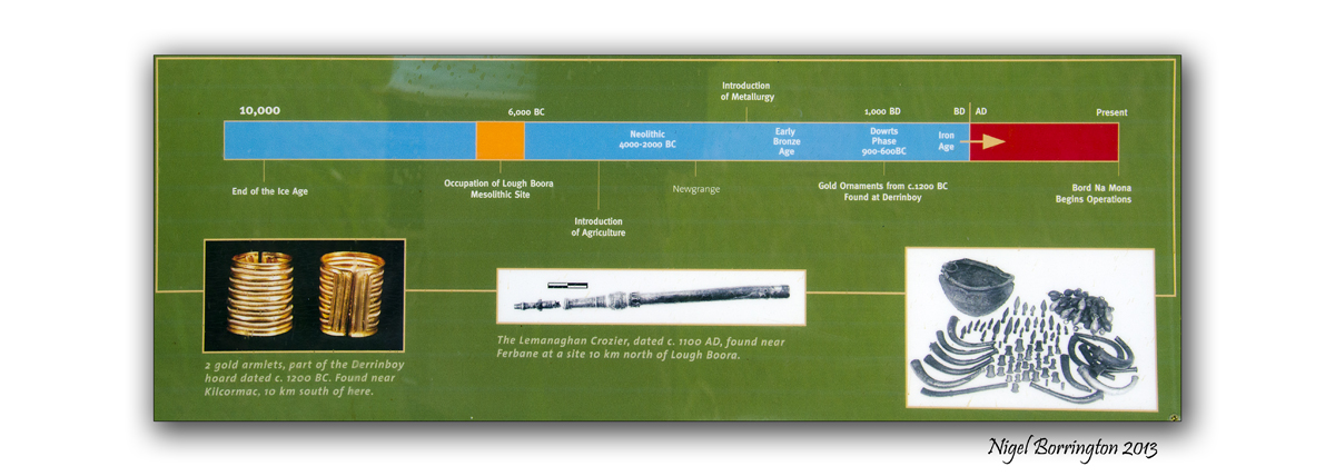
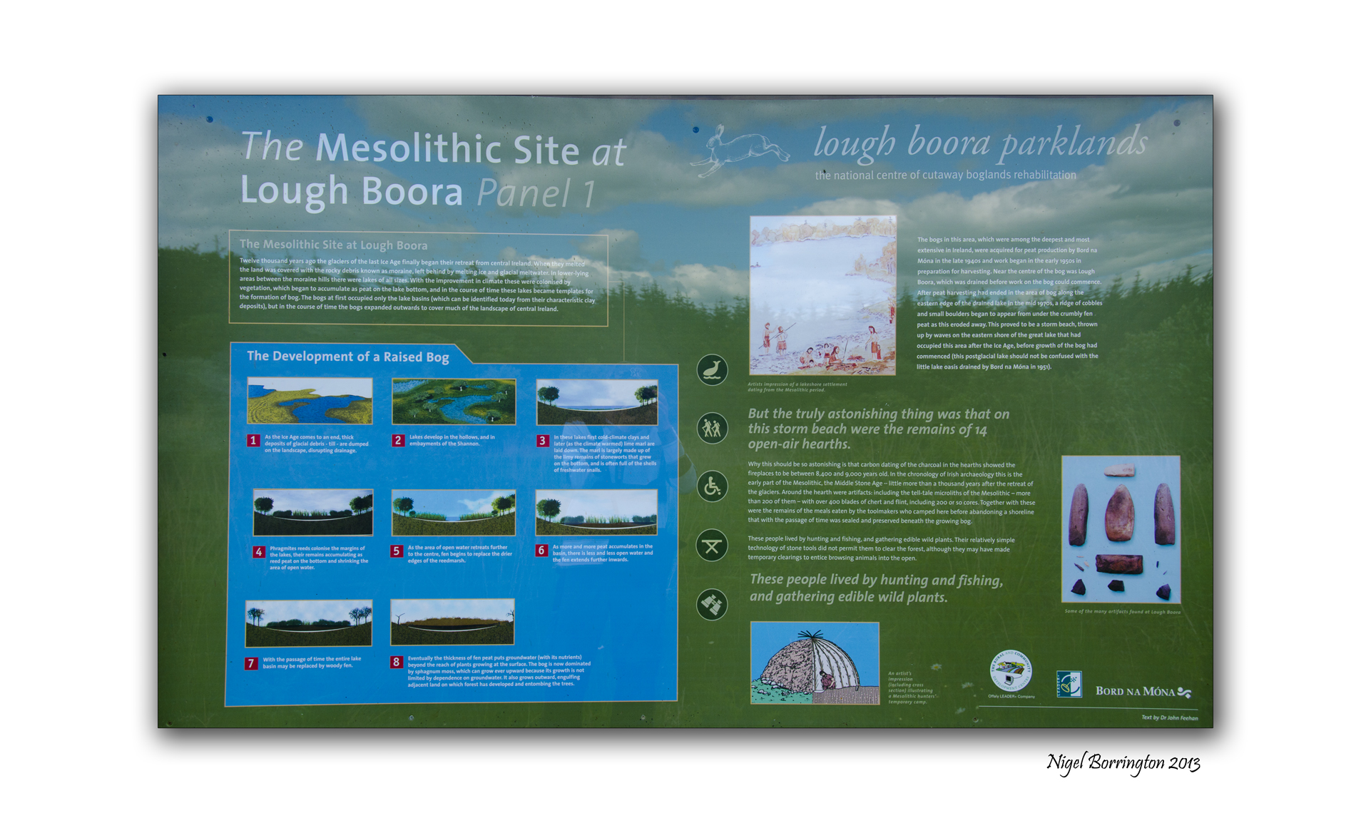
Lough Boora Parklands, County Offaly
Lough Boora Parklands, County Offaly
Irish Landscape photography : Nigel Borrington
Lough Boora parklands, are one of the most interesting outdoor locations you could visit in Ireland. They cover up to 14 kilometres of scenic views and cycle routes, the parkland has many sculptures and art installations for you to view along with miles of walking routes. The location is also a nature reserve that is home to many rare birds such as lapwings. The first image in the below Gallery is of two Lapwing flying above the park.
Along with the great sculptures which I will cover in full in another post, some archaeology found at the site has completely changed the history of the country. The remains of a village that would have sat on the banks of one of the biggest lakes in Europe at the time. The findings date the people living in this area back some eight and a half thousand years, this is some two and a half thousand years older than previously thought.
It also pre dates the Christian history of Ireland by some seven thousand years.
The village itself was large and well established for its time, indicating that man must have lived here for sometime before reaching this level of culture. This would indicate that Man moved back into Ireland soon after the ending of the last Ice age some ten thousand years ago.
I have taken some images of the information boards on the site, you can find them below the following images.
Image Gallery

Lapwing’s flying above the parklands.

Dog’s are fully welcomed , restrictions when the birds are nesting.

Many Installations and Sculpture’s.

Wooden Teepee Sculpture.

Bog Cotton, growing in the wetlands.
Information boards


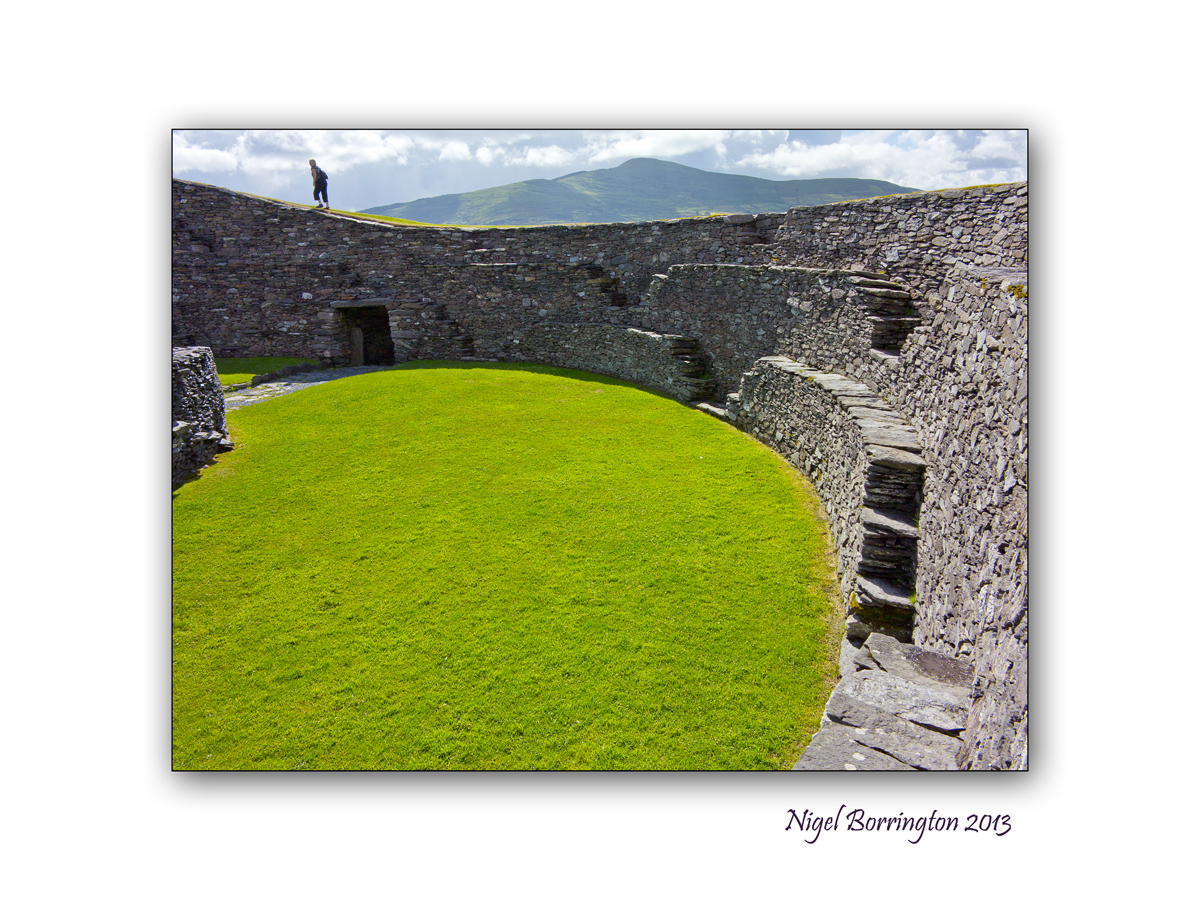
Cahergall ring fort, County Kerry

All Images : Canon G1x
Irish ring forts, Co.Kerry
Irish Landscape photography : Nigel Borrington
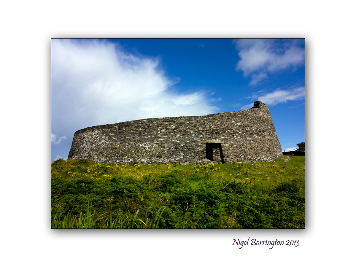
Cahergall Ring fort
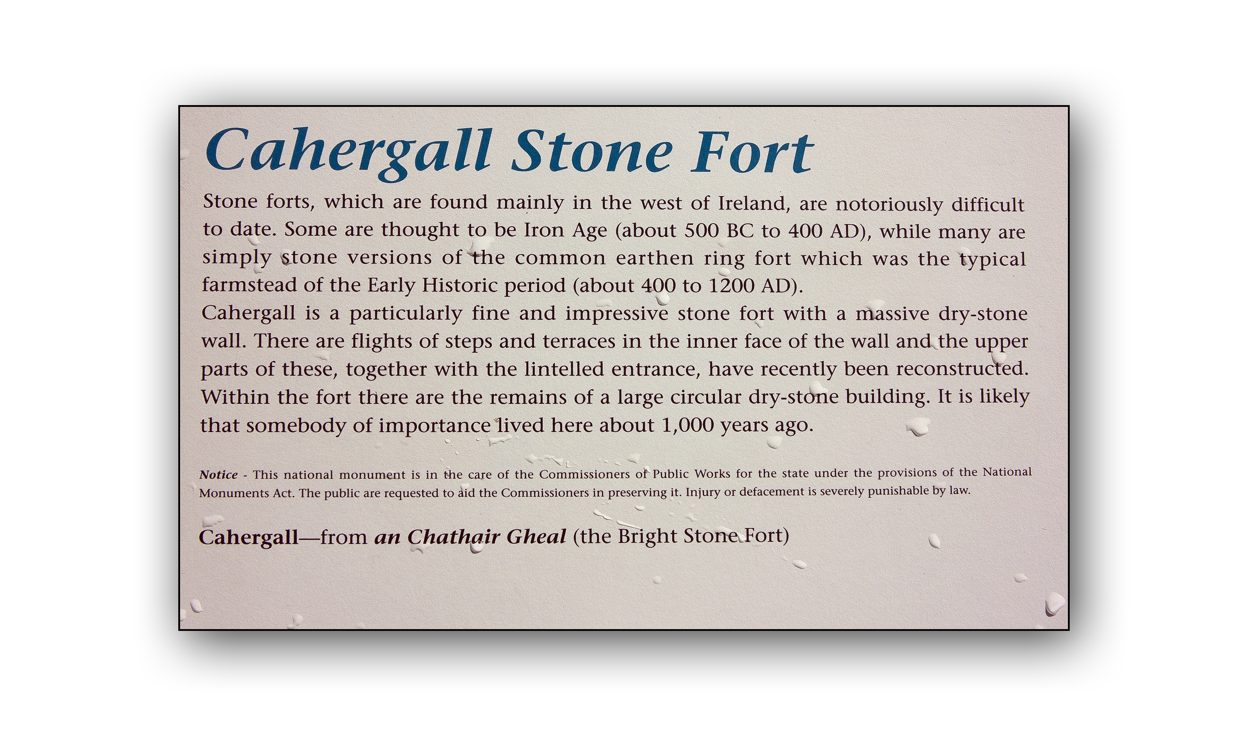
Following on from yesterdays post relating to Leacanabuile ring for in county Kerry, the area around the fort also contains more ring forts from the same period in Irish history.
Cahergall ring fort is a massive stone construction, built between 400BC and 500AD, It can be found close to Cahersiveen, County Kerry. Leacanabuaile feels very much more like a dwelling place for people to both live and keep themselves safe from the surrounding Environment. This included raiders and wild animals stealing cattle.
On approaching Cahergall, the scale of this fort is massive in comparison to Leacanabuaile, the walls rise some four to six meters from the ground, perfectly flat and sloping inwards from the ground towards the top. The fort is some twenty five meters wide and the walls some four meter thick.
Inside the fort the inner walls are stepped and consisting of three levels, each of these levels has a series of steps that take you the upper level. The top of the wall is full grassed and walkable. The views of the coastline and landscape around the fort is spectacular from here.
Although this fort is described as a living place, it is very different from other forts around, It has only one internal enclosure and this structure does not look like it could be lived in, at least not in the same way as the buildings within the other forts.
The semi-circular wall’s forming a circle in the center of the fort appear to be very much the focus point from the main walls, almost like this place was a ceremonial theater of some kind. You have to ask why the very different design for this place compared to the other forts and why it was built on such a grand scale. It is very much the focus point for the local community in the same way a church or public building would be today.
As to who these people where, Pat Flannery has some very interesting ideas and his views on Irish per-christian history is very interesting :
http://www.patflannery.com/IrishHistory/TheMilesians.htm
Cahergall Fort has been restored by the OPW and is owned by the Irish State.
Cahergall is well worth a visit if you are in the area and only short distance from Leacanabuaile Stone Fort.
Image Gallery


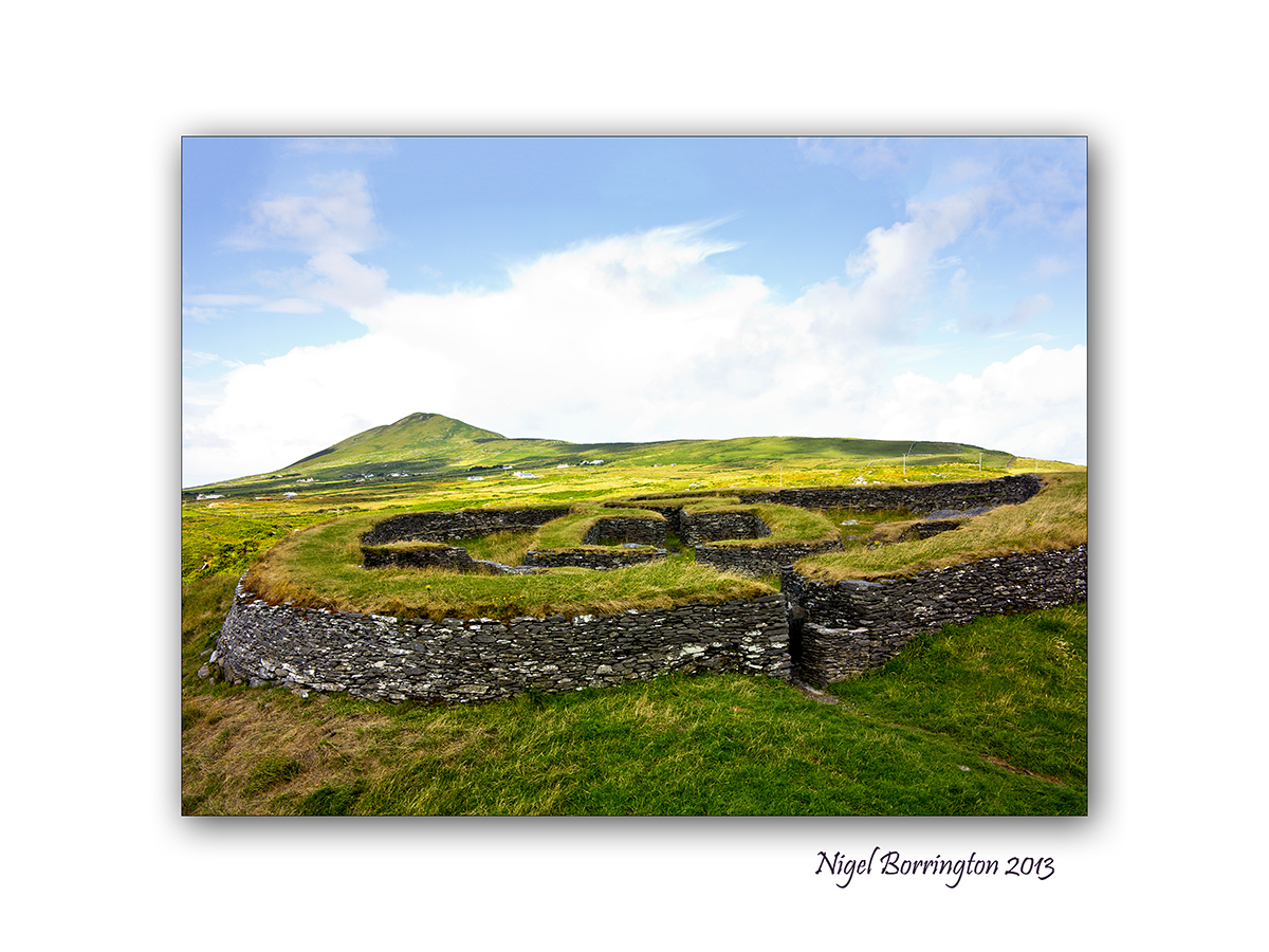
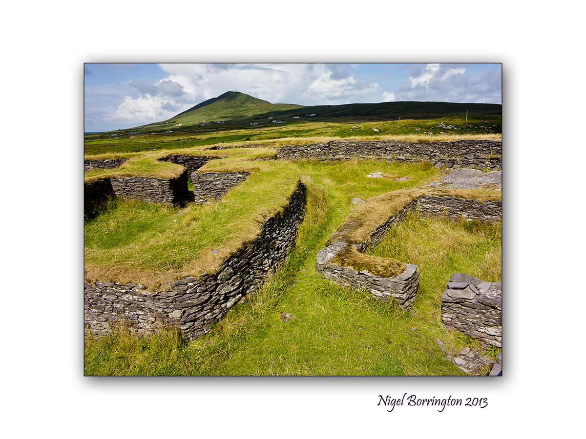
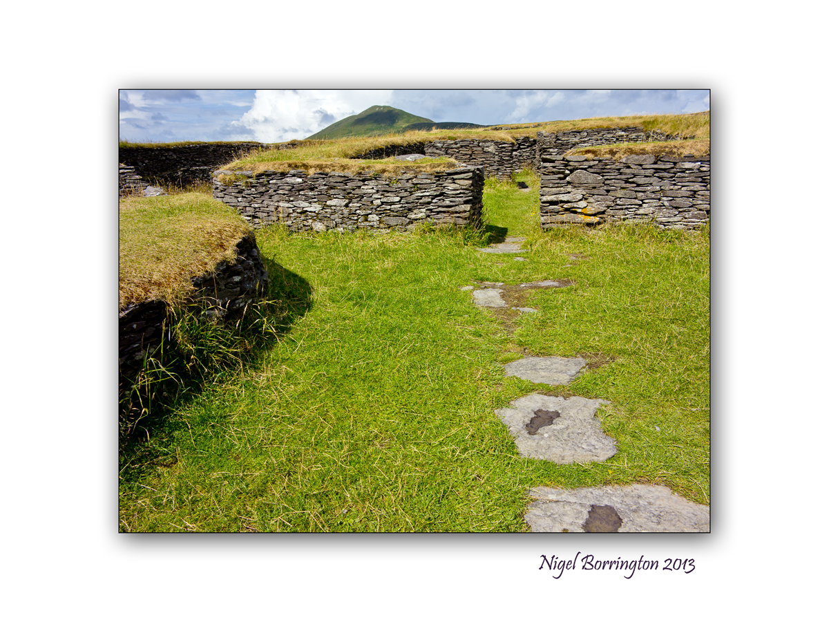
Leacanabuaile, stone ring Fort, Co.Kerry
All Images : Canon G1x
Irish ring forts, Co.Kerry
Irish Landscape photography : Nigel Borrington
Leacanabuaile, ring Fort
Sitting on a hill side near Cahersiveen in County Kerry is Leacanabuaile Stone Fort, it is considered one of the best examples of an Irish ring fort.
The name translates to ‘Hillside of the Summer Pasturage’.
This is a magical place and just the kind of prehistory site I love to be in and photograph.
This is the Ireland I have been searching for, this site predates the Irish christian period, and is a period in Irish history that is little covered and has been swallowed up by post christian teaching.
On researching this site I came across this link from Pat Flannery:
http://www.patflannery.com/IrishHistory/TheMilesians.htm
Having visited Leacanabuaile ring fort, I feel that there is some credibility to Pats views on Irish history. The site is located only a few fields in from the Kerry coast-line, it is very believable that the area around this ring fort is the landing site for peoples who settled here.
The Milesians
Around 1500 B.C. the Milisians who came from the Middle East and the Ionian sea came to Kerry in Ireland.
The most interesting thing about all these peoples is that they were Ionian people who were seafarers and thrived much, much earlier than the Celts who were totally Continental and not very good seafarers, rather like the Swiss.
The Irish language and customs would seem to support a close affinity with ancient Greece, the Middle East and Persia. Their heroic stories of warriors and chariots for example are very similar.
Spain and Portugal was merely a stepping off point for the sea journey north to Ireland, but scholars have confused the much later Iberian Celts with the Milesians. Apart from the fact that Celts did not occupy any part of Spain or Portugal until long after the Milesians, believing that everybody who came from Spain was Spanish, let alone Celtic, is similar to the belief of many Americans that their Irish ancestors came from County Cork simply because that’s where their ships left from.
Ring forts
Wikipedia description of ring forts : Ring forts
Excavation of Leacanabuaile
An archaeological excavation uncovered iron knives and mill stones suggesting the existence of an early farming community here. Standing atop the outer walls which are up to 3 metres thick, its great to imagine how the fort looked and how people lived in the past.
Image Gallery


—————————————-
Cahergall – ring fort
The area around Leacanabuaile also contains Cahergall – ring fort, an even more impressive fort and I will post about this very soon.
Stone circle in the comeragh mountains
All images using a Sigma SD15, 15-30mm lens, iso 50
Comeragh mountains – stone circle
Irish landscape photography : Nigel Borrington
Stone circles

For myself I love being out on a summer evening walking in the hills, a lot of the Irish hill sides are defined as common land and even though farmed by the same families for many generations these areas are by law open land.
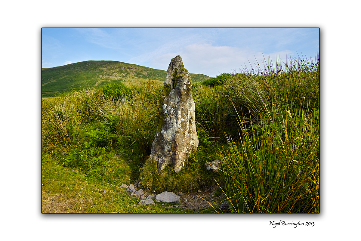
The Comeragh mountains in county waterford has many locations well worth finding but for myself the most interesting are the neolithic monuments and grave sites.
While out last evening I came across this stone circle resting in one of the many valleys in this area, it once would have been a monumental site with its some eight foot high standing stones used to mark the passing of the farming year.
Ireland has a wealth of prehistoric sites that few since the Christian period pay any attention to, for myself however this is where the true history of Ireland exists, People existed in small communities at a local level, however they had everything in common with and communicated with people throughout Europe.
They existed in nature, out in the wilds and they understood the world around them with their very survival in mind, they held personal skill that they learnt from each other.
This stone circle marks those skill’s very well as measuring the seasons was vital to them.
NB: I have circled the above map to locate the stone circle and give some idea as to its size.
Comeragh mountains stone circle – Gallery


Graystown Castle – Tipperary , An Irish castles
All images using a Nikon D200, 18-200 vr 2 lens, iso 100
Burnchurch Castle, County Tipperary
Landscape photography : Nigel Borrington
Graystown Castle- Tipperary
A little time back I blogged about the area of Burnchurch and Graystown, Killenaule, Co Tipperary (70 years of Potato farming), writing then about my in-laws history of farming in this area. At the time I was asked about the castle that was in one of the pictures at the end of the farm, in the distance.

The castle is Graystown Castle- Tipperary and it has stood in this area since 1654.
This is the best article I can find on the internet :

An old castle stands in ruins on the road from Moyglass to Graystown and it is called Graystown Castle. It is mentioned in Gough’s Camden as being in ruins and situated near Killynaul. It is built on a limestone rock of considerable height on west and north sides and sustaining on one extremely the north-west angle of the building.
The original castle was probably built around 1170, by a man named Raymond Le Gros who was a Norman. From the word ‘Gros’ we got we get the name Graystown or Baile Le Gros as it is known in Irish.
However, the present ruins can hardly be older than the 16th century. It is described in the Civil survey (1654) as follows “Upon this land standeth a good castle, a slate house wantinge repaire with a large bawne and severall cabbins”.
Henry Laffan who was an official of the Butler Family, acquired considerable property in Co. Tipperary at the beginning of the 14th century. In 1305 he got 120 acres in Graystown from Geruase De Raley. This Henry Laffan was said to be the first of the Laffan Family, whose chief seat was in Graystown from then on. In 1521, Thomas Laffan, Lord of Ballingarry, granted to the Earl of Ormonde, the land of Ballinure. He was probably dead before 1524, in which year James Laffan of Graystown was one of the freeholders of Tipperary, who complained to King Henry VIII of the extortions, coyne and livery levied on them by Sir James Butler of Kiltinan and Sir Edmond Butler of Cahir as dupties of the Earl of Ormonde. James Laffan died in 1607.
In 1613, Thomas Laffan of Graystown was a member of Parliament for Tipperary. The proprietor of Graystown and Noan, 3200 acres in 1640, was Henry Laffan of Graystown while Marcus Laffan, his son, apparently held the remainder of the family property in Lurgoe, 640 acres. Henry was dead before 1649, for Marcus was found in Graystown in that year and was a Commissioner for the levying of troops and taxes in Slieveardagh. Marcus was transplanted to Connaught where he was alotted 1184 acres.
The Cromwellian grantee of Graystown was Gyles Cooke. He held the title of the area in 1659 and had two hearths there in 1665 (Petty Cenus Money Records).
So here it stands today, sitting at the end of a valley in this wonderfully peaceful landscape.
Graystown Castle – Gallery

Kilcooley Abbey

All images using a Sigma SD15, 15-30mm lens, iso 50
A sense of place, Kilcooley Abbey, county Tipperary
Irish Landscape Photography : Nigel Borrington
Kilcooley Abbey, County Tipperary
Kilcooley Abbey is a Cistercian Abbey close to the Village of Gortnahoe,in Co Tipperary, located within the grounds of the Kilcooley Estate. This abbey dates from 1182 when Donal Mor O’ Brien granted lands to the Cistercians, to build an abbey here. The abbey which is a sister house to both Jerpoint Abbey and Holy Cross Abbey, is considered to be a hidden gem,tucked away in this remote corner of Co. Tipperary. The Abbey is found inside a walled estate.
The main part of the abbey consists of the Entrance Chamber, the Church, the Tower and the Sacristy. The Entrance Chamber has a well carved baptismal font on its south wall. The nave of the church is still roofed but the rest of it is out in the open. The church has two large carved windows on its east and west side. The chancel contains two stone tombs and a stone altar. One of these tombs is that of the knight Piers Fitz Oge Butler. His tomb records his death as taking place in 1526 and has some beautiful carvings of 10 apostles on the side of it carved by Rory O Tunney who is also noted for his work in Jerpoint Abbey. On top of Butler tomb there is the effigy of a knight with a dog curled up at his feet. The knight though hasn’t fared well through the years and most of his face has been chipped off. The Sacristy is entered through a magnificent carved archway which has many carvings such as a scene depicting the crucifixion and more bizarrely a mermaid holding a mirror which was meant to depict vanity. Roger Stalley suspects this screen wall may represent the entrance to a private Butler chapel, as two Butler shields are depicted. The east end of the nave is notable, because seats for the officiating clergy have been carved into the crossing piers. The work here is very fine, but does not have the sculptural finesse of nearby Holycross Abbey.

Outside the abbey there is also a beehive shaped ruin. It isn’t known whether this was used as a Columbarium to store ashes or a dove-cote for pigeons. But most probably it was a dove-cote since there is a 3-foot (0.91 m) wide hole in the ceiling from which they would have entered and left. Also outside the abbey is the Infirmary which is still in a fairly good condition although access to the roof of it is blocked.
The Cloisters of the abbey are long gone with only one column still remaining. The path of the cloisters though still remains with a pebbled walkway around the grass square. The centre even has a large tree growing in it. Beside the Cloisters the Parlour and Chapter House are still there. Also the Calefactory (Warming room) still remains but without a roof. And on the south side of the Cloisters the Monks Dining Hall still stands. The dining hall although it has no roof still has a spiral staircase but this sadly has been barred up because of an ever increasing Irish-to-American(sue-happy)society. You’ll also find all the second floor rooms such as the Monks Dorms and the Main Tower locked up by a certain Office of Public Works and for some reason the Parlour, Chapter House and Calefactory are also barred. But don’t let this deter you from visiting one of the most comprehensive abbeys in Ireland.
Kilcooly Abbey was also used in the making of the film by John Boorman “Excalibur” based on the tale of King Arthur and the knights of the round table. There is an interesting pyramid structure on the grounds of the abbey.
Gallery images


The ferry to Bere island
All images using a Nikon D7000, 18-200mm lens
The Castletownbere to Bere Island ferry, west Cork
Landscape Photography : Nigel Borrington
One summers afternoon on a visit to Castletownbere, I sat down on a bench at the quay’s and took some images of the ferry arriving from Bere island. West Cork has many small Islands but not all are serviced so well by ferries like this one.
I have lived in different locations during my life and lived with different methods of transport (Cars, A Bus, trains, motorcycles, cycles) but never a ferry, it must be an amazing things to live your life using one each and everyday to get home. The passengers on the ferry during the day were people getting to work, shopping, school kids and holiday makers.
Both locations well work a visit.
The Castletownbere ferry web pages
A Gallery of a ferry


The To-be-forgotten By Thomas Hardy

The To-be-forgotten
By Thomas Hardy
.
I
I heard a small sad sound,
And stood awhile among the tombs around:
“Wherefore, old friends,” said I, “are you distrest,
Now, screened from life’s unrest?”
II
—”O not at being here;
But that our future second death is near;
When, with the living, memory of us numbs,
And blank oblivion comes!
III
“These, our sped ancestry,
Lie here embraced by deeper death than we;
Nor shape nor thought of theirs can you descry
With keenest backward eye.

IV
“They count as quite forgot;
They are as men who have existed not;
Theirs is a loss past loss of fitful breath;
It is the second death.
V
“We here, as yet, each day
Are blest with dear recall; as yet, can say
We hold in some soul loved continuance
Of shape and voice and glance.
VI
“But what has been will be —
First memory, then oblivion’s swallowing sea;
Like men foregone, shall we merge into those
Whose story no one knows.
VII
“For which of us could hope
To show in life that world-awakening scope
Granted the few whose memory none lets die,
But all men magnify?
VIII
“We were but Fortune’s sport;
Things true, things lovely, things of good report
We neither shunned nor sought … We see our bourne,
And seeing it we mourn.”
Finding Samuel Richard Grubb

Nikon D7000, 18-200mm lens, iso 200
Monument to Samual Richard Grub, Sugarloaf Hill, Knockmealdown Mountains, Co Tipperary
Landscape Photography : Nigel Borrington
If you visit (Sugerloaf hill, Knickmealdowns, Co Tipperary) you will come across the Sanuel Richard Grubb monument, the monument was constructed in 1921 as a tribute to this man.
So who was this man and why even today does both the monument and his grave below it, sit looking out from the Knockmealdowns, county Tipperary.
The only records I can find are as follows:
Samuel Richard Grubb
M, #619382, b. 26 September 1855, d. 22 September 1921
Last Edited=1 Feb 2013
Consanguinity Index=6.64%
Samuel Richard Grubb was born on 26 September 1855.1 He was the son of Richard Davis Grubb and Margaret Butler Grubbe.2 He married Alice Hannah Binney, daughter of Edward William Binney, on 8 July 1885.1 He died on 22 September 1921 at age 65.1
He held the office of Justice of the Peace (J.P.).1 He held the office of High Sheriff in 1914.1 He lived at Castle Grace, County Tipperary, Ireland.1
Children of Samuel Richard Grubb and Alice Hannah Binney
Richard Raymond De Cruce Grubb+2 b. 11 Jun 1886, d. 28 Dec 1970
Joan Mary Grubb+2 b. 30 Jul 1889, d. 2 Feb 1968
Citations
[S47] Hugh Montgomery-Massingberd, editor, Burke’s Irish Family Records (London, U.K.: Burkes Peerage Ltd, 1976), page 527. Hereinafter cited as Burke’s Irish Family Records.
[S47] Hugh Montgomery-Massingberd, Burke’s Irish Family Records.
A justice of the peace in Ireland
Justices of the Peace existed in Ireland prior to 1922, sitting in a bench under the supervision of resident magistrates at Petty Sessions to try minor offences summarily, and with a County Court Judge (in his capacity of Chairman of Quarter Sessions) and jury to try more serious offences at Quarter Sessions. In the Irish Free State the position was effectively abolished by the District Justices (Temporary Provisions) Act 1923[11] and permanently abolished by the Courts of Justice Act 1924. Their judicial powers were replaced by full-time, legally qualified District Justices (now called District Judges) and their quasi judicial powers by lay Peace Commissioners. Peace Commissioners may sign statutory declarations and affidavits, and may issue search warrants to the Garda Síochána (Irish police).[12]
As with many of the tourist attractions around Clogheen, such as Bay Lough Shanrahan and The Vee, a visit to Samuel Grubb’s Grave, and the wonderful views across the Vee Valley. It is a wonderful area for a day trip.
According to Samuel’s descendant, Nicholas, the burial took place on the Sugar Loaf partly because it was requested by the deceased. This request, however, was largely because the family had been removed from the Society of Friends (better known as the Quakers) in 1844 (11 years before Samuel was born) for engaging in ‘amusements or entertainments of a hurtful or injurious tendency’, more specifically for attending ‘Balls at which music and dancing form a chief part’ and which were forbidden by the rules of the Society.
I cannot find on-line any death records to indicate how he died, I will keep looking ….
Gallery on the Monument and its views


Getting on-top of slievenamon

Canon g1x, iso 100
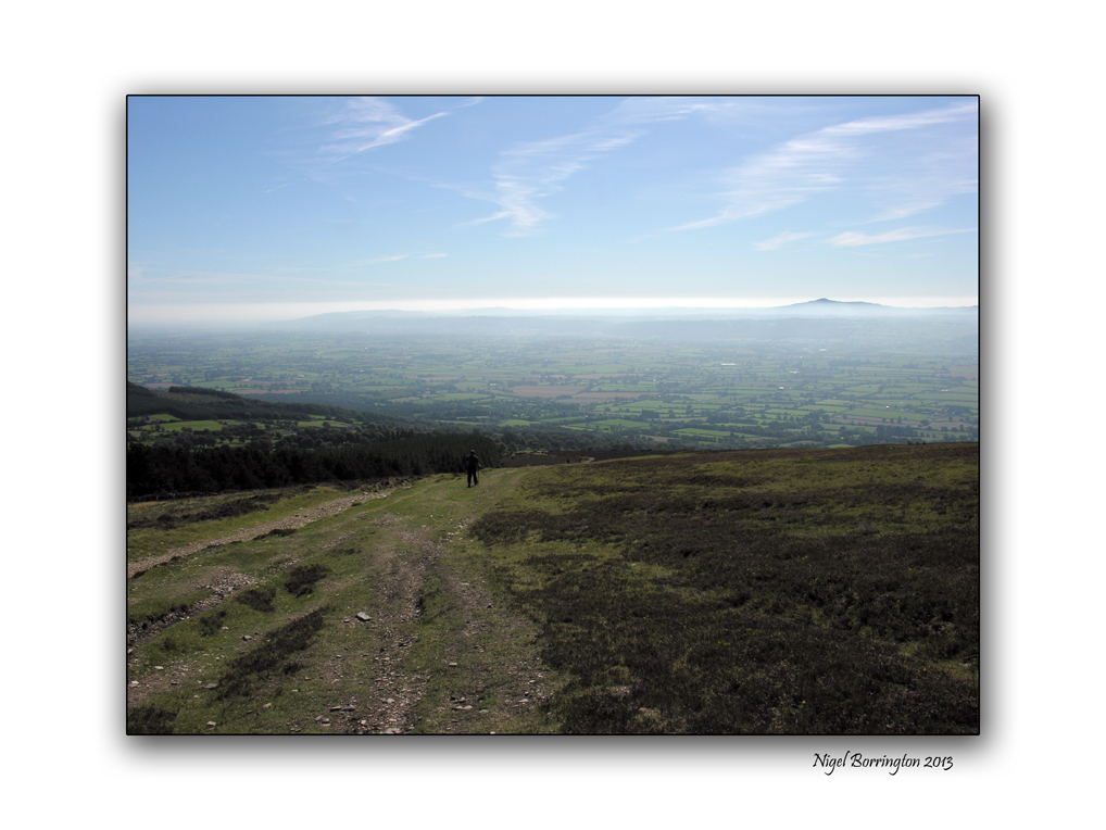
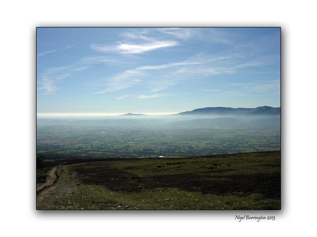
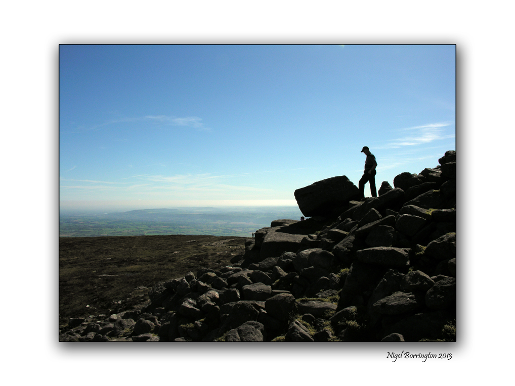
Slievenamon, county Tipperary
Irish landscape photography : Nigel borrington
Slievenanom, county Tipperary is our closest mountain about a 15min drive, I would love to begin including it into my posts much more than I have to date, I walked up this mountain a few times last year and although its hard going it is more that possible for most people.
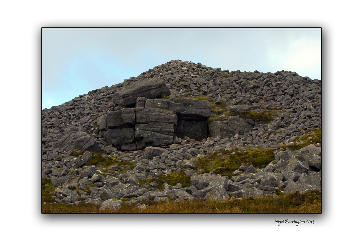
The most interesting thing to me about the mountain is at the very top and it is the burial Cairn you can see in the last of these pictures. No one appears to know anything about it yet its mystery must call someone to find out more….
This articular was published in 2008 in the “Tipperary star news paper”
The Story of Slievenamon
Published on 03/11/2008
Since our Tipperary Star travels all over the world, especially on the Internet our emigrants will surely be interested in the story behind the Tipperary’s anthem Slievenamon. It was printed in the Irish Daily Mail in September and all Tipperary people good and true would surely be in the better of knowing all about it.
The stirring strains of that great Tipperary anthem Slievenamon are guaranteed to bring a tear to the eye of many exiles. On first glance Slievenamon which is not far from Clonmel in South Tipperary and rises to 719 metres seems rather unprepossessing. But rocks and its valleys contain many hidden gems such as a prehistoric cairn which may contain a passage grave but remains unexcavated.
Slievenamon, which means mountain of the women in Irish deprives it’s name from the fairy women of Feidhlinn.
Legend has it that the celtic warrior Fionn Mac Cumhaill chose his bride Grainne from a group of maidens who raced to meet him near the top of the mountain. Slievenamon is also steeped in the national struggle. A group of United Irishmen were betrayed and slaughtered on the mountain during the 1798 rebellion.
Tipp. people are rightly proud of the mountain and guard it jealously, five years ago when an entrepreneur planned to build a wind farm in its slopes there was such public outrage that the scheme was dropped.
The song Slievenamon which began life as the Maid of Slievenamon was written by the Fenian author and journalist Charles J. Kickham who was born in Mullinahone, Co. Tipperary in 1828. The Irish version was attributed to Michel Og Langain. Kickham, the son of a draper wrote many more ballads while his novel Knocknagow first published in 1873 was the great nationalist novel of late 19th century Ireland. It was reprinted many times and also turned into one of the earliest feature firms in 1917.
Whichever version of Slievenamon you prefer, English or Irish, anyone with Tipp. blood in their veins will stand proud when they hear their county anthem.
And what about the time when the Thurles Cathedral Choir sang it on the steps of St. Peter’s in Rome. The many people who accompanied the choir on that very special occasion said they will never forget it, not to mind the choir itself which poured heart and soul into their rendering of such a beautiful melody. Traffic streaming by, mostly motor bikes made a recording, a true recording, an impossibility but anybody on foot – pedestrians – certainly watched and listened in joy and amazement and why not – a once in a life time occasion especially for the choir. Sadly some have gone to their reward and great it must be. We remember them especially.
The information was sent in by G. Brown of Dublin – Gratias Gerry. It will be enjoyed by the Tipp. people all over the world – yes – we are everywhere, and their families. Some Tipp. parents feel very proud when their children sing it at concerts and parties in the U.S. and indeed receive many requests for repeat performances. One young boy with beautiful tenor voice is in great demand and there is a promising future ahead of him – his parents emigrated from Cashel and enjoy a wide social circle of people who want to hear the boy with the beautiful voice – Slievenamon is always included. So be proud of your anthem and of your county too wherever you are.
I am very much drawn towards the Mountain that towers above the local landscape in which we live, I am going to spend more time posting this summer and recording its landscape and finding out as much as I can about its history.
The Pagan Moon

Esbats and Moon Phases
~~~~~~~~~~~~~~~~~~~~~~
The Esbats are the Wiccan Full Moon Celebrations.
There are 12 – 13 Full Moons yearly, or one every 28.1/4 days.
The Moon is symbolic of the Goddess, as well as a source of energy.
Each Moon has a traditional name.
Each Full Moon has a different meaning and magickal purpose. Because of this, it is a good idea to plan your Full Moon Rituals to work with the meaning and purpose of the Moon. The Full Moon is also a traditional time for divinations of all kinds, as the power of the Moon aids in such work.
January – Wolf Moon Plan a ritual of protection around your home and family.
February – Storm Moon Plan a ritual to ask the Old Ones for help in planning your future.
March – Chaste Moon Plan a ritual to help fulfill your wishes is appropriate.
April – Seed Moon Plan a ritual to physically plant your seeds of desire in Mother Earth.
May – Hare Moon Plan a ritual to reaffirm your goals.
June – Dyad (pair) Moon Plan a ritual to balance your spiritual and physical desires.
July – Mead Moon Plan a ritual to decide what you will do once your goals have been met.
August – Wyrt (green plant) Moon Plan a ritual to preserve what you already have.
September – Barley Moon Plan a ritual of Thanksgiving for all the Old Ones have given you.
October – Blood Moon Plan a ritual to remember those who have passed from this world, and be sure to make an offering to them.
November – Snow Moon Plan for a ritual to work on ridding yourself of negative thoughts and vibrations.
December – Oak Moon Plan for a ritual to help you remain steadfast in your convictions.
A Blue Moon is variable and occurs when the Moon with it’s 28 day cycle
appears twice within the same calendar month, due to that month’s 31 day duration.
New Moon – Sometimes the moon phases are broken down further, where the new moon represents enchantments and temptations. These properties are also present at any other times during a lunar phase when the moon is unseen or clouded over.
Waxing Moon – New beginnings, protection, positive magick for growth, magick to bring things to you.
Full Moon – Any magick can be done during the full moon because magickal energies have reached their peek. This is the ideal time to do any magick.
Waning Moon – Banishments, bindings, removing yourself from negative influences, negative magick ONLY to protect yourself.
Irish Moon Gods
Elatha
~~~~~~
In Irish mythology, Elatha or Elathan (modern spelling: Ealadha) was a prince of the Fomorians and the father of Bres by Eri of the Tuatha Dé Danann. The imagery surrounding him (he visits Ériu at night by sea on a silver boat) suggests he may once have been a moon god.
Elatha is quoted as being the “The beautiful Miltonic prince of darkness with golden hair”. He was the son of Dalbaech and a king of the Fomor, he was father of Bres by Eri, a woman of the Tuatha de Danann. He came to her over the sea in a vessel of silver, himself having the appearance of a young man with yellow hair, wearing clothes of gold and five gold torcs. He was one of the Fomor who took part in the Second Battle of Magh Tuireadh.
During the Second Battle of Magh Tuireadh, Elatha, son of Dalbaech, watched over Dagda’s magic harp, Uaithne, sometimes called Dur-da-Bla, the Oak of Two Blossoms, and sometimes Coir-cethar-chuin, the Four-Angled Music. He is said to have a sense of humor and a sense of nobility.
Though considered to be the Fomorian father of Eochu Bres, Elatha (Elada) was also the father of the Dagda, Ogma, a son named Delbaeth, and Elloth (the father of Manannan mac Lir) according to the Lebor Gabala Erinn. The mother of these “Tuatha De Danann” chiefs may have been Ethne, the mother of Lug, based on Ogma’s often cited matronymic “mac Ethliu.” Since Ethne was Fomorian, this means they are all Fomorians. This is rather confusing, but may betray the battle between the two groups as actually being about the new generation of gods displacing the older generation.
Elatha and Bres
She told him that his father was Elatha, one of the Kings of the Fomorians; that he had come to her one time over a level sea in a great vessel that seemed to be of silver; that he himself had the appearance of a young man with yellow hair, his clothes decked with gold and five rings of gold around his neck. She had refused the love of all the young men of her own people, had given him her love and cried when he had left her.
Before he left he had given her a ring from his own hand and had bade her give it only to the man whose finger it would fit. Eri brought out the ring and put it on the finger of Bres and it fit him well. She and Bres and some of their followers then set out of the land of the Fomorians. At long last they came to that faraway land. Elatha the local King saw the ring on Bres’s hand and asked him the whole story and said that Bres was his own son. Elatha then asked Bres what it was that drove him out of his own country and his own kingship. Bres answered truthfully: “Nothing drove me out but my own injustice and my own hardness; I took away their treasures from the people and their jewels and their food itself. And there were never taxes put on them before I was their King. And still I am come to look for fighting men that I may take Ireland by force”. Elatha listened and then bade him go to the chief King of the Fomorians, Balar of the Evil Eye.
Names
These are the names that Elatha has gone by and where that name stems from.
Elatha – Rolleston (author): Myths and Legends of Celtic Race
Elathan – Squire (author): Mythology of the Celtic People
Elathan – Lady Gregory (author): Gods and Fighting Men
Elathan represents an incorrect usage by Squire and Lady Gregory as Elathan is the genitive case of Elatha and means ‘of Elatha’.
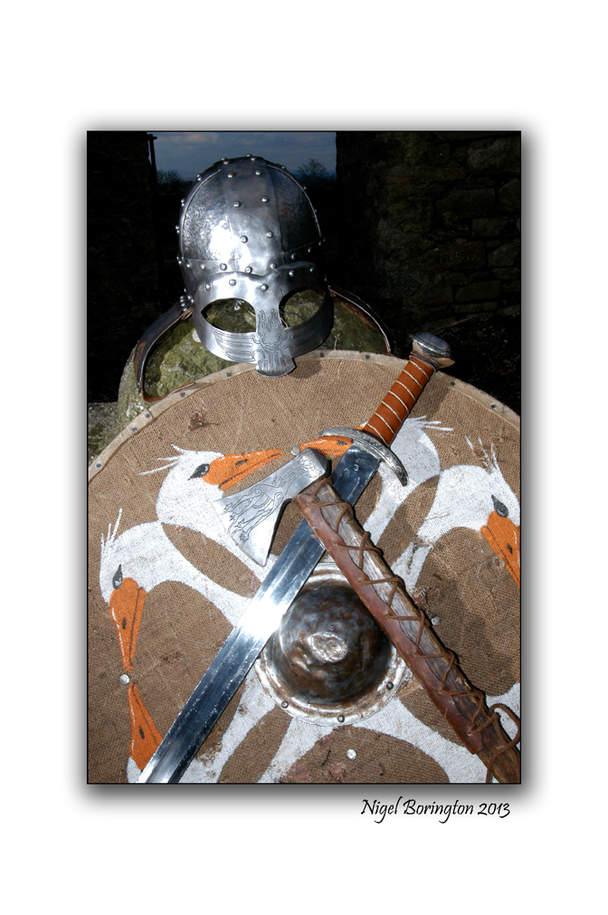
The Vikings in Ireland
A couple of years back I was asked to create some images for a group of Co.Kerry based Re-enactors and they selected the Vikings as there historic period, this shoot was great fun to do for the day. We selected the remains and grounds of an old church yard and this worked very well.
I have posted some history of the Vikings in Ireland at the bottom of the images.
Nigel


At the end of the eighth century the first Viking raiders appeared in Irish waters. These raiders came exclusively from Norway. The first recorded raid was in 795 on Rathlin Island off the coast of Antrim where the church was burned. On the west coast the monasteries on Inismurray and Inisbofin were plundered possibly by the same raiders. The Scottish island of Iona was also attacked in the same year.
For the first four decades, 795-c.836, the raids followed a clear pattern of hit-and -run affairs by small, probably independent, free-booters. Attacks were usually on coastal targets no Viking raid is recorded for areas further inland than about twenty miles. These attacks were difficult to defend but the Vikings were sometimes defeated. In 811 a raiding party was slaughtered by the Ulaid and the following year raiding parties were defeated by the men of Umall and the king of Eóganacht Locha Léin. By 823 the Vikings had raided around all the coast and in 824 the island monastery of Sceilg, off the Kerry coast, was attacked. The monastic city of Armagh was attacked three times in 832.
In the first quarter century of Viking attacks only twenty-six plunderings by Vikings are recorded in the Irish Annals. During the same time eighty-seven raids by the Irish themselves are recorded. An average of one Viking raid a year can have caused no great disorder or distress in Irish society. Attacks on Irish monasteries were common before the Viking Age. The burning of churches also was an integral part of Irish warfare. Wars and battles between monasteries also occurred in Ireland before the coming of the Vikings. Irish monasteries had become wealthy and politically important with considerable populations. The Vikings attacked the monasteries because they were rich in land, stock and provisions. They also took valuable objects but this was not their primary concern.
Intensified Raids and Settlements
From c. 830 Viking raids became more intense in Ireland. In 832 for instance, there were extensive plunderings in the lands of the Cianachta who lived near the sea in Louth. In 836 the Vikings attacked the land of the Uí Néill of southern Brega and attacked the lands of Connacht. In 837 a fleet of sixty ships appeared on the Boyne and a similar fleet on the Liffey. Soon afterwards Vikings made their way up the Shannon and the Erne and put a fleet on Lough Neagh.
The Vikings wintered for the first time on Lough Neagh in 840-41. In 841 they established a longphort at Annagassan in Louth and at Dublin and used these bases for attacks on the south and west. They wintered for the first time at Dublin in 841-842 and in 842 another large fleet arrived. Also in this year there is the first reference to co-operation between Vikings and the Irish though this may have occurred previously. A fleet was based on Lough Ree and the Shannon and built a fortified position on the shores of Lough Ree from where they ravaged the surrounding countryside in 844. Máel Seachnaill, overking of the Uí Néill attacked the Vikings, captured a leader called Turgesius and drowned him in Lough Owel in Westmeath.
From now on Irish kings began to fiercely fight back against the Vikings. Because they now had fixed settlements or fortified positions they were vulnerable to attack. Máel Seachnaill routed a Viking force near Skreen, County Meath and killed 700 of them. At Castledermot, in Kildare, the joint armies of the kings of Munster and Leinster defeated a large force of Vikings. The newly founded Viking settlement at Cork was destroyed and in 849 the Norse territory of Dublin was ravaged by Máel Seachnaill. The Vikings were now a factor in the internal politics of Ireland and were accepted as such. Norse-Irish alliances became commonplace.
During the years 849-852 new Vikings, probably from Denmark, arrived in the Irish Sea area and many battles took place between the new arrivals and the more established Vikings. In 853 Olaf the White arrived in Dublin and with Ivar, another Viking, assumed sovereignity of the Viking settlement there. Along the Irish coast were other Viking settlements. Vikings at Waterford attacked the King of Osraige but were slaughtered in 860. There was a longphort settlement at Youghal which was destroyed in 866. In 887 the Limerick Vikings were slaughtered by Connachtmen and in 892 the Vikings of Waterford, Wexford and St. Mullins were defeated.
Ivar, joint king of Dublin died in 873 and there were struggles and division in Dublin for the next two decades. In 902 the kings of Brega and of Leinster combined again the Norse of Dublin and defeated them, destroyed their settlement and expelled them from Ireland. By his time extensive cultural assimilation had taken place between the Irish and the Norse. Olaf, king of Dublin in the middle of the ninth century was married to the daughter of Áed Finnliath, king of the northern Uí Néill. The Hiberno-Norse also had gradually become christianised. The annals in recording the death of Ivar in 872 said that “he rested in Christ”.
The Second Phase of Viking Attacks on Ireland
By the first decades of the tenth century opportunities for Vikings in Britain and the Europe were limited. It is not surprising that they chose to attack Ireland again. From 914 large fleets again began to attack Ireland, these Vikings came from those already settled elsewhere in Britain. Munster was ravaged widely in 915 and the king of Tara was defeated when he went to the aid of the Munstermen. The king of Leinster was killed in a battle with Vikings under the leadership of Sitric at Leixlip. The king of Tara was killed in a combined Irish attack on the Norse of Dublin in 919. For the next two decades the Norse kings of Dublin were also trying to establish their power in York. Their activities in Ireland gradually became more confined to Dublin and its immediate hinterland. The Irish began to counter attack with growing success. Dublin was burned by the king of Tara in 936 and was sacked in 944. Its power had declined considerably by the second half of the tenth century.
The Wars of the Great Dynasties
One of the great leaders of this period was Brian Boru of Dál Cais in County Clare. He had defeated the Vikings of Munster. His great rival was Máel Sechnaill 2, King of Tara who had defeated the Norse of Dublin in 980. Brian at times made alliances with Norse as in 984 when the Norse of Waterford attacked Leinster by sea while he attacked by land. In 977 an agreement was made between Brian and Máel Sechnaill that the former would be king of the southern part of Ireland while the latter would be king of the northern part. In 998 the two kings co-operated in an attack on the Norse of Dublin.
A sculpture of Máel Seachnaill in Trim, Co. Meath, by James McKenna.
The next year the Dublin Norse allied with the Leinstermen revolted and were defeated by Brian. He spent January and February 1000 in Dublin, plundering the city and destroying its fortress. He expelled Sitric, king of Norse Dublin who could find refuge nowhere else in Ireland. He returned, gave hostages to Brian and was restored. Brian now claimed the kingship of the whole island and Máel Sechnaill submitted.
In 1012 Leinster revolted against Brian and the Norse of Dublin assisted them. Brian and Máel Sechnaill together attacked Leinster and blockaded the city of Dublin from September to Christmas before returning home. Knowing that the attack would be renewed the Norse set about getting help from allies. Sitric, king of Dublin visited Sigurd, earl of the Orkneys who agreed to be in Dublin on Palm Sunday 1014. Sitric then went to the Isle of Man and persuaded two Viking leaders Brodar and Ospak to support him.
Brian and Máel Sechnaill marched to Dublin but a dispute arose between them and Máel Sechnaill took no part in the battle. Battle was joined at Clontarf on Good Friday 1014 and after a long battle Brian’s forces were victorious. Brian himself was killed. Sigurd and Brodar were also killed though Sitric who remained inside the town during the battle survived.
In subsequent traditions, both Irish and Norse, Clontarf became a heroic battle of saga and story-telling. Fearsome portents and visions were said to have been seen by both sides on the eve of the battle. A fairy woman appeared to Brian’s followers and foretold disaster. Saint Senan appeared to Brian’s followers the night before the battle demanding compensation for an attack by Brian on a monastery years before. In the Isle of Man there were ghostly assaults on Brodar’s ships and ravens with iron beaks and claws attacked his followers. Evil portents were seen throughout the Norse world even in Iceland. Everyone wished his ancestors to have participated in the great battle.
While the battle of Clontarf was not a simple Irish against Norse battle it did signal the end of the power of Norse Dublin and the effective end of the Viking Age in Ireland.
The Lighthouse keepers of Ireland

The picture above is of St John point lighthouse, Co.Donegal.
Back in 2011 I started a project of capturing photos and information about the history and lives of the Lighthouse keepers of the Ireland.
I just want to share a small amount in this post.

St johns point is a very haunting and beautiful part of the coast line of County,Donegal.
St Johns Point Donegal
“This is a harbour light to guide from Donegal Bay and to mark the north side of the bay leading to Killybegs Harbour from the entrance up to Rotten Island.
The tower, built of cut granite, was designed by the Board’s Inspector of Works and Inspector of Lighthouses, George Halpin, and erected by the Board’s workmen under Halpin’s supervision.
The tower, painted white, had a first order catoptric fixed light 98 feet above high water with a visibility in clear weather of 14 miles. The light was first exhibited on 4 November 1831 with the buildings in an uncompleted state. The final cost at the end of 1833 was £10,507.8.5.
The Lighthouse Keeper’s videos:


This lighthouse project is ongoing and will most likely take sometime, I will keep updating..
Nigel

Templemichael church, Ballynatray estate, Cork.
All images : Sigma SD15, 15-30mm f3.5-4.5 lens,iso 50
Templemichael church and grave yard, County Cork
Landscape Photography : Nigel Borrington
TempleMichael church, County Cork
If you walk around the Irish landscape, one feature that cannot be avoided and that you will come across very quickly is the countries abandoned church yards, I find these places just amazing to walk around. The grave yard here must contain at least 200 graves, all surrounding the church which is itself in ruins and just a shell.
I have no intention of dealing with the history and as to why these places are forgotten, but I think that anyone would feel a little uneasy walking around these yards. Generations of French/British/Irish – European people rest here, families going back some two or three hundred years.
No one left to lay flowers, No one to cut the grass. Most of the head stones are slowly falling over and the names disappearing. my only personal interest in these church’s is based around the fact that when I walk around them I see no one visiting, no one sitting next to the grave’s of their ancestors, any descendants are absent from these place’s.
History of TempleMichael church
In 1183 Raymond le Gros established a Preceptory of Knights Templar at Rhincrew, an out post of which was TempleMichael. The keep was built specifically to control the river crossing.
The now ruined Church of Ireland parish church dates from 1823 it was built with a grant from the Board of the First Fruits, and until about twenty years ago was used for worship.
Gallery of TempleMichael church and grave’s
Share this:
July 1, 2013 | Categories: Comment, Gallery, Landscape, Travel Locations | Tags: blackwater river, Cork, irish history, Irish photography, Knights Templar, Landscape, Nigel Borrington, Raymond le Gros, sigma sd15, templemichael church | 11 Comments