Capturing the world with Photography, Painting and Drawing

Latest

Oweynagcat cave,County Roscommon , Into the Underworld.

Oweynagat Cave 1
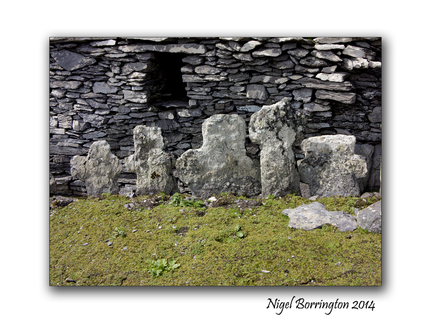
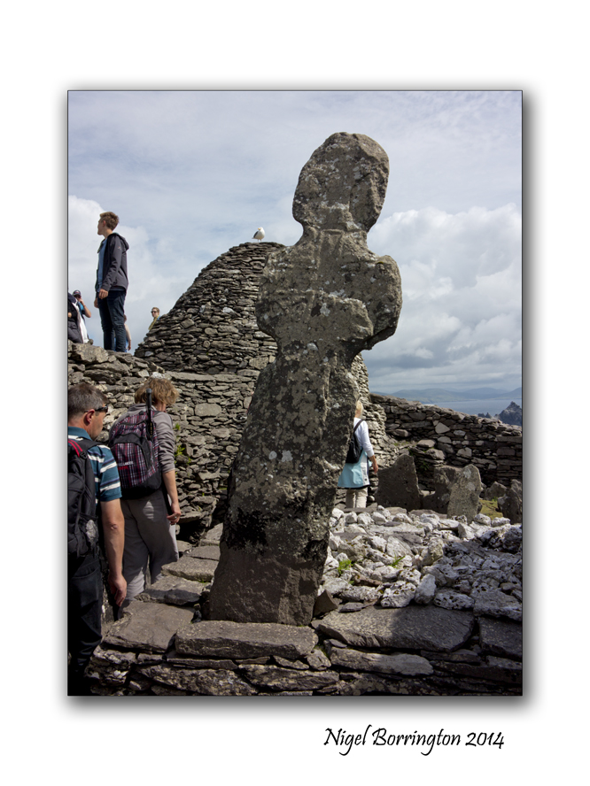
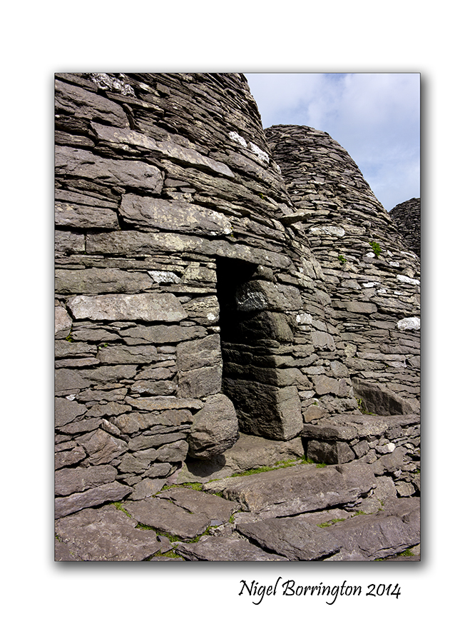
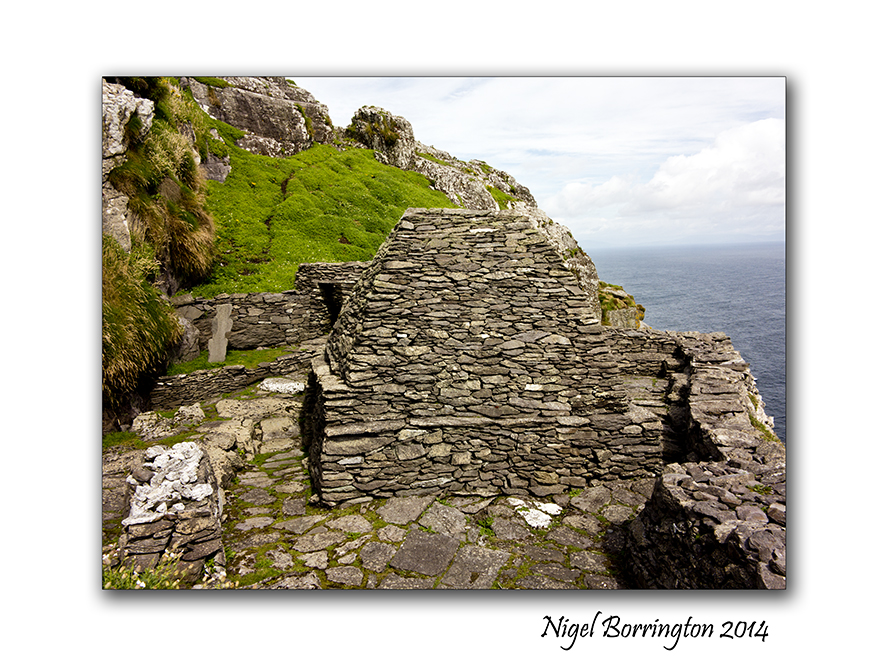
Oweynagat caves, County Roscommon
Landscape Photography Nigel Borrington
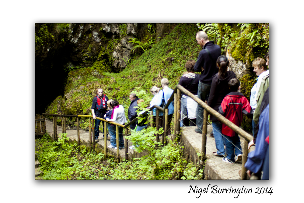
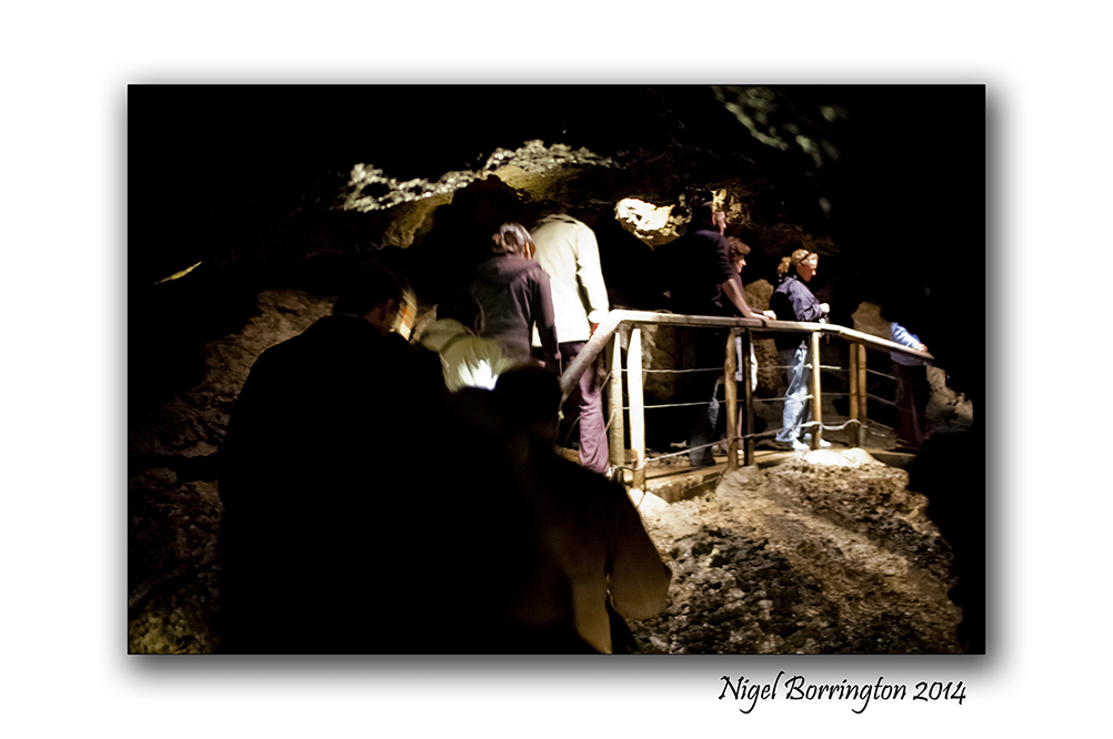
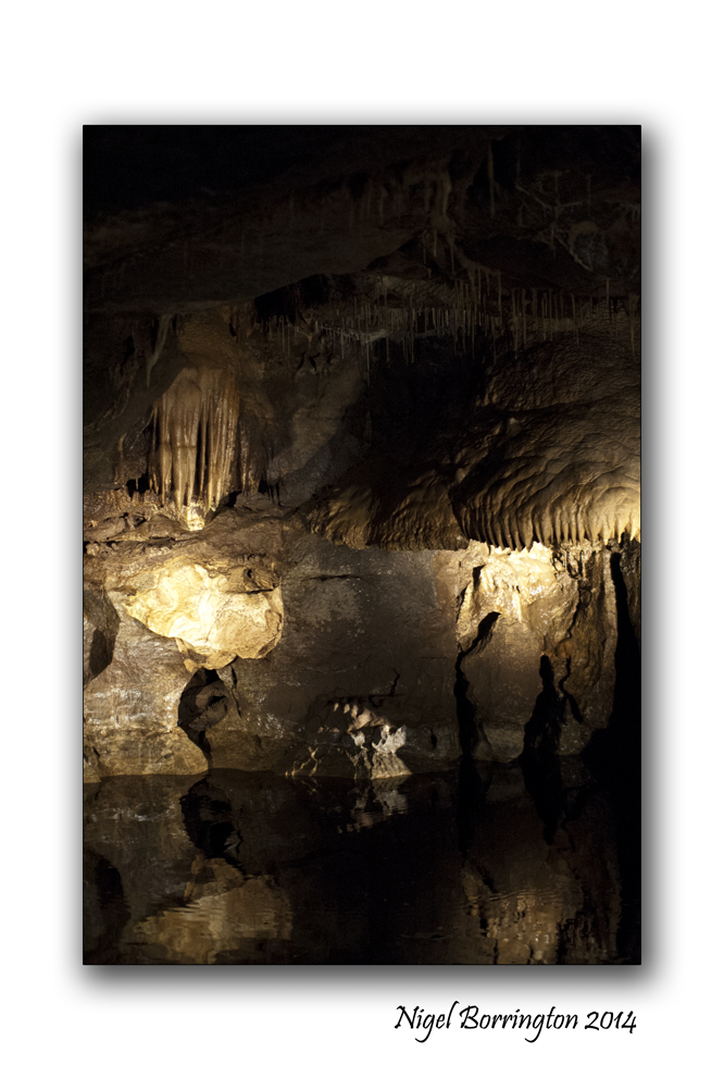
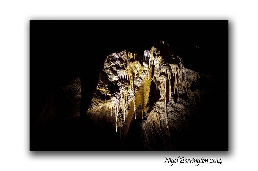
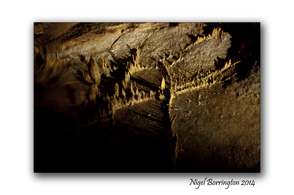
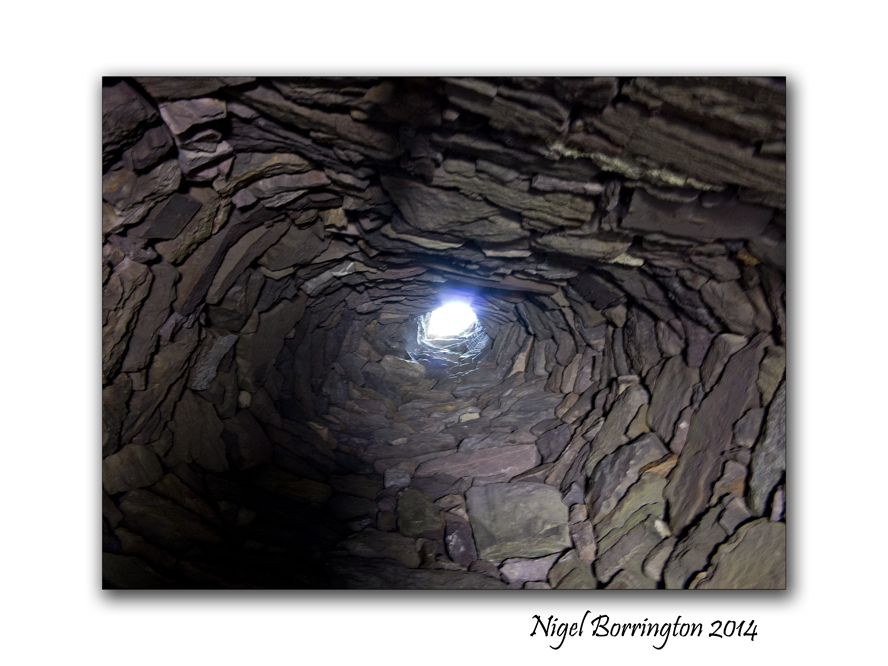
Oweynagat Cave

Oweynagat or the ‘Cave of Cats’ has to be one of the more unusual and unique sites in Ireland. The cave features a souterrain with a lintel supporting the entrance but then leads into a naturally formed cave. Oweynagat features heavily in Irish mythology, mainly because of its placement near Queen Medb’s fort which was at the center of the ancient Connaught capital of ‘Cruachan‘. The cave was said to be the actual birthplace of Queen Medb herself, the story goes that a goddess and fairy queen named Étain was fleeing her human husband with her fairy lover Midir. Midir wished to visit a relative named Sinech (meaning ‘large-breasted one’) who lived in the cave, the cave was said to be a great palace in the other-world and a maidservant named Crochan Crogderg (meaning ‘blood-red cup’) became enamoured with the place. She was granted the cave by Étian and it was here at Crochan gave birth to a daughter, Medb.

Many different myths from the lifetime of Medb surround the cave, it was said to have served as a portal through which the Goddess Morrigan used to pass to the other-world Morrigan was the goddess of battle and strive and was said to drive her other-world cattle into the cave at Oweynagat each sunset. Once Morrigan was said to have stolen the herds of a girl named Odras and brought them with her to the other-world, Odras tried to follow Morrigan but the unfortunate girl was turned into a lake by the goddess.

Another mention of the cave of the cats features one of Medb’s male servants Nera who had met a fairy woman in the cave and married her. His fairy bride warned that Medb’s palace would be burnt to the ground the following Samhain (November 1st) by creatures from the other-world , with this Medb stationed all her forces in the cave at Samhain to protect Cruachan from utter destruction.

The cave continued to be known as a place of power, acting as a portal to the other-world its power was extremely pronounced near Samhain as this was when the veil between the worlds lessened. Another story relates to the ‘Ellen Trechen’, this was a three headed monster that emerged from the cave and ravaged the local countryside before being killed by the Ulaid poet and hero Amergin.

As Christianity took hold in Ireland the belief in the cave being a ‘gateway to hell’ grew, an 18th century religious text describes Oweynagat as the ‘hell-mouth of Ireland’. It was believed that Oweynagat was linked to another ’hell-mouth’ many kilometres away at the Kesh Corran .

Oweynagcat cave, Gallery

Oweynagat Cave 8

Oweynagat Cave 7

Oweynagat Cave 2

Oweynagat Cave 3

Oweynagat Cave 6

Oweynagat Cave 4

Oweynagat Cave 5

Oweynagat Cave 1

The Blackbird, A Poem by : William Ernest Henley.

blackbird
A Blackbird, in a kilkenny woodland.
Wildlife photography : Nigel Borrington

The Blackbird

By : William Ernest Henley.

The nightingale has a lyre of gold,
The lark’s is a clarion call,
And the blackbird plays but a boxwood flute,
But I love him best of all.

For his song is all of the joy of life,
And we in the mad, spring weather,
We two have listened till he sang
Our hearts and lips together.

Yellow summer daisies, by : Robert Graves

Yellow daisies
Yellow summer daisies
Nature Photography : Nigel Borrington

Summer Daisies

Summer daisies, they’re my flowers,
Which nobody else may grow.
In a big quarrelsome house like ours
They try it sometimes—but no,
I root them up because they’re my flowers,
Which nobody else may grow.

Claire has a tea-rose, but she didn’t plant it;
Ben has an iris, but I don’t want it.
Daisies, double Yellow daisies for me,
The beautiful-est flowers in the garden.

The summer daisy, that’s my mark:
I paint it in all my books!
It’s carved high up on the beech-tree bark,
How neat and lovely it looks!
So don’t forget that it’s my trade mark;
Don’t copy it in your books.

Claire has a tea-rose, but she didn’t plant it;
Ben has an iris, but I don’t want it.
Daisies, yellow daisies for me,
The beautiful-est flowers in the garden.

By : Robert Graves

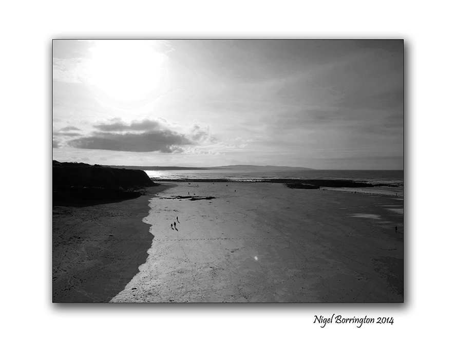
A day at Ballybunion beach, a Poem

Ballybunion county kerry 05
Ballybunion beach, county Kerry, Ireland
Landscape photography : Nigel Borrington

One day last summer while I was walking along the beach at Ballybunion,county Kerry, I was trying to think of words that gave a sense of this place , so I jotted down the following word list for a poem, but I feel its a poem as it is.

Ballybunion beach

cool air, sound of sea birds, fresh breeze,
people walking, dogs running, cold swimmers, children shouting,
Waves rolling, people eating, chatting, talking, cliffs casting shadows,

Old castle walls dominating, caves temping you to explore,
Posters offering family photographs, lunch time meals and places to shop,
Restful moments , capturing views,

Old people pottering, memories of traditions past,
Time dragging to a stop, mind slowing,

Families gathering, men managing, car doors shutting, keys locking, after parking,
deep breaths taken, locations chosen, bags unpacked,
People now sitting, grannies talking, best instructions, suggestions given,

Steps taken, shoes in hand,
Temperature falling, evening calling, holiday homes inviting,
Beach clearing, winds rising, cold setting in,
Sea birds return, dogs last walk of the day
Night fisher man setting lines, day over

Peace and nature returning, tide rising,
On Ballybunion beach.

Ballybunion county kerry 07

Ballybunion , a view from the cliff

Ballybunion county kerry 01
Ballybunion, county Kerry
Irish Landscape Photography : Nigel Borrington

Ballybunion , county Kerry

Ballybunion in county Kerry is one of Ireland’s most visited sea side locations, it a wonderful little town with a long history of holiday makers visiting here.

It has one very interesting feature that relates to its beach’s, there are two commonly used beaches divided by the reamins of an old castle on the cliff. The beach to the left of the castle (if looking toward the sea) is called the “Men’s Beach”, and the one to the right the “Ladies Beach”, given to the fact that men used to bathe on a separate beach from women and children. Although this practice has not been observed for decades, its amazing to think in this day and age how it even worked or became Normal practice.

Family members having to split-up for a swim.

There is a small cafe, hot seaweed baths and ice cream shop on the women’s beach. The large cliffs to the right of the women’s beach have shallow caves.

The sheer cliffs over the beach have a scenic walking path, featuring a blowhole, views of sea stacks and a multitude of wildlife. The path takes about 20 minutes to walk, and goes round to the “Nun’s Beach”, a beautiful beach with no access these days, it is overlooked by an old convent.

You get an overwhelming feeling of history here from times when traditions and culture was very different than the many visitors today experience.

Ballybunion, is still a place well worth a visit !!

Gallery

Ballybunion county kerry 02

Ballybunion county kerry 04

Ballybunion county kerry 03

Ballybunion county kerry 01

Ballybunion county kerry 06

After the Storm, Poem by : Hilen Letiro

After the storm 1
Killamery woodlands after the February storms of 2014
Landscape photography : Nigel Borrington

After the Storm

by Hilen Letiro

The storms may come And limbs may break;
Yet others bend Beneath the weight
Of heavy rain And windy breeze…
A storm can mark The strongest trees.

After the storm 2.

Life sometimes deals With us this way;
In unseen trials We meet each day.
It’s not how much our bodies break
Or how much they may bend;
It’s Our Outlook In Our Own Life
That helps our spirits mend!

Read more at Poem : After the Storm

Skellig Michael : Inside the walls

Skellig Michael 30
Skellig Michael, county Kerry, Ireland
Landscape Photography : Nigel Borrington

Skellig Michael : Inside the walls

Skellig Michael is an Island some 12 to 16 kilometres by boat from the ring of kerry, county Kerry, Ireland. It is most famous for the fact that during the 6th to the 8th Century’s a religious settlement was established here.

The Island is a world heritage site and falls under the guardianship of UNESCO, you can find the official historic details from the link on the world heritage web page here : Skellig Michael

In my last two posts I shared the boat trip to the Island and then the long but wonderful walk up to the settlement at the very top of the Island some 218 meters from sea level. Today I just want to share images of the inside area , the location that the people who lived here spent their life’s and also the location in which they are buried and there final resting place.

The images in the Gallery below are placed in the order that you view the buildings when you walk through the site, the only access is through a small passage in the outer walls.

Skellig Michael 33

Skellig Michael 37

The very first thing that greets you are two small head stones, in a very small patch of grass. These are the graves of two young boys, it was a tradition that monks in this period would take very young boys as members to their orders. These boys where from families on the main land and once they moved here they would most likely never return to see there families. Our guide informed us that it is a possibility that both boys were killed by Viking invaders as when the remains where examined wounds were found that indicate that they were killed by the use of weapons, both boy did not pass the ages of ten or twelve. It is also thought that other graves in the pictures here, in the centre of the living area contain some adult victims of such attacks.

Skellig Michael 35

A monastery may have been founded as early as the sixth century, reputedly by Saint Fionán but in 1044 rededicated to Saint Michael, the image here shows a large sculpture that is located towards the middle of the complex. It was described by our guide as being a cross but it could also be very much in the form of a human figure, with the arms to the side and a head looking over the site.

The word Skellig is defined as meaning “splinter of a stone”, and thus this rocky island was dedicated to saint Michael, there are also other Islands around Europe and maybe further away that are dedicated to this saint ( Mont Saint-Michel France, St Michael’s Mount Cornwall)

Skellig Michael 24

One of the most famous features of Skellig Michael are the so called Beehive structures, there were may be six or seven of these of which six are still standing, they were the living space for each of the monks, this fact would indicate that a maximum of seven people lived here in the beehives at any one time, there is a structure at the very end of the settlement that is constructed completely differently, It is thought that the head of the order would have lived in this building but few fact to prove this exist.

In any case the indications are that eight people lived on Skellig Michael at anyone time during its long history.

Living with in these stone constructions looks very harsh , during the time they were occupied however they would have looked very different, in some of the pictures you can see supporting stones that stick out of the main buildings by some amount, it is thought that these stones supported a covering of thatch consisting of straw and clay, this would have been deep and was used to keep the inner stone structure warn and dry. Not all but some of the Beehives have a hole in the roof that was used to let out smoke from fires inside.

At some point I want to post about the life’s of these people, who they were and why they chose to live here, I need to read a little more however , so for the moment that’s it. Three post over the last three day that I hope share a visit to this wonderful and mystical island. If you get a chance I would really in-courage you to visit. Its an experience of a lifetime and helps to open your mind to European history.

I cannot help however feeling that this place holds something else other than the official history, The question as to why these monks felt the need to occupy Skellig Michael, so far of the Irish coast line, is very big !

This place feels like an escape, a refuge but from what and why ?

With such massive risk’s taken by a small group of people to construct three stone walk-ways to the top of the Island and then build the settlement, the question of why looms very large. These were times that the word of Christianity was first being spread across Ireland so why the need to hide away here ?

I need Much more reading, before I understand these bigger questions 🙂

Gallery

Skellig Michael 23

Skellig Michael 31

Skellig Michael 33

Skellig Michael 34

Skellig Michael 35

Skellig Michael 43

Skellig Michael 38

Skellig Michael 40

Skellig Michael 39

Skellig Michael 42

Skellig Michael 37

Skellig Michael 36

Skellig Michael 41

Skellig Michael, Six hundred steps to heaven

Skellig Michael 27
Skellig Michael (unesco heratage site) , country Kerry Ireland
Irish Landscape Photography : Nigel Borrington

Skellig Michael, six hundred steps to heaven

During the summer last year I finally achieved a long ambition, to visit Skellig Michael and the Skellig islands some 16 kilometres off the county Kerry coast line, Ireland.

In yesterday post I shared the boat trip out to the Islands, today I want to share the walk up the six hundred plus stone laid steps to the very top where the world famous monastic outpost is located.

Skellig Michael 28

During the boat trip one of our guides pointed out one of three stair cases to the top, if you open up this picture you will see it rising up to the settlement, there are three of these routes up that were hand built with stone cut on the island. The three of them provided landing points during different tides and weather conditions.

Landing on the Island is an experience in its own right as the swell from the sea water makes stepping off the boat great fun. As you set foot on ground again, the first stage of the walk to the top is a well laid foot path taking you to about half way around the island and about one third of the way up the 218 meters you need to climb before reaching the settlement.

As this path ends you are met by a guide, who very firmly insists you all receive a health and safety talk, sadly sometime back a visitor died while walking up the steps, the walk is very steep and if you loose your footing the drop all the way to the sea below is not broken by any obstacles. He advises to take your time, “its not a race to the top and that if you need a rest to take one.”

The walk up is hard but very pleasurable, the views as you go are stunning if a little breath taking due to the hight. One of the warnings however was to keep your eyes on your steps and not to take any images unless you had stopped in a secure location and moved aside for others to pass, even telling the people behind that you intend to stop. as you can see in the images below there are some platforms and viewing points and I did my best to only stop here.

One of the wonderful views on your way up was the hundreds of Puffins nesting here, they were due to leave any-time so its was great to still find so many of them, I got many images of them along the way.

Finally after some forty minutes you reach the last set of steps , turning through some sharp rocks you get the first view of the Settlement. This sight just takes you back, the stone wall that greets you is about four meters high from a terrace that is the only flat area on the entire Island, being used to grows vegetables in its day.

From here the only access to the inner yards and structures is through a small door in the stone wall.

Skellig Michael 24

On entering you are met with the sight of the famous beehive cells of which six are still standing. The enclosed area is small and fully protected from the elements by the hight of the sea facing wall. The structure of the cells is very unique and fascinating to see. in the centre of the buildings is a small grassed area that served as a grave yard. I found this fact very interesting as it outlines the fact that the people who lived here spent their entire lives living on this Island from the moment they first arrived.

I want to post one more time on Skellig Michael, showing the full structures , living spaces and detail some of the history of this place. It is truly a fascinating place that holds some mysterys. The biggest one’s to me are : why here ?, why did these people select to live at the top of a rock over ten kilometres from the Kerry coast line, when they could have just lived on the main land?

More in the next post …

Skellig Michael, image Gallery

Skellig Michael 11

Skellig Michael 12

Skellig Michael 14

Skellig Michael 15

Skellig Michael 16

Skellig Michael 17

Skellig Michael 18

Skellig Michael 19

Skellig Michael 20

Skellig Michael 21

Skellig Michael 22

Skellig Michael 23

Skellig Michael 24

Skellig Michael 25

Skellig Michael 26

The boat to Skellig Michael

Skellig Michael 1
Skellig Michael and the Skellig islands
Irish Landscape photography : Nigel Borrington

The boat to Skellig Michael

During the summer last year I finally achieved a long ambition, to visit Skellig Michael and the Skellig islands some 16 kilometres off the county Kerry coast line, Ireland.

These Islands are full of mystery and mythology from the distant past, a history that goes back to before the 8th and 9th century.

Wikipedia : Skellig Michael

In my next post I will show lots of images taken on the island that show the walk from the landing point to the Pre-Monastic settlement at the very top, but here I just wanted to show the boat trip out to Skellig Michael itself.

There are many fishing towns around county kerry and west Cork that run boat trips out to the islands and we got our boat from the town of Portmagee on the ring of kerry.

You can see from the images below that there are about eight boats that do the daily trip out from Portmagee. There is only one trip a day, however the trip is very dependant on the weather and sea conditions , if the tide or swell of the water is to high then landing at the small quays on Skellig Michael is not possible, we were lucky on our day that both these needed conditions were perfect.

The trip out takes about an hour and we had some great company with us along the way with people from America and Canada along with us on the boat. This helped past the time very quickly and it was great to meet people who had a common interest in getting out to see the same location.

As you approach the Islands you pass the first of the two Skellig’s an Island that has only even been occupied by sea birds and almost every inch of the rocks here are covered in nesting birds. The sight and sound was just wonderful as we passed. Beyond here you have about another 20 mins before you can land on Skellig Michael itself, waiting your turn along with many other boats to land.

The trip is one of the most memorable boat journeys I have done, the views towards the Islands and back toward the Kerry coast line and the ring of Kerry are spectacular. You can see both these Islands from the coast line yet when you arrive and look back you feel very distant from the coast, the people who lived out here had a very remote existence considering the boats they used had no engines to speed up there journey.

Skellig Michael

The boat to Skellig Michael Gallery

Skellig Michael 9

Skellig Michael 4

Skellig Michael 5

Skellig Michael 6

Skellig Michael 7

Skellig Michael 3

Skellig Michael 2

Skellig Michael 8

Skellig Michael 10

Slate Quarries, Ahenny

Kilkenny Slate Quarries 8
Ahenny Slate Quarries, County Tipperary
Irish Landscape photography : Nigel borrington

Slate Quarries, Ahenny County Tipperary

The now disused slate quarry at Ahenny County Tipperary was quarried from the 14th Century onwards. Stone from this site was used in the building of Kell Priory in Kells and Ornmonde Castle in Carrick on Suir. The quarry now hosts an outdoor gallery of sculptures.

Located to the south of the village, the Victorian Slate Quarries is an area of both local and international history. Quarrying in the slate quarries of Tullahought were predominant during the reign of Queen Victoria. A large community was built up around the area which covers land in both Kilkenny and Tipperary. Tullahought shares its association with the quarries with the south Tipperary village of Ahenny, which claims the larger of the 3 lakes created by the quarrying of slate in the area.

In the mid 90’s, a yearly festival known as the “Slate Quarries Festival”. The first festival was marked with the creation of stunning works of art which were made entirely out of slate. The art work included the Miners Egg, The Weir, the Dinosaur and most notably, Noah’s arc which sat at the cliff edge over looking the lake.

The most notable building attributed to have the quarries slate is the Palace of Westminster in London (UK House of Parliament).

Gallery

Kilkenny Slate Quarries 1

Kilkenny Slate Quarries 2

Kilkenny Slate Quarries 3

Kilkenny Slate Quarries 4

Kilkenny Slate Quarries 5

Kilkenny Slate Quarries 6

Kilkenny Slate Quarries 7