
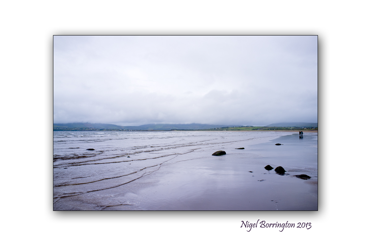
Rainbow over the river Suir

Rainbow over the river Suir, Clonmel, County Tipperary
Irish landscape photography : Nigel Borrington
Walking in the mountains and forests above Clonmel in county Tipperary is one on the most enjoyable things I can find myself doing. The views over the river Suir as it flows through the town of Clonmel down towards the port of Waterford are just wonderful.
The Saturday Morning I took these two images, the weather was very mixed with rain showers never that far away, the sun however was breaking through the clouds and producing rainbows every now and then.
These two photos are amongst the best I got during the walk.

Rainbow over the river Suir, Clonmel, County Tipperary
Irish landscape photography : Nigel Borrington
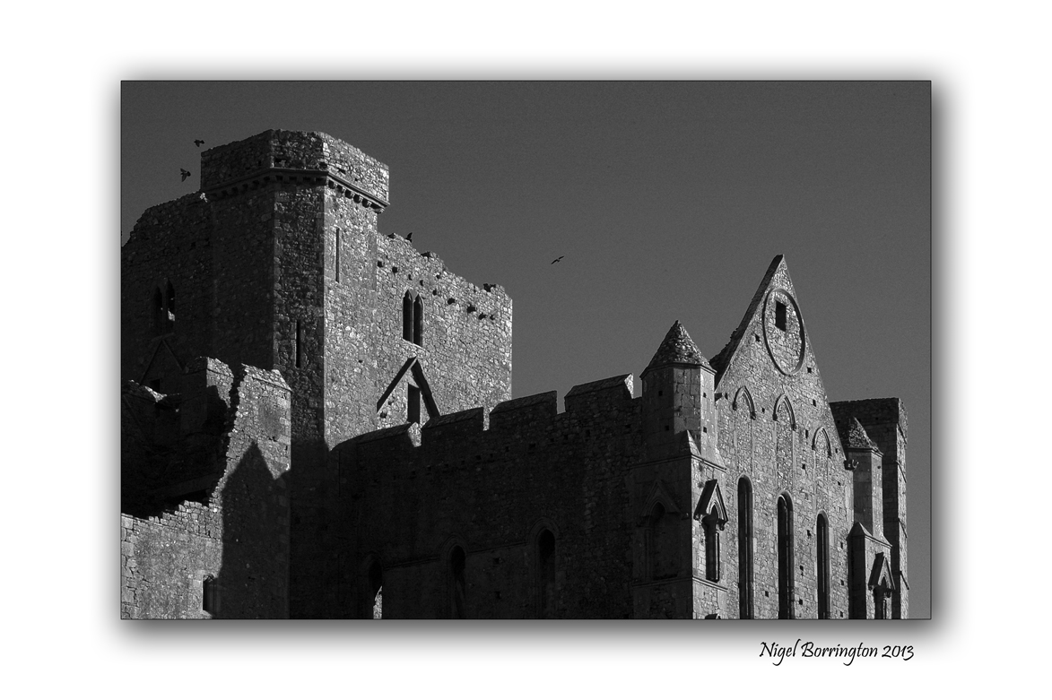
The Rock of Cashel

The Rock of Cashel, County Tipperary
Irish Landscape Photography , Nigel Borrington
The Rock of Cashel

The town of Cashel, in County Tipperary is home to one of Ireland best known and most visited locations, the Rock. It must be one of the most photographed locations in the country and has visitors all year around.
A Wikipedia page describes it as follows:
History
According to local mythology, the Rock of Cashel originated in the Devil’s Bit, a mountain 20 miles (30 km) north of Cashel when St. Patrick banished Satan from a cave, resulting in the Rock’s landing in Cashel.[1] Cashel is reputed to be the site of the conversion of the King of Munster by St. Patrick in the 5th century.
The Rock of Cashel was the traditional seat of the kings of Munster for several hundred years prior to the Norman invasion. In 1101, the King of Munster, Muirchertach Ua Briain, donated his fortress on the Rock to the Church. The picturesque complex has a character of its own and is one of the most remarkable collections of Celtic art and medieval architecture to be found anywhere in Europe, Few remnants of the early structures survive; the majority of buildings on the current site date from the 12th and 13th centuries.
Image Gallery
I took the images in this post early one cold November morning last year.


Sir Thomas’s Bridge, Clonmel, County Tipperary

Sir Thomas’s Bridge, Clonmel, County Tipperary
Irish landscape Photography : Nigel Borrington
The river Suir is one of Ireland most loved and visited rivers. It flows through counties Tipperary and Waterford before reaching the Atlantic at Hook -head lighthouse. I have taken a lot of photographs of this river over the years. one of my favourite subject are the old bridges that cross the river, most of them are some hundreds of years old and even though they were designed for horse and cart they still stand strong today and cope very well with modern demands
Sir Thomas’s Bridge is just on the edge of Clonmel in county Tipperary and has been used in many films and advertisements.
The photograph above was taken one early September morning a couple of years ago, the river Suir and the hills above were covered in early morning fog, this just added too the atmosphere. I decided to develop the image in black and white as I felt that this photograph was all about tones and not colour.
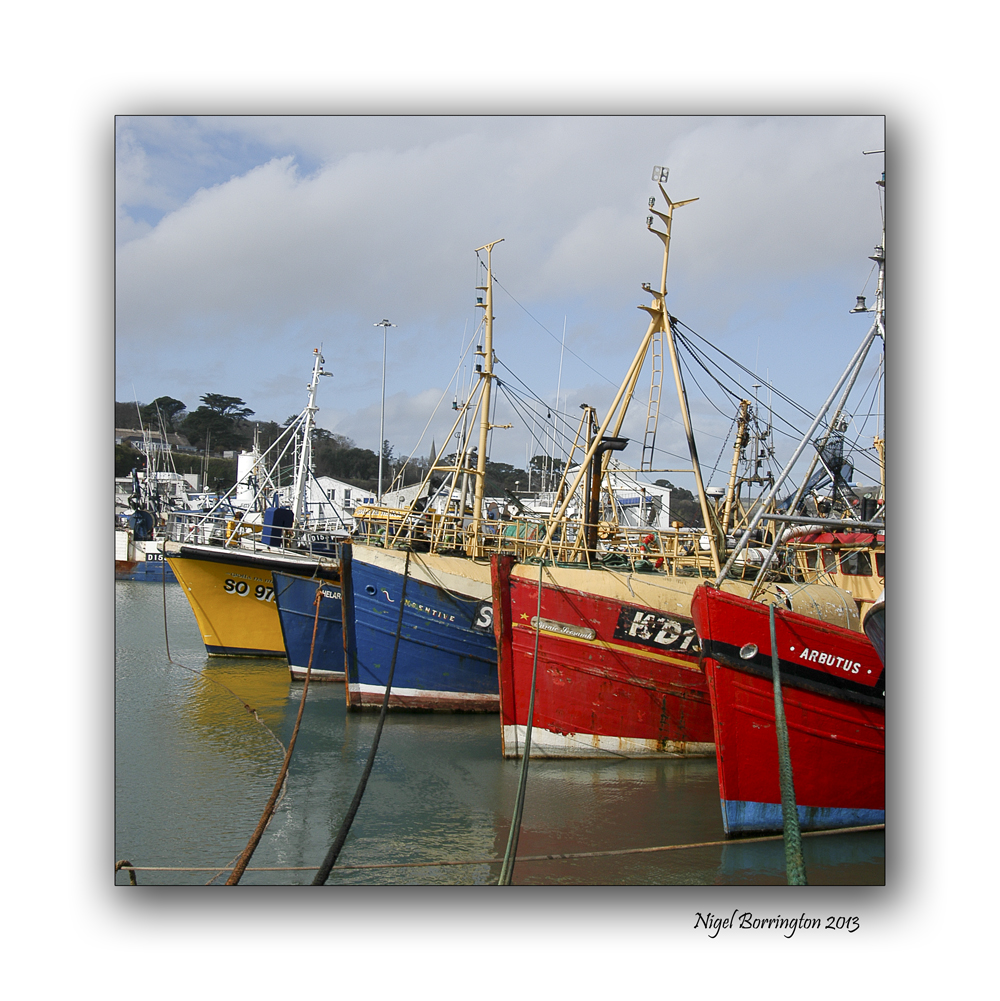
Dunmore east, county Waterford

Dunmore east, fishing village in County Waterford, Ireland.
All images using a Fujifilm x100
Irish landscape photography : Nigel Borrington
Dunmore east is one of my favourite places in Ireland to visit with a camera, its fishing harbour is the countries second busiest and on the day the fish is landed for the fish-market, it is full of life and colour with the boats all being in port.
The day I went down to capture these images I took my then new fuji-film X100 and took many images along the quays, the following gallery I hope captures a sense of this wonderful place to visit and take photographs.
Dunmore east, image Gallery


Coumfea a corrie lake, Nire Valley, County Waterford

Coumfea, Nire Valley, County Waterford
Landscape Photography, Irish photography : Nigel Borrington
Taken on the same day as the image of Milk hill, this image shows a view of Coumfea a corrie lake in the Nier valley, I have many other images of the lake that I will post in full.
A Corrie lake is formed as follows :
How Is a Corrie Formed?
Answer
A corrie is formed in different steps. First, the snow accumulates in a hillside hollow and turns to ice. Then, the hollow is deepened by abrasion and plucking and the ice in the corrie moves under the influence of gravity, deepening the hollow still further. Since the ice is at the foot of the hollow and moves more slowly, a rock lip forms. When the ice melts, a lake or tarn may be formed in the corrie. The steep back wall may be severely weathered by freeze€“thaw weathering, providing material for further abrasion.
Milk hill, Nire Valley, County Waterford

Milk hill, Nire valley, county Waterford.
Irish photography, Irish Landscape photography : Nigel Borrington
Black and white photography remains one of by biggest photographic interests, I just love the tones that can be developed from some landscape images.
The day I took this image the weather was very mixed with showers and strong sunny intervals, this allowed for very mixed lighting on the fields below in the Nire Valley, Waterford. I processed this black and white image from the original colour photo sometime later, I just love the strong contrasts and tone produced.
Its the weekend so…..

All images taken at Ardmore, County Waterford
Fujifilm X100
Irish Landscape photography : Nigel Borrington
Its the weekend so why not find a coastline to walk alone, look down at the views relax, and clear you mind…..


On Contemplating a Sheep’s Skull ~ Poem by: John Kinsella

All images taken in the Nier valley, county waterford
Fujifilm X100
Irish Landscape Photography : Nigel Borrington
On Contemplating a Sheep’s Skull
Poem by John Kinsella
A sheep’s Skull aged so much in rain and heat,
broken jawbone and chipped teeth half-
gnaw soil; zippered fuse-mark tracks
back to front, runs through to base
of neck, widening faultline under
stress: final crack close at hand.
Skull I can’t bring myself to move.
White-out red soil unearthed
from hillside fox den and cat haven,
now hideaway for short-beaked echidna
toppling rocks and stones, disrupting
artfulness a spirit might impose,
frisson at seeing counterpoint.
Skull I can’t bring myself to move.
Sometimes avoid the spot to avoid
looking half-hearted into its sole
remaining eye socket; mentally to join
bones strewn downhill, come apart
or torn from mountings years before
arriving with good intentions.

Skull I can’t bring myself to move.
Not something you can ‘clean up’,
shape of skull is not a measure of all
it contained: weight of light and dark,
scales of sound, vast and varied taste
of all grass eaten from these hills;
slow and steady gnawing at soil.
Skull I can’t bring myself to move.
Neither herbivore nor carnivore,
earth and sky-eater, fire in its shout
or whisper, racing through to leave a bed
of ash on which the mind might rest,
drinking sun and light and smoke,
choked up with experience.
Skull I can’t bring myself to move.
Drawn to examine
despite aversion, consider
our head on its shoulders,
drawn expression
greeting loved ones
with arms outstretched.

John Kinsella is Founding editor of the journal Salt in Australia; he serves as international editor at the Kenyon Review. His most recent volume of poetry is Divine Comedy: Journeys through a Regional Geography (W. W. Norton) with a new volume, Disturbed Ground: Jam Tree Gully/Walden, due out with W.W. Norton in November 2011.
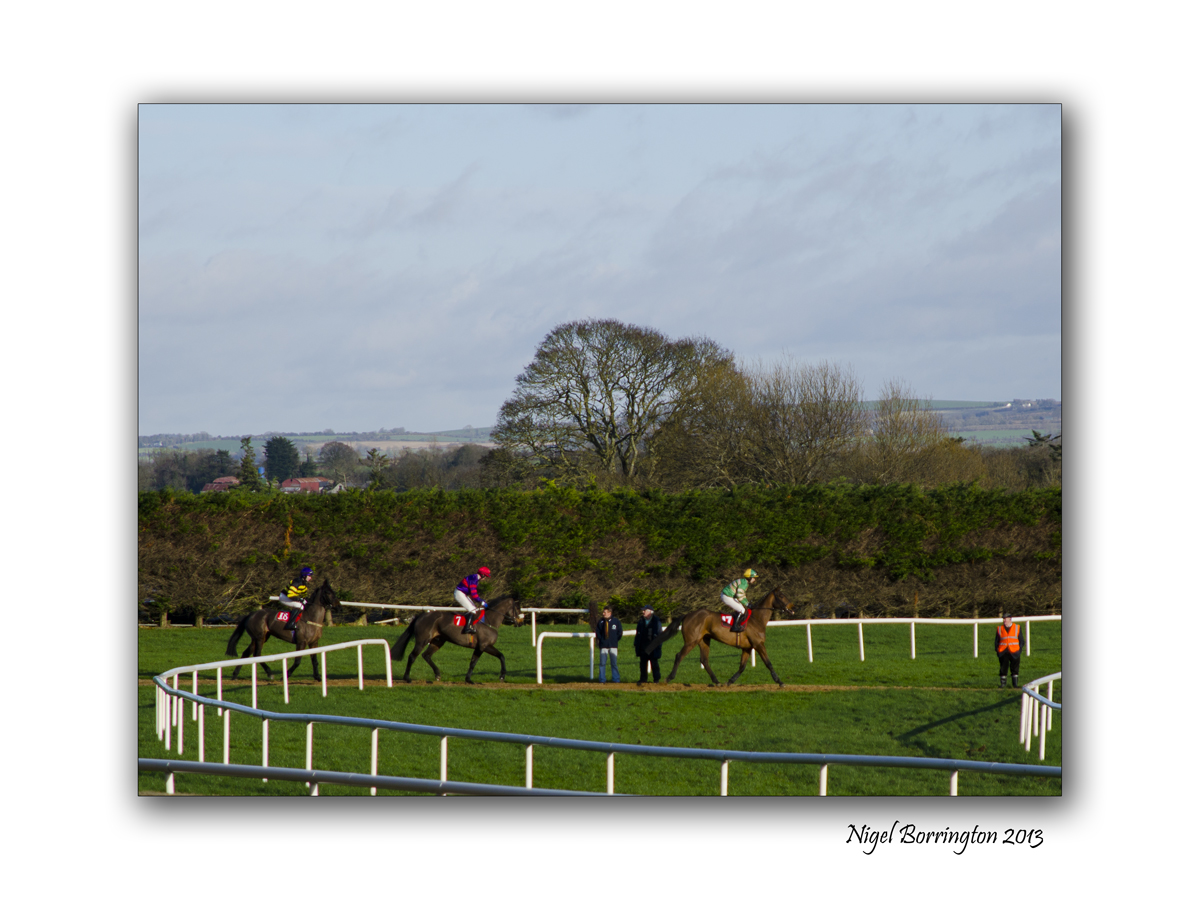
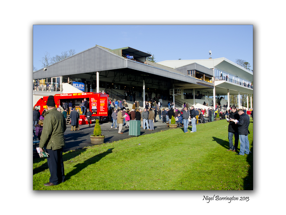
Gowran park, a day at the races

January 24th races at Gowran park, County Kilkenny
Events photography by : Nigel Borrington
It was a January afternoon at Gowran Park , County Kilkenny. Thursday, January 24th and the meeting was the National Hunt “Goffs Thyestes H’cap Chase Grade A & John Mulhern Memorial Hdle Grade 2”
It was a cold afternoon but the going was good, it’s the fullest I had seen the race course for this event and the bookies must have been rubbing their hands, not from the cold.
I arrived with the aim of photographing as much of the events as possible. I wanted to capture not just the race itself, actually this was the least interesting to me. I wanted to capture events behind the races, the bookies and the show ring. I felt I wanted to get a sense of the day in full, to capture what a race meeting is all about.
I got lots of images of the events and present some of them here, from the show ring to the finishing line, I am only starting this project to be honest and plan to return many times.
The the 14:30 race, Gowran Park, a Gallery


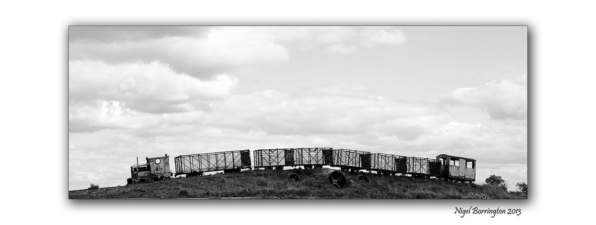
Wooden Teepee, Lough Boora, Offaly

Wooden Teepee over a spring, Boora Parklands, County Offaly
Landscape Photography : Nigel Borrington
Boora Parklands has many works of art and sculpture and this wooden Teepee is just one, I very much liked its design and the concept behind it from the moment I first came across it.
It is constructed from old oak wood, found in the peat of the bog, the wood is held together with metal ring’s inside. The entire structure feels naturally and locally aged and stands on top of a natural spring that flows with fresh water.
I very much loved the concept of placing a natural structure like this on top of a life giving spring. A standing stone inside the teepee marks the point were the spring water reaches the surface, it may have come from very deep in the ground. Other stones inside act as seat’s and you can go in and sit around the spring just to hear the water flow over stones and flags that have been used to great effect.
Personally, I feel this is a wonderful place, a modern temple to the old gods of the elements and a place to mark the history of man here. A history that goes back some eight thousand five hundred years and maybe beyond.
Gallery


Lough Boora Parklands, County Offaly
Lough Boora Parklands, County Offaly
Irish Landscape photography : Nigel Borrington
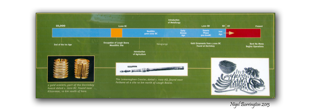
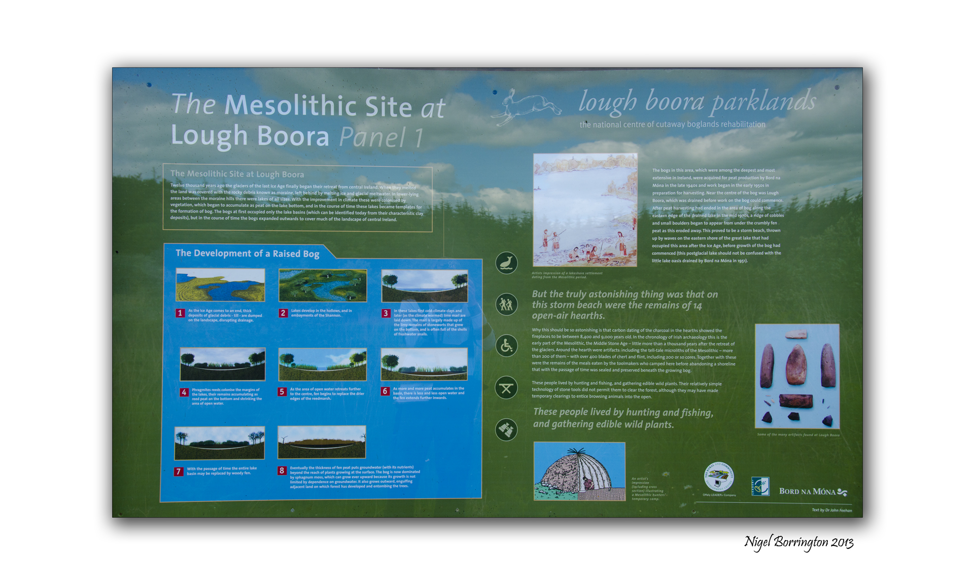
Lough Boora parklands, are one of the most interesting outdoor locations you could visit in Ireland. They cover up to 14 kilometres of scenic views and cycle routes, the parkland has many sculptures and art installations for you to view along with miles of walking routes. The location is also a nature reserve that is home to many rare birds such as lapwings. The first image in the below Gallery is of two Lapwing flying above the park.
Along with the great sculptures which I will cover in full in another post, some archaeology found at the site has completely changed the history of the country. The remains of a village that would have sat on the banks of one of the biggest lakes in Europe at the time. The findings date the people living in this area back some eight and a half thousand years, this is some two and a half thousand years older than previously thought.
It also pre dates the Christian history of Ireland by some seven thousand years.
The village itself was large and well established for its time, indicating that man must have lived here for sometime before reaching this level of culture. This would indicate that Man moved back into Ireland soon after the ending of the last Ice age some ten thousand years ago.
I have taken some images of the information boards on the site, you can find them below the following images.
Image Gallery

Lapwing’s flying above the parklands.

Dog’s are fully welcomed , restrictions when the birds are nesting.

Many Installations and Sculpture’s.

Wooden Teepee Sculpture.

Bog Cotton, growing in the wetlands.
Information boards


Via Condotti, Rome – Getting out of the rain

Via Condotti, rome – Shopping in the rain
Street photography : Nigel Borrington
This is one of my most memorable camera moments, captured while shopping on the Via Condotti, Rome. The heavens opened and almost everyone headed towards the shops, as fast as they could. So many in fact that queue’s formed outside each one.
I spent as much time as possible just taking images of this moment.
Its the weekend so ……..

Clodragh, Waterville, county Kerry
Irish Landscape photography : Nigel Borrington
Its the weekend so, may-be you should find a hideaway for two days …..

Take a walk in the hills…..
Wander down by the lakes…..
Walk along the beaches…..
But most of all relax and clear your mind ……..
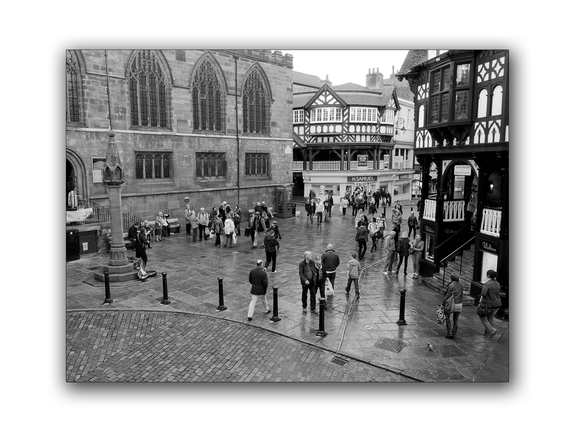
Street Photography : Chester

Street photography on a wet day in Chester

Lets get away from the Kerry mountains and lakes for a little time anyway, lets visit Chester in the North west of England. The junction of Watergate and Bridge street to be exact, the last time I visited this wonderful old Roman town was in August 2012 and it was just like I remembered it as a kid.
The old Tudor black and white four story buildings, the narrow side streets, small shop fronts, café’s and clothes shops. Street entertainers and most of all the rain. It rains a lot in the North west of England. The rain comes down from the mountains of the Peak-district and the Mountains of North Wales.
The Morning We arrived in the town it was very wet as you can see from these images, One of the greatest features of Chester however is the raised and covered walkways running above the street level shops. They run all the way up Watergate street and down Bridge street on both sides, as you can see from the photo on the left/above.
While I waited for the others to come back from different directions and shops, I took some of the images in this post from these walkways. It was a great view point to do some people watching, just snapping away and wondering what all these people had on their minds. Presents maybe or just gifting themselves to something new, things for kids birthdays, a new phone or just a chat and a coffee with a friend.
Just people watching and wondering and recording, isn’t that what street photography is all about ?
Image Gallery – Chester on the streets


Its the weekend so….

Canon G1x
Derriana lake, county Kerry
Landscape photography by Nigel Borrington
It the weekend so, why not find a place to walk a place to relax and a place to stay and watch the sun go down over a lake.
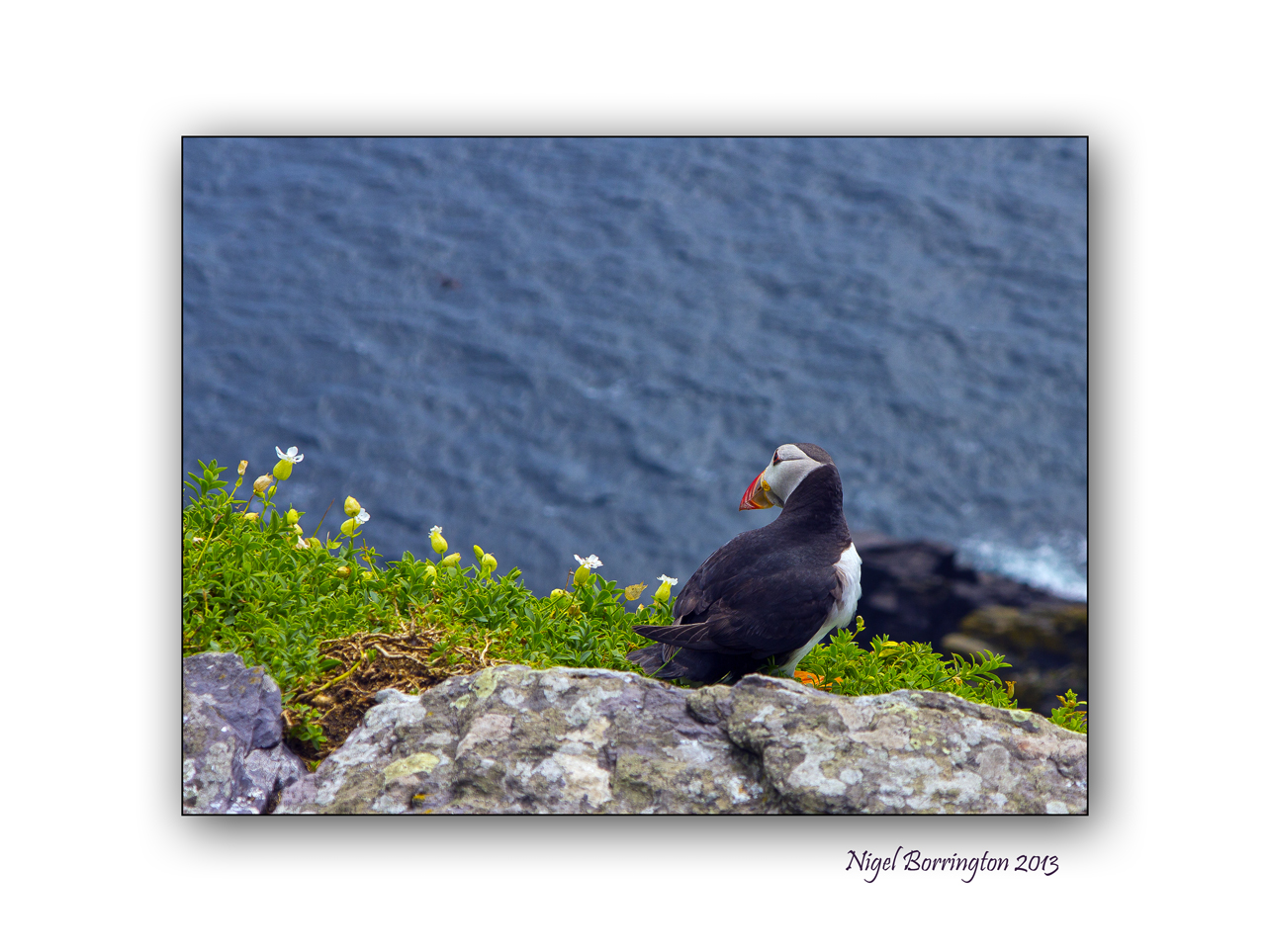
Puffins on Skellig Michael, County Kerry
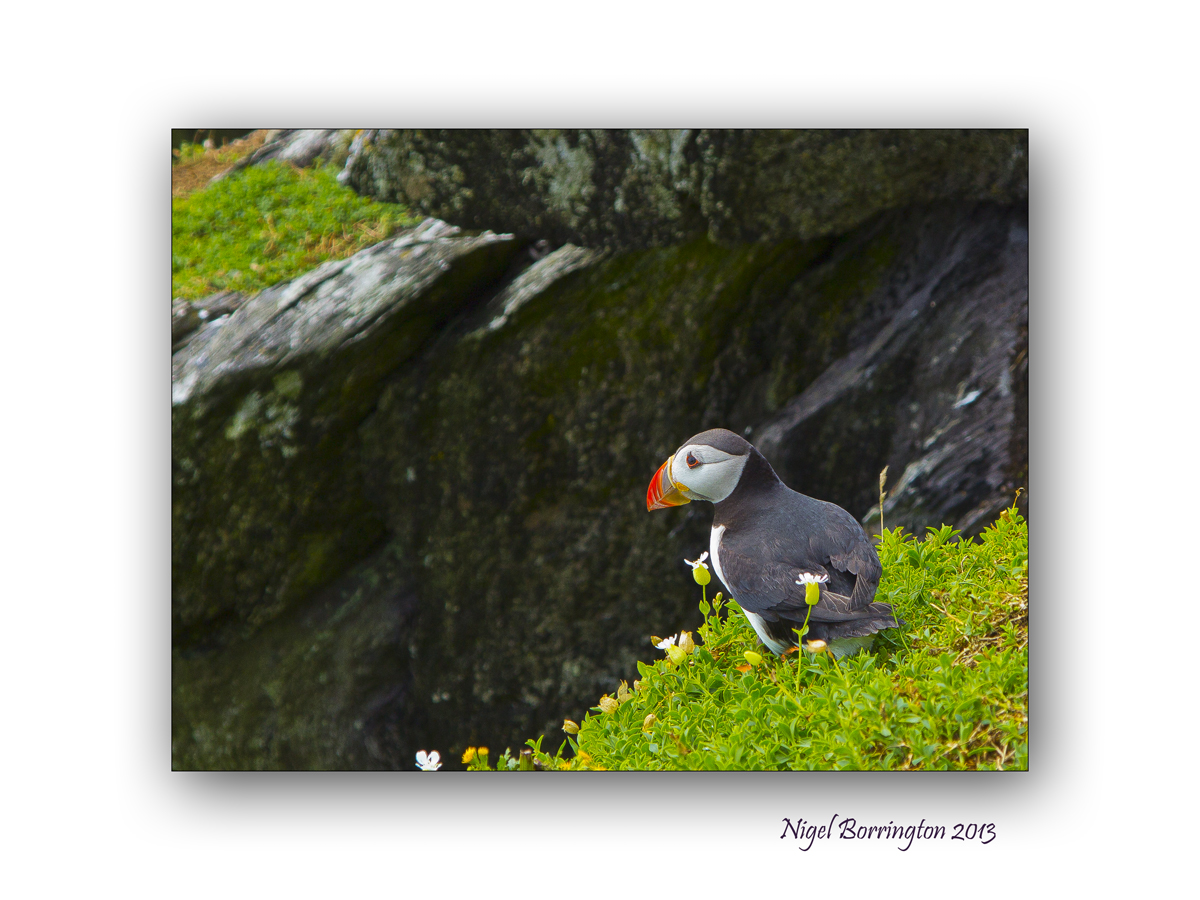
Images using a Canon G1x
Puffins on Skellig Michael, county Kerry
Irish Wildlife images by Kilkenny based photographer : Nigel Borrington
On a very recent trip to the Skellig islands I got lots of images of the puffins that nest here in large numbers each year, Ireland has two large populations of Puffins, one here and the other the Saltee islands of the Wexford coast line.
When you visit both these locations, it is very hard to be perfectly honest to miss getting great images of these birds. They are very trusting of humans and can get very close to you, so even with a camera like the Canon G1x you can get some very good images. These are just two and I got lots more.
They are a lot smaller than you may think if you have never seen them in the flesh, it’s when you see them in flight that they are at their most impressive.
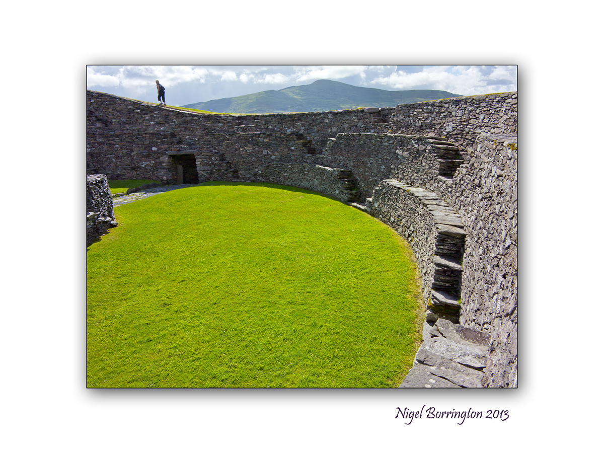
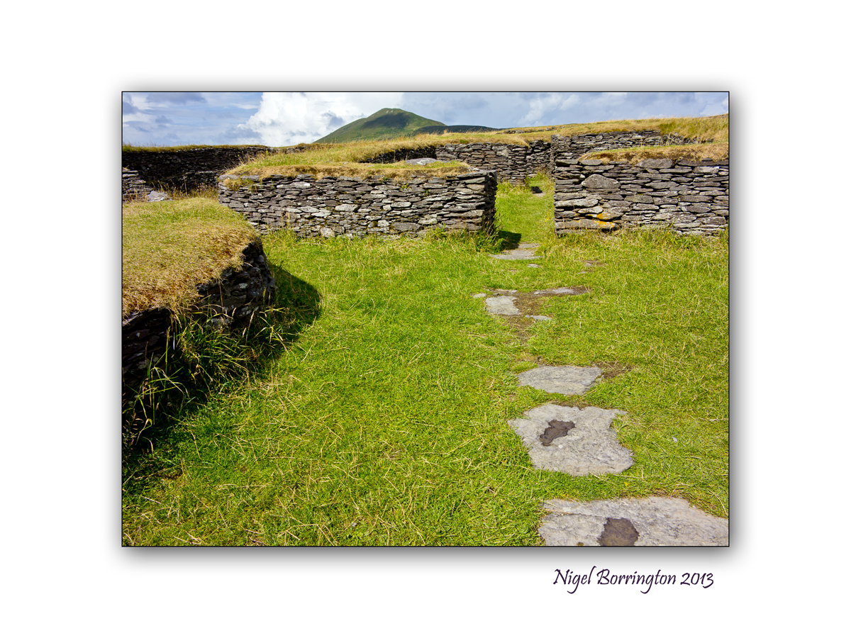
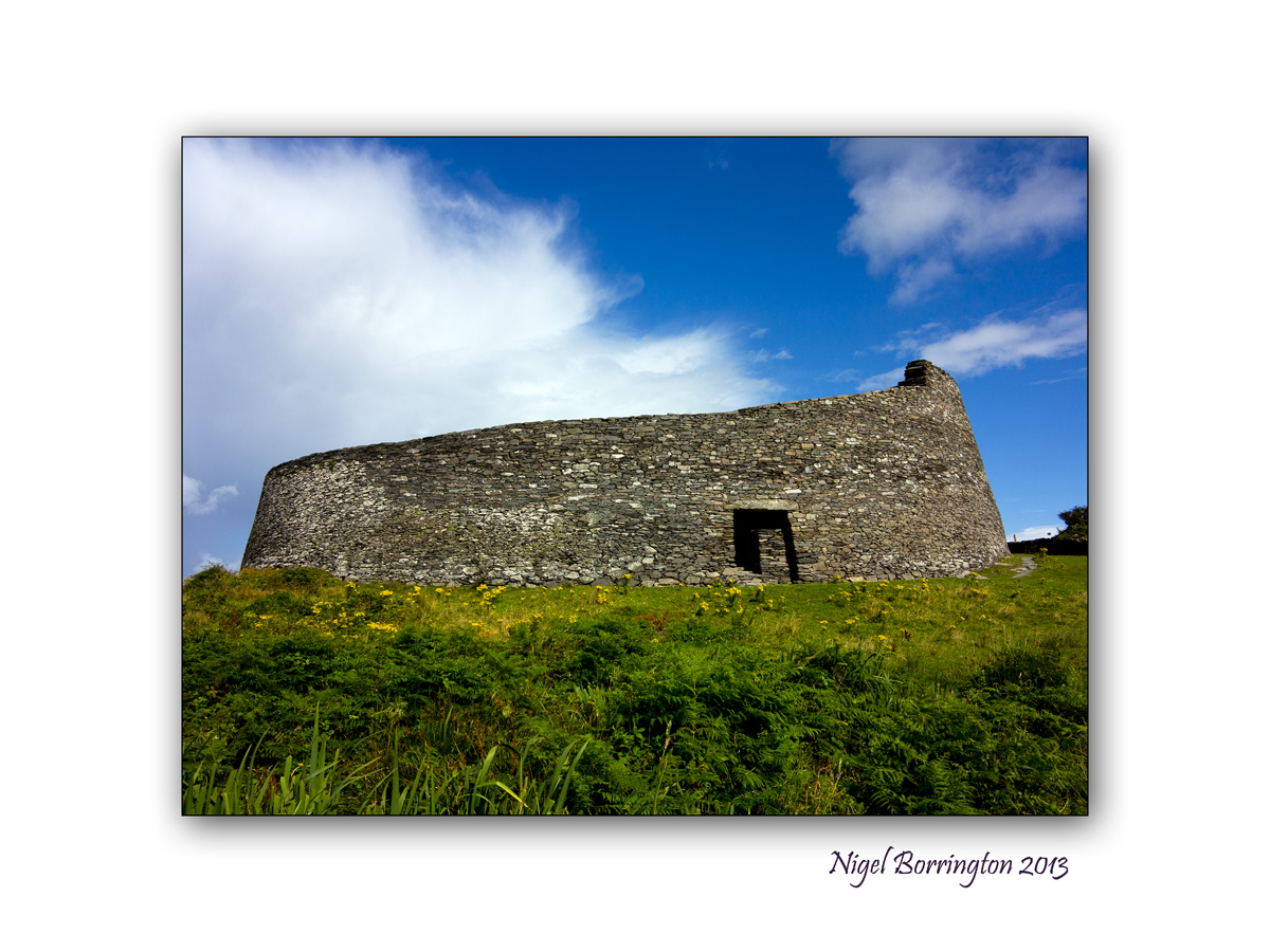
Cahergall ring fort, County Kerry

All Images : Canon G1x
Irish ring forts, Co.Kerry
Irish Landscape photography : Nigel Borrington
Cahergall Ring fort
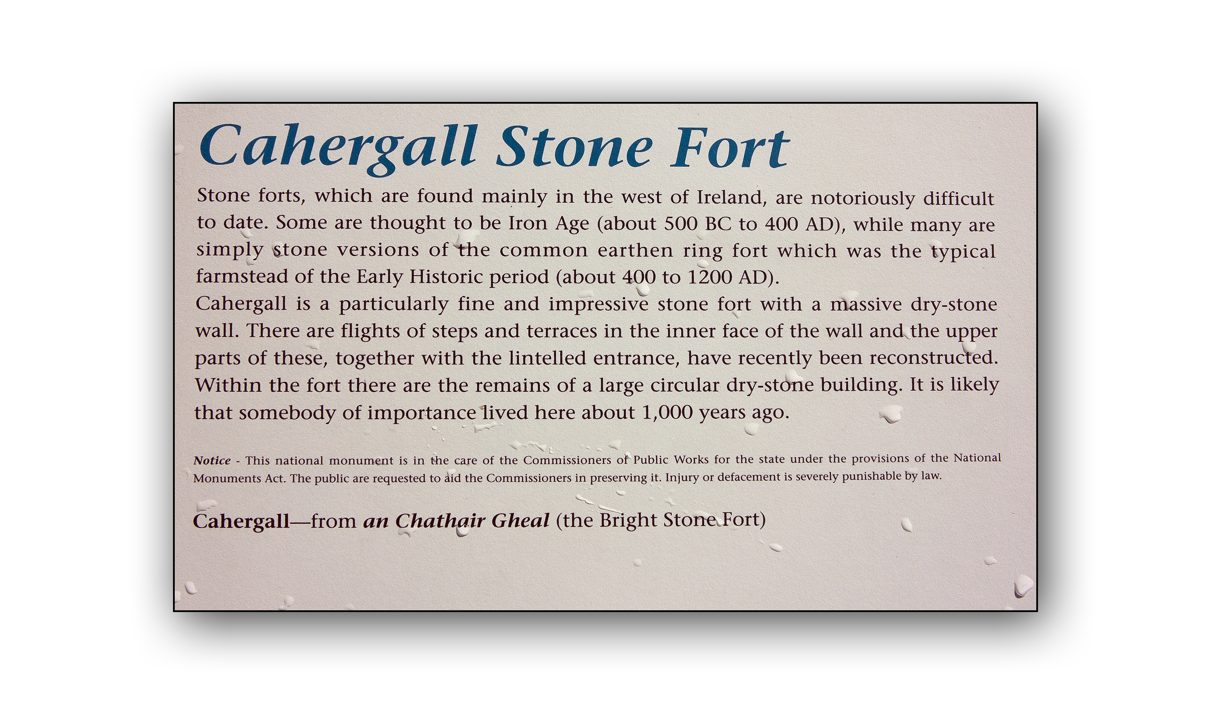
Following on from yesterdays post relating to Leacanabuile ring for in county Kerry, the area around the fort also contains more ring forts from the same period in Irish history.
Cahergall ring fort is a massive stone construction, built between 400BC and 500AD, It can be found close to Cahersiveen, County Kerry. Leacanabuaile feels very much more like a dwelling place for people to both live and keep themselves safe from the surrounding Environment. This included raiders and wild animals stealing cattle.
On approaching Cahergall, the scale of this fort is massive in comparison to Leacanabuaile, the walls rise some four to six meters from the ground, perfectly flat and sloping inwards from the ground towards the top. The fort is some twenty five meters wide and the walls some four meter thick.
Inside the fort the inner walls are stepped and consisting of three levels, each of these levels has a series of steps that take you the upper level. The top of the wall is full grassed and walkable. The views of the coastline and landscape around the fort is spectacular from here.
Although this fort is described as a living place, it is very different from other forts around, It has only one internal enclosure and this structure does not look like it could be lived in, at least not in the same way as the buildings within the other forts.
The semi-circular wall’s forming a circle in the center of the fort appear to be very much the focus point from the main walls, almost like this place was a ceremonial theater of some kind. You have to ask why the very different design for this place compared to the other forts and why it was built on such a grand scale. It is very much the focus point for the local community in the same way a church or public building would be today.
As to who these people where, Pat Flannery has some very interesting ideas and his views on Irish per-christian history is very interesting :
http://www.patflannery.com/IrishHistory/TheMilesians.htm
Cahergall Fort has been restored by the OPW and is owned by the Irish State.
Cahergall is well worth a visit if you are in the area and only short distance from Leacanabuaile Stone Fort.
Image Gallery


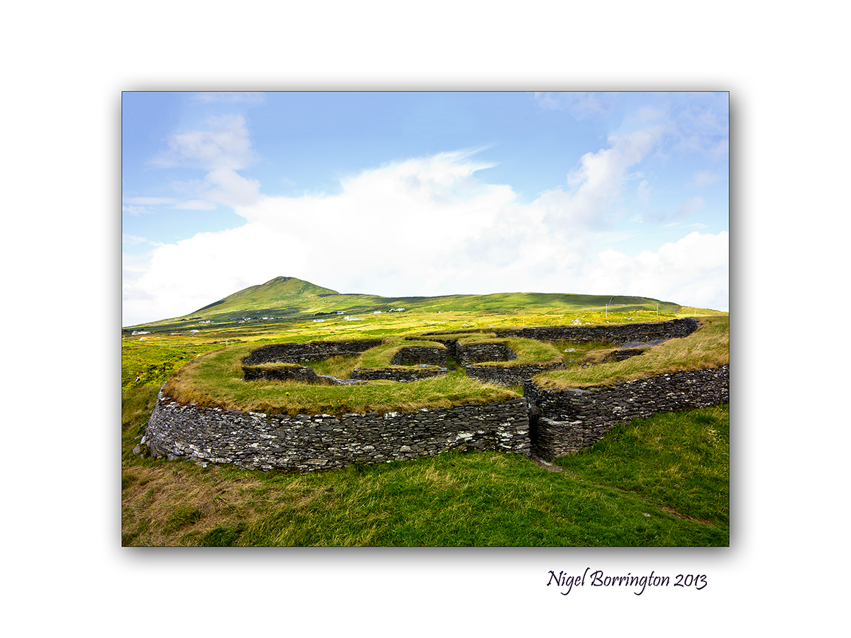
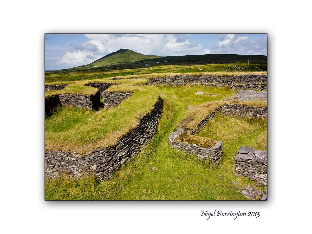
Leacanabuaile, stone ring Fort, Co.Kerry
All Images : Canon G1x
Irish ring forts, Co.Kerry
Irish Landscape photography : Nigel Borrington
Leacanabuaile, ring Fort
Sitting on a hill side near Cahersiveen in County Kerry is Leacanabuaile Stone Fort, it is considered one of the best examples of an Irish ring fort.
The name translates to ‘Hillside of the Summer Pasturage’.
This is a magical place and just the kind of prehistory site I love to be in and photograph.
This is the Ireland I have been searching for, this site predates the Irish christian period, and is a period in Irish history that is little covered and has been swallowed up by post christian teaching.
On researching this site I came across this link from Pat Flannery:
http://www.patflannery.com/IrishHistory/TheMilesians.htm
Having visited Leacanabuaile ring fort, I feel that there is some credibility to Pats views on Irish history. The site is located only a few fields in from the Kerry coast-line, it is very believable that the area around this ring fort is the landing site for peoples who settled here.
The Milesians
Around 1500 B.C. the Milisians who came from the Middle East and the Ionian sea came to Kerry in Ireland.
The most interesting thing about all these peoples is that they were Ionian people who were seafarers and thrived much, much earlier than the Celts who were totally Continental and not very good seafarers, rather like the Swiss.
The Irish language and customs would seem to support a close affinity with ancient Greece, the Middle East and Persia. Their heroic stories of warriors and chariots for example are very similar.
Spain and Portugal was merely a stepping off point for the sea journey north to Ireland, but scholars have confused the much later Iberian Celts with the Milesians. Apart from the fact that Celts did not occupy any part of Spain or Portugal until long after the Milesians, believing that everybody who came from Spain was Spanish, let alone Celtic, is similar to the belief of many Americans that their Irish ancestors came from County Cork simply because that’s where their ships left from.
Ring forts
Wikipedia description of ring forts : Ring forts
Excavation of Leacanabuaile
An archaeological excavation uncovered iron knives and mill stones suggesting the existence of an early farming community here. Standing atop the outer walls which are up to 3 metres thick, its great to imagine how the fort looked and how people lived in the past.
Image Gallery


—————————————-
Cahergall – ring fort
The area around Leacanabuaile also contains Cahergall – ring fort, an even more impressive fort and I will post about this very soon.
Old Barracks, Cahersiveen, Co.Kerry

Canon G1 x
Old Barracks,Cahersiveen, Co.Kerry
Landscape photography : Nigel Borrington
Old Barracks,Cahersiveen, Co.Kerry
The Barracks was constructed between 1870 and 1875 and served as the Royal Irish Constabulary Barracks. It has an interesting history which can be further looked at in the information page.
Today it serves as a Heritage Centre for the Iveragh Peninsula. It is home to various exhibitions that relate to the local area, including The Great Southern and Western Railway, The Life and Times of Daniel O’Connell, The Fenin Rising of 1867, The 1916 Rising and Monsignor Hugh O’ Flaherty (The Scarlet Pimpernel).
Valentia Island Lighthouse

Canon G1x
Valentia Island Light house, County Kerry
Landscape photography : Nigel Borrington
Valentia Island, county Kerry is located just west of Cahersiveen, and accessed by bridge from Portmagee or by ferry at Renards point. It is the location of the first communications cable to cross between the USA and Europe back in the 1800’s.
The Lighthouse has been restored and is now open to visitors and it is well worth doing so, I took this photo on a recent trip, just as a boat passed us, between Valentia and Beginish Islands.
A cottage in the Irish Mountains

Canon G1x
Cottage in the Irish landscape
Landscape photography : Nigel Borrington
Sunday evening in the mountains

Mountain views of Country Kerry
Landscape photography : Nigel Borrington
In My Dreams I was traveling, Probably in my car, through the hills of Kerry, little valleys where everyday life is lived, A voice reproached me for squandering my time on trifles , instead of writing about the essence of life, which is such a so-ness.
Probably all my voyages in dreams have a model in one, very real, by car from cork to Kerry, A boggy road with ruts, always either up or down, stubble fields on the hills in the rain, here and there a spruce grove, then alders by streams,huts,well-sweeps.
Taken from : Czeslaw Milosz
Its the weekend so….

Waterford coastline, above boats strand.
Landscape photography : Nigel Borrington
Its the weekend so why not find a coastline to visit, take a walk along the cliff tops and watch the tide come in on the beach below ……
Have a great weekend …

Derriana lake – County Kerry
Derriana Lodge, County Kerry
Irish Landscape Photography : Nigel Borrington
Derriana Lake, a home for two weeks
On the 31st of July I reached the fine age of 50 and along with friends and family we went to Kerry for two weeks. Staying in a self-catering lodge called Derriana lodge
I would very much like to say thank you to family and friends for making the time spent away just brilliant and also some of you noticed my birthday date from my face-book page, so I would like to say thank you for sending me Happy Birthday messages !
The lodge is just a wonderful place to stay as its located above Derriana Lake, county Kerry, the below images are just some that I took during the two week’s. You have already seen some of the others from my posts during the two weeks away.
I will post more !
Thank you to everyone again for such a great time !
Panoramic views of the Lodge and Lake
Image Gallery of the Lake
Share this:
August 13, 2013 | Categories: Comment, Landscape, Travel Locations | Tags: 50th birthday, Canon G1x, derriana lake, fujifilm X100, Irish photography, kerry, Landscape, Nigel Borrington, Thank you | 27 Comments