
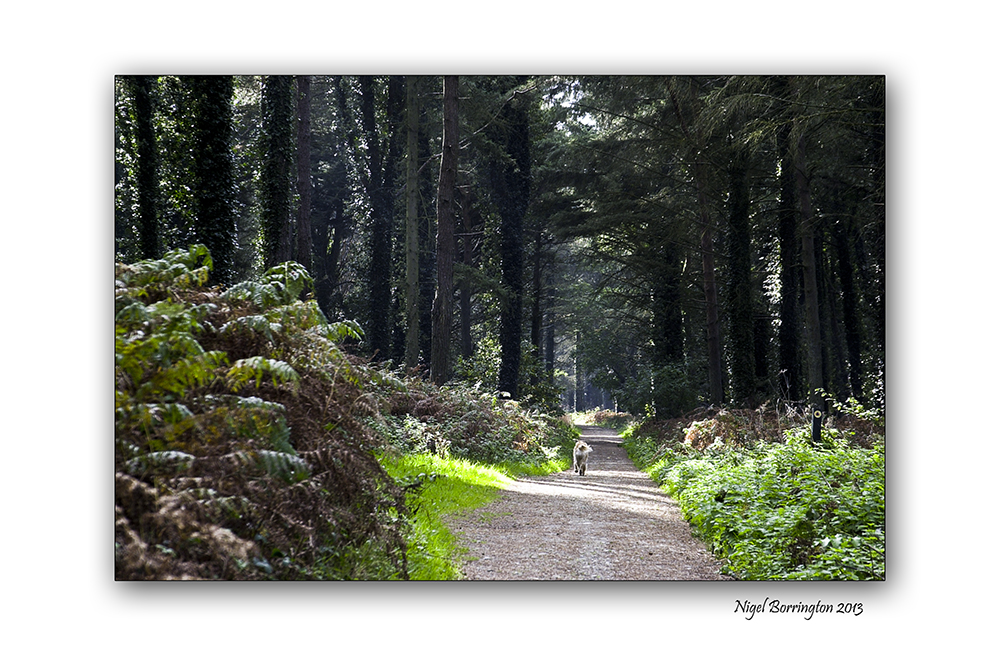
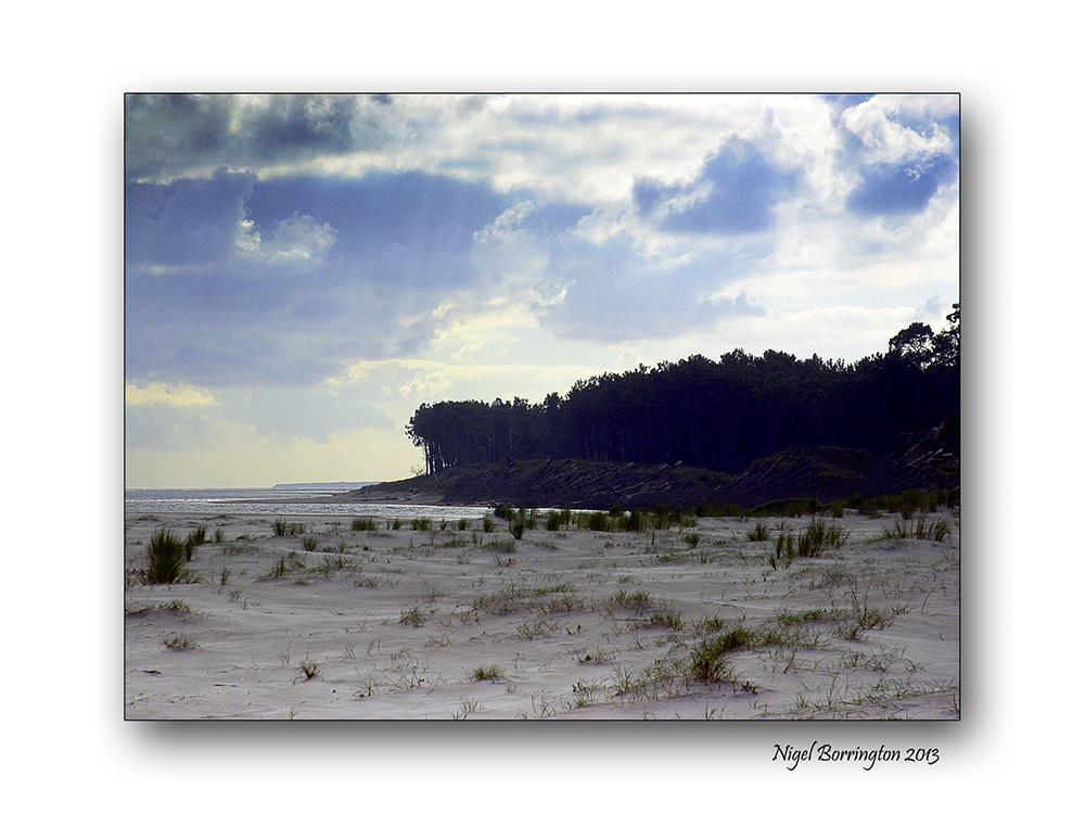
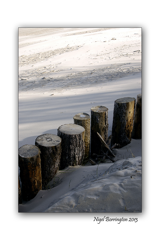
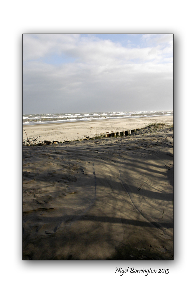
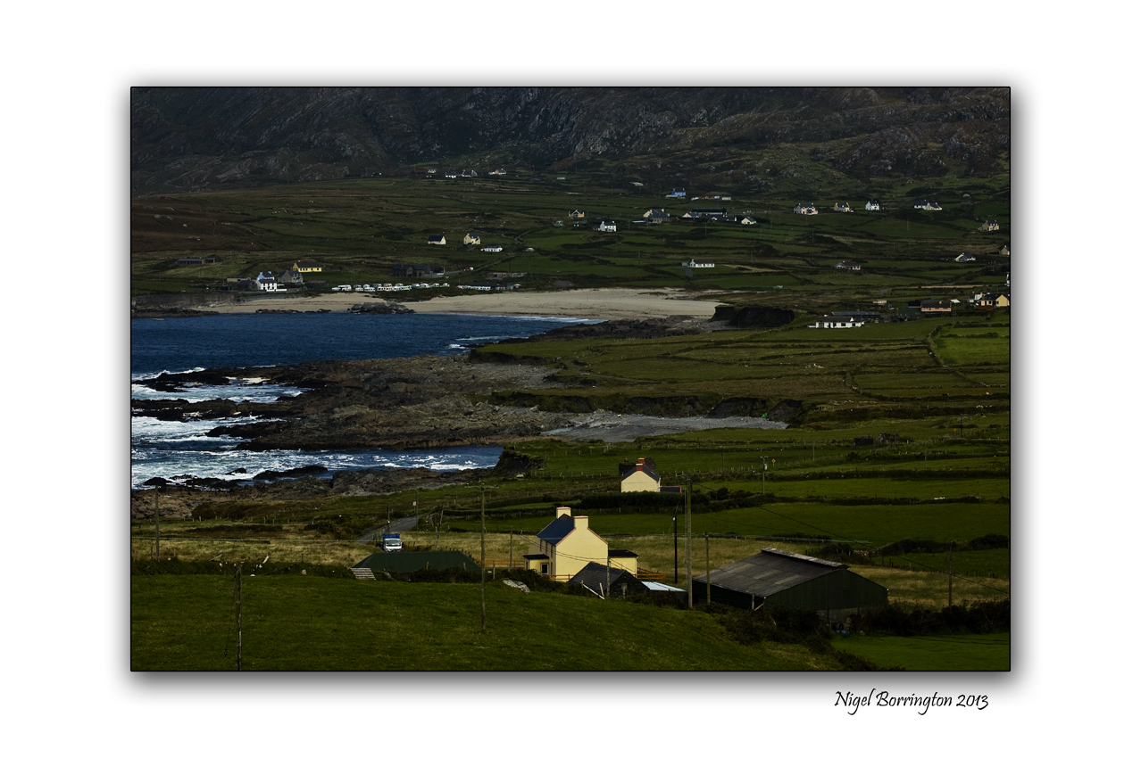
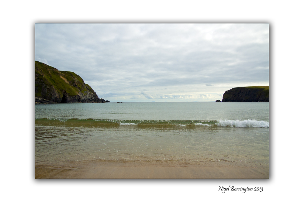
The Raven, Curracloe, Co. Wexford

Images taken using a Nikon D700
The Raven nature reserve, Curracloe, Co.Wexford
Irish landscape photography : Nigel Borrington
The Raven Nature Reserve and Curracloe beach
located at Raven Point on the north side of Wexford ( Loch Garman) Harbour, Co. Wexford.
Raven Point is a spit, a type of peninsula created by deposited sand. It is a portion of an area consisting of a series of sand dunes known as the North Slob with views of the Irish sea and the harbour.
The Reserve is located beside Curracloe beach, best known for having featured in the Second World War themed motion picture ‘Saving Private Ryan.’
Raven Point is planted with a forest of pine and other evergreen trees. It is also a sanctuary for birds such as geese and wildlife especially the red squirrel. Seals can also be seen on the beaches and in Wexford Harbour.
A looped walk of the area goes to the tip of the Raven Point spit through the wood and back again via the beach.
It’s a wonderful place to visit for a day and offers long walks and one of Ireland best white sandy beaches.
Raven point a Gallery


Kilkenny landscape photography
All images using a Nikon D7000
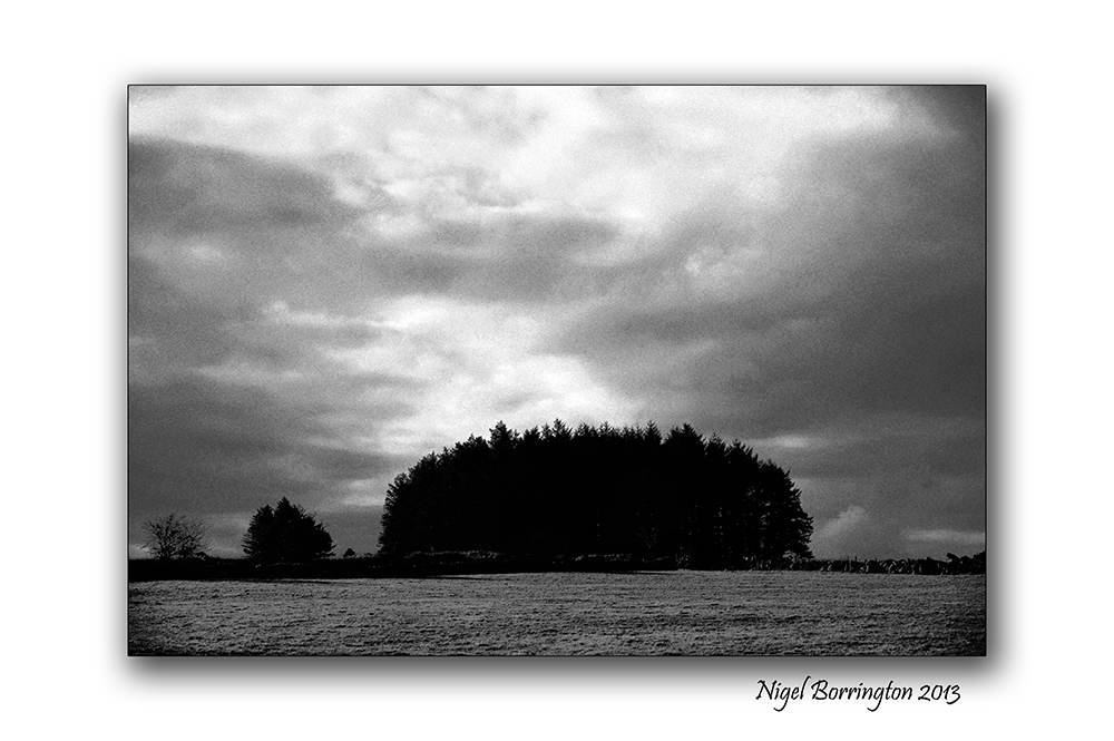
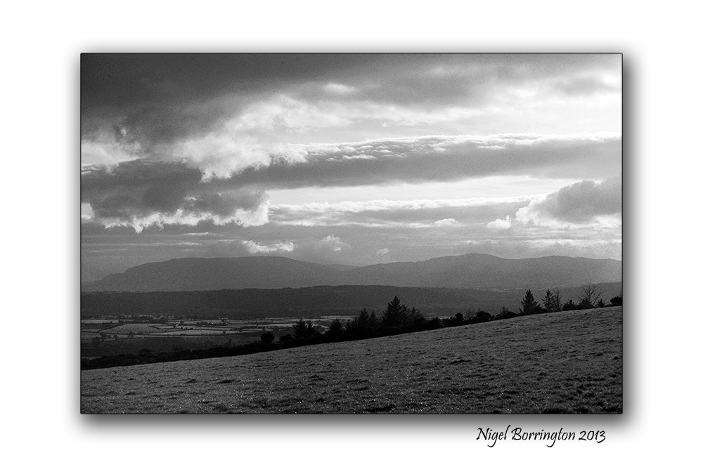
Landscape of County Kilkenny in black and white
Irish Landscape photography by : Nigel Borrington
A black and white Monday, these images of the landscape around county Kilkenny have been taken over the last three or four years.
I am selecting some landscape work this morning and wanted to share a few of them here.
County Kilkenny in black and white, a Gallery


Kilkenny photography

Fuji film x100
Mullins Mill, Kells, country kilkenny
Irish landscape photography : Nigel Borrington
Mullins Mill, Kells, country kilkenny
One feature of the landscape around county kilkenny is it’s old mills, the main river flowing through the county is the river Nore , the county however also has many smaller rivers, including the Kings river that flows from the Slieveardagh Hills in South Tipperary to the river Nore at stoneyford.
Along many of the rivers in county kilkenny you will find the remains of a once thriving milling industry that has long since stop any production, Most of these building however still stand today and some have been very well perserved.
Mullins Mill (Pictured here) in the town of Kells, has to be one of the best such example

Frosty Morning at Mullins Mill, Kells, Co.Kilkenny : Nigel Borrington
Its the weekend so….
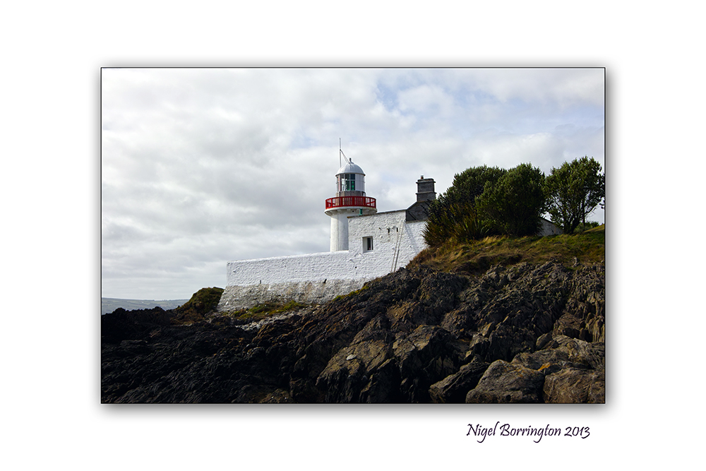
Images of Dungarvan, county Waterford, Ireland
Irish Landscape photography : Nigel Borrington
It’s the weekend so why not find a beach to visit, take a walk and relax.
Take time to notice things you have not seen before, a lighthouse or Herons flying with the gulls.
Take your dog for a walk and throw her a stick or two…..
Gallery of Ballyncourty beach, Dungarvan


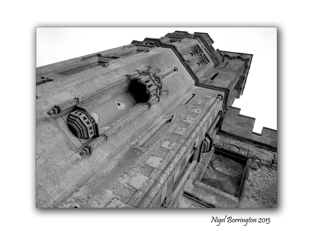
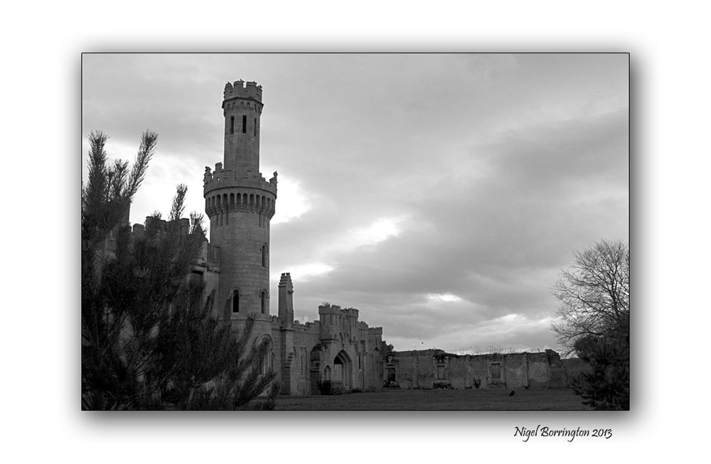
Ducketts grove, county Carlow

Images of Duckett’s Grove, County Carlow
Irish landscape photography By,
Kilkenny photographer : Nigel Borrington
A sense of place Ducketts grove, county Carlow
Ducketts grove is described in full on this link.
Here in this post however I just wanted to show a visual sense of this old Castle sitting in the middle of county Carlow, the photographs were taken during the winter of 2010. Its a wonderful place to visit on a late winters afternoon when the tree’s are all stripped of leafs and the ground is hard and cold.
The cold and snow of a winters day, seems to match so well this wonderful abandoned place.
Ducketts grove in twelve images : a Gallery


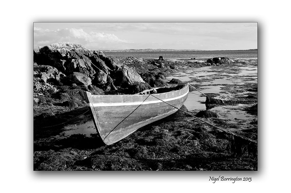
Boat-men of the river Suir.

Fisher men and punts on the river Suir, County Tipperary
Irish landscape photography : Nigel Borrington
Fishing on the River suir
The walk along the river Suir, County Tipperary is one of the best river walks in the south east of Ireland.
The river is used by many local people during the year but the fisher man are most probably it’s most common visitors, the River is renowned for its game angling, holding both salmon (Salmo salar) and brown trout (Salmo trutta).
I have taken many photographs of the fishermen here over the years alone with the boats they use for their fishing, these boats ( all made locally ) are used more like punts as the have a completely flat bottom and are moved along the river with a pole.
Fishing in Ireland : CLOCULLY TO CARRICK-ON-SUIR
The River Suir from Clocully to Carrick-on-Suir is a combination of deep pools, fast glides and varying widths and depths.
From Clocully to Ballydonagh, a consortium of private landowners control the angling, these are all private fisheries. This stretch also includes parts of the River Tar and River Nire, which contain good stocks of trout of up to 30 cm.
Fishing on the river Suir : Gallery

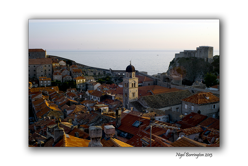
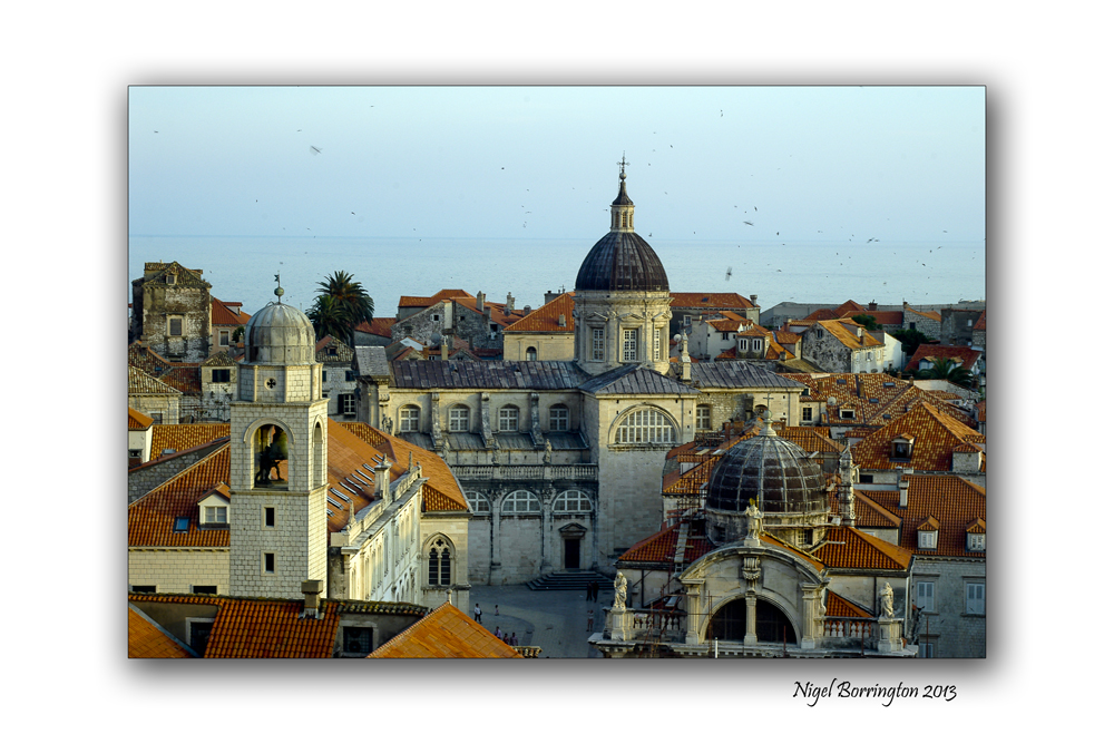
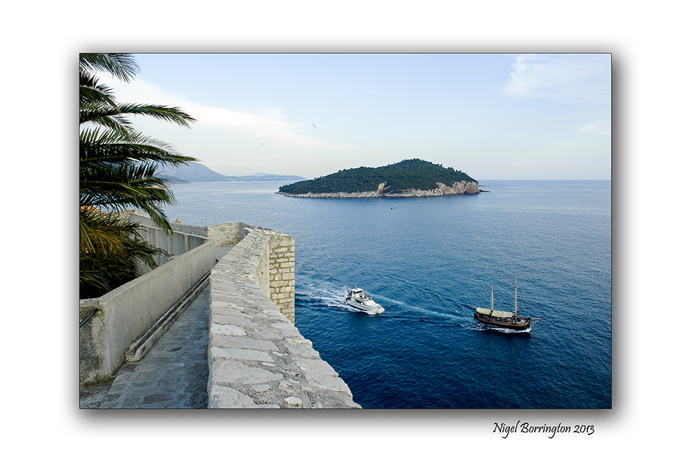
A roof top view of, Dubrovnik

All images using a Nikon D7000
rooftop view of Dubrovnik
Landscape photography : Nigel Borrington
Dubrovnik city walls and roof top views
If you visit the town of Dubrovnik in the region of Dalmatia within Croatia, you just have to walk the walls.
The Walls are a feature of Dubrovnik that run almost 2km around the city. The walls run from four to six metres thick on the landward side but are much thinner on the seaward side. The system of turrets and towers were intended to protect the vulnerable city.
These images were taken one morning in June 2011, while walking the full length around the city, the views of the rooftops and the city that sits on the Mediterranean sea where just wonderful.
The City of Dubrovnik from its walls, Gallery


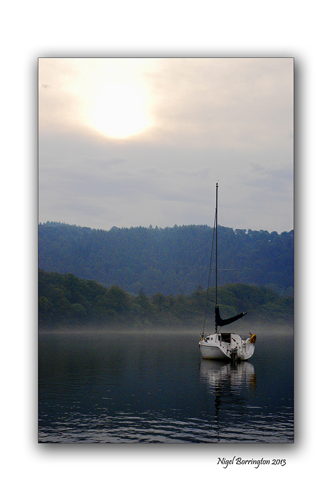
Monday morning – Sail boats on lake Windermere

Sail boats on Lake Windermere
Landscape photography by : Nigel Borrington
Monday Morning on Windermere
One September sometime ago, along with some friends we all hired a boat on Lake Windermere in The lake District.
I remember very well waking up on the first Monday morning, we had arrived late Saturday afternoon after a long drive up from north London. It had started to rain the moment we got out of the car and continued all of the day Sunday.
In a small boat you can hear every drop of rain but I remember waking on the Monday morning only to the sound of gulls and other birds.
I opened the door of the boat and this is the view I got, early morning mist still sitting on the surface of the lake but the sun was burning it’s way slowly through. The rest of the week was one of the best September weeks, weather wise – that you could have wished for.
Sailing On lake Windermere, well it’s is just one of the best holidays you can have.


Sunday evening at Galway bay, a fishing boat.

Images taken using a Nikon D700
A Fishing boat at Galway bay
Irish landscape photography : Nigel Borrington
Sunday evening at Galway bay
One Sunday evening last year while visiting Galway bay, we went for a walk along the shoreline.
We came across this fishing boat resting in a small bay, I felt this image pictures Sunday evening very well.
Rested during the weekend, but ready to start again on Monday morning, just not yet !
Its the weekend so……

All images, using a nikon Dslr.
Allihies, west cork
Irish landscape Photography : Nigel Borrington
Its the weekend so why not find a coastal village to stay in, take time to look at the views, watch the sun go down and relax ……..

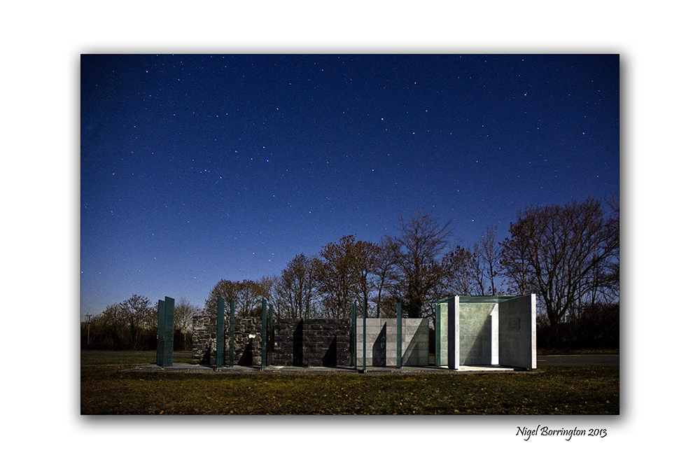
James Hoban – Spirit of place
Nikon D7000 and Sigma SD15
Spirit of place, James Hoban Memorial, Callan county Kilkenny
Irish Landscape Photography : Nigel Borrington
James Hoban was from the Desart estate, near Callan county Kilkenny and is the architect of the White House (late-1793 or early-1794).
In 2008, 24 architecture students from the a University in Washington DC completed the memorial “Spirit of place” in his honour. I took the photographs posted here in 2011, one very clear night and then the last image on a evening last spring.
From : http://en.wikipedia.org/wiki/James_Hoban
“James Hoban was raised on an estate belonging to the Earl of Desart in Cuffesgrange, near Callan in County Kilkenny. He worked there as a wheelwright and carpenter until his early twenties, when he was given an ‘advanced student’ place in the Dublin Society’s Drawing School on Lower Grafton Street.
He excelled in his studies and received the prestigious Duke of Leinster’s medal for drawings of “Brackets, Stairs, and Roofs.” from the Dublin Society in 1780. Later Hoban found a position as an apprentice to the headmaster of the Dublin Society School the Cork-born architect Thomas Ivory from 1779? to 1785 .
Following the American Revolutionary War, Hoban immigrated to the United States, and established himself as an architect in Philadelphia in 1785.[1]
Charleston County Courthouse, Charleston, SC (1790-92), James Hoban, architect.
Hoban’s amended elevation of the White House (late-1793 or early-1794).
Hoban was in South Carolina by April 1787, where he designed numerous buildings including the Charleston County Courthouse (1790–92), built on the ruins of the former South Carolina Statehouse (1753, burned 1788). President Washington admired Hoban’s work on his Southern Tour, may have met with him in Charleston in May 1791, and summoned the architect to Philadelphia, Pennsylvania (the temporary national capital) in June 1792.
In July 1792, Hoban was named winner of the design competition for the White House.[4] His initial design seems to have had a 3-story facade, 9 bays across (like the Charleston courthouse). Under Washington’s influence, Hoban amended this to a 2-story facade, 11 bays across, and, at Washington’s insistence, the whole presidential mansion was faced with stone. It is unclear whether any of Hoban’s surviving drawings are actually from the competition.
Hoban was also one of the supervising architects who served on the Capitol, carrying out the design of Dr. William Thornton.
Hoban lived the rest of his life in Washington, D.C., where he worked on other public buildings and government projects, including roads and bridges. He also designed Rossenarra House near the village of Kilmoganny in Kilkenny, Ireland in 1824.
Hoban’s wife Susanna Sewall was the daughter of the prominent Georgetown “City Tavern” proprietor.
Hoban was also involved in the development of Catholic institutions in the city, including Georgetown University (where his son was a member of the Jesuit community), St. Patrick’s Parish, and the Visitation Convent founded by another Kilkenny native, Teresa Lalor of Ballyragget.
Hoban died in Washington, D.C. on December 8, 1831. He is buried at historic Mount Olivet Cemetery in Washington, D.C.”
A Spirit of place


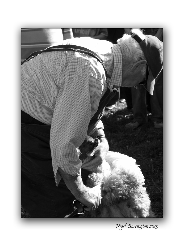
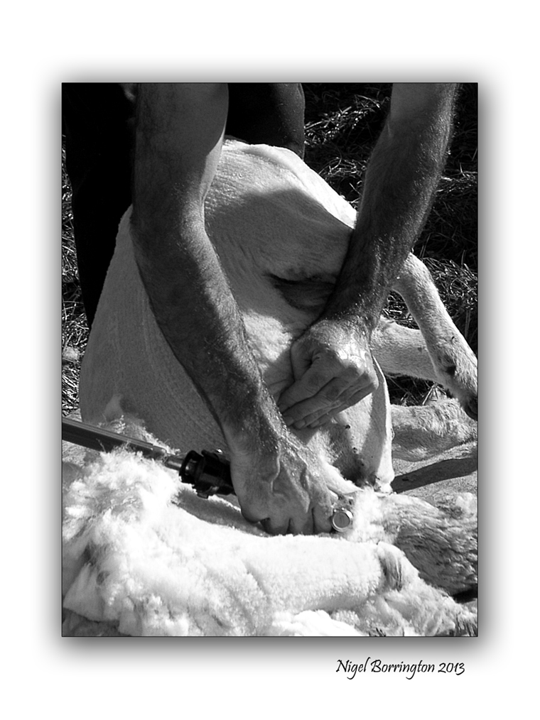
Kilkenny (Iverk show ) – Sheep shearers
All images using a Nikon D7000
Sheep shearers and the Kilkenny county show
Events photography : Nigel Borrington
The Kilkenny – Iverk show, is held in the village of (Piltown, county Kilkenny) each September.
It’s a great day of agricultural events from horse and cattle shows to equipment demonstrations.
The sheep shearing competitions and demonstrations each year bring in a big crowd. The images below show how sheep are sheared both in modern and older times.
Sheep shearing demonstration gallery


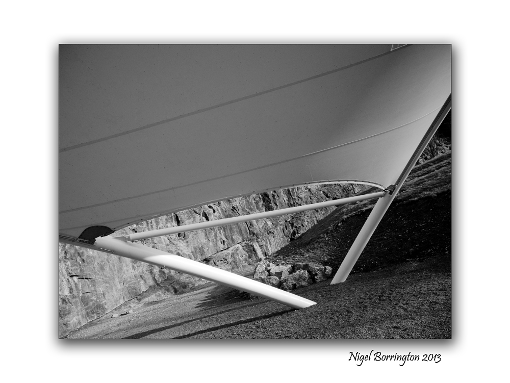
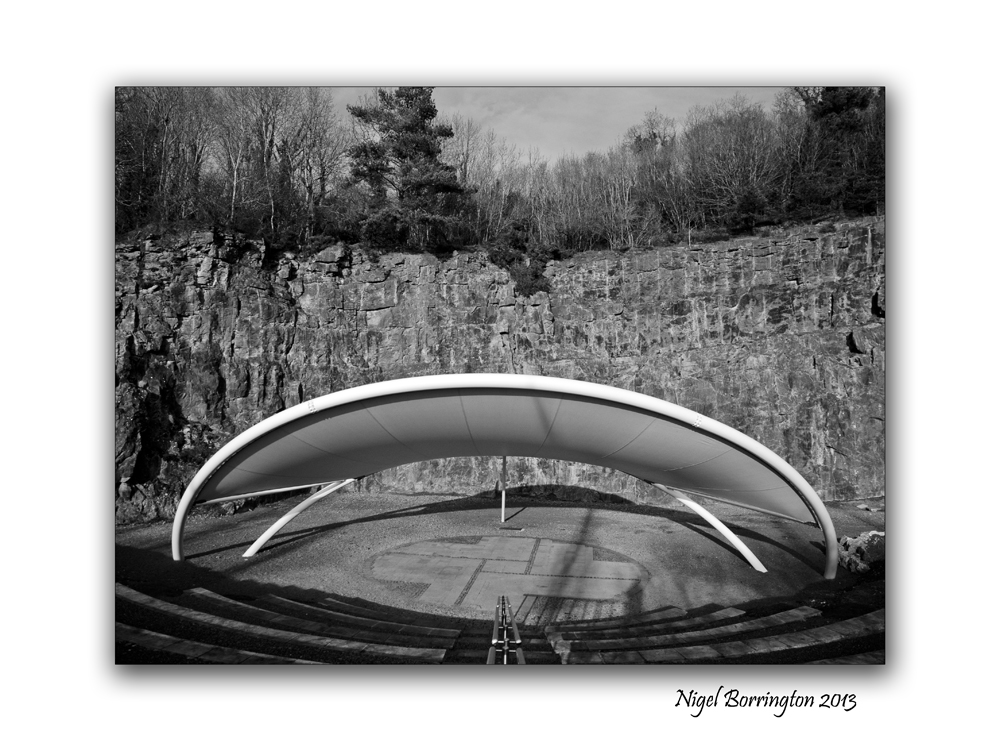
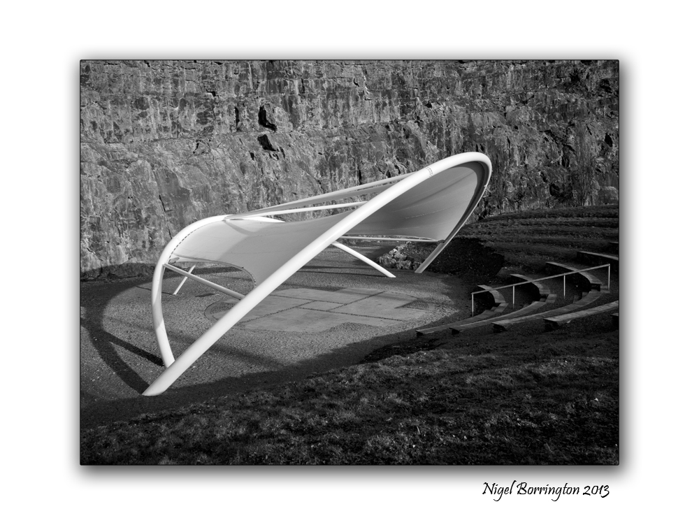
Ballykeeffe Amphitheatre

All images using a Nikon D7000
Ballykeeffe Amphitheatre, county KIlkenny
KIlkenny landscape photography
Ballykeeffe Amphitheatre, county kilkenny
The Ballykeeffe Amphitheatre is Kilkenny’s outdoor auditorium and it is used many times during the year for outdoor performances. Located beneath Ballykeeffe Woods and Nature Reserve, I have visited this area many times to walk our dog and get some exercise.
The Amphitheatre was build in the remains of an old slate quarry, for a longtime the performances were held in the open air but very recently it boasts a state of the art canopy which fits within the worked-out quarry.
The acoustics and setting are designed to provide for a great outdoor theatre and music performance.
When the new canopy first appeared, I took the following images.
Ballykeeffe Amphitheatre – a gallery


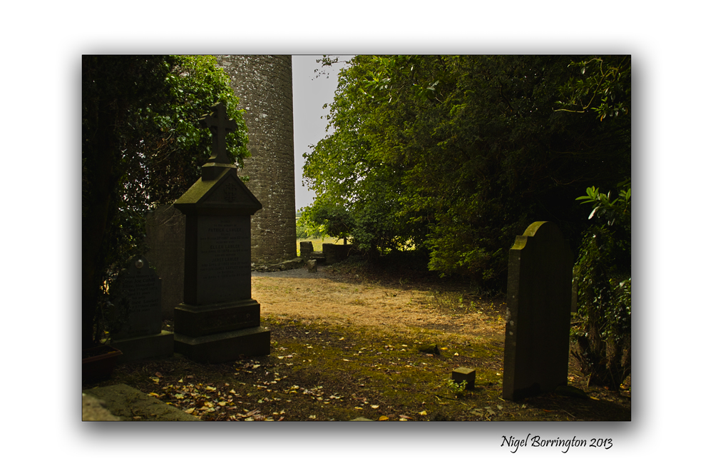
Kilree Round Tower, County KIlkenny

All image using a sigma SD15. 15-30mm lens
The Secret of Kells, Kilree Round Tower, County KIlkenny
Landscape Photography : Nigel Borrington
The secrets of the Kells is at Kilree
Kells, county kilkenny is full of heritage from past and while most people are drawn immediately to Kells Priory, one of the largest and best preserved walled monastic sites in Europe, there is another just as important with a history stretching back longer than the Cistercian brotherhood of the priory.
At Kilree, there is a trio of treasures – A round tower, an ancient church and a high cross where a king may or may not be buried. And adding to the mystique is a fourth, natural phenomenon, a Ballaun stone going back to pre-historic times that was used by the first inhabitants of this island. to drink from an for pagan idolatry.
Historians and archaeologists may have got it wrong about Kilree on a number of levels. When you first view if coming from Kells village it reminds you of Freestone Hill – An ancient place used before Christianity. It has commanding views of the surrounding countryside and seems to be the highest spot in the area and therefore a natural stronghold. Looking from it, you take in Knockdrinnagh Wood, Ballygowan, Hugginstown and the high lands beyond it and around to the Slieveardagh Hills. It also boasts commanding views of Sliabh an mBan and the Comeraghs in the distance.

So it begs the question was the round tower of Kilree used as a look out with its bells when danger was imminent. Was it used by the monks who were for all intents and purposes living in a hollow by the King’s River and therefore had no idea of who or what was approaching them. It’s probably too simplistic a view but we are sure of one thing – the tower was built around the 11th century and would have been used as a defence against the maurauding Vikings who had a stronghold in Waterford.
It is said but not proven that the bones of a great king are buried under the high Cross at Kilree, just 40 yards from the round tower and the church of St Brigid that lies in ruins yet still has a strong association with the people of the area in both Kells and Stoneyford. Although it stands 90 feet high, Kilree Round tower is not easy to see because it is set amid a grove of trees. A fine slim building with a diameter inside of just 9 feet it must have been tight in there. With six different levels and a battlement area at the top as well as a belfry, it is little wonder that rope ladders were used here.
Like the other round towers in the county, its entrance faces the church and there is a long association between the two.
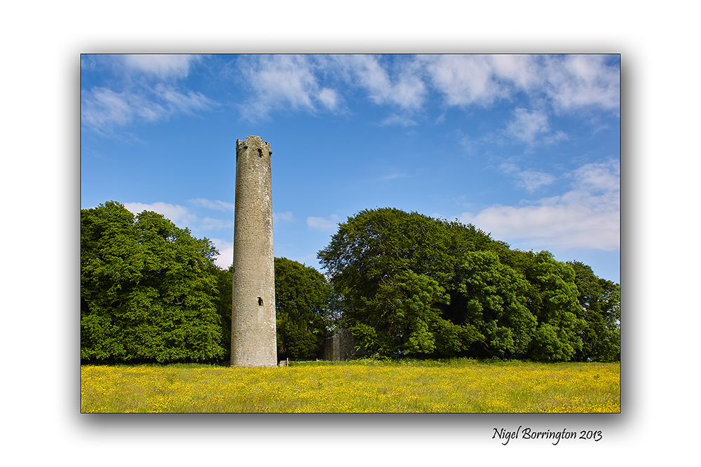
The round tower and church are enclosed in a grove of beautiful trees which seem to detract slightly from the height of the tower but once you enter this wonderful place you can feel the past coming at you. It’s sad that a sign in bold yellow at the entrance tells you to beware of the bull. What a lovely first impression for visitors. The land is extremely fertile and there is a rich covering of spring grass on the field and you can appreciate why a farmer would be so anxious to keep it so but the sign should be taken down when the bull is not there.
It is important to appreciate the work done by researchers over the years on Kilree and the rest of the county none more so that Canon Carrigan in his History of the Diocese of Ossory; the wonderful parish history of Dunnamaggin by Richard Lahart which provides us with so much detail but it is the findings of Ireland’s great antiquarian scholar from Slieverue in South Kilkenny, that is most revealing. The research by John O’Donovan on place names and on sites like Kilree for the Ordance Survey is invaluable in deepening our knowledge of our past.
Up to the middle of the 19th century it was claimed that King Niall Caille was buried here in 844AD and that his bones lay under the high Cross which is uninscribed. It seems now that the high cross was erected significantly before this date and we learn from different researchers that these kind of crosses were commemorative and not built to cover the dead. He upset a lot of people when he said the real ancient Irish name for the site was not actually Kilree which up to them was meant to be the church of the king but Cill Freach after a female saint, Freach. Canon Corrigan also studied this and felt that Kilree was a corruption of the name Cill Ruiddchi, the church of St Ruiddchi. While it is hard to go past the original name of Cill Bride as the name for the church, named after St Brigid, we do know from local people and from Richard Lahart that the well at Kilree was also named in honour of St Brigid and that goes back over 1,000 years. It is hard to see past Cill An Ri and of course it is still known locally by people as The Steeple, a reference to the bell tower on top of the round tower.
Inside the church,tombs of local people remain. The poorer people would have bee buried furthest away from the church. From Norman times the Howlings, Holdens or Howels are associated with the site and for some reason these are the same people as the Walsh’s of the Mountain (I don’t understand that). From medieval times, the Comerfords were closely associated with Kilree along with the Izod family, Flemings, Ryans, St Legers and of course in recent times, the Goreys.
Again the lack of signposts for such an amazing place is sad. The only sign coming from Kilkenny city is at Kells Priory and those in charge of the site, have done a good job in keeping it quiet.
But what stands out most about Kilree is that it is still used as a graveyard and the ancient burial ground is well looked after by the people iving in the area..
Kilree is also home to a Ballaun Stone located 250 yards north of the round tower in the corner of a field of heavily weathered limestone and is marked on the Ordance survey map for the area. A bullaun is the term used for the depression in a stone which is often water filled.
Local folklore often attaches religious or magical significance to bullaun stones, such as the belief that the rainwater collecting in a stone’s hollow has healing properties. Ritual use of some bullaun stones continued well into the Christian period and many are found in association with early churches like Kilree or should that be St Brigids or St Freach’s or St Ruiddchi’s/ take your pick.
Published in the kilkenny people. 2012
Image Gallery

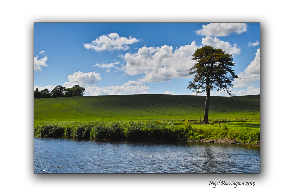
Where the Rivers Flow
Sigma SD15, 15-30mm lens, ISO 50
River Barrow, County Kilkenny
Irish landscape photography : Nigel Borrington
Where the Rivers Flow
By : Monique Sapla
Have you ever wondered,
Where do the rivers flow
Do they flow forever,
Where does the water go.
Do rivers somewhere finish,
Where does a river start
Do all lead to the ocean,
Or do they break apart.
Someday I’d like to follow,
A river to its end
I’d run to the horizon,
Through fields and around bends.
Have you ever wondered,
Where do the rivers flow
Do they go on forever
Someday I’d like to know
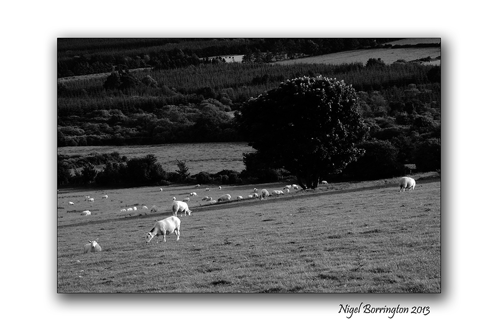
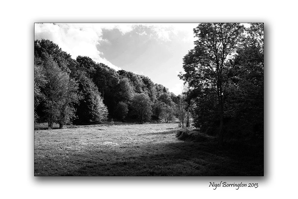
County Kilkenny – through it’s trees

All images using a – Sigma SD15, 15-30mm lens
County kilkenny, through its trees
Landscape photography : Nigel Borrington
A sense of county Kilkenny , September 2013
Getting out and about in county Kilkenny on these late summer days is just wonderful, this Gallery of images was from an evenings walk through some local country lanes. I hope they get across a sense of the county and its wonderful landscape on an early evening in September.


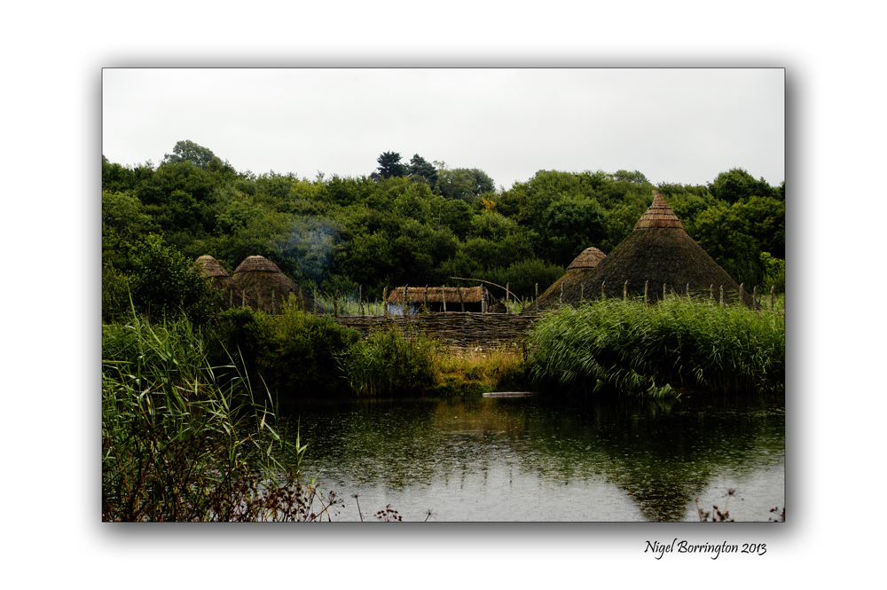
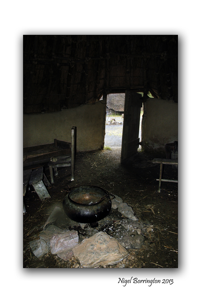
Irish National Heritage park
All images using a Nikon D700
Irish National Heritage park – A Crannog
Landscape photography : Nigel borrington
One place in Ireland you have to visit, in order to get a good sense of the nations history is the National heritage park.
Location
The Irish National Heritage Park Ferrycarrig, is Located in the South East of Ireland, approximately 3 miles from Wexford Town off the Dublin (N11) Rosslare Road (N25). Eleven miles from Rosslare Europort.
Sat Nav: N: 52.348 W: -6.51673
This park is Unique in Europe, occuping 35 acres and has 16 archaeological and historical reconstructions all located in their natural settings. The Heritage Park outlines the history of Irish life as the story of 10000 years unfolds before you. It is history presented in a unique way in magical and varied settings.
A Crannog
The images in this post are from the reconstructed Crannog, Wiki-pedia defines a Crannog as follows
“Crannogs were used as dwellings over five millennia from the European Neolithic Period, to as late as the 17th/early 18th century although in Scotland, convincing evidence for Early and Middle Bronze Age or Norse Period use is not currently present in the archaeological record. The earliest radiocarbon determinations obtained from key sites such as Oakbank in Loch Tay or Redcastle, Beauly Firth approach the Late Bronze Age – Early Iron Age transition at their widest interpretation at 2 sigma or 95.4% probability, falling after c.800BC and therefore could only be considered Late Bronze Age by the narrowest of margins. Crannogs have been variously interpreted as free-standing wooden structures, as at Loch Tay, although more commonly they exist as brush, stone or timber mounds which can be revetted with timber piles. However, in areas such as the Western Isles of Scotland, timber was unavailable from the Neolithic onwards. As a result, completely stone crannogs supporting drystone architecture are common here.
Today, crannogs typically appear as small, circular islets, often 10 to 30 metres (30 to 100 ft) in diameter, covered in dense vegetation due to their inaccessibility to grazing livestock.”
http://en.wikipedia.org/wiki/Crannog
Crannog images


Castlerigg stone circle, Keswick in Cumbria, September Equinox

Castlerigg stone circle, Keswick in Cumbria
Landscape photography, Nigel Borrington
September Equinox, 22nd of September
There are two equinoxes every year – in September and March – when the sun shines directly on the equator and the length of day and night is nearly equal. Seasons are opposite on either side of the equator, so the equinox in September is also known as the “autumnal (fall) equinox” in the northern hemisphere. However, in the southern hemisphere, it’s known as the “spring (vernal) equinox”.
The Earth’s postion during the September equinox (ill. not to scale).
September Equinox in Kilkenny, Ireland is on the
Sunday, 22 September 2013, 21:44 IST
Castlerigg stone circle
The stone circle at Castlerigg (alt. Keswick Carles, Carles, Carsles or Castle-rig) is situated near Keswick in Cumbria, North West England. One of around 1,300 stone circles in the British Isles and Brittany, it was constructed as a part of a megalithic tradition that lasted from 3,300 to 900 BCE, during the Late Neolithic and Early Bronze Ages.
Various archaeologists have commented positively on the beauty and romance of the Castlerigg ring and its natural environment. In his study of the stone circles of Cumbria, archaeologist John Waterhouse commented that the site was “one of the most visually impressive prehistoric monuments in Britain.”
Every year, thousands of tourists travel to the site, making it the most visited stone circle in Cumbria. This plateau forms the raised centre of a natural amphitheatre created by the surrounding fells and from within the circle it is possible to see some of the highest peaks in Cumbria: Helvellyn, Skiddaw, Grasmoor and Blencathra.
Sunday on the river bank

All images using a Sigma SD15
Images of the river Nore, County Kilkenny
Irish landscape photography : Nigel Borrington
Sundays at this time of year can be a great time to go for a river walk, its getting towards autumn but the walk along the river Nore towards St Mullins can still be green and full of life.
There were still lots of people around, including one family rowing in their Canadian Canoes, I got some images of them and we met them again later on outside a Cafe and shared a drink or two.
The River Nore in September – Gallery


Its the weekend so ….

Images taken using a Fujifilm X100
Mountains of county Kerry
Irish landscape Photography : Nigel Borrington
Its the weekend so why not find a mountain road and take a walk, look at the views, take your time and relax ……..

Going down to Littleton bog, County Tipperary

All images using a Canon G1x and a Fujifilm x100
Images of Littleton peat bog, County Tipperary
Irish landscape photography by : Nigel Borrington
Going down to Littleton Bog.
To myself I feel that very little depicts the landscape of Ireland as much as it’s peat bog areas, peat has been cut from this landscape for hundreds if not thousands of years.
Littleton Bog is about 30km from my home and I visit this area many times during the year, too both walk our dog Molly and take sometime too take images and just be out in what can be a very wild place in the winter months along with a wonderful place in the summer.
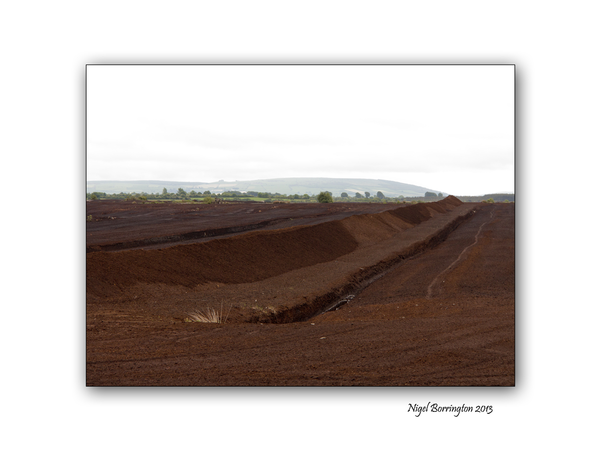
The mass production of peat from the Littleton area has left this landscape deeply affected as you can see from this photo and the photographs below. However I have also tried by best to show how the area around the bog can be reclaimed for both nature and wildlife.
Many Animals and Birds make the reclaimed lakes here their home during both the winter and summer months. Littleton bog is also home to many rare plants and insects with multiple entries in the Irish national biodiversity database.
Seamus Heaney
Last week the Irish Poet Seamus Heaney died and he wrote this Poem about the Irish bog lands.
Bogland
By Seamus Heaney
We have no prairies
To slice a big sun at evening–
Everywhere the eye concedes to
Encrouching horizon,
Is wooed into the cyclops’ eye
Of a tarn. Our unfenced country
Is bog that keeps crusting
Between the sights of the sun.
They’ve taken the skeleton
Of the Great Irish Elk
Out of the peat, set it up
An astounding crate full of air.
Butter sunk under
More than a hundred years
Was recovered salty and white.
The ground itself is kind, black butter
Melting and opening underfoot,
Missing its last definition
By millions of years.
They’ll never dig coal here,
Only the waterlogged trunks
Of great firs, soft as pulp.
Our pioneers keep striking
Inwards and downwards,
Every layer they strip
Seems camped on before.
The bogholes might be Atlantic seepage.
The wet centre is bottomless.
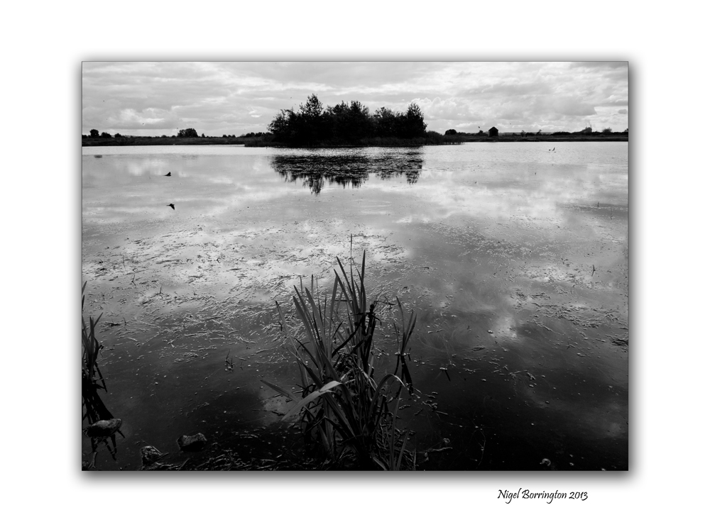
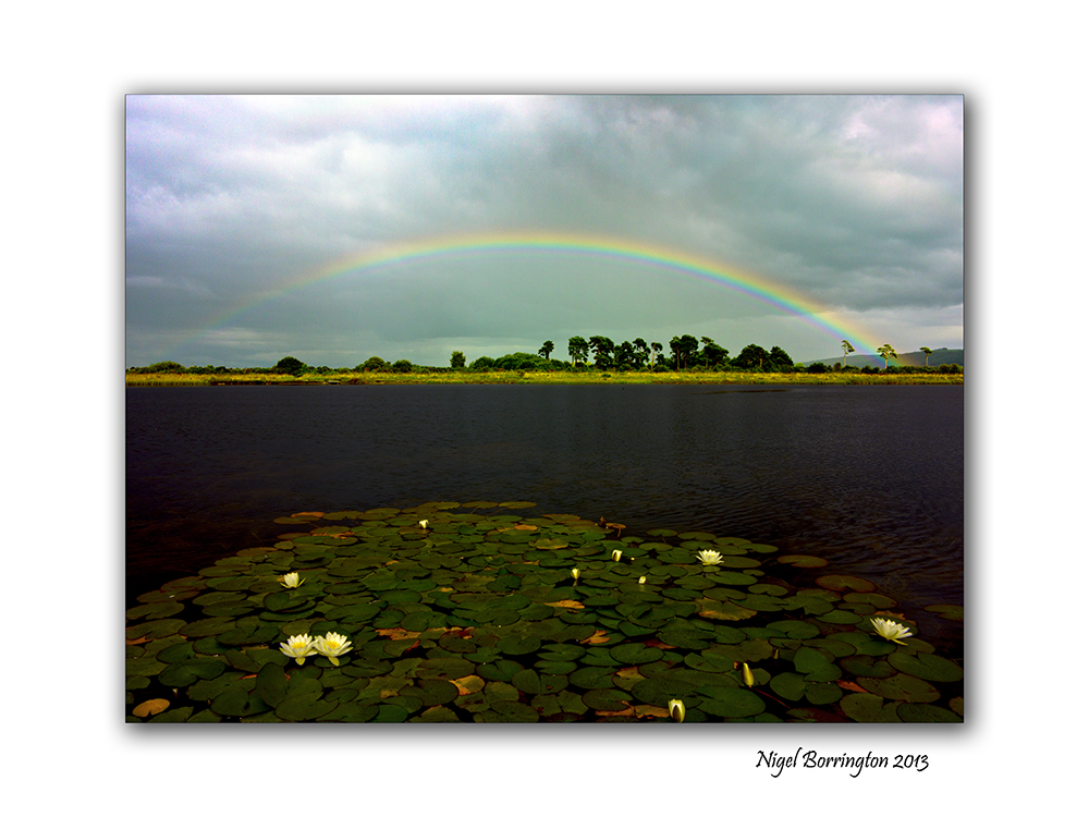
Images of the Bog – Gallery


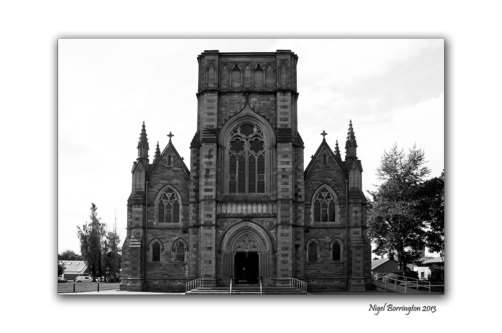
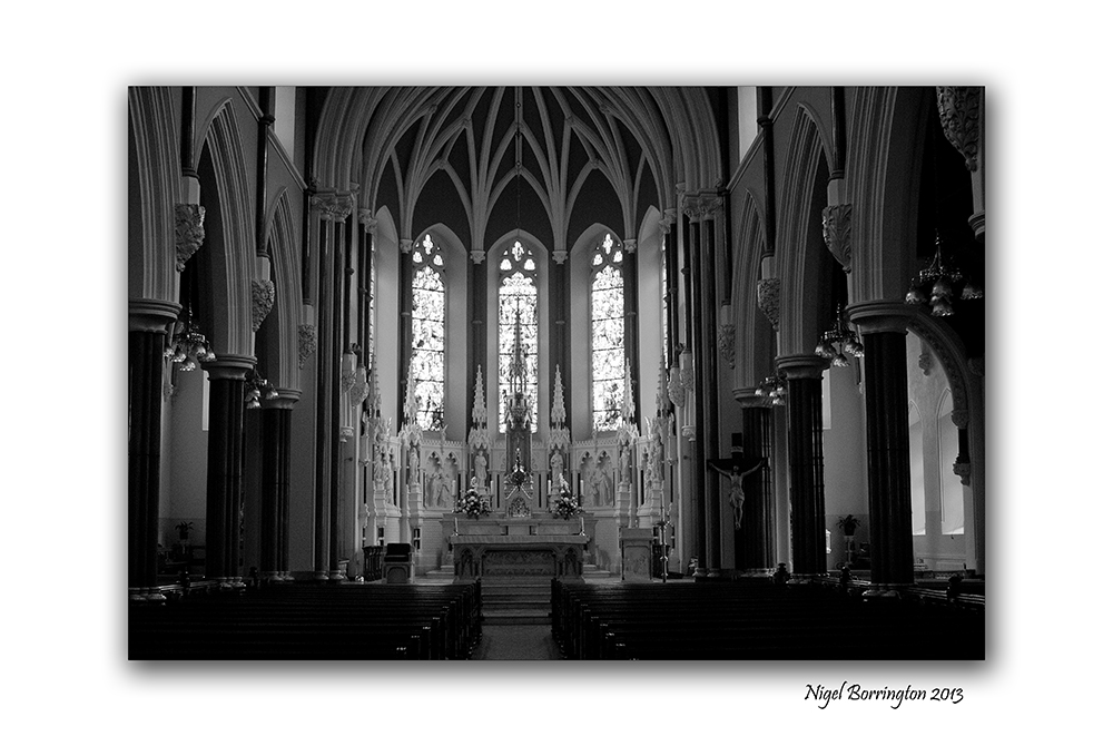
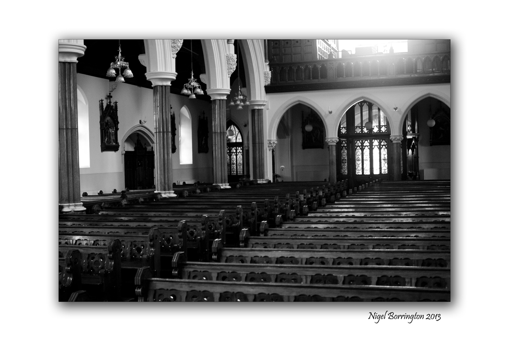
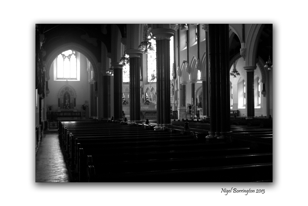
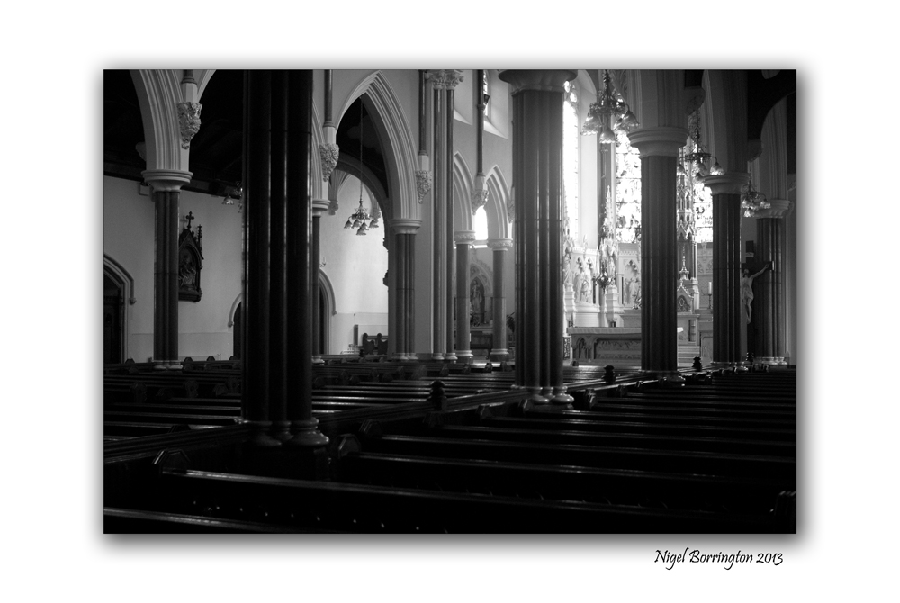
St John, Kilkenny
All images using a Nikon D7000
St Johns parish church, county Kilkenny
Kilkenny photographer: Nigel Borrington.
St Johns, Kilkenny is one of the counties best known churches and I have photographed weddings for a few wedding couples here since I have been working as a photographer here in Ireland.
It’s not the main church in the town but I have to say I think its the best looking of them all, the images below were taken the very first time I worked on a wedding here. I always if possible attend the church a day or two before a wedding just to do some test shots and check on my access around the church along with the lighting condition.
As you can see in these images the hight of the church and the windows creates some very dramatic lighting.
Gallery of St Johns, Kilkenny


Our dog Molly at Malin Beg, County Donegal

Molly our Golden Retriever
Malin beg beach, county Donegal
Molly our ten year old Golden Retriever has been swimming in the sea all over Ireland, she has loved the water since she was about one year old.
We have been on holiday with her during this ten years to just about every coastal county in Ireland. The beaches being our favourite places to visit. One of the most memorable beaches was Malin beg, in county Donegal.
We stayed here for an afternoon about three years ago and we all went for a swim in the warm waters.
If you get to visit Donegal, I would highly recommend this beach as a must visit location.


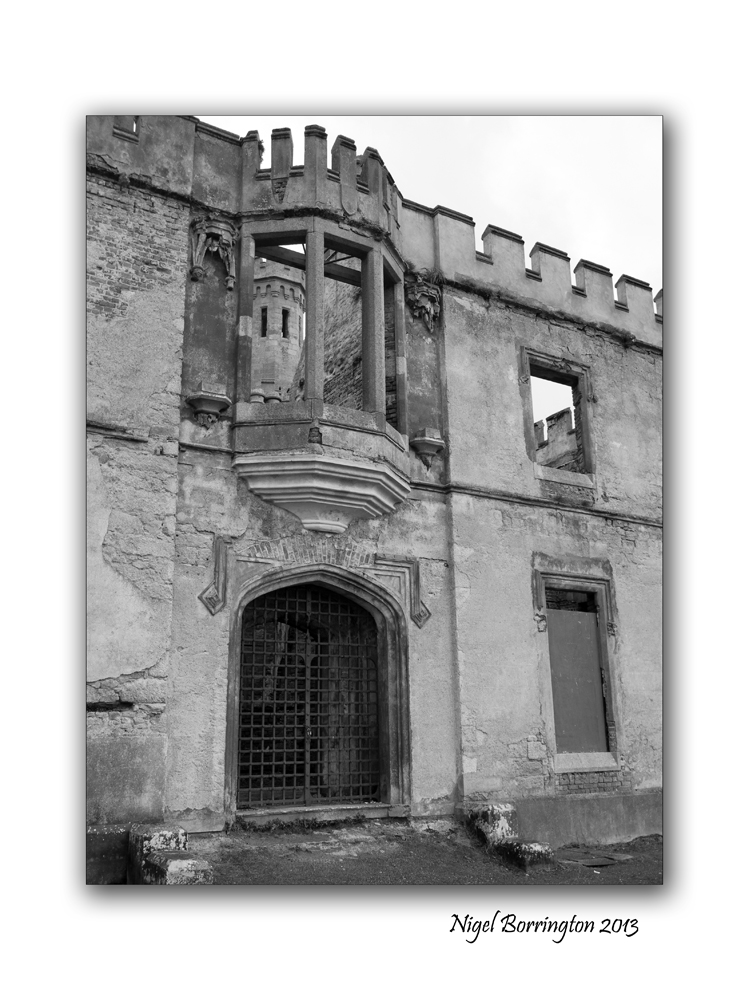
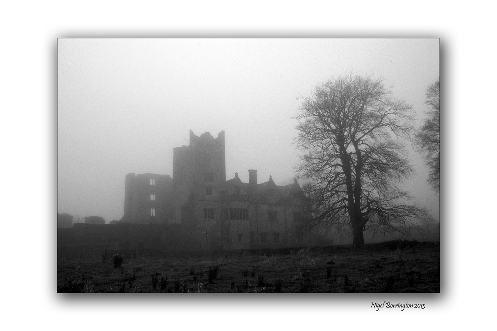
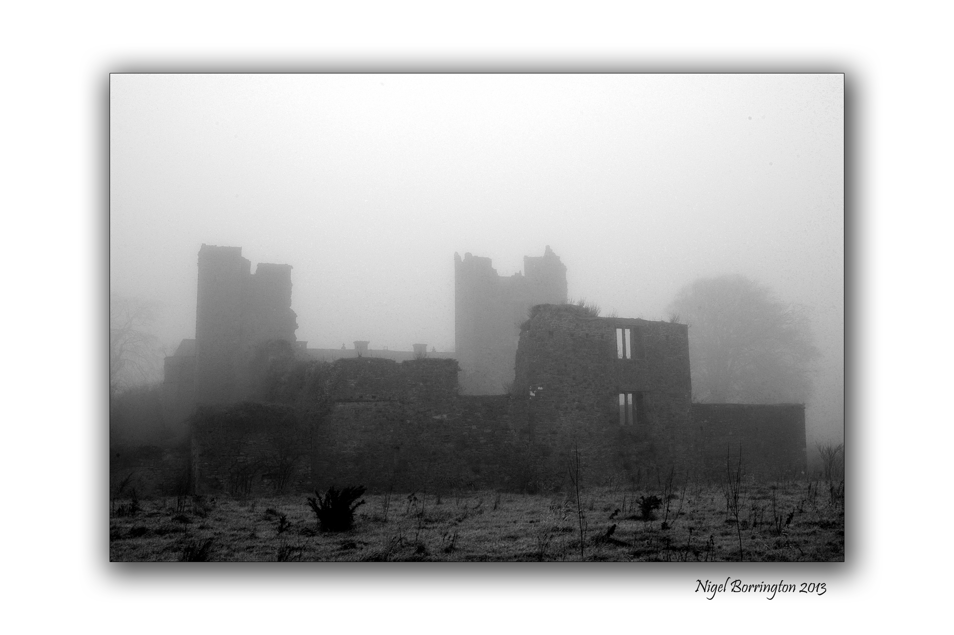
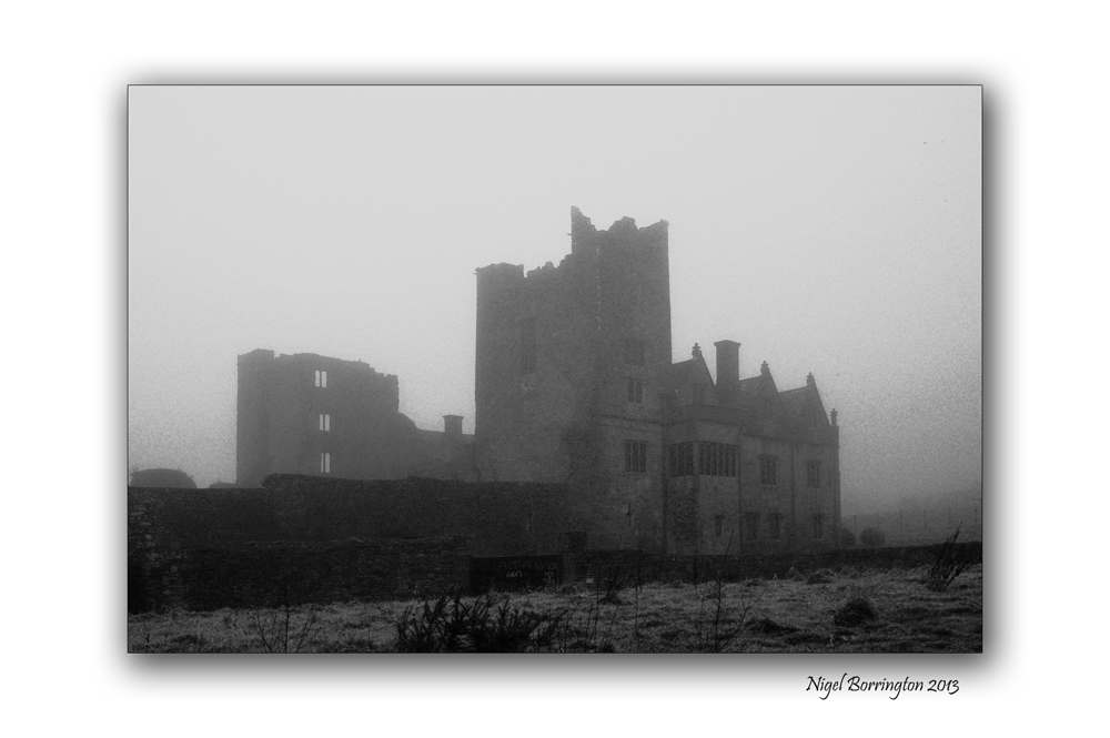
Ormonde Castle
All images using a Nikon D7000
Ormonde Castle, County Tipperary
Irish Landscape photography: Nigel Borrington
Sitting on the bank of the river Suir ( Carrick-on-suir, county Tipperary ), Ormonde Castle calls out of Irish history and it’s fifteen hundreds.
From the misty past this castle still stands on the edge of a town whose history is completely dependant on this castle and the Ormonde family who built it. I will post with more details on the town and castle but for the moment I just wanted to give you a sense of this place.
These pictures where taken last December, about four day before Christmas and on a very foggy morning, the Castle stands on the banks of the river Suir and is often covered in mist during the winter months.
Ormonde castle a gallery


You must be logged in to post a comment.