
Images of Ireland, The Connemara Mountains Galway
Connemara mountains
Irish Landscapes
Nigel Borrington
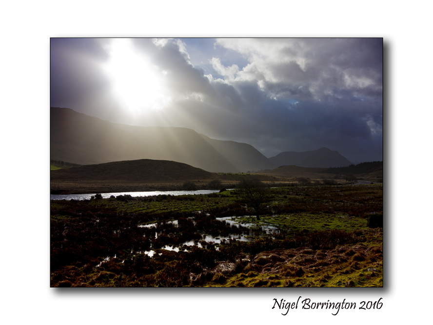
At the end of last week I visited the Connemara Mountains in County Galway, one of Ireland most beautiful landscape areas.
The weather was just amazing, changing every ten minutes with heavy showers moving very quickly across the mountains and lakes.
I just love this part of Ireland, the mountains here contain the following ranges ….
Mountains in County Galway
Twelve Bens
The Twelve Bens or Twelve Pins (Irish Na Beanna Beola) is a mountain range in Connemara. Dedicated hill climbers can hike all twelve in a single day. The twelve Bens are a group of small mountains that are the dominant feature of the Connemara countryside. They are easily accessible from the N59 or from the villages of Letterfrack or Recess.
Mweelrea Mountains
Mweelrea rising from the northern shores of Killary Harbour, is one of the finest mountain massifs in Ireland. It may be climbed from Delphi following the ridges to the fjord.
Maamturk Mountains
Mammturk Mountains are a picturesque mountain range in North Connemara. They are less well known than their more famous neighbours, the Twelve Bens on the other side of the Inagh Valley. They are not very big (max 667m) but a pleasant climb in fine weather, with superb views and no congestion.
Mount Gable
Mount Gable (1370 feet) is one of the most beautiful and scenic mountain walks in Ireland. It dominates the isthmus between Lough Corrib and Lough Mask and guards one of the major routes into Connemara from the east. The starting point for a walk is approximately 2km from the village of Clonbur.
Slieve Aughty Mountains
The Slieve Aughty Mountains are a mountain range spread over both County Galway and County Clare. The highest peak in the Slieve Aughty Mountains is Maghera in Clare which rises to 400m (1,314ft). The mountain range consists of two ridges divided by the Owendallaigh river which flows west into Lough Cutra.
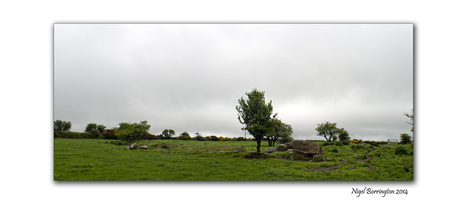
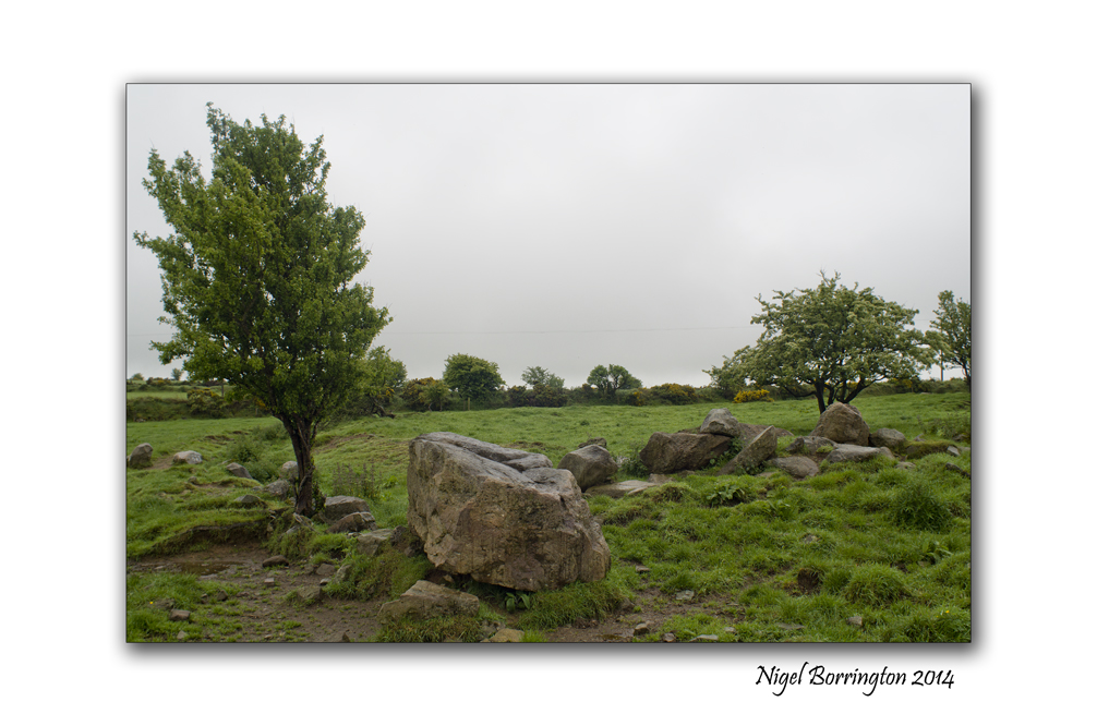
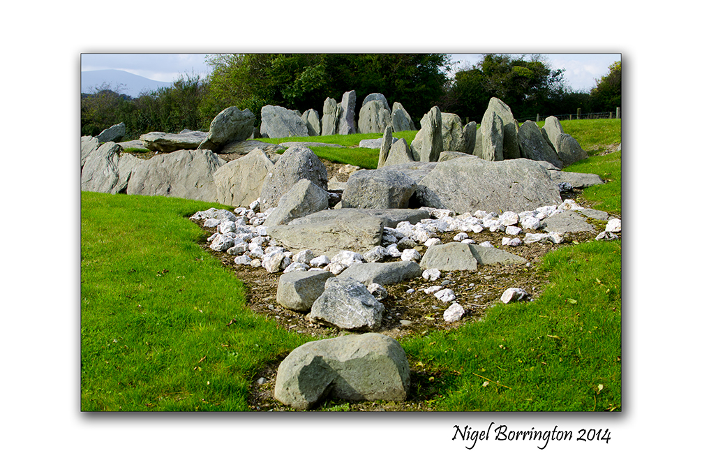
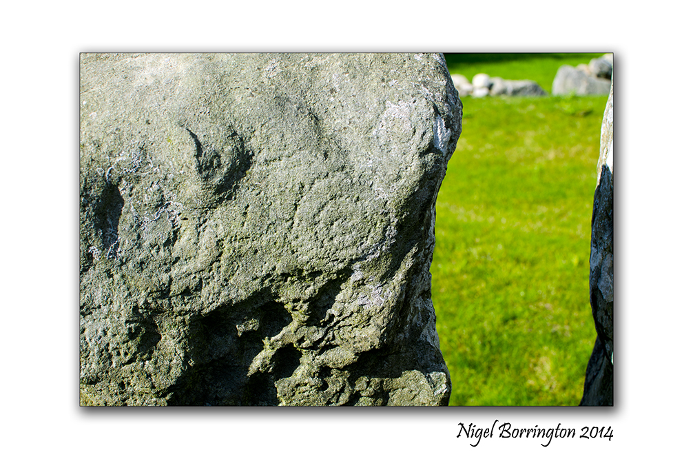
Pagan ring forts and passage tombs , From Kerry to kilkenny
 Knockroe passage tomb, county Kilkenny
Irish landscape Photography : Nigel Borrington
Pagan ring forts and passage tombs , From Kerry to kilkenny
During July last year 2013, I visited two ring forts near Cahersiveen, County Kerry and posted on them as below :
 .
.
Cahergall ring fort is a massive stone construction, built between 400BC and 500AD, It can be found close to Cahersiveen, County Kerry. Leacanabuaile feels very much more like a dwelling place for people to both live and keep themselves safe from the surrounding Environment. This included raiders and wild animals stealing cattle.
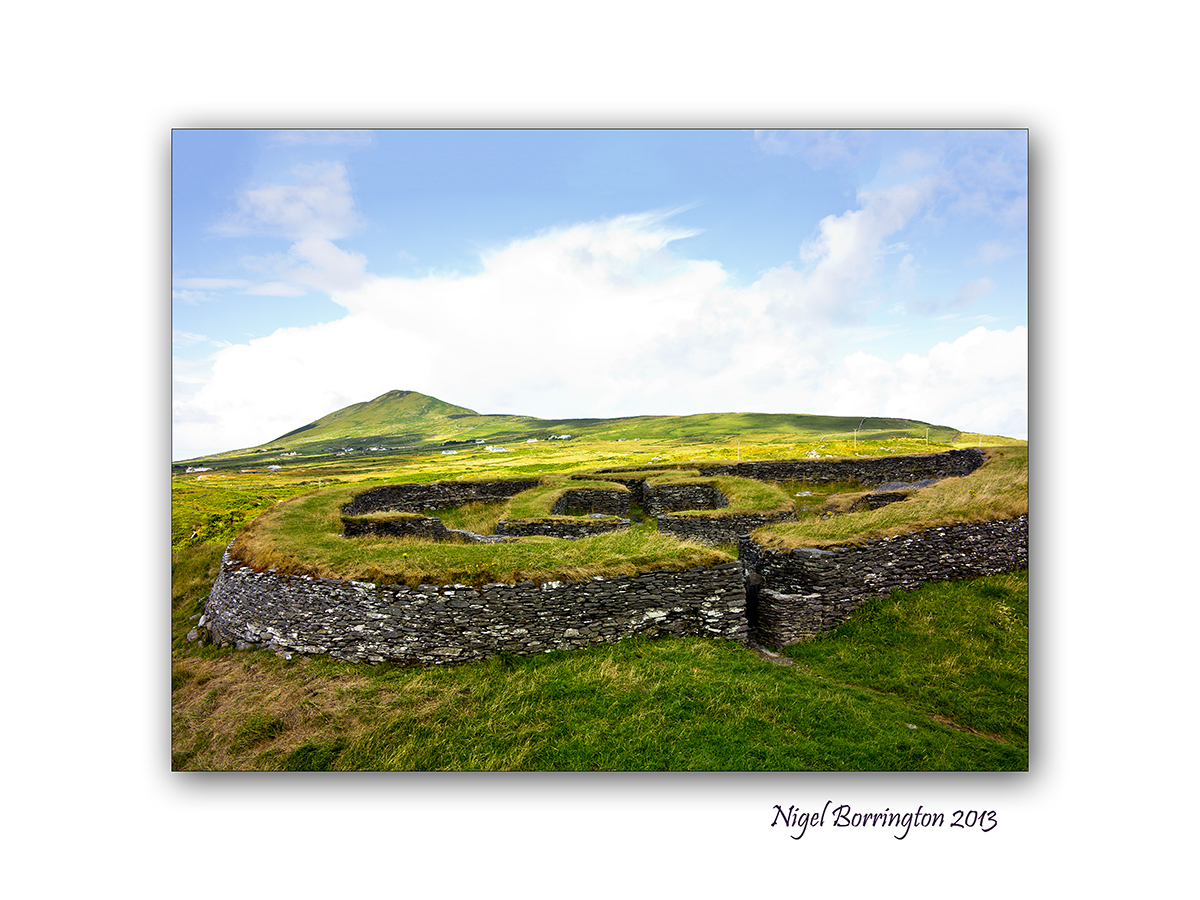
Leacanabuaile, stone ring Fort
Sitting on a hill side near Cahersiveen in County Kerry is Leacanabuaile Stone Fort, it is considered one of the best examples of an Irish ring fort.
The name translates to ‘Hillside of the Summer Pasturage’.
Returning home
The visit to both these locations was one of the most interesting history trips I have ever done and left me with a great sense of the History of Europe and of the people who lived here before Christian times.
On returning to county Kilkenny I fell like I was living in a place with a much more limited sense of history, Tipperary and Kilkenny feel much less remote than the coast line and mountains of county Kerry and their history seems to be much more modern.
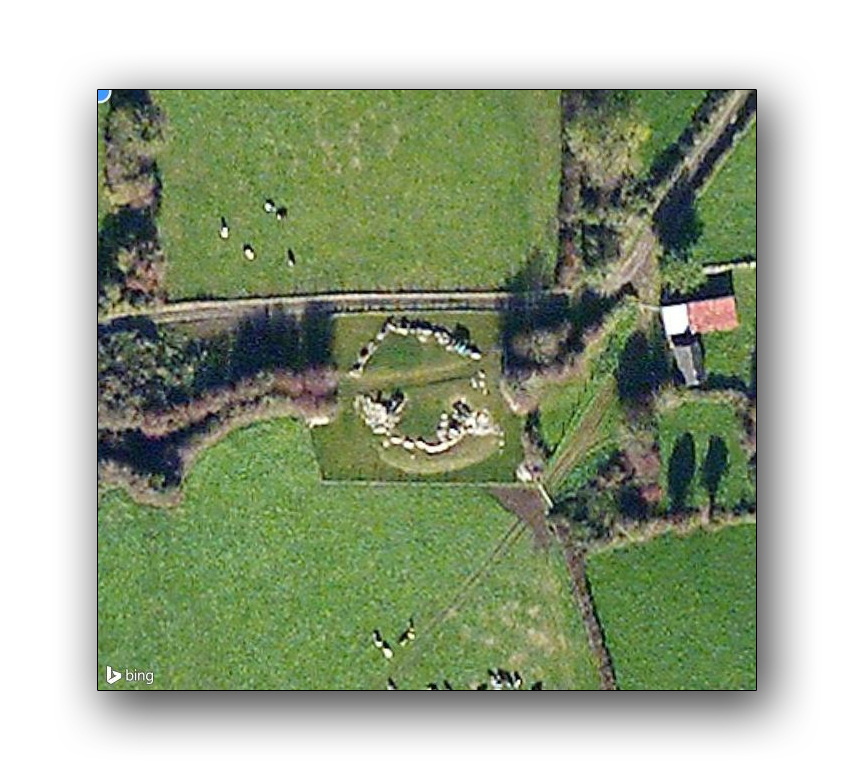
Well it has taken me almost a year since the visit to Cahergall and Leacanabuaile to realise that this impression of my local area is far from true. Apart from the location of Knockroe (Post here), I have started to visit and find more and more local remains of Ireland’s past and it clearly goes way beyond the days of St Patrick and the early church.
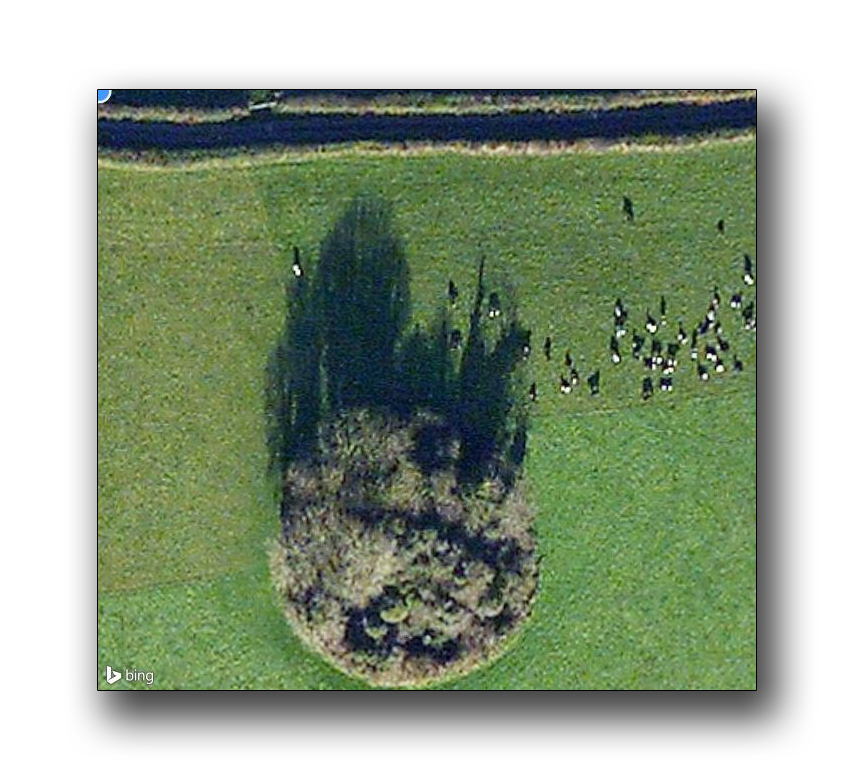
The images below are satellite images of many passage tombs and ring forts, within 10km of our home :


 .
.
Finding these locations was a real eye opener and showed to me that these forts and passage tombs must have been located through out the country.
The forts in Kerry have been restored over the last 5 years and may well have been in the same poor condition as the local ones here.
It is more than likely that the stone from these locations has been used in more modern times to build local Churches, Farms and stone walls on farm land, Yesterday I posted on the high cross at Kilkamerry and talked about this re-use of Pagan sites to build Christian locations.
It is very likely then that current church yards and grave yards have also been constructed on more of these sites, many more circular features exist on the local landscape and are possibly also ring forts but for these ones time has made things a little less clear.
What does becomes clear from looking deeper is that the pagan history of Ireland was extensive and that the pre-Christian population of this Island was as big as any other location on the European continent.
The images here are of the tomb or ring fort on Ballinlinagh hill, county Kilkenny and of the passage tomb of Knockroe :
Gallery

 —————–

Stradbally cove and caves, County Waterford

Stradbally Cove and caves, County Waterford
Irish Landscape Photography : Nigel Borrington
The cove at Stradbally, County Waterford is on of my favourite places to visit along the coast line of souther Ireland, it a deep cove that contains some wonderful little caves that have a long history, Most likely used for smuggling goods in the past.
These days they more used to take shelter from bad weather or just sit in and enjoy for views of the blue sea here , they are a great feature well worth a visit.
Stradbally Cove and cave: Gallery


Images from the road , A west cork Sunrise

Nikon D7000, 35mm, f2.8 Nikon lens
The Sunrises over Reentrusk bay and the Atlantic ocean , West Cork, Ireland
Irish Landscape Photography
Nigel Borrington
One very early Morning on the first of November, I was out walking our dog Molly along the coast road that links Reentrusk and Allihies, west cork. The Sun was just starting to rise in the distance so I took this images along the Atlantic coastline looking to the North.
These early morning coastline walks in the Autumn are wonderful after a cold a fresh night.

You must be logged in to post a comment.