
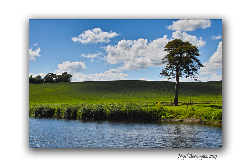
All images, using a nikon Dslr.
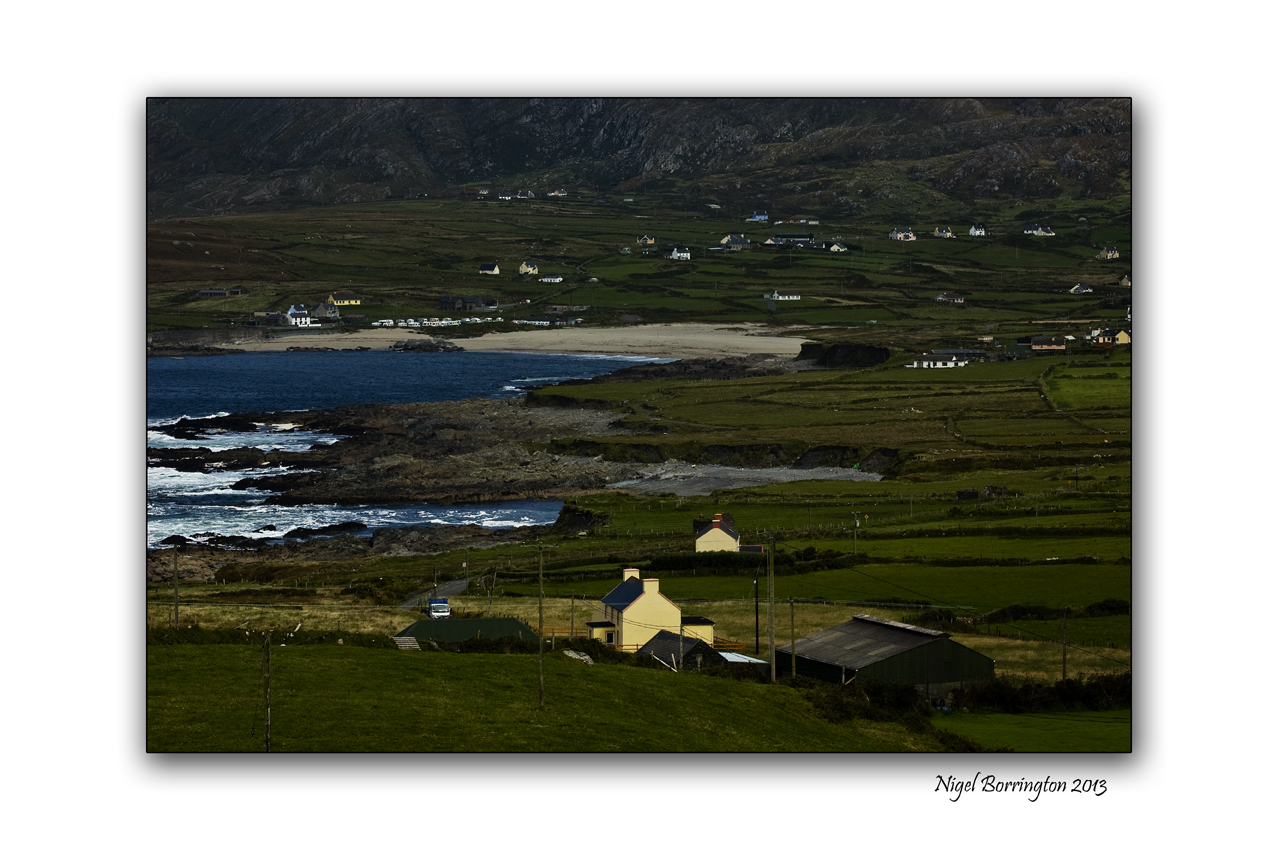
Allihies, west cork
Irish landscape Photography : Nigel Borrington
Its the weekend so why not find a coastal village to stay in, take time to look at the views, watch the sun go down and relax ……..


All images, using a nikon Dslr.
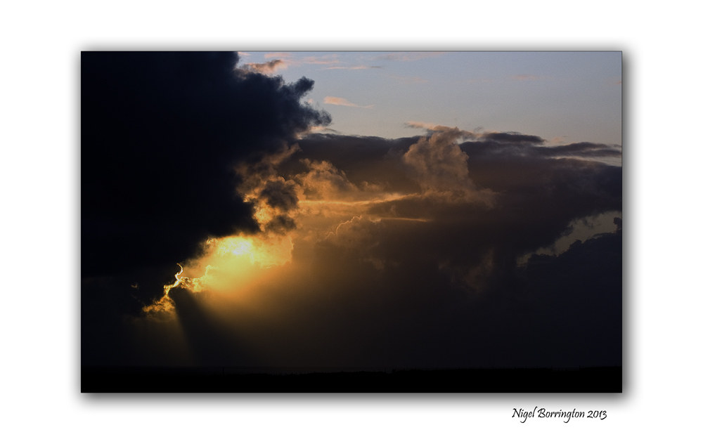
Allihies, west cork
Irish landscape Photography : Nigel Borrington
Its the weekend so why not find a coastal village to stay in, take time to look at the views, watch the sun go down and relax ……..
Nikon D7000 and Sigma SD15
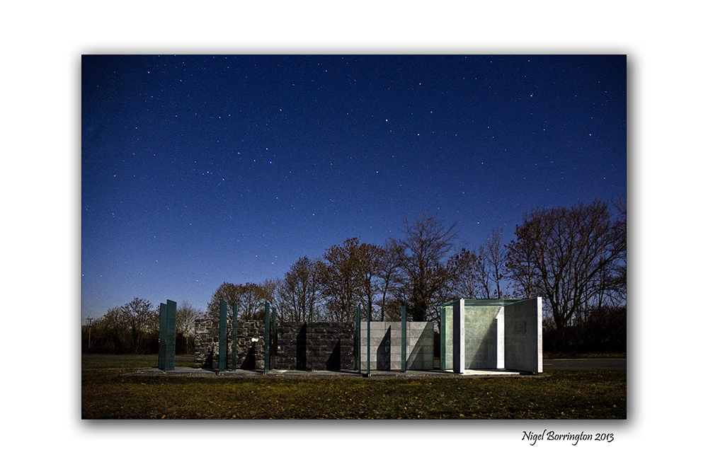
Spirit of place, James Hoban Memorial, Callan county Kilkenny
Irish Landscape Photography : Nigel Borrington
James Hoban was from the Desart estate, near Callan county Kilkenny and is the architect of the White House (late-1793 or early-1794).
In 2008, 24 architecture students from the a University in Washington DC completed the memorial “Spirit of place” in his honour. I took the photographs posted here in 2011, one very clear night and then the last image on a evening last spring.
From : http://en.wikipedia.org/wiki/James_Hoban
“James Hoban was raised on an estate belonging to the Earl of Desart in Cuffesgrange, near Callan in County Kilkenny. He worked there as a wheelwright and carpenter until his early twenties, when he was given an ‘advanced student’ place in the Dublin Society’s Drawing School on Lower Grafton Street.
He excelled in his studies and received the prestigious Duke of Leinster’s medal for drawings of “Brackets, Stairs, and Roofs.” from the Dublin Society in 1780. Later Hoban found a position as an apprentice to the headmaster of the Dublin Society School the Cork-born architect Thomas Ivory from 1779? to 1785 .
Following the American Revolutionary War, Hoban immigrated to the United States, and established himself as an architect in Philadelphia in 1785.[1]
Charleston County Courthouse, Charleston, SC (1790-92), James Hoban, architect.
Hoban’s amended elevation of the White House (late-1793 or early-1794).
Hoban was in South Carolina by April 1787, where he designed numerous buildings including the Charleston County Courthouse (1790–92), built on the ruins of the former South Carolina Statehouse (1753, burned 1788). President Washington admired Hoban’s work on his Southern Tour, may have met with him in Charleston in May 1791, and summoned the architect to Philadelphia, Pennsylvania (the temporary national capital) in June 1792.
In July 1792, Hoban was named winner of the design competition for the White House.[4] His initial design seems to have had a 3-story facade, 9 bays across (like the Charleston courthouse). Under Washington’s influence, Hoban amended this to a 2-story facade, 11 bays across, and, at Washington’s insistence, the whole presidential mansion was faced with stone. It is unclear whether any of Hoban’s surviving drawings are actually from the competition.
Hoban was also one of the supervising architects who served on the Capitol, carrying out the design of Dr. William Thornton.
Hoban lived the rest of his life in Washington, D.C., where he worked on other public buildings and government projects, including roads and bridges. He also designed Rossenarra House near the village of Kilmoganny in Kilkenny, Ireland in 1824.
Hoban’s wife Susanna Sewall was the daughter of the prominent Georgetown “City Tavern” proprietor.
Hoban was also involved in the development of Catholic institutions in the city, including Georgetown University (where his son was a member of the Jesuit community), St. Patrick’s Parish, and the Visitation Convent founded by another Kilkenny native, Teresa Lalor of Ballyragget.
Hoban died in Washington, D.C. on December 8, 1831. He is buried at historic Mount Olivet Cemetery in Washington, D.C.”
A Spirit of place


Canon G1x
Newtown lane, County Kilkenny
Kilkenny landscape photography : Nigel Borrington
Strolling down memory lane
By : taran burke
Strolling down memory lane
Where the colors begin to fade.
Strolling down memory lane
Is where I want you to come along.
Strolling down memory lane
is a test of time and mind.
Strolling down memory lane
I won’t be afraid.
Strolling down memory lane
Is lacking in color.
Strolling down memory lane
Is travelling in time.
Strolling down memory lane
Not a storm in sight
Strolling down memory lane
is joy without fright.
A memory that I have created in my mind,
Stands the test of time.
All images using a Nikon D7000
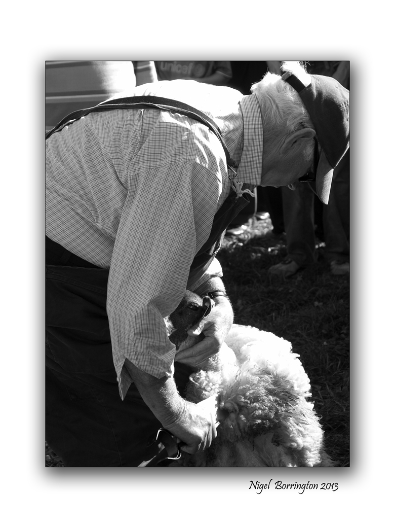
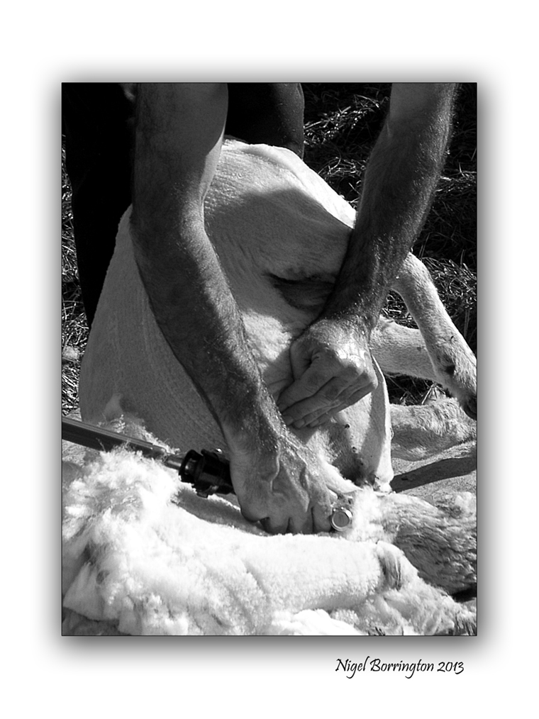
Sheep shearers and the Kilkenny county show
Events photography : Nigel Borrington
The Kilkenny – Iverk show, is held in the village of (Piltown, county Kilkenny) each September.
It’s a great day of agricultural events from horse and cattle shows to equipment demonstrations.
The sheep shearing competitions and demonstrations each year bring in a big crowd. The images below show how sheep are sheared both in modern and older times.
Sheep shearing demonstration gallery


All images using a Nikon D7000
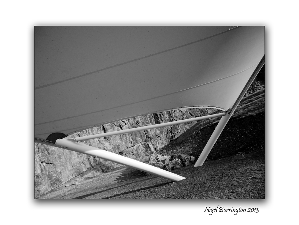
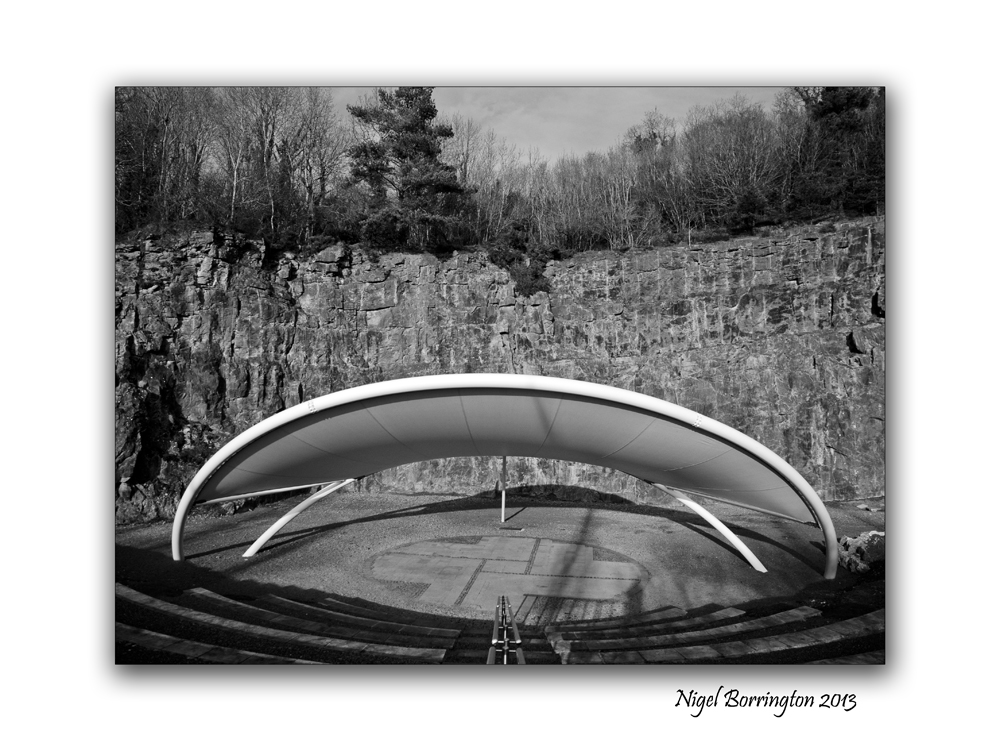
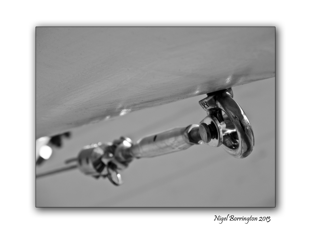
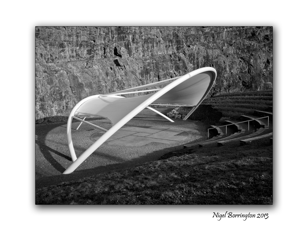
Ballykeeffe Amphitheatre, county KIlkenny
KIlkenny landscape photography
Ballykeeffe Amphitheatre, county kilkenny
The Ballykeeffe Amphitheatre is Kilkenny’s outdoor auditorium and it is used many times during the year for outdoor performances. Located beneath Ballykeeffe Woods and Nature Reserve, I have visited this area many times to walk our dog and get some exercise.
The Amphitheatre was build in the remains of an old slate quarry, for a longtime the performances were held in the open air but very recently it boasts a state of the art canopy which fits within the worked-out quarry.
The acoustics and setting are designed to provide for a great outdoor theatre and music performance.
When the new canopy first appeared, I took the following images.
Ballykeeffe Amphitheatre – a gallery


All image using a sigma SD15. 15-30mm lens
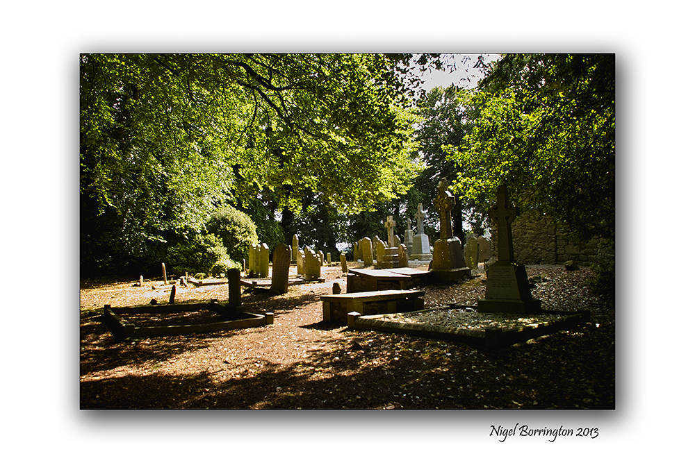
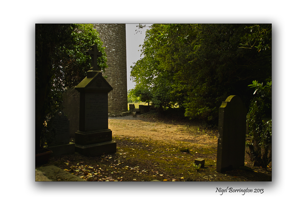
The Secret of Kells, Kilree Round Tower, County KIlkenny
Landscape Photography : Nigel Borrington
The secrets of the Kells is at Kilree
Kells, county kilkenny is full of heritage from past and while most people are drawn immediately to Kells Priory, one of the largest and best preserved walled monastic sites in Europe, there is another just as important with a history stretching back longer than the Cistercian brotherhood of the priory.
At Kilree, there is a trio of treasures – A round tower, an ancient church and a high cross where a king may or may not be buried. And adding to the mystique is a fourth, natural phenomenon, a Ballaun stone going back to pre-historic times that was used by the first inhabitants of this island. to drink from an for pagan idolatry.
Historians and archaeologists may have got it wrong about Kilree on a number of levels. When you first view if coming from Kells village it reminds you of Freestone Hill – An ancient place used before Christianity. It has commanding views of the surrounding countryside and seems to be the highest spot in the area and therefore a natural stronghold. Looking from it, you take in Knockdrinnagh Wood, Ballygowan, Hugginstown and the high lands beyond it and around to the Slieveardagh Hills. It also boasts commanding views of Sliabh an mBan and the Comeraghs in the distance.

So it begs the question was the round tower of Kilree used as a look out with its bells when danger was imminent. Was it used by the monks who were for all intents and purposes living in a hollow by the King’s River and therefore had no idea of who or what was approaching them. It’s probably too simplistic a view but we are sure of one thing – the tower was built around the 11th century and would have been used as a defence against the maurauding Vikings who had a stronghold in Waterford.
It is said but not proven that the bones of a great king are buried under the high Cross at Kilree, just 40 yards from the round tower and the church of St Brigid that lies in ruins yet still has a strong association with the people of the area in both Kells and Stoneyford. Although it stands 90 feet high, Kilree Round tower is not easy to see because it is set amid a grove of trees. A fine slim building with a diameter inside of just 9 feet it must have been tight in there. With six different levels and a battlement area at the top as well as a belfry, it is little wonder that rope ladders were used here.
Like the other round towers in the county, its entrance faces the church and there is a long association between the two.
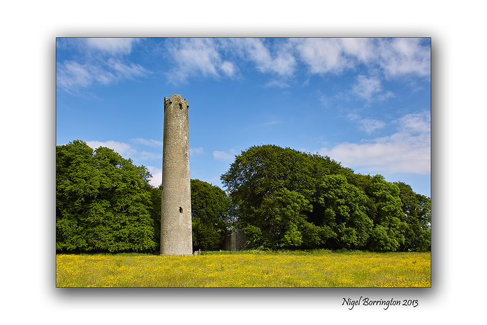
The round tower and church are enclosed in a grove of beautiful trees which seem to detract slightly from the height of the tower but once you enter this wonderful place you can feel the past coming at you. It’s sad that a sign in bold yellow at the entrance tells you to beware of the bull. What a lovely first impression for visitors. The land is extremely fertile and there is a rich covering of spring grass on the field and you can appreciate why a farmer would be so anxious to keep it so but the sign should be taken down when the bull is not there.
It is important to appreciate the work done by researchers over the years on Kilree and the rest of the county none more so that Canon Carrigan in his History of the Diocese of Ossory; the wonderful parish history of Dunnamaggin by Richard Lahart which provides us with so much detail but it is the findings of Ireland’s great antiquarian scholar from Slieverue in South Kilkenny, that is most revealing. The research by John O’Donovan on place names and on sites like Kilree for the Ordance Survey is invaluable in deepening our knowledge of our past.
Up to the middle of the 19th century it was claimed that King Niall Caille was buried here in 844AD and that his bones lay under the high Cross which is uninscribed. It seems now that the high cross was erected significantly before this date and we learn from different researchers that these kind of crosses were commemorative and not built to cover the dead. He upset a lot of people when he said the real ancient Irish name for the site was not actually Kilree which up to them was meant to be the church of the king but Cill Freach after a female saint, Freach. Canon Corrigan also studied this and felt that Kilree was a corruption of the name Cill Ruiddchi, the church of St Ruiddchi. While it is hard to go past the original name of Cill Bride as the name for the church, named after St Brigid, we do know from local people and from Richard Lahart that the well at Kilree was also named in honour of St Brigid and that goes back over 1,000 years. It is hard to see past Cill An Ri and of course it is still known locally by people as The Steeple, a reference to the bell tower on top of the round tower.
Inside the church,tombs of local people remain. The poorer people would have bee buried furthest away from the church. From Norman times the Howlings, Holdens or Howels are associated with the site and for some reason these are the same people as the Walsh’s of the Mountain (I don’t understand that). From medieval times, the Comerfords were closely associated with Kilree along with the Izod family, Flemings, Ryans, St Legers and of course in recent times, the Goreys.
Again the lack of signposts for such an amazing place is sad. The only sign coming from Kilkenny city is at Kells Priory and those in charge of the site, have done a good job in keeping it quiet.
But what stands out most about Kilree is that it is still used as a graveyard and the ancient burial ground is well looked after by the people iving in the area..
Kilree is also home to a Ballaun Stone located 250 yards north of the round tower in the corner of a field of heavily weathered limestone and is marked on the Ordance survey map for the area. A bullaun is the term used for the depression in a stone which is often water filled.
Local folklore often attaches religious or magical significance to bullaun stones, such as the belief that the rainwater collecting in a stone’s hollow has healing properties. Ritual use of some bullaun stones continued well into the Christian period and many are found in association with early churches like Kilree or should that be St Brigids or St Freach’s or St Ruiddchi’s/ take your pick.
Published in the kilkenny people. 2012
Image Gallery

Sigma SD15, 15-30mm lens, ISO 50
River Barrow, County Kilkenny
Irish landscape photography : Nigel Borrington
Where the Rivers Flow
By : Monique Sapla
Have you ever wondered,
Where do the rivers flow
Do they flow forever,
Where does the water go.
Do rivers somewhere finish,
Where does a river start
Do all lead to the ocean,
Or do they break apart.
Someday I’d like to follow,
A river to its end
I’d run to the horizon,
Through fields and around bends.
Have you ever wondered,
Where do the rivers flow
Do they go on forever
Someday I’d like to know

All images using a – Sigma SD15, 15-30mm lens
County kilkenny, through its trees
Landscape photography : Nigel Borrington
A sense of county Kilkenny , September 2013
Getting out and about in county Kilkenny on these late summer days is just wonderful, this Gallery of images was from an evenings walk through some local country lanes. I hope they get across a sense of the county and its wonderful landscape on an early evening in September.


All images using a Nikon D700
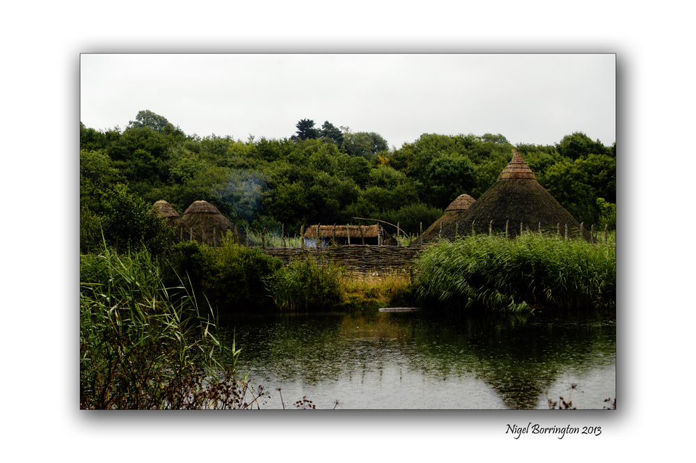
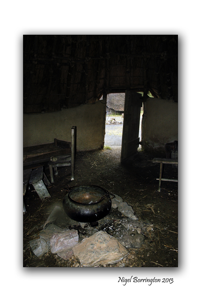
Irish National Heritage park – A Crannog
Landscape photography : Nigel borrington
One place in Ireland you have to visit, in order to get a good sense of the nations history is the National heritage park.
Location
The Irish National Heritage Park Ferrycarrig, is Located in the South East of Ireland, approximately 3 miles from Wexford Town off the Dublin (N11) Rosslare Road (N25). Eleven miles from Rosslare Europort.
Sat Nav: N: 52.348 W: -6.51673
This park is Unique in Europe, occuping 35 acres and has 16 archaeological and historical reconstructions all located in their natural settings. The Heritage Park outlines the history of Irish life as the story of 10000 years unfolds before you. It is history presented in a unique way in magical and varied settings.
A Crannog
The images in this post are from the reconstructed Crannog, Wiki-pedia defines a Crannog as follows
“Crannogs were used as dwellings over five millennia from the European Neolithic Period, to as late as the 17th/early 18th century although in Scotland, convincing evidence for Early and Middle Bronze Age or Norse Period use is not currently present in the archaeological record. The earliest radiocarbon determinations obtained from key sites such as Oakbank in Loch Tay or Redcastle, Beauly Firth approach the Late Bronze Age – Early Iron Age transition at their widest interpretation at 2 sigma or 95.4% probability, falling after c.800BC and therefore could only be considered Late Bronze Age by the narrowest of margins. Crannogs have been variously interpreted as free-standing wooden structures, as at Loch Tay, although more commonly they exist as brush, stone or timber mounds which can be revetted with timber piles. However, in areas such as the Western Isles of Scotland, timber was unavailable from the Neolithic onwards. As a result, completely stone crannogs supporting drystone architecture are common here.
Today, crannogs typically appear as small, circular islets, often 10 to 30 metres (30 to 100 ft) in diameter, covered in dense vegetation due to their inaccessibility to grazing livestock.”
http://en.wikipedia.org/wiki/Crannog
Crannog images


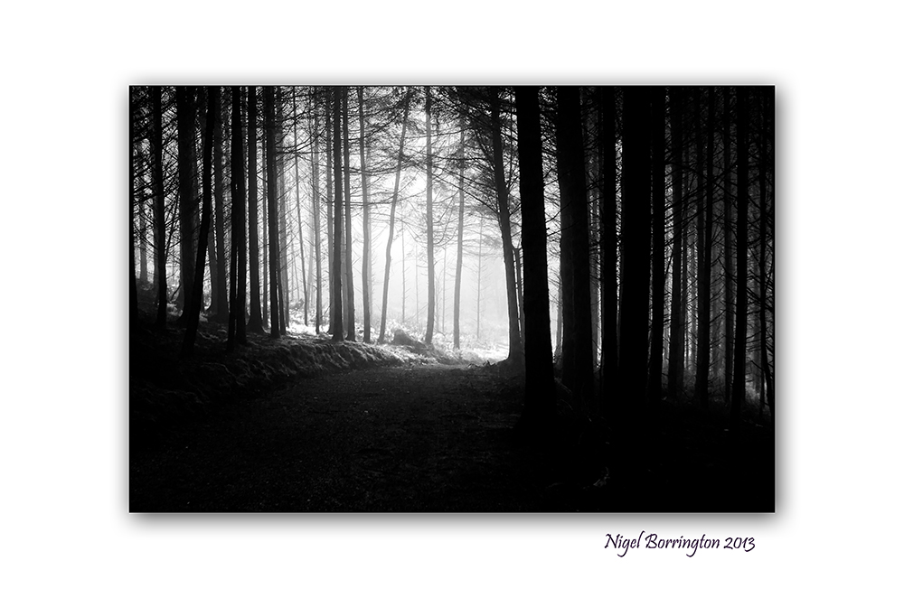
Monday morning mist in the woods
Kilkenny landscape photography : Nigel Borrington
Monday Mornings
Finally breaks the morning light,
ending a long, restful night.
From this place, the sun through the trees,
appears to reveal some misty scene.
Colorless branches contorting the rays of the sun,
light breaking through trees from some place of desolation.
Slowly to the world vision returns,
it becomes apparent that nothing has changed.
So an excuse not to begin the week,
fades into the glimmer of the soft sun rays.
Our tired bodies, hardly able to stir,
begin our long journey to the weeks return.

You must be logged in to post a comment.