
County Kilkenny – through it’s trees

All images using a – Sigma SD15, 15-30mm lens
County kilkenny, through its trees
Landscape photography : Nigel Borrington
A sense of county Kilkenny , September 2013
Getting out and about in county Kilkenny on these late summer days is just wonderful, this Gallery of images was from an evenings walk through some local country lanes. I hope they get across a sense of the county and its wonderful landscape on an early evening in September.


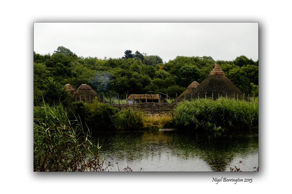
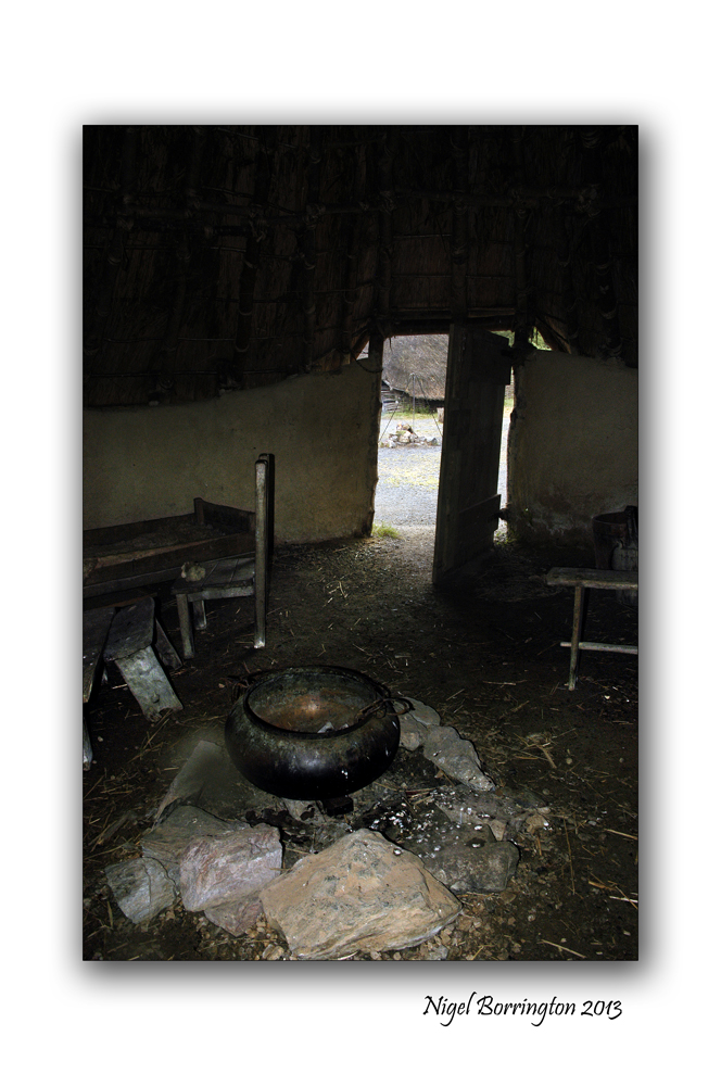
Irish National Heritage park
All images using a Nikon D700
Irish National Heritage park – A Crannog
Landscape photography : Nigel borrington
One place in Ireland you have to visit, in order to get a good sense of the nations history is the National heritage park.
Location
The Irish National Heritage Park Ferrycarrig, is Located in the South East of Ireland, approximately 3 miles from Wexford Town off the Dublin (N11) Rosslare Road (N25). Eleven miles from Rosslare Europort.
Sat Nav: N: 52.348 W: -6.51673
This park is Unique in Europe, occuping 35 acres and has 16 archaeological and historical reconstructions all located in their natural settings. The Heritage Park outlines the history of Irish life as the story of 10000 years unfolds before you. It is history presented in a unique way in magical and varied settings.
A Crannog
The images in this post are from the reconstructed Crannog, Wiki-pedia defines a Crannog as follows
“Crannogs were used as dwellings over five millennia from the European Neolithic Period, to as late as the 17th/early 18th century although in Scotland, convincing evidence for Early and Middle Bronze Age or Norse Period use is not currently present in the archaeological record. The earliest radiocarbon determinations obtained from key sites such as Oakbank in Loch Tay or Redcastle, Beauly Firth approach the Late Bronze Age – Early Iron Age transition at their widest interpretation at 2 sigma or 95.4% probability, falling after c.800BC and therefore could only be considered Late Bronze Age by the narrowest of margins. Crannogs have been variously interpreted as free-standing wooden structures, as at Loch Tay, although more commonly they exist as brush, stone or timber mounds which can be revetted with timber piles. However, in areas such as the Western Isles of Scotland, timber was unavailable from the Neolithic onwards. As a result, completely stone crannogs supporting drystone architecture are common here.
Today, crannogs typically appear as small, circular islets, often 10 to 30 metres (30 to 100 ft) in diameter, covered in dense vegetation due to their inaccessibility to grazing livestock.”
http://en.wikipedia.org/wiki/Crannog
Crannog images


You must be logged in to post a comment.